Swindon

Settlement in Wiltshire

England

Swindon

Benchmark on #252 Marlborough Road Ordnance Survey cut mark benchmark described on the Bench Mark Database at <span class="nowrap"><a title="http://www.bench-marks.org.uk/bm66427" rel="nofollow ugc noopener" href="http://www.bench-marks.org.uk/bm66427">Link</a><img style="margin-left:2px;" alt="External link" title="External link - shift click to open in new window" src="https://s1.geograph.org.uk/img/external.png" width="10" height="10"/></span>
Benchmark on #252 Marlborough Road Credit: Roger Templeman

Swindon is a town located in the county of Wiltshire, England. Situated in the southwest of the country, it lies about 81 miles west of London and 35 miles east of Bristol. With a population of approximately 182,441 people, as of 2021, Swindon is one of the largest towns in Wiltshire.

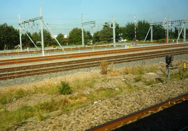
Historically, Swindon was a small market town, but it experienced significant growth during the Industrial Revolution when the Great Western Railway was established in the mid-19th century. This led to the development of Swindon as a major railway town, with the construction of the Swindon Works, which became one of the largest railway engineering facilities in the country.

Today, Swindon is a thriving and diverse town with a mix of industrial, commercial, and residential areas. It is known for its strong economy, particularly in the sectors of automotive manufacturing, engineering, and telecommunications. The town is also home to several multinational companies, including Honda, Intel, and Nationwide Building Society.

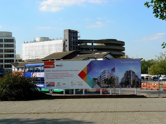
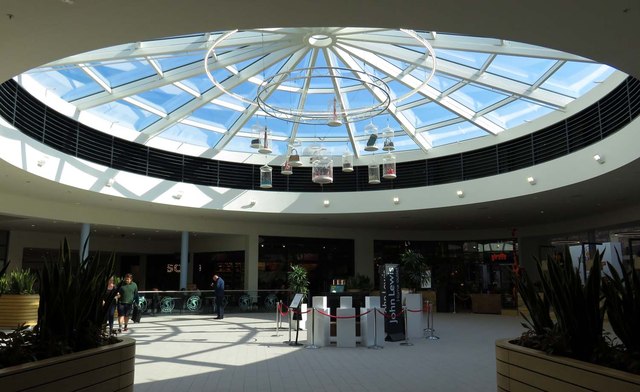
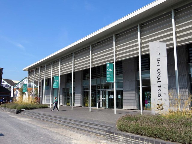
Swindon offers a range of amenities and attractions for residents and visitors alike. It boasts a number of shopping centers, including the popular McArthurGlen Designer Outlet, which attracts shoppers from across the region. The town also has a vibrant cultural scene, with a variety of theaters, art galleries, and museums, such as the Swindon Museum and Art Gallery.

In terms of transportation, Swindon benefits from excellent connectivity. It is served by the M4 motorway, which provides easy access to London and Bristol. The town also has a well-developed public transport system, with regular bus services and a railway station that offers frequent connections to major cities across the country.

If you have any feedback on the listing, please let us know in the comments section below.
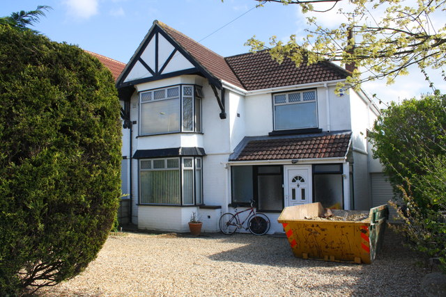
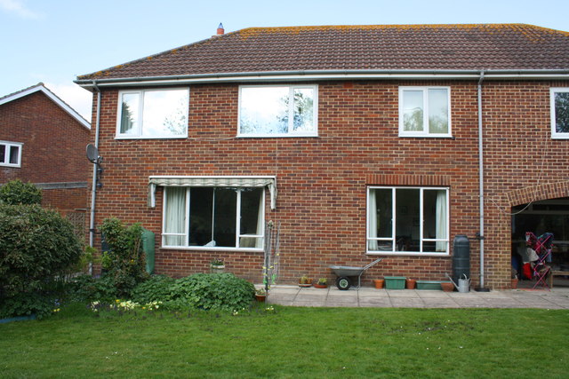
Swindon Images

Images are sourced within 2km of 51.559114/-1.773494 or Grid Reference SU1584. Thanks to Geograph Open Source API. All images are credited.

Benchmark on #252 Marlborough Road Ordnance Survey cut mark benchmark described on the Bench Mark Database at <span class="nowrap"><a title="http://www.bench-marks.org.uk/bm66427" rel="nofollow ugc noopener" href="http://www.bench-marks.org.uk/bm66427">Link</a><img style="margin-left:2px;" alt="External link" title="External link - shift click to open in new window" src="https://s1.geograph.org.uk/img/external.png" width="10" height="10"/></span>
Benchmark on #252 Marlborough Road
Ordnance Survey cut mark benchmark described on the Bench Mark Database at LinkExternal link
#252 Marlborough Road There is an OS benchmark <a href="https://www.geograph.org.uk/photo/4621750">SU1682 : Benchmark on #252 Marlborough Road</a> on the right hand side of the house
#252 Marlborough Road
There is an OS benchmark SU1682 : Benchmark on #252 Marlborough Road on the right hand side of the house
Benchmark on #186 Marlborough Road Ordnance Survey cut mark benchmark described on the Bench Mark Database at <span class="nowrap"><a title="http://www.bench-marks.org.uk/bm66428" rel="nofollow ugc noopener" href="http://www.bench-marks.org.uk/bm66428">Link</a><img style="margin-left:2px;" alt="External link" title="External link - shift click to open in new window" src="https://s1.geograph.org.uk/img/external.png" width="10" height="10"/></span>
Benchmark on #186 Marlborough Road
Ordnance Survey cut mark benchmark described on the Bench Mark Database at LinkExternal link
#186 Marlborough Road There is an OS benchmark <a href="https://www.geograph.org.uk/photo/4621828">SU1682 : Benchmark on #186 Marlborough Road</a> on the right hand side of the house near the front corner
#186 Marlborough Road
There is an OS benchmark SU1682 : Benchmark on #186 Marlborough Road on the right hand side of the house near the front corner
Benchmark on Lawn Primary School Ordnance Survey cut mark benchmark described on the Bench Mark Database at <span class="nowrap"><a title="http://www.bench-marks.org.uk/bm66429" rel="nofollow ugc noopener" href="http://www.bench-marks.org.uk/bm66429">Link</a><img style="margin-left:2px;" alt="External link" title="External link - shift click to open in new window" src="https://s1.geograph.org.uk/img/external.png" width="10" height="10"/></span>
Benchmark on Lawn Primary School
Ordnance Survey cut mark benchmark described on the Bench Mark Database at LinkExternal link
Lawn Primary School There is an OS benchmark <a href="https://www.geograph.org.uk/photo/4622339">SU1682 : Benchmark on Lawn Primary School</a> on the bricks right of the orange hexagon
Lawn Primary School
There is an OS benchmark SU1682 : Benchmark on Lawn Primary School on the bricks right of the orange hexagon
Benchmark on #41 Windsor Road Ordnance Survey cut mark benchmark described on the Bench Mark Database at <span class="nowrap"><a title="http://www.bench-marks.org.uk/bm66430" rel="nofollow ugc noopener" href="http://www.bench-marks.org.uk/bm66430">Link</a><img style="margin-left:2px;" alt="External link" title="External link - shift click to open in new window" src="https://s1.geograph.org.uk/img/external.png" width="10" height="10"/></span>
Benchmark on #41 Windsor Road
Ordnance Survey cut mark benchmark described on the Bench Mark Database at LinkExternal link
Back of #41 Windsor Road There is an OS benchmark <a href="https://www.geograph.org.uk/photo/4622364">SU1682 : Benchmark on #41 Windsor Road</a> on the left hand side of the house near the corner.
Back of #41 Windsor Road
There is an OS benchmark SU1682 : Benchmark on #41 Windsor Road on the left hand side of the house near the corner.
Swindon Station Swindon railway station.
Swindon Station
Swindon railway station.
New commercial development, Queens Drive, Swindon (1) As recently as four years ago a public house stood on the site at centre right <a title="https://www.geograph.org.uk/photo/2602009" href="https://www.geograph.org.uk/photo/2602009">Link</a> By March 2012 the site had been cleared <a title="https://www.geograph.org.uk/photo/2827374" href="https://www.geograph.org.uk/photo/2827374">Link</a> Now a new building has been constructed. Future occupiers will include a Cooperative shop, a Subway outlet and a Barnardo's charity shop. More below
New commercial development, Queens Drive, Swindon (1)
As recently as four years ago a public house stood on the site at centre right Link By March 2012 the site had been cleared Link Now a new building has been constructed. Future occupiers will include a Cooperative shop, a Subway outlet and a Barnardo's charity shop. More below
New commercial development, Queens Drive, Swindon (2) This affords a closer look at the new development on the old Bulldog site seen here <a title="https://www.geograph.org.uk/photo/4654255" href="https://www.geograph.org.uk/photo/4654255">Link</a> More below...
New commercial development, Queens Drive, Swindon (2)
This affords a closer look at the new development on the old Bulldog site seen here Link More below...
View across Fleming Way, Swindon At left and centre are two of several office blocks occupied by Zurich Insurance. The structure that has been sheeted is a multi-storey car park which is being demolished to make way for redevelopment of the bus station area. The buses in view are in what is acting as a temporary bus station. For a view of the area in April this year see <a title="https://www.geograph.org.uk/photo/4436602" href="https://www.geograph.org.uk/photo/4436602">Link</a>
View across Fleming Way, Swindon
At left and centre are two of several office blocks occupied by Zurich Insurance. The structure that has been sheeted is a multi-storey car park which is being demolished to make way for redevelopment of the bus station area. The buses in view are in what is acting as a temporary bus station. For a view of the area in April this year see Link
View to Carfax Street car park, Swindon The car park looming in the background was built around 1980 plus or minus a year or two. It is now closed and is being demolished as part of the redevelopment of the area. The typically glamorous signboard in the centre shows what the area is intended to look like in a few years' time.
View to Carfax Street car park, Swindon
The car park looming in the background was built around 1980 plus or minus a year or two. It is now closed and is being demolished as part of the redevelopment of the area. The typically glamorous signboard in the centre shows what the area is intended to look like in a few years' time.
Carfax Street car park, Swindon The car park is the multi-storey structure looming above the trees in the foreground. It is in the process of being demolished after about 35 years of service. It is having to go to make way for a comprehensive and much-needed redevelopment of the area. The car park has echoes of art deco about it although I doubt that was intentional on the part of the designers.
Carfax Street car park, Swindon
The car park is the multi-storey structure looming above the trees in the foreground. It is in the process of being demolished after about 35 years of service. It is having to go to make way for a comprehensive and much-needed redevelopment of the area. The car park has echoes of art deco about it although I doubt that was intentional on the part of the designers.
Glass roof in the Great Western Outlet Village
Heelis Heelis is the headquarters of the National Trust. There is a shop and a cafe for the general public.
Heelis
Heelis is the headquarters of the National Trust. There is a shop and a cafe for the general public.
The Church of St Marks at Swindon Viewed from the north-east.
The Church of St Marks at Swindon
Viewed from the north-east.
Railway lines near Swindon Station Multiple rail lines visible from eastbound train, shortly after leaving Swindon Railway Station. Looking towards the Great Western Way (B4289) with TKMaxx store visible in the background.
Railway lines near Swindon Station
Multiple rail lines visible from eastbound train, shortly after leaving Swindon Railway Station. Looking towards the Great Western Way (B4289) with TKMaxx store visible in the background.
Show me another place!

Swindon is located at Grid Ref: SU1584 (Lat: 51.559114, Lng: -1.773494)

Unitary Authority: Swindon

Police Authority: Wiltshire

What 3 Words

///riding.myself.pilots. Near Swindon, Wiltshire

Nearby Locations

Walcot West Swindon

Related Wikis

Queens Park, Swindon

Queens Park is a public park in the centre of the town of Swindon, England, east of the Regent Circus area. It is about 12 acres (49,000 m2) in size, with...

South Swindon Parish

South Swindon is a civil parish in the town of Swindon, England. In 2021 it had a population of 62,871. South Swindon is the largest civil parish in the...

Holy Rood Church, Swindon

Holy Rood Church is a Roman Catholic parish church in Swindon, Wiltshire, England. It was founded in 1851 as a chapel and was rebuilt as a church in 1905...

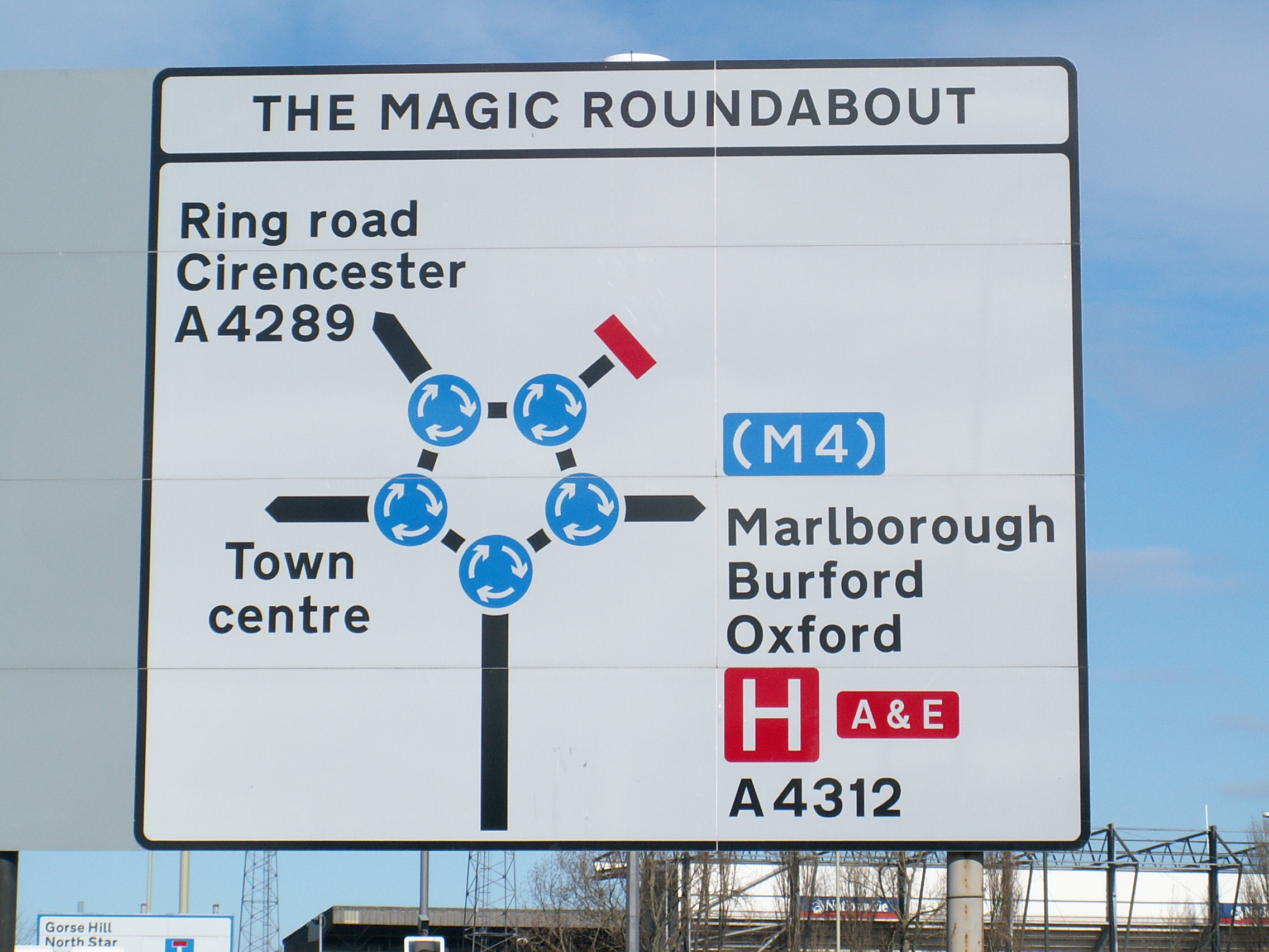
Magic Roundabout (Swindon)

The Magic Roundabout in Swindon, England, is a ring junction constructed in 1972 consisting of five mini-roundabouts arranged in a circle. Located near...

Swindon

Swindon ( ) is a large town in Wiltshire, England. At the time of the 2021 Census the population of the built-up area was 183,638, making it the largest...
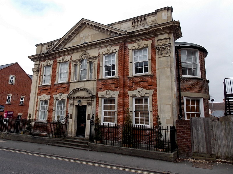
Swindon Town Hall

Swindon Town Hall is a former municipal building in Swindon, England which was built in 1891 to be a centrepiece of New Swindon. It is currently used by...

South Swindon (UK Parliament constituency)

South Swindon is a constituency in the Borough of Swindon, Wiltshire, represented in the House of Commons of the UK Parliament since 2010 by Sir Robert...

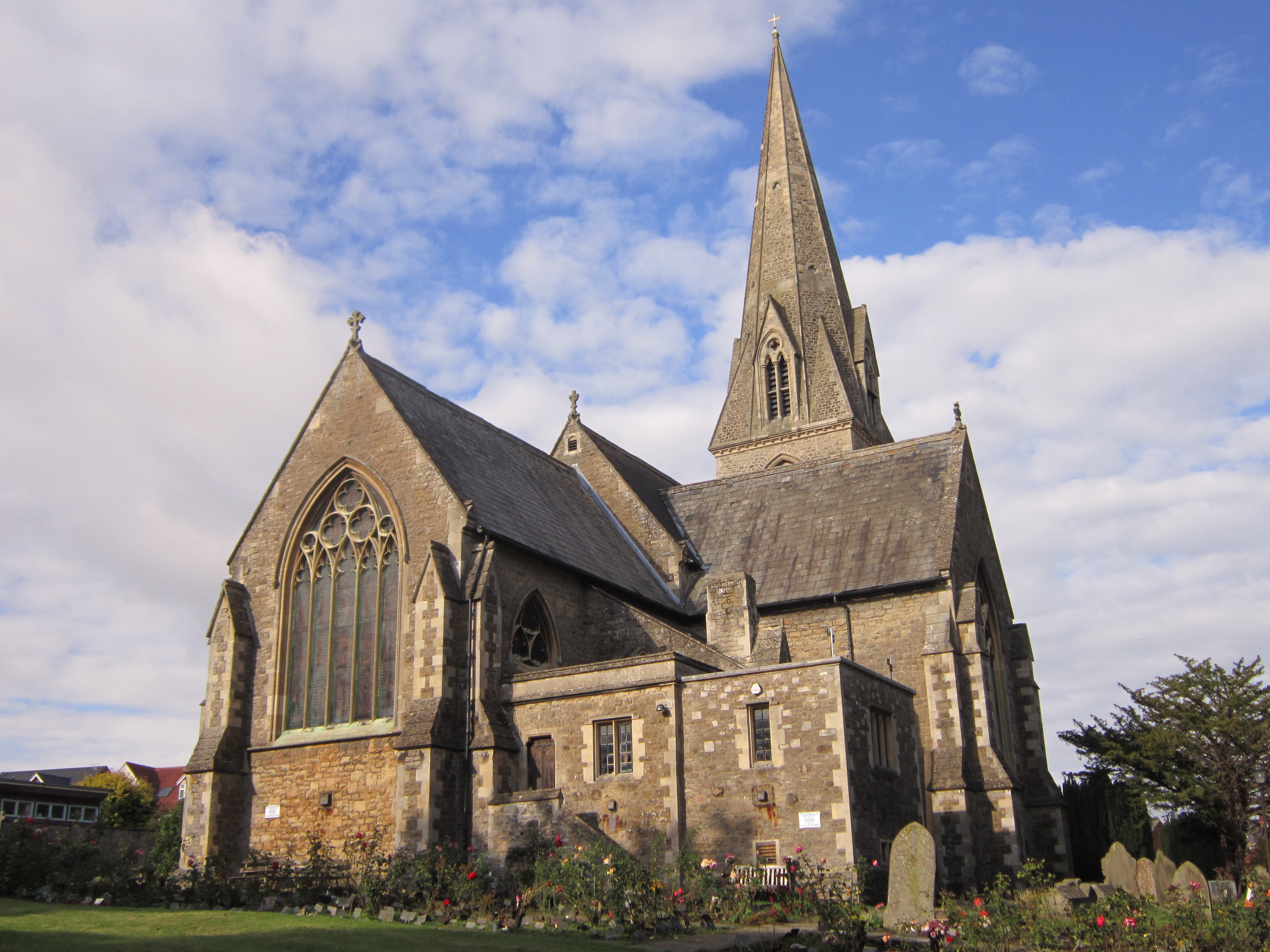
Christ Church, Swindon

Christ Church is a Grade II* listed church in Cricklade Street, Swindon, Wiltshire, England. It was built in 1851 to a design by George Gilbert Scott....

Related Videos

Walking in UK, Swindon Town Centre│Shopping Street│4K Urban Walking Tour - Trip to UK │英國Swindon市中心

A first-person perspective UK walk tour, the 4K video taken in big shopping Street of Swindon town centre , including Primark, ...

4K Swindon Town Centre Walk Through - English Countryside

Swindon is a town in Wiltshire in the South West of England. Postcode: SN1 The main shopping centre in Swindon is called the ...

Ashdene Holiday Cottage vlog September 2023

Beautiful Country Cottage private Indoor Swimming Pool ,Hot Tub, & Games room. 4.6 out of 5 Wonderful 4.6/5 Wonderful See all ...

Nearby Amenities

Located within 500m of 51.559114,-1.773494
Traffic Signals
Traffic Signals Direction: forward
Lat/Long: 51.5596242/-1.7714788
Crossing
Bicycle: yes
Button Operated: yes
Crossing: traffic_signals
Crossing Ref: toucan
Kerb: lowered
Tactile Paving: yes
Traffic Signals Sound: yes
Traffic Signals Vibration: yes
Lat/Long: 51.56302/-1.7722753
Fuel
Esso
Brand: Esso
Brand Wikidata: Q867662
Brand Wikipedia: en:Esso
Contact Website: https://www.esso.co.uk/en-gb/find-station/esso-swindon-essomfgflemingway-100354369
Operator: Motor Fuel Group
Operator Website: https://www.motorfuelgroup.com/locations/fleming-way-fs851/
Operator Wikidata: Q107271358
Lat/Long: 51.5625878/-1.7731415
Turning Circle
Lat/Long: 51.5625886/-1.7748403
Barrier: bollard
Bollard: fixed
Lat/Long: 51.5629932/-1.7759677
Post Office
Queens Drive Post Office
Addr Country: GB
Addr Postcode: SN3 1AW
Brand: Post Office
Brand Wikidata: Q1783168
Contact Website: https://www.postoffice.co.uk/branch-finder/2075482/queens-drive
Ref Pol Id: 7374
Lat/Long: 51.562502/-1.7706682
Mini Roundabout
Upham
Direction: clockwise
Lat/Long: 51.5568669/-1.7736907
Turning Circle
Lat/Long: 51.5611457/-1.7699472
Turning Circle
Lat/Long: 51.5605012/-1.7704802
Turning Circle
Lat/Long: 51.5588807/-1.771152
Turning Circle
Lat/Long: 51.5573474/-1.7720993
Turning Circle
Lat/Long: 51.5588527/-1.767937
Crossing
Bicycle: dismount
Crossing: uncontrolled
Kerb: lowered
Lat/Long: 51.5631522/-1.7710186
Barrier: bollard
Lat/Long: 51.5632027/-1.7711278
Place Of Worship
Holy Rood
Denomination: catholic
Religion: christian
Wikidata: Q23018644
Wikipedia: en:Holy Rood Church, Swindon
Lat/Long: 51.5585208/-1.7779999
Crossing
Bicycle: yes
Crossing: unmarked
Crossing Markings: no
Kerb: lowered
Lat/Long: 51.5632133/-1.7714477
The Co-operative Food
Brand: The Co-operative Food
Brand Wikidata: Q107617274
Operator: Midcounties Co-operative
Operator Wikidata: Q6841138
Shop: convenience
Lat/Long: 51.5592755/-1.7755609
Fast Food
Country Fayre Fish and Chips
Cuisine: fish_and_chips
Lat/Long: 51.561683/-1.775109
Crossing
Bicycle: dismount
Crossing: traffic_signals
Crossing Ref: pelican
Kerb: lowered
Lat/Long: 51.5624673/-1.7722136
Traffic Signals
Source: Bing
Traffic Signals Direction: forward
Lat/Long: 51.562546/-1.7722523
Crossing
Lat/Long: 51.5548612/-1.7744994
Crossing
Bicycle: dismount
Button Operated: yes
Crossing: traffic_signals
Crossing Island: no
Crossing Ref: pelican
Tactile Paving: yes
Traffic Signals Sound: yes
Traffic Signals Vibration: yes
Lat/Long: 51.5628918/-1.7765129
Fast Food
Best Barbecue
Addr Housenumber: 24
Addr Postcode: SN1 3AW
Addr Street: Victoria Road
Fhrs Id: 253554
Source: survey
Source Addr: FHRS Open Data
Lat/Long: 51.5574716/-1.7790329
Traffic Signals
Traffic Signals: traffic_lights
Traffic Signals Direction: forward
Lat/Long: 51.5613256/-1.7711165
Crossing
Crossing: unmarked
Crossing Markings: no
Lat/Long: 51.5614147/-1.7713097
Bus Stop
The Brow
Bench: no
Bin: no
Bus: yes
Lit: no
Naptan AtcoCode: 4680SWA10380
Naptan Bearing: SE
Naptan CommonName: The Brow
Naptan Indicator: SE-bound
Naptan NaptanCode: swidmpw
Naptan PlusbusZoneRef: SDON
Naptan Street: Victoria Road
Naptan Verified: no
Public Transport: platform
Shelter: no
Tactile Paving: no
Lat/Long: 51.5553973/-1.7774558
Bus Stop
The Brow
Bench: yes
Bin: no
Bus: yes
Lit: no
Naptan AtcoCode: 4680SWA10381
Naptan Bearing: N
Naptan CommonName: Cannon Street
Naptan Indicator: N-bound
Naptan NaptanCode: swidmgw
Naptan PlusbusZoneRef: SDON
Naptan Street: Victoria Road
Naptan Verified: no
Public Transport: platform
Shelter: yes
Tactile Paving: no
Lat/Long: 51.5559741/-1.7784737
Traffic Signals
Crossing: no
Traffic Signals: signal
Traffic Signals Direction: forward
Lat/Long: 51.558053/-1.7797068
Traffic Signals
Crossing: no
Traffic Signals: signal
Traffic Signals Direction: backward
Lat/Long: 51.5583313/-1.7793321
Traffic Signals
Crossing: traffic_signals
Traffic Signals: signal
Traffic Signals Direction: forward
Lat/Long: 51.5583901/-1.7796365
Give Way
Direction: forward
Lat/Long: 51.5591895/-1.7798487
Crossing
Crossing: uncontrolled
Crossing Island: no
Crossing Markings: surface
Kerb: lowered
Tactile Paving: yes
Lat/Long: 51.5592711/-1.7802831
Crossing
Bicycle: dismount
Crossing: traffic_signals
Crossing Ref: pelican
Lat/Long: 51.5593498/-1.7804877
Entrance: main
Lat/Long: 51.5600419/-1.7779494
Crossing
Bicycle: yes
Crossing: unmarked
Crossing Markings: no
Kerb: lowered
Lat/Long: 51.5625185/-1.7695237
Crossing
Bicycle: yes
Crossing: unmarked
Crossing Markings: no
Kerb: lowered
Lat/Long: 51.5625434/-1.7697505
Post Box
Operator: Royal Mail
Operator Wikidata: Q638098
Post Box Type: pillar
Ref: SN1 195
Royal Cypher: EIIR
Royal Cypher Wikidata: Q33102113
Lat/Long: 51.5591956/-1.7751677
Bus Stop
Regent Circus
Bus: yes
Local Ref: swidjwj
Naptan AtcoCode: 4680SWA10377
Naptan Bearing: S
Naptan CommonName: Regent Circus
Naptan Indicator: Stop D
Naptan NaptanCode: swidjwj
Naptan PlusbusZoneRef: SDON
Naptan Street: Princes Street
Naptan Verified: no
Public Transport: platform
Route Ref: 11; 12; 17; 19; 22; 25; 49; 70A; 71; 72
Shelter: yes
Lat/Long: 51.5596864/-1.780098
Bus Stop
York Road
Bus: yes
Local Ref: Local Knowledge
Naptan AtcoCode: 4680SWA10448
Naptan Bearing: E
Naptan CommonName: York Road
Naptan Indicator: E-bound
Naptan NaptanCode: swidpgp
Naptan PlusbusZoneRef: SDON
Naptan Street: Groundwell Road
Naptan Verified: no
Public Transport: platform
Lat/Long: 51.5592311/-1.7750499
Telephone
Booth: KX300
Covered: booth
Lat/Long: 51.5591518/-1.7755756
Telephone
Booth: KX100
Covered: booth
Operator: BT
Operator Wikidata: Q593786
Lat/Long: 51.5595704/-1.7787575
Recycling
Lat/Long: 51.5597088/-1.7783177
Restaurant
Swindon Rendezvous
Addr Housenumber: 11-12
Addr Postcode: SN1 1QN
Addr Street: Theatre Square
Cuisine: chinese
Fhrs Id: 1193646
Source Addr: FHRS Open Data
Lat/Long: 51.5593287/-1.780714
Bus Stop
York Road
Bus: yes
Local Ref: Local Knowledge
Naptan AtcoCode: 4680SWA10447
Naptan Bearing: W
Naptan CommonName: York Road
Naptan Indicator: W-bound
Naptan NaptanCode: swidpdg
Naptan PlusbusZoneRef: SDON
Naptan Street: Groundwell Road
Naptan Verified: no
Public Transport: platform
Lat/Long: 51.5589851/-1.7756829
Bicycle Parking
Lat/Long: 51.5602737/-1.7792988
Bicycle Parking
Lat/Long: 51.5605326/-1.7792511
Toilets
Lat/Long: 51.5580085/-1.7754054
Shop: clothes
Lat/Long: 51.5597496/-1.7754338
Shop: greengrocer
Lat/Long: 51.5597596/-1.7755411
Restaurant
Fratellos Pizzeria
Addr Housenumber: 12
Addr Postcode: SN1 3AJ
Addr Street: Victoria Road
Cuisine: italian
Fhrs Authority: Swindon
Fhrs Id: 252855
Fhrs Local Authority Id: D01GSS12VI/1
Source Addr: FHRS Open Data
Lat/Long: 51.5583155/-1.7797894
Bar
The Dream Lounge
Addr City: Swindon
Addr Country: GB
Addr Housenumber: 8-9
Addr Postcode: SN1 3AJ
Addr Street: Victoria Road
Fhrs Authority: Swindon
Fhrs Id: 253203
Fhrs Local Authority Id: 04/00066/FOOD
Lat/Long: 51.5582705/-1.7800563
Restaurant
Chennai Dosa
Addr City: Swindon
Addr Country: GB
Addr Housenumber: 1
Addr Postcode: SN1 3AJ
Addr Street: Victoria Road
Cuisine: indian
Fhrs Authority: Swindon
Fhrs Id: 682795
Fhrs Local Authority Id: 14/00036/FOOD
Lat/Long: 51.5582772/-1.7805297
Restaurant
The Khyber
Addr Housenumber: 5-6
Addr Postcode: SN1 3AJ
Addr Street: Victoria Road
Cuisine: indian
Fhrs Authority: Swindon
Fhrs Id: 252916
Fhrs Local Authority Id: C40HSS5-6V/1
Source Addr: FHRS Open Data
Lat/Long: 51.5582405/-1.7802575
Fast Food
Tennessee Chicken
Addr Housenumber: 10
Addr Postcode: SN1 3AJ
Addr Street: Victoria Road
Cuisine: american
Fhrs Authority: Swindon
Fhrs Id: 1087024
Fhrs Local Authority Id: 23/00130/FOOD
Source Addr: FHRS Open Data
Lat/Long: 51.5582814/-1.7799638
Bar
The Kop
Addr City: Swindon
Addr Country: GB
Addr Housenumber: 4
Addr Postcode: SN1 3AJ
Addr Street: Victoria Road
Fhrs Authority: Swindon
Fhrs Id: 1610003
Fhrs Local Authority Id: 22/00247/FOOD
Lat/Long: 51.558258/-1.7804197
Restaurant
The Original Gandhi
Addr City: Swindon
Addr Country: GB
Addr Housenumber: 2
Addr Postcode: SN1 3AJ
Addr Street: Victoria Road
Cuisine: indian
Fhrs Authority: Swindon
Fhrs Id: 1636035
Fhrs Local Authority Id: 23/00158/FOOD
Source Addr: FHRS Open Data
Lat/Long: 51.558263/-1.7804841
Barrier: bollard
Foot: yes
Lat/Long: 51.5601981/-1.7797884
Barrier: bollard
Foot: yes
Lat/Long: 51.5602046/-1.779798
Barrier: bollard
Foot: yes
Lat/Long: 51.5602106/-1.7798082
Crossing
Crossing: unmarked
Crossing Markings: no
Traffic Calming: table
Lat/Long: 51.5605899/-1.779325
Crossing
Bicycle: dismount
Crossing: traffic_signals
Crossing Ref: pelican
Lat/Long: 51.5593744/-1.7799892
Barrier: bollard
Lat/Long: 51.5603973/-1.7801998
Barrier: bollard
Lat/Long: 51.5606121/-1.7802903
Direction: forward
Surface: asphalt
Traffic Calming: hump
Lat/Long: 51.558977/-1.7806856
Barrier: lift_gate
Lat/Long: 51.5619165/-1.7701635
Barrier: lift_gate
Lat/Long: 51.5619349/-1.7706112
Telephone
Booth: KX300
Check Date: 2021-01-01
Covered: booth
Lat/Long: 51.5632332/-1.7726787
Walcot West
Alt Name: Old Walcot
Place: suburb
Lat/Long: 51.5586343/-1.767148
Crossing
Bicycle: yes
Crossing: marked
Crossing Markings: yes
Lat/Long: 51.5604427/-1.7802091
Note: STC2013
Traffic Calming: bump
Lat/Long: 51.5604667/-1.7801176
Bicycle Parking
Capacity: 3
Covered: no
Lat/Long: 51.5623245/-1.7693253
Bicycle Parking
Access: yes
Bicycle Parking: wall_loops
Capacity: 24
Check Date: 2024-04-29
Covered: yes
Fee: no
Lat/Long: 51.5621578/-1.7766531
Street Lamp
Height: 30
Lamp Mount: high_mast
Lat/Long: 51.5628396/-1.7714659
Crossing
Bicycle: dismount
Button Operated: yes
Crossing: traffic_signals
Crossing Island: no
Crossing Markings: dots
Crossing Ref: pelican
Kerb: lowered
Tactile Paving: yes
Traffic Signals Sound: yes
Lat/Long: 51.5585728/-1.7781392
Crossing
Bicycle: dismount
Button Operated: yes
Crossing: traffic_signals
Crossing Island: no
Crossing Markings: dots
Crossing Ref: pelican
Kerb: lowered
Tactile Paving: yes
Traffic Signals Sound: yes
Lat/Long: 51.557092/-1.7735412
Crossing
Bicycle: dismount
Button Operated: yes
Crossing: traffic_signals
Crossing Island: no
Crossing Ref: pelican
Kerb: lowered
Tactile Paving: yes
Traffic Signals Sound: yes
Traffic Signals Vibration: yes
Lat/Long: 51.5569135/-1.7789419
Crossing
Crossing: traffic_signals
Crossing Ref: pelican
Kerb: lowered
Lat/Long: 51.562641/-1.7743464
Note: STC2013
Traffic Calming: bump
Lat/Long: 51.560535/-1.7796691
Fast Food
Pizza Hut Delivery
Addr City: Swindon
Addr Housename: Empire House
Addr Postcode: SN1 2LT
Addr Street: Groundwell Road
Addr Unit: 4
Brand: Pizza Hut Delivery
Brand Wikidata: Q107293079
Brand Wikipedia: en:Pizza Hut
Cuisine: pizza
Delivery: yes
Fhrs Id: 254080
Not Addr Postcode: SN1 2LS
Source Addr: FHRS Open Data
Source Addr Postcode: code-point_open
Takeaway: only
Website: https://www.pizzahut.co.uk/huts/uk-1/634-swindon-groundwell-rd/
Lat/Long: 51.5584346/-1.7792544
Restaurant
New Delhi
Addr Postcode: SN1 2LT
Addr Street: Groundwell Road
Cuisine: indian
Fhrs Id: 1097030
Source Addr: FHRS Open Data
Lat/Long: 51.5584113/-1.7793494
Restaurant
La Dolce Vita
Note: STC2013
Source: survey
Lat/Long: 51.5583847/-1.7795119
Machine Mart
Shop: doityourself
Lat/Long: 51.5576649/-1.7791629
Pharmacy
Victoria Road Pharmacy
Addr City: Swindon
Addr Postcode: SN1 3DF
Addr Street: Victoria Road
Dispensing: yes
Drive Through: no
Healthcare: pharmacy
Website: http://www.victoriaroadpharmacy.com/
Lat/Long: 51.5569275/-1.7790475
Hillier Funeral Service
Note: STC2013
Shop: funeral_directors
Source: survey
Lat/Long: 51.5568457/-1.7790099
Gemma Short School of Dance and Theatre Arts
Dance Teaching: yes
Leisure: dance
Note: STC2013
Source: survey
Lat/Long: 51.5572608/-1.7789482
Swandown Hotel
Addr Housenumber: 36-37
Addr Postcode: SN1 3AS
Addr Street: Victoria Road
Fhrs Id: 253900
Note: STC2013
Source: survey
Source Addr: FHRS Open Data
Tourism: hotel
Lat/Long: 51.5567274/-1.7787015
BPC Healthcare
Healthcare: physiotherapist
Note: STC2013
Source: survey
Lat/Long: 51.556694/-1.7789268
Post Box
Operator: Royal Mail
Operator Wikidata: Q638098
Post Box Type: pillar
Ref: SN1 13
Royal Cypher: GR
Royal Cypher Wikidata: Q33102273
Lat/Long: 51.5559727/-1.774549
Jessamine Cottage
Note: STC2013
Source: survey
Tourism: guest_house
Lat/Long: 51.556996/-1.7738412
Chic Butique
Note: STC2013
Shop: beauty
Source: survey
Lat/Long: 51.5617055/-1.770942
School
Westrin Study Centre
Note: STC2013
Source: survey
Website: http://www.westrinstudycentre.com/
Lat/Long: 51.555492/-1.7775348
Post Box
Note: STC2013
Operator: Royal Mail
Operator Wikidata: Q638098
Post Box Type: pillar
Ref: SN1 98
Royal Cypher: EIIR
Royal Cypher Wikidata: Q33102113
Source: survey
Lat/Long: 51.5561354/-1.7784513
Julie's Beauty Salon
Note: STC2013
Shop: beauty
Source: survey
Lat/Long: 51.5554486/-1.7774329
Bus Stop
Ambulance Station
Bench: yes
Bus: yes
Naptan AtcoCode: 4680SWA10005
Naptan Bearing: E
Naptan CommonName: Queens Drive
Naptan Indicator: E-bound
Naptan NaptanCode: swidtdj
Naptan PlusbusZoneRef: SDON
Naptan Street: Queens Drive
Naptan Verified: no
Public Transport: platform
Shelter: yes
Lat/Long: 51.562805/-1.7698139
Bench
Lat/Long: 51.5631934/-1.7711766
Waste Basket
Waste: dog_excrement
Lat/Long: 51.5632058/-1.7712246
A. E. Smith & Son Funeral Directors
Building: public
Lat/Long: 51.5624253/-1.7703153
Swindon Borough Council One Stop Shop
Government: public_service
Office: government
Lat/Long: 51.5602506/-1.7798979
Family Dental Healthcare
Building: yes
Designation: NHS Dentist
Lat/Long: 51.5585596/-1.778598
Car Sharing
Capacity: 1
Operator: Co-wheels
Operator Wikidata: Q104145154
Lat/Long: 51.5602705/-1.78027
Bus Stop
Cirencester Court
Bench: no
Bus: yes
Departures Board: timetable
Naptan AtcoCode: 4680SWA10432
Naptan Bearing: SW
Naptan CommonName: Cirencester Court
Naptan Indicator: SW-bound
Naptan NaptanCode: swidpgw
Naptan PlusbusZoneRef: SDON
Naptan Street: Drove Road
Naptan Verified: no
Public Transport: platform
Shelter: no
Tactile Paving: yes
Lat/Long: 51.5555817/-1.7747273
Bus Stop
Cirencester Court
Bench: no
Bus: yes
Naptan AtcoCode: 4680SWA10433
Naptan Bearing: NE
Naptan CommonName: Cirencester Court
Naptan Indicator: NE-bound
Naptan NaptanCode: swidpgd
Naptan PlusbusZoneRef: SDON
Naptan Street: Drove Road
Naptan Verified: no
Public Transport: platform
Shelter: no
Tactile Paving: yes
Lat/Long: 51.5557334/-1.7748672
Bus Stop
Holy Road Church
Bench: no
Bus: yes
Naptan AtcoCode: 4680SWA10450
Naptan Bearing: W
Naptan CommonName: Holy Rood Church
Naptan Indicator: W-bound
Naptan NaptanCode: swidmgp
Naptan PlusbusZoneRef: SDON
Naptan Street: Groundwell Road
Naptan Verified: no
Public Transport: platform
Shelter: no
Tactile Paving: yes
Lat/Long: 51.5584164/-1.7785965
Bus Stop
Holy Road Church
Bench: no
Bus: yes
Naptan AtcoCode: 4680SWA10449
Naptan Bearing: E
Naptan CommonName: Holy Rood Church
Naptan Indicator: E-bound
Naptan NaptanCode: swidmpa
Naptan PlusbusZoneRef: SDON
Naptan Street: Groundwell Road
Naptan Verified: no
Public Transport: platform
Shelter: no
Tactile Paving: yes
Lat/Long: 51.5587198/-1.7776923
Bus Stop
The Merlin
Bench: no
Bus: yes
Naptan AtcoCode: 4680SWA10445
Naptan Bearing: W
Naptan CommonName: The Merlin
Naptan Indicator: W-bound
Naptan NaptanCode: swidpwa
Naptan PlusbusZoneRef: SDON
Naptan Street: Groundwell Road
Naptan Verified: no
Public Transport: platform
Shelter: no
Tactile Paving: yes
Lat/Long: 51.5596024/-1.7723086
Bus Stop
The Merlin
Bench: no
Bus: yes
Naptan AtcoCode: 4680SWA10446
Naptan Bearing: E
Naptan CommonName: The Merlin
Naptan Indicator: E-bound
Naptan NaptanCode: swidptj
Naptan PlusbusZoneRef: SDON
Naptan Street: Groundwell Road
Naptan Verified: no
Public Transport: platform
Shelter: no
Tactile Paving: yes
Lat/Long: 51.5596175/-1.7729164
Bus Stop
Walcot Road
Bench: no
Bus: yes
Public Transport: platform
Shelter: no
Tactile Paving: yes
Lat/Long: 51.5573957/-1.773461
Bus Stop
Fire Station
Bench: no
Bus: yes
Naptan AtcoCode: 4680SWA10004
Naptan Bearing: W
Naptan CommonName: Fire Station
Naptan Indicator: W-bound
Naptan NaptanCode: swidpmd
Naptan PlusbusZoneRef: SDON
Naptan Street: Fleming Way
Naptan Verified: no
Public Transport: platform
Shelter: no
Tactile Paving: yes
Lat/Long: 51.5623644/-1.7730914
Bus Stop
Fire Station
Bench: no
Bus: yes
Naptan AtcoCode: 4680SWA10003
Naptan Bearing: E
Naptan CommonName: Fire Station
Naptan Indicator: E-bound
Naptan NaptanCode: swidpjw
Naptan PlusbusZoneRef: SDON
Naptan Street: Fleming Way
Naptan Verified: no
Public Transport: platform
Shelter: no
Tactile Paving: yes
Lat/Long: 51.5626351/-1.7739348
Bus Stop
Spring Gardens
Bench: yes
Bin: no
Bus: yes
Lit: yes
Naptan AtcoCode: 4680SWA10045
Naptan Bearing: W
Naptan CommonName: Spring Gardens
Naptan Indicator: W-bound
Naptan NaptanCode: swidmpd
Naptan PlusbusZoneRef: SDON
Naptan Street: Fleming Way
Naptan Verified: no
Public Transport: platform
Shelter: yes
Tactile Paving: yes
Lat/Long: 51.5627254/-1.7774735
New Town
Place: suburb
Lat/Long: 51.5614714/-1.7777867
Give Way
Lat/Long: 51.562784/-1.7711938
Give Way
Lat/Long: 51.5626737/-1.7714718
Give Way
Lat/Long: 51.5629352/-1.771689
Give Way
Lat/Long: 51.5627348/-1.7716946
Give Way
Lat/Long: 51.5631565/-1.7712598
Gorilla
Tourism: artwork
Lat/Long: 51.5579979/-1.7761419
Swindon Sea Cadets Hall and Swindon Air Cadets Hall
Landuse: military
Military: training_area
Lat/Long: 51.5562775/-1.771737
Entrance: yes
Lat/Long: 51.5578401/-1.7793253
Give Way
Lat/Long: 51.5630326/-1.7719641
Give Way
Lat/Long: 51.5625671/-1.7717698
Give Way
Give Way Direction: backward
Lat/Long: 51.5631282/-1.7710637
Crossing
Bicycle: dismount
Crossing: traffic_signals
Crossing Ref: pelican
Kerb: lowered
Lat/Long: 51.5625635/-1.7722032
Give Way
Lat/Long: 51.5625263/-1.7714552
Give Way
Lat/Long: 51.5628943/-1.7709331
Give Way
Lat/Long: 51.5625999/-1.7712651
Give Way
Lat/Long: 51.5626446/-1.7719881
Traffic Signals
Traffic Signals Direction: forward
Lat/Long: 51.5629846/-1.7721985
Give Way
Lat/Long: 51.5627206/-1.7709267
Give Way
Lat/Long: 51.5629727/-1.7712515
Traffic Calming: island
Lat/Long: 51.5619549/-1.7712448
Crossing
Bicycle: dismount
Crossing: traffic_signals
Crossing Ref: pelican
Kerb: lowered
Lat/Long: 51.5623866/-1.7713589
Bench
Lat/Long: 51.5571357/-1.776931
Bench
Lat/Long: 51.5571565/-1.7770004
Bench
Lat/Long: 51.5568992/-1.7764086
Give Way
Lat/Long: 51.5628794/-1.7719773
Traffic Signals
Traffic Signals Direction: forward
Lat/Long: 51.5627773/-1.7702932
Traffic Signals
Traffic Signals Direction: forward
Lat/Long: 51.5626484/-1.7700783
Traffic Signals
Source: Bing
Traffic Signals Direction: forward
Lat/Long: 51.5623584/-1.771353
Crossing
Bicycle: yes
Crossing: traffic_signals
Crossing Ref: toucan
Kerb: lowered
Lat/Long: 51.5626549/-1.7701417
Crossing
Bicycle: yes
Crossing: traffic_signals
Crossing Ref: toucan
Kerb: lowered
Lat/Long: 51.5627714/-1.7702332
Traffic Signals
Source: Bing
Traffic Signals Direction: forward
Lat/Long: 51.5624282/-1.7713166
Barrier: bollard
Lat/Long: 51.5630746/-1.7709136
Barrier: bollard
Lat/Long: 51.5630439/-1.7728347
Traffic Signals
Traffic Signals Direction: backward
Lat/Long: 51.5630345/-1.772356
Barrier: bollard
Lat/Long: 51.5631984/-1.771521
Barrier: bollard
Lat/Long: 51.5632339/-1.7713508
Traffic Signals
Traffic Signals Direction: backward
Lat/Long: 51.5626587/-1.7744391
Traffic Signals
Traffic Signals Direction: forward
Lat/Long: 51.5626271/-1.7742719
Barrier: bollard
Lat/Long: 51.5626083/-1.7722394
Traffic Signals
Traffic Signals Direction: forward
Lat/Long: 51.5628909/-1.7764363
Barrier: kerb
Lat/Long: 51.5628686/-1.7754534
Barrier: kerb
Kerb: raised
Tactile Paving: no
Lat/Long: 51.5629723/-1.7760284
Traffic Signals
Traffic Signals Direction: backward
Lat/Long: 51.5628888/-1.7765814
Barrier: kerb
Kerb: raised
Tactile Paving: no
Lat/Long: 51.562922/-1.7760307
Noexit: yes
Lat/Long: 51.5627052/-1.772236
The Magic Roundabout
Place: locality
Source Name: signs
Lat/Long: 51.5628296/-1.7714664
Crossing
Crossing: marked
Crossing Markings: yes
Lat/Long: 51.5618397/-1.7788927
Traffic Signals
Traffic Signals: traffic_lights
Traffic Signals Direction: backward
Lat/Long: 51.5613923/-1.7711251
Crossing
Button Operated: yes
Crossing: traffic_signals
Crossing Island: no
Crossing Markings: dots
Crossing Ref: puffin
Kerb: lowered
Tactile Paving: yes
Traffic Signals Sound: yes
Lat/Long: 51.5613594/-1.7711208
Bus Stop
Ambulance Station
Bench: yes
Bus: yes
Naptan AtcoCode: 4680SWA10006
Naptan Bearing: W
Naptan CommonName: Queens Drive
Naptan Indicator: W-bound
Naptan NaptanCode: swidtgw
Naptan PlusbusZoneRef: SDON
Naptan Street: Queen's Drive
Naptan Verified: no
Public Transport: platform
Shelter: yes
Tactile Paving: yes
Lat/Long: 51.5624859/-1.7689783
Barrier: bollard
Lat/Long: 51.5632288/-1.7715066
Barrier: bollard
Lat/Long: 51.5633297/-1.7716018
Barrier: bollard
Lat/Long: 51.5632855/-1.7714031
Barrier: bollard
Lat/Long: 51.5633194/-1.7724706
Barrier: bollard
Lat/Long: 51.5632809/-1.7726226
Barrier: bollard
Lat/Long: 51.563264/-1.771558
Barrier: bollard
Lat/Long: 51.5633226/-1.7724338
Barrier: bollard
Lat/Long: 51.563312/-1.7725019
Barrier: bollard
Lat/Long: 51.563265/-1.7726811
Barrier: bollard
Lat/Long: 51.5632737/-1.771387
Barrier: bollard
Lat/Long: 51.5632269/-1.7715401
Barrier: bollard
Lat/Long: 51.5632828/-1.7715693
Barrier: bollard
Lat/Long: 51.5633314/-1.7723503
Barrier: bollard
Lat/Long: 51.5632451/-1.7715486
Barrier: bollard
Lat/Long: 51.5632734/-1.7726504
Barrier: bollard
Lat/Long: 51.5632864/-1.7725993
Barrier: bollard
Lat/Long: 51.563349/-1.7716061
Barrier: bollard
Lat/Long: 51.5633045/-1.7725271
Barrier: bollard
Lat/Long: 51.5632982/-1.7725542
Barrier: bollard
Lat/Long: 51.5633189/-1.7724134
Barrier: bollard
Lat/Long: 51.5632917/-1.7725798
Barrier: bollard
Lat/Long: 51.5633041/-1.7715825
Barrier: bollard
Lat/Long: 51.5633675/-1.7716266
Barrier: bollard
Lat/Long: 51.5633872/-1.7716445
Barrier: bollard
Lat/Long: 51.5633369/-1.772327
Barrier: bollard
Lat/Long: 51.5633245/-1.7723787
Barrier: bollard
Lat/Long: 51.5633422/-1.7723047
Bench
Bench: yes
Lat/Long: 51.5596304/-1.7800052
Bench
Bench: yes
Lat/Long: 51.5596976/-1.7800182
Bench
Bench: yes
Lat/Long: 51.5596591/-1.7800108
Bench
Bin: yes
Lat/Long: 51.5596852/-1.780016
Give Way
Direction: forward
Lat/Long: 51.5616426/-1.7714785
Give Way
Direction: backward
Lat/Long: 51.5616562/-1.7712666
Give Way
Direction: forward
Lat/Long: 51.5625748/-1.7697741
Crossing
Crossing: zebra
Crossing Markings: yes
Tactile Paving: yes
Lat/Long: 51.5564448/-1.7716196
Traffic Calming: island
Lat/Long: 51.5569504/-1.7736353
Garden of Remembrance
Leisure: garden
Lat/Long: 51.5585511/-1.7768029
Bench
Lat/Long: 51.5586617/-1.7768843
Bench
Lat/Long: 51.5586709/-1.7768293
Bench
Lat/Long: 51.5586162/-1.7768053
Bench
Lat/Long: 51.558607/-1.7768604
Bench
Lat/Long: 51.5585595/-1.7767794
Bench
Lat/Long: 51.5585502/-1.7768345
Bench
Lat/Long: 51.5585045/-1.7767545
Bench
Lat/Long: 51.5584953/-1.7768096
Bench
Lat/Long: 51.5584479/-1.7767283
Bench
Lat/Long: 51.5584387/-1.7767834
Fountain
Lat/Long: 51.5578747/-1.7765494
Crossing
Button Operated: yes
Crossing: traffic_signals
Crossing Island: no
Crossing Markings: dots
Tactile Paving: yes
Lat/Long: 51.5583962/-1.7723964
Crossing
Crossing: unmarked
Crossing Island: yes
Crossing Markings: no
Tactile Paving: yes
Lat/Long: 51.5598395/-1.7715397
Crossing
Crossing: traffic_signals
Lat/Long: 51.559937/-1.7712685
Crossing
Crossing: traffic_signals
Lat/Long: 51.5599893/-1.7713506
Crossing
Crossing: unmarked
Crossing Island: yes
Crossing Markings: no
Tactile Paving: yes
Lat/Long: 51.5596461/-1.771378
Crossing
Crossing: unmarked
Crossing Island: yes
Crossing Markings: no
Tactile Paving: yes
Lat/Long: 51.5596612/-1.7714631
Crossing
Crossing: unmarked
Crossing Island: yes
Crossing Markings: no
Tactile Paving: yes
Lat/Long: 51.5597738/-1.7715374
Crossing
Crossing: unmarked
Crossing Island: yes
Crossing Markings: no
Tactile Paving: yes
Lat/Long: 51.559816/-1.7712073
Traffic Signals
Traffic Signals: signal
Traffic Signals Direction: forward
Lat/Long: 51.5598351/-1.7715718
Traffic Signals
Traffic Signals: signal
Traffic Signals Direction: forward
Lat/Long: 51.5599685/-1.7712567
Traffic Signals
Traffic Signals: signal
Traffic Signals Direction: backward
Lat/Long: 51.5598107/-1.7711643
Cycleway: asl
Direction: forward
Lat/Long: 51.5598216/-1.771649
Give Way
Direction: forward
Lat/Long: 51.5594786/-1.7690002
Give Way
Direction: backward
Lat/Long: 51.5594449/-1.768776
Bus Stop
Princes Street
Bus: yes
Naptan AtcoCode: 468000011
Naptan Bearing: N
Naptan CommonName: Princes Street
Naptan Indicator: Stop G
Naptan NaptanCode: swimtdp
Naptan Street: Princess street
Naptan Verified: no
Public Transport: platform
Lat/Long: 51.5598854/-1.7804887
Barrier: bollard
Motor Vehicle: no
Lat/Long: 51.5625587/-1.7744124
Bus Stop
Durham Street
Bus: yes
Departures Board: yes
Naptan AtcoCode: 4680SWA90854
Naptan Bearing: SE
Naptan CommonName: Durham Street
Naptan Indicator: SE-bound
Naptan NaptanCode: swimjdj
Naptan PlusbusZoneRef: SDON
Naptan Street: Victoria Road
Naptan Verified: no
Public Transport: platform
Lat/Long: 51.5575472/-1.7791575
Bus Stop
Durham Street
Bus: yes
Departures Board: yes
Public Transport: platform
Lat/Long: 51.5574168/-1.7792915
Bus Stop
Holy Rood Junior School
Bus: yes
Departures Board: yes
Naptan AtcoCode: 4680SWA10435
Naptan Bearing: E
Naptan CommonName: Holy Rood Primary School
Naptan Indicator: E-bound
Naptan NaptanCode: swidpmw
Naptan PlusbusZoneRef: SDON
Naptan Street: Upham Road
Naptan Verified: no
Public Transport: platform
Shelter: no
Lat/Long: 51.556681/-1.7729298
Bus Stop
Holy Rood Junior School
Bus: yes
Departures Board: yes
Naptan AtcoCode: 4680SWA10436
Naptan Bearing: W
Naptan CommonName: Holy Rood Primary School
Naptan Indicator: W-bound
Naptan NaptanCode: swidptd
Naptan PlusbusZoneRef: SDON
Naptan Street: Upham Road
Naptan Verified: no
Public Transport: platform
Shelter: no
Lat/Long: 51.5565925/-1.7728719
Bus Stop
Immanuel Church
Bus: yes
Departures Board: yes
Naptan AtcoCode: 4680SWA10439
Naptan Bearing: E
Naptan CommonName: Immanuel Church
Naptan Indicator: E-bound
Naptan NaptanCode: swidtgd
Naptan PlusbusZoneRef: SDON
Naptan Street: Upham Road
Naptan Verified: no
Public Transport: platform
Shelter: no
Lat/Long: 51.5561853/-1.76952
Bus Stop
Immanuel Church
Bus: yes
Departures Board: yes
Naptan AtcoCode: 4680SWA10438
Naptan Bearing: W
Naptan CommonName: Immanuel Church
Naptan Indicator: W-bound
Naptan NaptanCode: swidtga
Naptan PlusbusZoneRef: SDON
Naptan Street: Upham Road
Naptan Verified: no
Public Transport: platform
Shelter: yes
Lat/Long: 51.5561284/-1.769622
Give Way
Direction: backward
Lat/Long: 51.5610131/-1.7749972
Give Way
Direction: forward
Lat/Long: 51.5610236/-1.7751703
Give Way
Direction: forward
Lat/Long: 51.5616173/-1.7750444
Give Way
Direction: backward
Lat/Long: 51.5616087/-1.7748967
Give Way
Direction: backward
Lat/Long: 51.5616715/-1.775931
Fast Food
Trident Fish Bar and Kebabs
Addr City: Swindon
Addr Country: GB
Addr Housenumber: 7
Addr Postcode: SN1 3AJ
Addr Street: Victoria Road
Cuisine: fish_and_chips
Delivery: yes
Fhrs Authority: Swindon
Fhrs Id: 1042232
Fhrs Local Authority Id: 18/00072/FOOD
Takeaway: yes
Lat/Long: 51.5582423/-1.7801707
Traffic Calming: bump
Lat/Long: 51.5622635/-1.7768656
Traffic Calming: bump
Lat/Long: 51.5622828/-1.7771637
Traffic Calming: bump
Lat/Long: 51.562421/-1.777149
Traffic Calming: bump
Lat/Long: 51.5624018/-1.7768389
Traffic Calming: bump
Lat/Long: 51.5623277/-1.7778563
Bicycle Parking
Access: yes
Bicycle Parking: stands
Capacity: 14
Check Date: 2024-04-29
Covered: no
Fee: no
Lat/Long: 51.5580953/-1.7804074
Bicycle Parking
Access: yes
Bicycle Parking: stands
Capacity: 8
Check Date: 2024-04-29
Covered: no
Fee: no
Lat/Long: 51.562269/-1.778203
Bicycle Parking
Access: yes
Capacity: 12
Check Date: 2024-04-29
Covered: no
Fee: no
Lat/Long: 51.5618028/-1.7715322
Crossing
Crossing: unmarked
Crossing Island: yes
Crossing Markings: no
Kerb: lowered
Tactile Paving: no
Traffic Calming: island
Lat/Long: 51.5566198/-1.7738678
Crossing
Button Operated: yes
Crossing: traffic_signals
Crossing Island: no
Crossing Markings: dots
Kerb: lowered
Tactile Paving: yes
Traffic Signals Sound: yes
Lat/Long: 51.5554259/-1.77507
Crossing
Crossing: unmarked
Crossing Island: yes
Crossing Markings: no
Kerb: lowered
Tactile Paving: yes
Lat/Long: 51.5590746/-1.7755779
The data included in this document is from www.openstreetmap.org. The data is made available under ODbL.

Have you been to Swindon?

Leave your review of Swindon below (or comments, questions and feedback).