Swindon

Settlement in Staffordshire South Staffordshire

England

Swindon

Botterham Top Lock Looking north-north-west as the Staffordshire and Worcestershire Canal meanders towards Wolverhampton.
The Botterham double chamber staircase provides a rise (or fall) of 20ft 3in (about 6·2 metres).
Botterham Top Lock Credit: Roger Kidd

Swindon is a small town located in the county of Staffordshire, England. It lies approximately 7 miles west of the city of Stoke-on-Trent and is situated on the southern edge of the Peak District National Park. The town is nestled amidst picturesque countryside, offering residents and visitors a tranquil setting with beautiful natural surroundings.

With a population of around 3,500 people, Swindon is a close-knit community known for its friendly atmosphere and strong community spirit. The town has a rich history, dating back to medieval times, and boasts several historic buildings and landmarks, including the 17th-century St. Mary's Church and the Grade II listed Swindon Hall.

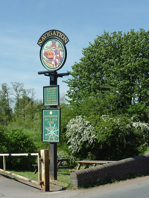
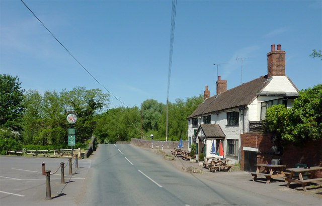
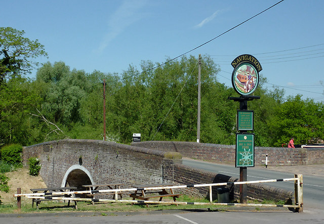
Despite its relatively small size, Swindon has a range of amenities to cater to the needs of its residents. The town has a primary school, a village hall, and a local pub, providing a focal point for socializing. Additionally, Swindon is well-connected to neighboring towns and cities, with good road links and public transport options, making it easily accessible for those commuting or looking to explore the wider area.

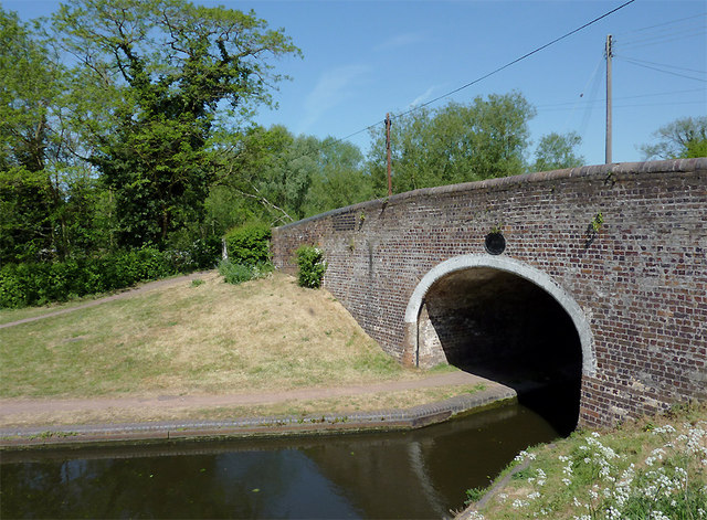
The surrounding countryside offers ample opportunities for outdoor activities, such as hiking, cycling, and fishing, attracting nature enthusiasts and adventurers alike. The nearby Peak District National Park provides stunning landscapes and scenic trails for visitors to explore, making Swindon an ideal base for outdoor enthusiasts.

Overall, Swindon is a charming and welcoming town, offering a peaceful and picturesque setting, along with convenient access to amenities and nearby attractions.

If you have any feedback on the listing, please let us know in the comments section below.
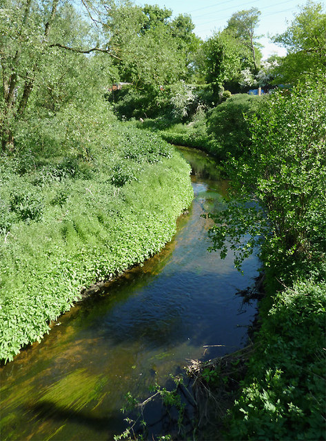
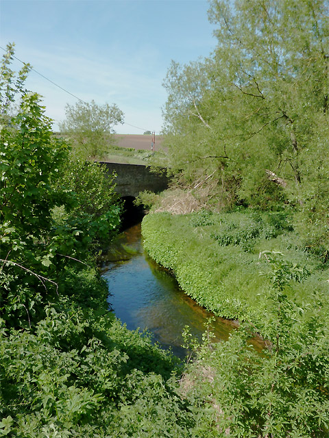
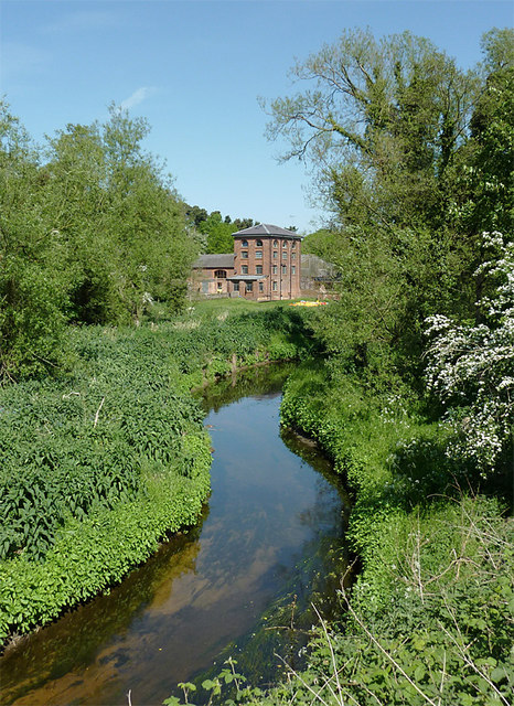
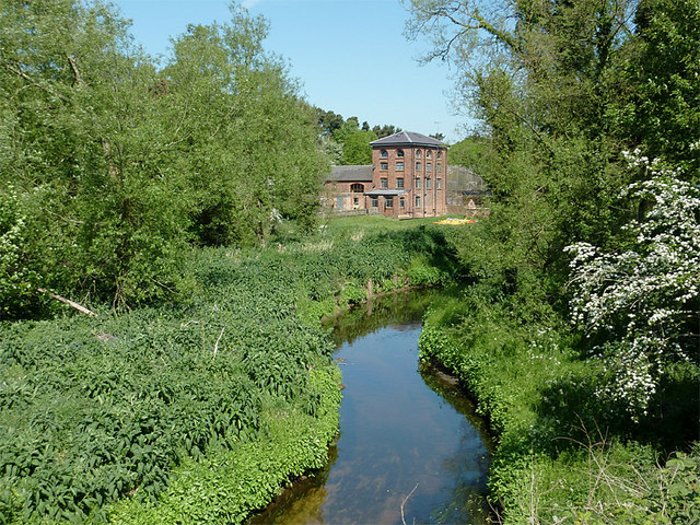
Swindon Images

Images are sourced within 2km of 52.512923/-2.2038313 or Grid Reference SO8690. Thanks to Geograph Open Source API. All images are credited.

Botterham Top Lock Looking north-north-west as the Staffordshire and Worcestershire Canal meanders towards Wolverhampton.
The Botterham double chamber staircase provides a rise (or fall) of 20ft 3in (about 6·2 metres).
Botterham Top Lock
Looking north-north-west as the Staffordshire and Worcestershire Canal meanders towards Wolverhampton. The Botterham double chamber staircase provides a rise (or fall) of 20ft 3in (about 6·2 metres).
Farmland north of Ashwood, Staffordshire The Wom Brook and the Smestow River have created a wide valley across which extensive arable farming and horse grazing are the main land uses.
Farmland north of Ashwood, Staffordshire
The Wom Brook and the Smestow River have created a wide valley across which extensive arable farming and horse grazing are the main land uses.
Farmland north of Ashwood, Staffordshire This telephoto assisted view of fields and woodland around Elm Tree Farm was taken from near Ashwood Lodge. Land is much used for crop growing, with some grassy paddocks for horses. Stabling for the horse riding community is widespread in the vicinity.
Farmland north of Ashwood, Staffordshire
This telephoto assisted view of fields and woodland around Elm Tree Farm was taken from near Ashwood Lodge. Land is much used for crop growing, with some grassy paddocks for horses. Stabling for the horse riding community is widespread in the vicinity.
Pub sign by Greensforge Bridge, Staffordshire The Navigation Inn is by Bridge No 37 on the Staffordshire and Worcestershire Canal at Greensforge Lock near Kingswinford.
Pub sign by Greensforge Bridge, Staffordshire
The Navigation Inn is by Bridge No 37 on the Staffordshire and Worcestershire Canal at Greensforge Lock near Kingswinford.
Ashwood Lower Lane at Greensforge, Staffordshire The Navigation Inn is on the right. Greensforge Bridge ahead crosses the Staffordshire and Worcestershire Canal by Greensforge Lock.
Ashwood Lower Lane at Greensforge, Staffordshire
The Navigation Inn is on the right. Greensforge Bridge ahead crosses the Staffordshire and Worcestershire Canal by Greensforge Lock.
Greensforge Bridge near Kingswinford, Staffordshire This is Bridge No 37 across the Staffordshire and Worcestershire Canal. The pub sign refers to The Navigation Inn, off to the right. The woman in red (top right) is at the tiller of a narrowboat negotiating Greensforge Lock.

<a href="https://www.geograph.org.uk/photo/2398674">SO8688 : Ashwood Lower Lane at Greensforge, Staffordshire</a>
Greensforge Bridge near Kingswinford, Staffordshire
This is Bridge No 37 across the Staffordshire and Worcestershire Canal. The pub sign refers to The Navigation Inn, off to the right. The woman in red (top right) is at the tiller of a narrowboat negotiating Greensforge Lock. SO8688 : Ashwood Lower Lane at Greensforge, Staffordshire
Greensforge Bridge near Kingswinford, Staffordshire This is Bridge No 37 across the Staffordshire and Worcestershire Canal. Narrowboats entering the bridge hole here go directly into Greensforge Lock.
Greensforge Bridge near Kingswinford, Staffordshire
This is Bridge No 37 across the Staffordshire and Worcestershire Canal. Narrowboats entering the bridge hole here go directly into Greensforge Lock.
The Smestow River at Greensforge, Staffordshire The river is flowing south,towards the camera. It meets the River Stour about two miles away. Above the bank on the right, narrowboats moored on the Staffordshire and Worcestershire Canal are just visible.

Much work has been done on the Smestow Brook in recent years to reduce the frequency of its flooding. Apparently, the dredging work has increased the depth in places to four feet (1.25m) resulting in the brook's upgrading to "river" status, but map makers are not yet cognisant of this (everyone still calls it Smestow Brook anyway!). Of course, such work needs constant maintenance. <span class="nowrap"><a title="http://www.roman-britain.org/places/greensforge.htm" rel="nofollow ugc noopener" href="http://www.roman-britain.org/places/greensforge.htm">Link</a><img style="margin-left:2px;" alt="External link" title="External link - shift click to open in new window" src="https://s1.geograph.org.uk/img/external.png" width="10" height="10"/></span>
The Smestow River at Greensforge, Staffordshire
The river is flowing south,towards the camera. It meets the River Stour about two miles away. Above the bank on the right, narrowboats moored on the Staffordshire and Worcestershire Canal are just visible. Much work has been done on the Smestow Brook in recent years to reduce the frequency of its flooding. Apparently, the dredging work has increased the depth in places to four feet (1.25m) resulting in the brook's upgrading to "river" status, but map makers are not yet cognisant of this (everyone still calls it Smestow Brook anyway!). Of course, such work needs constant maintenance. LinkExternal link
The Smestow River at Greensforge, Staffordshire The river is flowing south, away from the camera. It meets the River Stour about two miles downstream. 
Much work has been done on the Smestow Brook in recent years to reduce the frequency of its flooding. Apparently, the dredging work has increased the depth in places to four feet (1.25m) resulting in the brook's upgrading to "river" status, but map makers are not yet cognisant of this (everyone still calls it Smestow Brook anyway!). Of course, such work needs constant maintenance. <span class="nowrap"><a title="http://www.roman-britain.org/places/greensforge.htm" rel="nofollow ugc noopener" href="http://www.roman-britain.org/places/greensforge.htm">Link</a><img style="margin-left:2px;" alt="External link" title="External link - shift click to open in new window" src="https://s1.geograph.org.uk/img/external.png" width="10" height="10"/></span>
The Smestow River at Greensforge, Staffordshire
The river is flowing south, away from the camera. It meets the River Stour about two miles downstream. Much work has been done on the Smestow Brook in recent years to reduce the frequency of its flooding. Apparently, the dredging work has increased the depth in places to four feet (1.25m) resulting in the brook's upgrading to "river" status, but map makers are not yet cognisant of this (everyone still calls it Smestow Brook anyway!). Of course, such work needs constant maintenance. LinkExternal link
The Smestow River at Greensforge, Staffordshire The river is flowing south, towards the camera. It meets the River Stour about two miles away. On the far bank is Greensforge Mill.

Much work has been done on the Smestow Brook in recent years to reduce the frequency of its flooding. Apparently, the dredging work has increased the depth in places to four feet (1.25m) resulting in the brook's upgrading to "river" status, but map makers are not yet cognisant of this (everyone still calls it Smestow Brook anyway!). Of course, such work needs constant maintenance. <span class="nowrap"><a title="http://www.roman-britain.org/places/greensforge.htm" rel="nofollow ugc noopener" href="http://www.roman-britain.org/places/greensforge.htm">Link</a><img style="margin-left:2px;" alt="External link" title="External link - shift click to open in new window" src="https://s1.geograph.org.uk/img/external.png" width="10" height="10"/></span>

There has been a mill on this site since at least the 16th century. In 1602 the existing corn mill was converted into a hammer mill. It was rebuilt in the late 19th century and was a corn mill again until it closed in about 1925. Further conversion into apartments has now taken place.
The Smestow River at Greensforge, Staffordshire
The river is flowing south, towards the camera. It meets the River Stour about two miles away. On the far bank is Greensforge Mill. Much work has been done on the Smestow Brook in recent years to reduce the frequency of its flooding. Apparently, the dredging work has increased the depth in places to four feet (1.25m) resulting in the brook's upgrading to "river" status, but map makers are not yet cognisant of this (everyone still calls it Smestow Brook anyway!). Of course, such work needs constant maintenance. LinkExternal link There has been a mill on this site since at least the 16th century. In 1602 the existing corn mill was converted into a hammer mill. It was rebuilt in the late 19th century and was a corn mill again until it closed in about 1925. Further conversion into apartments has now taken place.
The Smestow River at Greensforge, Staffordshire The river is flowing south, towards the camera. It meets the River Stour about two miles away. On the far bank is Greensforge Mill.

Much work has been done on the Smestow Brook in recent years to reduce the frequency of its flooding. Apparently, the dredging work has increased the depth in places to four feet (1.25m) resulting in the brook's upgrading to "river" status, but map makers are not yet cognisant of this (everyone still calls it Smestow Brook anyway). Of course, such work needs constant maintenance. <span class="nowrap"><a title="http://www.roman-britain.org/places/greensforge.htm" rel="nofollow ugc noopener" href="http://www.roman-britain.org/places/greensforge.htm">Link</a><img style="margin-left:2px;" alt="External link" title="External link - shift click to open in new window" src="https://s1.geograph.org.uk/img/external.png" width="10" height="10"/></span>

There has been a mill on this site since at least the 16th century. In 1602 the existing corn mill was converted into a hammer mill. It was rebuilt in the late 19th century and was a corn mill again until it closed in about 1925. Further conversion into apartments has now taken place.
The Smestow River at Greensforge, Staffordshire
The river is flowing south, towards the camera. It meets the River Stour about two miles away. On the far bank is Greensforge Mill. Much work has been done on the Smestow Brook in recent years to reduce the frequency of its flooding. Apparently, the dredging work has increased the depth in places to four feet (1.25m) resulting in the brook's upgrading to "river" status, but map makers are not yet cognisant of this (everyone still calls it Smestow Brook anyway). Of course, such work needs constant maintenance. LinkExternal link There has been a mill on this site since at least the 16th century. In 1602 the existing corn mill was converted into a hammer mill. It was rebuilt in the late 19th century and was a corn mill again until it closed in about 1925. Further conversion into apartments has now taken place.
Play area, Wall Heath
Shopping Precinct, Wall Heath
Cross Street, Wall Heath
View over Gates and Barriers on the Mile Flat These barriers in the gateways are there to prevent unlawful access. In the distance is Swindon to the right and Camp Hill to the left.
View over Gates and Barriers on the Mile Flat
These barriers in the gateways are there to prevent unlawful access. In the distance is Swindon to the right and Camp Hill to the left.
The End of the Mile Flat This junction splits the Mile Flat, right turn goes to The Navigation Inn and Highgate Common, left turn goes back to the A449 passing Ashwood Nurseries.
The End of the Mile Flat
This junction splits the Mile Flat, right turn goes to The Navigation Inn and Highgate Common, left turn goes back to the A449 passing Ashwood Nurseries.
Chasepool Lodge trig in evening sunshine Looking NNE across the autumn fields, with Chasepool Farm in the middle distance.
Chasepool Lodge trig in evening sunshine
Looking NNE across the autumn fields, with Chasepool Farm in the middle distance.
St Andrew's Church Wall Heath St Andrew's United Reformed church Wall Heath.
St Andrew's Church Wall Heath
St Andrew's United Reformed church Wall Heath.
Show me another place!

Swindon is located at Grid Ref: SO8690 (Lat: 52.512923, Lng: -2.2038313)

Administrative County: Staffordshire

District: South Staffordshire

Police Authority: Staffordshire

What 3 Words

///toned.charge.reform. Near Wombourn, Staffordshire

Nearby Locations

Swindon Rough Swindon

Related Wikis

Swindon, Staffordshire

Swindon is a village and civil parish located in the West Midlands. The nearest major town is Dudley, approximately five miles eastwards. It stands halfway...

Himley railway station

Himley was a station on the Wombourne Branch Line. Unlike other stops along the route, it was deemed worthy of full station status. It was opened by the...

Himley

Himley is a small village and civil parish in Staffordshire, England, 4 miles (6.4 km) west of Dudley and 5 mi (8.0 km) southwest of Wolverhampton. At...

Wall Heath

Wall Heath is a suburban village in the Dudley Metropolitan Borough in the West Midlands of England. It is located on the A449 road, approximately 1.5...

Greensforge

Greensforge is a scattered hamlet on the boundary of Kinver and Swindon parishes, in South Staffordshire, England. It is noted for its Roman associations...

Holbeche House

Holbeche House (also, in some texts, Holbeach or Holbeache) is a mansion located approximately 1 mile (1.6 km) north of Kingswinford, now in the Metropolitan...

Wombourne

Wombourne is a village and civil parish located in the district of South Staffordshire, in the county of Staffordshire, England. It is 4 miles (6 km) south...

Summerhill School, Kingswinford

Summerhill School is a mixed community secondary school located in Kingswinford, West Midlands, England. == History == The school was built by Brierley...

Nearby Amenities

Located within 500m of 52.512923,-2.2038313
Swindon
Created By: Potlatch 0.5d
Is In: Staffordshire
Place: village
Wikidata: Q2276930
Lat/Long: 52.5140554/-2.2035803
Pub
Old Bush
Real Ale: yes
Source: survey
Lat/Long: 52.5131617/-2.202531
Welcome to Swindon
Description: Board with information about the village and its history
Information: board
Source: survey
Tourism: information
Lat/Long: 52.5135938/-2.2044299
Bench
Source: survey
Lat/Long: 52.5130092/-2.2044894
Barrier: stile
Foot: yes
Lat/Long: 52.5161695/-2.2027302
Post Box
Operator: Royal Mail
Ref: DY3 507
Lat/Long: 52.5132824/-2.2028348
Pub
The Green Man
Food: yes
Real Ale: yes
Source: survey
Lat/Long: 52.5125495/-2.2060582
Seamark Type: gate
Source: visual survey; bing
Waterway: lock_gate
Lat/Long: 52.5153714/-2.2051014
Seamark Type: gate
Source: visual survey; bing
Waterway: lock_gate
Lat/Long: 52.5155845/-2.2050496
Seamark Type: gate
Source: visual survey; bing
Waterway: lock_gate
Lat/Long: 52.5131214/-2.2045641
Seamark Type: gate
Source: visual survey; bing
Waterway: lock_gate
Lat/Long: 52.5129053/-2.2046063
Bus Stop
The Greyhound Inn PH
Bus: yes
Naptan AtcoCode: 3800C609200
Naptan Bearing: S
Naptan CommonName: The Greyhound Inn PH
Naptan Indicator: Opp
Naptan Landmark: The Greyhound Inn PH
Naptan Street: Wombourne Rd
Naptan Verified: yes
Operator: National Express West Midlands
Public Transport: platform
Route Ref: 255
Shelter: no
Source: naptan_import;survey
Lat/Long: 52.514288/-2.2025663
Bus Stop
The Greyhound Inn PH
Bus: yes
Naptan AtcoCode: 3800C609201
Naptan Bearing: N
Naptan CommonName: The Greyhound Inn PH
Naptan Indicator: Adj
Naptan Landmark: The Greyhound Inn PH
Naptan Street: Wombourne Road
Naptan Verified: yes
Public Transport: platform
Shelter: no
Source: naptan_import;survey
Lat/Long: 52.5146594/-2.2027687
Bus Stop
The Green Man Inn PH
Bus: yes
Naptan AtcoCode: 3800C609300
Naptan Bearing: W
Naptan CommonName: The Green Man Inn PH
Naptan Indicator: Opp
Naptan Landmark: The Green Man Inn PH
Naptan Street: High Street
Naptan Verified: yes
Public Transport: platform
Shelter: no
Source: naptan_import
Lat/Long: 52.5123448/-2.2062761
Bus Stop
The Green Man Inn PH
Bus: yes
Naptan AtcoCode: 3800C609301
Naptan Bearing: NE
Naptan BusStopType: CUS
Naptan CommonName: The Green Man Inn PH
Naptan Indicator: Adj
Naptan Landmark: The Green Man Inn PH
Naptan Street: High Street
Naptan Verified: no
Public Transport: platform
Source: naptan_import
Lat/Long: 52.5125118/-2.2058672
Bus Stop
Hinksford Gardens
Bus: yes
Naptan AtcoCode: 3800C636301
Naptan Bearing: S
Naptan CommonName: Hinksford Gardens
Naptan Indicator: Adj
Naptan Landmark: Hinksford Gardens
Naptan Street: Hinksford Lane
Naptan Verified: yes
Public Transport: platform
Shelter: no
Source: naptan_import;survey
Lat/Long: 52.5125191/-2.2023756
Bus Stop
Hinksford Gardens
Bus: yes
Naptan AtcoCode: 3800C636302
Naptan Bearing: N
Naptan CommonName: Hinksford Gardens
Naptan Indicator: Opp
Naptan Landmark: Hinksford Gardens
Naptan Street: Hinksford Lane
Naptan Verified: yes
Public Transport: platform
Shelter: no
Source: naptan_import;survey
Lat/Long: 52.5123427/-2.2024626
Bus Stop
Reynolds Close
Bus: yes
Naptan AtcoCode: 3800C641401
Naptan Bearing: W
Naptan CommonName: Reynolds Close
Naptan Indicator: Adj
Naptan Landmark: Reynolds Close
Naptan Street: High Street
Naptan Verified: no
Public Transport: platform
Source: naptan_import
Lat/Long: 52.512945/-2.2033798
Bus Stop
Reynolds Close
Bus: yes
Naptan AtcoCode: 3800C641402
Naptan Bearing: E
Naptan BusStopType: CUS
Naptan CommonName: Reynolds Close
Naptan Indicator: Opp
Naptan Landmark: Reynolds Close
Naptan Street: High Street
Naptan Verified: no
Public Transport: platform
Source: naptan_import
Lat/Long: 52.5130285/-2.2035667
Bus Stop
Albert Drive
Naptan AtcoCode: 3800C641701
Naptan Bearing: SW
Naptan CommonName: Albert Drive
Naptan Indicator: Adj
Naptan Landmark: Albert Drive
Naptan Street: Wombourne Road
Naptan Verified: yes
Public Transport: platform
Shelter: no
Source: naptan_import;survey
Lat/Long: 52.5162842/-2.2017684
Bus Stop
Albert Drive
Naptan AtcoCode: 3800C641702
Naptan Bearing: NE
Naptan CommonName: Albert Drive
Naptan Indicator: Opp
Naptan Landmark: Albert Drive
Naptan Street: Wombourne Road
Naptan Verified: yes
Public Transport: platform
Shelter: no
Source: naptan_import;survey
Lat/Long: 52.5165194/-2.2016518
Power: tower
Source: OS 1:25k
Lat/Long: 52.5153053/-2.1977495
Power: tower
Source: bing
Lat/Long: 52.5121876/-2.1974637
Power: tower
Source: bing
Lat/Long: 52.5122578/-2.1969773
Power: tower
Source: bing
Lat/Long: 52.5147748/-2.1986847
Power: tower
Source: bing
Lat/Long: 52.5148326/-2.1980417
Barrier: cycle_barrier
Source: survey
Lat/Long: 52.5129009/-2.2045255
Seamark Type: gate
Waterway: lock_gate
Lat/Long: 52.5090361/-2.2005224
Seamark Type: gate
Waterway: lock_gate
Lat/Long: 52.5090567/-2.2001673
Barrier: stile
Source: survey
Lat/Long: 52.5091169/-2.2001386
Bench
Source: survey
Lat/Long: 52.5100596/-2.2036427
Bench
Source: survey
Lat/Long: 52.5154148/-2.2052013
Bench
Source: survey
Lat/Long: 52.5156303/-2.2051761
Waste Basket
Lat/Long: 52.5132713/-2.2026367
Swindon Parish Council
Board Type: notice
Information: board
Tourism: information
Lat/Long: 52.513224/-2.202858
Bicycle Parking
Bicycle Parking: wave
Capacity: 4
Covered: no
Fee: no
Lat/Long: 52.5132879/-2.2026441
The data included in this document is from www.openstreetmap.org. The data is made available under ODbL.

Have you been to Swindon?

Leave your review of Swindon below (or comments, questions and feedback).