Sutton Bridge
Settlement in Lincolnshire South Holland
England
Sutton Bridge
Sutton Bridge is a small town located in the district of South Holland, Lincolnshire, England. Situated on the banks of the River Nene, it serves as a vital crossing point between Lincolnshire and Norfolk. The town has a population of around 4,700 residents.
Historically, Sutton Bridge was an important trading post due to its proximity to the river, which provided a direct route to the North Sea. The town's name originates from the bridge that was built in the 19th century to connect Lincolnshire to Norfolk. This bridge, now known as the Sutton Bridge Swing Bridge, is a notable landmark and is still in operation today.
The town boasts a rich industrial heritage, with agriculture and shipping playing significant roles in its economic development. The nearby Port of Sutton Bridge is an important commercial port, handling a range of goods, including aggregates, grain, and timber. The town is also home to several industrial estates, providing employment opportunities for its residents.
Sutton Bridge offers a range of amenities and services to its residents, including shops, pubs, and restaurants. The town is well-connected, with good transportation links, including the A17 road that runs through it. Additionally, the nearby railway station at King's Lynn provides further transportation options.
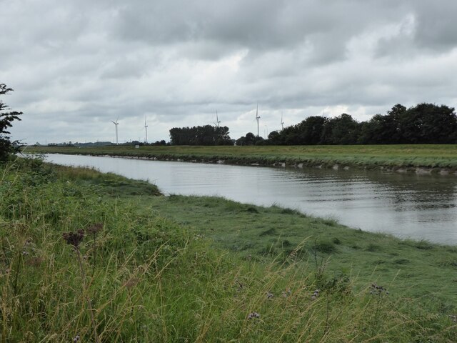
For nature enthusiasts, Sutton Bridge provides access to the beautiful Lincolnshire countryside. The area is known for its scenic landscapes and offers opportunities for walking, cycling, and birdwatching.
Overall, Sutton Bridge is a small yet thriving town with a rich history and strong industrial connections, making it an important hub within the Lincolnshire region.
If you have any feedback on the listing, please let us know in the comments section below.
Sutton Bridge Images
Images are sourced within 2km of 52.768986/0.188703 or Grid Reference TF4721. Thanks to Geograph Open Source API. All images are credited.


Sutton Bridge is located at Grid Ref: TF4721 (Lat: 52.768986, Lng: 0.188703)
Division: Parts of Holland
Administrative County: Lincolnshire
District: South Holland
Police Authority: Lincolnshire
What 3 Words
///mainly.outfit.clays. Near Sutton Bridge, Lincolnshire
Nearby Locations
Related Wikis

Sutton Bridge
Sutton Bridge is a village and civil parish in the South Holland district of Lincolnshire, England. It is situated on the A17 road, 7 miles (11 km) north...
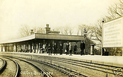
Sutton Bridge railway station
Sutton Bridge railway station was a station in Sutton Bridge, south Lincolnshire, England, which opened in the 19th century. It became part of the Midland...

Cross Keys Bridge
Cross Keys Bridge is a swing bridge that carries the busy single carriageway A17 road which runs from Newark in Nottinghamshire to King's Lynn in Norfolk...

RAF Sutton Bridge
Royal Air Force Sutton Bridge or more simply RAF Sutton Bridge is a former Royal Air Force station found next to the village of Sutton Bridge in the south...
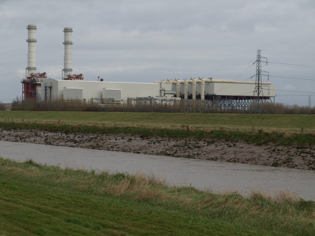
Sutton Bridge Power Station
Sutton Bridge Power Station is an 819 MW gas-fired power station in Sutton Bridge in the south-east of Lincolnshire in South Holland, England. It is situated...

Little Sutton, Lincolnshire
Little Sutton is a small civil parish, containing a few farms and a few houses, lying between the much larger parishes of Long Sutton and Sutton Bridge...
Tydd railway station
Tydd railway station was a station, opened by the Peterborough, Wisbech and Sutton Bridge Railway on 1 August 1866, in Lincolnshire serving the villages...

Tydd Gote
Tydd Gote is an English village, partly, at the north, in the civil parish of Tydd St Mary of the South Holland District of Lincolnshire, and partly, at...
Nearby Amenities
Located within 500m of 52.768986,0.188703Have you been to Sutton Bridge?
Leave your review of Sutton Bridge below (or comments, questions and feedback).