Sundridge

Settlement in Kent Sevenoaks

England

Sundridge

Mond Court this interesting building at Sundridge is dated 1913 and located just South of the A25 on the Ide Hill road.
Mond Court Credit: Chris Shaw

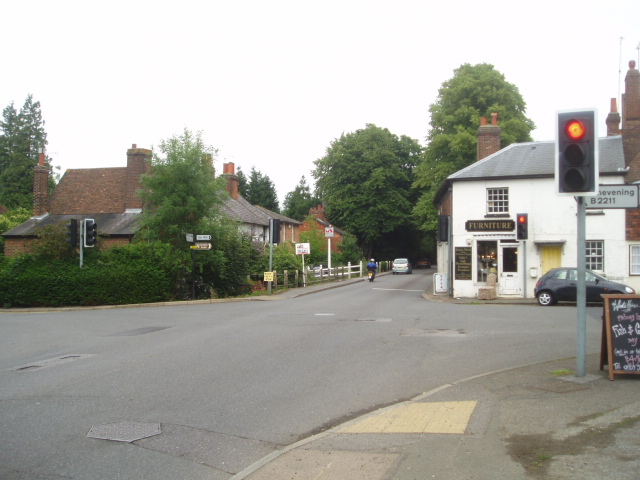
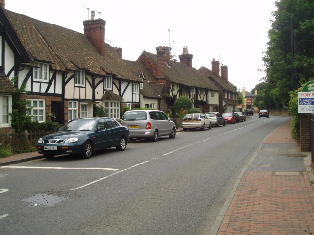
Sundridge is a charming village situated in the district of Sevenoaks, Kent, England. With a population of approximately 1,000 residents, it is a small but vibrant community that offers a peaceful and picturesque setting.

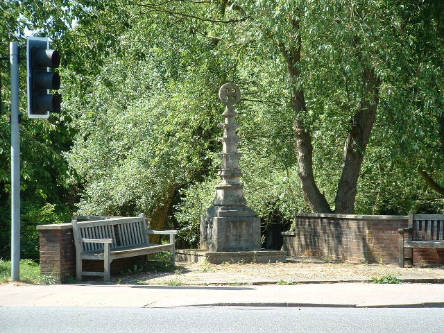
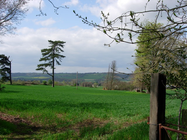
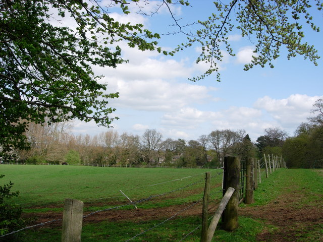
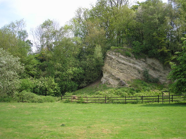
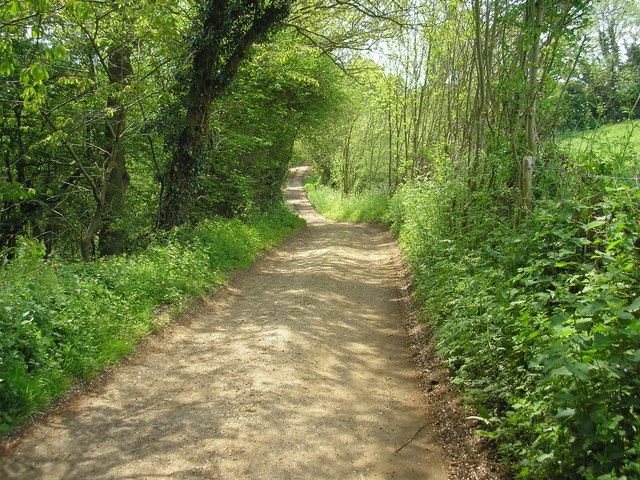
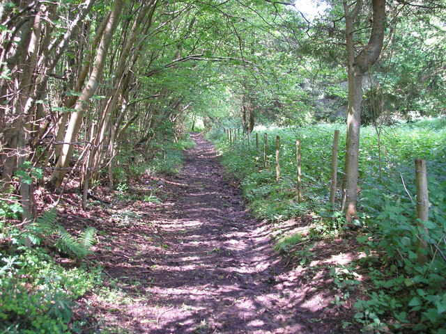
Nestled among the rolling hills of the North Downs, Sundridge is renowned for its stunning natural beauty. The village is surrounded by lush green fields, majestic woodlands, and idyllic countryside, making it an ideal location for nature lovers and outdoor enthusiasts. The area is also home to several walking and cycling trails, providing ample opportunities to explore the scenic surroundings.

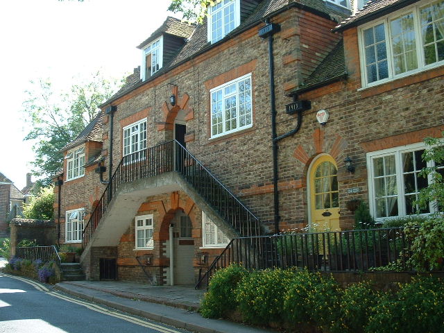
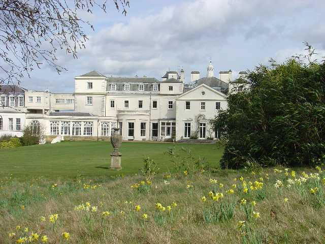
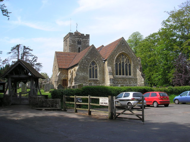
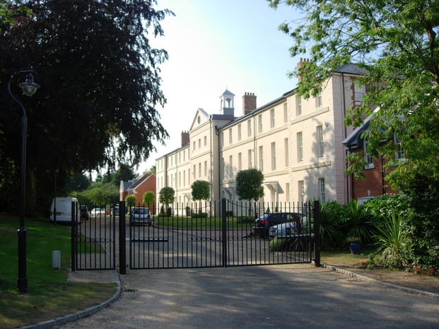
The village itself boasts a rich history and a quaint, traditional feel. Its architecture is a blend of historic and modern buildings, with many well-preserved period properties lining the streets. The iconic Sundridge Park, a Grade I listed mansion, is a notable landmark that adds to the village's charm.

Sundridge offers a range of amenities and services to cater to its residents' needs. There is a village hall, a primary school, and a local pub that serves as a social hub for the community. The village also hosts various events and festivals throughout the year, fostering a strong sense of community spirit.

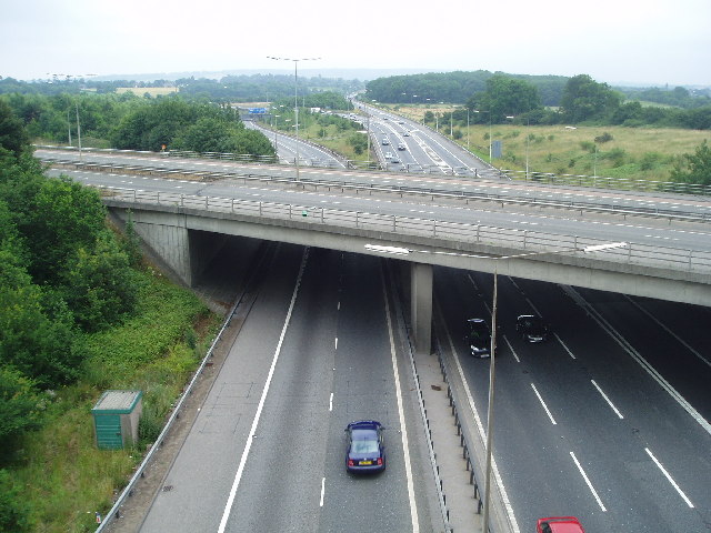
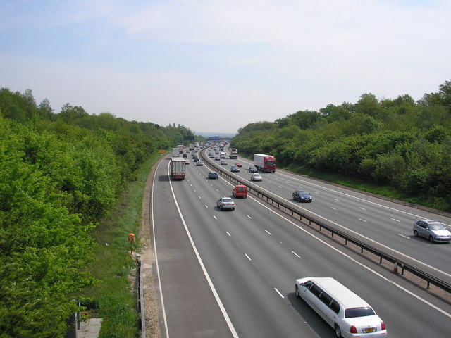
Transport links in Sundridge are excellent, with easy access to nearby towns such as Sevenoaks and Bromley. Additionally, the village is well-connected to London, with regular train services available from nearby stations.

In summary, Sundridge is a picturesque village that offers a tranquil and close-knit community, stunning natural surroundings, and convenient access to nearby amenities. It is a hidden gem in the heart of Kent, appealing to those seeking a peaceful and idyllic lifestyle.

If you have any feedback on the listing, please let us know in the comments section below.
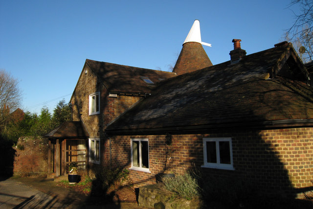
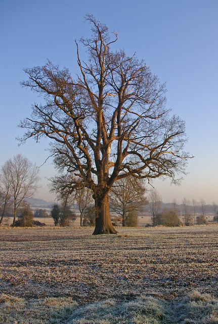
Sundridge Images

Images are sourced within 2km of 51.278144/0.127512 or Grid Reference TQ4855. Thanks to Geograph Open Source API. All images are credited.

Mond Court this interesting building at Sundridge is dated 1913 and located just South of the A25 on the Ide Hill road.
Mond Court
this interesting building at Sundridge is dated 1913 and located just South of the A25 on the Ide Hill road.
Sundridge Memorial At crossroads on A25.
Sundridge Memorial
At crossroads on A25.
Combe Bank School, Sundridge Combe Bank is a fine Palladian house built in 1720. The buildings are now used as an independent girls school. Details of the school and estate can be found at: <span class="nowrap"><a title="http://www.combebank.kent.sch.uk" rel="nofollow ugc noopener" href="http://www.combebank.kent.sch.uk">Link</a><img style="margin-left:2px;" alt="External link" title="External link - shift click to open in new window" src="https://s1.geograph.org.uk/img/external.png" width="10" height="10"/></span>
Combe Bank School, Sundridge
Combe Bank is a fine Palladian house built in 1720. The buildings are now used as an independent girls school. Details of the school and estate can be found at: LinkExternal link
M25 & M26 near Chevening & Chipstead This is where the M25 London Orbital Road turns to the north (left in the picture) and the M26 continues to the east.
M25 & M26 near Chevening & Chipstead
This is where the M25 London Orbital Road turns to the north (left in the picture) and the M26 continues to the east.
Cross roads on the A25 at Sundridge A familiar view for those driving along the A25 towards Sevenoaks
Cross roads on the A25 at Sundridge
A familiar view for those driving along the A25 towards Sevenoaks
Brasted High Street on the A25 Picture taken from close to the village hall, this village was 'saved' by the building of the M25 nearby.
Brasted High Street on the A25
Picture taken from close to the village hall, this village was 'saved' by the building of the M25 nearby.
M25 Motorway A photograph of the M25 near Sevenoaks taken early afternoon before the rush hour.
M25 Motorway
A photograph of the M25 near Sevenoaks taken early afternoon before the rush hour.
M25 Motorway - West Early afternoon traffic near Sevenoaks on the M25 going west.
M25 Motorway - West
Early afternoon traffic near Sevenoaks on the M25 going west.
Farmland looking towards M25 and North Downs Over the fields is Brasted village on the busy A25 with the equally busy and noisy M25 motorway beyond that, with the North downs in the distance.
Farmland looking towards M25 and North Downs
Over the fields is Brasted village on the busy A25 with the equally busy and noisy M25 motorway beyond that, with the North downs in the distance.
Birchfield Farmland This photograph was taken from New Road that runs from Ide Hill to Brasted and is looking across towards Sundridge.
Birchfield Farmland
This photograph was taken from New Road that runs from Ide Hill to Brasted and is looking across towards Sundridge.
M25 from Brasted Hill Road A motorway does not make the most beautiful of pictures, but here cars, vans, HGVs and a stretch limo. all add interest - and CO2
M25 from Brasted Hill Road
A motorway does not make the most beautiful of pictures, but here cars, vans, HGVs and a stretch limo. all add interest - and CO2
Ragstone outcrop, Dryhill Nature Reserve, Kent Dryhill Local Nature Reserve is to be found just south of the A25 near Sundridge village.  This fine Ragstone outcrop and other interesting rock formations are to be seen.
Ragstone outcrop, Dryhill Nature Reserve, Kent
Dryhill Local Nature Reserve is to be found just south of the A25 near Sundridge village. This fine Ragstone outcrop and other interesting rock formations are to be seen.
Dryhill Lane, a public bridleway Thankfully, the southern portion of Dryhill Lane only has bridleway status, so those nasty gas-guzzling 4x4s (or other motor cars) cannot be brought here to disturb its peace.
Dryhill Lane, a public bridleway
Thankfully, the southern portion of Dryhill Lane only has bridleway status, so those nasty gas-guzzling 4x4s (or other motor cars) cannot be brought here to disturb its peace.
St. Martin's Church, Brasted, Kent This fine parish church is built mainly of the local Kentish ragstone. It occupies a secluded site on the northern edge of the village - and there is even a quiet pub. (the Stanhope Arms) adjoining.
St. Martin's Church, Brasted, Kent
This fine parish church is built mainly of the local Kentish ragstone. It occupies a secluded site on the northern edge of the village - and there is even a quiet pub. (the Stanhope Arms) adjoining.
A muddy bridleway It occurred to me as I took this photograph to wonder if anyone goes out taking geographs on horseback?  Some use a car, others, especially in urban areas, use public transport.  A motor cycle or bicycle is useful.  But on this extremely muddy bridleway, which runs westwards from New Road, Sundridge, Kent, a horse would have been the best of all.
A muddy bridleway
It occurred to me as I took this photograph to wonder if anyone goes out taking geographs on horseback? Some use a car, others, especially in urban areas, use public transport. A motor cycle or bicycle is useful. But on this extremely muddy bridleway, which runs westwards from New Road, Sundridge, Kent, a horse would have been the best of all.
Birchwood apartments -Sundridge Originally built as a Poor Law Institution and later a hospital for people unable to look after themselves.  Today there are about 27 apartments plus individual housing.
Birchwood apartments -Sundridge
Originally built as a Poor Law Institution and later a hospital for people unable to look after themselves. Today there are about 27 apartments plus individual housing.
Oast House Single round kiln oast house.
Oast House
Single round kiln oast house.
Bare tree in winter View from Chevening Lane, with the North Downs in the distance.
Bare tree in winter
View from Chevening Lane, with the North Downs in the distance.
Show me another place!

Sundridge is located at Grid Ref: TQ4855 (Lat: 51.278144, Lng: 0.127512)

Administrative County: Kent

District: Sevenoaks

Police Authority: Kent

What 3 Words

///shakes.medium.upgrading. Near Sundridge, Kent

Related Wikis

Radnor House Sevenoaks School

Radnor House Sevenoaks School (formerly Combe Bank School) is a coeducational private day school located in Sundridge (near Sevenoaks) in the English county...

R. Durtnell & Sons

R. Durtnell & Sons was an English building company established in 1591 that had been continuously in the same family in Brasted, in the English county...

Dryhill

Dryhill is a small hamlet in the Sevenoaks district, in the county of Kent, England. == Location == It is about two miles away from the large town of Sevenoaks...

Brasted

Brasted is a village and civil parish in the Sevenoaks District of Kent, England. Brasted lies on the A25 road, between Sundridge and Westerham; the road...

Bessels Green

Bessels Green is a village now incorporated into the built-up area of Sevenoaks in Kent, England. It is on the north-western outskirts of Sevenoaks, in...

Sundridge, Kent

Sundridge is a village within the civil parish of Sundridge with Ide Hill, in the Sevenoaks district of Kent, England. The village is located on the A25...

Dryhill Nature Reserve

Dryhill is an 11.7-hectare (29-acre) geological Site of Special Scientific Interest on the western outskirts of Sevenoaks in Kent. It is a Geological Conservation...

Brasted railway station

Brasted is a disused intermediate railway station in Brasted, Kent on the closed Westerham Valley branch line. The station closed in 1961 and the site...

Nearby Amenities

Located within 500m of 51.278144,0.127512
Bus Stop
Twenties Corner
Naptan AtcoCode: 2400A006400A
Naptan Bearing: W
Naptan CommonName: Twenties Corner
Naptan Indicator: W-bound
Naptan Landmark: Twenties Corner
Naptan NaptanCode: kntajdmd
Naptan Street: Main Road
Naptan Verified: no
Public Transport: platform
Source: naptan_import
Lat/Long: 51.2791214/0.1342083
Bus Stop
White Horse
Bench: yes
Bin: yes
Naptan AtcoCode: 2400A006410A
Naptan Bearing: W
Naptan CommonName: White Horse
Naptan Indicator: opp
Naptan Landmark: White Horse Ph
Naptan NaptanCode: kntajdmg
Naptan Street: Main Road
Naptan Verified: no
Public Transport: platform
Shelter: yes
Source: naptan_import
Lat/Long: 51.2779288/0.1264076
Bus Stop
White Horse
Bench: yes
Bin: yes
Naptan AtcoCode: 2400A006620A
Naptan Bearing: E
Naptan CommonName: White Horse
Naptan Indicator: adj
Naptan Landmark: White Horse Ph
Naptan NaptanCode: kntajdwa
Naptan Street: Main Road
Naptan Verified: no
Public Transport: platform
Shelter: yes
Source: naptan_import
Lat/Long: 51.2780411/0.1255367
Barrier: stile
Lat/Long: 51.2775262/0.1343762
Barrier: stile
Lat/Long: 51.2774188/0.130076
Pub
White Horse
Source: local_knowledge
Toilets: yes
Toilets Access: customers
Lat/Long: 51.2780367/0.1272553
Turning Circle
Lat/Long: 51.2769628/0.1214517
Post Office
Sundridge Post Office
Addr Postcode: TN14 6ET
Branch: Sundridge
Brand: Post Office
Brand Wikidata: Q1783168
Check Date: 2020-02-20
Contact Website: https://www.postoffice.co.uk/branch-finder/1369482/sundridge
Ref Pol Id: 2450
Lat/Long: 51.278133/0.1237046
Traffic Signals
Traffic Signals Forward: backward
Lat/Long: 51.2780408/0.1276017
Traffic Signals
Traffic Signals Forward: backward
Lat/Long: 51.2781163/0.1272771
Traffic Signals
Traffic Signals Direction: backward
Lat/Long: 51.2782304/0.1277117
Traffic Signals
Traffic Signals Direction: backward
Lat/Long: 51.2783109/0.1274408
Street Lamp
Source: Personal memory
Lat/Long: 51.2782456/0.12737
Street Lamp
Source: Personal memory
Lat/Long: 51.2779588/0.1250205
Street Lamp
Source: Personal memory
Lat/Long: 51.2780443/0.1265761
Street Lamp
Source: Personal memory
Lat/Long: 51.2779253/0.1261308
Street Lamp
Source: Personal memory
Lat/Long: 51.2780594/0.124004
Street Lamp
Source: Personal memory
Lat/Long: 51.2779521/0.1224267
Street Lamp
Source: Personal memory
Lat/Long: 51.2779001/0.1211447
Street Lamp
Source: Personal memory
Lat/Long: 51.2778765/0.1203614
Street Lamp
Source: Personal memory
Lat/Long: 51.2780545/0.1225742
Street Lamp
Source: Personal memory
Lat/Long: 51.2787374/0.1273217
Street Lamp
Source: Personal memory
Lat/Long: 51.2817767/0.12825
Street Lamp
Source: Personal memory
Lat/Long: 51.2791231/0.1266673
Termination pole
Material: wood
Power: pole
Voltage: 33000
Lat/Long: 51.2782046/0.1342115
Post Box
Collection Times: Mo-Fr 17:15; Sa 10:45; Su off
Colour: red
Ref: TN14 180
Royal Cypher: GR
Royal Cypher Wikidata: Q33102273
Lat/Long: 51.2780794/0.1238142
Post Box
Collection Times: Mo-Fr 09:00; Sa 07:00; Su off
Colour: red
Ref: TN14 179
Royal Cypher: EIIR
Royal Cypher Wikidata: Q33102113
Lat/Long: 51.2771797/0.1276542
Barratt Homes
Brand: Barratt Homes
Brand Wikidata: Q43851666
Contact Website: https://www.barrattcareers.co.uk/locations/south-coast-and-kent
Office: company
Lat/Long: 51.2793269/0.1335847
The data included in this document is from www.openstreetmap.org. The data is made available under ODbL.

Have you been to Sundridge?

Leave your review of Sundridge below (or comments, questions and feedback).