Summerhill

Settlement in Worcestershire Wyre Forest

England

Summerhill

The Old Waggon and Horses A public house along Kidderminster Road in Wribbenhall, Bewdley.
The Old Waggon and Horses Credit: Mat Fascione

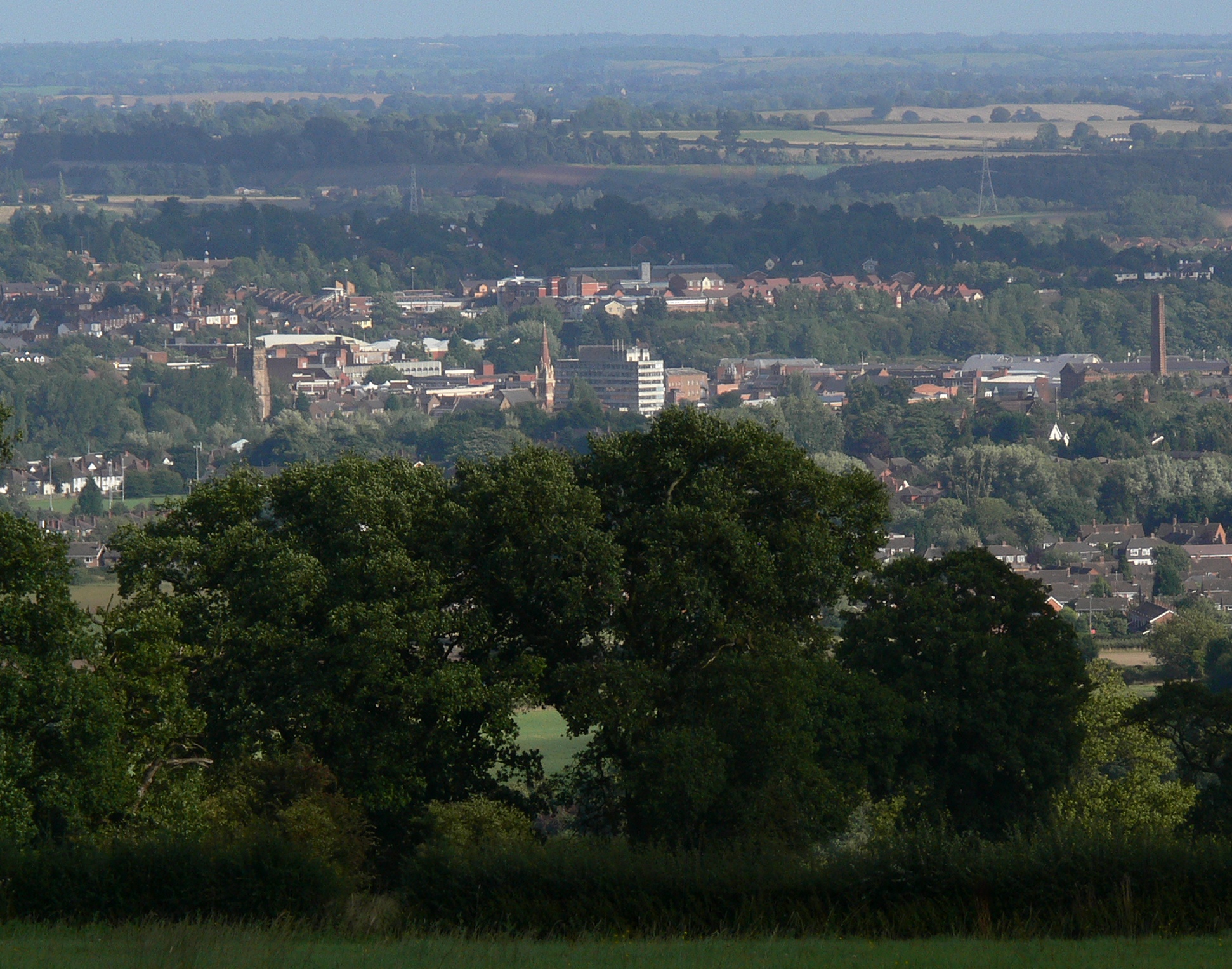
Summerhill is a small village located in the county of Worcestershire, England. Situated in the west of the county, it lies approximately 4 miles southeast of the town of Kidderminster. The village is nestled amidst picturesque countryside, with rolling hills and lush green fields defining its surroundings.

Despite its small size, Summerhill boasts a rich history that dates back centuries. The village is mentioned in the Domesday Book of 1086, highlighting its longstanding presence in the region. The architecture in Summerhill is a mix of traditional and modern styles, with charming cottages and well-maintained houses dotting the landscape.

The village is home to a close-knit community, with a population of around 300 residents. It offers a peaceful and tranquil environment, away from the hustle and bustle of larger towns. Summerhill benefits from its proximity to nearby amenities, with Kidderminster providing a range of shops, schools, and healthcare facilities just a short drive away.

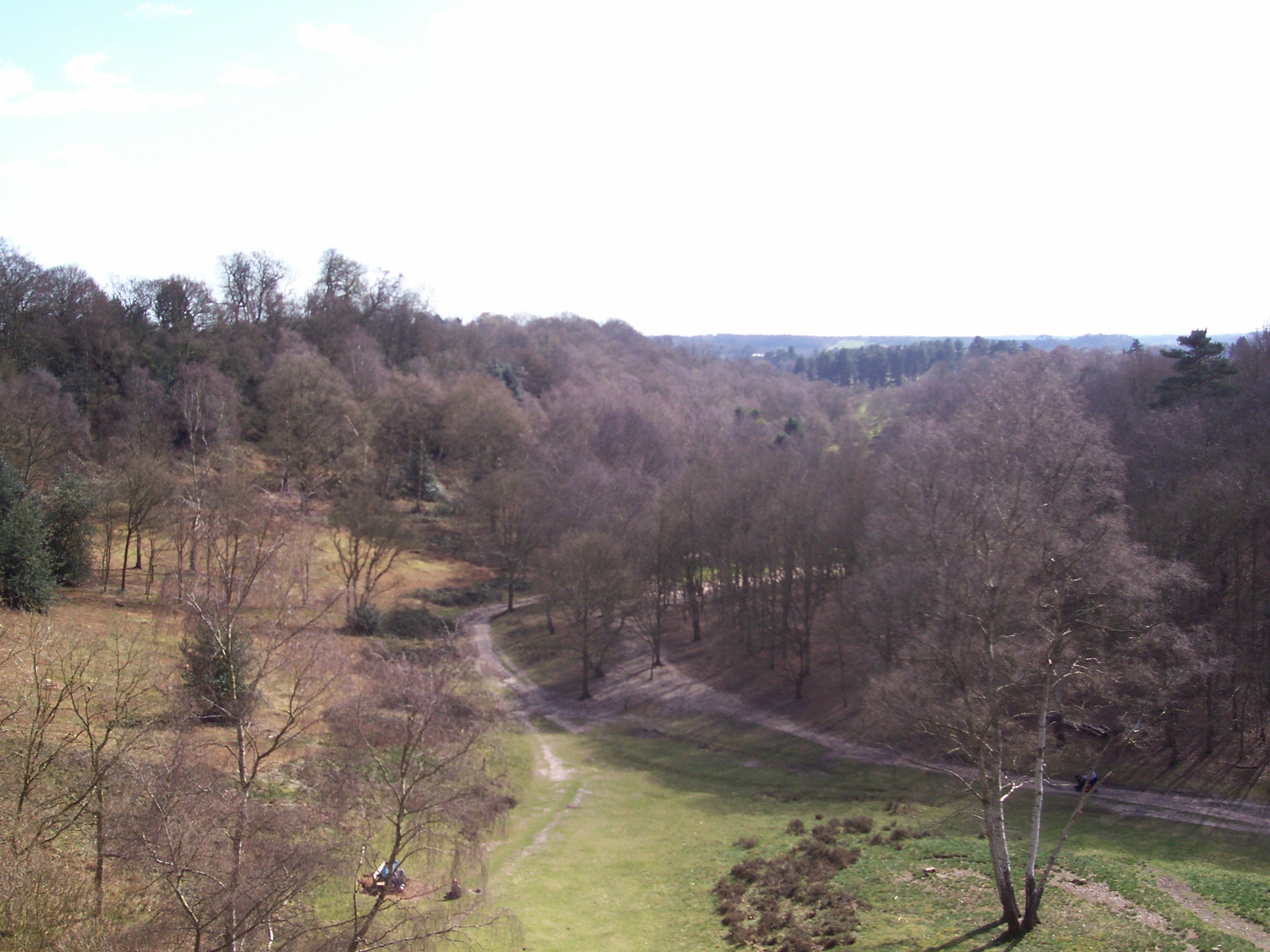
For outdoor enthusiasts, the surrounding countryside offers ample opportunities for exploration and leisure activities. Walking and cycling trails crisscross the area, allowing residents and visitors to enjoy the natural beauty of Worcestershire. Nearby attractions include the Wyre Forest, a vast woodland area renowned for its diverse flora and fauna.

Overall, Summerhill is a charming village with a rich history and a peaceful atmosphere. Its idyllic location and strong sense of community make it an attractive place to live for those seeking a quieter rural lifestyle.

If you have any feedback on the listing, please let us know in the comments section below.

Summerhill Images

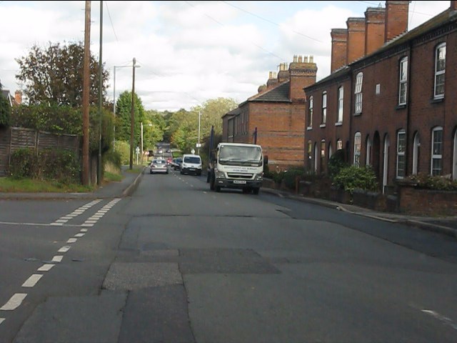
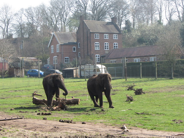
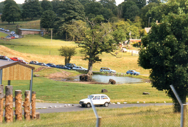
Images are sourced within 2km of 52.384047/-2.2766975 or Grid Reference SO8176. Thanks to Geograph Open Source API. All images are credited.

The Old Waggon and Horses A public house along Kidderminster Road in Wribbenhall, Bewdley.
The Old Waggon and Horses
A public house along Kidderminster Road in Wribbenhall, Bewdley.
Elephant Enclosure, West Midlands Safari Park Viewed from the railway line beside the Safari Park, this is the elephant enclosure.
Elephant Enclosure, West Midlands Safari Park
Viewed from the railway line beside the Safari Park, this is the elephant enclosure.
The West Midland Safari Park Taken from the Severn Valley Railway.
The West Midland Safari Park
Taken from the Severn Valley Railway.
Humped zebra crossing ahead Nothing to do with the safari park - at least one hopes not.
Humped zebra crossing ahead
Nothing to do with the safari park - at least one hopes not.
Kidderminster Road meets Habberley Road
Habberley Road
Habberley Road
West Midland Safari Park
West Midlands Safari Park 1998
Trimpley Lane, Wribbenhall, Bewdley The start of Trimpley Lane photographed from its junction with Habberley Road. The part of Bewdley on the east side of the River Severn is usually known as Wribbenhall. This particular part is or was known as Catchems End, although that name seems to be falling into disuse. On the left is a warning sign against using Trimpley Lane as a route into Bewdley's town centre. However, anyone ignoring this would still have to rejoin the main road to cross the River Severn by Bewdley Bridge.
Trimpley Lane, Wribbenhall, Bewdley
The start of Trimpley Lane photographed from its junction with Habberley Road. The part of Bewdley on the east side of the River Severn is usually known as Wribbenhall. This particular part is or was known as Catchems End, although that name seems to be falling into disuse. On the left is a warning sign against using Trimpley Lane as a route into Bewdley's town centre. However, anyone ignoring this would still have to rejoin the main road to cross the River Severn by Bewdley Bridge.
New Road, Wribbenhall, Bewdley New Road is a mixture of old and new housing. It runs between Habberley Road and Kidderminster Road. There is no access for motor vehicles from Habberley Road, as bollards have been placed across New Road, just behind the camera position in this photograph.
New Road, Wribbenhall, Bewdley
New Road is a mixture of old and new housing. It runs between Habberley Road and Kidderminster Road. There is no access for motor vehicles from Habberley Road, as bollards have been placed across New Road, just behind the camera position in this photograph.
Habberley Road (B4190), Wribbenhall, Bewdley Habberley Road is part of the B4190 road which goes to the outskirts of Kidderminster, and then on to the village of Wolverley.
Habberley Road (B4190), Wribbenhall, Bewdley
Habberley Road is part of the B4190 road which goes to the outskirts of Kidderminster, and then on to the village of Wolverley.
Threlfall Drive, Wribbenhall, Bewdley Threlfall Drive is the entrance road, off Habberley Road, to a modern housing development.
Threlfall Drive, Wribbenhall, Bewdley
Threlfall Drive is the entrance road, off Habberley Road, to a modern housing development.
Catchems End Fish Bar, 134 Kidderminster Road, Wribbenhall, Bewdley A fish and chip shop whose name reflects the fact that this area used to be known as Catchems End, but except on maps this name seems to be rarely used these days.
Catchems End Fish Bar, 134 Kidderminster Road, Wribbenhall, Bewdley
A fish and chip shop whose name reflects the fact that this area used to be known as Catchems End, but except on maps this name seems to be rarely used these days.
Junction of Kidderminster Road and Habberley Road, Wribbenhall, Bewdley In the foreground is Kidderminster Road, which to the left goes to Bewdley via Bewdley Bridge, and to the right goes to Kidderminster. The road ahead is Habberley Road (part of the B4190), which goes through the outskirts of Kidderminster on its way to the village of Wolverley.
Junction of Kidderminster Road and Habberley Road, Wribbenhall, Bewdley
In the foreground is Kidderminster Road, which to the left goes to Bewdley via Bewdley Bridge, and to the right goes to Kidderminster. The road ahead is Habberley Road (part of the B4190), which goes through the outskirts of Kidderminster on its way to the village of Wolverley.
Elephant, West Midland Safari Park
New Road, Wribbenhall, Bewdley The road contains a mix of housing and runs between Kidderminster Road and Habberley Road. At the latter end motor vehicles are blocked by bollards.
New Road, Wribbenhall, Bewdley
The road contains a mix of housing and runs between Kidderminster Road and Habberley Road. At the latter end motor vehicles are blocked by bollards.
Abi Lane, looking south, Wribbenhall, Bewdley The lane starts at a junction with Kidderminster Road, just behind the camera position. Eventually it leads to a grassy track, which is a public footpath and is fenced on both sides, and this comes out on the other side of the Severn Valley Railway line. See also:- <a href="https://www.geograph.org.uk/photo/3169224">SO7975 : Abi Lane - road name sign,  Wribbenhall, Bewdley</a>.
Abi Lane, looking south, Wribbenhall, Bewdley
The lane starts at a junction with Kidderminster Road, just behind the camera position. Eventually it leads to a grassy track, which is a public footpath and is fenced on both sides, and this comes out on the other side of the Severn Valley Railway line. See also:- SO7975 : Abi Lane - road name sign, Wribbenhall, Bewdley.
Abi Lane - road name sign,  Wribbenhall, Bewdley The lane off Kidderminster Road is named Abi Lane. The origin of the name is unknown to me. See:- <a href="https://www.geograph.org.uk/photo/3169156">SO7975 : Abi Lane, looking south, Wribbenhall, Bewdley</a>.
Abi Lane - road name sign, Wribbenhall, Bewdley
The lane off Kidderminster Road is named Abi Lane. The origin of the name is unknown to me. See:- SO7975 : Abi Lane, looking south, Wribbenhall, Bewdley.
Show me another place!

Summerhill is located at Grid Ref: SO8176 (Lat: 52.384047, Lng: -2.2766975)

Administrative County: Worcestershire

District: Wyre Forest

Police Authority: West Mercia

What 3 Words

///lively.emerge.class. Near Kidderminster, Worcestershire

Nearby Locations

Summerhill

Related Wikis

Habberley, Worcestershire

Habberley was one of the hamlets of the ancient parish of Kidderminster in the county of Worcestershire, England. It is now divided so that part of it...

Baxter College

Baxter College is a mixed secondary school with academy status located in Kidderminster, Worcestershire, England. Prior to September 2002 the school was...

Kidderminster Hospital

Kidderminster Hospital is an acute general hospital in Kidderminster in Worcestershire, England. It is managed by the Worcestershire Acute Hospitals NHS...

St John's Church, Kidderminster

St John's Church, Kidderminster is a Church of England parish church in Kidderminster, Worcestershire, England. The church is a Grade II listed building...

West Midland Safari Park

West Midland Safari and Leisure Park is a safari park located in Bewdley in Worcestershire, England. It was opened under the name of West Midland Safari...

Kidderminster Register Office

Kidderminster Register Office is the former Register Office for the town of Kidderminster, Worcestershire, England. As such, it was a designated venue...

Wyre Forest District

Wyre Forest is a local government district in Worcestershire, England. The district includes the towns of Kidderminster, Stourport-on-Severn and Bewdley...

Kidderminster Rural District

Kidderminster Rural District was a Rural District in Worcestershire, England until 1974 when it was abolished under the Local Government Act 1972, becoming...

Nearby Amenities

Located within 500m of 52.384047,-2.2766975
Bus Stop
Canterbury Road Shops
Bus: yes
Naptan AtcoCode: 2000G101102
Naptan Bearing: E
Naptan CommonName: Canterbury Road Shops
Naptan Indicator: opp
Naptan Landmark: Shops
Naptan NaptanCode: wocgmjgw
Naptan PlusbusZoneRef: KDRMNST
Naptan Street: Canterbury Road
Naptan Verified: no
Public Transport: platform
Source: naptan_import
Lat/Long: 52.3871941/-2.2769589
Bus Stop
Lea Bank Avenue
Bus: yes
Naptan AtcoCode: 2000G195602
Naptan Bearing: E
Naptan CommonName: Lea Bank Avenue
Naptan Crossing: Lea Bank Avenue
Naptan Indicator: Adj
Naptan NaptanCode: wocgjgda
Naptan PlusbusZoneRef: KDRMNST
Naptan Street: Bewdley Hill
Naptan Verified: no
Public Transport: platform
Source: naptan_import
Lat/Long: 52.3833571/-2.2742204
Bus Stop
Bewdley Hill (K'minster)- Oakfield Road
Bus: yes
Naptan AtcoCode: 2000G201000
Naptan Bearing: SW
Naptan CommonName: Bewdley Hill (K'minster)- Oakfield Road
Naptan Indicator: Adj
Naptan Landmark: Oakfield Road
Naptan NaptanCode: wocdgtgj
Naptan PlusbusZoneRef: KDRMNST
Naptan Street: Bewdley Hill
Naptan Verified: no
Public Transport: platform
Source: naptan_import
Lat/Long: 52.3838809/-2.2705189
Bus Stop
Ludgate Avenue
Bus: yes
Naptan AtcoCode: 2000G502503
Naptan Bearing: SE
Naptan CommonName: Ludgate Avenue
Naptan Indicator: Opp
Naptan NaptanCode: wocgpwma
Naptan Street: Ludgate Avenue
Public Transport: platform
Route Ref: 1
Source: naptan_import; survey
Lat/Long: 52.3800651/-2.2747847
Bus Stop
Kidderminster- Bewdley Hill
Bus: yes
Naptan AtcoCode: 2000G502510
Naptan Bearing: NE
Naptan CommonName: Kidderminster- Bewdley Hill
Naptan Indicator: Adj
Naptan Landmark: Bewdley Hill
Naptan NaptanCode: wocgmgtj
Naptan PlusbusZoneRef: KDRMNST
Naptan Street: Oakfield Road
Naptan Verified: yes
Public Transport: platform
Shelter: yes
Source: naptan_import
Lat/Long: 52.3841007/-2.2706252
Bus Stop
Lea Bank Avenue
Bus: yes
Naptan AtcoCode: 2000G502512
Naptan Bearing: W
Naptan CommonName: Lea Bank Avenue
Naptan Crossing: Lea Bank Avenue
Naptan Indicator: opp
Naptan NaptanCode: wocdmatd
Naptan PlusbusZoneRef: KDRMNST
Naptan Street: Bewdley Hill
Naptan Verified: no
Public Transport: platform
Source: naptan_import
Lat/Long: 52.3831309/-2.2744508
Bus Stop
Holmwood Avenue
Bus: yes
Naptan AtcoCode: 2000G502530
Naptan Bearing: W
Naptan CommonName: Holmwood Avenue
Naptan Crossing: St Johns Avenue
Naptan Indicator: adj
Naptan NaptanCode: wocdmawa
Naptan PlusbusZoneRef: KDRMNST
Naptan Street: Holmwood Avenue
Naptan Verified: no
Public Transport: platform
Source: naptan_import
Lat/Long: 52.3876497/-2.2736276
Bus Stop
Canterbury Road Shops
Bus: yes
Naptan AtcoCode: 2000G581509
Naptan Bearing: W
Naptan CommonName: Canterbury Road Shops
Naptan Indicator: adj
Naptan Landmark: Shops
Naptan NaptanCode: wocdpajd
Naptan PlusbusZoneRef: KDRMNST
Naptan Street: Canterbury Road
Naptan Verified: no
Public Transport: platform
Source: naptan_import
Lat/Long: 52.3870341/-2.2771659
Grit Bin
Ref: 165
Lat/Long: 52.3817987/-2.2769196
Ludgate Avenue S/S
Power: substation
Ref: 0733038
Lat/Long: 52.3802239/-2.2762127
Northgate Close
Operator: Severn Trent Water
Utility: sewage_pumping_station
Lat/Long: 52.3812689/-2.2788522
Crossing
Crossing Island: yes
Lat/Long: 52.3827312/-2.2752497
Grit Bin
Ref: 164
Lat/Long: 52.3805334/-2.2770418
Turning Circle
Lat/Long: 52.3884583/-2.2762661
Turning Circle
Lat/Long: 52.3851949/-2.2750962
Turning Circle
Lat/Long: 52.3845846/-2.2746159
Western Way
Power: substation
Ref: 8159
Lat/Long: 52.3834359/-2.2741253
Post Box
Post Box Type: lamp
Ref: DY11 33
Lat/Long: 52.3830962/-2.2745218
Barrier: lift_gate
Foot: yes
Lat/Long: 52.3838945/-2.2706185
Grit Bin
Lat/Long: 52.3805692/-2.2731584
Lea Bank Avenue
Power: substation
Ref: 0708011
Lat/Long: 52.3816565/-2.2729891
Building: hut
Club: scout
Lat/Long: 52.385347/-2.2777973
Shop: convenience
Lat/Long: 52.3869008/-2.2771769
Shop: hairdresser
Lat/Long: 52.3869452/-2.2769581
Fast Food
Cuisine: fish_and_chips
Lat/Long: 52.3868472/-2.2774529
Crossing
Crossing: traffic_signals
Crossing Ref: pelican
Lat/Long: 52.3837789/-2.2721554
Generator Method: photovoltaic
Generator Output Electricity: yes
Generator Source: solar
Generator Type: solar_photovoltaic_panel
Location: roof
Power: generator
Lat/Long: 52.3848948/-2.2745039
Generator Method: photovoltaic
Generator Output Electricity: yes
Generator Source: solar
Generator Type: solar_photovoltaic_panel
Location: roof
Power: generator
Lat/Long: 52.3832781/-2.2747453
Generator Method: photovoltaic
Generator Output Electricity: yes
Generator Source: solar
Generator Type: solar_photovoltaic_panel
Location: roof
Power: generator
Lat/Long: 52.3832421/-2.274697
Generator Method: photovoltaic
Generator Output Electricity: yes
Generator Source: solar
Generator Type: solar_photovoltaic_panel
Location: roof
Power: generator
Lat/Long: 52.3848858/-2.2771566
Generator Method: photovoltaic
Generator Output Electricity: yes
Generator Source: solar
Generator Type: solar_photovoltaic_panel
Location: roof
Power: generator
Lat/Long: 52.3831578/-2.2791588
Generator Method: photovoltaic
Generator Output Electricity: yes
Generator Source: solar
Generator Type: solar_photovoltaic_panel
Location: roof
Power: generator
Lat/Long: 52.3859458/-2.2799139
Generator Method: photovoltaic
Generator Output Electricity: yes
Generator Source: solar
Generator Type: solar_photovoltaic_panel
Location: roof
Power: generator
Lat/Long: 52.3859196/-2.2797234
Generator Method: photovoltaic
Generator Output Electricity: yes
Generator Source: solar
Generator Type: solar_photovoltaic_panel
Location: roof
Power: generator
Lat/Long: 52.3860129/-2.2801043
Generator Method: photovoltaic
Generator Output Electricity: yes
Generator Source: solar
Generator Type: solar_photovoltaic_panel
Location: roof
Power: generator
Lat/Long: 52.3877743/-2.2785312
Generator Method: photovoltaic
Generator Output Electricity: yes
Generator Source: solar
Generator Type: solar_photovoltaic_panel
Location: roof
Power: generator
Lat/Long: 52.3824874/-2.271772
Generator Method: photovoltaic
Generator Output Electricity: yes
Generator Source: solar
Generator Type: solar_photovoltaic_panel
Location: roof
Power: generator
Lat/Long: 52.3813168/-2.2721502
Generator Method: photovoltaic
Generator Output Electricity: yes
Generator Source: solar
Generator Type: solar_photovoltaic_panel
Location: roof
Power: generator
Lat/Long: 52.3807126/-2.2772893
Generator Method: photovoltaic
Generator Output Electricity: yes
Generator Source: solar
Generator Type: solar_photovoltaic_panel
Location: roof
Power: generator
Lat/Long: 52.3835892/-2.2713992
Post Box
Royal Mail Postbox
Operator: Royal Mail
Operator Wikidata: Q638098
Lat/Long: 52.3872035/-2.2769178
The data included in this document is from www.openstreetmap.org. The data is made available under ODbL.

Have you been to Summerhill?

Leave your review of Summerhill below (or comments, questions and feedback).