Strubby

Settlement in Lincolnshire East Lindsey

England

Strubby

Landing at Strubby North: aerial 2021
Landing at Strubby North: aerial 2021 Credit: Simon Tomson

Strubby is a small village located in the East Lindsey district of Lincolnshire, England. Situated approximately 5 miles south of the town of Louth, Strubby covers an area of around 5 square miles. The village is nestled in a rural setting, surrounded by picturesque countryside and farmland.

Strubby has a population of just over 200 residents, making it a close-knit community. The village is primarily residential, with a mix of traditional stone cottages and newer houses. The center of Strubby is characterized by its quaint village green, which serves as a focal point for community events and gatherings.

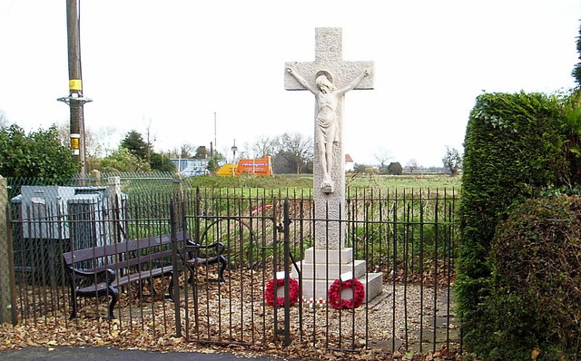
The village is home to St. Paul's Church, a beautiful Grade II listed building that dates back to the 13th century. The church boasts stunning stained glass windows and is known for its architectural charm.

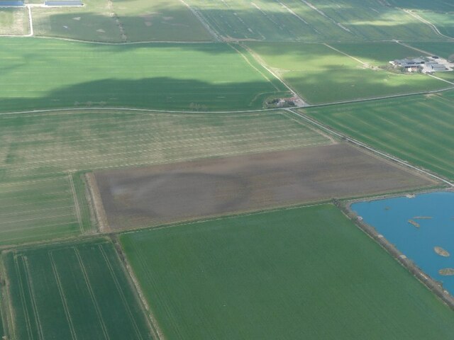
Strubby is also notable for its proximity to RAF Strubby, a former Royal Air Force station. During World War II, the airfield played a vital role in defending the country. Today, the site is no longer in use, but remnants of the airfield can still be seen, including some original buildings and runways.

The surrounding area offers plenty of opportunities for outdoor activities, such as hiking, cycling, and horse riding. The nearby Lincolnshire Wolds, an Area of Outstanding Natural Beauty, provides breathtaking landscapes and panoramic views.

In summary, Strubby is a small and idyllic village in Lincolnshire, known for its charming rural setting, historic church, and association with RAF Strubby. It offers a peaceful retreat for residents and visitors alike, with ample opportunities to explore the natural beauty of the surrounding countryside.

If you have any feedback on the listing, please let us know in the comments section below.

Strubby Images

Images are sourced within 2km of 53.318156/0.17963141 or Grid Reference TF4582. Thanks to Geograph Open Source API. All images are credited.

Landing at Strubby North: aerial 2021
Direction Sign – Signpost on the A157 at Strubby Located on the southwest side of the junction of the A157 Peter's Lane and Field Lane in Strubby with Woodthorpe parish. 3 arms and no finial.

Milestone Society National ID: LI_TF4582
Direction Sign – Signpost on the A157 at Strubby
Located on the southwest side of the junction of the A157 Peter's Lane and Field Lane in Strubby with Woodthorpe parish. 3 arms and no finial. Milestone Society National ID: LI_TF4582
Strubby Airfield: aerial 2021 (1)
Strubby Airfield: aerial 2021 (2)
Part of Medieval settlement of Withern: aerial January 2022 (1) Fields on the corner of Stain Lane, near Strubby. Included in <span class="nowrap"><a title="https://www.heritagegateway.org.uk/Gateway/Results_Single.aspx?uid=MLI88311&resourceID=1006" rel="nofollow ugc noopener" href="https://www.heritagegateway.org.uk/Gateway/Results_Single.aspx?uid=MLI88311&resourceID=1006">Link</a><img style="margin-left:2px;" alt="External link" title="External link - shift click to open in new window" src="https://s1.geograph.org.uk/img/external.png" width="10" height="10"/></span>

Sadly, until recently, the dark brown field centre left contained upstanding earthworks.
Part of Medieval settlement of Withern: aerial January 2022 (1)
Fields on the corner of Stain Lane, near Strubby. Included in LinkExternal link Sadly, until recently, the dark brown field centre left contained upstanding earthworks.
Part of Medieval settlement of Withern: aerial January 2022 (2) Fields on the corner of Stain Lane, near Strubby. Included in <span class="nowrap"><a title="https://www.heritagegateway.org.uk/Gateway/Results_Single.aspx?uid=MLI88311&resourceID=1006" rel="nofollow ugc noopener" href="https://www.heritagegateway.org.uk/Gateway/Results_Single.aspx?uid=MLI88311&resourceID=1006">Link</a><img style="margin-left:2px;" alt="External link" title="External link - shift click to open in new window" src="https://s1.geograph.org.uk/img/external.png" width="10" height="10"/></span>

Sadly, until recently, the dark brown field centre left contained upstanding earthworks.
Part of Medieval settlement of Withern: aerial January 2022 (2)
Fields on the corner of Stain Lane, near Strubby. Included in LinkExternal link Sadly, until recently, the dark brown field centre left contained upstanding earthworks.
Part of Medieval settlement of Withern: aerial, January 2022 (3) Fields on the corner of Stain Lane, near Strubby. Included in <span class="nowrap"><a title="https://www.heritagegateway.org.uk/Gateway/Results_Single.aspx?uid=MLI88311&resourceID=1006" rel="nofollow ugc noopener" href="https://www.heritagegateway.org.uk/Gateway/Results_Single.aspx?uid=MLI88311&resourceID=1006">Link</a><img style="margin-left:2px;" alt="External link" title="External link - shift click to open in new window" src="https://s1.geograph.org.uk/img/external.png" width="10" height="10"/></span>

Sadly until recently the dark brown field centre left contained upstanding earthworks.

See <a href="https://www.geograph.org.uk/photo/7162760">TF4483 : Part of Medieval settlement of Withern: aerial, April 2022</a> for April photo with the rape in full flower.
Part of Medieval settlement of Withern: aerial, January 2022 (3)
Fields on the corner of Stain Lane, near Strubby. Included in LinkExternal link Sadly until recently the dark brown field centre left contained upstanding earthworks. See TF4483 : Part of Medieval settlement of Withern: aerial, April 2022 for April photo with the rape in full flower.
Part of the Shrunken Medieval Village of Strubby, Strubby with Woodthorpe: aerial 2022 (1) Depicted as earthwork enclosures, tofts, field systems, ridge and furrow and a trackway. See <span class="nowrap"><a title="https://www.heritagegateway.org.uk/Gateway/Results_Single.aspx?uid=MLI89183&resourceID=1006" rel="nofollow ugc noopener" href="https://www.heritagegateway.org.uk/Gateway/Results_Single.aspx?uid=MLI89183&resourceID=1006">Link</a><img style="margin-left:2px;" alt="External link" title="External link - shift click to open in new window" src="https://s1.geograph.org.uk/img/external.png" width="10" height="10"/></span>
Part of the Shrunken Medieval Village of Strubby, Strubby with Woodthorpe: aerial 2022 (1)
Depicted as earthwork enclosures, tofts, field systems, ridge and furrow and a trackway. See LinkExternal link
Part of the Shrunken Medieval Village of Strubby, Strubby with Woodthorpe: aerial 2022 (2) Depicted as earthwork enclosures, tofts, field systems, ridge and furrow and a trackway. See <span class="nowrap"><a title="https://www.heritagegateway.org.uk/Gateway/Results_Single.aspx?uid=MLI89183&resourceID=1006" rel="nofollow ugc noopener" href="https://www.heritagegateway.org.uk/Gateway/Results_Single.aspx?uid=MLI89183&resourceID=1006">Link</a><img style="margin-left:2px;" alt="External link" title="External link - shift click to open in new window" src="https://s1.geograph.org.uk/img/external.png" width="10" height="10"/></span>
Part of the Shrunken Medieval Village of Strubby, Strubby with Woodthorpe: aerial 2022 (2)
Depicted as earthwork enclosures, tofts, field systems, ridge and furrow and a trackway. See LinkExternal link
Tracks in the grass in a field at Strubby, Lincs: aerial 2022 The field seems to have been recently returned to pasture after a long period as arable.
Tracks in the grass in a field at Strubby, Lincs: aerial 2022
The field seems to have been recently returned to pasture after a long period as arable.
Part of Medieval settlement of Withern: aerial, April 2022 (1) Cropmarks in the rape. 

See also <a href="https://www.geograph.org.uk/photo/7068740">TF4483 : Part of Medieval settlement of Withern: aerial, January 2022 (3)</a>.

Fields on the corner of Stain Lane, near Strubby. Included in <span class="nowrap"><a title="https://www.heritagegateway.org.uk/Gateway/Results_Single.aspx?uid=MLI88311&resourceID=1006" rel="nofollow ugc noopener" href="https://www.heritagegateway.org.uk/Gateway/Results_Single.aspx?uid=MLI88311&resourceID=1006">Link</a><img style="margin-left:2px;" alt="External link" title="External link - shift click to open in new window" src="https://s1.geograph.org.uk/img/external.png" width="10" height="10"/></span>

Sadly until recently the dark brown field centre left contained upstanding earthworks.
Part of Medieval settlement of Withern: aerial, April 2022 (1)
Cropmarks in the rape. See also TF4483 : Part of Medieval settlement of Withern: aerial, January 2022 (3). Fields on the corner of Stain Lane, near Strubby. Included in LinkExternal link Sadly until recently the dark brown field centre left contained upstanding earthworks.
Part of Medieval settlement of Withern: aerial, April 2022 (2) Cropmarks in the rape. 

See also <a href="https://www.geograph.org.uk/photo/7068740">TF4483 : Part of Medieval settlement of Withern: aerial, January 2022 (3)</a>.

Fields on the corner of Stain Lane, near Strubby. Included in <span class="nowrap"><a title="https://www.heritagegateway.org.uk/Gateway/Results_Single.aspx?uid=MLI88311&resourceID=1006" rel="nofollow ugc noopener" href="https://www.heritagegateway.org.uk/Gateway/Results_Single.aspx?uid=MLI88311&resourceID=1006">Link</a><img style="margin-left:2px;" alt="External link" title="External link - shift click to open in new window" src="https://s1.geograph.org.uk/img/external.png" width="10" height="10"/></span>

Sadly until recently the dark brown field centre left contained upstanding earthworks.
Part of Medieval settlement of Withern: aerial, April 2022 (2)
Cropmarks in the rape. See also TF4483 : Part of Medieval settlement of Withern: aerial, January 2022 (3). Fields on the corner of Stain Lane, near Strubby. Included in LinkExternal link Sadly until recently the dark brown field centre left contained upstanding earthworks.
Soilmark on field between Clark's Bank Drain and Stain Lane: aerial 2022 (1)
Soilmark on field between Clark's Bank Drain and Stain Lane: aerial 2022 (2)
Ridge and furrow and earthworks in field at Withern: aerial 2022
The glider strip at Strubby: aerial 2022 The horizontal (on the shot) runway. Winch centre left.
The glider strip at Strubby: aerial 2022
The horizontal (on the shot) runway. Winch centre left.
Part of Medieval settlement of Withern: aerial, April 2022 For details and January photo see <a href="https://www.geograph.org.uk/photo/7068740">TF4483 : Part of Medieval settlement of Withern: aerial, January 2022 (3)</a>.
Part of Medieval settlement of Withern: aerial, April 2022
Blue waters near Strubby Grange: aerial 2022
Show me another place!

Strubby is located at Grid Ref: TF4582 (Lat: 53.318156, Lng: 0.17963141)

Division: Parts of Lindsey

Administrative County: Lincolnshire

District: East Lindsey

Police Authority: Lincolnshire

What 3 Words

///whips.aviators.dusty. Near Mablethorpe, Lincolnshire

Nearby Locations

Strubby

Related Wikis

Strubby

Strubby is a village in the East Lindsey district of Lincolnshire, England. It is situated just north of the A157 road, 8 miles (13 km) south-east from...

Maltby le Marsh

Maltby le Marsh is a village and civil parish in the East Lindsey district of Lincolnshire, England. The village is situated between Alford and Mablethorpe...

RAF Strubby

Royal Air Force Strubby or more simply RAF Strubby is a former Royal Air Force station 2.9 miles (4.7 km) north of Alford, Lincolnshire, and 8.6 miles...

Withern

Withern is a village in the civil parish of Withern with Stain, in the East Lindsey district of Lincolnshire, England. It is situated on the A157 road...

Nearby Amenities

Located within 500m of 53.318156,0.17963141
Bus Stop
Wayside Cottage
Naptan AtcoCode: 270000010577
Naptan Bearing: N
Naptan CommonName: Wayside Cottage
Naptan Indicator: opp
Naptan Landmark: Wayside Cottage
Naptan NaptanCode: linjmwtd
Naptan Street: High Street
Naptan Verified: no
Source: naptan_import
Lat/Long: 53.3170053/0.1817721
Bus Stop
Wayside Cottage
Naptan AtcoCode: 270000010578
Naptan Bearing: S
Naptan CommonName: Wayside Cottage
Naptan Indicator: adj
Naptan Landmark: Wayside Cottage
Naptan NaptanCode: linjmwtg
Naptan Street: High Street
Naptan Verified: no
Source: naptan_import
Lat/Long: 53.3170382/0.181939
Bus Stop
Field Lane
Naptan AtcoCode: 2700LS004849
Naptan Bearing: W
Naptan CommonName: Field Lane
Naptan Indicator: opp
Naptan Landmark: Field Lane
Naptan NaptanCode: lindpapd
Naptan Street: A157
Naptan Verified: no
Source: naptan_import
Lat/Long: 53.3146096/0.1824907
Bus Stop
Field Lane
Naptan AtcoCode: 2700LSA02256
Naptan Bearing: E
Naptan CommonName: Field Lane
Naptan Indicator: adj
Naptan Landmark: Field Lane
Naptan NaptanCode: linapmgw
Naptan Street: A157
Naptan Verified: no
Source: naptan_import
Lat/Long: 53.3147387/0.1818216
Strubby
Place: hamlet
Source: Bing
Lat/Long: 53.3157746/0.1818111
Hill House Farm
Addr City: Alford
Addr Country: GB
Addr Postcode: LN13 0LR
Addr Street: Field Lane
Email: the6cherrie@btinternet.com
Name En: Hill House Farm/ Berry Barn
Opening Hours: Mo-Su 09:00-20:00
Phone: +44 7790 209533
Place: farm
Source: Bing
Lat/Long: 53.3195606/0.1790209
Ivy House Farm
Place: farm
Source: Bing
Lat/Long: 53.3162277/0.1836078
The Laurels Farm
Place: farm
Source: Bing
Lat/Long: 53.3183527/0.1779538
Twyne Road Farm
Place: farm
Source: Bing
Lat/Long: 53.3155678/0.1762688
The data included in this document is from www.openstreetmap.org. The data is made available under ODbL.

Have you been to Strubby?

Leave your review of Strubby below (or comments, questions and feedback).