Bohortha

Settlement in Cornwall

England

Bohortha

Arriving by ferry at St Mawes
Arriving by ferry at St Mawes Credit: Roy Hughes

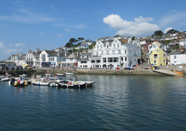
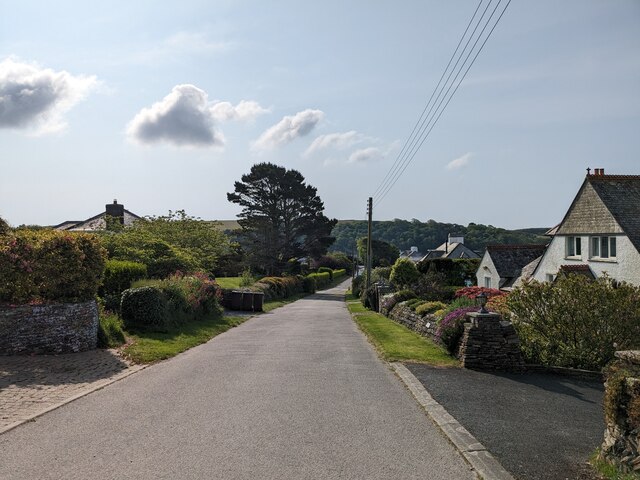
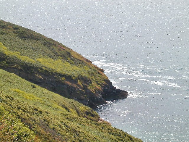
Bohortha is a small village located in Cornwall, England. Situated near the Roseland Peninsula, Bohortha is known for its picturesque countryside and charming traditional cottages. The village is surrounded by rolling hills and lush green fields, making it a popular destination for nature lovers and hikers.

Bohortha is a peaceful and quiet village, perfect for those looking to escape the hustle and bustle of city life. The village has a strong sense of community, with a local pub and church serving as gathering places for residents and visitors alike.

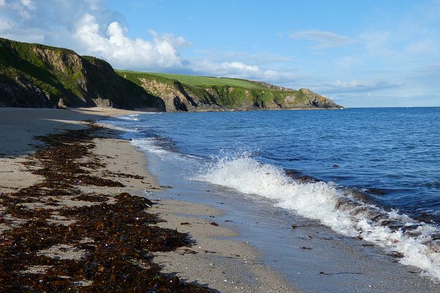
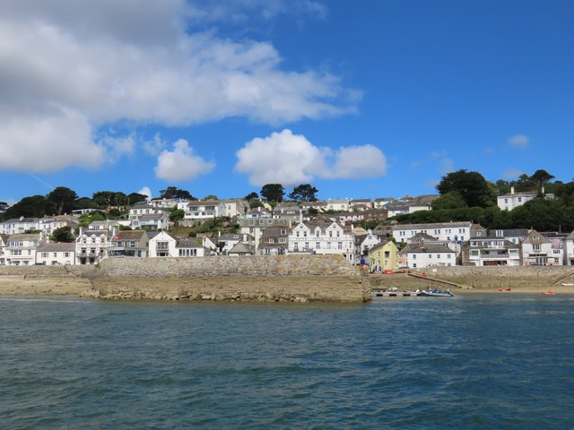
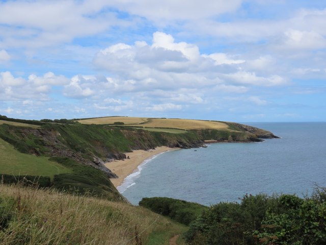
The nearby coastline offers stunning views of the English Channel and is a great spot for birdwatching and beachcombing. The village is also within easy reach of popular tourist attractions such as the Eden Project and the Lost Gardens of Heligan.

Overall, Bohortha is a hidden gem in Cornwall, offering a relaxing and idyllic setting for those looking to explore the beauty of the English countryside.

If you have any feedback on the listing, please let us know in the comments section below.

Bohortha Images

Images are sourced within 2km of 50.151822/-4.99608 or Grid Reference SW8632. Thanks to Geograph Open Source API. All images are credited.

Arriving by ferry at St Mawes
Folbot folding canoe, St Mawes 1938 Folding canoes of fabric over a frame originated with Inuit kayaks. Commercial ones started in Germany with Klepper's Faltboot in 1908. In the UK Jack Kissner started making the Folbot in 1933, and the company continued to 2016. In World War 2 Special Forces used folding canoes, known as cockles, the first ones were based on the Folbot design.
The Folbot in the photo is on Tavern Beach; the photographer was on holiday in "Our Cottage" in Lower Castle Road, just above the beach.
View towards Carricknath Point, as shown in <a href="https://www.geograph.org.uk/photo/29338">SW8432 : Carricknath Point</a>, also a view from St Mawes.
Folbot folding canoe, St Mawes 1938
Folding canoes of fabric over a frame originated with Inuit kayaks. Commercial ones started in Germany with Klepper's Faltboot in 1908. In the UK Jack Kissner started making the Folbot in 1933, and the company continued to 2016. In World War 2 Special Forces used folding canoes, known as cockles, the first ones were based on the Folbot design. The Folbot in the photo is on Tavern Beach; the photographer was on holiday in "Our Cottage" in Lower Castle Road, just above the beach. View towards Carricknath Point, as shown in SW8432 : Carricknath Point, also a view from St Mawes.
Tavern Beach St Mawes with yachts on harbour, 1938 Photo from Lower Castle Road where the photographer was on holiday in "Our Cottage". The sea wall beside the road is seen on the left. Across the estuary is the coast from Carricknath Point to St. Anthony.  A similar recent view is <a href="https://www.geograph.org.uk/photo/774705">SW8432 : St Mawes Harbour, Roseland, Cornwall taken 1964</a>.
Tavern Beach St Mawes with yachts on harbour, 1938
Photo from Lower Castle Road where the photographer was on holiday in "Our Cottage". The sea wall beside the road is seen on the left. Across the estuary is the coast from Carricknath Point to St. Anthony. A similar recent view is SW8432 : St Mawes Harbour, Roseland, Cornwall taken 1964.
Porthbeor Beach, Gerrans The tide was quite well in with relatively little of the beach exposed.  Access down a steep path is discouraged by the National Trust due to the risk of rockfalls.
Porthbeor Beach, Gerrans
The tide was quite well in with relatively little of the beach exposed. Access down a steep path is discouraged by the National Trust due to the risk of rockfalls.
St Anthony's Lighthouse St Anthony's Lighthouse is situated on St Anthony Head, on the eastern side of the entrance to Falmouth harbour. It was built in 1835 by the Chief Engineer of Trinity House to guide shipping away from the Manacles Rocks south of Falmouth Harbour (<span class="nowrap"><a title="https://www.trinityhouse.co.uk/lighthouses-and-lightvessels/st-anthonys-lighthouse" rel="nofollow ugc noopener" href="https://www.trinityhouse.co.uk/lighthouses-and-lightvessels/st-anthonys-lighthouse">Link</a><img style="margin-left:2px;" alt="External link" title="External link - shift click to open in new window" src="https://s1.geograph.org.uk/img/external.png" width="10" height="10"/></span>  Trinity House). It is a Grade II listed building (Historic England List Entry Number: 1136282 <span class="nowrap"><a title="https://historicengland.org.uk/listing/the-list/list-entry/1136282" rel="nofollow ugc noopener" href="https://historicengland.org.uk/listing/the-list/list-entry/1136282">Link</a><img style="margin-left:2px;" alt="External link" title="External link - shift click to open in new window" src="https://s1.geograph.org.uk/img/external.png" width="10" height="10"/></span> )

St Anthony's lighthouse was featured in the UK version of Jim Henson's Fraggle Rock, as "Fraggle Rock Lighthouse" in external scenes.

Today the light is automated, flashing white every 15 seconds
St Anthony's Lighthouse
St Anthony's Lighthouse is situated on St Anthony Head, on the eastern side of the entrance to Falmouth harbour. It was built in 1835 by the Chief Engineer of Trinity House to guide shipping away from the Manacles Rocks south of Falmouth Harbour (LinkExternal link Trinity House). It is a Grade II listed building (Historic England List Entry Number: 1136282 LinkExternal link ) St Anthony's lighthouse was featured in the UK version of Jim Henson's Fraggle Rock, as "Fraggle Rock Lighthouse" in external scenes. Today the light is automated, flashing white every 15 seconds
St Mawes Parish Church
Catholic Church of Our Lady Star of the Sea and St Anthony
Former Wesleyan Methodist Chapel
Former Congregational chapel
Pedn-Moran Road
Pedn-Moran Road
St Mawes Quay
St Mawes Quay
St Mawes Quay
St Mawes Quay
St Anthony-in-Roseland Church
St Anthony Head
St Anthony Head
Path towards Porthbeor Beach
Porthbeor Beach
Porthbeor Beach
House in Bothortha
House in Bothortha
St Mawes quayside
St Mawes quayside
Show me another place!

Bohortha is located at Grid Ref: SW8632 (Lat: 50.151822, Lng: -4.99608)

Unitary Authority: Cornwall

Police Authority: Devon and Cornwall

What 3 Words

///invoices.latches.lowest. Near Portscatho, Cornwall

Related Wikis

Bohortha

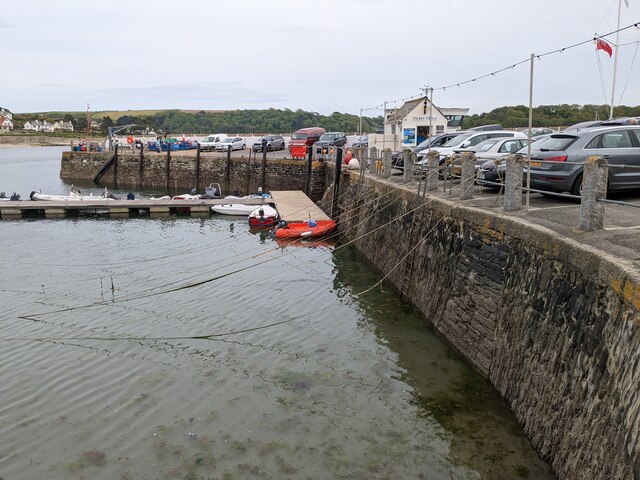
Bohortha (Cornish: Buorthow) is a coastal village in south Cornwall, England, United Kingdom. It is situated on the east side of the Roseland Peninsula...

St Anthony in Roseland

St Anthony in Roseland is a village and a former parish in Cornwall, England, in the United Kingdom. It is a small settlement on the Roseland Peninsula...

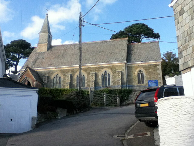
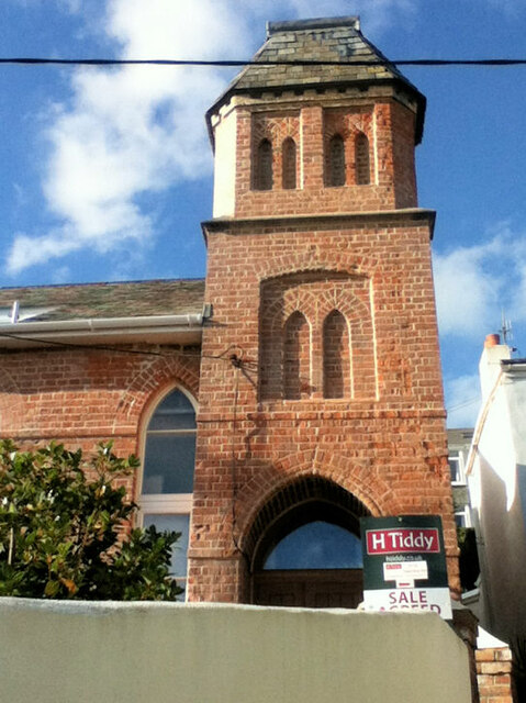
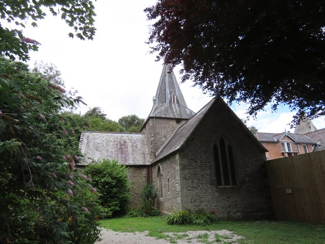
St Mawes' Church, St Mawes

St Mawes’ Church is a Grade II listed parish church in the Church of England Diocese of Truro in St Mawes, Cornwall, England, UK. == History == The name...
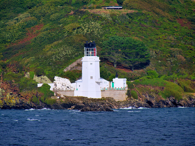
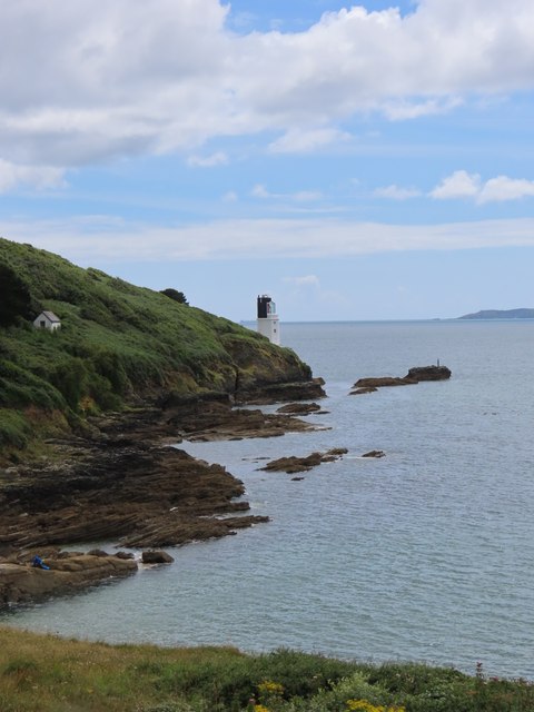
Zone Point

Zone Point (Cornish: Sawan Hir, meaning long chasm) is the southernmost extremity of the Roseland peninsula extending into Falmouth Bay near St Mawes in...

Nearby Amenities

Located within 500m of 50.151822,-4.99608
Bohortha
Is In: Cornwall, England, UK
Is In Country: England
Is In Country Code: GB
Is In County: Cornwall
Name Kw: Buorthow
Place: village
Source: npe
Wikidata: Q4938213
Wikipedia: en:Bohortha
Lat/Long: 50.1518028/-4.9954981
Barrier: kissing_gate
Lat/Long: 50.1511318/-5.000721
Barrier: stile
Material: stone
Step Count: 6
Stile: stepover
Lat/Long: 50.1479854/-4.997295
Bench
Backrest: no
Material: wood
Seats: 4
Lat/Long: 50.1501703/-4.9939915
Bench
Backrest: no
Material: wood
Seats: 4
Survey Date: 2023-05-20
Lat/Long: 50.1553838/-5.0003543
Barrier: stile
Material: stone
Step Count: 4
Stile: stepover
Lat/Long: 50.1495021/-4.9952968
Access: no
Barrier: fence
Lat/Long: 50.1501739/-4.993936
Barrier: stile
Bicycle: no
Foot: yes
Stile: stepover
Lat/Long: 50.1511124/-4.9993654
Post Box
Brand: Royal Mail
Brand Wikidata: Q638098
Brand Wikipedia: en:Royal Mail
Collection Times: Mo-Fr 09:00; Sa 07:00; Su off
Note: It's an E2R lamp box that's been firmly embedded into a wall clad with ivy
Operator: Royal Mail
Operator Wikidata: Q638098
Post Box Mounting: stone wall
Post Box Type: lamp
Ref: TR2 204D
Royal Cypher: EIIR
Royal Cypher Wikidata: Q33102113
Source: survey;aerial imagery
Lat/Long: 50.1516021/-4.9966355
Barrier: stile
Lat/Long: 50.1492552/-5.0011394
Barrier: kissing_gate
Lat/Long: 50.1504497/-4.9947699
Bench
Lat/Long: 50.1510827/-4.9994717
Barrier: stile
Lat/Long: 50.1551931/-4.9995682
The data included in this document is from www.openstreetmap.org. The data is made available under ODbL.

Have you been to Bohortha?

Leave your review of Bohortha below (or comments, questions and feedback).