Stoke Farthing

Settlement in Wiltshire

England

Stoke Farthing

Broad Chalke - The Queen's Head Pub on North Street in the centre of Broad Chalke village.
Broad Chalke - The Queen's Head Credit: Colin Smith

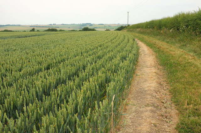
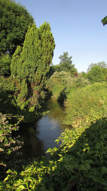
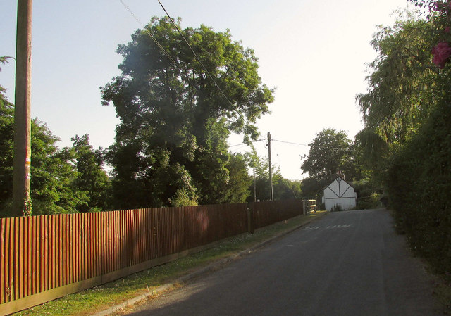
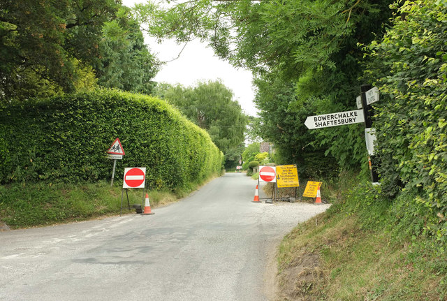
Stoke Farthing is a small village located in the county of Wiltshire, England. Nestled in the heart of the picturesque countryside, it is known for its tranquil and idyllic setting. The village is situated approximately 8 miles southeast of the town of Marlborough and is surrounded by lush green fields and rolling hills.

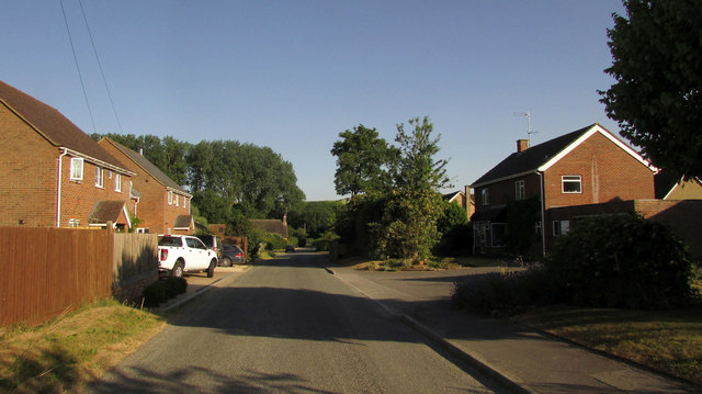
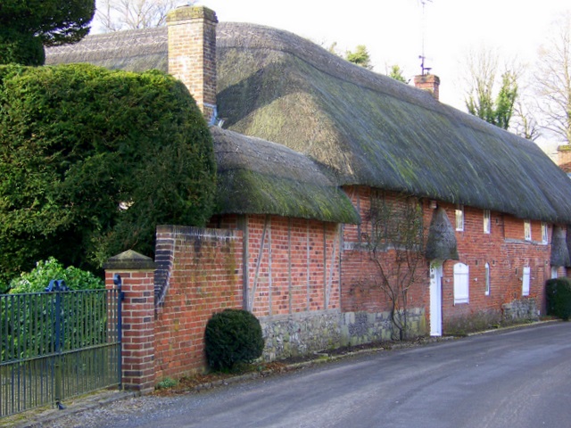
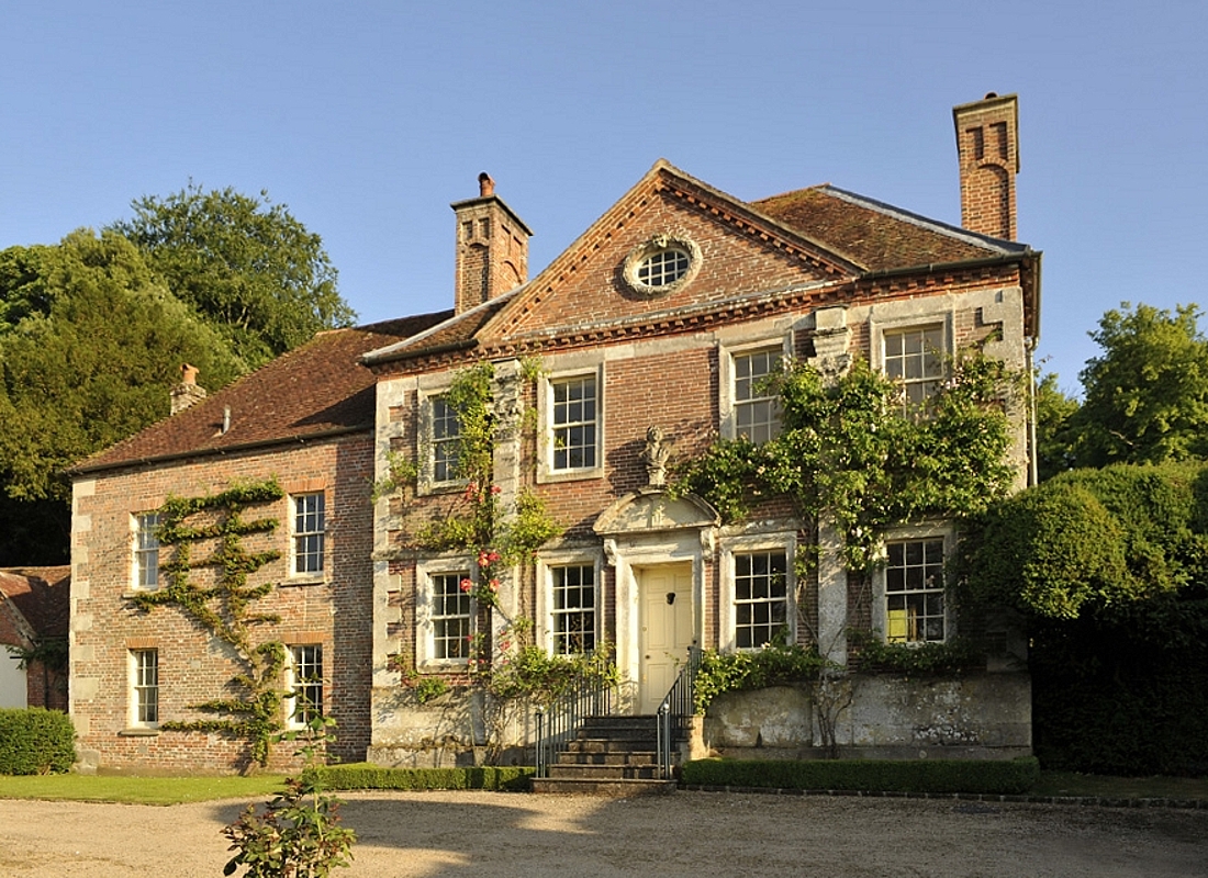
With a population of around 300 residents, Stoke Farthing exudes a strong sense of community. The village is characterized by its charming thatched-roof cottages and historic buildings, giving it a quintessentially English feel. The local church, St. Mary's, is a prominent landmark and dates back to the 12th century.

Stoke Farthing boasts a range of amenities for its residents. The village has a primary school, providing education for the local children, and a village hall that serves as a hub for various community activities and gatherings. Additionally, there is a small convenience store where locals can purchase essential items.

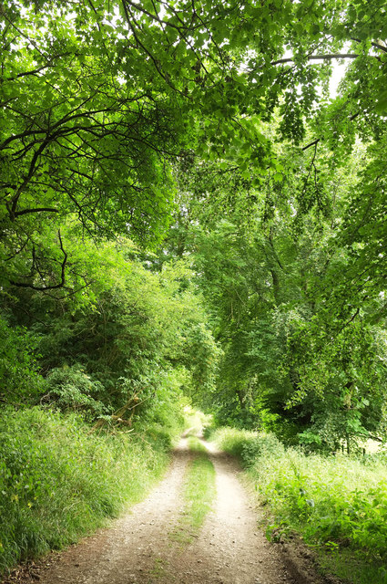
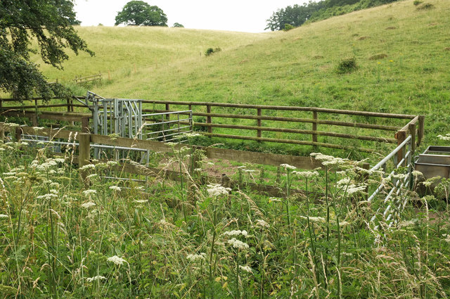
The surrounding countryside offers ample opportunities for outdoor activities, such as hiking and cycling. Stoke Farthing is also within close proximity to the expansive Savernake Forest, which is renowned for its scenic beauty and diverse wildlife.

Despite its small size, Stoke Farthing has a rich history. Archaeological discoveries have revealed evidence of Roman occupation in the area, and the village was mentioned in the Domesday Book of 1086.

Overall, Stoke Farthing is a charming and peaceful village that offers a close-knit community and breathtaking natural surroundings, making it an attractive place to live for those seeking a rural and serene lifestyle.

If you have any feedback on the listing, please let us know in the comments section below.

Stoke Farthing Images

Images are sourced within 2km of 51.027611/-1.920828 or Grid Reference SU0525. Thanks to Geograph Open Source API. All images are credited.

Broad Chalke - The Queen's Head Pub on North Street in the centre of Broad Chalke village.
Broad Chalke - The Queen's Head
Pub on North Street in the centre of Broad Chalke village.
Broad Chalke - River Ebble A study in green beside Broad Chalke Church.
Broad Chalke - River Ebble
A study in green beside Broad Chalke Church.
Church Bottom Cattle on grassland south of Broad Chalke.
Church Bottom
Cattle on grassland south of Broad Chalke.
Path over Knighton Hill Footpath BROA 36 runs along the edge of a field of wheat before dropping into the Ebble valley to Stoke Farthing.
Path over Knighton Hill
Footpath BROA 36 runs along the edge of a field of wheat before dropping into the Ebble valley to Stoke Farthing.
Bridleway over the Ebble Bridleway BSTO47 is unlikely to be mistaken for a motorable road, with signs and posts, though the latter wouldn't deter a determined motorcyclist. The bridge, with its bollards, is listed: "Early C19 bridge, bollards probably late C19 ... Vehicular access across bridge blocked by two pairs of cast-iron cylindrical bollards with moulded angles and scalloped cappings" <span class="nowrap"><a title="https://www.historicengland.org.uk/listing/the-list/list-entry/1146158" rel="nofollow ugc noopener" href="https://www.historicengland.org.uk/listing/the-list/list-entry/1146158">Link</a><img style="margin-left:2px;" alt="External link" title="External link - shift click to open in new window" src="https://s1.geograph.org.uk/img/external.png" width="10" height="10"/></span> .

This is seen from The Alley, and <a href="https://www.geograph.org.uk/photo/4393581">SU0625 : Footbridge over the River Ebble at Bishopstone</a> and <a href="https://www.geograph.org.uk/photo/1630703">SU0625 : Bridge over the River Ebble, Bishopstone</a> were taken from the same place.
Bridleway over the Ebble
Bridleway BSTO47 is unlikely to be mistaken for a motorable road, with signs and posts, though the latter wouldn't deter a determined motorcyclist. The bridge, with its bollards, is listed: "Early C19 bridge, bollards probably late C19 ... Vehicular access across bridge blocked by two pairs of cast-iron cylindrical bollards with moulded angles and scalloped cappings" LinkExternal link . This is seen from The Alley, and SU0625 : Footbridge over the River Ebble at Bishopstone and SU0625 : Bridge over the River Ebble, Bishopstone were taken from the same place.
Harvest Lane, Bishopstone Modern housing at the east end of the village.
Harvest Lane, Bishopstone
Modern housing at the east end of the village.
Bridge over the Ebble Another view of the listed bridge <span class="nowrap"><a title="https://historicengland.org.uk/listing/the-list/list-entry/1146158" rel="nofollow ugc noopener" href="https://historicengland.org.uk/listing/the-list/list-entry/1146158">Link</a><img style="margin-left:2px;" alt="External link" title="External link - shift click to open in new window" src="https://s1.geograph.org.uk/img/external.png" width="10" height="10"/></span> shown in <a href="https://www.geograph.org.uk/photo/5836572">SU0625 : Bridleway over the Ebble</a>. "Limestone ashlar segmental-arched bridge with plain parapet with half-round coping."
Bridge over the Ebble
Another view of the listed bridge LinkExternal link shown in SU0625 : Bridleway over the Ebble. "Limestone ashlar segmental-arched bridge with plain parapet with half-round coping."
River Ebble at Bishopstone Looking downstream from the bridge shown in <a href="https://www.geograph.org.uk/photo/5836572">SU0625 : Bridleway over the Ebble</a>.
River Ebble at Bishopstone
Looking downstream from the bridge shown in SU0625 : Bridleway over the Ebble.
The Alley, Bishopstone The lane runs beside the River Ebble and past the bridge shown in <a href="https://www.geograph.org.uk/photo/5836572">SU0625 : Bridleway over the Ebble</a>
The Alley, Bishopstone
The lane runs beside the River Ebble and past the bridge shown in SU0625 : Bridleway over the Ebble
Junction, Broad Chalke Almost a crossroads, though the right turn is a bridleway up Church Bottom and is not quite opposite The Causeway, which is the left turn.
Junction, Broad Chalke
Almost a crossroads, though the right turn is a bridleway up Church Bottom and is not quite opposite The Causeway, which is the left turn.
Bridleway, Church Bottom A similar view to <a href="https://www.geograph.org.uk/photo/467996">SU0424 : Bridleway towards Church Bottom</a>. This is bridleway BROA 6. The tents are associated with the history festival.
Bridleway, Church Bottom
A similar view to SU0424 : Bridleway towards Church Bottom. This is bridleway BROA 6. The tents are associated with the history festival.
Bridleway, Church Bottom A gradual climb in a long dry valley. This is bridleway BROA 6.
Bridleway, Church Bottom
A gradual climb in a long dry valley. This is bridleway BROA 6.
Bridleway, Church Bottom Bridleway BROA 6 progresses up the long dry valley.
Bridleway, Church Bottom
Bridleway BROA 6 progresses up the long dry valley.
Bomber in Church Bottom Take cover! The sheep seem remarkably unconcerned.
Bomber in Church Bottom
Take cover! The sheep seem remarkably unconcerned.
Church Bottom The hut, a pump house, is shown more clearly in <a href="https://www.geograph.org.uk/photo/285165">SU0423 : Hut at Sheep Dip in Church Bottom</a>. The bridleway is BROA 6.
Church Bottom
The hut, a pump house, is shown more clearly in SU0423 : Hut at Sheep Dip in Church Bottom. The bridleway is BROA 6.
Bridleway, Church Bottom Bridleway BROA 6 progresses up the long dry valley, here approaching Middleton Down Nature Reserve.
Bridleway, Church Bottom
Bridleway BROA 6 progresses up the long dry valley, here approaching Middleton Down Nature Reserve.
Sheep pen, Church Bottom In the background is part of the Middleton Down Nature Reserve.
Sheep pen, Church Bottom
In the background is part of the Middleton Down Nature Reserve.
Church Bottom See <a href="https://www.geograph.org.uk/photo/5968511">SU0423 : Middleton Down Nature Reserve</a>; I later realised I should have been on the other side of this fence, though I am on access land, according to the maps. Below is the sheep pen shown in <a href="https://www.geograph.org.uk/photo/5968504">SU0423 : Sheep pen, Church Bottom</a>.
Church Bottom
See SU0423 : Middleton Down Nature Reserve; I later realised I should have been on the other side of this fence, though I am on access land, according to the maps. Below is the sheep pen shown in SU0423 : Sheep pen, Church Bottom.
Show me another place!

Stoke Farthing is located at Grid Ref: SU0525 (Lat: 51.027611, Lng: -1.920828)

Unitary Authority: Wiltshire

Police Authority: Wiltshire

What 3 Words

///thumps.strong.investors. Near Bishopstone, Wiltshire

Nearby Locations

Stoke Farthing

Related Wikis

Bishopstone, Salisbury

Bishopstone is a village and civil parish in Wiltshire, England, in the Ebble valley about 5.5 miles (9 km) south-west of Salisbury. The parish is on the...

Broad Chalke

Broad Chalke, sometimes spelled Broadchalke, Broad Chalk or Broadchalk, is a village and civil parish in Wiltshire, England, about 8 miles (13 km) west...

Reddish House

Reddish House, also known as Reddish Manor, is an early 18th-century manor house in the village of Broad Chalke in Wiltshire, England. It was possibly...

Knighton Downs and Wood

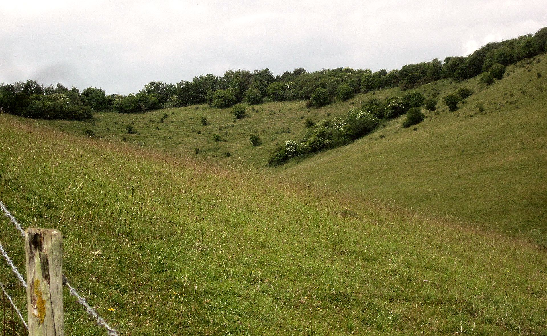
Knighton Downs and Wood (grid reference SU048237) is a 203.7 hectare biological Site of Special Scientific Interest in Wiltshire, notified in 1971. �...

River Chalke

The River Chalke is a small river within the English county of Wiltshire. It is the most significant tributary of the River Ebble. The river rises at Mead...

Knapp and Barnett's Downs

Knapp and Barnett's Downs (grid reference SU030266) is a 71.4 hectare biological Site of Special Scientific Interest in Wiltshire, notified in 1971....

Throope Down

Throope Down (grid reference SU086244) is a 34.4 hectare biological Site of Special Scientific Interest in Wiltshire, England, on chalk grassland in Bishopstone...

Gurston Down Motorsport Hillclimb

The Gurston Down Speed Hill Climb is a hillclimb in Broad Chalke, Wiltshire, England, organised by the South Western Centre of the British Automobile Racing...

Nearby Amenities

Located within 500m of 51.027611,-1.920828
Barrier: stile
Lat/Long: 51.0250201/-1.9256777
Disused Amenity: post_box
Post Box Type: lamp
Royal Cypher: EIIR
Lat/Long: 51.0297373/-1.9202581
Shelter
Lat/Long: 51.0297542/-1.9204778
The data included in this document is from www.openstreetmap.org. The data is made available under ODbL.

Have you been to Stoke Farthing?

Leave your review of Stoke Farthing below (or comments, questions and feedback).