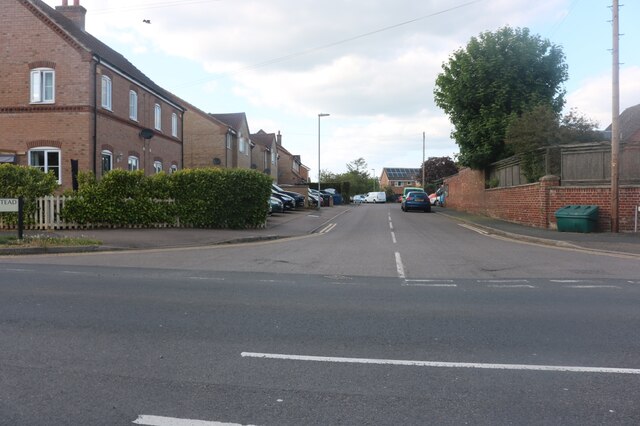
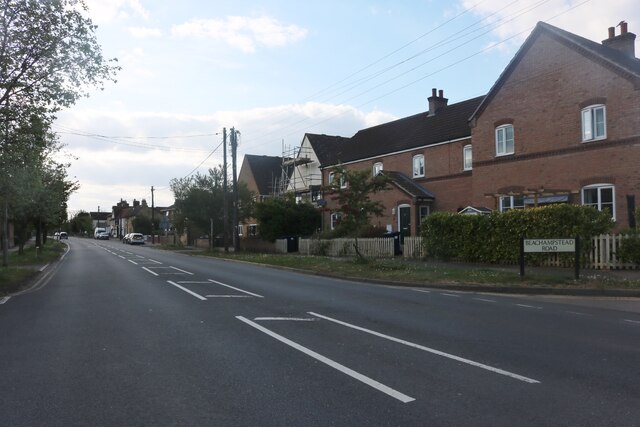
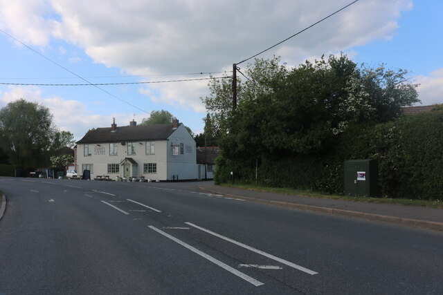
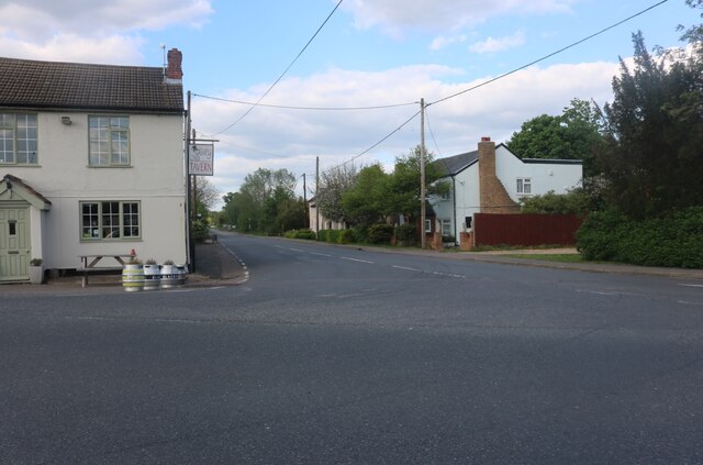
Staughton Green

Settlement in Huntingdonshire Huntingdonshire

England

Staughton Green

Beachampstead Road, Great Staughton From The Highway which goes to Kimbolton.
Beachampstead Road, Great Staughton Credit: David Howard

Staughton Green is a small village located in the district of Huntingdonshire, in the county of Cambridgeshire, England. Situated approximately 8 miles west of the market town of Huntingdon, Staughton Green is nestled amidst the picturesque Cambridgeshire countryside.

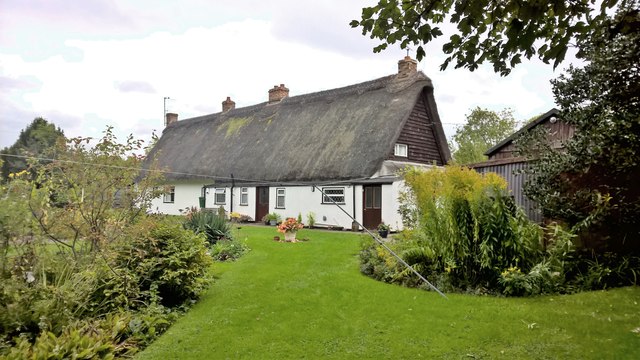
The village is primarily residential, with a population of around 200 residents. It is known for its tranquil and idyllic setting, surrounded by rolling hills, green fields, and charming rural landscapes. The houses in Staughton Green are mostly traditional, reflecting the area's rich heritage and architectural style.

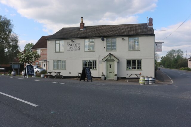
Although small in size, Staughton Green boasts a strong sense of community, with various local activities and events organized throughout the year. The village has a local pub, which serves as a gathering place for residents and visitors alike. Additionally, the nearby towns of Huntingdon and St Neots offer a wider range of amenities, including shops, supermarkets, and leisure facilities.

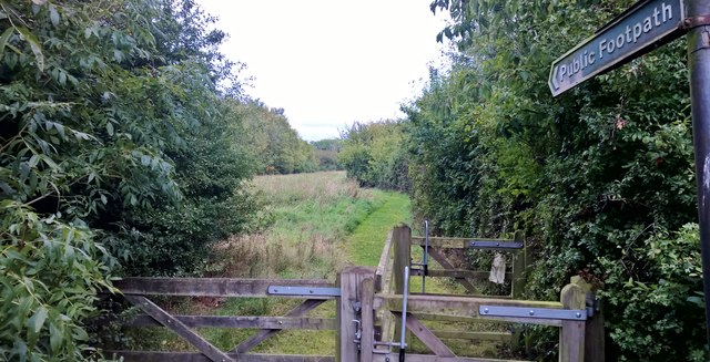
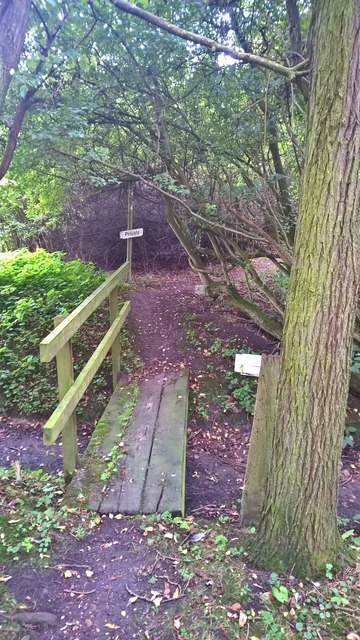
Nature enthusiasts will find plenty to explore in the surrounding area, as Staughton Green is close to numerous nature reserves, parks, and rivers. The nearby Great Ouse River provides opportunities for boating, fishing, and riverside walks.

Overall, Staughton Green offers a peaceful and rural lifestyle, making it an ideal place for those seeking a quiet retreat away from the hustle and bustle of urban life.

If you have any feedback on the listing, please let us know in the comments section below.

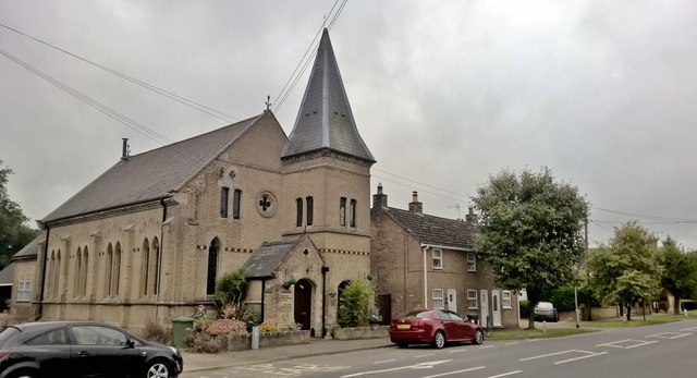
Staughton Green Images

Images are sourced within 2km of 52.27166/-0.34664097 or Grid Reference TL1265. Thanks to Geograph Open Source API. All images are credited.

Beachampstead Road, Great Staughton From The Highway which goes to Kimbolton.
Beachampstead Road, Great Staughton
From The Highway which goes to Kimbolton.
The Highway, Great Staughton
The Green, Great Staughton Looking towards the Snooty Tavern
The Green, Great Staughton
Looking towards the Snooty Tavern
The B661, Great Staughton At the junction of The Green. The Snooty Tavern is on the left.
The B661, Great Staughton
At the junction of The Green. The Snooty Tavern is on the left.
The Snooty Tavern, Staughton Green
Footpath off The Green at Staughton Green,
Cottage at Staughton Green
Well hidden footpath at Staughton Green
Former Methodist Chapel, Great Staughton This Frith postcard shows it in better times about 1955; <span class="nowrap"><a title="https://www.francisfrith.com/uk/great-staughton/great-staughton-the-highway-c1955_g279005" rel="nofollow ugc noopener" href="https://www.francisfrith.com/uk/great-staughton/great-staughton-the-highway-c1955_g279005">Link</a><img style="margin-left:2px;" alt="External link" title="External link - shift click to open in new window" src="https://s1.geograph.org.uk/img/external.png" width="10" height="10"/></span>
Former Methodist Chapel, Great Staughton
This Frith postcard shows it in better times about 1955; LinkExternal link
The White Hart, Great Staughton A rather gloomy day!
The White Hart, Great Staughton
A rather gloomy day!
Old School, Great Staughton
Flag's out at The Snooty Tavern
Buildings at Rushey Farm All securely locked up, with a large vent in the lean-to at the near end. What goes on inside?
Buildings at Rushey Farm
All securely locked up, with a large vent in the lean-to at the near end. What goes on inside?
Farmland with power lines Near Great Staughton.
Farmland with power lines
Near Great Staughton.
The Green, Great Staughton The name of the B645 road. No real green is obvious from the road.
The Green, Great Staughton
The name of the B645 road. No real green is obvious from the road.
Grassy field corner with small wood and ditch Probably for the (short term) benefit of game.
Grassy field corner with small wood and ditch
Probably for the (short term) benefit of game.
Farmland east of Cage Lane
Road heading west from Dillington
Show me another place!

Staughton Green is located at Grid Ref: TL1265 (Lat: 52.27166, Lng: -0.34664097)

Administrative County: Cambridgeshire

District: Huntingdonshire

Police Authority: Cambridgeshire

What 3 Words

///secure.atoms.defenders. Near Kimbolton, Cambridgeshire

Related Wikis

Great Staughton

Great Staughton is a village and civil parish in Cambridgeshire, England. Great Staughton lies approximately 8 miles (13 km) south-west of Huntingdon....

Perry Woods

Perry Woods is a 67.9-hectare (168-acre) biological Site of Special Scientific Interest south-east of Kimbolton in Cambridgeshire. It is composed of three...

Perry, Cambridgeshire

Perry is a village and civil parish in Cambridgeshire, England, approximately 6 miles (10 km) south-west of Huntingdon. Perry is in Huntingdonshire, a...

Gaynes Hall

Gaynes Hall is a Grade II* listed Georgian mansion set in 20 acres (81,000 m2) of parkland in the heart of the Cambridgeshire countryside. Located in the...

Nearby Amenities

Located within 500m of 52.27166,-0.34664097
Great Staughton
Is In: Cambridgeshire
Place: village
Lat/Long: 52.2685602/-0.3444957
Staughton Green
Place: locality
Source: npe
Lat/Long: 52.2716663/-0.3458655
Source: gps walk
Lat/Long: 52.2691867/-0.3501545
Post Box
Lat/Long: 52.270131/-0.3462136
Leisure: pitch
Sport: soccer
Lat/Long: 52.2697512/-0.34701
Bus Stop
Bus: yes
Public Transport: platform
Lat/Long: 52.2704818/-0.3463384
The Willows
Tourism: guest_house
Lat/Long: 52.2680564/-0.3445336
Pub
White Hart
Wikidata: Q26576927
Lat/Long: 52.2682142/-0.3434242
sundial
Historic: yes
Lat/Long: 52.2681949/-0.3440849
G M Gilbert
Shop: butcher
Lat/Long: 52.2681771/-0.3437062
Bus Stop
Surgery
Bus: yes
Naptan AtcoCode: 0500HGRES003
Naptan Bearing: E
Naptan CommonName: Surgery
Naptan Crossing: Laura's Close
Naptan Indicator: opp
Naptan Landmark: Surgery
Naptan NaptanCode: cmbdpdjm
Naptan ShortCommonName: Surgery
Naptan Street: The Highway
Naptan Verified: no
Public Transport: platform
Source: naptan_import
Lat/Long: 52.2681086/-0.3433565
Bus Stop
Vicarage Walk
Bus: yes
Naptan AtcoCode: 0500HGRES004
Naptan Bearing: N
Naptan CommonName: Vicarage Walk
Naptan Indicator: near
Naptan Landmark: Vicarage Walk
Naptan NaptanCode: cmbdpdjp
Naptan ShortCommonName: Vicarage Walk
Naptan Street: The Green
Naptan Verified: no
Public Transport: platform
Source: naptan_import
Lat/Long: 52.2710016/-0.3463998
Bus Stop
Vicarage Walk
Bus: yes
Naptan AtcoCode: 0500HGRES005
Naptan Bearing: S
Naptan CommonName: Vicarage Walk
Naptan Indicator: opp
Naptan Landmark: Vicarage Walk
Naptan NaptanCode: cmbdpdjt
Naptan ShortCommonName: Vicarage Walk
Naptan Street: The Green
Naptan Verified: no
Public Transport: platform
Source: naptan_import
Lat/Long: 52.2710179/-0.3462819
Bus Stop
Surgery
Bus: yes
Naptan AtcoCode: 0500HGRES006
Naptan Bearing: W
Naptan CommonName: Surgery
Naptan Crossing: Laura's Close
Naptan Indicator: o/s
Naptan Landmark: Surgery
Naptan NaptanCode: cmbdpdjw
Naptan ShortCommonName: Surgery
Naptan Street: The Highway
Naptan Verified: no
Public Transport: platform
Source: naptan_import
Lat/Long: 52.2679924/-0.3434048
Bus Stop
The Tavern PH
Bus: yes
Local Ref: OS
Naptan AtcoCode: 0500HGRES007
Naptan Bearing: NE
Naptan BusStopType: CUS
Naptan CommonName: The Tavern PH
Naptan Crossing: B645
Naptan Indicator: os
Naptan Landmark: The Tavern PH
Naptan NaptanCode: cmbgjdwt
Naptan ShortCommonName: The Tavern PH
Naptan Street: The Green
Naptan Verified: no
Public Transport: platform
Source: naptan_import
Lat/Long: 52.2719881/-0.3462165
Bus Stop
The Tavern PH
Bus: yes
Naptan AtcoCode: 0500HGRES008
Naptan Bearing: SW
Naptan BusStopType: CUS
Naptan CommonName: The Tavern PH
Naptan Crossing: B645
Naptan Indicator: opp
Naptan Landmark: The Tavern PH
Naptan NaptanCode: cmbgjgad
Naptan ShortCommonName: The Tavern PH
Naptan Street: The Green
Naptan Verified: no
Public Transport: platform
Source: naptan_import
Lat/Long: 52.2719682/-0.3460853
Power: pole
Lat/Long: 52.2751232/-0.3510312
Power: pole
Lat/Long: 52.2746049/-0.3498667
Power: pole
Lat/Long: 52.2740039/-0.3486442
Power: pole
Lat/Long: 52.2734167/-0.3474318
Power: pole
Lat/Long: 52.2724439/-0.3453952
Power: pole
Lat/Long: 52.2714043/-0.3415148
Power: pole
Lat/Long: 52.2712777/-0.3439717
Power: pole
Lat/Long: 52.271949/-0.3402056
Power: pole
Lat/Long: 52.2703865/-0.3436713
Power: pole
Lat/Long: 52.2710116/-0.3423541
Place: isolated_dwelling
Lat/Long: 52.2727328/-0.3448338
Historic: milestone
Inscription: 60 miles from London. Gt Staughton
Wikidata: Q66479275
Lat/Long: 52.2684165/-0.3454792
The data included in this document is from www.openstreetmap.org. The data is made available under ODbL.

Have you been to Staughton Green?

Leave your review of Staughton Green below (or comments, questions and feedback).