Staines

Settlement in Middlesex Spelthorne

England

Staines

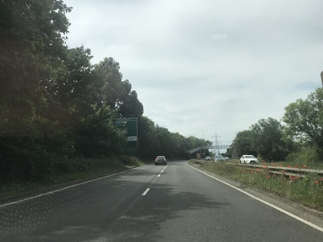
On the A308
On the A308 Credit: Dave Thompson

Staines, Middlesex, is a historic market town located in the county of Surrey, England. Situated on the banks of the River Thames, it lies approximately 17 miles southwest of central London. With a population of around 30,000, Staines is a vibrant and diverse town that offers a mix of historical charm and modern amenities.

The town has a rich history, dating back to the Roman era when it was known as "Ad Pontes" due to the various bridges that spanned the river. Today, remnants of its past can still be seen in the form of Staines Bridge, a stone structure that has been rebuilt multiple times over the centuries.

Staines boasts a bustling town center, home to a range of shops, restaurants, and cafes. The Elmsleigh Shopping Centre is a popular retail destination, offering a variety of high-street brands and independent stores. The town also benefits from a vibrant market, held twice a week, where locals and visitors can browse an array of fresh produce, clothing, and household goods.

For those seeking outdoor activities, Staines offers several green spaces and parks. Staines Moor, a nature reserve located on the outskirts of the town, provides a peaceful retreat for nature lovers and wildlife enthusiasts. Additionally, the nearby Runnymede meadows, famous for being the site of the signing of the Magna Carta in 1215, offer picturesque walks along the riverside.

Staines benefits from excellent transport links, with direct train services to London Waterloo taking approximately 35 minutes. The town is also well-connected by road, with the M25 motorway providing easy access to the wider region.

Overall, Staines, Middlesex, offers a blend of historical significance, natural beauty, and modern conveniences, making it an attractive place to live and visit.

If you have any feedback on the listing, please let us know in the comments section below.

Staines Images

Images are sourced within 2km of 51.426116/-0.5012 or Grid Reference TQ0470. Thanks to Geograph Open Source API. All images are credited.

On the A308
On the A308
On the A308
On the A308
Lammas Recreation Ground, Staines
Outdoor exercise area, Lammas Recreation Ground, Staines
Houses on Greenpark, Staines
Vicarage Road, Staines
The London Stone, Staines On Church Street.
See <a href="https://www.geograph.org.uk/photo/7298114">TQ0371 : Sign for the London Stone, Staines</a> for sign.
The London Stone, Staines
On Church Street. See TQ0371 : Sign for the London Stone, Staines for sign.
Sign for the London Stone, Staines See <a href="https://www.geograph.org.uk/photo/7298113">TQ0371 : The London Stone, Staines</a> for context.
Sign for the London Stone, Staines
Church Street, Staines
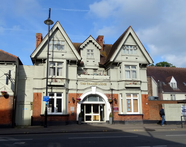
The Thames Lodge, Staines
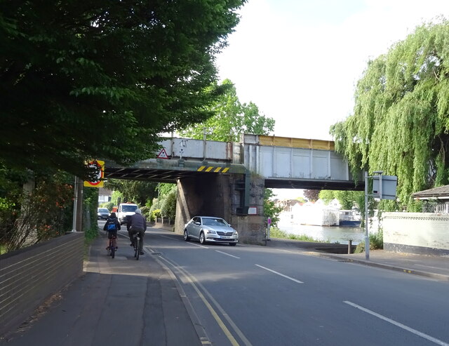
Railway bridge over the B376, Staines
St Peter's Church Staines
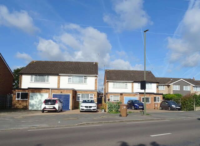
Houses on Laleham Road, Staines
Laleham Road (B376), Staines
Houses on Laleham Road, Staines
Laleham Road (B376), Staines
George V postbox on Laleham Road, Staines-upon-Thames Postbox No. TW18 506.
George V postbox on Laleham Road, Staines-upon-Thames
Postbox No. TW18 506.
Flamm restaurant, Staines  On High Street.
Flamm restaurant, Staines
On High Street.
Show me another place!

Staines is located at Grid Ref: TQ0470 (Lat: 51.426116, Lng: -0.5012)

Administrative County: Surrey

District: Spelthorne

Police Authority: Surrey

What 3 Words

///pushed.gifted.scales. Near Staines, Surrey

Nearby Locations

Staines

Related Wikis

Staines railway station

Staines railway station is on the Waterloo to Reading line and is the junction station for the diverging Windsor line, in southern England to the west...

Wheatsheaf Park (football stadium)

Wheatsheaf Park is a football stadium in Staines-upon-Thames, England. It was the home ground of Staines Town between its opening in 1951 and the club...

Staines Town F.C.

Staines Town Football Club was a football club based in Staines-upon-Thames, Middlesex. Founded in 1892, it last competed in the Isthmian League, until...

Borough of Spelthorne

Spelthorne is a local government district with borough status in Surrey, England. Its council is based in Staines-upon-Thames; other settlements in the...

Nearby Amenities

Located within 500m of 51.426116,-0.5012
Bus Stop
Wheatsheaf Lane
Naptan AtcoCode: 40004402079A
Naptan Bearing: SE
Naptan CommonName: Wheatsheaf Lane
Naptan Indicator: Just Before
Naptan Landmark: Wheatsheaf Lane
Naptan NaptanCode: surdjwmw
Naptan Street: Laleham Road
Naptan Verified: no
Public Transport: platform
Source: naptan_import
Lat/Long: 51.4221629/-0.5011982
Bus Stop
Wheatsheaf Lane
Naptan AtcoCode: 40004402079B
Naptan Bearing: NW
Naptan CommonName: Wheatsheaf Lane
Naptan Indicator: Just after
Naptan Landmark: Wheatsheaf Lane
Naptan NaptanCode: surdjwpa
Naptan Street: Laleham Road
Naptan Verified: no
Public Transport: platform
Source: naptan_import
Lat/Long: 51.4217533/-0.5009943
Bus Stop
Carlyle Road
Naptan AtcoCode: 40004402080A
Naptan Bearing: SE
Naptan CommonName: Carlyle Road
Naptan Indicator: Nr
Naptan Landmark: Carlyle Road
Naptan NaptanCode: surdjwpd
Naptan Street: Laleham Road
Naptan Verified: no
Public Transport: platform
Source: naptan_import
Lat/Long: 51.4249058/-0.5047173
Bus Stop
Carlyle Road
Naptan AtcoCode: 40004402080B
Naptan Bearing: NW
Naptan CommonName: Carlyle Road
Naptan Indicator: Just Before
Naptan Landmark: Carlyle Road
Naptan NaptanCode: surdjwpg
Naptan Street: Laleham Road
Naptan Verified: no
Public Transport: platform
Source: naptan_import
Lat/Long: 51.4235076/-0.5032259
Bus Stop
Park Avenue
Naptan AtcoCode: 40004402081A
Naptan Bearing: S
Naptan BusStopType: CUS
Naptan CommonName: Park Avenue
Naptan Indicator: Just after
Naptan Landmark: Park Avenue
Naptan NaptanCode: surgpmaj
Naptan Street: Laleham Road
Naptan Verified: no
Public Transport: platform
Source: naptan_import
Lat/Long: 51.4262764/-0.5061081
Bus Stop
Park Avenue
Naptan AtcoCode: 40004402081B
Naptan Bearing: N
Naptan CommonName: Park Avenue
Naptan Indicator: Just Before
Naptan Landmark: Park Avenue
Naptan NaptanCode: surdjwpj
Naptan Street: Laleham Road
Naptan Verified: no
Public Transport: platform
Source: naptan_import
Lat/Long: 51.4262208/-0.5062661
Bus Stop
Edgell Road
Naptan AtcoCode: 40004402082A
Naptan Bearing: SE
Naptan CommonName: Edgell Road
Naptan Indicator: Just after
Naptan Landmark: Edgell Road
Naptan NaptanCode: surdmatm
Naptan Street: Laleham Road
Naptan Verified: no
Public Transport: platform
Source: naptan_import
Lat/Long: 51.4279101/-0.5075131
Bus Stop
Worple Avenue
Bus: yes
Naptan AtcoCode: 40004402119A
Naptan Bearing: N
Naptan CommonName: Worple Avenue
Naptan Indicator: Just after
Naptan Landmark: Worple Avenue
Naptan NaptanCode: surdptmw
Naptan Street: Worple Road
Naptan Verified: no
Public Transport: platform
Source: naptan_import
Lat/Long: 51.4273696/-0.4948287
Bus Stop
Worple Avenue
Bus: yes
Naptan AtcoCode: 40004402119B
Naptan Bearing: S
Naptan CommonName: Worple Avenue
Naptan Indicator: Just Before
Naptan Landmark: Worple Avenue
Naptan NaptanCode: surdptpd
Naptan Street: Worple Road
Naptan Verified: no
Public Transport: platform
Source: naptan_import
Lat/Long: 51.4273207/-0.4946653
Bus Stop
Hurstdene Avenue
Bench: no
Bin: no
Naptan AtcoCode: 40004402134A
Naptan Bearing: N
Naptan CommonName: Hurstdene Avenue
Naptan Indicator: Opp
Naptan Landmark: Hurstdene Avenue
Naptan NaptanCode: surdtgjd
Naptan Street: Worple Road
Naptan Verified: no
Public Transport: platform
Shelter: no
Source: naptan_import
Lat/Long: 51.425152/-0.4945539
Turning Circle
Lat/Long: 51.4262399/-0.496924
Turning Circle
Lat/Long: 51.4248064/-0.4988015
Crossing
Crossing: unmarked
Kerb: lowered
Sloped Curb: yes
Source: Bing
Lat/Long: 51.4250577/-0.5049984
Check Date: 2022-07-30
Traffic Calming: hump
Lat/Long: 51.4252393/-0.5024341
Traffic Calming: hump
Lat/Long: 51.4253168/-0.5011461
Check Date: 2022-07-30
Traffic Calming: hump
Lat/Long: 51.4254412/-0.4990552
Check Date: 2022-07-30
Traffic Calming: hump
Lat/Long: 51.4255158/-0.4978746
Crossing
Bicycle: yes
Crossing: unmarked
Crossing Markings: no
Kerb: lowered
Lat/Long: 51.429284/-0.4999568
Crossing
Bicycle: yes
Crossing: unmarked
Crossing Markings: no
Kerb: lowered
Lat/Long: 51.4293219/-0.4994623
Crossing
Bicycle: yes
Crossing: unmarked
Crossing Markings: no
Kerb: lowered
Lat/Long: 51.4293465/-0.4997609
Crossing
Crossing: unmarked
Kerb: lowered
Sloped Curb: yes
Lat/Long: 51.4297014/-0.5012847
Barrier: cycle_barrier
Lat/Long: 51.4299852/-0.5030296
Townhall
Spelthorne Borough Council
Addr City: Staines-upon-Thames
Addr Housename: Spelthorne Borough Council
Addr Postcode: TW18 1XB
Addr Street: Knowle Green
Website: https://www.spelthorne.gov.uk/
Wheelchair: yes
Wikidata: Q1234166
Wikipedia: en:Spelthorne
Lat/Long: 51.4297725/-0.4988334
Crossing
Source: sas
Lat/Long: 51.4267081/-0.5064601
Post Box
Operator: Royal Mail
Post Box Type: pillar
Ref: TW18 524D
Royal Cypher: VR
Royal Cypher Wikidata: Q33102356
Lat/Long: 51.4247322/-0.5069238
Addr City: Staines-upon-Thames
Addr Housenumber: 21
Addr Postcode: TW18 1EP
Addr Street: Stuart Way
Lat/Long: 51.4247443/-0.4962239
Pharmacy
Broadway Pharmacy
Healthcare: pharmacy
Lat/Long: 51.4287712/-0.4953987
Broadway Wines
Shop: alcohol
Lat/Long: 51.4288337/-0.4955181
Natural Meats
Shop: butcher
Lat/Long: 51.4287979/-0.4954497
Traffic Signals
Source: Surrey Air Survey
Traffic Signals Direction: forward
Lat/Long: 51.426736/-0.5064826
Traffic Signals
Source: Surrey Air Survey
Traffic Signals Direction: backward
Lat/Long: 51.4266764/-0.506438
Crossing
Bicycle: yes
Crossing: unmarked
Kerb: lowered
Sloped Curb: yes
Lat/Long: 51.4296312/-0.5021352
Crossing
Bicycle: yes
Crossing: unmarked
Kerb: lowered
Sloped Curb: yes
Lat/Long: 51.4294619/-0.5012748
Crossing
Bicycle: yes
Crossing: unmarked
Crossing Markings: no
Kerb: lowered
Lat/Long: 51.4299754/-0.4975278
Crossing
Bicycle: yes
Crossing: unmarked
Kerb: lowered
Sloped Curb: yes
Lat/Long: 51.4293572/-0.5012321
Crossing
Bicycle: yes
Crossing: unmarked
Crossing Markings: no
Kerb: lowered
Lat/Long: 51.4295938/-0.4985235
Crossing
Bicycle: yes
Crossing: unmarked
Crossing Markings: no
Kerb: lowered
Lat/Long: 51.4297724/-0.4981012
Crossing
Bicycle: yes
Crossing: unmarked
Crossing Markings: no
Kerb: lowered
Lat/Long: 51.4292854/-0.4993245
Crossing
Bicycle: yes
Crossing: unmarked
Crossing Markings: no
Kerb: lowered
Lat/Long: 51.4296064/-0.498187
Flag Pole
Man Made: flagpole
Lat/Long: 51.4298326/-0.4984372
Memorial Bench
Backrest: yes
Historic: memorial
Inscription: "In loving memory of PAUL STONE, Your friends at SBC"
Memorial: bench
Lat/Long: 51.4290756/-0.499914
Horse Statue
Artwork Type: statue
Tourism: artwork
Lat/Long: 51.4291848/-0.4997666
Model Railway Sign
Historic: monument
Inscription: Staines Society of Model Engineers
Lat/Long: 51.4255509/-0.4992534
Memorial Bench
Historic: memorial
Inscription: "In Fond Remembrance of JAMES and FLORA KERR. Local Residents for 50 years."
Memorial: bench
Lat/Long: 51.4282662/-0.4992791
Memorial Plaque
Historic: memorial
Inscription: "In loving memory of C.T. Ridout. Chairman Penton Hook association" 1967 - 19??
Memorial: plaque
Lat/Long: 51.4298798/-0.4980157
Memorial Bench
Historic: memorial
Inscription: Donated by Help Unlimited Charity Shop Staines. In Memory of Mrs. Emily Perkins
Memorial: bench
Lat/Long: 51.4301356/-0.4981363
Fairy and Tree
Artist Name: Ceefa (T17)
Artwork Type: graffiti
Tourism: artwork
Lat/Long: 51.4259826/-0.5000399
Crossing
Crossing: unmarked
Crossing Island: yes
Kerb: lowered
Sloped Curb: yes
Source: Bing
Lat/Long: 51.4249642/-0.5049634
Bus Stop
Grovebarns
Naptan AtcoCode: 40004402167A
Naptan NaptanCode: surdwatg
Physically Present: no
Public Transport: platform
Lat/Long: 51.4273502/-0.5035074
Doctors
Knowle Green Medical
Addr City: Staines-upon-Thames
Addr Housename: Staines Health Centre
Addr Postcode: TW18 1XD
Addr Street: Burges Way
Healthcare: doctor
Healthcare Speciality: general
Opening Hours: Mo-Fr 08:00-18:00
Operator: NHS
Phone: +44 1784 883654
Website: https://knowlegreenmedical.nhs.uk/
Lat/Long: 51.429122/-0.5011596
Doctors
The Hythe Medical Centre
Addr City: Staines-upon-Thames
Addr Housename: Staines Health Centre
Addr Postcode: TW18 1XD
Addr Street: Burges Way
Healthcare: doctor
Healthcare Speciality: general
Opening Hours: Mo-Fr 08:30-18:00
Operator: NHS
Phone: +44 1784 456619
Website: https://thehythemedicalcentre.nhs.uk/
Lat/Long: 51.4290915/-0.5011675
Diacore Concrete Cutting Ltd
Addr City: Staines-upon-Thames
Addr Housenumber: 2
Addr Postcode: TW18 2RA
Addr Street: Witheygate Avenue
Email: diacore@suxiid.com
Facebook: https://www.facebook.com/Diacore-Concrete-Cutting-Ltd-174293979614362/
Office: yes
Phone: 01784456013
Website: https://www.diacore.co.uk/
Lat/Long: 51.4268506/-0.4952594
Check Date: 2022-07-30
Traffic Calming: hump
Lat/Long: 51.4254145/-0.4996655
Noexit: yes
Lat/Long: 51.4304072/-0.5024875
The data included in this document is from www.openstreetmap.org. The data is made available under ODbL.

Have you been to Staines?

Leave your review of Staines below (or comments, questions and feedback).