St Stephens

Settlement in Hertfordshire St. Albans

England

St Stephens

Park Looking NE from TL138067 across the lake in the park, toward the abbey in TL1407
Park Credit: Rob Hinkley

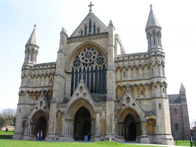
St Stephens is a small village located in the county of Hertfordshire, England. Situated just south of the larger town of St Albans, it forms part of the St Albans City and District. Covering an area of approximately 2 square miles, St Stephens is home to a population of around 5,000 residents.

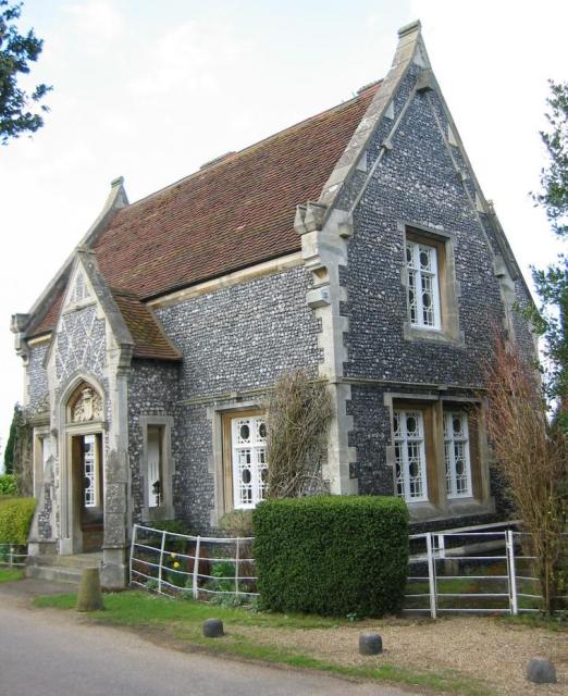
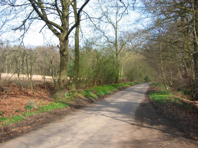
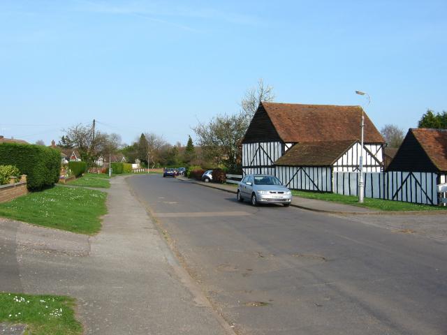
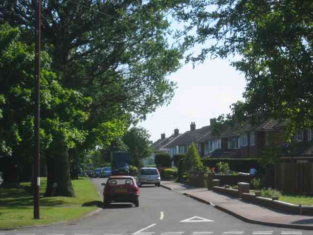
The village is known for its picturesque countryside, with rolling green hills and charming rural landscapes. It is primarily a residential area, with a mix of housing options ranging from modern developments to traditional cottages. The village offers a peaceful and tranquil setting, making it an attractive place to live for those seeking a quieter lifestyle.

St Stephens boasts a close-knit community, with a number of local amenities and facilities that cater to the needs of its residents. These include a primary school, a few local shops, and a village hall that serves as a hub for various community activities.

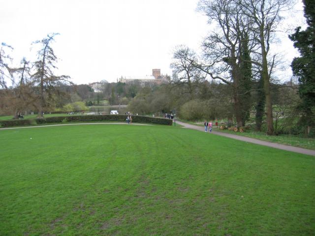
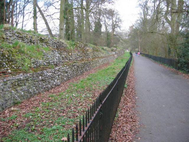
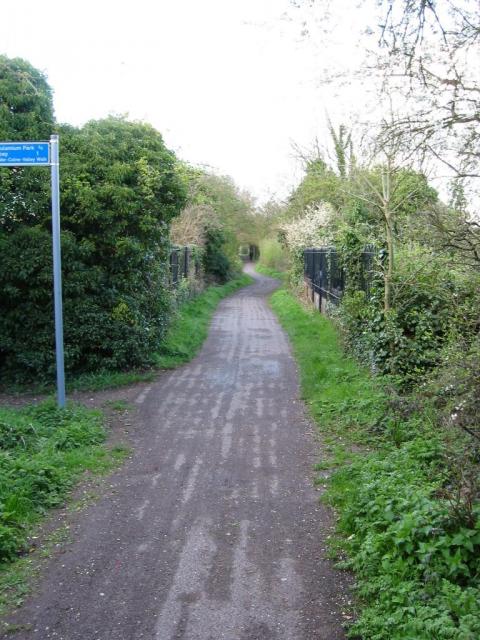
For those who enjoy outdoor activities, the village provides easy access to several nature reserves, parks, and walking trails. Verulamium Park, located nearby in St Albans, offers expansive green spaces, a lake, and recreational facilities such as tennis courts and a playground.

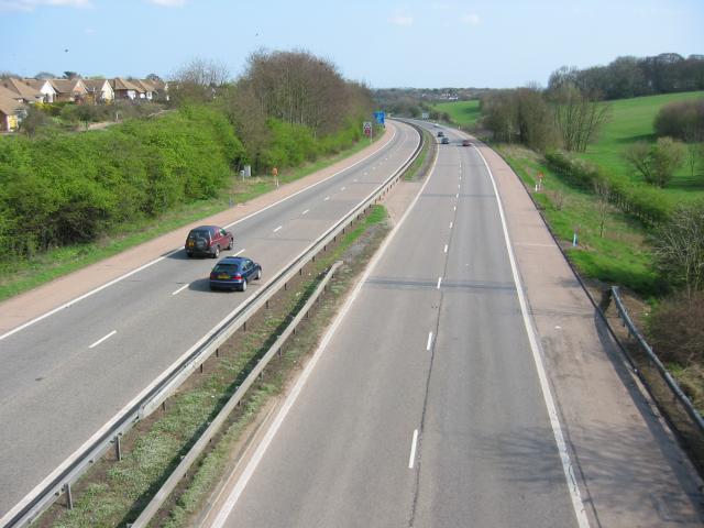
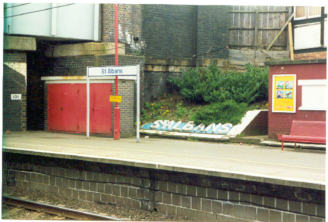
Transport links in St Stephens are convenient, with good road connections to nearby towns and cities. The village is also served by regular bus services, providing access to wider transport networks.

In summary, St Stephens is a charming village in Hertfordshire, offering a peaceful and scenic environment for its residents to enjoy. With its strong sense of community and proximity to nature, it provides a desirable place to call home.

If you have any feedback on the listing, please let us know in the comments section below.

St Stephens Images

Images are sourced within 2km of 51.743686/-0.35386179 or Grid Reference TL1306. Thanks to Geograph Open Source API. All images are credited.

Park Looking NE from TL138067 across the lake in the park, toward the abbey in TL1407
Park
Looking NE from TL138067 across the lake in the park, toward the abbey in TL1407
Roman city wall Looking NE from TL137066, with the old Roman city wall on the left.
Roman city wall
Looking NE from TL137066, with the old Roman city wall on the left.
Stone house House by the entrance to Verulamium Roman Theatre, on the left hand side coming into St Albans along the A4147 (TL135074).
Stone house
House by the entrance to Verulamium Roman Theatre, on the left hand side coming into St Albans along the A4147 (TL135074).
Roman theatre at Verulamium Remains of the theatre at the Roman city of Verulamium (Saint Albans), TL134074.
Roman theatre at Verulamium
Remains of the theatre at the Roman city of Verulamium (Saint Albans), TL134074.
Road from Potters Crouch to Chiswell Green Looking East from TL123052 with copse on the right, open field and then woods on the left.
Road from Potters Crouch to Chiswell Green
Looking East from TL123052 with copse on the right, open field and then woods on the left.
Gateway to suburbia On the Western edge of Chiswell Green, having just left the farmland behind, looking East from TL131045.
Gateway to suburbia
On the Western edge of Chiswell Green, having just left the farmland behind, looking East from TL131045.
M10, from bridge. Looking East from the bridge over the M10 at TL137055.
M10, from bridge.
Looking East from the bridge over the M10 at TL137055.
St Alban's cathedral The west front as rebuilt in the late C19 by a benefactor, Lord Grimthorpe, to his own specification. From TL143071, looking East
St Alban's cathedral
The west front as rebuilt in the late C19 by a benefactor, Lord Grimthorpe, to his own specification. From TL143071, looking East
St Albans cathedral Looking West from TL146070
St Albans cathedral
Looking West from TL146070
Cycleway bridge Looking East over the bridge over the Ver on the St Albans to Hatfield cycleway - an abandoned railway line - at TL153063.
Cycleway bridge
Looking East over the bridge over the Ver on the St Albans to Hatfield cycleway - an abandoned railway line - at TL153063.
Ruined nunnery The ruined nunnery at TL151064
Ruined nunnery
The ruined nunnery at TL151064
The Allotments Near the River Ver are the Allotments just off Cottonmill Lane.
The Allotments
Near the River Ver are the Allotments just off Cottonmill Lane.
Railway Bridge over the Alban Way Just near London Road is a pedestrian route from St.Albans to Hatfield.
Railway Bridge over the Alban Way
Just near London Road is a pedestrian route from St.Albans to Hatfield.
Where are we? St. Albans Railway Station is not shy in proclaiming its identity.  See Stacey Harris's photo <a href="https://www.geograph.org.uk/photo/788654">TL1507 : St Albans Station</a> for the context of this close-up.
Where are we?
St. Albans Railway Station is not shy in proclaiming its identity. See Stacey Harris's photo TL1507 : St Albans Station for the context of this close-up.
St Alban's R.C. Church at St Julians This church is almost at the southern edge of St Albans.
St Alban's R.C. Church at St Julians
This church is almost at the southern edge of St Albans.
A road in Chiswell Green The forest trees at least show that it has some attraction
A road in Chiswell Green
The forest trees at least show that it has some attraction
St Stephen's Church  St Albans This church has sufficient land for car parking which is a boon as the road outside is always busy.
St Stephen's Church St Albans
This church has sufficient land for car parking which is a boon as the road outside is always busy.
The King Harry Pub St Albans This is an awkward junction with a double mini roundabout. Best avoided if possible. {see note re St Stephens Church}
The King Harry Pub St Albans
This is an awkward junction with a double mini roundabout. Best avoided if possible. {see note re St Stephens Church}
Show me another place!

St Stephens is located at Grid Ref: TL1306 (Lat: 51.743686, Lng: -0.35386179)

Administrative County: Hertfordshire

District: St. Albans

Police Authority: Hertfordshire

What 3 Words

///windy.decay.lasted. Near St Albans, Hertfordshire

Nearby Locations

St Stephens

Related Wikis

St Columba's College, St Albans

St Columba's College is a co-educational 4–18 private, Catholic day school and sixth form in St Albans, Hertfordshire, England. It was founded in 1939...

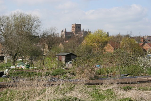
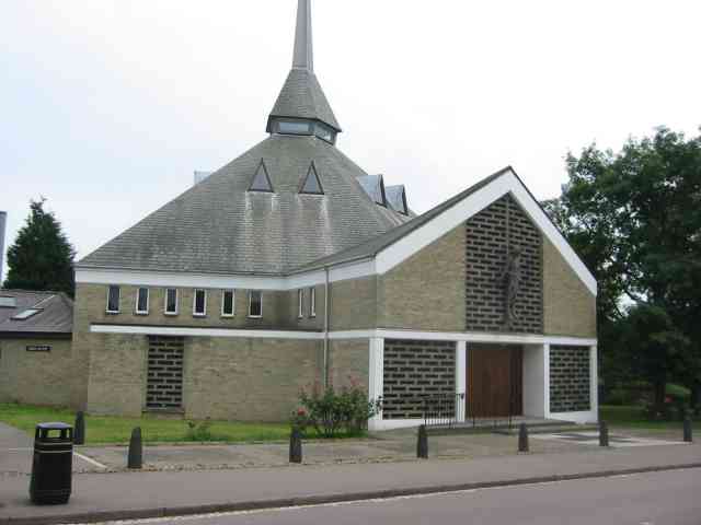
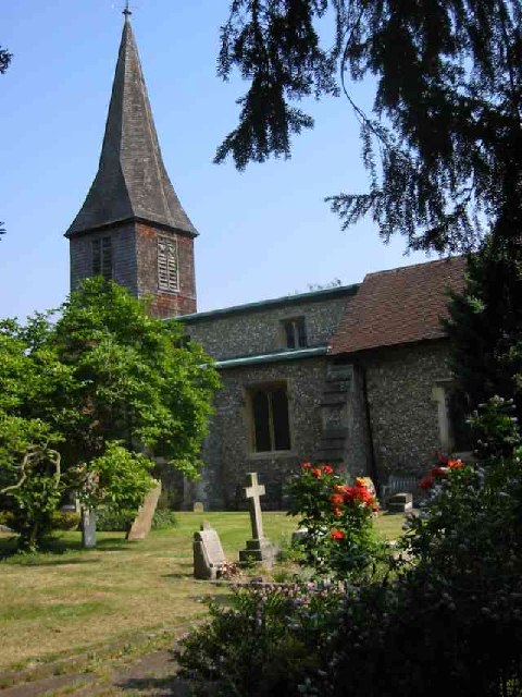
St Stephen's Church, St Albans

St Stephen's Church is a Church of England parish church in St Albans, Hertfordshire, England. It is located to the south of the town centre, at the top...
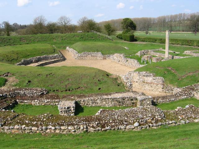
Verulamium Park

Verulamium Park is a park in St Albans, Hertfordshire. Set in over 100 acres (0.40 km2) of parkland, Verulamium Park was purchased from the Earl of Verulam...

Turning Forms

Turning Forms (BH 166) is a concrete sculpture by Barbara Hepworth, one of her first public commissions, made in 1950 for the Festival of Britain. It was...

Nearby Amenities

Located within 500m of 51.743686,-0.35386179
Mini Roundabout
Direction: clockwise
Lat/Long: 51.741867/-0.3491376
Mini Roundabout
Direction: clockwise
Lat/Long: 51.7418026/-0.3494367
Toilets
Check Date: 2023-09-07
Fee: no
Opening Hours: Closed pending structural survey (RAAC)
Lat/Long: 51.7464791/-0.3489814
Mini Roundabout
Direction: clockwise
Lat/Long: 51.7462715/-0.3575861
Parking
Lat/Long: 51.7465065/-0.3590309
Pub
King Harry
Addr City: St Albans
Addr Housenumber: 2
Addr Postcode: AL3 4BL
Addr Street: King Harry Lane
Fhrs Authority: St Albans City
Fhrs Id: 305897
Indoor Seating: yes
Outdoor Seating: yes
Toilets: yes
Toilets Access: customers
Wikidata: Q26468915
Lat/Long: 51.7420415/-0.3493771
Crossing
Crossing: uncontrolled
Crossing Island: no
Crossing Ref: zebra
Tactile Paving: yes
Lat/Long: 51.7425369/-0.3511574
Bus Stop
Waitrose
Bench: yes
Bin: no
Bus: yes
Naptan AtcoCode: 210021503360
Naptan Bearing: NW
Naptan CommonName: Waitrose
Naptan Crossing: Prae Wood School
Naptan Indicator: nr
Naptan Landmark: Prae Wood School
Naptan NaptanCode: hrtawptd
Naptan PlusbusZoneRef: STALBCY
Naptan ShortCommonName: NA
Naptan Street: Mayne Avenue
Naptan Verified: no
Public Transport: platform
Shelter: yes
Source: naptan_import
Lat/Long: 51.7460596/-0.3587018
Bus Stop
King Harry PH
Bench: yes
Bin: yes
Bus: yes
Lit: yes
Naptan AtcoCode: 210021503480
Naptan Bearing: SW
Naptan CommonName: King Harry Lane
Naptan Crossing: Watling Street
Naptan Indicator: opp
Naptan Landmark: Watling Street
Naptan NaptanCode: hrtawpwa
Naptan PlusbusZoneRef: STALBCY
Naptan ShortCommonName: NA
Naptan Street: Watford Road
Naptan Verified: no
Public Transport: platform
Shelter: no
Source: naptan_import
Tactile Paving: yes
Lat/Long: 51.7408789/-0.3502525
Bus Stop
King Harry PH
Bench: yes
Bin: yes
Bus: yes
Lit: yes
Naptan AtcoCode: 210021508300
Naptan Bearing: NE
Naptan CommonName: King Harry Lane
Naptan Crossing: St Stephen's Avenue
Naptan Indicator: nr
Naptan Landmark: St Stephen's Avenue
Naptan NaptanCode: hrtatwpt
Naptan PlusbusZoneRef: STALBCY
Naptan ShortCommonName: NA
Naptan Street: Watford Road
Naptan Verified: no
Public Transport: platform
Shelter: no
Source: naptan_import
Tactile Paving: yes
Lat/Long: 51.7412169/-0.350171
Bus Stop
St Stephen's Avenue
Bus: yes
Local Ref: NR
Naptan AtcoCode: 210021508310
Naptan Bearing: SW
Naptan BusStopType: CUS
Naptan CommonName: St Stephen's Avenue
Naptan Crossing: Midway
Naptan Indicator: nr
Naptan Landmark: Midway
Naptan NaptanCode: hrtatwpw
Naptan PlusbusZoneRef: STALBCY
Naptan ShortCommonName: NA
Naptan Street: Abbey Avenue
Naptan Verified: no
Public Transport: platform
Source: naptan_import
Lat/Long: 51.7418747/-0.3565214
Bus Stop
Abbey Avenue
Bus: yes
Naptan AtcoCode: 210021508320
Naptan Bearing: SW
Naptan CommonName: Abbey Avenue
Naptan Crossing: Westfields
Naptan Indicator: SW-bound
Naptan Landmark: Westfields
Naptan NaptanCode: hrtatwta
Naptan PlusbusZoneRef: STALBCY
Naptan ShortCommonName: NA
Naptan Street: Abbey Avenue
Naptan Verified: no
Public Transport: platform
Source: naptan_import
Lat/Long: 51.7409438/-0.3579148
Turning Circle
Lat/Long: 51.7397258/-0.3540908
Traffic Calming: island
Lat/Long: 51.7462527/-0.3573883
Bus Stop
St Columba's College
Bus: yes
Naptan AtcoCode: 210021503340
Naptan Bearing: NW
Naptan BusStopType: CUS
Naptan CommonName: St Columba's College
Naptan Crossing: opp Sacred Heart Junior School
Naptan Indicator: opp
Naptan Landmark: opp Sacred Heart Junior School
Naptan NaptanCode: hrtawtat
Naptan PlusbusZoneRef: STALBCY
Naptan ShortCommonName: NA
Naptan Street: King Harry Lane
Naptan Verified: no
Public Transport: platform
Source: naptan_import
Lat/Long: 51.7427134/-0.351812
Traffic Calming: island
Lat/Long: 51.7463306/-0.357752
Crossing
Crossing: marked
Crossing Island: no
Tactile Paving: yes
Lat/Long: 51.7417139/-0.3489614
Turning Circle
Lat/Long: 51.7407362/-0.3488126
Turning Circle
Lat/Long: 51.7404124/-0.3491725
Turning Circle
Lat/Long: 51.7406877/-0.3498187
Westfields News
Addr City: St Albans
Addr Housenumber: 35
Addr Postcode: AL3 4BH
Addr Street: Abbey Avenue
Fhrs Authority: St Albans City
Fhrs Id: 305366
Opening Hours: Mo-Su 07:00-19:00
Phone: +44 1727853874
Shop: convenience
Website: http://www.westfieldsnews.com/
Lat/Long: 51.7414617/-0.3570585
Charging Station
Capacity: 4
Lat/Long: 51.7459468/-0.3600997
Turning Circle
Lat/Long: 51.7404672/-0.3540664
The Beacon (NHS)
Addr City: St Albans
Addr Housename: The Beacon (NHS)
Addr Postcode: AL3 4AU
Addr Street: King Harry Lane
Lat/Long: 51.7452649/-0.353725
Bus Stop
St Columba's College
Bus: yes
Naptan AtcoCode: 210021503340;210021508420
Naptan Bearing: NW;SE
Naptan BusStopType: CUS
Naptan CommonName: St Columba's College
Naptan Crossing: opp Sacred Heart Junior School;Sacred Heart Junior School
Naptan Indicator: opp;nr
Naptan Landmark: opp Sacred Heart Junior School;Sacred Heart Junior School
Naptan NaptanCode: hrtawtat;hrtatwjm
Naptan PlusbusZoneRef: STALBCY
Naptan ShortCommonName: NA
Naptan Street: King Harry Lane
Naptan Verified: no
Public Transport: platform
Source: naptan_import
Lat/Long: 51.7427542/-0.3516528
Crossing
Lat/Long: 51.7461254/-0.3577368
Traffic Signals
Crossing: traffic_signals
Kerb: lowered
Tactile Paving: yes
Traffic Signals: crossing
Lat/Long: 51.7457702/-0.3561271
Glenalmond
Addr City: St Albans
Addr Housename: Glenalmond
Addr Housenumber: 14
Addr Postcode: AL3 4AP
Addr Street: King Harry Lane
Building: house
Lat/Long: 51.7439389/-0.3522822
Post Box
Brand: Royal Mail
Brand Wikidata: Q638098
Brand Wikipedia: en:Royal Mail
Collection Times: Mo-Fr 17:00; Sa 11:30
Operator: Royal Mail
Operator Wikidata: Q638098
Royal Cypher: EIIR
Royal Cypher Wikidata: Q33102113
Lat/Long: 51.7458936/-0.3581925
Post Box
Brand: Royal Mail
Brand Wikidata: Q638098
Brand Wikipedia: en:Royal Mail
Operator: Royal Mail
Operator Wikidata: Q638098
Lat/Long: 51.7415045/-0.3571031
Turning Circle
Lat/Long: 51.7434202/-0.359266
Addr Postcode: AL3 4GE
Building: yes
Lat/Long: 51.7421621/-0.3580887
Addr Postcode: AL3 4GD
Building: yes
Lat/Long: 51.7441738/-0.3566252
Addr Postcode: AL3 4GJ
Building: yes
Lat/Long: 51.7436886/-0.3572946
Bench
Backrest: yes
Lat/Long: 51.7468858/-0.3492502
Direction: 210
Generator Method: photovoltaic
Generator Output Electricity: yes
Generator Solar Modules: 16
Generator Source: solar
Generator Type: solar_photovoltaic_panel
Location: roof
Power: generator
Lat/Long: 51.7407206/-0.3494097
Crossing
Crossing: uncontrolled
Crossing Island: no
Crossing Ref: zebra
Tactile Paving: yes
Lat/Long: 51.7416034/-0.3496776
Direction: 230
Generator Method: photovoltaic
Generator Output Electricity: yes
Generator Solar Modules: 8
Generator Source: solar
Generator Type: solar_photovoltaic_panel
Location: roof
Power: generator
Lat/Long: 51.7419994/-0.3600929
Traffic Calming: island
Lat/Long: 51.745973/-0.3581249
Traffic Calming: island
Lat/Long: 51.7460485/-0.3578703
Traffic Calming: island
Lat/Long: 51.7464491/-0.3580779
Direction: 135
Generator Method: photovoltaic
Generator Output Electricity: yes
Generator Solar Modules: 6
Generator Source: solar
Generator Type: solar_photovoltaic_panel
Location: roof
Power: generator
Lat/Long: 51.7452827/-0.3602144
Turning Circle
Lat/Long: 51.7449276/-0.3604848
Direction: 225
Generator Method: photovoltaic
Generator Output Electricity: yes
Generator Solar Modules: 14
Generator Source: solar
Generator Type: solar_photovoltaic_panel
Location: roof
Power: generator
Lat/Long: 51.7439041/-0.3602721
Direction: 135
Fixme: survey for panel count
Generator Method: photovoltaic
Generator Output Electricity: yes
Generator Solar Modules: 12
Generator Source: solar
Generator Type: solar_photovoltaic_panel
Location: roof
Power: generator
Lat/Long: 51.7441609/-0.3605861
Direction: 225
Generator Method: photovoltaic
Generator Output Electricity: yes
Generator Solar Modules: 5
Generator Source: solar
Generator Type: solar_photovoltaic_panel
Location: roof
Power: generator
Lat/Long: 51.7441054/-0.3605841
Direction: 135
Generator Method: photovoltaic
Generator Output Electricity: yes
Generator Solar Modules: 12
Generator Source: solar
Generator Type: solar_photovoltaic_panel
Location: roof
Power: generator
Lat/Long: 51.7445146/-0.3600314
Crossing
Crossing: unmarked
Lat/Long: 51.7436326/-0.3539522
Direction: 185
Fixme: survey for panel count
Generator Method: photovoltaic
Generator Output Electricity: yes
Generator Solar Modules: 20
Generator Source: solar
Generator Type: solar_photovoltaic_panel
Location: roof
Power: generator
Lat/Long: 51.7433472/-0.3538952
Direction: 135
Generator Method: photovoltaic
Generator Output Electricity: yes
Generator Solar Modules: 10
Generator Source: solar
Generator Type: solar_photovoltaic_panel
Location: roof
Power: generator
Lat/Long: 51.7425956/-0.3559647
Direction: 225
Generator Method: photovoltaic
Generator Output Electricity: yes
Generator Solar Modules: 12
Generator Source: solar
Generator Type: solar_photovoltaic_panel
Location: roof
Power: generator
Lat/Long: 51.7425418/-0.3561772
Direction: 135
Generator Method: photovoltaic
Generator Output Electricity: yes
Generator Solar Modules: 7
Generator Source: solar
Generator Type: solar_photovoltaic_panel
Location: roof
Power: generator
Lat/Long: 51.7406464/-0.3580316
Direction: 135
Generator Method: photovoltaic
Generator Output Electricity: yes
Generator Solar Modules: 5
Generator Source: solar
Generator Type: solar_photovoltaic_panel
Location: roof
Power: generator
Lat/Long: 51.7406781/-0.3579713
Turning Circle
Lat/Long: 51.7413735/-0.3568878
Direction: 210
Generator Method: photovoltaic
Generator Output Electricity: yes
Generator Solar Modules: 10
Generator Source: solar
Generator Type: solar_photovoltaic_panel
Location: roof
Power: generator
Lat/Long: 51.7402443/-0.3526536
Direction: 215
Generator Method: photovoltaic
Generator Output Electricity: yes
Generator Solar Modules: 13
Generator Source: solar
Generator Type: solar_photovoltaic_panel
Location: roof
Power: generator
Lat/Long: 51.7427199/-0.3524767
Barrier: bollard
Lat/Long: 51.7440886/-0.3568712
Clinic
Health Barn Clinic
Addr City: St Albans
Addr Housenumber: 37
Addr Postcode: AL3 4BH
Addr Street: Abbey Avenue
Healthcare: clinic
Phone: +44 1727 833698
Website: http://www.naturaltherapyclinic.co.uk/
Lat/Long: 51.7414219/-0.3571072
Skin & Tonic Beauty Salon
Addr City: St Albans
Addr Housenumber: 39
Addr Postcode: AL3 4BH
Addr Street: Abbey Avenue
Opening Hours: Mo-Fr 09:00-21:00
Phone: +44 1727 857223
Shop: beauty
Website: http://www.beautyatskinandtonic.co.uk/
Lat/Long: 51.7413754/-0.3571742
Paul Adler Optometrist
Addr City: St Albans
Addr Housenumber: 41a
Addr Postcode: AL3 4BH
Addr Street: Abbey Avenue
Healthcare: optometrist
Opening Hours: Mo-Fr 09:30-18:00
Phone: +44 1727 842232
Website: https://www.eyezone.co.uk/
Lat/Long: 51.741292/-0.357295
Tielsi Hairdressing
Addr City: St Albans
Addr Housenumber: 41
Addr Postcode: AL3 4BH
Addr Street: Abbey Avenue
Opening Hours: Mo-Fr 09:00-17:30
Phone: +44 1727 859498
Shop: hairdresser
Website: https://www.tielsihair.com/
Lat/Long: 51.7413385/-0.3572266
The data included in this document is from www.openstreetmap.org. The data is made available under ODbL.

Have you been to St Stephens?

Leave your review of St Stephens below (or comments, questions and feedback).