St Julians

Settlement in Hertfordshire St. Albans

England

St Julians

Park Looking NE from TL138067 across the lake in the park, toward the abbey in TL1407
Park Credit: Rob Hinkley

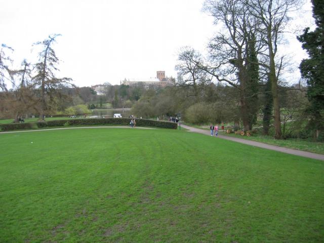
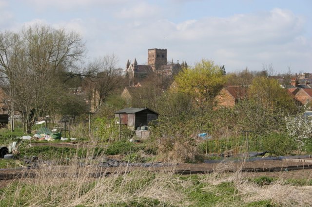
St Julians is a small village located in the county of Hertfordshire, England. Situated approximately 3 miles northwest of the town of St Albans, it is nestled in a picturesque rural setting surrounded by rolling green hills and scenic countryside.

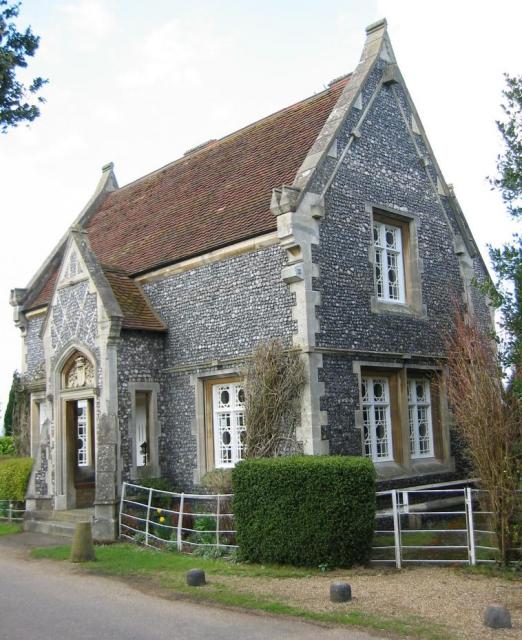
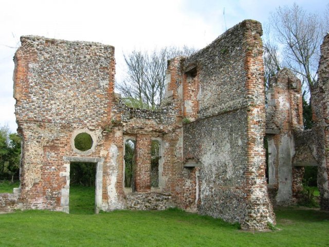
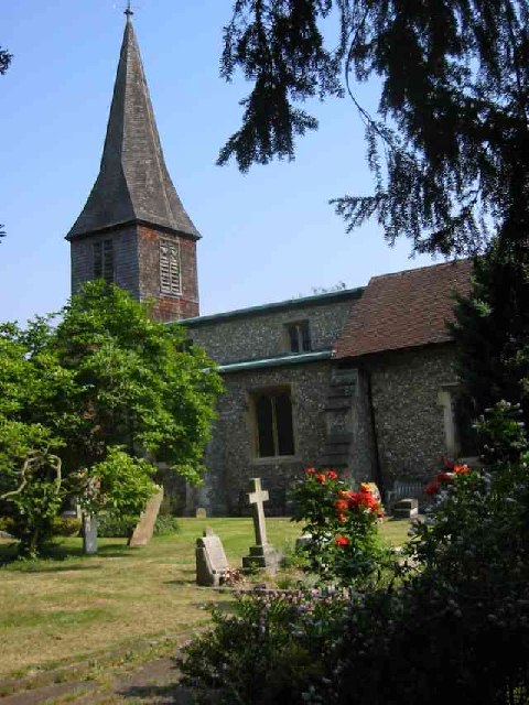
The village is known for its charming and historic character, with many of its buildings dating back to the 17th and 18th centuries. The centerpiece of St Julians is its beautiful church, St Julian's Church, which dates back to the 12th century and showcases stunning architectural details.

Despite its small size, St Julians offers a range of amenities for its residents. These include a local pub, The Chequers Inn, which provides a cozy and inviting atmosphere for visitors to enjoy a drink or a meal. The village also has a small primary school, St Julian's Church of England School, which serves the educational needs of the local children.

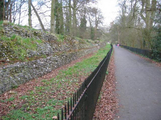
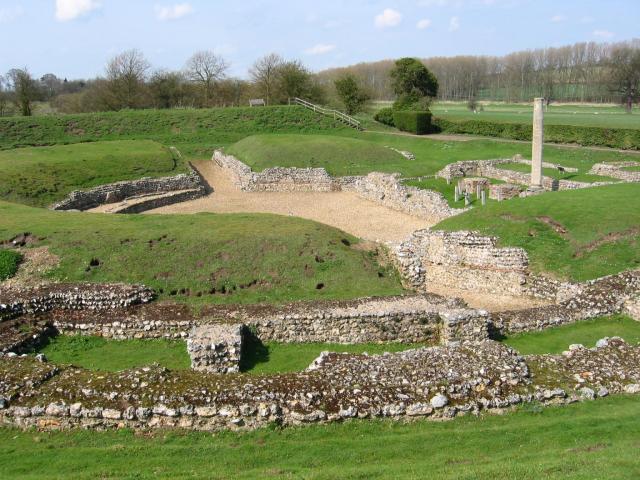
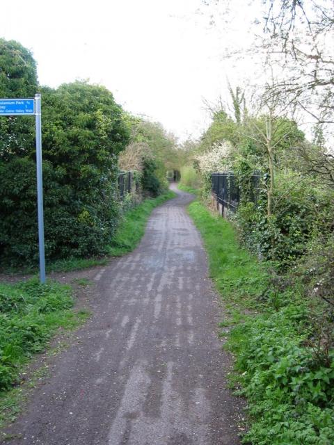
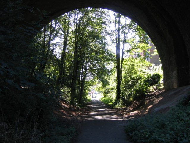
Nature enthusiasts will find plenty to explore in and around St Julians. The village is surrounded by picturesque walking trails, offering opportunities for leisurely strolls and outdoor activities. Additionally, the nearby Verulamium Park and Nature Reserve provide a haven for wildlife and offer beautiful scenic views.

With its idyllic rural setting and historic charm, St Julians is a peaceful and welcoming village that offers a retreat from the hustle and bustle of modern life. Its close proximity to St Albans ensures that residents have access to a wider range of amenities and services, making it a desirable place to live for those seeking a balance between tranquility and convenience.

If you have any feedback on the listing, please let us know in the comments section below.
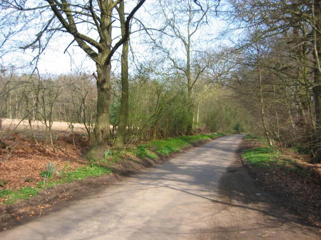
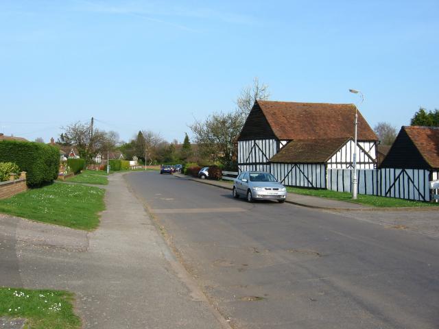
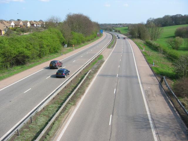
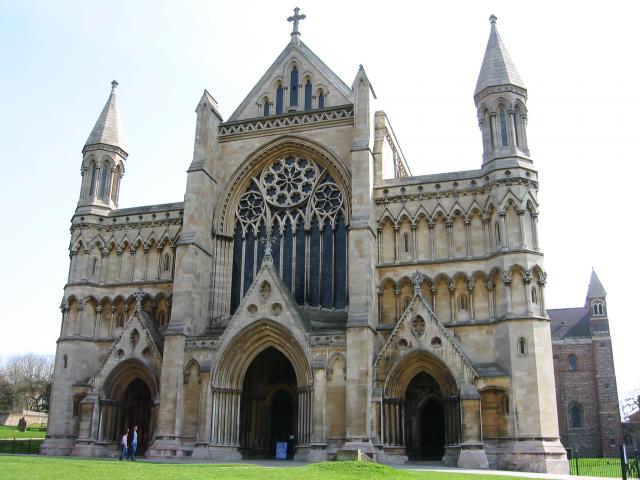
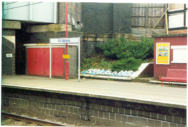
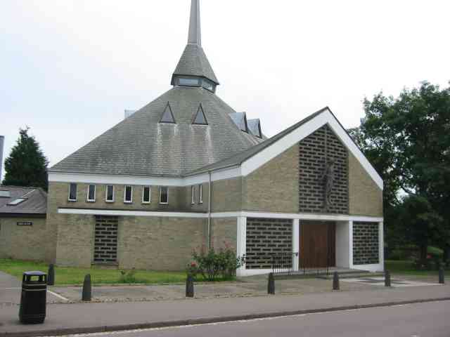
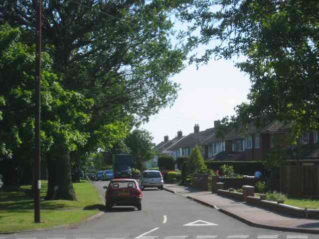
St Julians Images

Images are sourced within 2km of 51.740485/-0.35067579 or Grid Reference TL1305. Thanks to Geograph Open Source API. All images are credited.

Park Looking NE from TL138067 across the lake in the park, toward the abbey in TL1407
Park
Looking NE from TL138067 across the lake in the park, toward the abbey in TL1407
Roman city wall Looking NE from TL137066, with the old Roman city wall on the left.
Roman city wall
Looking NE from TL137066, with the old Roman city wall on the left.
Stone house House by the entrance to Verulamium Roman Theatre, on the left hand side coming into St Albans along the A4147 (TL135074).
Stone house
House by the entrance to Verulamium Roman Theatre, on the left hand side coming into St Albans along the A4147 (TL135074).
Roman theatre at Verulamium Remains of the theatre at the Roman city of Verulamium (Saint Albans), TL134074.
Roman theatre at Verulamium
Remains of the theatre at the Roman city of Verulamium (Saint Albans), TL134074.
Road from Potters Crouch to Chiswell Green Looking East from TL123052 with copse on the right, open field and then woods on the left.
Road from Potters Crouch to Chiswell Green
Looking East from TL123052 with copse on the right, open field and then woods on the left.
Gateway to suburbia On the Western edge of Chiswell Green, having just left the farmland behind, looking East from TL131045.
Gateway to suburbia
On the Western edge of Chiswell Green, having just left the farmland behind, looking East from TL131045.
M10, from bridge. Looking East from the bridge over the M10 at TL137055.
M10, from bridge.
Looking East from the bridge over the M10 at TL137055.
St Alban's cathedral The west front as rebuilt in the late C19 by a benefactor, Lord Grimthorpe, to his own specification. From TL143071, looking East
St Alban's cathedral
The west front as rebuilt in the late C19 by a benefactor, Lord Grimthorpe, to his own specification. From TL143071, looking East
St Albans cathedral Looking West from TL146070
St Albans cathedral
Looking West from TL146070
Cycleway bridge Looking East over the bridge over the Ver on the St Albans to Hatfield cycleway - an abandoned railway line - at TL153063.
Cycleway bridge
Looking East over the bridge over the Ver on the St Albans to Hatfield cycleway - an abandoned railway line - at TL153063.
Ruined nunnery The ruined nunnery at TL151064
Ruined nunnery
The ruined nunnery at TL151064
The Allotments Near the River Ver are the Allotments just off Cottonmill Lane.
The Allotments
Near the River Ver are the Allotments just off Cottonmill Lane.
Railway Bridge over the Alban Way Just near London Road is a pedestrian route from St.Albans to Hatfield.
Railway Bridge over the Alban Way
Just near London Road is a pedestrian route from St.Albans to Hatfield.
Where are we? St. Albans Railway Station is not shy in proclaiming its identity.  See Stacey Harris's photo <a href="https://www.geograph.org.uk/photo/788654">TL1507 : St Albans Station</a> for the context of this close-up.
Where are we?
St. Albans Railway Station is not shy in proclaiming its identity. See Stacey Harris's photo TL1507 : St Albans Station for the context of this close-up.
St Alban's R.C. Church at St Julians This church is almost at the southern edge of St Albans.
St Alban's R.C. Church at St Julians
This church is almost at the southern edge of St Albans.
A road in Chiswell Green The forest trees at least show that it has some attraction
A road in Chiswell Green
The forest trees at least show that it has some attraction
St Stephen's Church  St Albans This church has sufficient land for car parking which is a boon as the road outside is always busy.
St Stephen's Church St Albans
This church has sufficient land for car parking which is a boon as the road outside is always busy.
The King Harry Pub St Albans This is an awkward junction with a double mini roundabout. Best avoided if possible. {see note re St Stephens Church}
The King Harry Pub St Albans
This is an awkward junction with a double mini roundabout. Best avoided if possible. {see note re St Stephens Church}
Show me another place!

St Julians is located at Grid Ref: TL1305 (Lat: 51.740485, Lng: -0.35067579)

Administrative County: Hertfordshire

District: St. Albans

Police Authority: Hertfordshire

What 3 Words

///race.scout.sizes. Near St Albans, Hertfordshire

Nearby Locations

St Julians

Related Wikis

Turning Forms

Turning Forms (BH 166) is a concrete sculpture by Barbara Hepworth, one of her first public commissions, made in 1950 for the Festival of Britain. It was...

St Stephen's Church, St Albans

St Stephen's Church is a Church of England parish church in St Albans, Hertfordshire, England. It is located to the south of the town centre, at the top...

The Marlborough Science Academy

The Marlborough Science Academy is a secondary school and sixth form with Academy status, located in St Albans, Hertfordshire, England. It has a specialism...

St Columba's College, St Albans

St Columba's College is a co-educational 4–18 private, Catholic day school and sixth form in St Albans, Hertfordshire, England. It was founded in 1939...

Nearby Amenities

Located within 500m of 51.740485,-0.35067579
Mini Roundabout
Direction: clockwise
Lat/Long: 51.741867/-0.3491376
Mini Roundabout
Direction: clockwise
Lat/Long: 51.7418026/-0.3494367
Traffic Calming: hump
Lat/Long: 51.7401022/-0.3447068
Mini Roundabout
Lat/Long: 51.7382334/-0.3451831
Pub
King Harry
Addr City: St Albans
Addr Housenumber: 2
Addr Postcode: AL3 4BL
Addr Street: King Harry Lane
Fhrs Authority: St Albans City
Fhrs Id: 305897
Indoor Seating: yes
Outdoor Seating: yes
Toilets: yes
Toilets Access: customers
Wikidata: Q26468915
Lat/Long: 51.7420415/-0.3493771
Crossing
Crossing: uncontrolled
Crossing Island: no
Crossing Ref: zebra
Tactile Paving: yes
Lat/Long: 51.7425369/-0.3511574
Bus Stop
Watford Road
Bus: yes
Naptan AtcoCode: 210021503460
Naptan Bearing: SE
Naptan CommonName: Watford Road
Naptan Crossing: Westfields
Naptan Indicator: nr
Naptan Landmark: Westfields
Naptan NaptanCode: hrtawptw
Naptan PlusbusZoneRef: STALBCY
Naptan ShortCommonName: NA
Naptan Street: Midway
Naptan Verified: no
Public Transport: platform
Shelter: no
Source: naptan_import
Lat/Long: 51.738571/-0.3539942
Bus Stop
King Harry PH
Bench: yes
Bin: yes
Bus: yes
Lit: yes
Naptan AtcoCode: 210021503480
Naptan Bearing: SW
Naptan CommonName: King Harry Lane
Naptan Crossing: Watling Street
Naptan Indicator: opp
Naptan Landmark: Watling Street
Naptan NaptanCode: hrtawpwa
Naptan PlusbusZoneRef: STALBCY
Naptan ShortCommonName: NA
Naptan Street: Watford Road
Naptan Verified: no
Public Transport: platform
Shelter: no
Source: naptan_import
Tactile Paving: yes
Lat/Long: 51.7408789/-0.3502525
Bus Stop
Midway
Bench: yes
Bin: yes
Bus: yes
Lit: yes
Naptan AtcoCode: 210021503500
Naptan Bearing: SW
Naptan CommonName: Midway
Naptan Crossing: opp Midway
Naptan Indicator: opp
Naptan Landmark: opp Midway
Naptan NaptanCode: hrtawpwd
Naptan PlusbusZoneRef: STALBCY
Naptan ShortCommonName: NA
Naptan Street: Watford Road
Naptan Verified: no
Public Transport: platform
Shelter: yes
Source: naptan_import
Tactile Paving: yes
Lat/Long: 51.7383052/-0.352131
Bus Stop
Vesta Avenue
Bin: yes
Bus: yes
Naptan AtcoCode: 210021503860
Naptan Bearing: SW
Naptan CommonName: Vesta Avenue
Naptan Crossing: Watling Street
Naptan Indicator: SW-bound
Naptan Landmark: Watling Street
Naptan NaptanCode: hrtawpdj
Naptan PlusbusZoneRef: STALBCY
Naptan ShortCommonName: NA
Naptan Street: Vesta Avenue
Naptan Verified: no
Public Transport: platform
Shelter: no
Source: naptan_import
Lat/Long: 51.7372329/-0.3457995
Bus Stop
Tavistock Avenue
Bus: yes
Naptan AtcoCode: 210021503875
Naptan Bearing: N
Naptan CommonName: Tavistock Avenue
Naptan Crossing: opp Maynard Drive
Naptan Indicator: N-bound
Naptan Landmark: opp Maynard Drive
Naptan NaptanCode: hrtawpdm
Naptan PlusbusZoneRef: STALBCY
Naptan ShortCommonName: NA
Naptan Street: Doggetts Way
Naptan Verified: no
Public Transport: platform
Source: naptan_import
Lat/Long: 51.7400043/-0.3436835
Bus Stop
Vesta Avenue
Bus: yes
Naptan AtcoCode: 210021507920
Naptan Bearing: NE
Naptan CommonName: Vesta Avenue
Naptan Crossing: Watling Street
Naptan Indicator: NE-bound
Naptan Landmark: Watling Street
Naptan NaptanCode: hrtawajp
Naptan PlusbusZoneRef: STALBCY
Naptan ShortCommonName: NA
Naptan Street: Vesta Avenue
Naptan Verified: no
Public Transport: platform
Source: naptan_import
Lat/Long: 51.7376675/-0.3457018
Bus Stop
Maynard Drive
Bus: yes
Naptan AtcoCode: 210021507940
Naptan Bearing: N
Naptan CommonName: Maynard Drive
Naptan Crossing: opp Maynard Drive
Naptan Indicator: N-bound
Naptan Landmark: opp Maynard Drive
Naptan NaptanCode: hrtawada
Naptan PlusbusZoneRef: STALBCY
Naptan ShortCommonName: NA
Naptan Street: Doggetts Way
Naptan Verified: no
Public Transport: platform
Shelter: yes
Source: naptan_import
Lat/Long: 51.7408882/-0.3437197
Bus Stop
Midway
Bench: yes
Bin: yes
Lit: yes
Naptan AtcoCode: 210021508280
Naptan Bearing: NE
Naptan CommonName: Midway
Naptan Crossing: Midway
Naptan Indicator: nr
Naptan Landmark: Midway
Naptan NaptanCode: hrtatwpm
Naptan PlusbusZoneRef: STALBCY
Naptan ShortCommonName: NA
Naptan Street: Watford Road
Naptan Verified: no
Public Transport: platform
Shelter: no
Source: naptan_import
Tactile Paving: no
Lat/Long: 51.7376785/-0.3528935
Bus Stop
King Harry PH
Bench: yes
Bin: yes
Bus: yes
Lit: yes
Naptan AtcoCode: 210021508300
Naptan Bearing: NE
Naptan CommonName: King Harry Lane
Naptan Crossing: St Stephen's Avenue
Naptan Indicator: nr
Naptan Landmark: St Stephen's Avenue
Naptan NaptanCode: hrtatwpt
Naptan PlusbusZoneRef: STALBCY
Naptan ShortCommonName: NA
Naptan Street: Watford Road
Naptan Verified: no
Public Transport: platform
Shelter: no
Source: naptan_import
Tactile Paving: yes
Lat/Long: 51.7412169/-0.350171
Bus Stop
St Stephen's Avenue
Bus: yes
Local Ref: NR
Naptan AtcoCode: 210021508310
Naptan Bearing: SW
Naptan BusStopType: CUS
Naptan CommonName: St Stephen's Avenue
Naptan Crossing: Midway
Naptan Indicator: nr
Naptan Landmark: Midway
Naptan NaptanCode: hrtatwpw
Naptan PlusbusZoneRef: STALBCY
Naptan ShortCommonName: NA
Naptan Street: Abbey Avenue
Naptan Verified: no
Public Transport: platform
Source: naptan_import
Lat/Long: 51.7418747/-0.3565214
Marlborough School
Naptan AtcoCode: 210021585150
Naptan Bearing: E
Naptan BusStopType: CUS
Naptan CommonName: Marlborough School
Naptan Crossing: Marlborough School
Naptan Indicator: o/s
Naptan Landmark: Marlborough School
Naptan NaptanCode: hrtatgad
Naptan ShortCommonName: NA
Naptan Street: Watling Street
Naptan Verified: no
Source: naptan_import
Lat/Long: 51.7387673/-0.3491027
Turning Circle
Lat/Long: 51.7378724/-0.3547551
Turning Circle
Lat/Long: 51.7370012/-0.354221
Post Office
Saint Stephen's Post Office
Addr Postcode: AL1 2PD
Addr Street: Watling View
Branch: St Stephens
Brand: Post Office
Brand Wikidata: Q1783168
Check Date: 2020-02-20
Contact Website: https://www.postoffice.co.uk/branch-finder/1280333/st-stephens
Operator: Londis
Ref Pol Id: 18970
Lat/Long: 51.7383071/-0.3446077
Post Box
Brand: Royal Mail
Brand Wikidata: Q638098
Brand Wikipedia: en:Royal Mail
Operator: Royal Mail
Operator Wikidata: Q638098
Post Box Type: pillar
Ref: AL1 138
Lat/Long: 51.738228/-0.344732
Noexit: yes
Lat/Long: 51.7393456/-0.3442488
Turning Circle
Lat/Long: 51.7384754/-0.3525959
Turning Circle
Lat/Long: 51.7397258/-0.3540908
Crossing
Crossing: unmarked
Crossing Island: yes
Tactile Paving: yes
Lat/Long: 51.7371785/-0.3464006
Bus Stop
St Columba's College
Bus: yes
Naptan AtcoCode: 210021503340
Naptan Bearing: NW
Naptan BusStopType: CUS
Naptan CommonName: St Columba's College
Naptan Crossing: opp Sacred Heart Junior School
Naptan Indicator: opp
Naptan Landmark: opp Sacred Heart Junior School
Naptan NaptanCode: hrtawtat
Naptan PlusbusZoneRef: STALBCY
Naptan ShortCommonName: NA
Naptan Street: King Harry Lane
Naptan Verified: no
Public Transport: platform
Source: naptan_import
Lat/Long: 51.7427134/-0.351812
Crossing
Crossing: marked
Crossing Island: no
Tactile Paving: yes
Lat/Long: 51.7417139/-0.3489614
St Stephens
Place: suburb
Wikidata: Q7595493
Lat/Long: 51.7412875/-0.3476022
Turning Circle
Lat/Long: 51.7407362/-0.3488126
Turning Circle
Lat/Long: 51.7404124/-0.3491725
Turning Circle
Lat/Long: 51.7406877/-0.3498187
Give Way
Lat/Long: 51.7365993/-0.3478156
Post Box
Brand: Royal Mail
Brand Wikidata: Q638098
Brand Wikipedia: en:Royal Mail
Operator: Royal Mail
Operator Wikidata: Q638098
Post Box Type: lamp
Ref: AL1 68D
Royal Cypher: EIIR
Royal Cypher Wikidata: Q33102113
Lat/Long: 51.7402208/-0.3480802
Westfields News
Addr City: St Albans
Addr Housenumber: 35
Addr Postcode: AL3 4BH
Addr Street: Abbey Avenue
Fhrs Authority: St Albans City
Fhrs Id: 305366
Opening Hours: Mo-Su 07:00-19:00
Phone: +44 1727853874
Shop: convenience
Website: http://www.westfieldsnews.com/
Lat/Long: 51.7414617/-0.3570585
Crossing
Button Operated: yes
Crossing: traffic_signals
Crossing Island: no
Tactile Paving: yes
Lat/Long: 51.7391801/-0.3475902
Turning Circle
Lat/Long: 51.7404672/-0.3540664
Bus Stop
St Columba's College
Bus: yes
Naptan AtcoCode: 210021503340;210021508420
Naptan Bearing: NW;SE
Naptan BusStopType: CUS
Naptan CommonName: St Columba's College
Naptan Crossing: opp Sacred Heart Junior School;Sacred Heart Junior School
Naptan Indicator: opp;nr
Naptan Landmark: opp Sacred Heart Junior School;Sacred Heart Junior School
Naptan NaptanCode: hrtawtat;hrtatwjm
Naptan PlusbusZoneRef: STALBCY
Naptan ShortCommonName: NA
Naptan Street: King Harry Lane
Naptan Verified: no
Public Transport: platform
Source: naptan_import
Lat/Long: 51.7427542/-0.3516528
Glenalmond
Addr City: St Albans
Addr Housename: Glenalmond
Addr Housenumber: 14
Addr Postcode: AL3 4AP
Addr Street: King Harry Lane
Building: house
Lat/Long: 51.7439389/-0.3522822
Post Box
Brand: Royal Mail
Brand Wikidata: Q638098
Brand Wikipedia: en:Royal Mail
Operator: Royal Mail
Operator Wikidata: Q638098
Lat/Long: 51.7415045/-0.3571031
Turning Circle
Lat/Long: 51.7371751/-0.3493611
Noexit: yes
Lat/Long: 51.7383982/-0.3449688
Give Way
Lat/Long: 51.7391077/-0.3446814
Traffic Calming: hump
Lat/Long: 51.7393169/-0.3447441
Turning Circle
Lat/Long: 51.7397992/-0.3435168
Traffic Calming: hump
Lat/Long: 51.7411738/-0.344794
Crossing
Crossing: unmarked
Crossing Island: no
Tactile Paving: no
Lat/Long: 51.7398243/-0.3455234
Artwork Type: sculpture
Tourism: artwork
Wikidata: Q26282973
Wikipedia: en:Turning Forms
Lat/Long: 51.738999/-0.3490528
Traffic Calming: island
Lat/Long: 51.7373875/-0.352999
Crossing
Crossing: unmarked
Crossing Island: yes
Tactile Paving: no
Lat/Long: 51.7370246/-0.346166
Direction: 250
Generator Method: photovoltaic
Generator Output Electricity: yes
Generator Solar Modules: 9
Generator Source: solar
Generator Type: solar_photovoltaic_panel
Location: roof
Power: generator
Lat/Long: 51.7375868/-0.3480669
Traffic Calming: island
Lat/Long: 51.7386259/-0.3520494
Crossing
Crossing: marked
Crossing Island: no
Tactile Paving: yes
Lat/Long: 51.7392742/-0.3516604
Direction: 210
Generator Method: photovoltaic
Generator Output Electricity: yes
Generator Solar Modules: 16
Generator Source: solar
Generator Type: solar_photovoltaic_panel
Location: roof
Power: generator
Lat/Long: 51.7407206/-0.3494097
Crossing
Crossing: uncontrolled
Crossing Island: no
Crossing Ref: zebra
Tactile Paving: yes
Lat/Long: 51.7416034/-0.3496776
Direction: 245
Generator Method: photovoltaic
Generator Output Electricity: yes
Generator Solar Modules: 6
Generator Source: solar
Generator Type: solar_photovoltaic_panel
Location: roof
Power: generator
Lat/Long: 51.737999/-0.3472941
Direction: 155
Generator Method: photovoltaic
Generator Output Electricity: yes
Generator Solar Modules: 13
Generator Source: solar
Generator Type: solar_photovoltaic_panel
Location: roof
Power: generator
Lat/Long: 51.737938/-0.3472674
Traffic Calming: choker
Lat/Long: 51.7400985/-0.3436084
Direction: 265
Generator Method: photovoltaic
Generator Output Electricity: yes
Generator Solar Modules: 8
Generator Source: solar
Generator Type: solar_photovoltaic_panel
Location: roof
Power: generator
Lat/Long: 51.7403988/-0.3445343
Direction: 85
Generator Method: photovoltaic
Generator Output Electricity: yes
Generator Solar Modules: 8
Generator Source: solar
Generator Type: solar_photovoltaic_panel
Location: roof
Power: generator
Lat/Long: 51.7403979/-0.3444866
Direction: 125
Generator Method: photovoltaic
Generator Output Electricity: yes
Generator Solar Modules: 16
Generator Source: solar
Generator Type: solar_photovoltaic_panel
Location: roof
Power: generator
Lat/Long: 51.7378812/-0.3549181
Crossing
Crossing: unmarked
Lat/Long: 51.7436326/-0.3539522
Direction: 185
Fixme: survey for panel count
Generator Method: photovoltaic
Generator Output Electricity: yes
Generator Solar Modules: 20
Generator Source: solar
Generator Type: solar_photovoltaic_panel
Location: roof
Power: generator
Lat/Long: 51.7433472/-0.3538952
Direction: 135
Generator Method: photovoltaic
Generator Output Electricity: yes
Generator Solar Modules: 10
Generator Source: solar
Generator Type: solar_photovoltaic_panel
Location: roof
Power: generator
Lat/Long: 51.7425956/-0.3559647
Direction: 225
Generator Method: photovoltaic
Generator Output Electricity: yes
Generator Solar Modules: 12
Generator Source: solar
Generator Type: solar_photovoltaic_panel
Location: roof
Power: generator
Lat/Long: 51.7425418/-0.3561772
Turning Circle
Lat/Long: 51.7413735/-0.3568878
Direction: 210
Generator Method: photovoltaic
Generator Output Electricity: yes
Generator Solar Modules: 10
Generator Source: solar
Generator Type: solar_photovoltaic_panel
Location: roof
Power: generator
Lat/Long: 51.7402443/-0.3526536
Direction: 215
Generator Method: photovoltaic
Generator Output Electricity: yes
Generator Solar Modules: 13
Generator Source: solar
Generator Type: solar_photovoltaic_panel
Location: roof
Power: generator
Lat/Long: 51.7427199/-0.3524767
Direction: 240
Generator Method: photovoltaic
Generator Output Electricity: yes
Generator Solar Modules: 9
Generator Source: solar
Generator Type: solar_photovoltaic_panel
Location: roof
Power: generator
Lat/Long: 51.7410526/-0.345633
Clinic
Health Barn Clinic
Addr City: St Albans
Addr Housenumber: 37
Addr Postcode: AL3 4BH
Addr Street: Abbey Avenue
Healthcare: clinic
Phone: +44 1727 833698
Website: http://www.naturaltherapyclinic.co.uk/
Lat/Long: 51.7414219/-0.3571072
Skin & Tonic Beauty Salon
Addr City: St Albans
Addr Housenumber: 39
Addr Postcode: AL3 4BH
Addr Street: Abbey Avenue
Opening Hours: Mo-Fr 09:00-21:00
Phone: +44 1727 857223
Shop: beauty
Website: http://www.beautyatskinandtonic.co.uk/
Lat/Long: 51.7413754/-0.3571742
Paul Adler Optometrist
Addr City: St Albans
Addr Housenumber: 41a
Addr Postcode: AL3 4BH
Addr Street: Abbey Avenue
Healthcare: optometrist
Opening Hours: Mo-Fr 09:30-18:00
Phone: +44 1727 842232
Website: https://www.eyezone.co.uk/
Lat/Long: 51.741292/-0.357295
Tielsi Hairdressing
Addr City: St Albans
Addr Housenumber: 41
Addr Postcode: AL3 4BH
Addr Street: Abbey Avenue
Opening Hours: Mo-Fr 09:00-17:30
Phone: +44 1727 859498
Shop: hairdresser
Website: https://www.tielsihair.com/
Lat/Long: 51.7413385/-0.3572266
Crossing
Crossing: unmarked
Crossing Island: yes
Crossing Markings: no
Tactile Paving: yes
Lat/Long: 51.736717/-0.3534644
Crossing
Crossing: unmarked
Crossing Island: yes
Crossing Markings: no
Tactile Paving: yes
Lat/Long: 51.7367558/-0.353585
Turning Circle
Lat/Long: 51.7412604/-0.3457335
Crossing
Crossing: unmarked
Crossing Island: no
Tactile Paving: no
Lat/Long: 51.7399076/-0.3455685
Crossing
Crossing: unmarked
Crossing Island: no
Tactile Paving: no
Lat/Long: 51.7400552/-0.3454963
Crossing
Crossing: unmarked
Crossing Island: no
Tactile Paving: yes
Lat/Long: 51.7402094/-0.3447885
Traffic Calming: choker
Lat/Long: 51.7411719/-0.3436375
Traffic Calming: choker
Lat/Long: 51.7405756/-0.343621
Crossing
Crossing: unmarked
Crossing Island: no
Tactile Paving: yes
Traffic Calming: choker
Lat/Long: 51.7386956/-0.344921
Crossing
Crossing: unmarked
Crossing Island: no
Tactile Paving: yes
Lat/Long: 51.7371119/-0.3466438
The 1st St. Albans Scout Group
Brand: The Scout Association
Brand Wikidata: Q849740
Club: scout
Lat/Long: 51.7368987/-0.354686
The data included in this document is from www.openstreetmap.org. The data is made available under ODbL.

Have you been to St Julians?

Leave your review of St Julians below (or comments, questions and feedback).