Boarhills

Settlement in Fife

Scotland

Boarhills

Golfers on Kittocks Kittocks Course is one of the courses in St Andrews Bay golf complex associated with the Fairmont Hotel.
Golfers on Kittocks Credit: James Allan

Boarhills is a small village located in the county of Fife, Scotland. Situated approximately 8 miles south of St Andrews, the village lies on the east coast of Scotland, offering stunning views of the North Sea. Boarhills is surrounded by beautiful countryside, making it a popular destination for nature lovers and outdoor enthusiasts.

The village itself is characterized by its quaint and peaceful atmosphere. Boarhills is known for its charming stone cottages and traditional architecture, which adds to its rural charm. The local community is tight-knit and friendly, creating a welcoming atmosphere for residents and visitors alike.

Although small, Boarhills has a rich history. The village dates back to the medieval period and has several notable historical landmarks. The impressive Boarhills Church, with its distinctive bell tower, is a prominent feature in the village. There are also remnants of a prehistoric fort nearby, showcasing the area's ancient past.

For those who enjoy outdoor activities, Boarhills offers an abundance of opportunities. The surrounding countryside is ideal for hiking, cycling, and birdwatching. The nearby Fife Coastal Path is a popular route that provides stunning coastal views and connects Boarhills with other coastal towns and villages in Fife.

Overall, Boarhills is a charming village that offers a peaceful retreat in the heart of the Fife countryside. With its beautiful landscapes, rich history, and friendly community, it is a hidden gem waiting to be discovered by travelers seeking a tranquil Scottish experience.

If you have any feedback on the listing, please let us know in the comments section below.
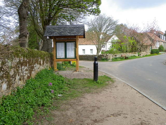
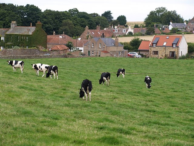
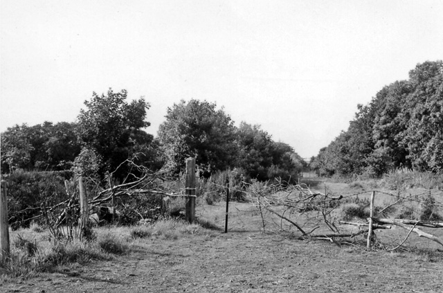
Boarhills Images

Images are sourced within 2km of 56.317772/-2.703706 or Grid Reference NO5614. Thanks to Geograph Open Source API. All images are credited.

Golfers on Kittocks Kittocks Course is one of the courses in St Andrews Bay golf complex associated with the Fairmont Hotel.
Golfers on Kittocks
Kittocks Course is one of the courses in St Andrews Bay golf complex associated with the Fairmont Hotel.
Holiday cottages Balmashie holiday cottages seen from Kittocks golf course at St Andrews Bay.
Holiday cottages
Balmashie holiday cottages seen from Kittocks golf course at St Andrews Bay.
Kittock's Den With the North Sea in the background.
Kittock's Den
With the North Sea in the background.
14th tee at Kittock's A foursome of golfers driving off the 14th tee on the Kittocks Course.
14th tee at Kittock's
A foursome of golfers driving off the 14th tee on the Kittocks Course.
Near Buddo Ness North Sea coastline, with Buddo Rock on the right.
Near Buddo Ness
North Sea coastline, with Buddo Rock on the right.
Coastal rocks Near Buddo Rock.
Coastal rocks
Near Buddo Rock.
Buddo Rock Seen from the top of former sea cliffs on the edge of Kittock's golf course.
Buddo Rock
Seen from the top of former sea cliffs on the edge of Kittock's golf course.
Boarhills and Dunino Parish Kirk The building, which stands on the site of an earlier kirk was built in 1826 and was designed by James Gillespie Graham and many of the additions are by P MacGregor Chalmers and were completed in 1928.

There is an Ordnance Survey bench mark on the south face of the building.
Boarhills and Dunino Parish Kirk
The building, which stands on the site of an earlier kirk was built in 1826 and was designed by James Gillespie Graham and many of the additions are by P MacGregor Chalmers and were completed in 1928. There is an Ordnance Survey bench mark on the south face of the building.
Bench Mark, Boarhills and Dunino Parish Kirk The Ordnance Survey bench mark is to be found on the south face of the building.  For a view of the kirk <a href="https://www.geograph.org.uk/photo/2755175">NO5613 : Boarhills and Dunino Parish Kirk</a> and for further information on the cut mark and others in the area <span class="nowrap"><a title="http://www.bench-marks.org.uk/bm38205" rel="nofollow ugc noopener" href="http://www.bench-marks.org.uk/bm38205">Link</a><img style="margin-left:2px;" alt="External link" title="External link - shift click to open in new window" src="https://s1.geograph.org.uk/img/external.png" width="10" height="10"/></span>
Bench Mark, Boarhills and Dunino Parish Kirk
The Ordnance Survey bench mark is to be found on the south face of the building. For a view of the kirk NO5613 : Boarhills and Dunino Parish Kirk and for further information on the cut mark and others in the area LinkExternal link
Tending the land, Boarhills The land is being made ready for this year's crop.  The picture is taken from the kirkyard of Boarhills and Dunino Parish Kirk.
Tending the land, Boarhills
The land is being made ready for this year's crop. The picture is taken from the kirkyard of Boarhills and Dunino Parish Kirk.
Junction, Kenlygreen Cottages The minor road joins A917.  There is an Ordnance Survey bench mark on the corner of the cottages.
Junction, Kenlygreen Cottages
The minor road joins A917. There is an Ordnance Survey bench mark on the corner of the cottages.
Bench Mark, Kenlygreen Cottages The Ordnance Survey bench mark is to be found on the south face of the building.  For a view of the building <a href="https://www.geograph.org.uk/photo/2756296">NO5613 : Junction, Kenlygreen Cottages</a> and for further information on the cut mark and others in the area <span class="nowrap"><a title="http://www.bench-marks.org.uk/bm40867" rel="nofollow ugc noopener" href="http://www.bench-marks.org.uk/bm40867">Link</a><img style="margin-left:2px;" alt="External link" title="External link - shift click to open in new window" src="https://s1.geograph.org.uk/img/external.png" width="10" height="10"/></span>
Bench Mark, Kenlygreen Cottages
The Ordnance Survey bench mark is to be found on the south face of the building. For a view of the building NO5613 : Junction, Kenlygreen Cottages and for further information on the cut mark and others in the area LinkExternal link
Village scene, Boarhills Boarhills is a small hamlet situated near the sea on the East Neuk.
Village scene, Boarhills
Boarhills is a small hamlet situated near the sea on the East Neuk.
Honesty, Boarhills Honesty is a plant best known for its seed cases rather than its flowers.
Honesty, Boarhills
Honesty is a plant best known for its seed cases rather than its flowers.
Greater Periwinkle, Boarhills (Vinca major)

The plant produces large violet-blue flowers from April to June and the plant roots easily from the tips of the stems.  In folklore it represents eternal life and fidelity like all deciduous plants and it was also valued as a protection against witches and magicians.
Greater Periwinkle, Boarhills
(Vinca major) The plant produces large violet-blue flowers from April to June and the plant roots easily from the tips of the stems. In folklore it represents eternal life and fidelity like all deciduous plants and it was also valued as a protection against witches and magicians.
Memorial seat, Boarhills The seat is dedicated to Marjorie Wilson (1920-2004).
Memorial seat, Boarhills
The seat is dedicated to Marjorie Wilson (1920-2004).
Track near Boarhills The tracks heads towards Burnside Farm.
Track near Boarhills
The tracks heads towards Burnside Farm.
Roller, Boarhills The Cambridge roller is at the edge of the field of cereal.
Roller, Boarhills
The Cambridge roller is at the edge of the field of cereal.
Show me another place!

Boarhills is located at Grid Ref: NO5614 (Lat: 56.317772, Lng: -2.703706)

Unitary Authority: Fife

Police Authority: Fife

What 3 Words

///reminds.advantage.exhaling. Near St Andrews, Fife

Nearby Locations

Boarhills

Related Wikis

Boarhills

Boarhills is a hamlet close to Kingsbarns in the East Neuk of Fife, Scotland. It is located off the A917 road, 4+1⁄2 miles (7 km) from St Andrews and 5...

Boarhills railway station

Boarhills railway station served the hamlet of Boarhills, Fife, Scotland from 1883 to 1930 on the Anstruther and St Andrews Railway. == History == The...

Fairmont St Andrews

The Fairmont St Andrews Bay is a 5-star resort hotel situated 2 miles (3.2 km) outside the town of St. Andrews in Fife, Scotland. The hotel is managed...

Scottish Championship (golf)

The Scottish Championship was a professional golf tournament that was held 15–18 October 2020 at Fairmont St Andrews, in Fife, Scotland. The principal...

Hero Open

The Hero Open was a professional golf tournament played on the European Tour. The event was created as part of the tour's overhaul in response to the COVID...

Kingsbarns railway station

Kingsbarns railway station served the village of Kingsbarns, Fife, Scotland from 1883 to 1930 on the Fife Coast Railway. == History == The station opened...

RNAS Dunino (HMS Jackdaw II)

Royal Naval Air Station Dunino or more simply RNAS Dunino (HMS Jackdaw II) is a former Fleet Air Arm base located 1.8 miles (2.9 km) west of Kingsbarns...

Kinkell, Fife

Kinkell was an estate to the east of St Andrews in Scotland. In the Middle Ages it was the site of a chapel, hospital, dovecote and a castle or manor house...

Nearby Amenities

Located within 500m of 56.317772,-2.703706
Boarhills
Is In: Fife, Scotland, UK
Name Sco: Byrehills
Place: hamlet
Wikidata: Q4931462
Wikipedia: en:Boarhills
Lat/Long: 56.3169026/-2.7040609
Post Box
Collection Times: Mo-Fr 16:15; Sa 09:00
Operator: Royal Mail
Post Box Type: wall
Ref: KY16 111
Royal Cypher: GR
Royal Cypher Wikidata: Q33102273
Lat/Long: 56.3162462/-2.705074
Board Type: notice
Check Date: 2022-09-21
Information: board
Tourism: information
Lat/Long: 56.316984/-2.7053113
Tourism: artwork
Lat/Long: 56.317103/-2.7051826
Boarhills Road End
Bus: yes
Operator: SIF
Public Transport: stop_position
Ref: 34342827
Lat/Long: 56.3141622/-2.7050127
Boarhills Road End
Bus: yes
Operator: SIF
Public Transport: stop_position
Ref: 34342826
Lat/Long: 56.314225/-2.7039957
Bus Stop
Naptan AtcoCode: 6500N0394
Naptan NaptanCode: 34342827
Public Transport: platform
Shelter: yes
Lat/Long: 56.3141369/-2.7049878
Bus Stop
Public Transport: platform
Lat/Long: 56.3142459/-2.7039528
Addr Housenumber: 3
Lat/Long: 56.3159677/-2.7037646
Addr Housenumber: 2
Lat/Long: 56.3159595/-2.7035822
Addr Housenumber: 1
Lat/Long: 56.3159655/-2.7033864
Addr Housenumber: 2
Lat/Long: 56.3159157/-2.7045035
Addr Housenumber: 1
Lat/Long: 56.3159789/-2.7046135
Addr Housenumber: 3
Lat/Long: 56.3166014/-2.7051955
Addr Housenumber: 2
Lat/Long: 56.3165233/-2.7052331
Addr Housenumber: 1
Lat/Long: 56.3164281/-2.7052747
Addr Housenumber: 4
Lat/Long: 56.3174055/-2.7040181
Addr Housenumber: 3
Lat/Long: 56.3173541/-2.7040972
Addr Housenumber: 2
Lat/Long: 56.3172723/-2.7042353
Addr Housenumber: 1
Lat/Long: 56.3172336/-2.7043198
Addr Housename: Craighartle Cottage
Lat/Long: 56.3183679/-2.7027588
Addr Housename: Seaview
Lat/Long: 56.3184921/-2.7032858
Addr Housenumber: 8
Addr Street: Old Edinburgh
Lat/Long: 56.3179261/-2.7037646
Addr Housenumber: 7
Addr Street: Old Edinburgh
Lat/Long: 56.3180726/-2.7038866
Addr Housenumber: 6
Addr Street: Old Edinburgh
Lat/Long: 56.3182422/-2.7036613
Addr Housenumber: 5
Addr Street: Old Edinburgh
Lat/Long: 56.3185241/-2.7038008
Addr Housenumber: 4
Addr Street: Old Edinburgh
Lat/Long: 56.3184475/-2.7041079
Addr Housenumber: 3
Addr Street: Old Edinburgh
Lat/Long: 56.3182013/-2.7042675
Addr Housenumber: 2
Addr Street: Old Edinburgh
Lat/Long: 56.3179923/-2.7044378
Addr Housenumber: 1
Addr Street: Old Edinburgh
Lat/Long: 56.3177825/-2.7041736
Addr Housenumber: 3
Lat/Long: 56.3187859/-2.7028151
Addr Housenumber: 2
Lat/Long: 56.3186572/-2.7028969
Addr Housenumber: 1
Lat/Long: 56.3185769/-2.7029425
Power: pole
Lat/Long: 56.3208739/-2.6992043
Material: wood
Power: pole
Lat/Long: 56.3204953/-2.7001133
Material: wood
Power: pole
Lat/Long: 56.3200956/-2.7010814
Material: wood
Power: pole
Lat/Long: 56.3196771/-2.7020031
Material: wood
Power: pole
Lat/Long: 56.3189784/-2.7021827
Material: wood
Power: pole
Lat/Long: 56.3183208/-2.7023687
Power: pole
Lat/Long: 56.3179574/-2.7024766
Power: pole
Lat/Long: 56.3175893/-2.7026414
Power: pole
Lat/Long: 56.317043/-2.7031297
Power: pole
Lat/Long: 56.3165658/-2.7035736
Power: pole
Lat/Long: 56.3160805/-2.7040175
The data included in this document is from www.openstreetmap.org. The data is made available under ODbL.

Have you been to Boarhills?

Leave your review of Boarhills below (or comments, questions and feedback).