Bloxwich

Settlement in Staffordshire

England

Bloxwich

Wyrley & Essington Canal towards Stubbs Bridge
Wyrley & Essington Canal towards Stubbs Bridge Credit: Ian S

Bloxwich is a small town located in the county of Staffordshire, England. Situated approximately 3 miles north of Walsall, it is part of the West Midlands conurbation.

Historically, Bloxwich was a mining and industrial town, known for its coal mines and ironworks. However, as the mining industry declined in the 20th century, the town transitioned into a more residential area. Today, it is predominantly a commuter town, with many residents traveling to nearby cities for work.

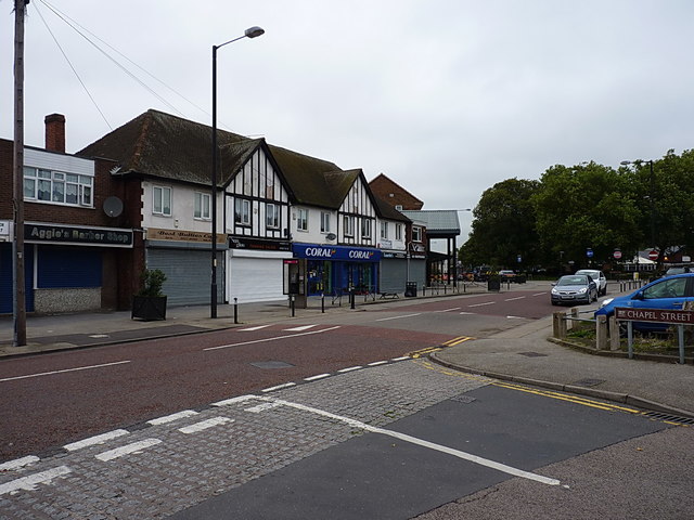
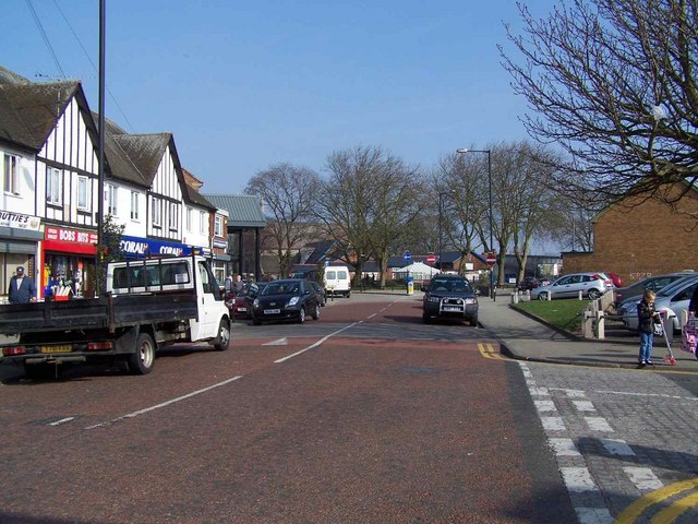
The town center of Bloxwich features a variety of shops, restaurants, and amenities, catering to the needs of its residents. The local market, held twice a week, is a popular attraction, offering a range of fresh produce, clothing, and household items. The town also has several parks and green spaces, providing opportunities for outdoor activities and recreation.

Education in Bloxwich is well-served, with a number of primary and secondary schools located in the area. There are also several healthcare facilities, including a local hospital and medical centers, ensuring residents have access to essential services.

Transportation is convenient in Bloxwich, with regular bus services connecting the town to neighboring areas. The M6 motorway is easily accessible, allowing for easy travel to other parts of the country.

Bloxwich is a close-knit community, with a strong sense of local pride. The town hosts various events and activities throughout the year, including festivals, fairs, and community gatherings, which contribute to its vibrant and friendly atmosphere.

In summary, Bloxwich is a residential town in Staffordshire, known for its history in mining and industry. With its convenient location, range of amenities, and strong community spirit, it offers a comfortable and pleasant living environment for its residents.

If you have any feedback on the listing, please let us know in the comments section below.
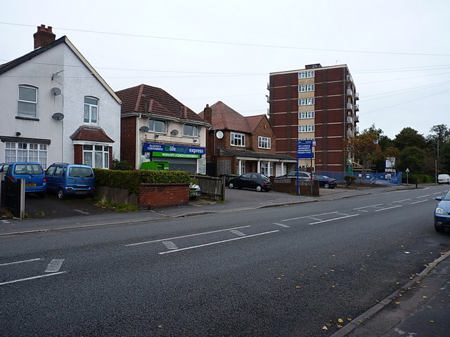
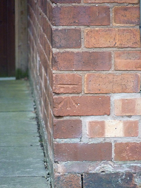
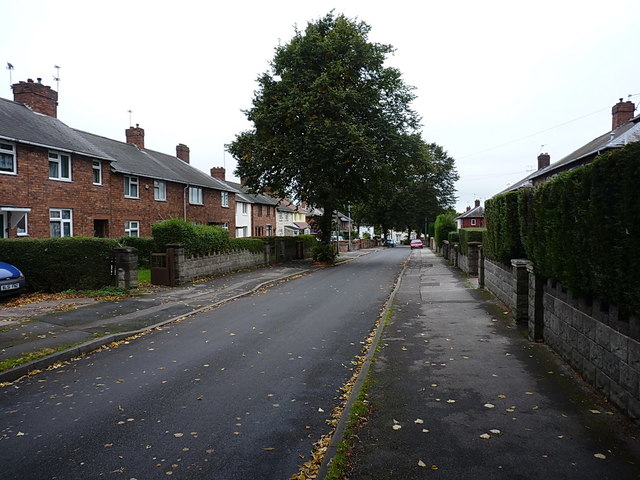
Bloxwich Images

Images are sourced within 2km of 52.617993/-2.002774 or Grid Reference SJ9902. Thanks to Geograph Open Source API. All images are credited.

Wyrley & Essington Canal towards Stubbs Bridge
Wyrley & Essington Canal at Stubbs Bridge
Hildicks Bridge, Wyrley & Essington Canal The canal passes under Goscote Lane as it winds through the Walsall suburbs.
Hildicks Bridge, Wyrley & Essington Canal
The canal passes under Goscote Lane as it winds through the Walsall suburbs.
Victoria Avenue, Blakenhall Heath Just north of Walsall, Blakenhall Heath is primarily given over to housing. Old maps prior to WW2 suggest that it was still very rural up until about the early 1930s, but building of the estates put an end to that between the wars. Many of the houses date from that period, although the ones on the right here are clearly more recent.
Victoria Avenue, Blakenhall Heath
Just north of Walsall, Blakenhall Heath is primarily given over to housing. Old maps prior to WW2 suggest that it was still very rural up until about the early 1930s, but building of the estates put an end to that between the wars. Many of the houses date from that period, although the ones on the right here are clearly more recent.
Shops, houses and flats on Field Road Described as Field Street on some of the older maps (1880s until 1938, at any rate) Field Road runs north-south through Blakenhall Heath, joining the High St B4210 to the A4142 Lichfield Road.
Shops, houses and flats on Field Road
Described as Field Street on some of the older maps (1880s until 1938, at any rate) Field Road runs north-south through Blakenhall Heath, joining the High St B4210 to the A4142 Lichfield Road.
OS benchmark - Blakenhall Heath, 214 Field Road An OS cutmark on the NW angle of 214 Field Road; originally levelled, probably in 1957, at 161.904m above Ordnance Datum Newlyn.
OS benchmark - Blakenhall Heath, 214 Field Road
An OS cutmark on the NW angle of 214 Field Road; originally levelled, probably in 1957, at 161.904m above Ordnance Datum Newlyn.
Penderel Street crosses Hamilton Street in Blakenhall Heath Part of the extensive inter-war housing developments north of Walsall.
Penderel Street crosses Hamilton Street in Blakenhall Heath
Part of the extensive inter-war housing developments north of Walsall.
Ash Street towards Ryle Street Interwar housing developments in Blakenhall Heath
Ash Street towards Ryle Street
Interwar housing developments in Blakenhall Heath
OS benchmark - Blakenhall Heath, 30 Ryle Street An OS cutmark on the front wall of 30 Ryle Street; originally levelled, probably in 1957, at 148.87m above Ordnance Datum Newlyn.
OS benchmark - Blakenhall Heath, 30 Ryle Street
An OS cutmark on the front wall of 30 Ryle Street; originally levelled, probably in 1957, at 148.87m above Ordnance Datum Newlyn.
OS benchmark - Blakenhall Heath, 136 Valley Road An OS cutmark on the north wall of 136 Valley Road; originally levelled, probably in 1957, at 114.411m above Ordnance Datum Newlyn.
OS benchmark - Blakenhall Heath, 136 Valley Road
An OS cutmark on the north wall of 136 Valley Road; originally levelled, probably in 1957, at 114.411m above Ordnance Datum Newlyn.
OS benchmark - Blakenhall Heath, 47 Green Rock Lane An OS cutmark on the NE wall of 47 Green Rock Lane; originally levelled, probably in 1957, at 150.023m above Ordnance Datum Newlyn.
OS benchmark - Blakenhall Heath, 47 Green Rock Lane
An OS cutmark on the NE wall of 47 Green Rock Lane; originally levelled, probably in 1957, at 150.023m above Ordnance Datum Newlyn.
The Green Rock Tavern, Blakenhall Heath Mapped in the 1920s as 'Rock House', this had become a public house by the late 1930s.
The Green Rock Tavern, Blakenhall Heath
Mapped in the 1920s as 'Rock House', this had become a public house by the late 1930s.
OS benchmark - Blakenhall Heath, 1 Green Rock Lane An OS cutmark on the side wall of 1 Green Rock Lane; originally levelled, probably in 1957, at 149.483m above Ordnance Datum Newlyn.
OS benchmark - Blakenhall Heath, 1 Green Rock Lane
An OS cutmark on the side wall of 1 Green Rock Lane; originally levelled, probably in 1957, at 149.483m above Ordnance Datum Newlyn.
Shops and businesses on Blakenall Lane A very similar view to the one in <a href="https://www.geograph.org.uk/photo/1213597">SK0001 : Blakenall Lane, Blakenall Heath</a>; it's a different time of year, and there are some slight changes to the businesses in the retail units over the last 6 or 7 years.
Shops and businesses on Blakenall Lane
A very similar view to the one in SK0001 : Blakenall Lane, Blakenall Heath; it's a different time of year, and there are some slight changes to the businesses in the retail units over the last 6 or 7 years.
Foster Street, Blakenall Heath A mixture of Victorian terracing and slightly more recent (inter- and post-war) housing development.
Foster Street, Blakenall Heath
A mixture of Victorian terracing and slightly more recent (inter- and post-war) housing development.
Hollemeadow Avenue, Blakenall Heath Closely-packed inter-war housing developments in Blakenall Heath
Hollemeadow Avenue, Blakenall Heath
Closely-packed inter-war housing developments in Blakenall Heath
Shops and stores, Hollemeadow Avenue
OS benchmark - Blakenall Heath, 15 Guild Avenue An OS cutmark located on the front wall of a house on Guild Avenue; originally levelled, probably in 1957, at 159.673m above Ordnance Datum Newlyn.
OS benchmark - Blakenall Heath, 15 Guild Avenue
An OS cutmark located on the front wall of a house on Guild Avenue; originally levelled, probably in 1957, at 159.673m above Ordnance Datum Newlyn.
Show me another place!

Bloxwich is located at Grid Ref: SJ9902 (Lat: 52.617993, Lng: -2.002774)

Unitary Authority: Walsall

Police Authority: West Midlands

What 3 Words

///smug.crowds.watch. Near Bloxwich, West Midlands

Nearby Locations

Bloxwich Sand Bank

Related Wikis

St Peter's Roman Catholic Church, Bloxwich

St Peter's Roman Catholic Church is a Roman Catholic church in the town of Bloxwich, West Midlands, England. It is an active catholic church in the centre...

Bloxwich

Bloxwich is a market town and civil parish in the Metropolitan Borough of Walsall, West Midlands, England. It is located between the towns of Walsall...

Bloxwich railway station

Bloxwich railway station serves Bloxwich, in the Metropolitan Borough of Walsall, West Midlands, England. The station, and all trains serving it, are...

Walsall Academy

Walsall Academy is a secondary school based in Bloxwich, Walsall, West Midlands, England. == School == It opened in January 2003 with 470 students on the...

Blakenall Heath

Blakenall Heath is a suburban village in the Metropolitan Borough of Walsall in the West Midlands County, England. It straddles the border of Walsall and...

Christ Church, Blakenall Heath

Christ Church is a grade-II listed church in the suburban village of Blakenall Heath, in the Metropolitan Borough of Walsall, in the county of the West...

Bloxwich Town F.C.

Bloxwich Town Football Club was a football club based in Bloxwich, West Midlands, England, based at The Red Lion Ground. == History == The original club...

Walsall North (UK Parliament constituency)

Walsall North is a constituency created in 1955 represented in the House of Commons of the UK Parliament since 2017 by Eddie Hughes, a member of the Conservative...

Nearby Amenities

Located within 500m of 52.617993,-2.002774
Traffic Signals
Source: bing
Lat/Long: 52.6207362/-2.0041864
Crossing
Crossing: traffic_signals
Crossing Island: no
Crossing Ref: pelican
Tactile Paving: yes
Lat/Long: 52.6176046/-2.0043232
Traffic Signals
Source: bing
Lat/Long: 52.620527/-2.0045186
Traffic Signals
Source: bing
Lat/Long: 52.6205983/-2.0038473
Entrance: main
Lat/Long: 52.6204648/-2.004448
Bus Stop
High St / Victoria Ave
NaPTANAreaCode: 43000621501
Asset Ref: 202367
Bus: yes
Local Ref: BA
Location: High Street;Bulls Head
Naptan AtcoCode: 43000621501
Naptan Bearing: S
Naptan BusStopType: MKD
Naptan CommonName: Bulls Head
Naptan Indicator: Stop BA
Naptan NaptanCode: nwmgwmjp
Naptan PlusbusZoneRef: BHAMNWS
Naptan Status: ACT
Naptan StopType: BCT
Naptan Street: HIGH ST
Naptan Towards: Blakenall Heath
Naptan Verified: no
Public Transport: platform
Route Ref: 23;25
Shelter: yes
Shelter Ref: 202367
Source: WMCA
Towards: Walsall
Lat/Long: 52.6181399/-2.0042302
Bus Stop
High St / Victoria Ave
NaPTANAreaCode: 43000621502
Bus: yes
Local Ref: BD
Location: High Street;Bulls Head
Naptan AtcoCode: 43000621502
Naptan Bearing: S
Naptan BusStopType: MKD
Naptan CommonName: Bulls Head
Naptan Indicator: Stop BD
Naptan NaptanCode: nwmtgjtd
Naptan PlusbusZoneRef: BHAMNWS
Naptan Status: ACT
Naptan StopType: BCT
Naptan Street: HIGH ST
Naptan Towards: Walsall
Naptan Verified: yes
Public Transport: platform
Route Ref: 1;2;2E;301;302;X51
Shelter: yes
Shelter Ref: 202354
Source: WMCA
Towards: Walsall
Lat/Long: 52.6178856/-2.0042259
Bus Stop
High St / Victoria Ave
NaPTANAreaCode: 43000621505
Asset Ref: 202322
Bench: yes
Bin: yes
Bus: yes
Lit: no
Local Ref: BP
Naptan AtcoCode: 43000621505
Naptan Bearing: N
Naptan BusStopType: MKD
Naptan CommonName: Bulls Head
Naptan Indicator: Stop BP
Naptan NaptanCode: nwmtgwpa
Naptan PlusbusZoneRef: BHAMNWS
Naptan Status: ACT
Naptan StopType: BCT
Naptan Street: HIGH ST
Naptan Towards: Lower Farm, Cannock
Naptan Verified: yes
Public Transport: platform
Route Ref: 1;2E;302;X51
Shelter: yes
Shelter Ref: 202322
Source: WMCA
Tactile Paving: no
Towards: Lower Farm;Cannock
Lat/Long: 52.6184245/-2.0043799
Field Rd / Harrison St
Naptan AtcoCode: 43000621801
Naptan Bearing: N
Naptan BusStopType: CUS
Naptan CommonName: Harrison St
Naptan Indicator: adj
Naptan NaptanCode: nwmtapdt
Naptan Status: ACT
Naptan StopType: BCT
Naptan Street: FIELD RD
Naptan Towards: Pelsall
Naptan Verified: no
Route Ref: 8A;23
Source: WMCA
Lat/Long: 52.6157236/-1.9982424
Field Rd / Harrison St
Naptan AtcoCode: 43000621802
Naptan Bearing: S
Naptan BusStopType: CUS
Naptan CommonName: Harrison St
Naptan Indicator: opp
Naptan NaptanCode: nwmtapdw
Naptan PlusbusZoneRef: BHAMNWS
Naptan Status: ACT
Naptan StopType: BCT
Naptan Street: FIELD RD
Naptan Towards: Bloxwich
Naptan Verified: no
Route Ref: 8A;23;29
Source: WMCA
Lat/Long: 52.6157146/-1.9980799
Bus Stop
Field Rd / Cemetery Main Gates
Bus: yes
Naptan AtcoCode: 43000621902
Naptan Bearing: S
Naptan BusStopType: MKD
Naptan CommonName: Cemetery Main Gates
Naptan Indicator: opp
Naptan NaptanCode: nwmtapgd
Naptan PlusbusZoneRef: BHAMNWS
Naptan Status: ACT
Naptan StopType: BCT
Naptan Street: FIELD RD
Naptan Towards: Bloxwich
Naptan Verified: no
Public Transport: platform
Route Ref: 8A;29
Source: WMCA
Lat/Long: 52.6192926/-1.995805
Bus Stop
High St / Bloxwich Hospital
NaPTANAreaCode: 43000622203
Bench: yes
Bin: no
Bus: yes
Lit: no
Local Ref: BG
Location: High Street;Bloxwich Hospital
Mapillary: 307909804243351
Naptan AtcoCode: 43000622203
Naptan Bearing: N
Naptan BusStopType: MKD
Naptan CommonName: Bloxwich Hospital
Naptan Indicator: Stop BG
Naptan Landmark: Asda
Naptan NaptanCode: nwmgwmpj
Naptan PlusbusZoneRef: BHAMNWS
Naptan Status: ACT
Naptan StopType: BCT
Naptan Street: HIGH ST
Naptan Towards: Mossley, Lower Farm
Naptan Verified: yes
Public Transport: platform
Route Ref: 1;2;2E;8A;23;25;29;301;302;X51
Shelter: yes
Shelter Ref: 202319
Source: WMCA
Survey Date: 2020-02-01
Tactile Paving: yes
Towards: Mossley;Lower Farm
Lat/Long: 52.6138843/-2.0041686
Bus Stop
High St / Bloxwich Hospital
NaPTANAreaCode: 43000622204
Bench: yes
Bin: no
Bus: yes
Lit: no
Local Ref: BF
Location: High Street;Bloxwich Hospital
Mapillary: 215269400153426
Naptan AtcoCode: 43000622204
Naptan Bearing: S
Naptan BusStopType: MKD
Naptan CommonName: Bloxwich Hospital
Naptan Indicator: Stop BF
Naptan Landmark: Asda
Naptan NaptanCode: nwmgwmpm
Naptan PlusbusZoneRef: BHAMNWS
Naptan Status: ACT
Naptan StopType: BCT
Naptan Street: HIGH ST
Naptan Towards: Walsall
Naptan Verified: yes
Public Transport: platform
Route Ref: 1;2;2E;8A;23;25;301;302
Shelter: yes
Shelter Ref: 202320
Source: WMCA
Survey Date: 2020-02-01
Tactile Paving: yes
Towards: Walsall
Lat/Long: 52.6140138/-2.0040228
Bus Stop
High St / Elmore Row
NaPTANAreaCode: 43000622301
Bench: yes
Bus: yes
Local Ref: BE
Location: High Street;Elmore Row
Naptan AtcoCode: 43000622301
Naptan Bearing: S
Naptan BusStopType: MKD
Naptan CommonName: High St
Naptan Indicator: Stop BE
Naptan Landmark: All Saints Church
Naptan NaptanCode: nwmgwmpt
Naptan PlusbusZoneRef: BHAMNWS
Naptan Status: ACT
Naptan StopType: BCT
Naptan Street: HIGH ST
Naptan Towards: Walsall
Naptan Verified: yes
Public Transport: platform
Route Ref: 1;2;2E;8A;23;25;301;302;X51
Shelter: yes
Shelter Ref: 202355
Source: WMCA
Tactile Paving: no
Towards: Walsall
Lat/Long: 52.6153603/-2.004307
Bus Stop
High St / Elmore Row
NaPTANAreaCode: 43000622302
Bus: yes
Local Ref: BH
Location: High Street;Elmore Row
Naptan AtcoCode: 43000622302
Naptan Bearing: N
Naptan BusStopType: MKD
Naptan CommonName: High St
Naptan Indicator: Stop BH
Naptan Landmark: All Saints Church
Naptan NaptanCode: nwmgwmpw
Naptan PlusbusZoneRef: BHAMNWS
Naptan Status: ACT
Naptan StopType: BCT
Naptan Street: HIGH ST
Naptan Towards: Mossley, Lower Farm
Naptan Verified: yes
Public Transport: platform
Route Ref: 1;2;2E;8A;23;25;29;301;302;X51
Shelter: yes
Shelter Ref: 202359
Source: WMCA
Towards: Mossley;Lower Farm
Lat/Long: 52.6163328/-2.0043959
Bus Stop
Park Rd / Drake Rd
NaPTANAreaCode: 43000622403
Bench: yes
Bus: yes
Lit: no
Local Ref: BB
Naptan AtcoCode: 43000622403
Naptan Bearing: NE
Naptan BusStopType: MKD
Naptan CommonName: Bloxwich Park
Naptan Indicator: Stop BB
Naptan NaptanCode: nwmdtgdp
Naptan PlusbusZoneRef: BHAMNWS
Naptan Status: ACT
Naptan StopType: BCT
Naptan Street: PARK RD
Naptan Towards: Pelsall, Brownhills
Naptan Verified: yes
Public Transport: platform
Route Ref: 8A;23;25;89
Shelter: yes
Shelter Ref: 202323
Source: WMCA
Tactile Paving: yes
Towards: Pelsall;Brownhills
Lat/Long: 52.6186566/-2.0038239
Bus Stop
Park Rd / Drake Rd
NaPTANAreaCode: 43000622404
Bench: yes
Bus: yes
Lit: no
Local Ref: BC
Naptan AtcoCode: 43000622404
Naptan Bearing: NE
Naptan BusStopType: MKD
Naptan CommonName: Bloxwich Park
Naptan Indicator: Stop BC
Naptan NaptanCode: nwmtgwpd
Naptan PlusbusZoneRef: BHAMNWS
Naptan Status: ACT
Naptan StopType: BCT
Naptan Street: PARK RD
Naptan Towards: Blakenall Heath
Naptan Verified: yes
Public Transport: platform
Route Ref: 19;29
Shelter: yes
Shelter Ref: 202324
Source: WMCA
Tactile Paving: yes
Towards: Blackenall
Lat/Long: 52.6188387/-2.0037745
Bus Stop
Park Rd / High St
Bench: no
Bin: no
Bus: yes
Local Ref: BR
Location: Park Road;High Street
Naptan AtcoCode: 43000622503
Naptan Bearing: SW
Naptan BusStopType: MKD
Naptan CommonName: High St
Naptan Indicator: before
Naptan NaptanCode: nwmgwmtd
Naptan PlusbusZoneRef: BHAMNWS
Naptan Status: ACT
Naptan StopType: BCT
Naptan Street: PARK RD
Naptan Towards: Walsall
Naptan Verified: yes
Public Transport: platform
Route Ref: 89;302
Shelter: no
Source: WMCA
Towards: Walsall
Lat/Long: 52.6200117/-2.0035468
Bus Stop
Wolverhampton Road / Sandbank
Asset Ref: 0622803
Bus: yes
Location: Wolverhampton Road;Sandbank
Naptan AtcoCode: 43000622803
Naptan Bearing: SE
Naptan BusStopType: MKD
Naptan CommonName: Sandbank
Naptan Indicator: opp
Naptan NaptanCode: nwmgwmtw
Naptan PlusbusZoneRef: BHAMNWS
Naptan Status: ACT
Naptan StopType: BCT
Naptan Street: WOLVERHAMPTON ROAD
Naptan Towards: Walsall
Naptan Verified: yes
Public Transport: platform
Route Ref: 2;89;301
Shelter: no
Source: WMCA
Towards: Walsall
Lat/Long: 52.6191086/-2.0067467
Bus Stop
Wolverhampton Road / Sandbank
Asset Ref: 0622804
Bus: yes
Location: Wolverhampton Road;Sandbank
Naptan AtcoCode: 43000622804
Naptan Bearing: NW
Naptan BusStopType: MKD
Naptan CommonName: Sandbank
Naptan Indicator: adj
Naptan NaptanCode: nwmtgwdt
Naptan PlusbusZoneRef: BHAMNWS
Naptan Status: ACT
Naptan StopType: BCT
Naptan Street: WOLVERHAMPTON ROAD
Naptan Towards: Mossley, New Invention
Naptan Verified: yes
Public Transport: platform
Route Ref: 2;16;70;89;301;326
Shelter: no
Source: WMCA
Towards: Mossley;New Invention
Lat/Long: 52.619198/-2.0071652
Bus Stop
BL
Asset Ref: 0622901
Bus: yes
Location: Croxdene Avenue;Elmore Green Road
Naptan AtcoCode: 43000622901
Naptan Bearing: SE
Naptan BusStopType: MKD
Naptan CommonName: Central Drive
Naptan Indicator: Stop BL
Naptan NaptanCode: nwmgwmwa
Naptan PlusbusZoneRef: BHAMNWS
Naptan Status: ACT
Naptan StopType: BCT
Naptan Street: CROXDENE AVE
Naptan Towards: Bloxwich
Naptan Verified: yes
Public Transport: platform
Route Ref: 326
Shelter: no
Source: WMCA
Towards: Bloxwich
Lat/Long: 52.6175155/-2.0100669
Bus Stop
Wolverhampton Rd / Samuel St
NaPTANAreaCode: 43000623701
Bus: yes
Local Ref: BJ
Location: Wolverhampton Road;High Street
Naptan AtcoCode: 43000623701
Naptan Bearing: NW
Naptan BusStopType: MKD
Naptan CommonName: High St
Naptan Indicator: Stop BJ
Naptan NaptanCode: nwmgwpat
Naptan PlusbusZoneRef: BHAMNWS
Naptan Status: ACT
Naptan StopType: BCT
Naptan Street: WOLVERHAMPTON ROAD
Naptan Verified: yes
Public Transport: platform
Route Ref: 16;319;326;347;351;370;560;568;570
Shelter: yes
Shelter Ref: 202362
Source: WMCA
Towards: New Invention
Lat/Long: 52.6182828/-2.0048884
Bus Stop
Wolverhampton Rd / Samuel St
NaPTANAreaCode: 43000623702
Bench: yes
Bin: no
Bus: yes
Local Ref: BK
Naptan AtcoCode: 43000623702
Naptan Bearing: NW
Naptan BusStopType: MKD
Naptan CommonName: High St
Naptan Indicator: Stop BK
Naptan NaptanCode: nwmtgwdw
Naptan PlusbusZoneRef: BHAMNWS
Naptan Status: ACT
Naptan StopType: BCT
Naptan Street: WOLVERHAMPTON ROAD
Naptan Towards: Mossley, New Invention
Naptan Verified: yes
Public Transport: platform
Route Ref: 2;16;70;89;301;326
Shelter: yes
Shelter Ref: 202321
Source: WMCA
Towards: Mossley
Lat/Long: 52.6184702/-2.0053779
Bus Stop
High St / Park Rd
Bench: no
Bin: no
Bus: yes
Naptan AtcoCode: 43000624801
Naptan Bearing: S
Naptan BusStopType: MKD
Naptan CommonName: Park Rd
Naptan Indicator: adj
Naptan NaptanCode: nwmgwpgm
Naptan PlusbusZoneRef: BHAMNWS
Naptan Status: ACT
Naptan StopType: BCT
Naptan Street: HIGH ST
Naptan Towards: Walsall
Naptan Verified: no
Public Transport: platform
Route Ref: 1;2E;16;X51
Shelter: no
Source: WMCA
Lat/Long: 52.6196252/-2.004136
Bus Stop
High St / Park Rd
Bench: no
Bin: no
Bus: yes
Naptan AtcoCode: 43000624802
Naptan Bearing: S
Naptan BusStopType: MKD
Naptan CommonName: Park Rd
Naptan Indicator: adj
Naptan NaptanCode: nwmtgwpg
Naptan PlusbusZoneRef: BHAMNWS
Naptan Status: ACT
Naptan StopType: BCT
Naptan Street: HIGH ST
Naptan Verified: no
Public Transport: platform
Route Ref: 19;70;326
Shelter: no
Source: WMCA
Lat/Long: 52.6199938/-2.0040917
Bus Stop
Field Rd / Hamilton House
Asset Ref: 0624902
Bus: yes
Location: Field Road;Hamilton House
Naptan AtcoCode: 43000624902
Naptan Bearing: S
Naptan BusStopType: MKD
Naptan CommonName: Hamilton House
Naptan Indicator: opp
Naptan NaptanCode: nwmtpmjm
Naptan PlusbusZoneRef: BHAMNWS
Naptan Status: ACT
Naptan StopType: BCT
Naptan Street: FIELD RD
Naptan Towards: Bloxwich
Naptan Verified: yes
Public Transport: platform
Route Ref: 8A;29
Shelter: no
Source: WMCA
Towards: Bloxwich
Lat/Long: 52.6174375/-1.9968459
Pub
The Turf Tavern
Addr City: Walsall
Addr Housenumber: 13
Addr Postcode: WS3 2EZ
Addr Street: Wolverhampton Road
Fhrs Id: 708780
Loc Name: Tinky's
Note: Approximate location
Real Ale: yes
Lat/Long: 52.6187799/-2.0062715
Mini Roundabout
Direction: clockwise
Lat/Long: 52.6173164/-2.0097521
Royal Exchange
Disused Amenity: pub
Source: GPS Survey
Wikidata: Q26343628
Lat/Long: 52.6213494/-2.0038776
Crossing
Button Operated: yes
Crossing: traffic_signals
Crossing Island: no
Crossing Ref: pelican
Tactile Paving: yes
Lat/Long: 52.6209642/-2.0027234
Bloxwich War Memorial
Historic: memorial
Memorial: war_memorial
Monument: memorial
Wikidata: Q104868712
Wikimedia Commons: Category:Bloxwich War Memorial
Lat/Long: 52.6146174/-2.0045834
Pub
Spring Cottage
Addr City: Walsall
Addr Housenumber: 60
Addr Postcode: WS3 2HW
Addr Street: Elmore Green Road
Fhrs Id: 743948
Source: GPS Survey
Lat/Long: 52.6172219/-2.0090619
Fast Food
Elmore Green Fish Bar
Lat/Long: 52.6180432/-2.0092541
Turning Circle
Lat/Long: 52.6155673/-2.0082021
Crossing
Crossing: traffic_signals
Crossing Ref: pelican
Lat/Long: 52.6163983/-2.0077729
NISA Local
Addr City: Walsall
Addr Postcode: WS3 2HS
Addr Street: Elmore Green Road
Disused Amenity: pub
Fhrs Id: 996471
Loc Name: Thatched House Tavern
Source: GPS Survey
Lat/Long: 52.6165982/-2.0077318
Post Box
Brand: Royal Mail
Brand Wikidata: Q638098
Check Date: 2022-03-22
Collection Times: Mo-Fr 09:00; Sa 07:00; Su off
Colour: red
Drive Through: no
Operator: Royal Mail
Operator Wikidata: Q638098
Post Box Apertures: 1
Post Box Design: type_b
Post Box Type: pillar
Ref: WS3 27
Royal Cypher: EIIR
Royal Cypher Wikidata: Q33102113
Lat/Long: 52.619016/-2.0085938
Telephone
Booth: KX300
Covered: booth
Source: GPS Survey
Lat/Long: 52.6196229/-2.0080302
Pub
The Spotted Cow
Addr City: Walsall
Addr Housenumber: 9
Addr Postcode: WS3 2EZ
Addr Street: Wolverhampton Road
Fhrs Id: 184547
Source: GPS Survey
Lat/Long: 52.6185727/-2.0057182
Telephone
Booth: KX100
Check Date: 2021-07-03
Covered: booth
Source: GPS Survey
Lat/Long: 52.6180153/-2.004175
Telephone
Booth: KX100
Check Date: 2021-07-03
Covered: booth
Source: GPS Survey
Lat/Long: 52.6180152/-2.004161
Barrier: bollard
Lat/Long: 52.6176947/-2.0062833
Social Club
Bloxwich Memorial Working Mens Club
Addr City: Walsall
Addr Housenumber: 5
Addr Postcode: WS3 3HP
Addr Street: Harrison Street
Fhrs Id: 480774
Source Addr: FHRS Open Data
Lat/Long: 52.6168598/-2.0035666
Pub
The Carousel
Source: GPS Survey
Lat/Long: 52.6180838/-2.0037438
Toilets
Source: GPS Survey
Lat/Long: 52.6186472/-1.9967418
Place Of Worship
Chapel Of Rest
Lat/Long: 52.6193041/-1.9972288
Church Hall
Parish of All Saints - Bloxwich. Church Hall
Lat/Long: 52.6157685/-2.0053356
Post Office
Bloxwich Post Office
Addr Country: GB
Addr Postcode: WS3 2JF
Brand: Post Office
Brand Wikidata: Q1783168
Contact Website: https://www.postoffice.co.uk/branch-finder/1902423/bloxwich
Ref Pol Id: 68936
Lat/Long: 52.6164768/-2.0052495
Post Box
Postal Code: WS3
Ref: WS3 91
Source: GPS Survey
Lat/Long: 52.6165309/-2.0052054
Recycling
Source: GPS Survey
Lat/Long: 52.614685/-2.003418
Telephone
Booth: KX100
Check Date: 2021-04-29
Covered: booth
Source: GPS Survey
Lat/Long: 52.6153238/-2.0044488
Bloxwich Hardware & DIY
Shop: doityourself
Source: GPS Survey
Lat/Long: 52.6159268/-2.0045393
Crossing
Crossing: traffic_signals
Crossing Island: no
Crossing Ref: pelican
Tactile Paving: yes
Lat/Long: 52.6161419/-2.004362
Post Box
Check Date: 2021-04-29
Collection Times: Mo-Fr 16:15, Sa 11:00
Postal Code: WS3
Ref: WS3 63
Royal Cypher: GR
Royal Cypher Wikidata: Q33102273
Source: GPS Survey
Lat/Long: 52.6155519/-2.004304
Atm
Lat/Long: 52.6138692/-2.0022133
Atm
Lat/Long: 52.6138042/-2.0022402
Atm
Lat/Long: 52.613755/-2.0022606
Pub
The Queens Head
Source: GPS Survey
Lat/Long: 52.6140665/-1.9997612
Bloxwich Excelsior Club
Club: yes
Lat/Long: 52.6171944/-2.0020066
Post Box
Check Date: 2021-04-29
Collection Times: Mo-Fr 09:00, Sa 07:00
Postal Code: WS3
Ref: WS3 42D
Royal Cypher: GR
Royal Cypher Wikidata: Q33102273
Source: GPS Survey
Lat/Long: 52.6146855/-1.9990359
Bloxwich
Is In County: West Midlands
Is In District: Walsall
Place: town
Source: OS_OpenData_StreetView
Wikidata: Q2571140
Wikipedia: en:Bloxwich
Lat/Long: 52.6161194/-2.0030496
Abbey Blinds
Addr City: Walsall
Addr Housenumber: 25 - 28
Addr Postcode: WS3 2HW
Addr Street: Elmore Green Road
Shop: furniture
Lat/Long: 52.6158241/-2.0073861
Lichfield Rd / St Peter'S Rc School
Naptan AtcoCode: 43000621002
Naptan Bearing: E
Naptan BusStopType: CUS
Naptan CommonName: St Peter's RC School
Naptan Indicator: opp
Naptan NaptanCode: nwmtjmad
Naptan Status: ACT
Naptan StopType: BCT
Naptan Street: LICHFIELD RD
Public Transport: platform
Route Ref: 89;302
Source: WMCA
Lat/Long: 52.6211675/-2.0024533
Lichfield Rd / St Peter'S Rc School
Naptan AtcoCode: 43000621001
Naptan Bearing: W
Naptan BusStopType: CUS
Naptan CommonName: St Peter's RC School
Naptan Indicator: adj
Naptan NaptanCode: nwmtjgwt
Naptan Status: ACT
Naptan StopType: BCT
Naptan Street: LICHFIELD RD
Naptan Towards: Bloxwich
Public Transport: platform
Route Ref: 19;89;302
Source: WMCA
Lat/Long: 52.6210506/-2.0024533
Bus Stop
Market Pl / Elmore Row
Bus: yes
Naptan AtcoCode: 43006229001
Naptan Bearing: N
Naptan BusStopType: MKD
Naptan CommonName: Elmore Row
Naptan NaptanCode: nwmwgtjg
Naptan Status: ACT
Naptan StopType: BCT
Naptan Street: MARKET PL
Public Transport: platform
Source: WMCA
Lat/Long: 52.6162679/-2.005082
Bus Stop
Field Rd / Hamilton House
Bus: yes
Naptan AtcoCode: 43000624901
Naptan Bearing: N
Naptan BusStopType: MKD
Naptan CommonName: Hamilton House
Naptan Indicator: adj
Naptan NaptanCode: nwmtpmjg
Naptan Status: ACT
Naptan StopType: BCT
Naptan Street: FIELD RD
Naptan Towards: Pelsall
Public Transport: platform
Route Ref: 8A
Source: WMCA
Lat/Long: 52.6177783/-1.9967813
Bus Stop
Victoria Ave / Penderel Street
Bench: no
Bus: yes
Naptan AtcoCode: 43000623902
Naptan Bearing: NW
Naptan BusStopType: MKD
Naptan CommonName: Penderel Street
Naptan Indicator: before
Naptan NaptanCode: nwmtapgt
Naptan Status: ACT
Naptan StopType: BCT
Naptan Street: VICTORIA AVE
Naptan Towards: Bloxwich
Public Transport: platform
Route Ref: 23
Shelter: no
Source: WMCA
Tactile Paving: no
Lat/Long: 52.6165916/-1.9966041
Bus Stop
Field Rd / Cemetery Main Gates
Bus: yes
Naptan AtcoCode: 43000621901
Naptan Bearing: N
Naptan BusStopType: MKD
Naptan CommonName: Cemetery Main Gates
Naptan Indicator: adj
Naptan NaptanCode: nwmtapga
Naptan Status: ACT
Naptan StopType: BCT
Naptan Street: FIELD RD
Naptan Towards: Pelsall
Public Transport: platform
Route Ref: 8A
Source: WMCA
Lat/Long: 52.6192975/-1.9959392
Corner Shop barbers
Shop: hairdresser
Lat/Long: 52.6182135/-2.0050165
Fast Food
Funky Grill
Addr City: Walsall
Addr Housenumber: 3
Addr Postcode: WS3 2EY
Addr Street: Wolverhampton Road
Fhrs Id: 1318139
Source Addr: FHRS Open Data
Lat/Long: 52.6181823/-2.0049115
Pound World Carpets
Shop: carpet
Lat/Long: 52.6181539/-2.0048251
White Move
Office: estate_agent
Lat/Long: 52.6181326/-2.004748
Fast Food
Pearl Fish Bar & Kebab House
Addr City: Walsall
Addr Housename: Queens Parade
Addr Housenumber: 8 The Parade
Addr Postcode: WS3 2EX
Addr Street: High Street
Addr Town: Bloxwich
Fhrs Id: 1414169
Source Addr: FHRS Open Data
Lat/Long: 52.6181085/-2.0046756
Goodchilds
Office: estate_agent
Lat/Long: 52.6180759/-2.0045986
Teddys
Beauty: nails
Shop: beauty
Lat/Long: 52.6180441/-2.0044964
Dhillon's Drink Stop
Addr City: Walsall
Addr Housenumber: 5
Addr Postcode: WS3 2EX
Addr Street: Queens Parade
Fhrs Id: 194166
Shop: alcohol
Lat/Long: 52.6180107/-2.0044702
Skitts
Office: estate_agent
Lat/Long: 52.6179653/-2.0044649
Petland
Shop: pet
Lat/Long: 52.6179194/-2.0044614
Work on the Horizon
Office: yes
Lat/Long: 52.6178753/-2.0044617
Shop: vacant
Lat/Long: 52.6177625/-2.0044505
Martin's
Brand: Martin's
Brand Wikidata: Q116779207
Brand Wikipedia: en:McColl's
Shop: newsagent
Lat/Long: 52.6176009/-2.0044528
Allmarks Bakery
Addr City: Walsall
Addr Housenumber: 179-181
Addr Postcode: WS3 3LH
Addr Street: High Street
Fhrs Id: 184807
Shop: bakery
Lat/Long: 52.6175272/-2.0044552
Playland
Shop: yes
Lat/Long: 52.6174974/-2.0044575
Alan Warwick Butchers
Addr City: Walsall
Addr Housenumber: 175
Addr Postcode: WS3 3LH
Addr Street: High Street
Fhrs Id: 184528
Shop: butcher
Lat/Long: 52.6174507/-2.0044598
A Ashton
Craft: key_cutter
Lat/Long: 52.6174166/-2.0044622
Pharmacy
Lloyds Pharmacy
Addr City: Walsall
Addr Housenumber: 169
Addr Postcode: WS3 3LH
Addr Street: High Street
Brand: Lloyds Pharmacy
Brand Wikidata: Q6662870
Brand Wikipedia: en:LloydsPharmacy
Fhrs Id: 708774
Healthcare: pharmacy
Lat/Long: 52.6173911/-2.0044622
Ladbrokes
Brand: Ladbrokes
Brand Wikidata: Q1799875
Brand Wikipedia: en:Ladbrokes Coral
Shop: bookmaker
Lat/Long: 52.6173344/-2.0044739
The Money Shop
Shop: pawnbroker
Lat/Long: 52.6172805/-2.0044902
Malcolm Frost
Addr City: Walsall
Addr Housenumber: 163
Addr Postcode: WS3 3LG
Addr Street: High Street
Fhrs Id: 418426
Shop: butcher
Lat/Long: 52.617143/-2.0045276
Wow That's Cheap
Addr Postcode: WS3 3LG
Fhrs Id: 1299815
Fixme Addr1: 161 High Street
Fixme Addr2: Bloxwich
Fixme Addr3: Walsall
Fixme Addr4: West Midlands
Shop: variety_store
Source Addr: FHRS Open Data
Lat/Long: 52.6171086/-2.0045276
TJ's
Shop: hairdresser
Lat/Long: 52.6170622/-2.0045299
Bloxwich Nail Bar
Beauty: nails
Shop: beauty
Lat/Long: 52.6170282/-2.0045299
Phone Shop
Shop: mobile_phone
Lat/Long: 52.6169763/-2.0045293
The Children's Society
Brand: The Children's Society
Brand Wikidata: Q7722484
Brand Wikipedia: en:The Children's Society
Shop: charity
Lat/Long: 52.6169277/-2.0045262
Savers
Addr City: Walsall
Addr Housenumber: 151
Addr Postcode: WS3 3LG
Addr Street: High Street
Brand: Savers
Brand Wikidata: Q7428189
Brand Wikipedia: en:Savers (UK retailer)
Fhrs Id: 639653
Official Name: Savers Health & Beauty
Shop: chemist
Lat/Long: 52.6168715/-2.0045231
William Hill
Brand: William Hill
Brand Wikidata: Q4053147
Brand Wikipedia: en:William Hill (bookmaker)
Shop: bookmaker
Lat/Long: 52.6168033/-2.00452
Pub
The Prince of Wales
Addr City: Walsall
Addr Housenumber: 145
Addr Postcode: WS3 3LE
Addr Street: High Street
Fhrs Id: 184529
Lat/Long: 52.6167369/-2.0045123
Fast Food
Greggs
Addr City: Walsall
Addr Housenumber: 143
Addr Postcode: WS3 3LG
Addr Street: High Street
Brand: Greggs
Brand Wikidata: Q3403981
Brand Wikipedia: en:Greggs
Contact Website: https://www.greggs.co.uk/shop-finder?shop-code=0482
Cuisine: sandwich;bakery
Fhrs Id: 184526
Takeaway: yes
Lat/Long: 52.6166751/-2.0045077
Cafe
Coffee 'n' Grill
Addr City: Walsall
Addr Housenumber: 4
Addr Postcode: WS3 2JH
Addr Street: Market Place
Fhrs Id: 194244
Lat/Long: 52.616663/-2.0048281
Oscars News
Addr City: Walsall
Addr Housenumber: 133
Addr Postcode: WS3 3LE
Addr Street: High Street
Fhrs Id: 510049
Shop: newsagent
Lat/Long: 52.6163674/-2.0045169
Specsavers
Brand: Specsavers
Brand Wikidata: Q2000610
Brand Wikipedia: en:Specsavers
Contact Website: https://www.specsavers.co.uk/stores/bloxwich
Shop: optician
Lat/Long: 52.616417/-2.0045216
Bright House
Shop: appliance
Lat/Long: 52.6165124/-2.0045262
Betfred
Brand: Betfred
Brand Wikidata: Q4897425
Brand Wikipedia: en:Betfred
Shop: bookmaker
Lat/Long: 52.6163234/-2.0045169
Bonnie Babies
Shop: gift
Lat/Long: 52.6159774/-2.0045308
Webbs
Office: estate_agent
Lat/Long: 52.6184715/-2.0036044
Fast Food
Spring Garden
Addr City: Walsall
Addr Housenumber: 74
Addr Postcode: WS3 3SW
Addr Street: Park Road
Cuisine: chinese
Fhrs Id: 1014518
Lat/Long: 52.6185295/-2.0036044
Adeles
Shop: hairdresser
Lat/Long: 52.6185888/-2.0036024
Eurofit
Shop: car_repair
Lat/Long: 52.6186776/-2.0034987
Simply The Best
Shop: gift
Lat/Long: 52.6180149/-2.003824
Posh Nails
Beauty: nails
Shop: beauty
Lat/Long: 52.6179396/-2.0039195
Parkside Carpets
Shop: carpet
Lat/Long: 52.6179048/-2.0039646
Net Curtains
Shop: variety_store
Lat/Long: 52.6178649/-2.004007
Cafe
Bloxwich Filling Station
Lat/Long: 52.6178368/-2.0040286
Broadway Domestic Appliances
Shop: appliance
Lat/Long: 52.6177321/-2.004101
Click Flooring
Shop: carpet
Lat/Long: 52.6176414/-2.0041565
Cafe
Little Desert Shop
Addr City: Walsall
Addr Housenumber: 242
Addr Postcode: WS3 3LQ
Addr Street: High Street
Fhrs Id: 977966
Lat/Long: 52.6174889/-2.0041626
Plimbley Travel
Addr City: Walsall
Addr Housenumber: 242
Addr Postcode: WS3 3LQ
Addr Street: High Street
Facebook: https://www.facebook.com/plimbleytravel/
Opening Hours: Mo-Fr 09:00-17:00
Phone: +44 1922 501338
Shop: travel_agency
Website: https://www.plimbleytravel.co.uk/
Lat/Long: 52.6173359/-2.004216
Robert Anthony
Shop: hairdresser
Lat/Long: 52.617352/-2.0041434
Co-operative Travel
Brand: Your Coop Travel
Brand Wikidata: Q7726526
Operator: Midcounties Co-operative
Operator Wikidata: Q6841138
Shop: travel_agency
Website: https://www.cooptravel.co.uk/contact/branches-experts/bloxwich/
Lat/Long: 52.6172983/-2.004223
W Marshall & Son
Shop: confectionery
Lat/Long: 52.6172403/-2.0042301
KB Opticians
Shop: optician
Lat/Long: 52.6172188/-2.0042337
St Giles
Shop: charity
Lat/Long: 52.6171232/-2.004239
Cash Converters
Brand: Cash Converters
Brand Wikidata: Q5048645
Brand Wikipedia: en:Cash Converters
Shop: pawnbroker
Website: https://www.cashconverters.co.uk/stores/bloxwich
Lat/Long: 52.6170158/-2.0042549
Restaurant
Delicious
Addr City: Walsall
Addr Housenumber: 222
Addr Postcode: WS3 3LQ
Addr Street: High Street
Cuisine: indian
Fhrs Id: 866272
Lat/Long: 52.6169738/-2.0042655
Beacon Centre for the Blind
Shop: charity
Lat/Long: 52.6169341/-2.0042708
Pharmacy
Rowlands Pharmacy
Addr City: Walsall
Addr Housenumber: 216
Addr Postcode: WS3 3LQ
Addr Street: High Street
Brand: Rowlands Pharmacy
Brand Wikidata: Q62663235
Fhrs Id: 708745
Healthcare: pharmacy
Source Addr: FHRS Open Data
Lat/Long: 52.6168535/-2.0042673
Acorns
Shop: charity
Lat/Long: 52.6166666/-2.0042744
Marrion & Co
Office: estate_agent
Lat/Long: 52.6166311/-2.0042779
Children And Baby Shop for Life
Shop: charity
Lat/Long: 52.6165871/-2.0042797
Andrews Jewellery
Shop: jewelry
Lat/Long: 52.6165452/-2.0042814
Cafe
Tea for Two
Lat/Long: 52.6163131/-2.0042531
Roxy's Pet Shop
Shop: pet
Lat/Long: 52.6162723/-2.0042514
Secure Direct
Office: insurance
Lat/Long: 52.6160499/-2.0042443
Boots Opticians
Brand: Boots Opticians
Brand Wikidata: Q4944037
Brand Wikipedia: en:Boots Opticians
Shop: optician
Short Name: Boots
Lat/Long: 52.6160004/-2.0042443
Drinks Oasis
Addr City: Walsall
Addr Housenumber: 196
Addr Postcode: WS3 3JT
Addr Street: High Street
Fhrs Id: 212807
Shop: alcohol
Lat/Long: 52.6159242/-2.0042337
KBM Framing Gallery
Shop: frame
Lat/Long: 52.6158704/-2.0042354
Fast Food
Chunky Grill
Addr City: Walsall
Addr Housenumber: 194
Addr Postcode: WS3 3LA
Addr Street: High Street
Fhrs Id: 1334889
Source Addr: FHRS Open Data
Lat/Long: 52.6158371/-2.0042354
Kissed By The Sun
Beauty: tanning
Shop: beauty
Lat/Long: 52.6157361/-2.0042319
Cafe
Scoff's
Addr Postcode: WS3 3LA
Fhrs Id: 194129
Lat/Long: 52.6157071/-2.0042319
Bloxwich Computer Centre
Shop: computer
Lat/Long: 52.615662/-2.0042319
Salon 69
Shop: hairdresser
Lat/Long: 52.6156233/-2.0042337
Jeneve
Clothes: bridal
Shop: clothes
Lat/Long: 52.6155631/-2.0042319
Fast Food
Slices Pizza
Addr Postcode: WS3 3LA
Cuisine: pizza
Fhrs Id: 184228
Lat/Long: 52.6155309/-2.0042319
Open Door Lettings
Office: estate_agent
Lat/Long: 52.6154879/-2.0042319
Customer Party Banners
Shop: gift
Lat/Long: 52.6154503/-2.0042319
Cafe
Bloxwich Cafe
Addr Postcode: WS3 3LA
Fhrs Id: 183525
Lat/Long: 52.6154084/-2.0042301
Veterinary
Melbourne Veterinary Center
Lat/Long: 52.6153644/-2.0042319
Fast Food
Subway
Addr Postcode: WS3 3HE
Brand: Subway
Brand Wikidata: Q244457
Brand Wikipedia: en:Subway (restaurant)
Contact Website: https://restaurants.subway.com/united-kingdom/en/walsall/1-church-street-bloxwich
Cuisine: sandwich
Fhrs Id: 910310
Takeaway: yes
Lat/Long: 52.6153268/-2.0042266
Dentist
Bloxwich Dental Centre
Healthcare: dentist
Lat/Long: 52.6151946/-2.0042053
Saigon Nails
Beauty: nails
Shop: beauty
Lat/Long: 52.6150893/-2.0042195
Hearts & Flowers
Shop: florist
Lat/Long: 52.6150313/-2.0042266
British Stores
Shop: e-cigarette
Lat/Long: 52.6149582/-2.0042354
Restaurant
Rose of Bengal
Cuisine: indian
Lat/Long: 52.6148927/-2.004239
Pub
The Bloxwich Showman
Addr Postcode: WS3 3JT
Brand: Wetherspoon
Brand Wikidata: Q6109362
Brand Wikipedia: en:Wetherspoons
Fhrs Id: 740473
Source Addr: FHRS Open Data
Website: https://www.jdwetherspoon.com/pubs/all-pubs/england/west-midlands/the-bloxwich-showman-bloxwich
Wheelchair: limited
Lat/Long: 52.6147885/-2.0042425
The Co-operative Funeralcare
Brand: The Co-operative Funeralcare
Brand Wikidata: Q7726521
Brand Wikipedia: en:Co-op Funeralcare
Operator: Central England Co-operative
Operator Wikidata: Q16986583
Shop: funeral_directors
Website: https://stores.centralengland.coop/walsall/154a-high-street
Lat/Long: 52.6145843/-2.0042354
Bodyworks
Shop: tattoo
Lat/Long: 52.6144866/-2.004239
Addr City: Walsall
Addr Housenumber: 2
Addr Postcode: WS3 2JH
Addr Street: Market Place
Disused Shop: variety_store
Old Name: Wilko
Lat/Long: 52.6165629/-2.0056862
Iceland
Addr City: Walsall
Addr Housenumber: 3
Addr Postcode: WS3 2JH
Addr Street: Market Place
Brand: Iceland
Brand Wikidata: Q721810
Brand Wikipedia: en:Iceland (supermarket)
Contact Website: https://www.iceland.co.uk/store-finder/store?StoreID=1350&StoreName=BLOXWICH
Fhrs Id: 589640
Shop: frozen_food
Lat/Long: 52.6167599/-2.0056996
Fast Food
Windsor Fish Bar
Addr City: Walsall
Addr Housenumber: 71
Addr Postcode: WS3 3SW
Addr Street: Park Road
Cuisine: fish_and_chips
Fhrs Id: 201656
Lat/Long: 52.6186311/-2.0035989
Bicycle Parking
Access: yes
Bicycle Parking: stands
Capacity: 3
Covered: no
Fee: no
Lat/Long: 52.6160454/-2.0056857
Bicycle Parking
Access: yes
Bicycle Parking: stands
Capacity: 3
Covered: no
Fee: no
Lat/Long: 52.6165086/-2.0050919
Bicycle Parking
Access: yes
Bicycle Parking: stands
Capacity: 3
Covered: no
Fee: no
Lat/Long: 52.6172565/-2.0051672
Defibrillator
Defibrillator Location: On external wall to the right of the door.
Emergency: defibrillator
Emergency Phone: 999
Survey Date: 2020-10-05
Lat/Long: 52.6163874/-2.004211
Post Box
Post Box Type: pillar
Royal Cypher: EIIR
Royal Cypher Wikidata: Q33102113
Lat/Long: 52.6140056/-2.0021404
Entrance: main
Lat/Long: 52.6139962/-2.0021607
Noexit: yes
Lat/Long: 52.6154569/-1.9999927
Noexit: yes
Lat/Long: 52.615525/-2.0002098
Noexit: yes
Lat/Long: 52.6155394/-1.9985939
Noexit: yes
Lat/Long: 52.6155928/-1.9988066
Noexit: yes
Lat/Long: 52.6156487/-1.9990196
Noexit: yes
Lat/Long: 52.6157059/-1.9992533
Old Hall Snooker Club
Leisure: sports_centre
Sport: snooker
Lat/Long: 52.6157747/-2.0001876
Regency Design Centre
Craft: plasterer
Lat/Long: 52.6152364/-1.9987218
Preson
Shop: beauty
Lat/Long: 52.6151968/-1.9987482
Deivine & Co
Office: accountant
Lat/Long: 52.6151572/-1.9987746
Sudz
Shop: laundry
Lat/Long: 52.6151175/-1.9988009
Gentelman's Hairdresser
Shop: hairdresser
Lat/Long: 52.6150779/-1.9988273
We Buy Properties
Office: estate_agent
Lat/Long: 52.6150383/-1.9988537
Field Road News & Wine
Addr City: Walsall
Addr Housenumber: 39
Addr Postcode: WS3 3JD
Addr Street: Field Road
Fhrs Id: 930324
Shop: newsagent
Lat/Long: 52.6149987/-1.9988801
Traffic Signals
Source: bing
Lat/Long: 52.6203677/-2.0041828
Traffic Signals
Source: bing
Lat/Long: 52.6144645/-2.0046361
Traffic Signals
Source: bing
Lat/Long: 52.6146282/-2.0043665
Traffic Signals
Source: bing
Lat/Long: 52.6142805/-2.0043598
Pharmacy
Addr City: Walsall
Addr Postcode: WS3 3JR
Addr Street: Woodall Street
Brand: Asda
Brand Wikidata: Q297410
Contact Phone: +44 1922 498010
Contact Website: https://storelocator.asda.com/west-midlands/walsall/woodhall-street/pharmacy
Fixme: Location not accurate
Healthcare: pharmacy
Opening Hours: Mo 08:00-23:00; Tu-Fr 07:00-23:00; Sa 07:00-22:00; Su 10:00-16:00
Lat/Long: 52.6136087/-2.0014992
Bench
Lat/Long: 52.6151805/-2.0044339
The data included in this document is from www.openstreetmap.org. The data is made available under ODbL.

Have you been to Bloxwich?

Leave your review of Bloxwich below (or comments, questions and feedback).