Kyme, South

Settlement in Lincolnshire North Kesteven

England

Kyme, South

Works in the Woods This concrete track leads to what appears to be a sewerage works in a small wood.
Works in the Woods Credit: Michael Patterson

Kyme, South, Lincolnshire is a small village located in the South Kesteven district of Lincolnshire, England. Situated about 18 miles east of the city of Lincoln, Kyme is nestled in a rural area with picturesque countryside surroundings.

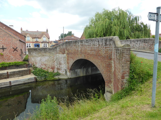
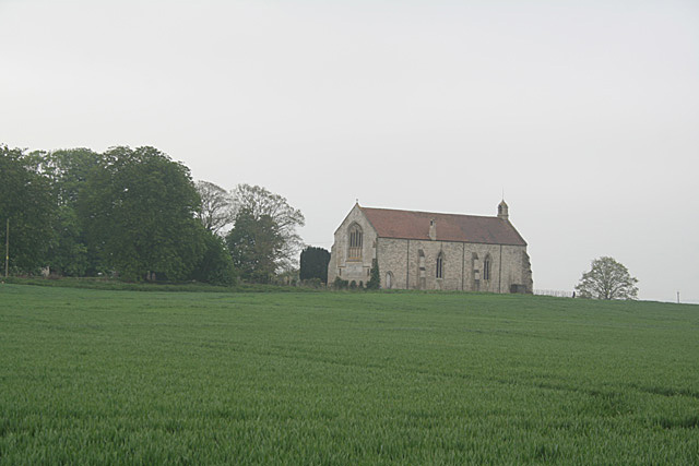
The village is known for its rich history, dating back to the Roman times. It was once an important settlement and a significant market town. Today, remnants of its past can still be seen, with historical buildings and structures scattered throughout. The Grade I listed St. Mary's Church, a stunning example of medieval architecture, stands proudly in the heart of the village.

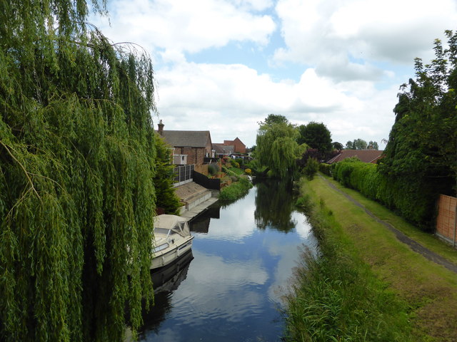
Kyme offers a tranquil and idyllic setting, with its charming cottages, lush green fields, and meandering waterways. The River Slea flows through the village, providing a serene spot for fishing and leisurely walks along its banks.

While small in size, Kyme offers amenities to its residents and visitors. The village boasts a community hall, a local pub, and a village green where events and gatherings take place throughout the year. It also benefits from its close proximity to nearby towns and cities, providing access to a wider range of services and facilities.

For those seeking outdoor activities, Kyme is surrounded by beautiful countryside, offering opportunities for hiking, cycling, and exploring nature. The village is also conveniently located near the historic market town of Sleaford, where additional amenities, shops, and leisure facilities can be found.

Overall, Kyme, South, Lincolnshire is a charming and historic village, offering a peaceful and scenic retreat for residents and visitors alike.

If you have any feedback on the listing, please let us know in the comments section below.
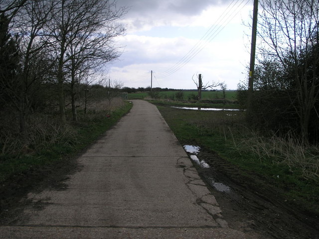
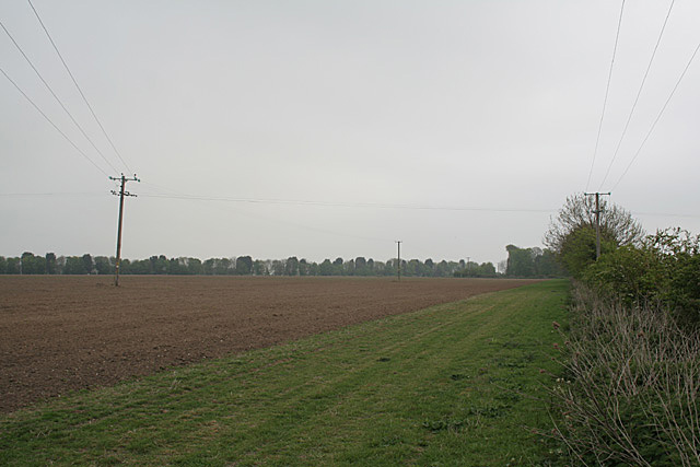
Kyme, South Images

Images are sourced within 2km of 53.030393/-0.252005 or Grid Reference TF1749. Thanks to Geograph Open Source API. All images are credited.

Works in the Woods This concrete track leads to what appears to be a sewerage works in a small wood.
Works in the Woods
This concrete track leads to what appears to be a sewerage works in a small wood.
South Kyme Golf Club
Lagoons, South Kyme When I took this picture, I was puzzled to know what the reason for these lagoons was. Another member has now provided the following helpful information:
The lagoons were constructed following the extraction of clay to reline the Kyme Eau. They were intended as a habitat creation measure (i.e. not fishing) and they are attracting plenty of wildlife. The adjacent farm has been converted from arable to poultry (free-range egg production), hence all the tree planting to provide shelter.
Lagoons, South Kyme
When I took this picture, I was puzzled to know what the reason for these lagoons was. Another member has now provided the following helpful information: The lagoons were constructed following the extraction of clay to reline the Kyme Eau. They were intended as a habitat creation measure (i.e. not fishing) and they are attracting plenty of wildlife. The adjacent farm has been converted from arable to poultry (free-range egg production), hence all the tree planting to provide shelter.
Kyme Eau The French name has persisted. It is an extension to the River Slea and was formerly navigable between the river Witham and Sleaford.
Kyme Eau
The French name has persisted. It is an extension to the River Slea and was formerly navigable between the river Witham and Sleaford.
Farmland near South Kyme
Farm track to a wood off Clay Bank, south of South Kyme
The Kyme Eau beside the B1935 Little west of Bottom Bridge on the High Street, South Kyme.
The Kyme Eau beside the B1935
Little west of Bottom Bridge on the High Street, South Kyme.
Redesigned entrance to Sycamore House, South Kyme
Clay Bank, B1395, South Kyme Fen
Entrance to Pattingden House, South Kyme Fen
The Hume Recently refurbished pub in South Kyme
The Hume
Recently refurbished pub in South Kyme
Inside the pub Interior of <a href="https://www.geograph.org.uk/photo/6200196">TF1749 : The Hume</a>, the domain of Vijay & Maeve Shukla the proprietors
Inside the pub
Interior of TF1749 : The Hume, the domain of Vijay & Maeve Shukla the proprietors
Datestone Datestone on the right-hand gable of <a href="https://www.geograph.org.uk/photo/6200196">TF1749 : The Hume</a>
it reads "E.R.C.C. 1890"
Datestone
Datestone on the right-hand gable of TF1749 : The Hume it reads "E.R.C.C. 1890"
Bridge over the navigation Bridge over the Slea Navigation at South Kyme
Bridge over the navigation
Bridge over the Slea Navigation at South Kyme
The Slea Navigation The view toward Sleaford from <a href="https://www.geograph.org.uk/photo/6201893">TF1749 : Bridge over the navigation</a>
The Slea Navigation
The view toward Sleaford from TF1749 : Bridge over the navigation
The Slea Navigation Looking toward Chapel Hill and the Witham from <a href="https://www.geograph.org.uk/photo/6201893">TF1749 : Bridge over the navigation</a>.
The Slea Navigation
Looking toward Chapel Hill and the Witham from TF1749 : Bridge over the navigation.
Large Lorry Without any livery it is impossible to attribute a name to this R440 Scania.
Large Lorry
Without any livery it is impossible to attribute a name to this R440 Scania.
Air Gauge under the bridge Canal bridge in South Kyme.  The Air Gauge under bridges is as much a limitation on boat size as the width of locks.
Air Gauge under the bridge
Canal bridge in South Kyme. The Air Gauge under bridges is as much a limitation on boat size as the width of locks.
Show me another place!

Kyme, South is located at Grid Ref: TF1749 (Lat: 53.030393, Lng: -0.252005)

Division: Parts of Kesteven

Administrative County: Lincolnshire

District: North Kesteven

Police Authority: Lincolnshire

What 3 Words

///defend.covers.developed. Near Billinghay, Lincolnshire

Related Wikis

South Kyme

South Kyme is a small village and civil parish in the North Kesteven district of Lincolnshire, England. The population of the civil parish at the 2011...

Kyme Priory

Kyme Priory was a priory in South Kyme, Lincolnshire, England. What remains of the buildings are now part of Saint Mary and All Saints Church. The Augustinian...

Car Dyke

The Car Dyke was, and to a large extent still is, a long ditch which runs along the western edge of the Fens in eastern England for a distance of over...

North Kyme

North Kyme is a village and civil parish in the North Kesteven district of Lincolnshire, England. The civil parish had a population of 431 at the 2011...

Nearby Amenities

Located within 500m of 53.030393,-0.252005
South Kyme
Is In: Lincolnshire, England, UK
Place: village
Source: NPE
Lat/Long: 53.0315636/-0.2513272
Bus Stop
Hume Arms PH
Naptan AtcoCode: 270002700089
Naptan Bearing: SW
Naptan CommonName: Hume Arms PH
Naptan Indicator: SW - bound
Naptan Landmark: Hume Arms PH
Naptan NaptanCode: linjtamw
Naptan Street: High Street
Naptan Verified: no
Source: naptan_import
Lat/Long: 53.0309451/-0.2528824
Bus Stop
South Parade
Naptan AtcoCode: 2700LSKF5386
Naptan Bearing: SW
Naptan CommonName: South Parade
Naptan Landmark: South Parade
Naptan NaptanCode: lindtjpm
Naptan Street: Low Road
Naptan Verified: no
Source: naptan_import
Lat/Long: 53.0312255/-0.2481137
Bus Stop
Hume Arms PH
Naptan AtcoCode: 2700LSKH5606
Naptan Bearing: NE
Naptan CommonName: Hume Arms PH
Naptan Indicator: NE - bound
Naptan Landmark: Hume Arms PH
Naptan NaptanCode: lindwatj
Naptan Street: High Street
Naptan Verified: no
Source: naptan_import
Lat/Long: 53.031036/-0.2529533
Pub
The Hume
Lat/Long: 53.031234/-0.2527012
Note: Name?
Place: farm
Source: Bing
Lat/Long: 53.0329398/-0.2484011
Parking
Lat/Long: 53.0322661/-0.2575345
Addr Housenumber: 14
Lat/Long: 53.0303125/-0.2477414
The data included in this document is from www.openstreetmap.org. The data is made available under ODbL.

Have you been to Kyme, South?

Leave your review of Kyme, South below (or comments, questions and feedback).