Hykeham, South

Settlement in Lincolnshire North Kesteven

England

Hykeham, South

Blackmoor Road near Aubourn Heading west towards Aubourn.
Blackmoor Road near Aubourn Credit: Stephen Richards

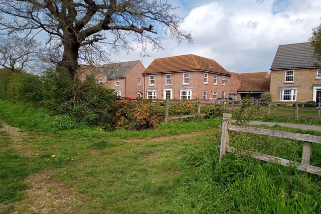
Hykeham, South is a village located in the county of Lincolnshire, in the east of England. Situated on the outskirts of the city of Lincoln, Hykeham, South is part of the North Kesteven district. It is a relatively small village with a population of approximately 3,000 people.

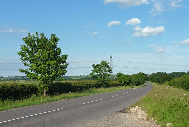
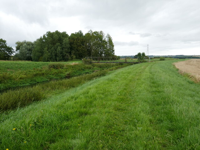
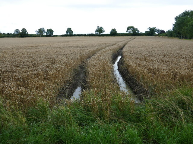
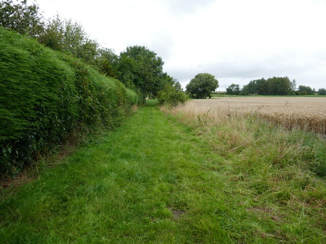
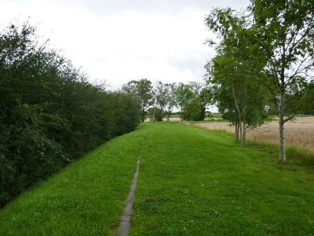
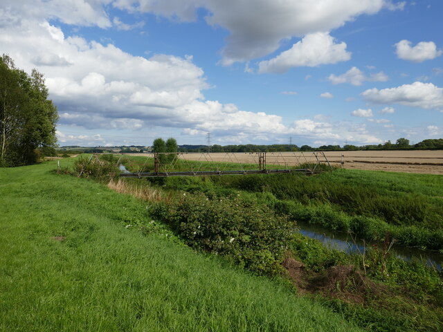
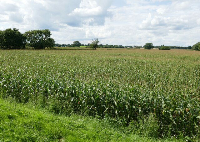
The village is known for its picturesque countryside, with rolling hills and scenic landscapes. It offers a peaceful and idyllic setting, making it a desirable place to live for those seeking a quiet rural lifestyle. The village is surrounded by farmland, and agriculture plays a significant role in the local economy.

Hykeham, South is well-connected to the nearby city of Lincoln, which is just a short drive away. The city offers a wide range of amenities and services, including shopping centers, restaurants, and cultural attractions. Additionally, the village has its own amenities, such as local shops, pubs, and a primary school, providing convenience for its residents.

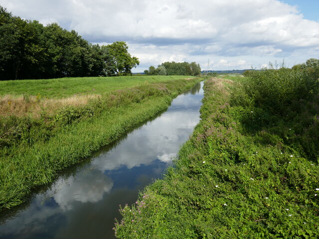
The village also benefits from its proximity to natural attractions, such as Whisby Nature Park and Hartsholme Country Park. These green spaces offer opportunities for outdoor activities, including walking, cycling, and birdwatching.

Overall, Hykeham, South offers a harmonious blend of rural living and access to urban amenities. With its beautiful surroundings and close proximity to Lincoln, it is a charming village that appeals to those looking for a tranquil lifestyle while still having easy access to city conveniences.

If you have any feedback on the listing, please let us know in the comments section below.

Hykeham, South Images

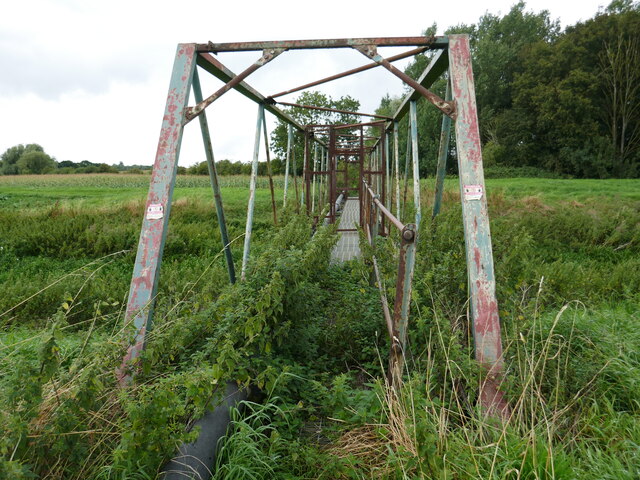
Images are sourced within 2km of 53.17002/-0.600868 or Grid Reference SK9364. Thanks to Geograph Open Source API. All images are credited.

Blackmoor Road near Aubourn Heading west towards Aubourn.
Blackmoor Road near Aubourn
Heading west towards Aubourn.
Footpath near Caspian Court, North Hykeham Two public footpaths link over a small catchwater drain looking northwestwards towards Caspian Court, a road which lies on the southern edge of one of North Hykeham's more affluent housing estates.

This photograph was taken on a warm and still Saturday morning in late April.  Apart from the odd dog walker both paths were completely deserted, with many of the residents instead taking to the open green spaces on the estate. Left undisturbed, the twittering birds and buzzing insects easily drowned out the distant hum of traffic from Mill Lane to the southeast.

The unpaved route on the left continues for some 200 metres before terminating at a gated field. The paved path (right) stretches for more than a kilometre and provides a direct pedestrian link from Mill Lane to Newark Road, approximately 900 metres to the northwest.
Footpath near Caspian Court, North Hykeham
Two public footpaths link over a small catchwater drain looking northwestwards towards Caspian Court, a road which lies on the southern edge of one of North Hykeham's more affluent housing estates. This photograph was taken on a warm and still Saturday morning in late April. Apart from the odd dog walker both paths were completely deserted, with many of the residents instead taking to the open green spaces on the estate. Left undisturbed, the twittering birds and buzzing insects easily drowned out the distant hum of traffic from Mill Lane to the southeast. The unpaved route on the left continues for some 200 metres before terminating at a gated field. The paved path (right) stretches for more than a kilometre and provides a direct pedestrian link from Mill Lane to Newark Road, approximately 900 metres to the northwest.
Footpath towards new houses, North Hykeham A public footpath cuts through the site of a housing estate under construction, looking northeastwards towards the East Village estate on Cleveland Avenue, the latest addition to North Hykeham's ever-expanding southern suburbs.

This photograph was taken on a warm morning in late May. There is perhaps nothing more geographically representative of this corner of North Hykeham than fields being consumed by new housing estates, and beyond the metal fencing on both sides of the path sits the next lot of land primed to meet the insatiable demand for housing nationwide.

This being the first day of a Bank Holiday weekend the site was deserted of workers, and with many of the new 'luxury houses' in frame still vacant the estate was eerily quiet for such a pleasant Saturday morning. There was once a distant eastwards view across the River Witham towards the village of Waddington from this path, but this is now partially obscured by the fencing.
Footpath towards new houses, North Hykeham
A public footpath cuts through the site of a housing estate under construction, looking northeastwards towards the East Village estate on Cleveland Avenue, the latest addition to North Hykeham's ever-expanding southern suburbs. This photograph was taken on a warm morning in late May. There is perhaps nothing more geographically representative of this corner of North Hykeham than fields being consumed by new housing estates, and beyond the metal fencing on both sides of the path sits the next lot of land primed to meet the insatiable demand for housing nationwide. This being the first day of a Bank Holiday weekend the site was deserted of workers, and with many of the new 'luxury houses' in frame still vacant the estate was eerily quiet for such a pleasant Saturday morning. There was once a distant eastwards view across the River Witham towards the village of Waddington from this path, but this is now partially obscured by the fencing.
Unsafe bridge Not for pedestrian use. A sign says there is an alternative route but gives no indication where it is.
Unsafe bridge
Not for pedestrian use. A sign says there is an alternative route but gives no indication where it is.
Bridleway alongside the River Witham The bridge over the river is closed. A sign gives notice of an alternative route but there is no indication where it goes.
Bridleway alongside the River Witham
The bridge over the river is closed. A sign gives notice of an alternative route but there is no indication where it goes.
Sodden field After a very wet July, August is not proving any drier. Harvest conditions are very poor.
Sodden field
After a very wet July, August is not proving any drier. Harvest conditions are very poor.
Bridleway at Aubourn In theory the bridleway goes to South Hykeham but as the bridge over the River Witham is closed (and has been for many years) it does not even reach the woodland seen on the right.
Bridleway at Aubourn
In theory the bridleway goes to South Hykeham but as the bridge over the River Witham is closed (and has been for many years) it does not even reach the woodland seen on the right.
Bridge over the River Witham The bridge has been deemed unsuitable for use by pedestrians for many years though it appears to carry a sewage pipe.
Bridge over the River Witham
The bridge has been deemed unsuitable for use by pedestrians for many years though it appears to carry a sewage pipe.
Field of maize near Aubourn
The River Witham near Aubourn Hall Looking downstream.
The River Witham near Aubourn Hall
Looking downstream.
St Peter's  church, Aubourn The chancel of the medieval church with a nineteenth century tower <span class="nowrap"><a title="https://historicengland.org.uk/listing/the-list/list-entry/1360541?section=official-list-entry" rel="nofollow ugc noopener" href="https://historicengland.org.uk/listing/the-list/list-entry/1360541?section=official-list-entry">Link</a><img style="margin-left:2px;" alt="External link" title="External link - shift click to open in new window" src="https://s1.geograph.org.uk/img/external.png" width="10" height="10"/></span>
St Peter's church, Aubourn
The chancel of the medieval church with a nineteenth century tower LinkExternal link
St Peter's church, Aubourn The chancel of the medieval church <span class="nowrap"><a title="https://historicengland.org.uk/listing/the-list/list-entry/1360541?section=official-list-entry" rel="nofollow ugc noopener" href="https://historicengland.org.uk/listing/the-list/list-entry/1360541?section=official-list-entry">Link</a><img style="margin-left:2px;" alt="External link" title="External link - shift click to open in new window" src="https://s1.geograph.org.uk/img/external.png" width="10" height="10"/></span>
St Peter's church, Aubourn
The chancel of the medieval church LinkExternal link
Footpath to South Hykeham Looking towards the bridge over the River Witham.
Footpath to South Hykeham
Looking towards the bridge over the River Witham.
Bridge over the River Witham On a footpath from Aubourn to South Hykeham.
Bridge over the River Witham
On a footpath from Aubourn to South Hykeham.
The River Witham near Aubourn Hall Looking upstream.
The River Witham near Aubourn Hall
Looking upstream.
Alongside the River Witham near Aubourn
Bridge over the River Witham Unsafe for pedestrian use.
Bridge over the River Witham
Unsafe for pedestrian use.
Show me another place!

Hykeham, South is located at Grid Ref: SK9364 (Lat: 53.17002, Lng: -0.600868)

Division: Parts of Kesteven

Administrative County: Lincolnshire

District: North Kesteven

Police Authority: Lincolnshire

What 3 Words

///speeded.maternal.bandwagon. Near Waddington, Lincolnshire

Related Wikis

South Hykeham

South Hykeham is a village and civil parish in the North Kesteven district of Lincolnshire, England. The population of the civil parish at the 2011 census...

Aubourn Haddington and South Hykeham

Aubourn Haddington and South Hykeham was a former civil parish in the North Kesteven district of Lincolnshire, England. According to the 2001 census it...

North Hykeham Priory

North Hykeham Priory was a priory in Lincolnshire, England. This priory is only mentioned in the Patent Roll of Edward IV, 1462, when it was granted to...

North Hykeham

North Hykeham is a town and civil parish in the North Kesteven district, in the county of Lincolnshire, England. It forms part of the Lincoln Urban Area...

Nearby Amenities

Located within 500m of 53.17002,-0.600868
South Hykeham
Is In: Lincolnshire, England, UK
Place: hamlet
Source: Bing
Lat/Long: 53.1696615/-0.5985305
Bus Stop
Beck Lane
Naptan AtcoCode: 2700LSHC1500
Naptan Bearing: E
Naptan CommonName: Beck Lane
Naptan Indicator: adj
Naptan Landmark: Beck Lane
Naptan NaptanCode: linajwtw
Naptan Street: Long Lane
Naptan Verified: no
Source: naptan_import
Lat/Long: 53.1701625/-0.6014694
Bus Stop
Beck Lane
Naptan AtcoCode: 2700LSHC2054
Naptan Bearing: W
Naptan CommonName: Beck Lane
Naptan Indicator: opp
Naptan Landmark: Beck Lane
Naptan NaptanCode: linapdjp
Naptan Street: Long Lane
Naptan Verified: no
Source: naptan_import
Lat/Long: 53.1700827/-0.6015618
Hall Farm
Place: farm
Source: Bing
Lat/Long: 53.168273/-0.5984679
Manor House Farm
Place: farm
Source: Bing
Lat/Long: 53.1692982/-0.5964847
Power: pole
Lat/Long: 53.1694486/-0.6081721
Power: pole
Lat/Long: 53.1720356/-0.6058574
Power: pole
Lat/Long: 53.1710372/-0.6067693
Power: pole
Lat/Long: 53.1702477/-0.6074613
South Hykeham
Aeroway: aerodrome
Note: a bit borderline between "airstrip" (for lack of facilities) and "airfield" (for having more than one runway)
Lat/Long: 53.1722935/-0.6040967
The data included in this document is from www.openstreetmap.org. The data is made available under ODbL.

Have you been to Hykeham, South?

Leave your review of Hykeham, South below (or comments, questions and feedback).