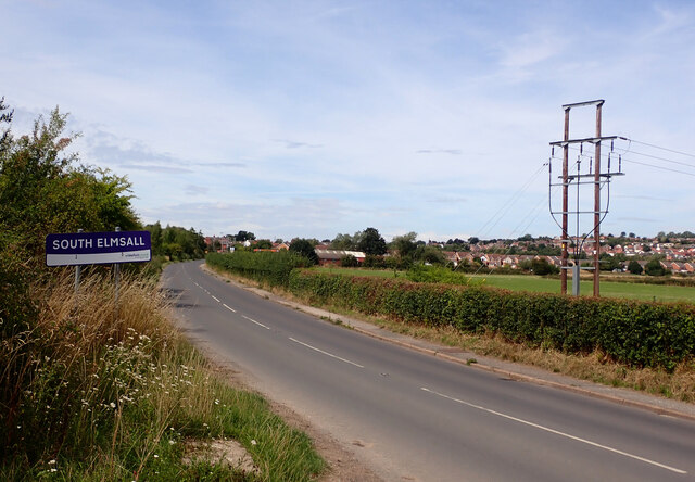
South Elmsall

Settlement in Yorkshire

England

South Elmsall

Chapel of rest in the cemetery at Moorthorpe
Chapel of rest in the cemetery at Moorthorpe Credit: Neil Theasby

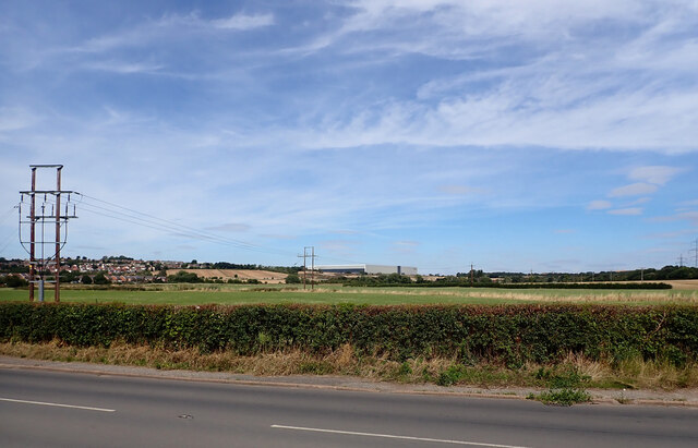
South Elmsall is a small town located in the metropolitan borough of Wakefield, in the county of Yorkshire, England. With a population of around 6,000 residents, South Elmsall is a close-knit community with a strong sense of local pride.

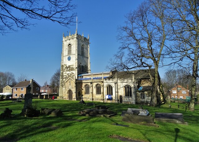
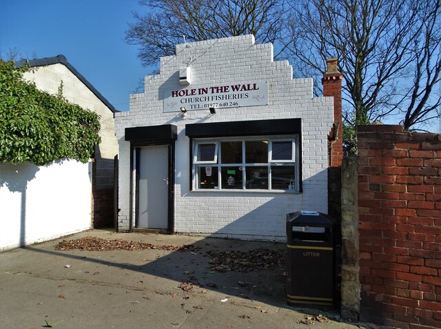
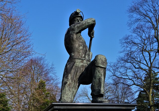
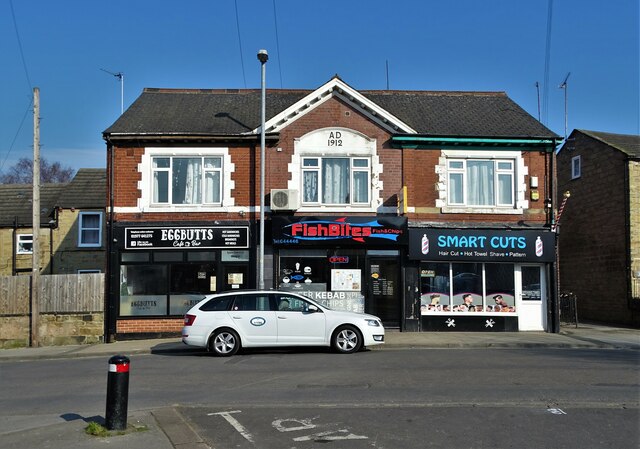
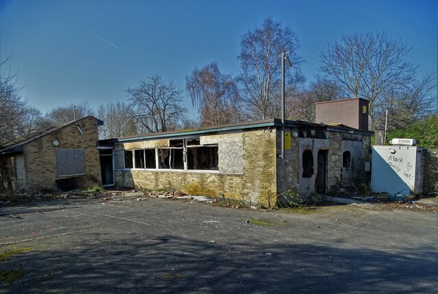
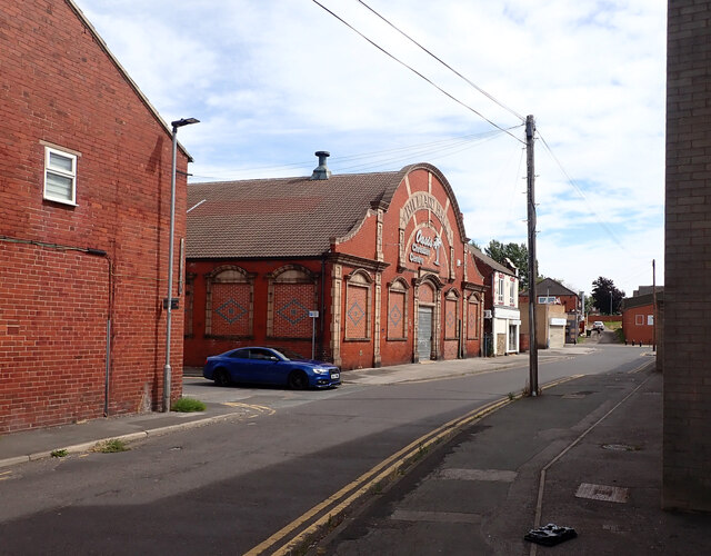
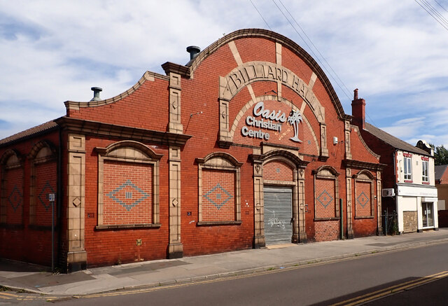
The town is known for its mining history, with the South Elmsall colliery once being a major employer in the area. Today, the town has a mix of residential areas, shops, and amenities, including a market square and a variety of independent businesses.

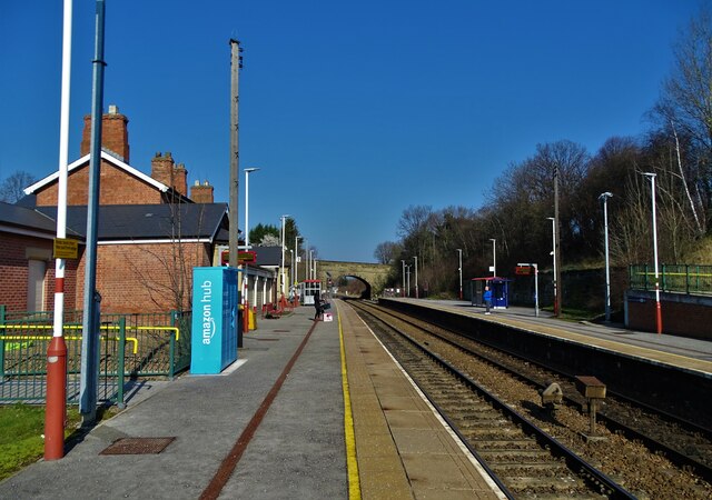
South Elmsall is well-connected, with a train station providing easy access to nearby cities such as Leeds and Wakefield. The town is also situated close to major motorways, making it a convenient location for commuters.

In terms of education, South Elmsall has several primary schools and a secondary school, providing local children with access to quality education.

Overall, South Elmsall is a charming town with a rich history and a strong sense of community spirit. Its convenient location and range of amenities make it a popular choice for both residents and visitors alike.

If you have any feedback on the listing, please let us know in the comments section below.

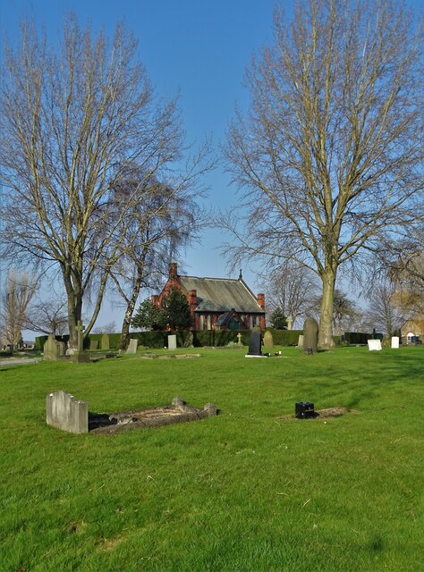
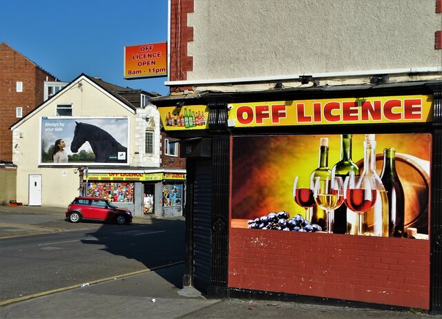
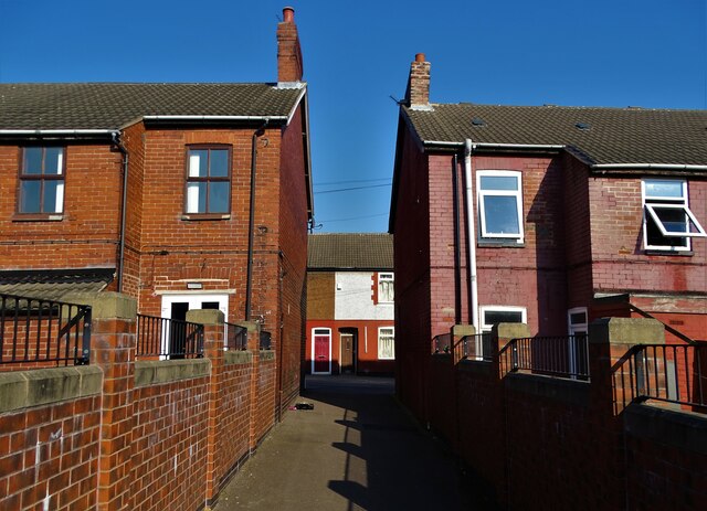
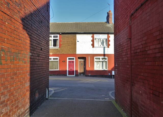
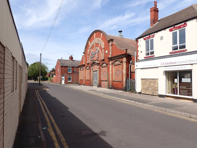
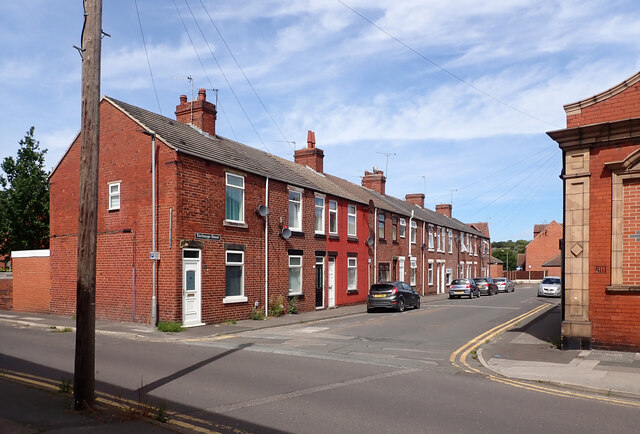
South Elmsall Images

Images are sourced within 2km of 53.594431/-1.288296 or Grid Reference SE4711. Thanks to Geograph Open Source API. All images are credited.

Chapel of rest in the cemetery at Moorthorpe
Two off licences on Barnsley Road, Moorthorpe
Burton Street, Moorthorpe
All Saints Church, South Kirkby According to the West Yorkshire Archeological Society, although appearing externally to be all one date, the different parts of the stone building date to different eras. Some parts probably date back to the eleventh century (or even earlier), while others e.g. the West Tower, were constructed in the major remodelling work that took place around 1470.
All Saints Church, South Kirkby
According to the West Yorkshire Archeological Society, although appearing externally to be all one date, the different parts of the stone building date to different eras. Some parts probably date back to the eleventh century (or even earlier), while others e.g. the West Tower, were constructed in the major remodelling work that took place around 1470.
Fish and chip shop on Northfield Lane, South Kirkby
Statue of a coal miner in South Kirkby Created by a relatively famous local sculptor called Graham Ibberson and unveiled in 2005 to commemorate the local men who lost their lives for coal. In a hundred years at least 250 died at South Kirkby, Frickley and South Elmsall Collieries - also includes Riddings Drift Mines.
Statue of a coal miner in South Kirkby
Created by a relatively famous local sculptor called Graham Ibberson and unveiled in 2005 to commemorate the local men who lost their lives for coal. In a hundred years at least 250 died at South Kirkby, Frickley and South Elmsall Collieries - also includes Riddings Drift Mines.
In the grounds of South Kirkby Town Hall The carving of an owl and butterflies - using the trunk of a dying tree - was completed very recently judging by the sawdust and wood chippings that surround it.
In the grounds of South Kirkby Town Hall
The carving of an owl and butterflies - using the trunk of a dying tree - was completed very recently judging by the sawdust and wood chippings that surround it.
Businesses on Carr Lane, South Kirkby
Former site of South Kirkby CMHT centre CMHT stands for Community Mental Health Team - a service that still operate in towns and cities around the country under the aegis of The National Health Service. Back in 2011 this centre was still up and running but now it is sadly derelict and an ongoing target for vandals. Perhaps services in the Barnsley area have been "rationalised" to save money.
Former site of South Kirkby CMHT centre
CMHT stands for Community Mental Health Team - a service that still operate in towns and cities around the country under the aegis of The National Health Service. Back in 2011 this centre was still up and running but now it is sadly derelict and an ongoing target for vandals. Perhaps services in the Barnsley area have been "rationalised" to save money.
Moorthorpe Railway Station
Exchange Street, South Elmsall The large building is a former billiard hall now used as a church.
Exchange Street, South Elmsall
The large building is a former billiard hall now used as a church.
Exchange Street, South Elmsall The large building is a former billiard hall now used as a church.
Exchange Street, South Elmsall
The large building is a former billiard hall now used as a church.
Exchange Street, South Elmsall
Former billiard hall now used as a church, Exchange Street, South Elmsall
Doncaster boundary on Elmsall Lane (B6422), Doncaster
South Elmsall boundary, Doncaster Road (B6422), South Elmsall
A view from Doncaster Road (B6422) near Frickley Country Park car park, South Elmsall
Show me another place!

South Elmsall is located at Grid Ref: SE4711 (Lat: 53.594431, Lng: -1.288296)

Division: West Riding

Unitary Authority: Wakefield

Police Authority: West Yorkshire

What 3 Words

///conspire.moderated.channel. Near South Elmsall, West Yorkshire

Related Wikis

South Elmsall railway station

South Elmsall railway station serves the town of South Elmsall in West Yorkshire, England. It lies on the Wakefield Line operated by Northern 8+3⁄4 miles...

Minsthorpe Community College

Minsthorpe Community College is a coeducational secondary school with academy status in South Elmsall, West Yorkshire, England. It is specifically for...

Frickley Colliery

Frickley & South Elmsall Colliery was opened by the Carlton Main Colliery Company Ltd in 1903 in South Elmsall, in Yorkshire, England. == Frickley... ==

South Elmsall

South Elmsall ( EM-səl) is a town and civil parish in the City of Wakefield in West Yorkshire, England. South Elmsall lies to the east of Hemsworth. The...

Nearby Amenities

Located within 500m of 53.594431,-1.288296
South Elmsall
Naptan AtcoCode: 9100SELMSAL
Network: National Rail
Network Website: https://www.nationalrail.co.uk/stations/ses/
Network Wikidata: Q26334
Operator: Northern Rail
Operator Website: https://www.northernrailway.co.uk/stations/south-elmsall
Operator Wikidata: Q85789775
Public Transport: station
Railway: station
Ref Crs: SES
Source: NPE
Wikidata: Q2431458
Wikipedia: en:South Elmsall railway station
Lat/Long: 53.5948464/-1.2853506
Bus Stop
Westfield Lane Carlton Road
Local Ref: 45017029
Naptan AtcoCode: 450017029
Naptan Bearing: SW
Naptan CommonName: Westfield Lane Carlton Road
Naptan Crossing: Carlton Road
Naptan Indicator: Stop 45017029
Naptan Landmark: School
Naptan PlusbusZoneRef: LEEDS
Naptan ShortCommonName: Carlton Road
Naptan Street: Westfield Lane
Naptan Verified: no
Source: naptan_import
Lat/Long: 53.5925411/-1.2919063
Bus Stop
Carlton Road Carlton Gardens
Local Ref: 45017043
Naptan AtcoCode: 450017043
Naptan Bearing: NW
Naptan CommonName: Carlton Road Carlton Gardens
Naptan Crossing: CARLTON GARDENS
Naptan Indicator: Stop 45017043
Naptan Notes: Enddated 28/10/2005Stop REINSTATED 19/06/2008
Naptan ShortCommonName: Carlton Road
Naptan Street: CARLTON ROAD
Naptan Verified: no
Source: naptan_import
Lat/Long: 53.5938862/-1.292881
Bus Stop
Carlton Street
Local Ref: 45017044
Naptan AtcoCode: 450017044
Naptan Bearing: SE
Naptan CommonName: Carlton Street
Naptan Crossing: CARLTON GARDENS
Naptan Indicator: Stop 45017044
Naptan Notes: Enddated 28/10/2005Stop REINSTATED 19/06/2008
Naptan ShortCommonName: Carlton Street
Naptan Street: Carlton Road
Naptan Verified: no
Source: naptan_import
Lat/Long: 53.5942115/-1.2931778
Bus Stop
Barnsley Road Witmore Street
Local Ref: 45017045
Naptan AtcoCode: 450017045
Naptan Bearing: E
Naptan CommonName: Barnsley Road Witmore Street
Naptan Crossing: Witmore Street
Naptan Indicator: Stop 45017045
Naptan PlusbusZoneRef: LEEDS
Naptan ShortCommonName: Witmore Street
Naptan Street: Barnsley Road
Naptan Verified: no
Source: naptan_import
Lat/Long: 53.5949651/-1.2898864
Bus Stop
Barnsley Road Carlton Road
Local Ref: 45017052
Naptan AtcoCode: 450017052
Naptan Bearing: NE
Naptan CommonName: Barnsley Road Carlton Road
Naptan Crossing: Carlton Road
Naptan Indicator: Stop 45017052
Naptan PlusbusZoneRef: LEEDS
Naptan ShortCommonName: Carlton Road
Naptan Street: Barnsley Road
Naptan Verified: no
Source: naptan_import
Lat/Long: 53.5948755/-1.2929703
Bus Stop
Barnsley Road Carlton Road
Local Ref: 45017053
Naptan AtcoCode: 450017053
Naptan Bearing: W
Naptan CommonName: Barnsley Road Carlton Road
Naptan Crossing: Carlton Road
Naptan Indicator: Stop 45017053
Naptan Landmark: Fire Station
Naptan PlusbusZoneRef: LEEDS
Naptan ShortCommonName: Carlton Road
Naptan Street: Barnsley Road
Naptan Verified: no
Source: naptan_import
Lat/Long: 53.5944152/-1.2941867
Bus Stop
High Street Ash Grove
Local Ref: 45016482
Naptan AtcoCode: 450016482
Naptan Bearing: NE
Naptan CommonName: High Street Ash Grove
Naptan Crossing: Ash Grove
Naptan Indicator: Stop 45016482
Naptan PlusbusZoneRef: LEEDS
Naptan ShortCommonName: Ash Grove
Naptan Street: High Street
Naptan Verified: no
Source: naptan_import
Lat/Long: 53.5965547/-1.2836192
Bus Stop
Ash Grove Manor Farm Estate
Local Ref: 45016483
Naptan AtcoCode: 450016483
Naptan Bearing: NW
Naptan CommonName: Ash Grove Manor Farm Estate
Naptan Crossing: Manor Farm Estate
Naptan Indicator: Stop 45016483
Naptan PlusbusZoneRef: LEEDS
Naptan ShortCommonName: Manor Farm Estate
Naptan Street: Ash Grove
Naptan Verified: no
Source: naptan_import
Lat/Long: 53.5969578/-1.2848968
Bus Stop
Ash Grove Manor Farm Estate
Local Ref: 45016484
Naptan AtcoCode: 450016484
Naptan Bearing: SE
Naptan CommonName: Ash Grove Manor Farm Estate
Naptan Crossing: Manor Farm Estate
Naptan Indicator: Stop 45016484
Naptan PlusbusZoneRef: LEEDS
Naptan ShortCommonName: Manor Farm Estate
Naptan Street: Ash Grove
Naptan Verified: no
Source: naptan_import
Lat/Long: 53.5970472/-1.2848197
Stand 1 South Elmsall Bus Station
Local Ref: 45024071
Naptan AtcoCode: 450024071
Naptan Bearing: SE
Naptan CommonName: Stand 1 South Elmsall Bus Station
Naptan Crossing: Kenyon Street
Naptan Indicator: Stop 45024071
Naptan Landmark: South Elmsall Bus Station
Naptan PlusbusZoneRef: LEEDS
Naptan ShortCommonName: S Elmsall BS 1
Naptan Street: South Elmsall Bus Station - Barnsley Road
Naptan Verified: no
Source: naptan_import
Was Highway: bus_stop
Lat/Long: 53.5938026/-1.2867872
Bus Stop
Stand C South Elmsall Bus Station
Bus: yes
Departures Board: realtime
Local Ref: 45024072
Naptan AtcoCode: 450024072
Naptan Bearing: SE
Naptan CommonName: Stand 2 South Elmsall Bus Station
Naptan Crossing: Kenyon Street
Naptan Indicator: Stop 45024072
Naptan Landmark: South Elmsall Bus Station
Naptan PlusbusZoneRef: LEEDS
Naptan ShortCommonName: S Elmsall BS 2
Naptan Street: South Elmsall Bus Station - Barnsley Road
Naptan Verified: no
Operator: Metro
Public Transport: platform
Shelter: yes
Source: naptan_import
Lat/Long: 53.593933/-1.2867055
Bus Stop
Stand B South Elmsall Bus Station
Bus: yes
Local Ref: 45024073
Naptan AtcoCode: 450024073
Naptan Bearing: NW
Naptan CommonName: Stand 3 South Elmsall Bus Station
Naptan Crossing: Kenyon Street
Naptan Indicator: Stop 45024073
Naptan Landmark: South Elmsall Bus Station
Naptan PlusbusZoneRef: LEEDS
Naptan ShortCommonName: S Elmsall BS 3
Naptan Street: South Elmsall Bus Station - Barnsley Road
Naptan Verified: no
Public Transport: platform
Source: naptan_import
Lat/Long: 53.5940042/-1.2869285
Bus Stop
Stand A South Elmsall Bus Station
Bus: yes
Local Ref: 45024074
Naptan AtcoCode: 450024074
Naptan Bearing: E
Naptan CommonName: Stand 4 South Elmsall Bus Station
Naptan Crossing: Station Road
Naptan Indicator: Stop 45024074
Naptan Landmark: South Elmsall Bus Station
Naptan PlusbusZoneRef: LEEDS
Naptan ShortCommonName: S Elmsall BS 4
Naptan Street: South Elmsall Bus Station - Barnsley Road
Naptan Verified: no
Public Transport: platform
Source: naptan_import
Lat/Long: 53.5941085/-1.2872347
Bus Stop
Westfield Lane Eric Street
Local Ref: 45025390
Naptan AtcoCode: 450025390
Naptan Bearing: NE
Naptan CommonName: Westfield Lane Eric Street
Naptan Crossing: Eric Street
Naptan Indicator: Stop 45025390
Naptan PlusbusZoneRef: LEEDS
Naptan ShortCommonName: Eric Street
Naptan Street: Westfield Lane
Naptan Verified: no
Source: naptan_import
Lat/Long: 53.5939202/-1.2895262
Bus Stop
Westfield Lane Grange Avenue
Local Ref: 45025391
Naptan AtcoCode: 450025391
Naptan Bearing: SW
Naptan CommonName: Westfield Lane Grange Avenue
Naptan Crossing: Grange Avenue
Naptan Indicator: Stop 45025391
Naptan PlusbusZoneRef: LEEDS
Naptan ShortCommonName: Grange Avenue
Naptan Street: Westfield Lane
Naptan Verified: no
Source: naptan_import
Lat/Long: 53.5939893/-1.2890415
Bus Stop
Westfield Lane Carlton Road
Local Ref: 45025936
Naptan AtcoCode: 450025936
Naptan Bearing: NE
Naptan CommonName: Westfield Lane Carlton Road
Naptan Crossing: Carlton Road
Naptan Indicator: Stop 45025936
Naptan Landmark: School
Naptan PlusbusZoneRef: LEEDS
Naptan ShortCommonName: Carlton Road
Naptan Street: Westfield Lane
Naptan Verified: no
Source: naptan_import
Lat/Long: 53.5925957/-1.2920263
Turning Circle
Lat/Long: 53.5957983/-1.286545
Noexit: yes
Lat/Long: 53.5943235/-1.2928462
Noexit: yes
Lat/Long: 53.5943842/-1.2929562
Noexit: yes
Lat/Long: 53.5955522/-1.2931445
Turning Circle
Lat/Long: 53.5942683/-1.29055
Traffic Signals
Traffic Signals: signal
Traffic Signals Direction: forward
Lat/Long: 53.5948818/-1.2895988
Crossing
Crossing: marked
Crossing Island: no
Tactile Paving: yes
Traffic Calming: table
Lat/Long: 53.5949629/-1.2922006
Crossing
Crossing: marked
Crossing Island: no
Tactile Paving: yes
Lat/Long: 53.5941928/-1.2957142
Crossing
Crossing: marked
Crossing Island: no
Tactile Paving: yes
Traffic Calming: table
Lat/Long: 53.5949916/-1.2912875
Man Made: surveillance
Lat/Long: 53.5938291/-1.2863772
Crossing
Crossing: zebra
Lat/Long: 53.5939848/-1.2870159
Crossing
Crossing: traffic_signals
Lat/Long: 53.5946442/-1.2935798
Post Box
Operator: Royal Mail
Operator Wikidata: Q638098
Post Box Type: pillar
Ref: WF9 177
Lat/Long: 53.5943073/-1.2881249
Social Facility
J S Care Ltd
Addr City: Pontefract
Addr Housename: Mellieha
Addr Postcode: WF9 2BZ
Addr Street: Hill Fold
Addr Suburb: South Elmsall
Addr Town: Pontefract
Fhrs Id: 771105
Social Facility: nursing_home
Lat/Long: 53.5975239/-1.2834504
Fast Food
Friar Tucks
Addr City: Pontefract
Addr Housenumber: 5
Addr Postcode: WF9 2JA
Addr Street: Doncaster Road
Addr Suburb: South Elmsall
Addr Town: Pontefract
Cuisine: fish_and_chips
Fhrs Id: 283481
Takeaway: yes
Lat/Long: 53.5929251/-1.2856659
Kindergarten
Westfield Centre Childrens Day Care
Addr City: Pontefract
Addr Housename: Westfield Centre
Addr Postcode: WF9 2PU
Addr Street: Westfield Lane
Addr Suburb: South Elmsall
Addr Town: Pontefract
Fhrs Id: 975372
Lat/Long: 53.5936096/-1.2909901
Cafe
The Lanes Cafe
Addr City: Pontefract
Addr Housename: Westfield Centre
Addr Postcode: WF9 2PU
Addr Street: Westfield Lane
Addr Suburb: South Elmsall
Addr Town: Pontefract
Fhrs Id: 1017597
Lat/Long: 53.5935704/-1.2909136
Social Facility
Westfield Centre Emergency Food Store
Addr City: Pontefract
Addr Housename: Westfield Centre
Addr Postcode: WF9 2PU
Addr Street: Westfield Lane
Addr Suburb: South Elmsall
Addr Town: Pontefract
Fhrs Id: 812037
Social Facility: food_bank
Lat/Long: 53.5936319/-1.2910733
Fast Food
Kerrys Sandwich Bar
Addr City: Pontefract
Addr Housenumber: 35
Addr Postcode: WF9 2QB
Addr Street: Westfield Lane
Addr Suburb: South Elmsall
Addr Town: Pontefract
Cuisine: sandwich
Fhrs Id: 1264677
Takeaway: yes
Lat/Long: 53.5935969/-1.2899387
Cafe
Nick & Lisa's Cafe
Addr City: Pontefract
Addr Housenumber: 2
Addr Postcode: WF9 2SG
Addr Street: Low Gate
Addr Suburb: South Elmsall
Addr Town: Pontefract
Fhrs Id: 446714
Lat/Long: 53.5947876/-1.2881148
Cafe
Palms Cafe
Addr City: Pontefract
Addr Housename: The Oasis Christian Centre
Addr Housenumber: 10a
Addr Postcode: WF9 2RD
Addr Street: Exchange Street
Addr Suburb: South Elmsall
Addr Town: Pontefract
Fhrs Id: 903941
Lat/Long: 53.5951506/-1.2936214
S & T Vodden Family Butchers
Addr City: Pontefract
Addr Housenumber: 274
Addr Postcode: WF9 2AD
Addr Street: Barnsley Road
Addr Suburb: South Elmsall
Addr Town: Pontefract
Fhrs Id: 283400
Shop: butcher
Lat/Long: 53.5942161/-1.2952133
Hinitts Bakery
Addr City: Pontefract
Addr Housenumber: 270
Addr Postcode: WF9 2AD
Addr Street: Barnsley Road
Addr Suburb: South Elmsall
Addr Town: Pontefract
Fhrs Id: 313722
Shop: bakery
Lat/Long: 53.5941962/-1.2953433
Lazy Lunches
Addr City: Pontefract
Addr Housename: The Saw Mill
Addr Housenumber: 61
Addr Postcode: WF9 2QW
Addr Street: Barnsley Road
Addr Suburb: South Elmsall
Addr Town: Pontefract
Craft: caterer
Fhrs Id: 1138740
Lat/Long: 53.5948051/-1.2923849
Cafe
Addr City: Pontefract
Addr Housename: St Luke's Church
Addr Postcode: WF9 2AD
Addr Street: Barnsley Road
Addr Suburb: South Elmsall
Addr Town: Pontefract
Fhrs Id: 1213324
Lat/Long: 53.5941477/-1.2948471
Generator Method: photovoltaic
Generator Output Electricity: yes
Generator Solar Modules: 15
Generator Source: solar
Generator Type: solar_photovoltaic_panel
Location: roof
Power: generator
Lat/Long: 53.5929517/-1.289366
Generator Method: photovoltaic
Generator Output Electricity: yes
Generator Solar Modules: 8
Generator Source: solar
Generator Type: solar_photovoltaic_panel
Location: roof
Power: generator
Lat/Long: 53.5926568/-1.2886311
Generator Method: photovoltaic
Generator Output Electricity: yes
Generator Solar Modules: 16
Generator Source: solar
Generator Type: solar_photovoltaic_panel
Location: roof
Power: generator
Lat/Long: 53.5925394/-1.2893499
Generator Method: photovoltaic
Generator Output Electricity: yes
Generator Solar Modules: 8
Generator Source: solar
Generator Type: solar_photovoltaic_panel
Location: roof
Power: generator
Lat/Long: 53.5920427/-1.289765
Generator Method: photovoltaic
Generator Output Electricity: yes
Generator Solar Modules: 8
Generator Source: solar
Generator Type: solar_photovoltaic_panel
Location: roof
Power: generator
Lat/Long: 53.5920296/-1.2897187
Generator Method: photovoltaic
Generator Output Electricity: yes
Generator Solar Modules: 18
Generator Source: solar
Generator Type: solar_photovoltaic_panel
Location: roof
Power: generator
Lat/Long: 53.5921916/-1.2890368
Generator Method: photovoltaic
Generator Output Electricity: yes
Generator Solar Modules: 18
Generator Source: solar
Generator Type: solar_photovoltaic_panel
Location: roof
Power: generator
Lat/Long: 53.5904798/-1.2866355
Generator Method: photovoltaic
Generator Output Electricity: yes
Generator Solar Modules: 18
Generator Source: solar
Generator Type: solar_photovoltaic_panel
Location: roof
Power: generator
Lat/Long: 53.5907922/-1.2877057
Generator Method: photovoltaic
Generator Output Electricity: yes
Generator Solar Modules: 18
Generator Source: solar
Generator Type: solar_photovoltaic_panel
Location: roof
Power: generator
Lat/Long: 53.5907532/-1.2881698
Generator Method: photovoltaic
Generator Output Electricity: yes
Generator Solar Modules: 18
Generator Source: solar
Generator Type: solar_photovoltaic_panel
Location: roof
Power: generator
Lat/Long: 53.5908663/-1.2884367
Generator Method: photovoltaic
Generator Output Electricity: yes
Generator Solar Modules: 16
Generator Source: solar
Generator Type: solar_photovoltaic_panel
Location: roof
Power: generator
Lat/Long: 53.5907377/-1.2915842
Generator Method: photovoltaic
Generator Output Electricity: yes
Generator Solar Modules: 13
Generator Source: solar
Generator Type: solar_photovoltaic_panel
Location: roof
Power: generator
Lat/Long: 53.5910856/-1.2906978
Generator Method: photovoltaic
Generator Output Electricity: yes
Generator Solar Modules: 15
Generator Source: solar
Generator Type: solar_photovoltaic_panel
Location: roof
Power: generator
Lat/Long: 53.5913359/-1.29051
Generator Method: photovoltaic
Generator Output Electricity: yes
Generator Solar Modules: 18
Generator Source: solar
Generator Type: solar_photovoltaic_panel
Location: roof
Power: generator
Lat/Long: 53.5915464/-1.2898247
Generator Method: photovoltaic
Generator Output Electricity: yes
Generator Solar Modules: 18
Generator Source: solar
Generator Type: solar_photovoltaic_panel
Location: roof
Power: generator
Lat/Long: 53.5915914/-1.2899474
Charging Station
Pod Point
Access: customers
Capacity: 2
Fee: yes
Operator: Pod Point
Operator Wikidata: Q42888154
Lat/Long: 53.5946652/-1.2948752
Information: terminal
Operator: Metro
Tourism: information
Lat/Long: 53.5941932/-1.2873619
Bench
Lat/Long: 53.5942191/-1.2874215
Pharmacy
White Rose Pharmacy
Addr City: Pontefract
Addr Postcode: WF9 2RD
Addr Street: Exchange Street
Dispensing: yes
Healthcare: pharmacy
Lat/Long: 53.5958697/-1.2946484
Clock
Date: no
Display: analog
Support: pole
Lat/Long: 53.5948921/-1.2893043
Charging Station
EVBOX
Capacity: 2
Operator: EVBOX
Operator Wikidata: Q28406392
Lat/Long: 53.5937454/-1.2950792
Atm
NoteMachine
Brand: NoteMachine
Brand Wikidata: Q104368525
Operator: NoteMachine
Operator Wikidata: Q104368525
Short Name: NMATM
Lat/Long: 53.594321/-1.2881818
Barrier: cycle_barrier
Lat/Long: 53.592612/-1.2878241
Barrier: cycle_barrier
Lat/Long: 53.5919134/-1.2871951
Turning Circle
Lat/Long: 53.5907899/-1.2879096
Atm
Lloyds Bank
Brand: Lloyds Bank
Brand Wikidata: Q1152847
Brand Wikipedia: en:Lloyds Bank
Operator: Lloyds Bank
Operator Wikidata: Q1152847
Lat/Long: 53.5943614/-1.2952662
Entrance: yes
Lat/Long: 53.5943412/-1.2953442
Traffic Signals
Traffic Signals: pedestrian_crossing
Traffic Signals Direction: forward
Lat/Long: 53.594176/-1.2957764
Traffic Signals
Traffic Signals: pedestrian_crossing
Traffic Signals Direction: backward
Lat/Long: 53.5942055/-1.2956655
Traffic Signals
Traffic Signals: pedestrian_crossing
Traffic Signals Direction: forward
Lat/Long: 53.5946292/-1.2936296
Traffic Signals
Traffic Signals: pedestrian_crossing
Traffic Signals Direction: backward
Lat/Long: 53.5946597/-1.2935292
Traffic Signals
Traffic Signals: signal
Traffic Signals Direction: backward
Lat/Long: 53.5948645/-1.2895148
Crossing
Crossing: marked
Lat/Long: 53.5948736/-1.289559
Crossing
Crossing: marked
Tactile Paving: yes
Traffic Calming: table
Lat/Long: 53.5945463/-1.2885067
Traffic Signals
Traffic Signals: signal
Traffic Signals Direction: backward
Lat/Long: 53.594527/-1.288463
Traffic Signals
Traffic Signals: signal
Traffic Signals Direction: forward
Lat/Long: 53.5945654/-1.2885499
Traffic Signals
Traffic Signals: signal
Traffic Signals Direction: forward
Lat/Long: 53.5943884/-1.2874343
Cycleway: asl
Direction: forward
Lat/Long: 53.5943608/-1.2874586
Crossing
Crossing: marked
Lat/Long: 53.594325/-1.2874901
Crossing
Crossing: marked
Lat/Long: 53.5943114/-1.2875955
Traffic Signals
Traffic Signals: signal
Traffic Signals Direction: forward
Lat/Long: 53.5942689/-1.2878386
Traffic Signals
Traffic Signals: signal
Traffic Signals Direction: forward
Lat/Long: 53.5941108/-1.2875035
Atm
Brand: NoteMachine
Brand Wikidata: Q104368525
Network: Allpoint
Network Wikidata: Q4733264
Operator: NoteMachine
Operator Short: NMATM
Operator Wikidata: Q104368525
Lat/Long: 53.5949256/-1.2913931
Generator Method: photovoltaic
Generator Output Electricity: yes
Generator Source: solar
Generator Type: solar_photovoltaic_panel
Location: roof
Power: generator
Lat/Long: 53.5955024/-1.2848935
Generator Method: photovoltaic
Generator Output Electricity: yes
Generator Source: solar
Generator Type: solar_photovoltaic_panel
Location: roof
Power: generator
Lat/Long: 53.5948863/-1.2810043
Generator Method: photovoltaic
Generator Output Electricity: yes
Generator Source: solar
Generator Type: solar_photovoltaic_panel
Location: roof
Power: generator
Lat/Long: 53.5952954/-1.2818223
Generator Method: photovoltaic
Generator Output Electricity: yes
Generator Source: solar
Generator Type: solar_photovoltaic_panel
Location: roof
Power: generator
Lat/Long: 53.5954753/-1.2821817
Generator Method: photovoltaic
Generator Output Electricity: yes
Generator Source: solar
Generator Type: solar_photovoltaic_panel
Location: roof
Power: generator
Lat/Long: 53.5962235/-1.2834907
Generator Method: photovoltaic
Generator Output Electricity: yes
Generator Source: solar
Generator Type: solar_photovoltaic_panel
Location: roof
Power: generator
Lat/Long: 53.5962203/-1.2883106
Generator Method: photovoltaic
Generator Output Electricity: yes
Generator Source: solar
Generator Type: solar_photovoltaic_panel
Location: roof
Power: generator
Lat/Long: 53.5963269/-1.2852046
Generator Method: photovoltaic
Generator Output Electricity: yes
Generator Source: solar
Generator Type: solar_photovoltaic_panel
Location: roof
Power: generator
Lat/Long: 53.5970814/-1.2861165
Generator Method: photovoltaic
Generator Output Electricity: yes
Generator Source: solar
Generator Type: solar_photovoltaic_panel
Location: roof
Power: generator
Lat/Long: 53.5968331/-1.2860253
Generator Method: photovoltaic
Generator Output Electricity: yes
Generator Source: solar
Generator Type: solar_photovoltaic_panel
Location: roof
Power: generator
Lat/Long: 53.5968315/-1.2859476
Generator Method: photovoltaic
Generator Output Electricity: yes
Generator Source: solar
Generator Type: solar_photovoltaic_panel
Location: roof
Power: generator
Lat/Long: 53.5980429/-1.284923
Generator Method: photovoltaic
Generator Output Electricity: yes
Generator Source: solar
Generator Type: solar_photovoltaic_panel
Location: roof
Power: generator
Lat/Long: 53.598062/-1.2850276
Generator Method: photovoltaic
Generator Output Electricity: yes
Generator Source: solar
Generator Type: solar_photovoltaic_panel
Location: roof
Power: generator
Lat/Long: 53.5980508/-1.2849659
Pro Logic Computers (UK) Ltd
Addr City: Pontefract
Addr Housenumber: 6 & 8
Addr Postcode: WF9 2HZ
Addr Street: Doncaster Road
Opening Hours: Mo-Fr 08:30-17:00
Payment App: yes
Payment Cash: yes
Payment Contactless: yes
Payment Credit Cards: yes
Payment Debit Cards: yes
Payment Mastercard: yes
Payment Visa: yes
Phone: 01977 649100
Shop: yes
Lat/Long: 53.5927944/-1.2859793
Parcel Locker
Brand: Amazon Locker
Brand Wikidata: Q16974764
Colour: yellow
Lat/Long: 53.5948892/-1.2857725
The data included in this document is from www.openstreetmap.org. The data is made available under ODbL.

Have you been to South Elmsall?

Leave your review of South Elmsall below (or comments, questions and feedback).