South Down

Settlement in Hampshire Winchester

England

South Down

Telephone box on the green in Coles Mead
Telephone box on the green in Coles Mead Credit: David Martin

South Down is a picturesque village nestled in the county of Hampshire, England. Located in the South Downs National Park, it offers stunning views of rolling hills, lush green meadows, and tranquil woodlands. The village is situated approximately 10 miles east of Winchester and 15 miles west of Petersfield.

South Down is a small and close-knit community, with a population of around 500 residents. It boasts a charming blend of traditional and modern architecture, with quaint thatched cottages and contemporary houses. The village is well-preserved and has managed to maintain its rural charm over the years.

The village is surrounded by an abundance of natural beauty, making it a haven for outdoor enthusiasts. The South Downs Way, a long-distance footpath, passes through the village, providing ample opportunities for hiking, cycling, and horseback riding. The area is also known for its diverse wildlife and is home to various species of birds, mammals, and butterflies.

South Down offers limited amenities within its boundaries, including a local pub, a village hall, and a small convenience store. However, residents can easily access a wider range of facilities in nearby towns and villages.

The village holds a range of community events and activities throughout the year, fostering a strong sense of community spirit. Additionally, the local primary school provides education for the village's children, ensuring a close-knit and supportive learning environment.

Overall, South Down is a delightful rural village that appeals to those seeking a peaceful and idyllic lifestyle amidst the breathtaking beauty of the South Downs National Park.

If you have any feedback on the listing, please let us know in the comments section below.
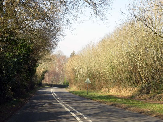
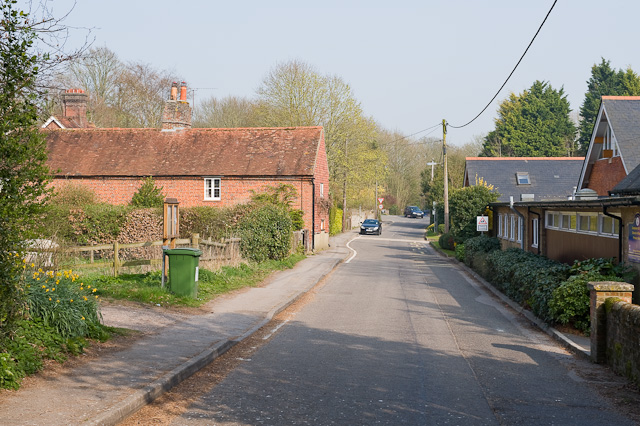
South Down Images

Images are sourced within 2km of 51.017494/-1.337535 or Grid Reference SU4624. Thanks to Geograph Open Source API. All images are credited.

Telephone box on the green in Coles Mead
Houses at end of Waterworks Road
Waterworks Road Road name, with the waterworks gate in the background.
Waterworks Road
Road name, with the waterworks gate in the background.
Blackberries beside Otterbourne Road
Blackberries against a blue sky Looks as if this is going to be a very good season!
Blackberries against a blue sky
Looks as if this is going to be a very good season!
M3 near Shawford The Twyford Down cutting is visible in the distance.
M3 near Shawford
The Twyford Down cutting is visible in the distance.
Path through field at Compton
Compton End seen from near footpath junction on Yew Hill The evening shadow of the hill is beginning to stretch across the farmland. Yew Tree Farm is left centre and Twyford church spire in the distance to the right.
Compton End seen from near footpath junction on Yew Hill
The evening shadow of the hill is beginning to stretch across the farmland. Yew Tree Farm is left centre and Twyford church spire in the distance to the right.
Railway Bridge at Shawford On the line between Winchester and Southampton.
Railway Bridge at Shawford
On the line between Winchester and Southampton.
The Bridge Inn, Shawford A busy lane, captured with relatively few vehicles.
The Bridge Inn, Shawford
A busy lane, captured with relatively few vehicles.
The Itchen Way and River Itchen Navigation Close to the road bridge, in Shawford.
The Itchen Way and River Itchen Navigation
Close to the road bridge, in Shawford.
Shawford Mill Seen from the Itchen Way
Shawford Mill
Seen from the Itchen Way
The Itchen Way and River Itchen Navigation Just north of the village of Shawford.
The Itchen Way and River Itchen Navigation
Just north of the village of Shawford.
Compton Lock, Itchen Navigation One of 17 locks, built to enable barges to reach Winchester. Seen from the Itchen Way.
Compton Lock, Itchen Navigation
One of 17 locks, built to enable barges to reach Winchester. Seen from the Itchen Way.
Compton Lock, Itchen Navigation One of 17 locks, built to enable barges to reach Winchester. Seen from the Itchen Way.
Compton Lock, Itchen Navigation
One of 17 locks, built to enable barges to reach Winchester. Seen from the Itchen Way.
The Itchen Way and River Itchen Navigation A quiet location, north of Shawford.
The Itchen Way and River Itchen Navigation
A quiet location, north of Shawford.
River Itchen Navigation Seen from the Itchen Way.
River Itchen Navigation
Seen from the Itchen Way.
Highbridge Road to Twyford
Show me another place!

South Down is located at Grid Ref: SU4624 (Lat: 51.017494, Lng: -1.337535)

Administrative County: Hampshire

District: Winchester

Police Authority: Hampshire

What 3 Words

///cakes.atoms.moral. Near Compton, Hampshire

Related Wikis

Shawford Down

Shawford Down is a 19.6-hectare (48-acre) Local Nature Reserve south of Winchester in Hampshire. It is owned by Hampshire County Council and managed by...

Shawford railway station

Shawford railway station serves the villages of Twyford, Compton and Shawford in Hampshire, England. It is 69 miles 50 chains (112.1 km) down the line...

Compton and Shawford

Compton and Shawford is a civil parish in the City of Winchester district, immediately southwest of the city, in Hampshire, England. Its main settlements...

Otterbourne

Otterbourne is a village in Hampshire, England. It is located approximately four miles (6.4 km) south of Winchester and eight miles (13 km) north of Southampton...

Nearby Amenities

Located within 500m of 51.017494,-1.337535
Bus Stop
South Down
Bench: yes
Bus: yes
Naptan AtcoCode: 1900HA110422
Naptan Bearing: SW
Naptan CommonName: South Down
Naptan NaptanCode: hamdgamp
Naptan Street: Otterbourne Road
Naptan Verified: no
Public Transport: platform
Shelter: yes
Source: naptan_import
Lat/Long: 51.0203355/-1.3352598
Bus Stop
South Down
Bench: yes
Bus: yes
Naptan AtcoCode: 1900HA110423
Naptan Bearing: N
Naptan CommonName: South Down
Naptan Crossing: Southdown Road
Naptan NaptanCode: hamdgagj
Naptan Street: Otterbourne Road
Naptan Verified: no
Public Transport: platform
Shelter: yes
Source: naptan_import
Lat/Long: 51.019246/-1.3365871
Bus Stop
Highways Road
Bench: yes
Bus: yes
Naptan AtcoCode: 1900HA110424
Naptan Bearing: N
Naptan CommonName: Highways Road
Naptan Crossing: Highways Road
Naptan NaptanCode: hamdawmd
Naptan Street: Otterbourne Road
Naptan Verified: no
Public Transport: platform
Shelter: no
Source: naptan_import
Lat/Long: 51.0159393/-1.3386301
Bus Stop
Highways Road
Bench: yes
Bus: yes
Naptan AtcoCode: 1900HA110425
Naptan Bearing: S
Naptan CommonName: Highways Road
Naptan Crossing: Grove Road
Naptan NaptanCode: hamdawjm
Naptan Street: Otterbourne Road
Naptan Verified: no
Public Transport: platform
Shelter: no
Source: naptan_import
Lat/Long: 51.0150781/-1.3389988
Operator: George Beckett Nurseries
Shop: garden_centre
Lat/Long: 51.0141721/-1.3402715
Bench
Backrest: yes
Material: wood
Seats: 2
Lat/Long: 51.021502/-1.339434
Post Box
Collection Plate: CP1
Collection Times: Mo-Fr 16:00; Sa 07:30
Operator: Royal Mail
Operator Wikidata: Q638098
Post Box Type: pillar
Ref: SO21 57
Royal Cypher: GR
Royal Cypher Wikidata: Q33102273
Lat/Long: 51.0193132/-1.3359923
South Down
Place: suburb
Lat/Long: 51.0165051/-1.3340491
Historic: milestone
Inscription: Winchester 3; Southampton 9
Lat/Long: 51.0180192/-1.3370546
Crossing
Lat/Long: 51.0208291/-1.3344866
The data included in this document is from www.openstreetmap.org. The data is made available under ODbL.

Have you been to South Down?

Leave your review of South Down below (or comments, questions and feedback).