South Down

Settlement in Devon Somerset West and Taunton

England

South Down

Churchstanton: Churchstanton School At Willand. Established on this site since 20 October 1879. Looking south west
Churchstanton: Churchstanton School Credit: Martin Bodman

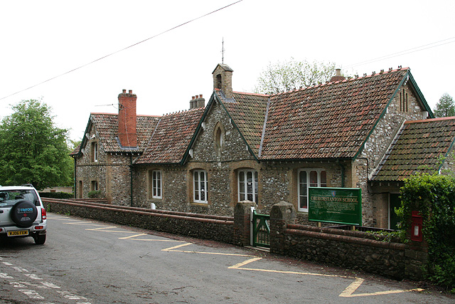
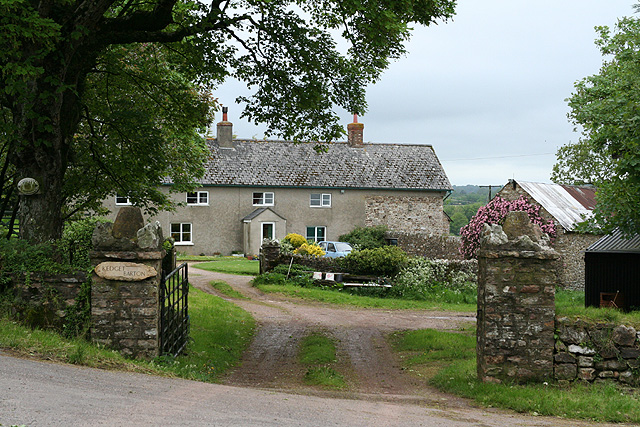
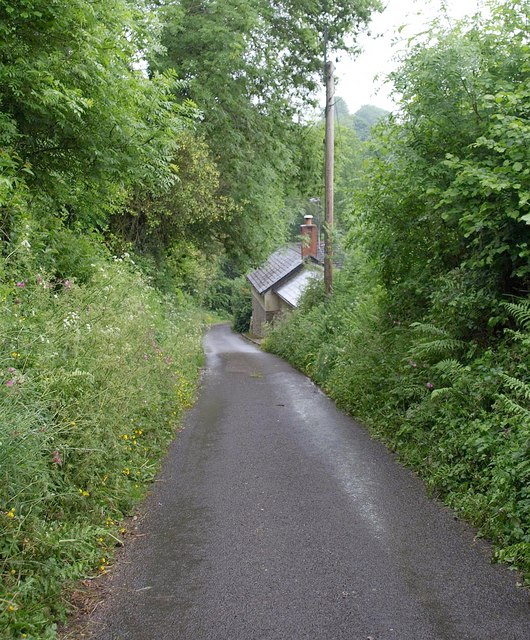
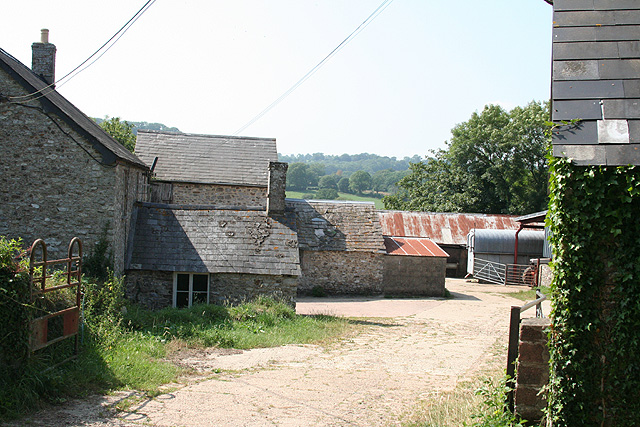
South Down is a picturesque village located in the county of Devon, in the southwestern part of England. Situated on the banks of the River Dart, the village offers stunning views of the surrounding countryside and is renowned for its natural beauty. With a population of around 500 residents, South Down is a close-knit community that exudes a peaceful and friendly ambiance.

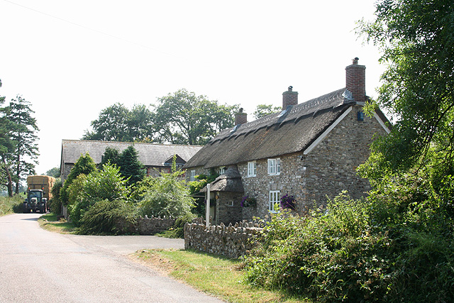
The village is characterized by its charming thatched cottages, which are a testament to its rich history dating back several centuries. The architecture in South Down reflects the traditional English countryside style, with its sloping roofs, white-washed walls, and attractive gardens. This quaint atmosphere attracts tourists and visitors throughout the year, who come to enjoy the tranquility and escape the hustle and bustle of city life.

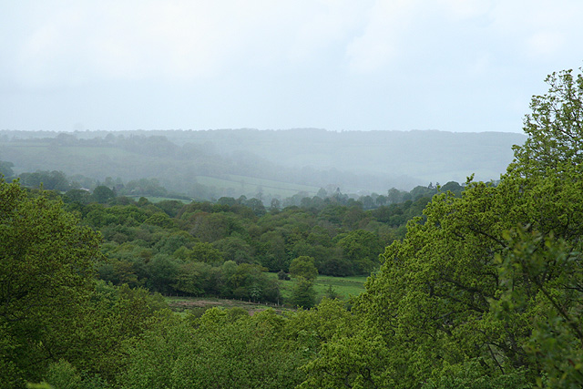
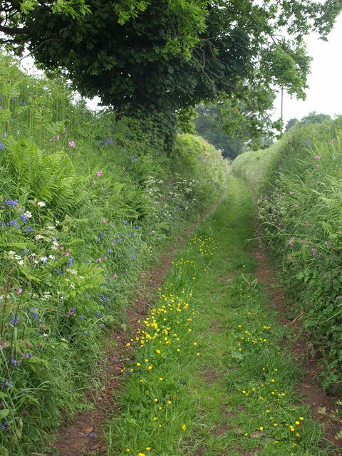
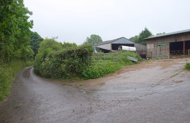
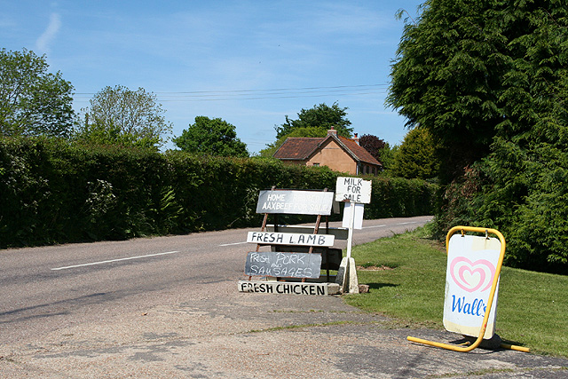
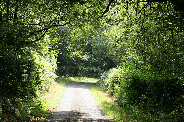
Surrounded by rolling hills and lush green fields, South Down offers ample opportunities for outdoor activities such as hiking, cycling, and fishing. The nearby Dartmoor National Park is a popular destination for nature enthusiasts, presenting a range of wildlife and breathtaking landscapes. The village is also well-known for its local pubs, where visitors can sample traditional Devonshire cuisine and experience the warm hospitality of the locals.

Despite its peaceful setting, South Down is conveniently located within easy reach of nearby towns and amenities. The bustling city of Exeter is just a short drive away, offering a wide range of shopping, cultural, and entertainment options. Additionally, the coastal town of Dartmouth is within close proximity, providing access to beautiful sandy beaches and water sports activities.

Overall, South Down, Devon, is a charming village that offers a perfect blend of natural beauty, historical charm, and a warm community spirit.

If you have any feedback on the listing, please let us know in the comments section below.
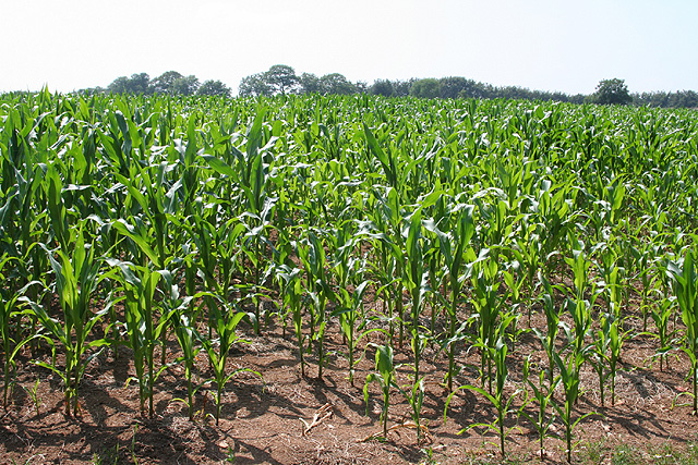
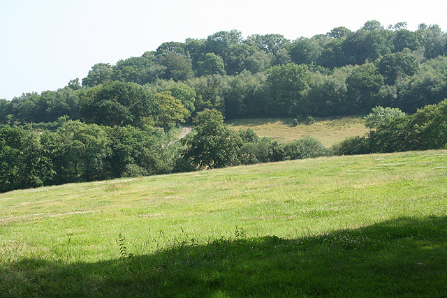
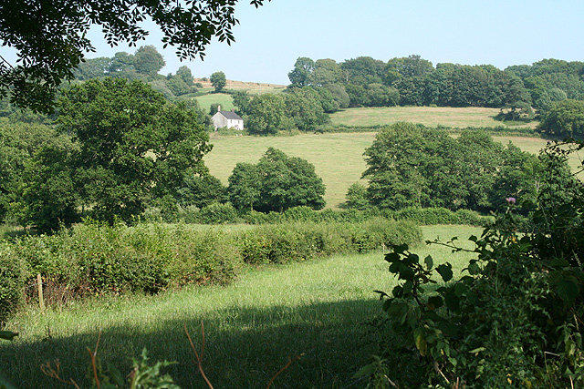
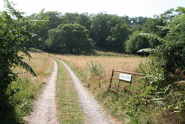
South Down Images

Images are sourced within 2km of 50.902241/-3.126729 or Grid Reference ST2012. Thanks to Geograph Open Source API. All images are credited.

Churchstanton: Churchstanton School At Willand. Established on this site since 20 October 1879. Looking south west
Churchstanton: Churchstanton School
At Willand. Established on this site since 20 October 1879. Looking south west
Churchstanton: Kedget Barton In the fork between roads to Hemyock and to Willand, Churchstanton, Looking north west
Churchstanton: Kedget Barton
In the fork between roads to Hemyock and to Willand, Churchstanton, Looking north west
Churchstanton: overlooking the Bolham valley Looking south west with rain falling on the far hill
Churchstanton: overlooking the Bolham valley
Looking south west with rain falling on the far hill
Footpath near Willand Footpath T 6/17 follows a very green lane (it's raining, so it's hardly surprising it's green) past flower-bedecked banks and an oak tree.
Footpath near Willand
Footpath T 6/17 follows a very green lane (it's raining, so it's hardly surprising it's green) past flower-bedecked banks and an oak tree.
Lane near Willand The lane from the hamlet drops past a cottage to cross a tributary of the River Culm. It's wet.
Lane near Willand
The lane from the hamlet drops past a cottage to cross a tributary of the River Culm. It's wet.
Lower Munty The entrance to the farm is at a lane junction; the lane on the left heads past Middle Munty to ... Higher Munty.
Lower Munty
The entrance to the farm is at a lane junction; the lane on the left heads past Middle Munty to ... Higher Munty.
Churchstanton: Taunton – Honiton road Looking south-south-west in the Honiton direction on a cold overcast May day
Churchstanton: Taunton – Honiton road
Looking south-south-west in the Honiton direction on a cold overcast May day
Churchstanton: a Blackdown crossroads The road ahead leads to Churchstanton, now barely a hamlet with church, rectory and a defunct public house. Looking north west
Churchstanton: a Blackdown crossroads
The road ahead leads to Churchstanton, now barely a hamlet with church, rectory and a defunct public house. Looking north west
Upottery: Highlands farm shop Signs by the Taunton-Honiton road at Smeatharpe
Upottery: Highlands farm shop
Signs by the Taunton-Honiton road at Smeatharpe
Upottery: Lambpark Farmhouse A datestone by the porch, partially obscured by thatch, indicates that this building was erected in 1795 or 1796. All the buildings here are now residential: the farming function has ceased
Upottery: Lambpark Farmhouse
A datestone by the porch, partially obscured by thatch, indicates that this building was erected in 1795 or 1796. All the buildings here are now residential: the farming function has ceased
Upottery: new crop Looking south west across a field near Lambpark
Upottery: new crop
Looking south west across a field near Lambpark
Upottery: Knackers Hole Lane This lane defines the border between Devon and Somerset and the parishes of Upottery and Churchstanton. Looking east-north-east
Upottery: Knackers Hole Lane
This lane defines the border between Devon and Somerset and the parishes of Upottery and Churchstanton. Looking east-north-east
Upottery: towards Lower Luxton Looking south-south-east across a valley to the east of Higher Luxton
Upottery: towards Lower Luxton
Looking south-south-east across a valley to the east of Higher Luxton
Upottery: towards Williambeer Farm Looking east across the Otter valley
Upottery: towards Williambeer Farm
Looking east across the Otter valley
Upottery: entrance to Pamos Farm Looking west
Upottery: entrance to Pamos Farm
Looking west
Yarcombe: Williambeer Farm Seen from the entrance with the farmhouse on the left. Looking west-north-west
Yarcombe: Williambeer Farm
Seen from the entrance with the farmhouse on the left. Looking west-north-west
Yarcombe: copse by the lane to Fry’s Moor Overlooking the Otter valley; looking north west
Yarcombe: copse by the lane to Fry’s Moor
Overlooking the Otter valley; looking north west
Otterford: near Fry’s Moor Looking south west
Otterford: near Fry’s Moor
Looking south west
Show me another place!

South Down is located at Grid Ref: ST2012 (Lat: 50.902241, Lng: -3.126729)

Administrative County: Somerset

District: Somerset West and Taunton

Police Authority: Avon and Somerset

What 3 Words

///joints.umbrellas.locate. Near Hemyock, Devon

Related Wikis

Southey and Gotleigh Moors

Southey and Gotleigh Moors (grid reference ST192110) is an 81.3 hectare (200.1 acre) biological Site of Special Scientific Interest on the Blackdown Hills...

Otterhead Lakes

Otterhead Lakes are a pair of reservoirs in the Blackdown Hills Area of Outstanding Natural Beauty south of Otterford in Somerset, England. They are fed...

Church of St Leonard, Otterford

The Anglican Church of St Leonard in Otterford, Somerset, England was built in the 14th century. It is a Grade II* listed building. == History == The church...

RAF Upottery

RAF Upottery (also known as Smeatharpe) is a former Royal Air Force station in East Devon, England. The airfield is located near the village of Upottery...

Nearby Amenities

Located within 500m of 50.902241,-3.126729
Generator Method: photovoltaic
Generator Output Electricity: yes
Generator Source: solar
Generator Type: solar_photovoltaic_panel
Location: roof
Power: generator
Source: Bing
Lat/Long: 50.8988048/-3.1250551
Generator Method: photovoltaic
Generator Output Electricity: yes
Generator Source: solar
Generator Type: solar_photovoltaic_panel
Location: roof
Power: generator
Source: Bing
Lat/Long: 50.898831/-3.1252778
Power: pole
Source: bing
Lat/Long: 50.9046186/-3.1315166
Power: pole
Source: bing
Lat/Long: 50.9043657/-3.1309399
Power: pole
Source: bing
Transformer: distribution
Lat/Long: 50.9027123/-3.1255326
Power: pole
Source: bing
Lat/Long: 50.9021905/-3.1266001
Power: pole
Source: bing
Lat/Long: 50.9022175/-3.1277749
Power: pole
Source: bing
Lat/Long: 50.9014428/-3.1331259
Power: pole
Source: bing
Lat/Long: 50.9017422/-3.1318787
Power: pole
Source: bing
Lat/Long: 50.9020315/-3.1307468
Power: pole
Source: bing
Lat/Long: 50.90227/-3.1298026
Power: pole
Source: bing
Transformer: distribution
Lat/Long: 50.9030447/-3.1296645
Power: pole
Source: bing
Lat/Long: 50.903706/-3.1302908
Power: pole
Source: bing
Lat/Long: 50.9022395/-3.1288505
Power: pole
Source: bing
Lat/Long: 50.901458/-3.1281182
Power: pole
Source: bing
Transformer: distribution
Lat/Long: 50.8991109/-3.125841
Power: pole
Source: bing
Lat/Long: 50.9006765/-3.1273538
Power: pole
Source: bing
Lat/Long: 50.8999001/-3.1266081
Power: pole
Source: bing
Lat/Long: 50.8984605/-3.1256264
The data included in this document is from www.openstreetmap.org. The data is made available under ODbL.

Have you been to South Down?

Leave your review of South Down below (or comments, questions and feedback).