Croxton, South

Settlement in Leicestershire Charnwood

England

Croxton, South

Bean field near South Croxton
Bean field near South Croxton Credit: Jonathan Thacker

Croxton, South, Leicestershire is a small village located in the East Midlands region of England. Situated in the county of Leicestershire, it is part of the Harborough district. The village is nestled in a rural setting, surrounded by picturesque countryside and rolling hills.

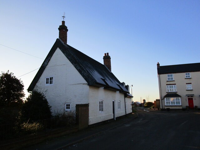
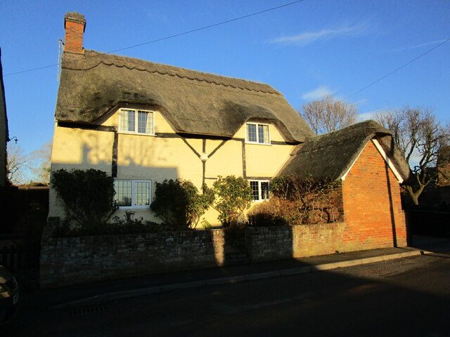
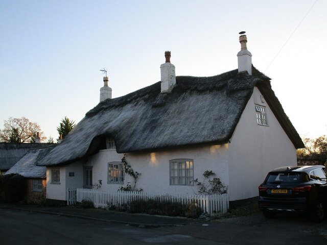
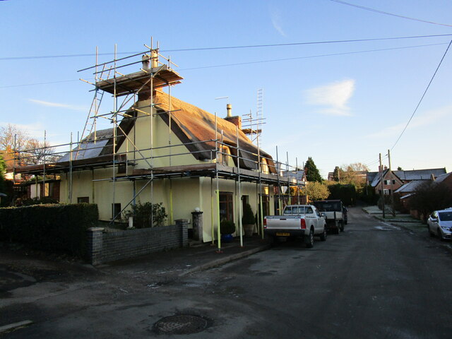
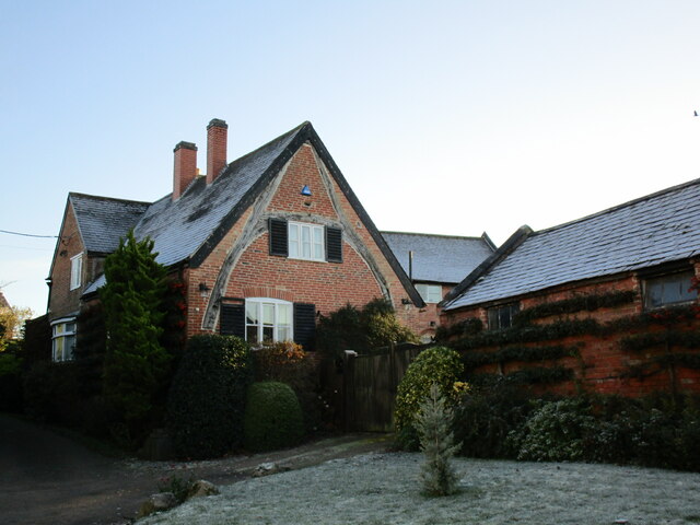
With a population of around 300 residents, Croxton is a close-knit community that offers a tranquil and peaceful lifestyle. The village is known for its charming thatched-roof cottages and traditional English architecture, which adds to its quaint and idyllic atmosphere.

Croxton is well-connected to the surrounding areas by road, with the A47 running close by and providing easy access to nearby towns and cities. The village is approximately 8 miles away from the market town of Melton Mowbray and 13 miles from Leicester city center.

While Croxton may be small, it has a strong sense of community spirit. The village boasts a range of amenities to cater to the needs of its residents, including a village hall, a local pub, and a primary school, which serves the surrounding area. The village also benefits from several scenic walking trails, allowing residents to explore the beautiful countryside that surrounds them.

Overall, Croxton, South, Leicestershire is a charming and peaceful village with a strong sense of community. Its rural location and range of amenities make it an attractive place to live for those seeking a tranquil lifestyle away from the hustle and bustle of larger towns and cities.

If you have any feedback on the listing, please let us know in the comments section below.

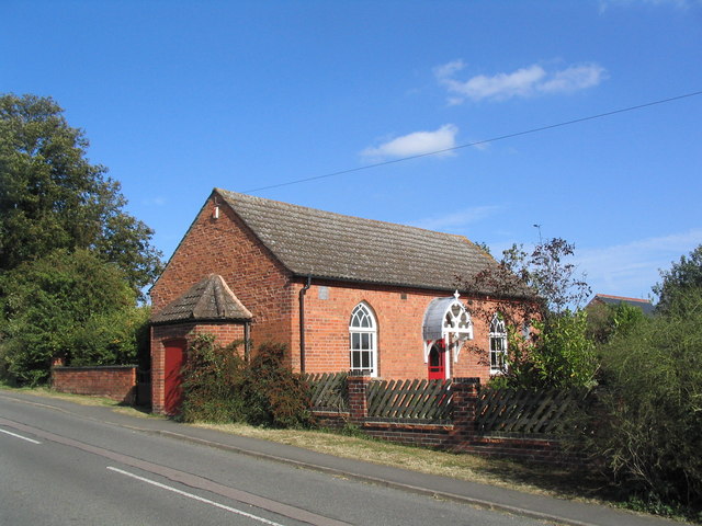
Croxton, South Images

Images are sourced within 2km of 52.684634/-0.983192 or Grid Reference SK6810. Thanks to Geograph Open Source API. All images are credited.

Bean field near South Croxton
Grass field and East Lodge East Lodge is being extended.
Grass field and East Lodge
East Lodge is being extended.
Pond and the grounds of Baggrave Hall
Bridleway near Waterloo Lodge Farm Follow the cattle trail.
Bridleway near Waterloo Lodge Farm
Follow the cattle trail.
Footpath to Keyham Follows the field edge.
Footpath to Keyham
Follows the field edge.
Ridge and furrow near the deserted village of Baggrave
South Croxton, St John the Baptist
Cream Cottage, Barsby Dates from the early eighteenth century. It once would have been thatched but now has a corrugated iron roof. <span class="nowrap"><a title="https://historicengland.org.uk/listing/the-list/list-entry/1061269?section=official-list-entry" rel="nofollow ugc noopener" href="https://historicengland.org.uk/listing/the-list/list-entry/1061269?section=official-list-entry">Link</a><img style="margin-left:2px;" alt="External link" title="External link - shift click to open in new window" src="https://s1.geograph.org.uk/img/external.png" width="10" height="10"/></span>
Cream Cottage, Barsby
Dates from the early eighteenth century. It once would have been thatched but now has a corrugated iron roof. LinkExternal link
14 Main Street, Barsby
Dilapidated building, Barsby Farm
Godson's Folly, Barsby Built as a mortuary chapel (in the ecclesiastical parish of Ashby Folville) but never consecrated and now a house.
Godson's Folly, Barsby
Built as a mortuary chapel (in the ecclesiastical parish of Ashby Folville) but never consecrated and now a house.
Thatch Cottage, Barsby Dates from the eighteenth century <span class="nowrap"><a title="https://historicengland.org.uk/listing/the-list/list-entry/1307604?section=official-list-entry" rel="nofollow ugc noopener" href="https://historicengland.org.uk/listing/the-list/list-entry/1307604?section=official-list-entry">Link</a><img style="margin-left:2px;" alt="External link" title="External link - shift click to open in new window" src="https://s1.geograph.org.uk/img/external.png" width="10" height="10"/></span>
Thatch Cottage, Barsby
Dates from the eighteenth century LinkExternal link
Cottage under repair, Barsby
House with a cruck frame, Barsby Most of the buildings seems fairly modern though it has a stone base.
House with a cruck frame, Barsby
Most of the buildings seems fairly modern though it has a stone base.
Former chapel, Barsby Now a house.
Former chapel, Barsby
Now a house.
Footpath near South Croxton The farmer has marked the route of the footpath with tractor marks
Footpath near South Croxton
The farmer has marked the route of the footpath with tractor marks
Footpath entering South Croxton
North Manor Farmhouse, South Croxton The wing on the right is the oldest part of the house and dates to the seventeenth century <span class="nowrap"><a title="https://historicengland.org.uk/listing/the-list/list-entry/1074491?section=official-list-entry" rel="nofollow ugc noopener" href="https://historicengland.org.uk/listing/the-list/list-entry/1074491?section=official-list-entry">Link</a><img style="margin-left:2px;" alt="External link" title="External link - shift click to open in new window" src="https://s1.geograph.org.uk/img/external.png" width="10" height="10"/></span>
North Manor Farmhouse, South Croxton
The wing on the right is the oldest part of the house and dates to the seventeenth century LinkExternal link
Show me another place!

Croxton, South is located at Grid Ref: SK6810 (Lat: 52.684634, Lng: -0.983192)

Administrative County: Leicestershire

District: Charnwood

Police Authority: Leicestershire

What 3 Words

///renovated.bronzes.sand. Near Queniborough, Leicestershire

Related Wikis

South Croxton

South Croxton (traditionally pronounced "crow-sun" [ˈkroʊsən]) is a village and civil parish in the Charnwood district of Leicestershire, England. It had...
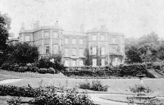
Baggrave Hall

Baggrave Hall is an 18th-century Grade II* listed country house in the parish of Hungarton, Leicestershire, England. It is a two and three-storey building...

Barsby

Barsby is a village and former civil parish now in the parish of Gaddesby, in the Melton district, in the county of Leicestershire, England. In 1931 the...

Ashby Folville Manor

Ashby Folville Manor is a late 19th-century house in Neo-Tudor style in the village of Ashby Folville, Leicestershire. The house was substantially rebuilt...

St Mary's Church, Ashby Folville

St Mary's Church is a church in Ashby Folville, Leicestershire. It is a Grade I listed building. == History == The church was founded in 1220 by Maud Bassett...

Ashby Folville

Ashby Folville is a village and former civil parish, now in the parish of Gaddesby, in the Melton district of Leicestershire, England, south west of Melton...

Hungarton

Hungarton (or Hungerton) is a small village and civil parish in the Harborough district, in the county of Leicestershire, England, about 10 miles (16 km...

Gaddesby Hall

Gaddesby Hall is an 18th-century brick-built house in the village of Gaddesby, Leicestershire. It was built in the late 1740s as a three-storey house with...

Nearby Amenities

Located within 500m of 52.684634,-0.983192
South Croxton
Is In Country: UK
Is In County: Leicestershire
Is In District: Charnwood
Place: village
Lat/Long: 52.6847557/-0.983758
Bus Stop
Bus: yes
Operator: Paul James Coaches
Public Transport: platform
Lat/Long: 52.6846639/-0.9830721
Post Box
Post Box Type: pillar
Royal Cypher: EIIR
Royal Cypher Wikidata: Q33102113
Lat/Long: 52.6851789/-0.9811929
Queen Elizabeth 2 Golden Jubilee 2002
Historic: monument
Lat/Long: 52.685199/-0.9816401
Defibrillator
Addr Postcode: LE7 3RT
Booth: K6
Covered: booth
Defibrillator Location: Inside old red phone box, Main Street, South Croxton - t junction with School Lne
Disused Amenity: telephone
Emergency: defibrillator
Ref: CHT14-423
Source Addr Postcode: ons_uprn_lookup
Lat/Long: 52.6847465/-0.9833093
The Pottery
Building: yes
Lat/Long: 52.6842072/-0.984579
Golden Fleece
Naptan AtcoCode: 260008600
Naptan Bearing: SW
Naptan BusStopType: CUS
Naptan CommonName: Golden Fleece
Naptan Indicator: outside
Naptan Landmark: Golden Fleece
Naptan NaptanCode: leidwmgj
Naptan Notes: Hourly - County
Naptan Street: Main Street
Naptan Verified: no
Source: naptan_import
Lat/Long: 52.6845862/-0.9832178
Golden Fleece
Naptan AtcoCode: 260008601
Naptan Bearing: NE
Naptan BusStopType: CUS
Naptan CommonName: Golden Fleece
Naptan Indicator: opposite
Naptan Landmark: Golden Fleece
Naptan NaptanCode: leidwmgm
Naptan Notes: Hourly - County
Naptan Street: Main Street
Naptan Verified: no
Source: naptan_import
Lat/Long: 52.6846874/-0.9834965
Gothic Farm
Place: farm
Source: Bing
Lat/Long: 52.6858154/-0.9811273
Power: pole
Lat/Long: 52.6870485/-0.9884684
Power: pole
Lat/Long: 52.6863247/-0.9876528
Location Transition: yes
Power: pole
Lat/Long: 52.6855623/-0.9868471
Power: pole
Lat/Long: 52.6885262/-0.9795712
The data included in this document is from www.openstreetmap.org. The data is made available under ODbL.

Have you been to Croxton, South?

Leave your review of Croxton, South below (or comments, questions and feedback).