South Carne

Settlement in Cornwall

England

South Carne

The A30 west at Fivelanes junction
The A30 west at Fivelanes junction Credit: Roy Hughes

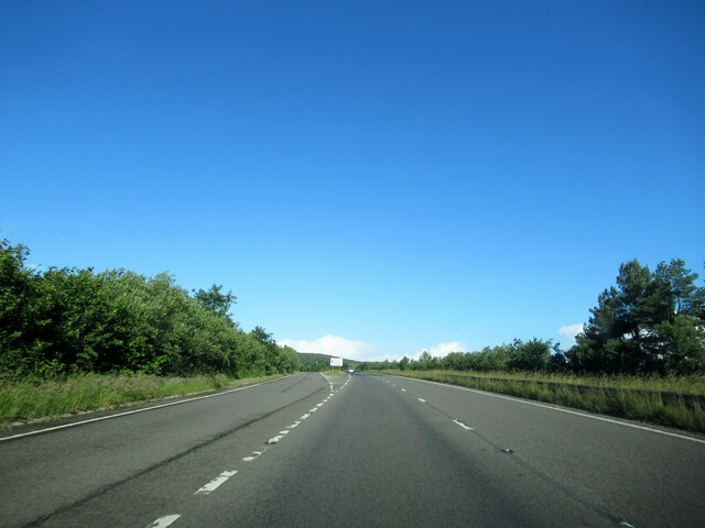
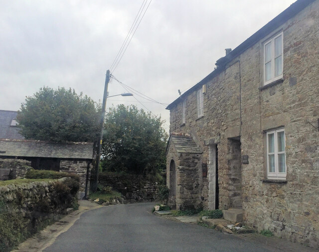
South Carne is a quaint village located in Cornwall, England. Situated near the coast, it offers stunning views of the ocean and surrounding countryside. The village is known for its peaceful and picturesque setting, making it a popular destination for those looking to escape the hustle and bustle of city life.

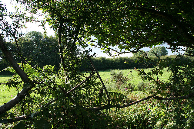
South Carne is home to a small population of residents who enjoy a close-knit community atmosphere. The village has a few local amenities, including a pub, a small convenience store, and a church. The surrounding area is perfect for outdoor enthusiasts, with plenty of walking and cycling trails to explore.

Visitors to South Carne can enjoy the beautiful sandy beaches nearby, as well as the charming coastal towns and villages that dot the coastline. The village is also within easy reach of popular tourist attractions such as the Eden Project and the Lost Gardens of Heligan.

Overall, South Carne offers a tranquil and idyllic setting for those seeking a peaceful retreat in the heart of Cornwall.

If you have any feedback on the listing, please let us know in the comments section below.

South Carne Images

Images are sourced within 2km of 50.605139/-4.53291 or Grid Reference SX2081. Thanks to Geograph Open Source API. All images are credited.

The A30 west at Fivelanes junction
Wesley Cottage
Wesley Cottage
West Carne Ford This ford at Wheal Bray was dry on the day of our visit.
West Carne Ford
This ford at Wheal Bray was dry on the day of our visit.
Lane between West Carne and Trebray In the background is Bray Down.
Lane between West Carne and Trebray
In the background is Bray Down.
Old Boundary Marker west of Carne Down Water Company Boundary Marker on the south side of the stream in the valley between Canaglaze and Carne Down. Altarnun parish. Inscribed LW (Launceston Water Company). Denotes the boundary of water intake and filter beds for a water supply piped to Launceston. Dated c.1895. One of a series of 12 shown on the 1905 OS 6 Inch map of which 7 have been located to date.

Milestone Society National ID: CW_ALTAR02em
Old Boundary Marker west of Carne Down
Water Company Boundary Marker on the south side of the stream in the valley between Canaglaze and Carne Down. Altarnun parish. Inscribed LW (Launceston Water Company). Denotes the boundary of water intake and filter beds for a water supply piped to Launceston. Dated c.1895. One of a series of 12 shown on the 1905 OS 6 Inch map of which 7 have been located to date. Milestone Society National ID: CW_ALTAR02em
Old Boundary Marker west of Carne Down Water Company Boundary Marker on the south side of the stream in the valley between Canaglaze and Carne Down. Altarnun parish. Inscribed LW (Launceston Water Company). Denotes the boundary of water intake and filter beds for a water supply piped to Launceston. Dated c.1895. One of a series of 12 shown on the 1905 OS 6 Inch map of which 7 have been located to date.

Milestone Society National ID: CW_ALTAR03em
Old Boundary Marker west of Carne Down
Water Company Boundary Marker on the south side of the stream in the valley between Canaglaze and Carne Down. Altarnun parish. Inscribed LW (Launceston Water Company). Denotes the boundary of water intake and filter beds for a water supply piped to Launceston. Dated c.1895. One of a series of 12 shown on the 1905 OS 6 Inch map of which 7 have been located to date. Milestone Society National ID: CW_ALTAR03em
Old Boundary Marker west of Carne Down Water Company Boundary Marker on the south side of the stream in the valley between Canaglaze and Carne Down. Altarnun parish. Inscribed LW (Launceston Water Company). Denotes the boundary of water intake and filter beds for a water supply piped to Launceston. Dated c.1895. One of a series of 12 shown on the 1905 OS 6 Inch map of which 7 have been located to date.

Milestone Society National ID: CW_ALTAR04em
Old Boundary Marker west of Carne Down
Water Company Boundary Marker on the south side of the stream in the valley between Canaglaze and Carne Down. Altarnun parish. Inscribed LW (Launceston Water Company). Denotes the boundary of water intake and filter beds for a water supply piped to Launceston. Dated c.1895. One of a series of 12 shown on the 1905 OS 6 Inch map of which 7 have been located to date. Milestone Society National ID: CW_ALTAR04em
Old Boundary Marker west of Carne Down Water Company Boundary Marker on the south side of the stream in the valley between Canaglaze and Carne Down. Altarnun parish. Inscribed LW (Launceston Water Company). Denotes the boundary of water intake and filter beds for a water supply piped to Launceston. Dated c.1895. One of a series of 12 shown on the 1905 OS 6 Inch map of which 7 have been located to date.

Milestone Society National ID: CW_ALTAR05em
Old Boundary Marker west of Carne Down
Water Company Boundary Marker on the south side of the stream in the valley between Canaglaze and Carne Down. Altarnun parish. Inscribed LW (Launceston Water Company). Denotes the boundary of water intake and filter beds for a water supply piped to Launceston. Dated c.1895. One of a series of 12 shown on the 1905 OS 6 Inch map of which 7 have been located to date. Milestone Society National ID: CW_ALTAR05em
Old Boundary Marker west of Carne Down Water Company Boundary Marker on the south side of the stream in the valley between Canaglaze and Carne Down. Altarnun parish. Inscribed LW (Launceston Water Company). Denotes the boundary of water intake and filter beds for a water supply piped to Launceston. Dated c.1895. One of a series of 12 shown on the 1905 OS 6 Inch map of which 7 have been located to date.

Milestone Society National ID: CW_ALTAR06em
Old Boundary Marker west of Carne Down
Water Company Boundary Marker on the south side of the stream in the valley between Canaglaze and Carne Down. Altarnun parish. Inscribed LW (Launceston Water Company). Denotes the boundary of water intake and filter beds for a water supply piped to Launceston. Dated c.1895. One of a series of 12 shown on the 1905 OS 6 Inch map of which 7 have been located to date. Milestone Society National ID: CW_ALTAR06em
Old Boundary Marker west of Carne Down Water Company Boundary Marker on the south side of the stream in the valley between Canaglaze and Carne Down. Altarnun parish. Inscribed LW (Launceston Water Company). Denotes the boundary of water intake and filter beds for a water supply piped to Launceston. Dated c.1895. One of a series of 12 shown on the 1905 OS 6 Inch map of which 7 have been located to date.

Milestone Society National ID: CW_ALTAR07em
Old Boundary Marker west of Carne Down
Water Company Boundary Marker on the south side of the stream in the valley between Canaglaze and Carne Down. Altarnun parish. Inscribed LW (Launceston Water Company). Denotes the boundary of water intake and filter beds for a water supply piped to Launceston. Dated c.1895. One of a series of 12 shown on the 1905 OS 6 Inch map of which 7 have been located to date. Milestone Society National ID: CW_ALTAR07em
Old Boundary Marker west of Carne Down Water Company Boundary Marker on the north side of the stream in the valley between Canaglaze and Carne Down. Altarnun parish. Inscribed LW (Launceston Water Company). Denotes the boundary of water intake and filter beds for a water supply piped to Launceston. Dated c.1895. One of a series of 12 shown on the 1905 OS 6 Inch map of which 7 have been located to date.

Milestone Society National ID: CW_ALTAR08em
Old Boundary Marker west of Carne Down
Water Company Boundary Marker on the north side of the stream in the valley between Canaglaze and Carne Down. Altarnun parish. Inscribed LW (Launceston Water Company). Denotes the boundary of water intake and filter beds for a water supply piped to Launceston. Dated c.1895. One of a series of 12 shown on the 1905 OS 6 Inch map of which 7 have been located to date. Milestone Society National ID: CW_ALTAR08em
Altarnun Bridge
Altarnun Bridge
Altarnun, Cornwall, St Nona's Church
Altarnun, Cornwall, the Wesleyan chapel
Altarnun Looking across the pack horse bridge to St. Nona's Church
Altarnun
Looking across the pack horse bridge to St. Nona's Church
Altarnun: Altarnun AFC Entrance to the ground, looking west-south-west
Altarnun: Altarnun AFC
Entrance to the ground, looking west-south-west
Altarnun: hay field Grass harvest for hay, rather than silage, seemingly. Looking south-south-east towards Fivelanes and Bodmin Moor. Altarnun village is hidden in the valley before Fivelanes
Altarnun: hay field
Grass harvest for hay, rather than silage, seemingly. Looking south-south-east towards Fivelanes and Bodmin Moor. Altarnun village is hidden in the valley before Fivelanes
Altarnun: near Hurden Field seen through a gap in a roadside hedge on a back lane between Carne Down and the Rising Sun. Looking north-north-west
Altarnun: near Hurden
Field seen through a gap in a roadside hedge on a back lane between Carne Down and the Rising Sun. Looking north-north-west
Show me another place!

South Carne is located at Grid Ref: SX2081 (Lat: 50.605139, Lng: -4.53291)

Unitary Authority: Cornwall

Police Authority: Devon and Cornwall

What 3 Words

///breathing.quiz.reclusive. Near Trewen, Cornwall

Related Wikis

St Nonna's Church, Altarnun

St Nonna's Church, also known as the Cathedral of the Moors, is the second largest church on Bodmin Moor, Cornwall, located in the village of Altarnun...

Trewint

Trewint is a hamlet in the civil parish of Altarnun, east Cornwall, England, UK. Trewint is on the A30 main road west of the village of Altarnun. Trewint...

Altarnun

Altarnun ( AWL-tər-NUN, OL-; Standard Written Form: Alternonn) is a village and civil parish in Cornwall, England, United Kingdom. It is located 7 miles...

Altarnun Wesleyan chapel

Altarnun Wesleyan chapel is the former Methodist chapel in Altarnun in Cornwall. Completed in 1859, the chapel has been a Grade II listed building since...

Related Videos

Fox Tor, Near Altarnun, Bodmin Moor - Explore Cornwall

Fox Tor stands within the parish of Altarnun on Bodmin Moor in Cornwall. One of the twenty highest points in Cornwall, Fox Tor ...

A new organ for Altarnun

In 2017, St Nonna's Church at Altarnun on Bodmin Moor in Cornwall got a new organ. This video shows the organ in 2017 when it ...

Altarnun Church - Doc Martin Filming Location

Located in the beautiful and peaceful village of Altarnun just minutes off the busy A30 near Launceston, St Nonna's Church is a ...

Fording Penpont Water Near Altarnun in Cornwall

This shallow ford is located west of Altranun in Cornwall. SX214813, 11.07.20 OS X (Eastings) 221476 OS Y (Northings) 81381 ...

Nearby Amenities

Located within 500m of 50.605139,-4.53291
South Carne
Name Kw: Karn Soth
Place: hamlet
Wikidata: Q7566516
Lat/Long: 50.6049538/-4.5355576
Ford: yes
Lat/Long: 50.6015557/-4.5319161
The data included in this document is from www.openstreetmap.org. The data is made available under ODbL.

Have you been to South Carne?

Leave your review of South Carne below (or comments, questions and feedback).