South Cadbury

Settlement in Somerset South Somerset

England

South Cadbury

Primary School, North Cadbury
Primary School, North Cadbury Credit: Roger Cornfoot

South Cadbury is a small village located in the county of Somerset, England. Situated on the southern slopes of Cadbury Hill, it lies approximately 17 miles south of the city of Wells and 8 miles east of Yeovil. The village is surrounded by picturesque countryside, characterized by rolling hills and lush green fields.

The history of South Cadbury dates back to ancient times, as it is believed to be the site of the legendary Camelot, King Arthur's castle. The village is also home to Cadbury Castle, an Iron Age hill fort that offers panoramic views of the surrounding area. This historical landmark attracts visitors from far and wide, as it provides a glimpse into the region's rich heritage.

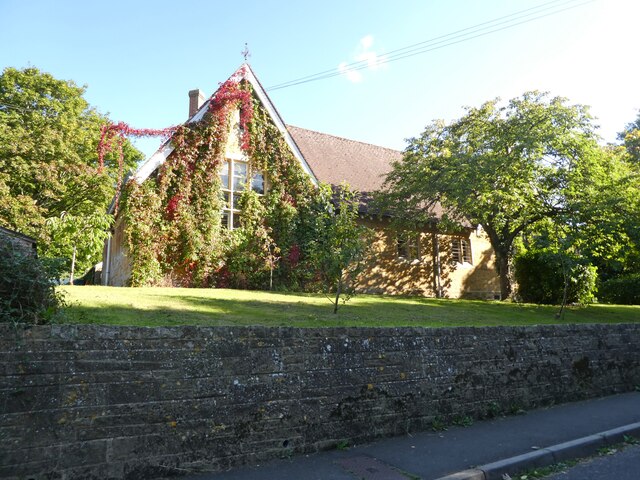
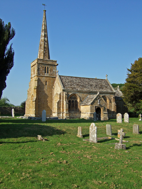
Despite its small size, South Cadbury boasts a close-knit community and a range of amenities. The village is home to a charming parish church, St. Thomas Becket, which dates back to the 12th century. Additionally, there is a local pub, The Camelot Inn, which serves traditional British cuisine and offers a friendly atmosphere for residents and visitors alike.

The village is surrounded by beautiful countryside, making it an ideal location for outdoor enthusiasts. There are several walking trails and footpaths in the area, allowing visitors to explore the stunning natural landscapes and enjoy the tranquility of the Somerset countryside.

Overall, South Cadbury offers a unique blend of history, natural beauty, and community spirit, making it a delightful place to visit or call home.

If you have any feedback on the listing, please let us know in the comments section below.

South Cadbury Images

Images are sourced within 2km of 51.028735/-2.5255731 or Grid Reference ST6325. Thanks to Geograph Open Source API. All images are credited.

Primary School, North Cadbury
The Catash Inn
The Catash Inn
Teals farm shop at South Cadbury This large farm shop includes a cafe, a deli and a butcher's. It even has its own cider orchard and beehives.
Teals farm shop at South Cadbury
This large farm shop includes a cafe, a deli and a butcher's. It even has its own cider orchard and beehives.
The gable end of Teals farm shop at South Cadbury
Old Milestone by road, SouthWest of Blackford The Milestone is located buried in hedge on the E of the road.  Parish of Compton Pauncefoot (South Somerset District). Metal plate attached to stone post, Sherbourne iron plate design, erected by the Sherborne turnpike trust in the 19th Century, very rusty. An earlier photograph can be found here: <a title="https://www.geograph.org.uk/photo/6102260" href="https://www.geograph.org.uk/photo/6102260">Link</a> 

Inscription reads:-   
6 / SHERBORNE / ANSFORD / 5¾ 

Grade II listed. List Entry Number: 1056556 <span class="nowrap"><a title="https://historicengland.org.uk/listing/the-list/list-entry/1056556" rel="nofollow ugc noopener" href="https://historicengland.org.uk/listing/the-list/list-entry/1056556">Link</a><img style="margin-left:2px;" alt="External link" title="External link - shift click to open in new window" src="https://s1.geograph.org.uk/img/external.png" width="10" height="10"/></span> 

Milestone Society National ID: SO_SBAF06
Old Milestone by road, SouthWest of Blackford
The Milestone is located buried in hedge on the E of the road.  Parish of Compton Pauncefoot (South Somerset District). Metal plate attached to stone post, Sherbourne iron plate design, erected by the Sherborne turnpike trust in the 19th Century, very rusty. An earlier photograph can be found here: Link  Inscription reads:- 6 / SHERBORNE / ANSFORD / 5¾ Grade II listed. List Entry Number: 1056556 LinkExternal link Milestone Society National ID: SO_SBAF06
South Cadbury: towards Cadbury Castle The lane linking South Cadbury and Corton Denham
South Cadbury: towards Cadbury Castle
The lane linking South Cadbury and Corton Denham
South Cadbury: towards Parrock Hill On the lane linking South Cadbury and Corton Denham. Now part of the Monarch's way. But the route is unconvincing here as it goes nowhere near Trent, where Charles II holed up for a week after defeat at the Battle of Worcester, before escaping to Fecamp
South Cadbury: towards Parrock Hill
On the lane linking South Cadbury and Corton Denham. Now part of the Monarch's way. But the route is unconvincing here as it goes nowhere near Trent, where Charles II holed up for a week after defeat at the Battle of Worcester, before escaping to Fecamp
Compton Pauncefoot: near the church and manor house In the 19th century the Manor House was Compton Farm's farmhouse. The church is dedicated to the Blessed Virgin Mary
Compton Pauncefoot: near the church and manor house
In the 19th century the Manor House was Compton Farm's farmhouse. The church is dedicated to the Blessed Virgin Mary
Compton Pauncefoot: church path The church is dedicated to the Blessed Virgin Mary
Compton Pauncefoot: church path
The church is dedicated to the Blessed Virgin Mary
Compton Pauncefoot: edge of the village Houses near the western end of Hockley Lane
Compton Pauncefoot: edge of the village
Houses near the western end of Hockley Lane
Compton Pauncefoot: Downyard This barn complex, now known as Downyard, was part of Compton Farm in the late 19th century. The barns have been converted and now provide residential accommodation
Compton Pauncefoot: Downyard
This barn complex, now known as Downyard, was part of Compton Farm in the late 19th century. The barns have been converted and now provide residential accommodation
Compton Pauncefoot: church and manor house Seen from a field path to Lower Woolston
Compton Pauncefoot: church and manor house
Seen from a field path to Lower Woolston
Compton Pauncefoot: towards the mill Seen from the field path to Lower Woolston and North Cadbury. The mill was at work in the late 19th century but is now a private house. The stream is a tributary of the River Cam
Compton Pauncefoot: towards the mill
Seen from the field path to Lower Woolston and North Cadbury. The mill was at work in the late 19th century but is now a private house. The stream is a tributary of the River Cam
Compton Pauncefoot: by Warren Hill By a public footpath to Lower Woolston and North Cadbury. In Compton Pauncefoot parish
Compton Pauncefoot: by Warren Hill
By a public footpath to Lower Woolston and North Cadbury. In Compton Pauncefoot parish
Compton Pauncefoot: nearing a stile On a field path from Compton Pauncefoot village to Lower Woolston and North Cadbury
Compton Pauncefoot: nearing a stile
On a field path from Compton Pauncefoot village to Lower Woolston and North Cadbury
Compton Pauncefoot: stile By Ash trees, with a field of oilseed rape beyond. On a public footpath from Compton Pauncefot village to Lower Woolston and North Cadbury
Compton Pauncefoot: stile
By Ash trees, with a field of oilseed rape beyond. On a public footpath from Compton Pauncefot village to Lower Woolston and North Cadbury
Compton Pauncefoot: by the mill On a field path beneath Warren Hill. The water-powered mill was at work in the late 19th century but has long since been converted to a private residence. In Compton Pauncefoot parish
Compton Pauncefoot: by the mill
On a field path beneath Warren Hill. The water-powered mill was at work in the late 19th century but has long since been converted to a private residence. In Compton Pauncefoot parish
A303, eastbound The A303 is a main trunk road running 92 miles between Basingstoke and Honiton. Along with the A30 and M3 it forms a major route between London and the South West. Much of the road is dual carriageway, but some stretches remain single and prone to congestion.

Wikipedia: <span class="nowrap"><a title="http://en.wikipedia.org/wiki/A303_road" rel="nofollow ugc noopener" href="http://en.wikipedia.org/wiki/A303_road">Link</a><img style="margin-left:2px;" alt="External link" title="External link - shift click to open in new window" src="https://s1.geograph.org.uk/img/external.png" width="10" height="10"/></span>
A303, eastbound
The A303 is a main trunk road running 92 miles between Basingstoke and Honiton. Along with the A30 and M3 it forms a major route between London and the South West. Much of the road is dual carriageway, but some stretches remain single and prone to congestion. Wikipedia: LinkExternal link
Show me another place!

South Cadbury is located at Grid Ref: ST6325 (Lat: 51.028735, Lng: -2.5255731)

Administrative County: Somerset

District: South Somerset

Police Authority: Avon and Somerset

What 3 Words

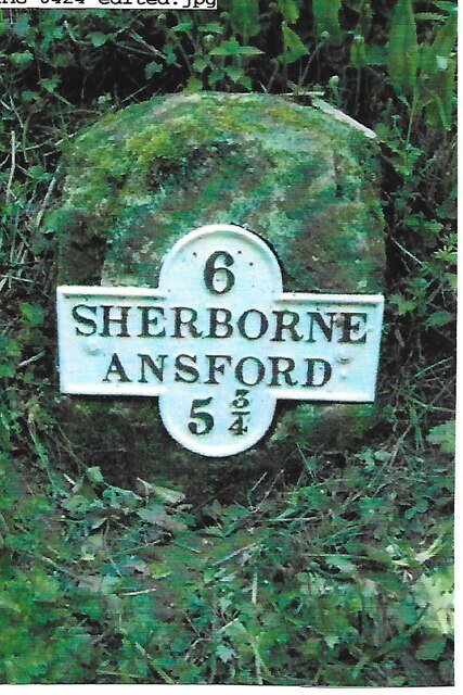
///rice.depravity.spaceship. Near Castle Cary, Somerset

Related Wikis

South Cadbury

South Cadbury is a village and former civil parish, now in the parish of South Cadbury and Sutton Montis, in the Somerset district of the ceremonial county...

Church of St Thomas à Becket, South Cadbury

The Church of St Thomas à Becket is the Anglican parish church for the ancient village of South Cadbury in Somerset and is dedicated to Thomas Becket....

Cadbury Castle, Somerset

Cadbury Castle is a Bronze and Iron Age hillfort in the civil parish of South Cadbury in the English county of Somerset. It is a scheduled monument and...

Church of the Holy Trinity, Sutton Montis

The Anglican Church of the Holy Trinity at Sutton Montis in the parish of South Cadbury and Sutton Montis, Somerset, England, has Saxon origins but most...

Church of St Mary, Compton Pauncefoot

The Anglican Church of St Mary in Compton Pauncefoot, Somerset, England was built in the 15th century. It is a Grade II* listed building. == History... ==

North Cadbury Court

North Cadbury Court in North Cadbury, Somerset, England is a country house built around 1580–1610, by Sir Francis Hastings. It has been designated as a...

Church of St Michael, North Cadbury

The Church of St Michael in North Cadbury, Somerset, England, dates from 1417, although the tower was built a few years earlier. It has been designated...

Compton Pauncefoot

Compton Pauncefoot is a village and civil parish in Somerset, England, situated beside the A303 road, 5 miles (8.0 km) south west of Wincanton in the South...

Nearby Amenities

Located within 500m of 51.028735,-2.5255731
South Cadbury
Place: village
Source: npe
Wikidata: Q1013052
Wikipedia: en:South Cadbury
Lat/Long: 51.0288034/-2.5254367
Pub
The Camelot
Addr City: South Cadbury
Addr Postcode: BA22 7EX
Addr Street: Chapel Road
Website: https://www.camelotpub.co.uk/
Lat/Long: 51.0287478/-2.5256577
Post Box
Operator: Royal Mail
Operator Wikidata: Q638098
Post Box Type: wall
Ref: BA22 72
Royal Cypher: GVIR
Royal Cypher Wikidata: Q33102169
Lat/Long: 51.0286454/-2.5255212
Power: pole
Lat/Long: 51.0318347/-2.5219795
Power: pole
Lat/Long: 51.0314569/-2.5231749
Power: pole
Lat/Long: 51.0306196/-2.525811
Power: pole
Lat/Long: 51.0301875/-2.5272709
Power: pole
Lat/Long: 51.029593/-2.5292832
Power: pole
Lat/Long: 51.0290552/-2.5311367
Power: pole
Lat/Long: 51.0286113/-2.5326342
Addr City: South Cadbury
Addr Housename: South Cadbury House
Lat/Long: 51.0278511/-2.5256214
Bench: yes
Leisure: picnic_table
Lat/Long: 51.0307649/-2.525308
Bench: yes
Leisure: picnic_table
Lat/Long: 51.0307457/-2.5252922
The data included in this document is from www.openstreetmap.org. The data is made available under ODbL.

Have you been to South Cadbury?

Leave your review of South Cadbury below (or comments, questions and feedback).