South Burlingham

Settlement in Norfolk Broadland

England

South Burlingham

Road verge with Danish Scurvy-grass Salt-tolerant plant that is a feature of many road verges in spring. Cochlearia danica is a member of the cabbage family rather than a grass <span class="nowrap"><a title="https://www.plantlife.org.uk/uk/discover-wild-plants-nature/plant-fungi-species/danish-scurvy-grass" rel="nofollow ugc noopener" href="https://www.plantlife.org.uk/uk/discover-wild-plants-nature/plant-fungi-species/danish-scurvy-grass">Link</a><img style="margin-left:2px;" alt="External link" title="External link - shift click to open in new window" src="https://s1.geograph.org.uk/img/external.png" width="10" height="10"/></span>
Road verge with Danish Scurvy-grass Credit: Jeremy Halls

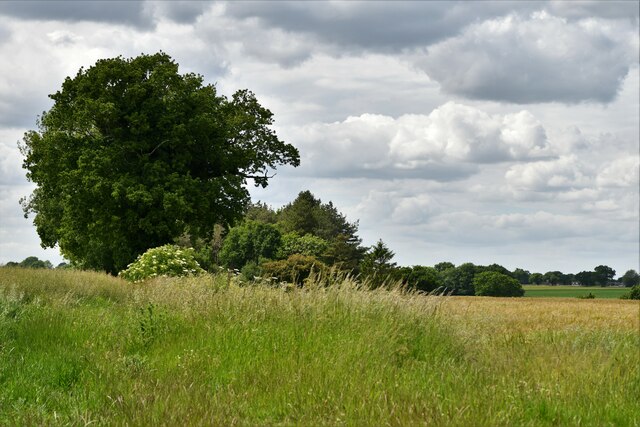
South Burlingham is a small village located in the county of Norfolk, in the eastern part of England. Situated about 12 miles east of the city of Norwich, it lies within the South Norfolk district. The village is surrounded by picturesque countryside, featuring rolling fields and charming rural landscapes.

South Burlingham is a close-knit community with a population of just over 400 residents. The village is known for its peaceful and quiet atmosphere, making it an ideal place for those seeking a tranquil lifestyle away from the hustle and bustle of city living.

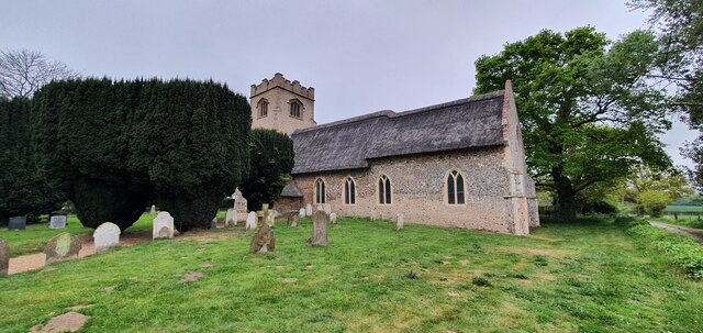
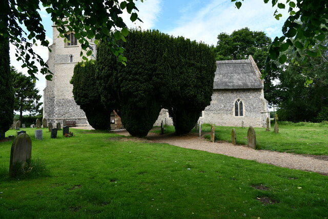
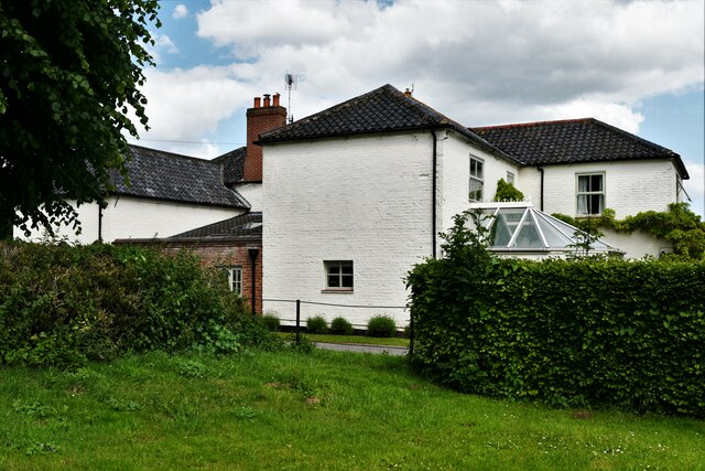
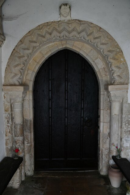
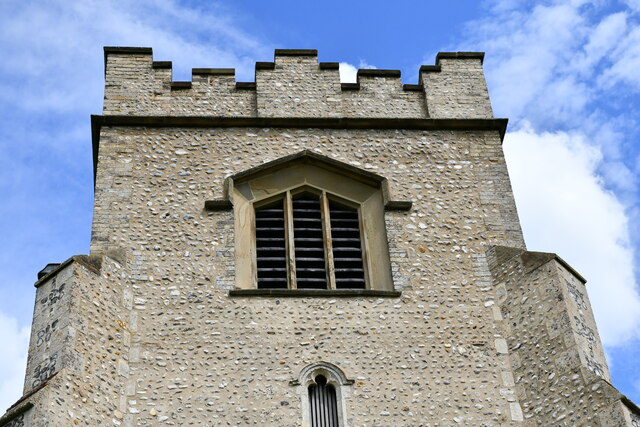
The village itself is made up of a collection of historic cottages and traditional buildings, giving it a distinctive character and charm. The local church, St. Edmund's, stands as a prominent feature in the village, dating back to the 12th century and serving as a reminder of South Burlingham's rich history.

Despite its small size, South Burlingham is well-connected to nearby towns and cities. The A47 road runs close to the village, providing easy access to Norwich as well as other major towns in the region. Public transport options are limited, but there are bus services that connect the village to neighboring areas.

While South Burlingham may lack some amenities, residents can find basic services such as a village hall and a small convenience store within the community. For more extensive amenities, residents often travel to nearby towns or Norwich.

Overall, South Burlingham offers a peaceful and idyllic setting for those seeking a rural lifestyle, while still remaining within reach of larger urban areas.

If you have any feedback on the listing, please let us know in the comments section below.

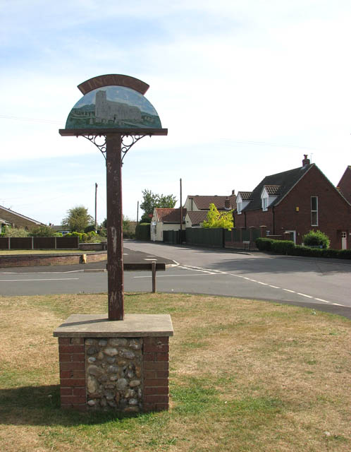
South Burlingham Images

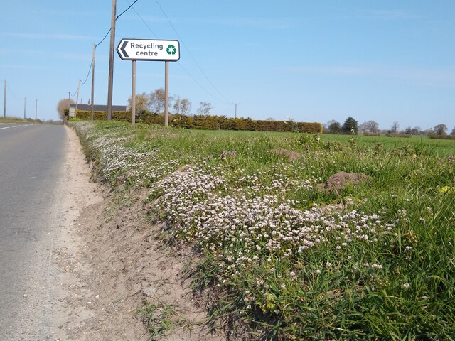
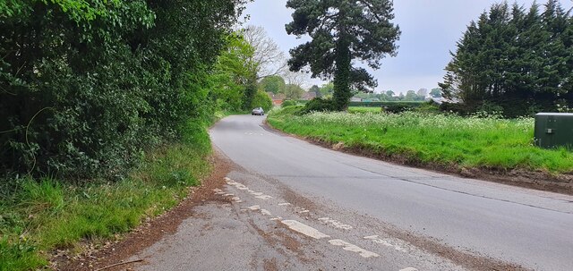
Images are sourced within 2km of 52.614548/1.509102 or Grid Reference TG3707. Thanks to Geograph Open Source API. All images are credited.

Road verge with Danish Scurvy-grass Salt-tolerant plant that is a feature of many road verges in spring. Cochlearia danica is a member of the cabbage family rather than a grass <span class="nowrap"><a title="https://www.plantlife.org.uk/uk/discover-wild-plants-nature/plant-fungi-species/danish-scurvy-grass" rel="nofollow ugc noopener" href="https://www.plantlife.org.uk/uk/discover-wild-plants-nature/plant-fungi-species/danish-scurvy-grass">Link</a><img style="margin-left:2px;" alt="External link" title="External link - shift click to open in new window" src="https://s1.geograph.org.uk/img/external.png" width="10" height="10"/></span>
Road verge with Danish Scurvy-grass
Salt-tolerant plant that is a feature of many road verges in spring. Cochlearia danica is a member of the cabbage family rather than a grass LinkExternal link
St Edmund's church, South Burlingham
Junction of South Burlingham Road and Lodge Road
South Burlingham, St. Edmund's Church
South Burlingham: A small wooded area
Hassingham: Wheat crop
South Burlingham, Church Farm: The farmhouse
South Burlingham, St. Edmund's Church: Norman south doorway
South Burlingham, St. Edmund's Church: Norman south doorway (detail) 1
South Burlingham, St. Edmund's Church: Norman south doorway (detail) 2
South Burlingham, St. Edmund's Church: Norman south doorway (detail) 3
South Burlingham, St. Edmund's Church: Bench mark
South Burlingham, St. Edmund's Church: The tower, western aspect
South Burlingham, St. Edmund's Church: Blocked up Norman north doorway
South Burlingham, St. Edmund's Church: Blocked up Norman north doorway (detail) 1
South Burlingham, St. Edmund's Church: Blocked up Norman north doorway (detail) 2
Show me another place!

South Burlingham is located at Grid Ref: TG3707 (Lat: 52.614548, Lng: 1.509102)

Administrative County: Norfolk

District: Broadland

Police Authority: Norfolk

What 3 Words

///telephone.papers.shippers. Near Lingwood, Norfolk

Related Wikis

Beighton, Norfolk

Beighton is a village and civil parish in the Broadland district of Norfolk, England, about two miles (3 km) South-West of Acle about 12.8 miles (20.6...

Lingwood

Lingwood is a village and former civil parish, 8 miles (13 km) east of Norwich, now in the parish of Lingwood and Burlingham, in the Broadland district...

Lingwood railway station

Lingwood railway station is on the Wherry Lines in the east of England, serving the village of Lingwood, Norfolk. It is 7 miles 78 chains (12.8 km) down...

Lingwood and Burlingham

Lingwood and Burlingham is a civil parish in the English county of Norfolk, comprising the large village of Lingwood together with the smaller villages...

Nearby Amenities

Located within 500m of 52.614548,1.509102
Bus Stop
village hall, adj
Naptan AtcoCode: 2900B231
Naptan Bearing: NE
Naptan BusStopType: CUS
Naptan CommonName: village hall
Naptan Indicator: adj
Naptan Landmark: Recreation Ground
Naptan Locality: Beighton
Naptan NaptanCode: nfoadwad
Naptan ShortCommonName: village hall
Naptan Street: High Road
Naptan Verified: no
Source: naptan_import
Lat/Long: 52.6157466/1.5161674
Bus Stop
Hopewell Gardens, opp
Naptan AtcoCode: 2900B2315
Naptan Bearing: SW
Naptan BusStopType: CUS
Naptan CommonName: Hopewell Gardens
Naptan Indicator: opp
Naptan Landmark: Hopwell Gardens
Naptan Locality: Beighton
Naptan NaptanCode: nfoadwam
Naptan ShortCommonName: Hopewell Gdns
Naptan Street: High Road
Naptan Verified: no
Source: naptan_import
Lat/Long: 52.6151174/1.5158509
Bus Stop
Southwood Road, opp
Bench: no
Naptan AtcoCode: 2900B2316
Naptan Bearing: NE
Naptan BusStopType: CUS
Naptan CommonName: Southwood Road
Naptan Indicator: opp
Naptan Landmark: Southwood Rd
Naptan Locality: Beighton
Naptan NaptanCode: nfoadwap
Naptan ShortCommonName: Southwood Rd
Naptan Street: High Road
Naptan Verified: no
Shelter: no
Source: naptan_import
Tactile Paving: no
Lat/Long: 52.6110423/1.5119336
Bus Stop
Hopewell Gardens, adj
Naptan AtcoCode: 2900B235
Naptan Bearing: NE
Naptan BusStopType: CUS
Naptan CommonName: Hopewell Gardens
Naptan Indicator: adj
Naptan Landmark: Hopwell Gardens
Naptan Locality: Beighton
Naptan NaptanCode: nfoadwaw
Naptan ShortCommonName: Hopewell Gdns
Naptan Street: High Road
Naptan Verified: no
Source: naptan_import
Lat/Long: 52.6151666/1.5157071
Bus Stop
Southwood Road, adj
Bench: no
Naptan AtcoCode: 2900B236
Naptan Bearing: SW
Naptan BusStopType: CUS
Naptan CommonName: Southwood Road
Naptan Indicator: adj
Naptan Landmark: Southwood Rd
Naptan Locality: Beighton
Naptan NaptanCode: nfoadwda
Naptan ShortCommonName: Southwood Rd
Naptan Street: High Road
Naptan Verified: no
Shelter: no
Source: naptan_import
Tactile Paving: no
Lat/Long: 52.6110101/1.5121083
South Burlingham
Place: hamlet
Lat/Long: 52.6147837/1.5077039
Power: pole
Lat/Long: 52.617132/1.5148661
The data included in this document is from www.openstreetmap.org. The data is made available under ODbL.

Have you been to South Burlingham?

Leave your review of South Burlingham below (or comments, questions and feedback).