South Broomhill

Settlement in Northumberland

England

South Broomhill

Part of Ladyburn Lakr at Druridge Country Park Reedbeds, open water and plenty of fresh air.
Part of Ladyburn Lakr at Druridge Country Park Credit: Jeremy Bolwell

The requested URL returned error: 429 Too Many Requests

If you have any feedback on the listing, please let us know in the comments section below.

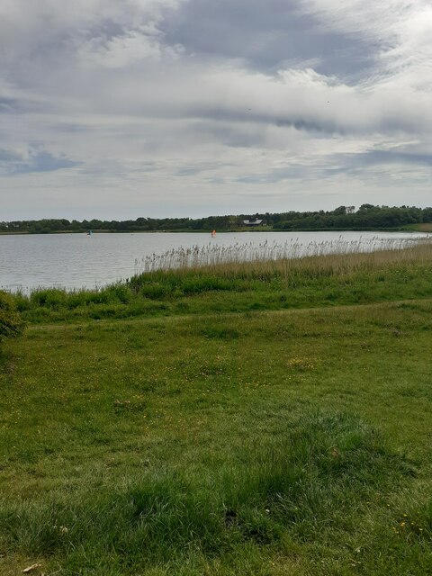
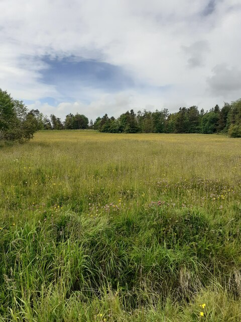
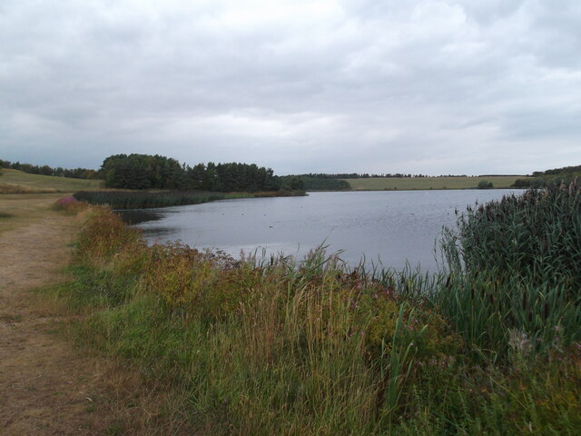
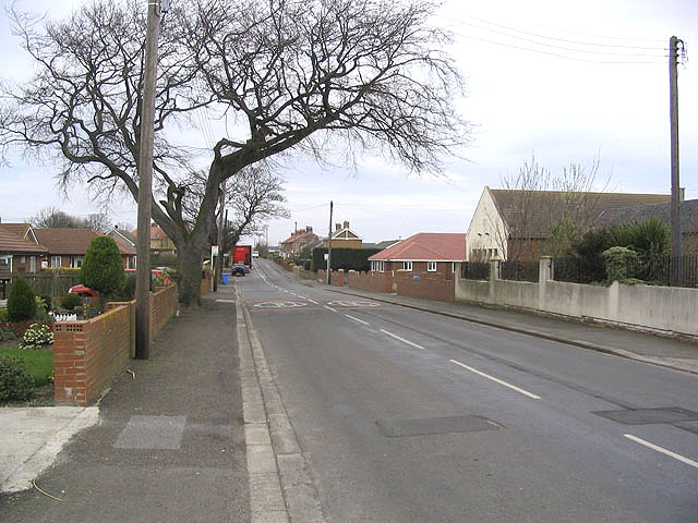
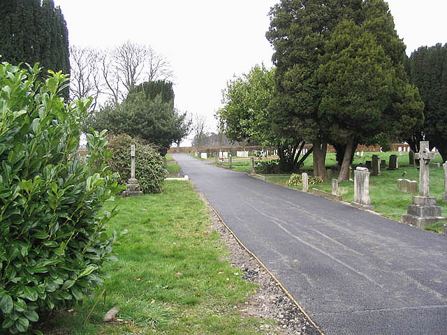
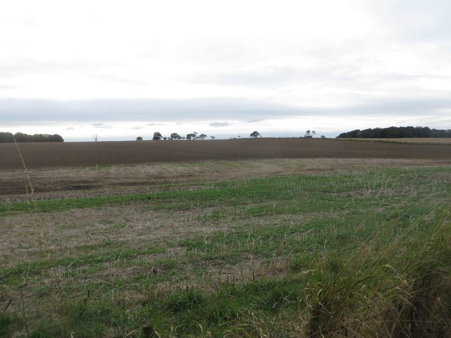
South Broomhill Images

Images are sourced within 2km of 55.29562/-1.6095405 or Grid Reference NU2400. Thanks to Geograph Open Source API. All images are credited.

Part of Ladyburn Lakr at Druridge Country Park Reedbeds, open water and plenty of fresh air.
Part of Ladyburn Lakr at Druridge Country Park
Reedbeds, open water and plenty of fresh air.
Grassy meadow at Druridge Country Park Nice to see.
Grassy meadow at Druridge Country Park
Nice to see.
Ladyburn Lake
Ladyburn Lake
Hadston The B1330 through Hadston.
Hadston
The B1330 through Hadston.
Cemetery 0.5km west of Hadston.
Cemetery
0.5km west of Hadston.
Red Row The B1330 at Red Row.
Red Row
The B1330 at Red Row.
Buildings at Woodside Farm
Rough grazing field
Rough grazing field
Dragline in semi-retirement?
The Brick Club, Red Row. The aptly named Brick Club in Red Row. Has been a social club for a long time, don't ask me how long, and continues although the coal mining industry which supported it for years has gone.
The Brick Club, Red Row.
The aptly named Brick Club in Red Row. Has been a social club for a long time, don't ask me how long, and continues although the coal mining industry which supported it for years has gone.
A Mouse on a wall An example of the Blacksmith's work on a wall outside his premises (The Blacksmith's not the Mouse). Opposite 'The Brick' referred to in another photo.
A Mouse on a wall
An example of the Blacksmith's work on a wall outside his premises (The Blacksmith's not the Mouse). Opposite 'The Brick' referred to in another photo.
Hebron Hall Red Row
Hebron Hall Red Row
Lakeside Footpath, Druridge Bay Looking along the path which follows the edge of Ladyburn Lake in Druridge Bay Country Park.
Lakeside Footpath, Druridge Bay
Looking along the path which follows the edge of Ladyburn Lake in Druridge Bay Country Park.
Hadston Health Centre Partially hidden behind trees is the health centre for the local community of Hadston and Broomhill.
Hadston Health Centre
Partially hidden behind trees is the health centre for the local community of Hadston and Broomhill.
Farmland on the edge of Hadston Arable land on the edge of Hadston. Part of the field has been cultivated following harvest.
Farmland on the edge of Hadston
Arable land on the edge of Hadston. Part of the field has been cultivated following harvest.
The Parish Church of St John the Divine, Chevington A parish church on the edge of Hadston.
The Parish Church of St John the Divine, Chevington
A parish church on the edge of Hadston.
Track, East Chevington Nature Reserve A wide track on the East Chevington Nature Reserve. The track is also a public bridleway.
Track, East Chevington Nature Reserve
A wide track on the East Chevington Nature Reserve. The track is also a public bridleway.
Road junction, Red Row A junction between one of the village's roads and the A1068 which passes to the east of the village.
Road junction, Red Row
A junction between one of the village's roads and the A1068 which passes to the east of the village.
Show me another place!

South Broomhill is located at Grid Ref: NU2400 (Lat: 55.29562, Lng: -1.6095405)

Unitary Authority: Northumberland

Police Authority: Northumbria

What 3 Words

///crowned.lookout.blackouts. Near Hadston, Northumberland

Related Wikis

Hadston

Hadston is a village and former civil parish, now in the parish of East Chevington, in Northumberland, England, about 2.5 miles (4 km) south of Amble....

East Chevington

East Chevington is a parish in Northumberland, England, and was a village until it disappeared in the 1900s.In 2001, the parish had a population of 3,192...

Broomhill (Northumberland) railway station

Broomhill railway station served the village of Broomhill in Northumberland, England, a former pit village. The station was on a short branch line of about...

Broomhill, Northumberland

Broomhill is a village in Northumberland, England. It lies to the south-west of Amble, a short distance inland from the North Sea. Broomhill is split into...

Nearby Amenities

Located within 500m of 55.29562,-1.6095405
Hadston
Place: village
Source: OS_OpenData_StreetView
Wikidata: Q5638103
Lat/Long: 55.2938879/-1.6026646
South Broomhill
Place: locality
Source: OS_OpenData_StreetView
Lat/Long: 55.2987391/-1.6129289
Noexit: yes
Lat/Long: 55.2972847/-1.6032202
Noexit: yes
Lat/Long: 55.2954812/-1.603467
Noexit: yes
Lat/Long: 55.2955778/-1.6061429
Noexit: yes
Lat/Long: 55.2951467/-1.6071056
Noexit: yes
Lat/Long: 55.2961184/-1.6032584
Noexit: yes
Lat/Long: 55.2978073/-1.6053288
Noexit: yes
Lat/Long: 55.294883/-1.6025691
Noexit: yes
Lat/Long: 55.2973065/-1.6062837
Noexit: yes
Lat/Long: 55.2972301/-1.6066217
Noexit: yes
Lat/Long: 55.2954696/-1.6072777
Noexit: yes
Lat/Long: 55.2971965/-1.6094648
Noexit: yes
Lat/Long: 55.2978043/-1.608923
Noexit: yes
Lat/Long: 55.297621/-1.6097652
Noexit: yes
Lat/Long: 55.2959897/-1.6079838
Noexit: yes
Lat/Long: 55.2957013/-1.6024086
Post Office
Hadston Post Office
Addr City: Hadston
Addr Housenumber: 16
Addr Postcode: NE65 9YF
Addr Street: The Precinct
Opening Hours: Mo-Sa 07:00-19:30; Su 07:00-12:30
Ref Pol Id: 141721
Source: OS_OpenData_StreetView
Lat/Long: 55.294419/-1.6038577
Noexit: yes
Lat/Long: 55.2931452/-1.6072928
Noexit: yes
Lat/Long: 55.2958873/-1.6060938
Chevington War Memorial
Historic: memorial
Lat/Long: 55.2922431/-1.607846
Fast Food
HFC Pizza
Addr Street: Hadston Road
Cuisine: pizza
Drive Through: no
Phone: +44 1670 762040
Source: survey
Takeaway: only
Lat/Long: 55.2941564/-1.6026484
Hadston Newsagency
Addr City: Hadston
Addr County: Northumberland
Addr Housenumber: 16
Addr Postcode: NE65 9YF
Addr Unit: The Precinct
Fhrs Id: 286116
Shop: newsagent
Source: survey
Lat/Long: 55.2940067/-1.6031047
Post Box
Brand: Royal Mail
Brand Wikidata: Q638098
Operator: Royal Mail
Operator Wikidata: Q638098
Post Box Type: lamp
Ref: NE65 96
Royal Cypher: EIIR
Royal Cypher Wikidata: Q33102113
Source: survey
Lat/Long: 55.2929006/-1.6080026
Community Centre
Druridge Bay Community Centre
Addr City: Hadston
Addr County: Northumberland
Addr Postcode: NE65 9YF
Addr Unit: The Precinct
Fhrs Id: 287907
Lat/Long: 55.2945151/-1.6041016
Shop: convenience
Lat/Long: 55.2942448/-1.6037127
Pharmacy
Boots Pharmacy
Brand Wikidata: Q6123139
Website: https://www.boots.com/stores/6242-hadston-precinct-ne65-9yf
Lat/Long: 55.2941715/-1.6036081
The Co-operative Food
Addr County: Northumberland
Addr Housename: The Precinct
Addr Postcode: NE65 9YF
Addr Unit: 7
Addr Village: Hadston
Brand: The Co-operative Food
Brand Wikidata: Q107617274
Fhrs Id: 285871
Operator: The Co-operative Group
Operator Wikidata: Q117202
Shop: convenience
Website: https://www.coop.co.uk/store-finder/NE65-9YF/hadston-estate
Lat/Long: 55.2940005/-1.6034579
Cafe
Krumbz
Addr City: Hadston
Addr County: Northumberland
Addr Housenumber: 4
Addr Postcode: NE65 9YF
Addr Unit: The Precinct
Fhrs Id: 486024
Lat/Long: 55.2943472/-1.6038093
Bench
Backrest: yes
Lat/Long: 55.293757/-1.6036401
Bench
Backrest: yes
Lat/Long: 55.2944084/-1.6040847
Waste Basket
Lat/Long: 55.2944295/-1.604037
Telephone
Lat/Long: 55.293853/-1.6033063
Bus Stop
Bench: no
Bin: no
Bus: yes
Covered: yes
Public Transport: platform
Shelter: yes
Lat/Long: 55.2939003/-1.6031721
Waste Basket
Lat/Long: 55.2940999/-1.6026156
Chisholm Bookmakers
Addr Street: Hadston Road
Shop: bookmaker
Lat/Long: 55.2940864/-1.6028798
Post Box
Ref: NE65 75
Lat/Long: 55.2943755/-1.6039373
S & J Partners
Shop: car_repair
Lat/Long: 55.297612/-1.6094301
Priority: backward
Traffic Calming: chicane
Lat/Long: 55.2934101/-1.6084175
Bus: yes
Bus Bay: left
Public Transport: stop_position
Lat/Long: 55.2933428/-1.6029013
Bus Stop
Hadston, Hadston Road End
Bench: yes
Bin: yes
Bus: yes
Departures Board: timetable
Public Transport: platform
Shelter: yes
Lat/Long: 55.2929566/-1.6082022
Bus Stop
Hadston, Hadston Road End
Bench: yes
Bin: yes
Bus: yes
Departures Board: timetable
Public Transport: platform
Shelter: yes
Lat/Long: 55.2923786/-1.6076656
Noexit: yes
Lat/Long: 55.2982194/-1.6103992
Generator Method: photovoltaic
Generator Output Electricity: yes
Generator Source: solar
Generator Type: solar_photovoltaic_panel
Location: roof
Power: generator
Lat/Long: 55.2928661/-1.6074562
Generator Method: photovoltaic
Generator Output Electricity: yes
Generator Source: solar
Generator Type: solar_photovoltaic_panel
Location: roof
Power: generator
Lat/Long: 55.2931495/-1.6068541
Generator Method: photovoltaic
Generator Output Electricity: yes
Generator Source: solar
Generator Type: solar_photovoltaic_panel
Location: roof
Power: generator
Lat/Long: 55.2932731/-1.6064228
Generator Method: photovoltaic
Generator Output Electricity: yes
Generator Source: solar
Generator Type: solar_photovoltaic_panel
Location: roof
Power: generator
Lat/Long: 55.2934775/-1.6060465
Generator Method: photovoltaic
Generator Output Electricity: yes
Generator Source: solar
Generator Type: solar_photovoltaic_panel
Location: roof
Power: generator
Lat/Long: 55.2933836/-1.6053374
Generator Method: photovoltaic
Generator Output Electricity: yes
Generator Source: solar
Generator Type: solar_photovoltaic_panel
Location: roof
Power: generator
Lat/Long: 55.293583/-1.6045153
Generator Method: photovoltaic
Generator Output Electricity: yes
Generator Source: solar
Generator Type: solar_photovoltaic_panel
Location: roof
Power: generator
Lat/Long: 55.2936341/-1.6043764
Generator Method: photovoltaic
Generator Output Electricity: yes
Generator Source: solar
Generator Type: solar_photovoltaic_panel
Location: roof
Power: generator
Lat/Long: 55.293672/-1.604249
Generator Method: photovoltaic
Generator Output Electricity: yes
Generator Source: solar
Generator Type: solar_photovoltaic_panel
Location: roof
Power: generator
Lat/Long: 55.2937099/-1.604113
Generator Method: photovoltaic
Generator Output Electricity: yes
Generator Source: solar
Generator Type: solar_photovoltaic_panel
Location: roof
Power: generator
Lat/Long: 55.2937165/-1.6046051
Generator Method: photovoltaic
Generator Output Electricity: yes
Generator Source: solar
Generator Type: solar_photovoltaic_panel
Location: roof
Power: generator
Lat/Long: 55.2937824/-1.6046745
Generator Method: photovoltaic
Generator Output Electricity: yes
Generator Source: solar
Generator Type: solar_photovoltaic_panel
Location: roof
Power: generator
Lat/Long: 55.2939208/-1.6054705
Generator Method: photovoltaic
Generator Output Electricity: yes
Generator Source: solar
Generator Type: solar_photovoltaic_panel
Location: roof
Power: generator
Lat/Long: 55.2944977/-1.6020215
Generator Method: photovoltaic
Generator Output Electricity: yes
Generator Source: solar
Generator Type: solar_photovoltaic_panel
Location: roof
Power: generator
Lat/Long: 55.2955026/-1.603144
Generator Method: photovoltaic
Generator Output Electricity: yes
Generator Source: solar
Generator Type: solar_photovoltaic_panel
Location: roof
Power: generator
Lat/Long: 55.2953819/-1.6026827
Generator Method: photovoltaic
Generator Output Electricity: yes
Generator Source: solar
Generator Type: solar_photovoltaic_panel
Location: roof
Power: generator
Lat/Long: 55.295866/-1.6024145
Generator Method: photovoltaic
Generator Output Electricity: yes
Generator Source: solar
Generator Type: solar_photovoltaic_panel
Location: roof
Power: generator
Lat/Long: 55.295892/-1.602452
Generator Method: photovoltaic
Generator Output Electricity: yes
Generator Source: solar
Generator Type: solar_photovoltaic_panel
Location: roof
Power: generator
Lat/Long: 55.2944993/-1.6055875
Generator Method: photovoltaic
Generator Output Electricity: yes
Generator Source: solar
Generator Type: solar_photovoltaic_panel
Location: roof
Power: generator
Lat/Long: 55.2941312/-1.6057646
Generator Method: photovoltaic
Generator Output Electricity: yes
Generator Source: solar
Generator Type: solar_photovoltaic_panel
Location: roof
Power: generator
Lat/Long: 55.2939235/-1.6065317
Generator Method: photovoltaic
Generator Output Electricity: yes
Generator Source: solar
Generator Type: solar_photovoltaic_panel
Location: roof
Power: generator
Lat/Long: 55.2961245/-1.6072075
Noexit: yes
Lat/Long: 55.2976446/-1.6102764
Bus Stop
Lat/Long: 55.293326/-1.6028036
Bus Stop
Bench: no
Bus: yes
Naptan AtcoCode: 3100U247004
Naptan NaptanCode: nldajtpw
Public Transport: platform
Shelter: no
Lat/Long: 55.297838/-1.6112528
Bus Stop
Bus: yes
Naptan AtcoCode: 3100U248003
Naptan NaptanCode: nldatmta
Public Transport: platform
Lat/Long: 55.2967492/-1.6102077
Generator Method: photovoltaic
Generator Output Electricity: yes
Generator Source: solar
Generator Type: solar_photovoltaic_panel
Location: roof
Power: generator
Lat/Long: 55.2956617/-1.6019976
Generator Method: photovoltaic
Generator Output Electricity: yes
Generator Source: solar
Generator Type: solar_photovoltaic_panel
Location: roof
Power: generator
Lat/Long: 55.2955823/-1.6022658
Generator Method: photovoltaic
Generator Output Electricity: yes
Generator Source: solar
Generator Type: solar_photovoltaic_panel
Location: roof
Power: generator
Lat/Long: 55.295364/-1.6019748
Generator Method: photovoltaic
Generator Output Electricity: yes
Generator Source: solar
Generator Type: solar_photovoltaic_panel
Location: roof
Power: generator
Lat/Long: 55.2952594/-1.6022149
Generator Method: photovoltaic
Generator Output Electricity: yes
Generator Source: solar
Generator Type: solar_photovoltaic_panel
Location: roof
Power: generator
Lat/Long: 55.2951372/-1.6017951
Generator Method: photovoltaic
Generator Output Electricity: yes
Generator Source: solar
Generator Type: solar_photovoltaic_panel
Location: roof
Power: generator
Lat/Long: 55.2948001/-1.6020814
Generator Method: photovoltaic
Generator Output Electricity: yes
Generator Source: solar
Generator Type: solar_photovoltaic_panel
Location: roof
Power: generator
Lat/Long: 55.2947852/-1.6021357
Generator Method: photovoltaic
Generator Output Electricity: yes
Generator Source: solar
Generator Type: solar_photovoltaic_panel
Location: roof
Power: generator
Lat/Long: 55.2947314/-1.6025052
Generator Method: photovoltaic
Generator Output Electricity: yes
Generator Source: solar
Generator Type: solar_photovoltaic_panel
Location: roof
Power: generator
Lat/Long: 55.294747/-1.6027513
Generator Method: photovoltaic
Generator Output Electricity: yes
Generator Source: solar
Generator Type: solar_photovoltaic_panel
Location: roof
Power: generator
Lat/Long: 55.2949516/-1.6030008
Generator Method: photovoltaic
Generator Output Electricity: yes
Generator Source: solar
Generator Type: solar_photovoltaic_panel
Location: roof
Power: generator
Lat/Long: 55.2950814/-1.6026843
Noexit: yes
Lat/Long: 55.2928381/-1.6048166
The data included in this document is from www.openstreetmap.org. The data is made available under ODbL.

Have you been to South Broomhill?

Leave your review of South Broomhill below (or comments, questions and feedback).