South Brent

Settlement in Devon South Hams

England

South Brent

Old Milestone in Aish village, South Brent Carved stone post by the UC road, in parish of South Brent (South Hams District), Aish, centre of village, by "Long Barn", opposite "Treeby", 15m South of telephone/post box, on grass verge by gate to Long Barn, on South West side of road. Small granite tombstone, erected by the parish in the 19th century.

Inscription reads:-
8
MILES
FROM
TOTNES

Milestone Society National ID: DV_TNAI08
Old Milestone in Aish village, South Brent Credit: Max Piper

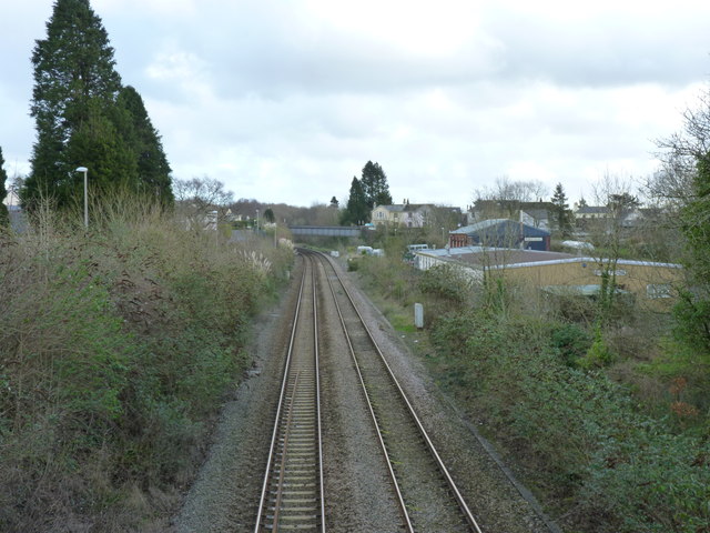
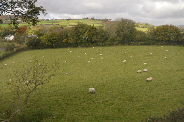
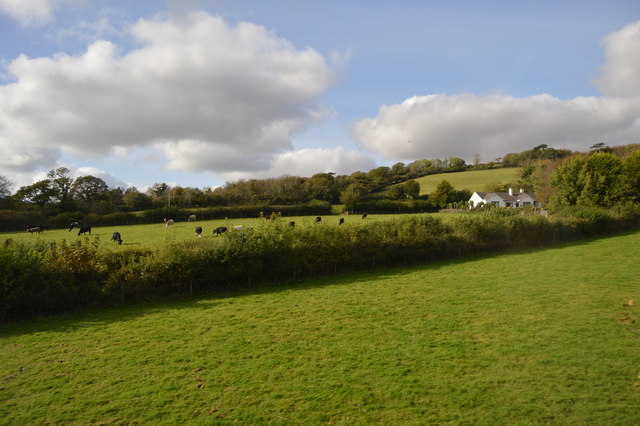
South Brent is a picturesque village located in the county of Devon, England. Nestled on the southern edge of Dartmoor National Park, it offers breathtaking views of the surrounding countryside and is a popular destination for nature enthusiasts and outdoor enthusiasts alike.

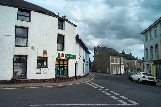
The village itself is small but vibrant, with a population of around 2,000 residents. It has a charming and tight-knit community, with a range of local amenities and services to cater to the needs of its residents. The village boasts a primary school, a post office, a grocery store, and a selection of shops, cafes, and pubs.

South Brent is steeped in history, with evidence of human habitation dating back to the Bronze Age. It has a number of historic buildings, including the 13th-century Church of St. Petroc, which is renowned for its beautiful stained glass windows and medieval architecture.

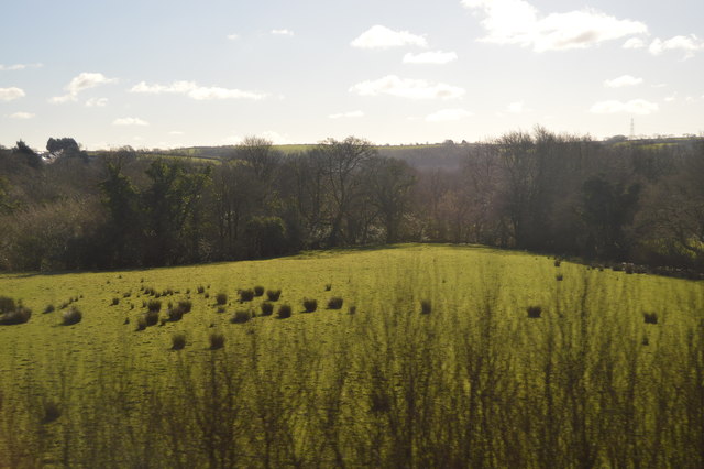
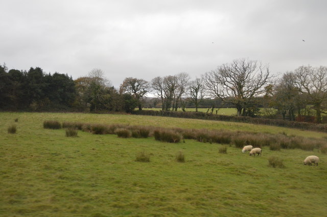
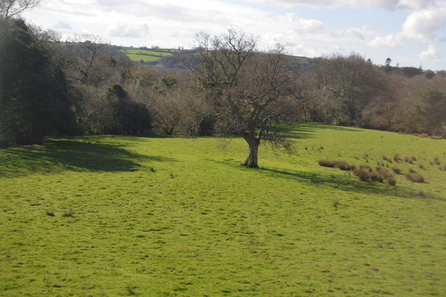
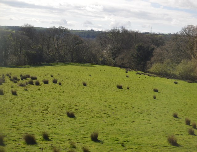
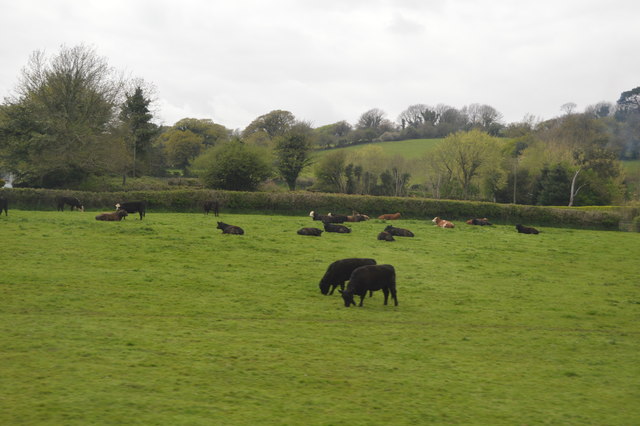
One of the main attractions of South Brent is its proximity to Dartmoor National Park. The park is a vast moorland known for its rugged landscapes, ancient woodlands, and diverse wildlife. It offers a range of outdoor activities, such as hiking, cycling, and horse riding, making it a haven for adventure seekers and nature lovers.

Overall, South Brent is a charming village that offers a peaceful and idyllic setting for residents and visitors alike. With its stunning natural surroundings and strong sense of community, it is a place that captures the essence of rural Devon.

If you have any feedback on the listing, please let us know in the comments section below.
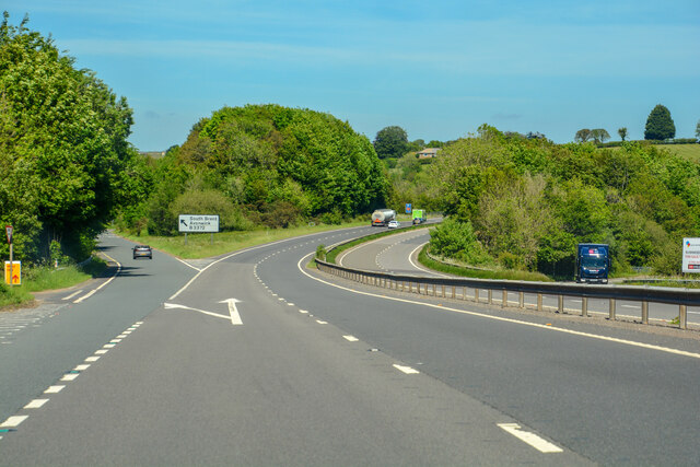
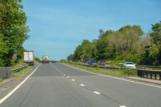
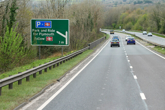
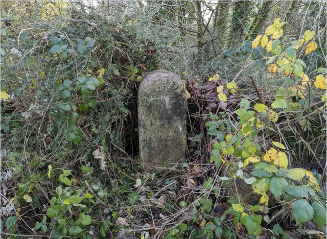
South Brent Images

Images are sourced within 2km of 50.426445/-3.834574 or Grid Reference SX6960. Thanks to Geograph Open Source API. All images are credited.

Old Milestone in Aish village, South Brent Carved stone post by the UC road, in parish of South Brent (South Hams District), Aish, centre of village, by "Long Barn", opposite "Treeby", 15m South of telephone/post box, on grass verge by gate to Long Barn, on South West side of road. Small granite tombstone, erected by the parish in the 19th century.

Inscription reads:-
8
MILES
FROM
TOTNES

Milestone Society National ID: DV_TNAI08
Old Milestone in Aish village, South Brent
Carved stone post by the UC road, in parish of South Brent (South Hams District), Aish, centre of village, by "Long Barn", opposite "Treeby", 15m South of telephone/post box, on grass verge by gate to Long Barn, on South West side of road. Small granite tombstone, erected by the parish in the 19th century. Inscription reads:- 8 MILES FROM TOTNES Milestone Society National ID: DV_TNAI08
Bridge over the Devon Expressway near South Brent The A38 is a major A-class trunk route. When first designated in 1922, it ran from Derby to Plymouth but it was later extended at both ends so that it now runs for 292 miles from Mansfield in Nottinghamshire to Bodmin in Cornwall.

Prior to the opening of the M5 motorway in the 1960s and 1970s, the A38 formed the main "holiday route" from the Midlands to Somerset, Devon and Cornwall and the south-western section was notorious at holiday times for the congestion. Nowadays, for most of the southern section, the A38 is a fairly quiet road shadowing the M5 extremely closely; often running alongside the motorway as a single carriageway road. The section between Exeter and Plymouth is, however, a busy dual carriageway which serves as the southern extension of the M5 and is known as “the Devon Expressway”.

More information at <span class="nowrap"><a title="http://en.wikipedia.org/wiki/A38_road" rel="nofollow ugc noopener" href="http://en.wikipedia.org/wiki/A38_road">Link</a><img style="margin-left:2px;" alt="External link" title="External link - shift click to open in new window" src="https://s1.geograph.org.uk/img/external.png" width="10" height="10"/></span>  (Wikipedia) and <span class="nowrap"><a title="http://www.sabre-roads.org.uk/wiki/index.php?title=A38" rel="nofollow ugc noopener" href="http://www.sabre-roads.org.uk/wiki/index.php?title=A38">Link</a><img style="margin-left:2px;" alt="External link" title="External link - shift click to open in new window" src="https://s1.geograph.org.uk/img/external.png" width="10" height="10"/></span>  (SABRE).
Bridge over the Devon Expressway near South Brent
The A38 is a major A-class trunk route. When first designated in 1922, it ran from Derby to Plymouth but it was later extended at both ends so that it now runs for 292 miles from Mansfield in Nottinghamshire to Bodmin in Cornwall. Prior to the opening of the M5 motorway in the 1960s and 1970s, the A38 formed the main "holiday route" from the Midlands to Somerset, Devon and Cornwall and the south-western section was notorious at holiday times for the congestion. Nowadays, for most of the southern section, the A38 is a fairly quiet road shadowing the M5 extremely closely; often running alongside the motorway as a single carriageway road. The section between Exeter and Plymouth is, however, a busy dual carriageway which serves as the southern extension of the M5 and is known as “the Devon Expressway”. More information at LinkExternal link (Wikipedia) and LinkExternal link (SABRE).
Devon Expressway near to South Brent The A38 is a major A-class trunk route. When first designated in 1922, it ran from Derby to Plymouth but it was later extended at both ends so that it now runs for 292 miles from Mansfield in Nottinghamshire to Bodmin in Cornwall.

Prior to the opening of the M5 motorway in the 1960s and 1970s, the A38 formed the main "holiday route" from the Midlands to Somerset, Devon and Cornwall and the south-western section was notorious at holiday times for the congestion. Nowadays, for most of the southern section, the A38 is a fairly quiet road shadowing the M5 extremely closely; often running alongside the motorway as a single carriageway road. The section between Exeter and Plymouth is, however, a busy dual carriageway which serves as the southern extension of the M5 and is known as “the Devon Expressway”.

More information at <span class="nowrap"><a title="http://en.wikipedia.org/wiki/A38_road" rel="nofollow ugc noopener" href="http://en.wikipedia.org/wiki/A38_road">Link</a><img style="margin-left:2px;" alt="External link" title="External link - shift click to open in new window" src="https://s1.geograph.org.uk/img/external.png" width="10" height="10"/></span>  (Wikipedia) and <span class="nowrap"><a title="http://www.sabre-roads.org.uk/wiki/index.php?title=A38" rel="nofollow ugc noopener" href="http://www.sabre-roads.org.uk/wiki/index.php?title=A38">Link</a><img style="margin-left:2px;" alt="External link" title="External link - shift click to open in new window" src="https://s1.geograph.org.uk/img/external.png" width="10" height="10"/></span>  (SABRE).
Devon Expressway near to South Brent
The A38 is a major A-class trunk route. When first designated in 1922, it ran from Derby to Plymouth but it was later extended at both ends so that it now runs for 292 miles from Mansfield in Nottinghamshire to Bodmin in Cornwall. Prior to the opening of the M5 motorway in the 1960s and 1970s, the A38 formed the main "holiday route" from the Midlands to Somerset, Devon and Cornwall and the south-western section was notorious at holiday times for the congestion. Nowadays, for most of the southern section, the A38 is a fairly quiet road shadowing the M5 extremely closely; often running alongside the motorway as a single carriageway road. The section between Exeter and Plymouth is, however, a busy dual carriageway which serves as the southern extension of the M5 and is known as “the Devon Expressway”. More information at LinkExternal link (Wikipedia) and LinkExternal link (SABRE).
Old Bridge Marker northeast of Glazebrook Bridge, South Brent County Bridge Marker on the northwest side of the road 98 metres northeast of Glazebrook Bridge, Glaze Brook. South Brent parish. Inscribed C, it marks the extent of roadway adjoining the bridge that the County was obliged to maintain.

Milestone Society National ID: DV_SBGB01br
Old Bridge Marker northeast of Glazebrook Bridge, South Brent
County Bridge Marker on the northwest side of the road 98 metres northeast of Glazebrook Bridge, Glaze Brook. South Brent parish. Inscribed C, it marks the extent of roadway adjoining the bridge that the County was obliged to maintain. Milestone Society National ID: DV_SBGB01br
Old Bridge Marker southwest of Glazebrook Bridge, Ugborough County Bridge Marker on the northwest side of the road 90 metres southwest of Glazebrook Bridge, Glaze Brook. Ugborough parish. Inscribed C, it marks the extent of roadway adjoining the bridge that the County was obliged to maintain.

Milestone Society National ID: DV_SBGB02br
Old Bridge Marker southwest of Glazebrook Bridge, Ugborough
County Bridge Marker on the northwest side of the road 90 metres southwest of Glazebrook Bridge, Glaze Brook. Ugborough parish. Inscribed C, it marks the extent of roadway adjoining the bridge that the County was obliged to maintain. Milestone Society National ID: DV_SBGB02br
South Brent : Devon Expressway A38 Looking along the A38.
South Brent : Devon Expressway A38
Looking along the A38.
South Brent : Devon Expressway A38 Looking along the A38.
South Brent : Devon Expressway A38
Looking along the A38.
A38 Devon Expressway near South Brent The A38 is a major A-class trunk route. When first designated in 1922, it ran from Derby to Plymouth but it was later extended at both ends so that it now runs for 292 miles from Mansfield in Nottinghamshire to Bodmin in Cornwall.

Prior to the opening of the M5 motorway in the 1960s and 1970s, the A38 formed the main "holiday route" from the Midlands to Somerset, Devon and Cornwall and the south-western section was notorious at holiday times for the congestion. Nowadays, for most of the southern section, the A38 is a fairly quiet road shadowing the M5 extremely closely; often running alongside the motorway as a single carriageway road. The section between Exeter and Plymouth is, however, a busy dual carriageway which serves as the southern extension of the M5 and is known as “the Devon Expressway”.

More information at <span class="nowrap"><a title="http://en.wikipedia.org/wiki/A38_road" rel="nofollow ugc noopener" href="http://en.wikipedia.org/wiki/A38_road">Link</a><img style="margin-left:2px;" alt="External link" title="External link - shift click to open in new window" src="https://s1.geograph.org.uk/img/external.png" width="10" height="10"/></span>  (Wikipedia) and <span class="nowrap"><a title="http://www.sabre-roads.org.uk/wiki/index.php?title=A38" rel="nofollow ugc noopener" href="http://www.sabre-roads.org.uk/wiki/index.php?title=A38">Link</a><img style="margin-left:2px;" alt="External link" title="External link - shift click to open in new window" src="https://s1.geograph.org.uk/img/external.png" width="10" height="10"/></span>  (SABRE).
A38 Devon Expressway near South Brent
The A38 is a major A-class trunk route. When first designated in 1922, it ran from Derby to Plymouth but it was later extended at both ends so that it now runs for 292 miles from Mansfield in Nottinghamshire to Bodmin in Cornwall. Prior to the opening of the M5 motorway in the 1960s and 1970s, the A38 formed the main "holiday route" from the Midlands to Somerset, Devon and Cornwall and the south-western section was notorious at holiday times for the congestion. Nowadays, for most of the southern section, the A38 is a fairly quiet road shadowing the M5 extremely closely; often running alongside the motorway as a single carriageway road. The section between Exeter and Plymouth is, however, a busy dual carriageway which serves as the southern extension of the M5 and is known as “the Devon Expressway”. More information at LinkExternal link (Wikipedia) and LinkExternal link (SABRE).
Old Milestone by Brentmill Bridge, South Brent Carved stone post by the B3372 (was A38), in parish of South Brent (South Hams District), East end of Brentmill Bridge, just off B3372, near old toll house, on muddy verge by small gate, on South side of road. Ashburton tombstone, erected by the Ashburton (Ashburton & Totnes Consolidated) turnpike trust in the 19th century.

Inscription reads:-
BRENT
FROM
ASH
BURTON
VIII
M(ILES)

Devon & Dartmoor HER.
HER Number: MDV3131 <span class="nowrap"><a title="https://www.heritagegateway.org.uk/Gateway/Results_Single.aspx?uid=MDV3131&resourceID=104" rel="nofollow ugc noopener" href="https://www.heritagegateway.org.uk/Gateway/Results_Single.aspx?uid=MDV3131&resourceID=104">Link</a><img style="margin-left:2px;" alt="External link" title="External link - shift click to open in new window" src="https://s1.geograph.org.uk/img/external.png" width="10" height="10"/></span>

Milestone Society National ID: DV_PLEX16
Old Milestone by Brentmill Bridge, South Brent
Carved stone post by the B3372 (was A38), in parish of South Brent (South Hams District), East end of Brentmill Bridge, just off B3372, near old toll house, on muddy verge by small gate, on South side of road. Ashburton tombstone, erected by the Ashburton (Ashburton & Totnes Consolidated) turnpike trust in the 19th century. Inscription reads:- BRENT FROM ASH BURTON VIII M(ILES) Devon & Dartmoor HER. HER Number: MDV3131 LinkExternal link Milestone Society National ID: DV_PLEX16
View towards the site of the old Brent Station This view changed fairly recently with the demolition of the old signal box.  It deserved a better fate.
View towards the site of the old Brent Station
This view changed fairly recently with the demolition of the old signal box. It deserved a better fate.
Sheep grazing
Sheep grazing
Farmland near South Brent
Ordnance Survey 1G Bolt This OS Bolt can be found on the west face of St Petroc's Church. It marks a point 121.1732m above mean sea level.
Ordnance Survey 1G Bolt
This OS Bolt can be found on the west face of St Petroc's Church. It marks a point 121.1732m above mean sea level.
Farmland near South Brent
Rough grazing
Rough grazing
Single tree
Single tree
Rough grazing
Rough grazing
Cattle
Cattle
Show me another place!

South Brent is located at Grid Ref: SX6960 (Lat: 50.426445, Lng: -3.834574)

Administrative County: Devon

District: South Hams

Police Authority: Devon and Cornwall

What 3 Words

///lawful.racked.gobblers. Near South Brent, Devon

Related Wikis

South Brent

South Brent is a large village on the southern edge of Dartmoor, England, in the valley of the River Avon. The parish includes the small hamlets of Aish...

Aish, South Brent

Aish is a relatively small hamlet in the English county of Devon. It is near the large village of South Brent. This Aish is not to be confused with the...

Lutton, South Brent

Lutton is a small farming hamlet on the outskirts of South Brent, Devon, England. It is a hillside community on the side of Brent Hill. It is only a small...

Glazebrook House, South Brent

Glazebrook House is a building of historical significance in South Brent, Devon. Part of the house was built in about 1650 and was successively added to...

Nearby Amenities

Located within 500m of 50.426445,-3.834574
Post Office
South Brent Post Office
Addr City: South Brent
Addr Housename: South Brent Old School Community Centre
Addr Postcode: TQ10 9BP
Addr Street: Totnes Road
Opening Hours: Mo,We,Fr 09:00-12:00
Ref Pol Id: 146934
Source: pol_branch_list_2020‑11‑13
Lat/Long: 50.4257052/-3.8334641
Source: OS OpenData StreetView
Lat/Long: 50.4241212/-3.8288485
Barrier: stile
Lat/Long: 50.4303904/-3.8340692
Barrier: stile
Lat/Long: 50.4296312/-3.8333641
Pub
The Pack Horse Inn
Guest House: bed_and_breakfast
Tourism: guest_house
Wikidata: Q79837849
Lat/Long: 50.4261732/-3.8341314
Cafe
Station House
Guest House: bed_and_breakfast
Opening Hours Covid19: restricted
Status: open
Tourism: guest_house
Wikidata: Q80476288
Lat/Long: 50.4271232/-3.8339463
Pharmacy
South Brent Pharmacy
Addr City: South Brent
Addr Housenumber: 7
Addr Postcode: TQ10 9AB
Addr Street: Church Street
Healthcare: pharmacy
Lat/Long: 50.4266687/-3.8349709
Co-op Food
Addr Housenumber: 2-4
Addr Postcode: TQ10 9AB
Addr Street: Church Street
Brand: Co-op Food
Brand Wikidata: Q3277439
Operator: The Co-operative Group
Operator Wikidata: Q117202
Shop: supermarket
Website: https://www.coop.co.uk/store-finder/TQ10-9AB/2-4-church-street
Lat/Long: 50.426438/-3.8349226
Fogg's
Shop: greengrocer
Lat/Long: 50.4269506/-3.8341554
South Brent Butchers
Shop: butcher
Lat/Long: 50.426402/-3.8346838
South Brent Flowers
Shop: florist
Lat/Long: 50.4266174/-3.8347617
Barrier: kissing_gate
Lat/Long: 50.4286757/-3.8365621
Recycling
Lat/Long: 50.4277861/-3.8341872
South Brent
Place: village
Lat/Long: 50.4265047/-3.8343345
Telephone
Booth: K6
Check Date: 2022-10-02
Covered: booth
Listed Status: Grade II
Operator: BT
Payment Coins: yes
Payment Credit Cards: yes
Lat/Long: 50.4265489/-3.8346043
Bus Stop
Bus: yes
Naptan AtcoCode: 1100DEA10369
Naptan NaptanCode: dvnatwjg
Public Transport: platform
Lat/Long: 50.4246747/-3.8289212
Bus Stop
Bus: yes
Public Transport: platform
Lat/Long: 50.4245459/-3.8289637
Bus Stop
South Brent London Road
Bus: yes
Naptan AtcoCode: 1100DEA10364
Naptan NaptanCode: dvnatwgj
Operator: Stagecoach South West
Public Transport: platform
Lat/Long: 50.4229655/-3.8308827
Post Box
Brand: Royal Mail
Brand Wikidata: Q638098
Brand Wikipedia: en:Royal Mail
Collection Times: Mo-Fr 09:00; Sa 07:00; Su off
Drive Through: no
Operator: Royal Mail
Operator Wikidata: Q638098
Post Box Design: 2010_pattern
Post Box Mounting: pier
Post Box Type: lamp
Ref: TQ10 125D
Royal Cypher: EIIR
Royal Cypher Wikidata: Q33102113
Source: survey;streetlevel imagery;aerial imagery
Lat/Long: 50.4247305/-3.8288785
Cafe
The Rowan Tree
Outdoor Seating: no
Lat/Long: 50.4266623/-3.834428
Toilets
Access: yes
Operator: South Brent Parish Council
Unisex: yes
Wheelchair: yes
Lat/Long: 50.4260588/-3.8347791
Generator Method: photovoltaic
Generator Output Electricity: yes
Generator Source: solar
Generator Type: solar_photovoltaic_panel
Location: roof
Power: generator
Lat/Long: 50.4287149/-3.8323289
Generator Method: photovoltaic
Generator Output Electricity: yes
Generator Source: solar
Generator Type: solar_photovoltaic_panel
Location: roof
Power: generator
Lat/Long: 50.4289507/-3.8324952
Generator Method: photovoltaic
Generator Output Electricity: yes
Generator Source: solar
Generator Type: solar_photovoltaic_panel
Location: roof
Power: generator
Lat/Long: 50.4290188/-3.8319616
Generator Method: photovoltaic
Generator Output Electricity: yes
Generator Source: solar
Generator Type: solar_photovoltaic_panel
Location: roof
Power: generator
Lat/Long: 50.4290324/-3.8318771
Generator Method: photovoltaic
Generator Output Electricity: yes
Generator Source: solar
Generator Type: solar_photovoltaic_panel
Location: roof
Power: generator
Lat/Long: 50.4292426/-3.8323921
Generator Method: photovoltaic
Generator Output Electricity: yes
Generator Source: solar
Generator Type: solar_photovoltaic_panel
Location: roof
Power: generator
Lat/Long: 50.427952/-3.8319938
Generator Method: photovoltaic
Generator Output Electricity: yes
Generator Source: solar
Generator Type: solar_photovoltaic_panel
Location: roof
Power: generator
Lat/Long: 50.4277265/-3.831739
Generator Method: photovoltaic
Generator Output Electricity: yes
Generator Source: solar
Generator Type: solar_photovoltaic_panel
Location: roof
Power: generator
Lat/Long: 50.428412/-3.8328696
Generator Method: photovoltaic
Generator Output Electricity: yes
Generator Source: solar
Generator Type: solar_photovoltaic_panel
Location: roof
Power: generator
Lat/Long: 50.4267853/-3.8304395
Generator Method: photovoltaic
Generator Output Electricity: yes
Generator Source: solar
Generator Type: solar_photovoltaic_panel
Location: roof
Power: generator
Lat/Long: 50.4267665/-3.8303724
Generator Method: photovoltaic
Generator Output Electricity: yes
Generator Source: solar
Generator Type: solar_photovoltaic_panel
Location: roof
Power: generator
Lat/Long: 50.4267153/-3.830249
Generator Method: photovoltaic
Generator Output Electricity: yes
Generator Source: solar
Generator Type: solar_photovoltaic_panel
Location: roof
Power: generator
Lat/Long: 50.4266777/-3.8301847
Generator Method: photovoltaic
Generator Output Electricity: yes
Generator Source: solar
Generator Type: solar_photovoltaic_panel
Location: roof
Power: generator
Lat/Long: 50.4266196/-3.8300532
Generator Method: photovoltaic
Generator Output Electricity: yes
Generator Source: solar
Generator Type: solar_photovoltaic_panel
Location: roof
Power: generator
Lat/Long: 50.4264931/-3.829903
Generator Method: photovoltaic
Generator Output Electricity: yes
Generator Source: solar
Generator Type: solar_photovoltaic_panel
Location: roof
Power: generator
Lat/Long: 50.4264914/-3.8298279
Generator Method: photovoltaic
Generator Output Electricity: yes
Generator Source: solar
Generator Type: solar_photovoltaic_panel
Location: roof
Power: generator
Lat/Long: 50.4265444/-3.8305548
Generator Method: photovoltaic
Generator Output Electricity: yes
Generator Source: solar
Generator Type: solar_photovoltaic_panel
Location: roof
Power: generator
Lat/Long: 50.4265188/-3.8304985
Generator Method: photovoltaic
Generator Output Electricity: yes
Generator Source: solar
Generator Type: solar_photovoltaic_panel
Location: roof
Power: generator
Lat/Long: 50.426459/-3.8303724
Generator Method: photovoltaic
Generator Output Electricity: yes
Generator Source: solar
Generator Type: solar_photovoltaic_panel
Location: roof
Power: generator
Lat/Long: 50.4264282/-3.8303215
Generator Method: photovoltaic
Generator Output Electricity: yes
Generator Source: solar
Generator Type: solar_photovoltaic_panel
Location: roof
Power: generator
Lat/Long: 50.4264094/-3.8305897
Generator Method: photovoltaic
Generator Output Electricity: yes
Generator Source: solar
Generator Type: solar_photovoltaic_panel
Location: roof
Power: generator
Lat/Long: 50.4263769/-3.8306299
Generator Method: photovoltaic
Generator Output Electricity: yes
Generator Source: solar
Generator Type: solar_photovoltaic_panel
Location: roof
Power: generator
Lat/Long: 50.4264231/-3.8310832
Generator Method: photovoltaic
Generator Output Electricity: yes
Generator Source: solar
Generator Type: solar_photovoltaic_panel
Location: roof
Power: generator
Lat/Long: 50.4264026/-3.8310457
Generator Method: photovoltaic
Generator Output Electricity: yes
Generator Source: solar
Generator Type: solar_photovoltaic_panel
Location: roof
Power: generator
Lat/Long: 50.4263154/-3.8301605
Generator Method: photovoltaic
Generator Output Electricity: yes
Generator Source: solar
Generator Type: solar_photovoltaic_panel
Location: roof
Power: generator
Lat/Long: 50.4262795/-3.8301847
Generator Method: photovoltaic
Generator Output Electricity: yes
Generator Source: solar
Generator Type: solar_photovoltaic_panel
Location: roof
Power: generator
Lat/Long: 50.426042/-3.8303751
Generator Method: photovoltaic
Generator Output Electricity: yes
Generator Source: solar
Generator Type: solar_photovoltaic_panel
Location: roof
Power: generator
Lat/Long: 50.4263052/-3.8308257
Generator Method: photovoltaic
Generator Output Electricity: yes
Generator Source: solar
Generator Type: solar_photovoltaic_panel
Location: roof
Power: generator
Lat/Long: 50.426312/-3.8308981
Generator Method: photovoltaic
Generator Output Electricity: yes
Generator Source: solar
Generator Type: solar_photovoltaic_panel
Location: roof
Power: generator
Lat/Long: 50.4262847/-3.8285445
Generator Method: photovoltaic
Generator Output Electricity: yes
Generator Source: solar
Generator Type: solar_photovoltaic_panel
Location: roof
Power: generator
Lat/Long: 50.4259626/-3.8287711
Generator Method: photovoltaic
Generator Output Electricity: yes
Generator Source: solar
Generator Type: solar_photovoltaic_panel
Location: roof
Power: generator
Lat/Long: 50.4237221/-3.8293062
Generator Method: photovoltaic
Generator Output Electricity: yes
Generator Source: solar
Generator Type: solar_photovoltaic_panel
Location: roof
Power: generator
Lat/Long: 50.4237452/-3.8293384
Generator Method: photovoltaic
Generator Output Electricity: yes
Generator Source: solar
Generator Type: solar_photovoltaic_panel
Location: roof
Power: generator
Lat/Long: 50.4234197/-3.8329607
Generator Method: photovoltaic
Generator Output Electricity: yes
Generator Source: solar
Generator Type: solar_photovoltaic_panel
Location: roof
Power: generator
Lat/Long: 50.4240161/-3.832891
Generator Method: photovoltaic
Generator Output Electricity: yes
Generator Source: solar
Generator Type: solar_photovoltaic_panel
Location: roof
Power: generator
Lat/Long: 50.4239306/-3.8334972
Generator Method: photovoltaic
Generator Output Electricity: yes
Generator Source: solar
Generator Type: solar_photovoltaic_panel
Location: roof
Power: generator
Lat/Long: 50.4247662/-3.8324431
Generator Method: photovoltaic
Generator Output Electricity: yes
Generator Source: solar
Generator Type: solar_photovoltaic_panel
Location: roof
Power: generator
Lat/Long: 50.4256001/-3.8340122
Generator Method: photovoltaic
Generator Output Electricity: yes
Generator Source: solar
Generator Type: solar_photovoltaic_panel
Location: roof
Power: generator
Lat/Long: 50.4251766/-3.8305955
Generator Method: photovoltaic
Generator Output Electricity: yes
Generator Source: solar
Generator Type: solar_photovoltaic_panel
Location: roof
Power: generator
Lat/Long: 50.425219/-3.8306607
Generator Method: photovoltaic
Generator Output Electricity: yes
Generator Source: solar
Generator Type: solar_photovoltaic_panel
Location: roof
Power: generator
Lat/Long: 50.4240159/-3.8307644
Generator Method: photovoltaic
Generator Output Electricity: yes
Generator Source: solar
Generator Type: solar_photovoltaic_panel
Location: roof
Power: generator
Lat/Long: 50.4236185/-3.8308905
Generator Method: photovoltaic
Generator Output Electricity: yes
Generator Source: solar
Generator Type: solar_photovoltaic_panel
Location: roof
Power: generator
Lat/Long: 50.4234243/-3.8315959
Generator Method: photovoltaic
Generator Output Electricity: yes
Generator Source: solar
Generator Type: solar_photovoltaic_panel
Location: roof
Power: generator
Lat/Long: 50.4263013/-3.8318467
Generator Method: photovoltaic
Generator Output Electricity: yes
Generator Source: solar
Generator Type: solar_photovoltaic_panel
Location: roof
Power: generator
Lat/Long: 50.4263209/-3.8319567
Generator Method: photovoltaic
Generator Output Electricity: yes
Generator Source: solar
Generator Type: solar_photovoltaic_panel
Location: roof
Power: generator
Lat/Long: 50.42681/-3.8326674
Generator Method: photovoltaic
Generator Output Electricity: yes
Generator Source: solar
Generator Type: solar_photovoltaic_panel
Location: roof
Power: generator
Lat/Long: 50.426857/-3.8327466
Generator Method: photovoltaic
Generator Output Electricity: yes
Generator Source: solar
Generator Type: solar_photovoltaic_panel
Location: roof
Power: generator
Lat/Long: 50.4267066/-3.8330376
Generator Method: photovoltaic
Generator Output Electricity: yes
Generator Source: solar
Generator Type: solar_photovoltaic_panel
Location: roof
Power: generator
Lat/Long: 50.426689/-3.8356407
Generator Method: photovoltaic
Generator Output Electricity: yes
Generator Source: solar
Generator Type: solar_photovoltaic_panel
Location: roof
Power: generator
Lat/Long: 50.4267539/-3.8358204
Generator Method: photovoltaic
Generator Output Electricity: yes
Generator Source: solar
Generator Type: solar_photovoltaic_panel
Location: roof
Power: generator
Lat/Long: 50.4273682/-3.8354006
Generator Method: photovoltaic
Generator Output Electricity: yes
Generator Source: solar
Generator Type: solar_photovoltaic_panel
Location: roof
Power: generator
Lat/Long: 50.4274331/-3.8354744
Generator Method: photovoltaic
Generator Output Electricity: yes
Generator Source: solar
Generator Type: solar_photovoltaic_panel
Location: roof
Power: generator
Lat/Long: 50.4279452/-3.8362911
Generator Method: photovoltaic
Generator Output Electricity: yes
Generator Source: solar
Generator Type: solar_photovoltaic_panel
Location: roof
Power: generator
Lat/Long: 50.428627/-3.8357922
Generator Method: photovoltaic
Generator Output Electricity: yes
Generator Source: solar
Generator Type: solar_photovoltaic_panel
Location: roof
Power: generator
Lat/Long: 50.4300718/-3.8319695
Generator Method: photovoltaic
Generator Output Electricity: yes
Generator Source: solar
Generator Type: solar_photovoltaic_panel
Location: roof
Power: generator
Lat/Long: 50.4307516/-3.832933
Generator Method: photovoltaic
Generator Output Electricity: yes
Generator Source: solar
Generator Type: solar_photovoltaic_panel
Location: roof
Power: generator
Lat/Long: 50.4306388/-3.8331811
Generator Method: photovoltaic
Generator Output Electricity: yes
Generator Source: solar
Generator Type: solar_photovoltaic_panel
Location: roof
Power: generator
Lat/Long: 50.4271967/-3.8343532
Generator Method: photovoltaic
Generator Output Electricity: yes
Generator Source: solar
Generator Type: solar_photovoltaic_panel
Location: roof
Power: generator
Lat/Long: 50.4264201/-3.833224
Generator Method: photovoltaic
Generator Output Electricity: yes
Generator Source: solar
Generator Type: solar_photovoltaic_panel
Location: roof
Power: generator
Lat/Long: 50.4254247/-3.832182
Generator Method: photovoltaic
Generator Output Electricity: yes
Generator Source: solar
Generator Type: solar_photovoltaic_panel
Location: roof
Power: generator
Lat/Long: 50.4264833/-3.8296835
Generator Method: photovoltaic
Generator Output Electricity: yes
Generator Source: solar
Generator Type: solar_photovoltaic_panel
Location: roof
Power: generator
Lat/Long: 50.4244746/-3.8283853
Generator Method: photovoltaic
Generator Output Electricity: yes
Generator Source: solar
Generator Type: solar_photovoltaic_panel
Location: roof
Power: generator
Lat/Long: 50.422365/-3.8332602
Generator Method: photovoltaic
Generator Output Electricity: yes
Generator Source: solar
Generator Type: solar_photovoltaic_panel
Location: roof
Power: generator
Lat/Long: 50.4238048/-3.8320412
Generator Method: photovoltaic
Generator Output Electricity: yes
Generator Source: solar
Generator Type: solar_photovoltaic_panel
Location: roof
Power: generator
Lat/Long: 50.4238048/-3.8320117
Generator Method: photovoltaic
Generator Output Electricity: yes
Generator Source: solar
Generator Type: solar_photovoltaic_panel
Location: roof
Power: generator
Lat/Long: 50.4238389/-3.8319956
Generator Method: photovoltaic
Generator Output Electricity: yes
Generator Source: solar
Generator Type: solar_photovoltaic_panel
Location: roof
Power: generator
Lat/Long: 50.4238176/-3.8321739
Generator Method: photovoltaic
Generator Output Electricity: yes
Generator Source: solar
Generator Type: solar_photovoltaic_panel
Location: roof
Power: generator
Lat/Long: 50.4246361/-3.8336451
Generator Method: photovoltaic
Generator Output Electricity: yes
Generator Source: solar
Generator Type: solar_photovoltaic_panel
Location: roof
Power: generator
Lat/Long: 50.424672/-3.8338034
Generator Method: photovoltaic
Generator Output Electricity: yes
Generator Source: solar
Generator Type: solar_photovoltaic_panel
Location: roof
Power: generator
Lat/Long: 50.4258887/-3.8333488
Generator Method: photovoltaic
Generator Output Electricity: yes
Generator Source: solar
Generator Type: solar_photovoltaic_panel
Location: roof
Power: generator
Lat/Long: 50.4258955/-3.8332669
Post Box
Brand: Royal Mail
Brand Wikidata: Q638098
Brand Wikipedia: en:Royal Mail
Collection Times: Mo-Fr 17:00; Sa 12:00; Su off
Drive Through: no
Note: A rare Romec pillar box, which replaced a 2010_pattern lamp box, which itself replaced a GR wall box at postbox TQ10 98
Operator: Royal Mail
Operator Wikidata: Q638098
Post Box Type: pillar
Ref: TQ10 98
Royal Cypher: EIIR
Royal Cypher Wikidata: Q33102113
Source: survey;streetlevel imagery;aerial imagery
Lat/Long: 50.4265408/-3.834577
Post Box
Brand: Royal Mail
Brand Wikidata: Q638098
Brand Wikipedia: en:Royal Mail
Collection Times: Mo-Fr 09:00; Sa 07:00; Su off
Drive Through: no
Operator: Royal Mail
Operator Wikidata: Q638098
Post Box Design: type_b
Post Box Mounting: building
Post Box Type: wall
Ref: TQ10 11D
Royal Cypher: GR
Royal Cypher Wikidata: Q33102273
Source: survey;streetlevel imagery;aerial imagery
Lat/Long: 50.4222703/-3.8332093
The data included in this document is from www.openstreetmap.org. The data is made available under ODbL.

Have you been to South Brent?

Leave your review of South Brent below (or comments, questions and feedback).