Acton, South

Settlement in Middlesex

England

Acton, South

E-scooters for hire, West Acton From 7 June 2021 there is a trial of legal hire of electric scooters. Ealing Borough is participating. The scooters shown in this designated area are from Lime and Dott. The location in Princes Gardens is near West Acton tube station.
E-scooters for hire, West Acton Credit: David Hawgood

Acton is a suburban area located in the borough of Ealing in the county of Middlesex, South West London, England. It is situated approximately six miles west of Charing Cross, making it an ideal commuter town for those working in central London. Acton is bordered by Chiswick to the east, Ealing to the west, Shepherd's Bush to the north, and South Acton to the south.

Historically, Acton was a predominantly rural village known for its agriculture and dairy farming. However, in the 19th century, the expansion of the railway network brought significant urban development to the area. Today, Acton is a lively and diverse community with a mix of residential, commercial, and industrial areas.

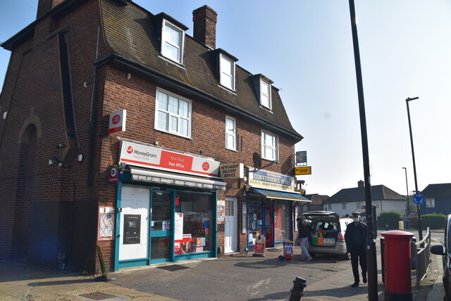
The town offers a wide range of amenities and facilities to its residents. It has several parks and green spaces, such as Acton Park and Gunnersbury Park, which provide recreational opportunities and beautiful landscapes. Acton High Street is the main shopping area, featuring a variety of shops, restaurants, and cafes. Additionally, there are numerous schools, healthcare centers, and sports facilities within the locality.

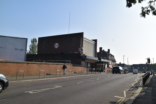
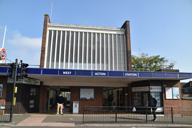
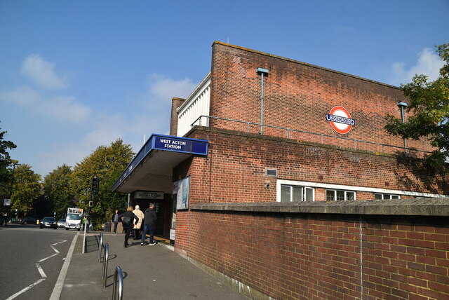
Transportation in Acton is well-served, with several London Underground stations providing easy access to the city, including Acton Town, South Acton, and North Acton. Multiple bus routes also operate in the area, connecting it to various parts of London.

Acton has a diverse population, with a mix of different cultures and ethnicities. This diversity is reflected in the various community events and cultural festivals that take place throughout the year. Overall, Acton offers a balanced blend of urban convenience and suburban charm, making it an attractive place to live for both families and professionals.

If you have any feedback on the listing, please let us know in the comments section below.
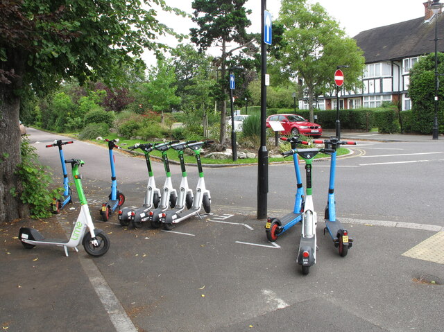
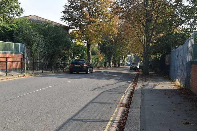
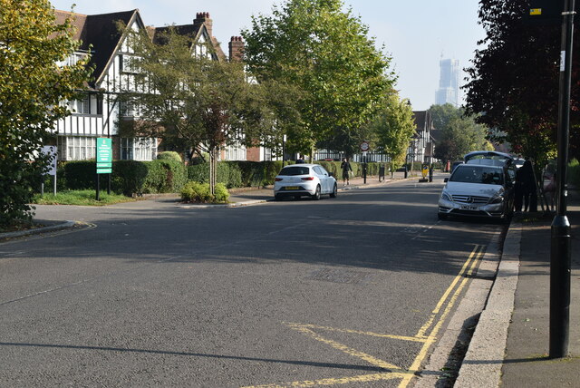
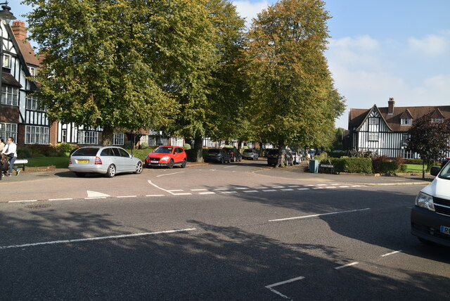
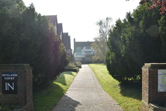
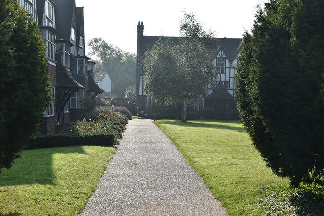
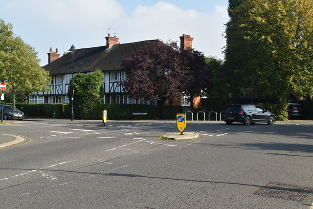
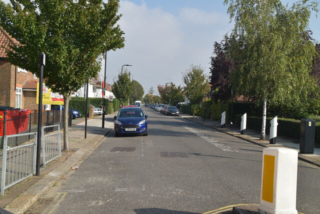
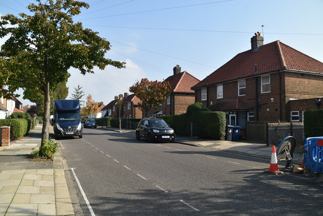
Acton, South Images

Images are sourced within 2km of 51.501572/-0.273684 or Grid Reference TQ1979. Thanks to Geograph Open Source API. All images are credited.

E-scooters for hire, West Acton From 7 June 2021 there is a trial of legal hire of electric scooters. Ealing Borough is participating. The scooters shown in this designated area are from Lime and Dott. The location in Princes Gardens is near West Acton tube station.
E-scooters for hire, West Acton
From 7 June 2021 there is a trial of legal hire of electric scooters. Ealing Borough is participating. The scooters shown in this designated area are from Lime and Dott. The location in Princes Gardens is near West Acton tube station.
Queen's Drive A few years ago I read a book by Mark Mason "Walking the lines" in which he walked the route of the London Underground lines, overground. I will repeat this visiting all 272 stations (some more than once). My route tries to follow the line of the railway as closely as possible, using footpaths and roads, deviations are made to make the walk more "interesting".
Queen's Drive
A few years ago I read a book by Mark Mason "Walking the lines" in which he walked the route of the London Underground lines, overground. I will repeat this visiting all 272 stations (some more than once). My route tries to follow the line of the railway as closely as possible, using footpaths and roads, deviations are made to make the walk more "interesting".
Thanet Court Hanger Hill Garden Estate is notable for its mock-Tudor houses and apartments built from 1928 to 1936 on a site which had been an airfield and aircraft factory. There is an active residents' association.  It has been a conservation area since 1969. The Ealing Council appraisal of the conservation area  has extensive details of the architecture and many photos.
Thanet Court
Hanger Hill Garden Estate is notable for its mock-Tudor houses and apartments built from 1928 to 1936 on a site which had been an airfield and aircraft factory. There is an active residents' association. It has been a conservation area since 1969. The Ealing Council appraisal of the conservation area has extensive details of the architecture and many photos.
Rutland Court Hanger Hill Garden Estate is notable for its mock-Tudor houses and apartments built from 1928 to 1936 on a site which had been an airfield and aircraft factory. There is an active residents' association.  It has been a conservation area since 1969. The Ealing Council appraisal of the conservation area  has extensive details of the architecture and many photos.
Rutland Court
Hanger Hill Garden Estate is notable for its mock-Tudor houses and apartments built from 1928 to 1936 on a site which had been an airfield and aircraft factory. There is an active residents' association. It has been a conservation area since 1969. The Ealing Council appraisal of the conservation area has extensive details of the architecture and many photos.
Links Rd Hanger Hill Garden Estate is notable for its mock-Tudor houses and apartments built from 1928 to 1936 on a site which had been an airfield and aircraft factory. There is an active residents' association.  It has been a conservation area since 1969. The Ealing Council appraisal of the conservation area  has extensive details of the architecture and many photos.
Links Rd
Hanger Hill Garden Estate is notable for its mock-Tudor houses and apartments built from 1928 to 1936 on a site which had been an airfield and aircraft factory. There is an active residents' association. It has been a conservation area since 1969. The Ealing Council appraisal of the conservation area has extensive details of the architecture and many photos.
Rutland Court Hanger Hill Garden Estate is notable for its mock-Tudor houses and apartments built from 1928 to 1936 on a site which had been an airfield and aircraft factory. There is an active residents' association.  It has been a conservation area since 1969. The Ealing Council appraisal of the conservation area  has extensive details of the architecture and many photos.
Rutland Court
Hanger Hill Garden Estate is notable for its mock-Tudor houses and apartments built from 1928 to 1936 on a site which had been an airfield and aircraft factory. There is an active residents' association. It has been a conservation area since 1969. The Ealing Council appraisal of the conservation area has extensive details of the architecture and many photos.
Oxford Court Hanger Hill Garden Estate is notable for its mock-Tudor houses and apartments built from 1928 to 1936 on a site which had been an airfield and aircraft factory. There is an active residents' association.  It has been a conservation area since 1969. The Ealing Council appraisal of the conservation area  has extensive details of the architecture and many photos.
Oxford Court
Hanger Hill Garden Estate is notable for its mock-Tudor houses and apartments built from 1928 to 1936 on a site which had been an airfield and aircraft factory. There is an active residents' association. It has been a conservation area since 1969. The Ealing Council appraisal of the conservation area has extensive details of the architecture and many photos.
Monks Drive Hanger Hill Garden Estate is notable for its mock-Tudor houses and apartments built from 1928 to 1936 on a site which had been an airfield and aircraft factory. There is an active residents' association.  It has been a conservation area since 1969. The Ealing Council appraisal of the conservation area  has extensive details of the architecture and many photos.
Monks Drive
Hanger Hill Garden Estate is notable for its mock-Tudor houses and apartments built from 1928 to 1936 on a site which had been an airfield and aircraft factory. There is an active residents' association. It has been a conservation area since 1969. The Ealing Council appraisal of the conservation area has extensive details of the architecture and many photos.
West Acton Station A few years ago I read a book by Mark Mason "Walking the lines" in which he walked the route of the London Underground lines, overground. I will repeat this visiting all 272 stations (some more than once). My route tries to follow the line of the railway as closely as possible, using footpaths and roads, deviations are made to make the walk more "interesting".
West Acton Station
A few years ago I read a book by Mark Mason "Walking the lines" in which he walked the route of the London Underground lines, overground. I will repeat this visiting all 272 stations (some more than once). My route tries to follow the line of the railway as closely as possible, using footpaths and roads, deviations are made to make the walk more "interesting".
West Acton Station West Acton is a London Underground station between Ealing Broadway and North Acton on the Ealing Broadway branch of the Central line, and is its only intermediate station. The station is a Grade II listed building. It is located in Travelcard Zone 3. The station is close to North Ealing tube station on the Piccadilly line, 550 metres away at the western end of Queens Drive. The station opened in 1923. 
Wikipedia: <span class="nowrap"><a title="https://en.wikipedia.org/wiki/West_Acton_tube_station" rel="nofollow ugc noopener" href="https://en.wikipedia.org/wiki/West_Acton_tube_station">Link</a><img style="margin-left:2px;" alt="External link" title="External link - shift click to open in new window" src="https://s1.geograph.org.uk/img/external.png" width="10" height="10"/></span>
West Acton Station
West Acton is a London Underground station between Ealing Broadway and North Acton on the Ealing Broadway branch of the Central line, and is its only intermediate station. The station is a Grade II listed building. It is located in Travelcard Zone 3. The station is close to North Ealing tube station on the Piccadilly line, 550 metres away at the western end of Queens Drive. The station opened in 1923. Wikipedia: LinkExternal link
Labyrinth #22, West Acton The London Underground system is also known as the "Tube". It is the oldest underground system in the world, the first section dating from 1863. The present system has over 250 miles of track and 272 stations. There are 11 lines covering Greater London, Essex, Buckinghamshire & Hertfordshire. Nearly half the system is above ground.
Wikipedia: <span class="nowrap"><a title="http://en.wikipedia.org/wiki/London_Underground" rel="nofollow ugc noopener" href="http://en.wikipedia.org/wiki/London_Underground">Link</a><img style="margin-left:2px;" alt="External link" title="External link - shift click to open in new window" src="https://s1.geograph.org.uk/img/external.png" width="10" height="10"/></span> 
Transport for London: <span class="nowrap"><a title="http://www.tfl.gov.uk/modalpages/2625.aspx" rel="nofollow ugc noopener" href="http://www.tfl.gov.uk/modalpages/2625.aspx">Link</a><img style="margin-left:2px;" alt="External link" title="External link - shift click to open in new window" src="https://s1.geograph.org.uk/img/external.png" width="10" height="10"/></span>
Labyrinth #22, West Acton
The London Underground system is also known as the "Tube". It is the oldest underground system in the world, the first section dating from 1863. The present system has over 250 miles of track and 272 stations. There are 11 lines covering Greater London, Essex, Buckinghamshire & Hertfordshire. Nearly half the system is above ground. Wikipedia: LinkExternal link Transport for London: LinkExternal link
West Acton Station West Acton is a London Underground station between Ealing Broadway and North Acton on the Ealing Broadway branch of the Central line, and is its only intermediate station. The station is a Grade II listed building. It is located in Travelcard Zone 3. The station is close to North Ealing tube station on the Piccadilly line, 550 metres away at the western end of Queens Drive. The station opened in 1923. 
Wikipedia: <span class="nowrap"><a title="https://en.wikipedia.org/wiki/West_Acton_tube_station" rel="nofollow ugc noopener" href="https://en.wikipedia.org/wiki/West_Acton_tube_station">Link</a><img style="margin-left:2px;" alt="External link" title="External link - shift click to open in new window" src="https://s1.geograph.org.uk/img/external.png" width="10" height="10"/></span>
West Acton Station
West Acton is a London Underground station between Ealing Broadway and North Acton on the Ealing Broadway branch of the Central line, and is its only intermediate station. The station is a Grade II listed building. It is located in Travelcard Zone 3. The station is close to North Ealing tube station on the Piccadilly line, 550 metres away at the western end of Queens Drive. The station opened in 1923. Wikipedia: LinkExternal link
Noel Rd Post Office
Noel Rd Post Office
Saxon Drive A few years ago I read a book by Mark Mason "Walking the lines" in which he walked the route of the London Underground lines, overground. I will repeat this visiting all 272 stations (some more than once). My route tries to follow the line of the railway as closely as possible, using footpaths and roads, deviations are made to make the walk more "interesting".
Saxon Drive
A few years ago I read a book by Mark Mason "Walking the lines" in which he walked the route of the London Underground lines, overground. I will repeat this visiting all 272 stations (some more than once). My route tries to follow the line of the railway as closely as possible, using footpaths and roads, deviations are made to make the walk more "interesting".
Former estate office
Saxon Drive
Saxon Drive
Show me another place!

Acton, South is located at Grid Ref: TQ1979 (Lat: 51.501572, Lng: -0.273684)

Unitary Authority: Ealing

Police Authority: Metropolitan

What 3 Words

///funded.wiped.racing. Near Acton, London

Nearby Locations

South Acton Acton, South

Related Wikis

South Acton railway station (England)

South Acton railway station is in the London Borough of Ealing in South Acton. It is on the North London line, and the station and all trains serving it...

Acton Town tube station

Acton Town is a London Underground station in the south-west corner of Acton, West London, in the London Borough of Ealing, close to the border with the...

Acton Works

Acton Works is a London Underground maintenance facility in West London, England. It is accessed from the District line and Piccadilly line tracks to the...

Eden Studios

Eden Studios was a commercial recording facility in west London. It opened in 1967, originally at 11 Eden Street in Kingston upon Thames (now under the...

Hooper (coachbuilder)

Hooper & Co. was a British coachbuilding business for many years based in Westminster London. From 1805 to 1959 it was a notably successful maker, to special...

Acton Green, London

Acton Green is a residential neighbourhood in Chiswick and the London Borough of Ealing, in West London, England. It is named for the nearby Acton Green...

Chiswick Park Footbridge

Chiswick Park Footbridge is a pedestrian bridge north of Gunnersbury Triangle Nature Reserve in Chiswick, London that connects Chiswick Business Park with...

Ark Acton Academy

Ark Acton Academy, is a coeducational secondary school and sixth form located in the Acton area of the London Borough of Ealing, England.The school teaches...

Nearby Amenities

Located within 500m of 51.501572,-0.273684
Acton Town
Operator: Transport for London
Public Transport: stop_position
Railway: stop
Subway: yes
Lat/Long: 51.5025332/-0.2795634
Mini Roundabout
Lat/Long: 51.5033644/-0.2801535
Give Way
Direction: forward
Lat/Long: 51.4989164/-0.2699818
Bollo Lane
Crossing Barrier: double_half
Railway: level_crossing
Lat/Long: 51.4978488/-0.2730616
Post Box
Brand: Royal Mail
Brand Wikidata: Q638098
Collection Times: Mo-Fr 18:45; Sa 12:00
Operator: Royal Mail
Operator Wikidata: Q638098
Post Box Type: pillar
Ref: W3 67
Royal Cypher: EIIR
Royal Cypher Wikidata: Q33102113
Lat/Long: 51.5004583/-0.2774064
Noexit: yes
Lat/Long: 51.4992112/-0.2687831
Crossing
Crossing: uncontrolled
Crossing Island: yes
Crossing Ref: zebra
Tactile Paving: yes
Lat/Long: 51.5032403/-0.2799446
Bicycle Parking
Access: yes
Bicycle Parking: stands
Capacity: 16
Covered: no
Fee: no
Operator: Ealing Council
Operator Type: government
Lat/Long: 51.5033696/-0.2799843
Toilets
Access: yes
Fee: no
Female: yes
Male: yes
Toilets Disposal: flush
Wheelchair: limited
Lat/Long: 51.502968/-0.2803045
Atm
Brand: NoteMachine
Brand Wikidata: Q104368525
Check Date: 2021-09-26
Operator: NoteMachine
Operator Short: NMATM
Operator Wikidata: Q104368525
Lat/Long: 51.5029341/-0.2802591
Ref GB Tflcid: RWG231224
Traffic Calming: table
Lat/Long: 51.5049516/-0.2728372
Bollo Lane Junction
Crossing Barrier: double_half
Railway: level_crossing
Lat/Long: 51.497398/-0.272248
Kindergarten
Sunlight Community Nursery and Resources Centre
Lat/Long: 51.5024194/-0.2762569
Dentist
Acton Town Dental Practice
Healthcare: dentist
Lat/Long: 51.5018511/-0.2710388
Collection Times: Mo-Fr 17:30; Sa 12:00
Fixme: has it been moved while old location is within construction area
Operator: Royal Mail
Postal Code: W3
Ref: W3 19
Removed Amenity: post_box
Lat/Long: 51.5019553/-0.2761735
Man Made: surveillance
Lat/Long: 51.5023327/-0.2739697
Community Centre
Oak Tree Community Centre
Lat/Long: 51.5024037/-0.27267
Public Building
South Acton Children's Centre
Postal Code: W3 8RX
Lat/Long: 51.5036388/-0.2729745
Man Made: surveillance
Lat/Long: 51.5036883/-0.2729779
Post Box
Collection Times: Mo-Fr 09:00, Sa 07:00
Postal Code: W3
Ref: W3 14
Royal Cypher: GR
Royal Cypher Wikidata: Q33102273
Lat/Long: 51.5047657/-0.2764345
Place Of Worship
Berrymead Evangelical Church
Denomination: evangelical
Religion: christian
Lat/Long: 51.504512/-0.2689663
Post Box
Brand: Royal Mail
Brand Wikidata: Q638098
Collection Times: Mo-Fr 09:00; Sa 07:00
Mapillary: 733421471607707
Operator: Royal Mail
Operator Wikidata: Q638098
Post Box Type: pillar
Postal Code: W3
Ref: W3 16D
Royal Cypher: GVIR
Royal Cypher Wikidata: Q33102169
Survey Date: 2023-03-14
Lat/Long: 51.504295/-0.2691097
Place Of Worship
Ukrainian Autocephalous Orthodox Church
Note: Cathedral of the Holy Transfiguration of our Saviour
Phone: +44 20 8992 4689
Postal Code: W3 8AJ
Religion: christian
Lat/Long: 51.5041342/-0.2686264
Telephone
Booth: KX100
Covered: booth
Lat/Long: 51.5045322/-0.2691877
Crossing
Crossing: uncontrolled
Crossing Ref: zebra
Kerb: lowered
Tactile Paving: yes
Lat/Long: 51.504647/-0.2698241
Ref GB Tflcid: RWG229418
Traffic Calming: cushion
Lat/Long: 51.5018281/-0.2704362
Bus Stop
Acton Town Station / Enfield Road
Bench: no
Bin: yes
Bus: yes
Lit: yes
Local Ref: Y
Naptan AtcoCode: 490020303S
Naptan Bearing: SE
Naptan CommonName: Acton Town
Naptan Verified: no
Public Transport: platform
Ref: 92045
Shelter: no
Source Local Ref: naptan
Tactile Paving: no
Lat/Long: 51.5023473/-0.2788363
Bus Stop
All Saints Road
Bus: yes
Local Ref: U
Naptan AtcoCode: 490003252E1
Naptan Bearing: E
Naptan CommonName: All Saints RdBollo Bridge Rd
Naptan Street: BOLLO BRIDGE ROAD
Naptan Verified: no
Public Transport: platform
Ref: 76412
Lat/Long: 51.5019927/-0.2697171
Bus Stop
Newton Avenue
Bus: yes
Local Ref: J
Naptan AtcoCode: 490003267W
Naptan Bearing: W
Naptan CommonName: Newton Avenue
Naptan Street: BOLLO BRIDGE ROAD
Naptan Verified: no
Public Transport: platform
Ref: 52971
Lat/Long: 51.5020347/-0.2690962
Bus Stop
Stanley Road
Bus: yes
Local Ref: T
Naptan AtcoCode: 490010741E
Naptan Bearing: N
Naptan CommonName: Palmerston Road Stanley Road
Naptan Verified: no
Public Transport: platform
Ref: 54892
Lat/Long: 51.5014018/-0.2733006
Bus Stop
Stanley Road
Bus: yes
Local Ref: K
Naptan AtcoCode: 490010741W
Naptan Bearing: N
Naptan CommonName: Palmerston Road Stanley Road
Naptan Verified: no
Public Transport: platform
Ref: 51322
Lat/Long: 51.5013091/-0.2732145
Bus Stop
Roslin Road
Bench: yes
Bin: yes
Bus: yes
Lit: yes
Local Ref: R
Naptan AtcoCode: 490011708N1
Naptan Bearing: N
Naptan CommonName: Roslin Road
Naptan Street: BOLLO LANE
Naptan Verified: no
Public Transport: platform
Ref: 73258
Shelter: yes
Tactile Paving: no
Lat/Long: 51.4997254/-0.2769907
Bus Stop
Roslin Road
Bench: yes
Bin: yes
Bus: yes
Lit: yes
Local Ref: M
Naptan AtcoCode: 490011708S
Naptan Bearing: N
Naptan CommonName: Roslin Road
Naptan Street: BOLLO LANE
Naptan Verified: no
Public Transport: platform
Ref: 72003
Shelter: yes
Tactile Paving: no
Lat/Long: 51.4993517/-0.2762849
Bus Stop
Stanhope Way / Acton Works
Bench: yes
Bin: yes
Bus: yes
Lit: yes
Local Ref: Q
Naptan AtcoCode: 490015579N
Naptan Bearing: N
Naptan CommonName: Weston Road
Naptan Verified: no
Public Transport: platform
Ref: 58343
Shelter: yes
Tactile Paving: no
Lat/Long: 51.4980929/-0.273636
Bus Stop
Stanhope Way / Acton Works
Bench: yes
Bin: yes
Bus: yes
Lit: yes
Local Ref: P
Naptan AtcoCode: 490015579S
Naptan Bearing: S
Naptan CommonName: Weston Road
Naptan Verified: no
Public Transport: platform
Ref: 48520
Shelter: yes
Tactile Paving: no
Lat/Long: 51.4980854/-0.27333
Bus Stop
Colville Road
Bench: yes
Bin: no
Bus: yes
Lit: yes
Local Ref: N
Naptan AtcoCode: 490015590S
Naptan Bearing: S
Naptan CommonName: Colville Road Bollo Lane
Naptan Street: BOLLO LANE
Naptan Verified: no
Public Transport: platform
Shelter: yes
Tactile Paving: no
Lat/Long: 51.4987371/-0.2751201
Bus Stop
Hanbury Road
Bus: yes
Local Ref: S
Naptan AtcoCode: 490015591E
Naptan Bearing: E
Naptan CommonName: Hanbury Road Bollo Bridge Rd
Naptan Street: BOLLO BRIDGE ROAD
Naptan Verified: no
Public Transport: platform
Ref: 57877
Lat/Long: 51.5010181/-0.2755479
Bus Stop
Hanbury Road
Bus: yes
Local Ref: L
Naptan AtcoCode: 490015591W
Naptan Bearing: W
Naptan CommonName: Hanbury Road Bollo Bridge Rd
Naptan Street: BOLLO BRIDGE ROAD
Naptan Verified: no
Public Transport: platform
Ref: 58870
Lat/Long: 51.5007437/-0.2765104
Post Box
Check Date: 2021-11-05
Collection Times: Mo-Fr 09:00; Sa 07:00
Operator: Royal Mail
Operator Wikidata: Q638098
Post Box Type: pillar
Ref: W4 50D
Royal Cypher: EVIIR
Royal Cypher Wikidata: Q33102324
Lat/Long: 51.4982326/-0.2695777
FIXME: OS Locator says "Castle Close"
Lat/Long: 51.5033855/-0.2727202
Acton Town
Operator: Transport for London
Public Transport: stop_position
Railway: stop
Subway: yes
Lat/Long: 51.5024799/-0.2797142
Acton Town
Operator: Transport for London
Public Transport: stop_position
Railway: stop
Subway: yes
Lat/Long: 51.502803/-0.2803222
Railway: switch
Lat/Long: 51.5031001/-0.2802832
Railway: level_crossing
Lat/Long: 51.4993893/-0.2798723
Acton Town
Operator: Transport for London
Public Transport: stop_position
Railway: stop
Subway: yes
Lat/Long: 51.5028013/-0.2801097
Bollo Lane Junction
Crossing Barrier: double_half
Railway: level_crossing
Lat/Long: 51.4974225/-0.2722976
Railway: switch
Lat/Long: 51.498979/-0.2710681
Bollo Lane
Crossing Barrier: double_half
Railway: level_crossing
Lat/Long: 51.4978259/-0.2730347
Railway: railway_crossing
Lat/Long: 51.498851/-0.2712017
Railway: switch
Lat/Long: 51.4990805/-0.27082
South Acton (Platform 1)
Public Transport: stop_position
Railway: stop
Ref: 1
Train: yes
Lat/Long: 51.4996989/-0.2699093
South Acton
Public Transport: stop_position
Railway: stop
Ref: 2
Train: yes
Lat/Long: 51.499714/-0.2699363
Railway: switch
Lat/Long: 51.5002862/-0.2690877
Railway: switch
Lat/Long: 51.5006239/-0.2687162
London Underground Acton Works
Addr Housenumber: 130
Addr Street: Bollo Lane
Lat/Long: 51.4981681/-0.2737895
Barrier: lift_gate
Lat/Long: 51.4971154/-0.272946
Crossing
Lat/Long: 51.4979899/-0.2743798
Railway: level_crossing
Lat/Long: 51.4993273/-0.279807
Post Box
Brand: Royal Mail
Brand Wikidata: Q638098
Collection Times: Mo-Fr 09:00, Sa 07:00
Mapillary: 135876668568036
Operator: Royal Mail
Operator Wikidata: Q638098
Post Box Type: pillar
Ref: W3 10D
Royal Cypher: GR
Royal Cypher Wikidata: Q33102273
Survey Date: 2021-02-02
Lat/Long: 51.5017021/-0.2715656
Halfords Autocentre
Brand: Halfords Autocentre
Brand Wikidata: Q5641894
Opening Hours: Mo-Fr 08:00-18:00; Sa 08:00-17:00; Su 10:00-16:00
Shop: car_repair
Website: https://www.halfords.com/locations/acton-autocentre/
Lat/Long: 51.5041816/-0.2794529
Acton Town
Fare Zone: 3
Line: District;Piccadilly
Naptan AtcoCode: 940GZZLUACT
Network: London Underground
Public Transport: station
Railway: station
Ref Crs: ZAT
Station: subway
Subway: yes
Wheelchair: yes
Wikidata: Q344481
Wikipedia: en:Acton Town tube station
Lat/Long: 51.5027051/-0.2799643
Sainsbury's Local
Brand: Sainsbury's Local
Brand Wikidata: Q13218434
Brand Wikipedia: en:Sainsbury's Local
Opening Hours: Mo-Su 07:00-23:00
Shop: convenience
Website: https://stores.sainsburys.co.uk/4368/london-acton-gardens-local
Lat/Long: 51.5017837/-0.2716377
Bicycle Parking
Bicycle Parking: stands
Capacity: 16
Covered: no
Lat/Long: 51.4994998/-0.2706206
Entrance: yes
Lat/Long: 51.4991725/-0.2744534
South Acton
Naptan AtcoCode: 9100SACTON
Network: National Rail
Network Website: https://www.nationalrail.co.uk/stations/sat/
Network Wikidata: Q26334
Operator: London Overground
Platforms: 2
Public Transport: station
Railway: station
Ref Crs: SAT
Source: NPE
Source Network: Sign
Source Ref: http://en.wikipedia.org/wiki/London_Overground#Stations
Train: yes
Wheelchair: limited
Wheelchair Description: Step-free platform interchange requires a 1300m journey via street. Use the Kingswood Terrace entrance for westbound platform. Use the Palmerston Road entrance for eastbound platform. Access from platform to train by manual boarding ramp.
Wikidata: Q451653
Wikipedia: en:South Acton railway station (England)
Lat/Long: 51.4997225/-0.2698979
Bicycle Parking
Access: yes
Bicycle Parking: stands
Capacity: 28
Covered: no
Fee: no
Operator: London Borough of Ealing
Operator Type: government
Lat/Long: 51.5032489/-0.2800762
Hammersmith Branch Junction
Historic Railway: junction
Railway: site
Lat/Long: 51.5002207/-0.2691796
Access: private
Addr City: London
Addr Housename: Blackburn Court
Addr Postcode: W3 8SX
Addr Street: Bollo Lane
Entrance: main
Level: 0
Wheelchair: yes
Lat/Long: 51.5015178/-0.2780755
Bicycle Parking
Bicycle Parking: stands
Capacity: 8
Covered: yes
Lat/Long: 51.4992866/-0.2703849
Bicycle Parking
Bicycle Parking: stands
Capacity: 6
Lat/Long: 51.4991712/-0.2705638
South Acton Junction
Railway: junction
Lat/Long: 51.498962/-0.2710483
Bicycle Parking
Access: yes
Bicycle Parking: stands
Capacity: 6
Covered: no
Fee: no
Operator: London Borough of Ealing
Operator Type: government
Lat/Long: 51.5031807/-0.279958
Bicycle Parking
Access: yes
Bicycle Parking: stands
Capacity: 8
Covered: no
Fee: no
Operator: London Borough of Ealing
Operator Type: government
Lat/Long: 51.5031838/-0.2797777
Bicycle Parking
Access: yes
Bicycle Parking: stands
Capacity: 6
Covered: no
Fee: no
Operator: London Borough of Ealing
Operator Type: government
Lat/Long: 51.5030737/-0.2796522
Bicycle Parking
Access: yes
Bicycle Parking: stands
Capacity: 14
Covered: no
Fee: no
Operator: London Borough of Ealing
Operator Type: government
Lat/Long: 51.5034009/-0.28025
Traffic Calming: hump
Lat/Long: 51.5047892/-0.2700866
Generator Method: photovoltaic
Generator Output Electricity: yes
Generator Source: solar
Generator Type: solar_photovoltaic_panel
Location: roof
Power: generator
Lat/Long: 51.4999923/-0.2746838
Generator Method: photovoltaic
Generator Output Electricity: yes
Generator Source: solar
Generator Type: solar_photovoltaic_panel
Location: roof
Power: generator
Lat/Long: 51.5008851/-0.2768159
Generator Method: photovoltaic
Generator Output Electricity: yes
Generator Source: solar
Generator Type: solar_photovoltaic_panel
Location: roof
Power: generator
Lat/Long: 51.4994694/-0.2744755
Generator Method: photovoltaic
Generator Output Electricity: yes
Generator Source: solar
Generator Type: solar_photovoltaic_panel
Location: roof
Power: generator
Lat/Long: 51.5012892/-0.2749992
Generator Method: photovoltaic
Generator Output Electricity: yes
Generator Source: solar
Generator Type: solar_photovoltaic_panel
Location: roof
Power: generator
Lat/Long: 51.5012737/-0.2756096
Generator Method: photovoltaic
Generator Output Electricity: yes
Generator Source: solar
Generator Type: solar_photovoltaic_panel
Location: roof
Power: generator
Lat/Long: 51.4993214/-0.2743943
Generator Method: photovoltaic
Generator Output Electricity: yes
Generator Source: solar
Generator Type: solar_photovoltaic_panel
Location: roof
Power: generator
Lat/Long: 51.5016063/-0.2769865
Generator Method: photovoltaic
Generator Output Electricity: yes
Generator Source: solar
Generator Type: solar_photovoltaic_panel
Location: roof
Power: generator
Lat/Long: 51.5018215/-0.275845
Generator Method: photovoltaic
Generator Output Electricity: yes
Generator Source: solar
Generator Type: solar_photovoltaic_panel
Location: roof
Power: generator
Lat/Long: 51.5010028/-0.2767566
Generator Method: photovoltaic
Generator Output Electricity: yes
Generator Source: solar
Generator Type: solar_photovoltaic_panel
Location: roof
Power: generator
Lat/Long: 51.5011461/-0.2755475
Generator Method: photovoltaic
Generator Output Electricity: yes
Generator Source: solar
Generator Type: solar_photovoltaic_panel
Location: roof
Power: generator
Lat/Long: 51.5015032/-0.2779035
Generator Method: photovoltaic
Generator Output Electricity: yes
Generator Source: solar
Generator Type: solar_photovoltaic_panel
Location: roof
Power: generator
Lat/Long: 51.5000247/-0.2743559
Generator Method: photovoltaic
Generator Output Electricity: yes
Generator Source: solar
Generator Type: solar_photovoltaic_panel
Location: roof
Power: generator
Lat/Long: 51.5002131/-0.2740833
Generator Method: photovoltaic
Generator Output Electricity: yes
Generator Source: solar
Generator Type: solar_photovoltaic_panel
Location: roof
Power: generator
Lat/Long: 51.5002788/-0.2736433
Generator Method: photovoltaic
Generator Output Electricity: yes
Generator Source: solar
Generator Type: solar_photovoltaic_panel
Location: roof
Power: generator
Lat/Long: 51.5013485/-0.276873
Generator Method: photovoltaic
Generator Output Electricity: yes
Generator Source: solar
Generator Type: solar_photovoltaic_panel
Location: roof
Power: generator
Lat/Long: 51.5016812/-0.2757829
Generator Method: photovoltaic
Generator Output Electricity: yes
Generator Source: solar
Generator Type: solar_photovoltaic_panel
Location: roof
Power: generator
Lat/Long: 51.4997558/-0.2745849
Generator Method: photovoltaic
Generator Output Electricity: yes
Generator Source: solar
Generator Type: solar_photovoltaic_panel
Location: roof
Power: generator
Lat/Long: 51.5015346/-0.2750764
Generator Method: photovoltaic
Generator Output Electricity: yes
Generator Source: solar
Generator Type: solar_photovoltaic_panel
Location: roof
Power: generator
Lat/Long: 51.5014206/-0.2756694
Generator Method: photovoltaic
Generator Output Electricity: yes
Generator Source: solar
Generator Type: solar_photovoltaic_panel
Location: roof
Power: generator
Lat/Long: 51.5015502/-0.2757276
Generator Method: photovoltaic
Generator Output Electricity: yes
Generator Source: solar
Generator Type: solar_photovoltaic_panel
Location: roof
Power: generator
Lat/Long: 51.5015971/-0.277213
Generator Method: photovoltaic
Generator Output Electricity: yes
Generator Source: solar
Generator Type: solar_photovoltaic_panel
Location: roof
Power: generator
Lat/Long: 51.5018729/-0.2752246
Generator Method: photovoltaic
Generator Output Electricity: yes
Generator Source: solar
Generator Type: solar_photovoltaic_panel
Location: roof
Power: generator
Lat/Long: 51.5013924/-0.2778582
Generator Method: photovoltaic
Generator Output Electricity: yes
Generator Source: solar
Generator Type: solar_photovoltaic_panel
Location: roof
Power: generator
Lat/Long: 51.5012391/-0.2768589
Generator Method: photovoltaic
Generator Output Electricity: yes
Generator Source: solar
Generator Type: solar_photovoltaic_panel
Location: roof
Power: generator
Lat/Long: 51.5008718/-0.2775483
Generator Method: photovoltaic
Generator Output Electricity: yes
Generator Source: solar
Generator Type: solar_photovoltaic_panel
Location: roof
Power: generator
Lat/Long: 51.5002588/-0.2737155
Generator Method: photovoltaic
Generator Output Electricity: yes
Generator Source: solar
Generator Type: solar_photovoltaic_panel
Location: roof
Power: generator
Lat/Long: 51.5050737/-0.2702779
Bicycle Parking
Access: private
Bicycle Parking: shed
Capacity: 6
Covered: yes
Fee: yes
Lit: yes
Operator: cyclehoop
Ref: Bikehangar 2419
Lat/Long: 51.5014993/-0.2668409
Crossing
Lat/Long: 51.5045076/-0.2694873
Crossing
Lat/Long: 51.5043561/-0.2690336
Traffic Calming: bump
Lat/Long: 51.504524/-0.2683798
Give Way
Direction: backward
Lat/Long: 51.5043345/-0.2690332
Historic: memorial
Inscription: In memory of the seven million victims of the artificial famine in Ukraine 1932 - 1935
Lat/Long: 51.5042871/-0.2688623
Crossing
Crossing: unmarked
Lat/Long: 51.5044421/-0.2691379
Crossing
Lat/Long: 51.5045844/-0.269741
Crossing
Crossing: marked
Crossing Ref: zebra
Kerb: lowered
Tactile Paving: yes
Lat/Long: 51.5048005/-0.2703782
Give Way
Direction: backward
Lat/Long: 51.5049952/-0.2713076
Give Way
Direction: forward
Lat/Long: 51.5015572/-0.2782132
Give Way
Direction: backward
Lat/Long: 51.5017836/-0.2767918
Traffic Calming: table
Lat/Long: 51.5017349/-0.2767711
Traffic Calming: bump
Lat/Long: 51.5017532/-0.2771178
Barrier: kerb
Kerb: flush
Tactile Paving: yes
Lat/Long: 51.5016135/-0.2781778
Barrier: kerb
Kerb: flush
Tactile Paving: yes
Lat/Long: 51.5015299/-0.2781258
Barrier: kerb
Kerb: flush
Tactile Paving: yes
Lat/Long: 51.501743/-0.2768342
Barrier: kerb
Kerb: flush
Tactile Paving: yes
Lat/Long: 51.5018636/-0.2761336
Barrier: kerb
Kerb: flush
Tactile Paving: yes
Lat/Long: 51.5017632/-0.276721
Crossing
Crossing: unmarked
Crossing Island: no
Tactile Paving: yes
Traffic Calming: table
Lat/Long: 51.5017529/-0.2767787
Crossing
Crossing: unmarked
Crossing Island: no
Tactile Paving: yes
Lat/Long: 51.5015685/-0.2781498
Crossing
Lat/Long: 51.5022988/-0.2741764
Crossing
Lat/Long: 51.5022225/-0.2746238
Crossing
Lat/Long: 51.5020233/-0.2758129
Crossing
Lat/Long: 51.5019298/-0.2763213
Crossing
Lat/Long: 51.5016738/-0.2778254
Crossing
Crossing: marked
Crossing Island: no
Tactile Paving: yes
Lat/Long: 51.5018383/-0.2762818
Barrier: kerb
Kerb: flush
Tactile Paving: yes
Lat/Long: 51.5018899/-0.2760069
Crossing
Crossing: unmarked
Traffic Calming: table
Lat/Long: 51.5018787/-0.276061
Traffic Calming: table
Lat/Long: 51.501457/-0.2766532
Traffic Calming: table
Lat/Long: 51.5011742/-0.2765331
Traffic Calming: table
Lat/Long: 51.5012938/-0.2757994
Traffic Calming: table
Lat/Long: 51.50157/-0.2759243
Crossing
Crossing: unmarked
Crossing Island: no
Tactile Paving: yes
Lat/Long: 51.5012754/-0.2757908
Crossing
Crossing: unmarked
Crossing Island: no
Tactile Paving: yes
Lat/Long: 51.5011556/-0.2765253
Crossing
Crossing: unmarked
Crossing Island: no
Tactile Paving: yes
Lat/Long: 51.5014709/-0.2766591
Crossing
Crossing: unmarked
Crossing Island: no
Tactile Paving: yes
Lat/Long: 51.5015922/-0.2759341
Give Way
Direction: backward
Lat/Long: 51.5019044/-0.2760724
Give Way
Direction: forward
Lat/Long: 51.5009717/-0.2756494
Give Way
Direction: forward
Lat/Long: 51.5008364/-0.2763898
Crossing
Lat/Long: 51.5020539/-0.2750255
Give Way
Direction: forward
Lat/Long: 51.502077/-0.2750354
Barrier: bollard
Lat/Long: 51.5029779/-0.2724337
Bicycle Parking
Access: private
Bicycle Parking: shed
Capacity: 6
Covered: yes
Operator: cyclehoop
Ref: Bikehangar 2697
Lat/Long: 51.5046452/-0.2688533
Bicycle Parking
Access: yes
Bicycle Parking: rack
Capacity: 12
Covered: no
Lat/Long: 51.5020922/-0.2721607
Escooter Rental
Lat/Long: 51.5017142/-0.2706031
Post Box
Collection Times: Mo-Fr 09:00; Sa 07:00
Operator: Royal Mail
Operator Wikidata: Q638098
Ref: W3 7D
Royal Cypher: VR
Royal Cypher Wikidata: Q33102356
Lat/Long: 51.5040774/-0.2721976
Bicycle Parking
Access: yes
Bicycle Parking: rack
Capacity: 20
Covered: no
Lat/Long: 51.5018505/-0.2720144
Charging Station
Source London
Brand: Source London
Brand Wikidata: Q7565133
Capacity: 3
Fee: yes
Operator: Source London
Operator Wikidata: Q7565133
Lat/Long: 51.5027058/-0.2792361
Crossing
Crossing: marked
Crossing Island: no
Tactile Paving: yes
Lat/Long: 51.5016062/-0.2717889
Post Box
Brand: Royal Mail
Brand Wikidata: Q638098
Collection Times: Mo-Fr 18:30; Sa 12:00
Operator: Royal Mail
Operator Wikidata: Q638098
Post Box Type: pillar
Ref: W3 69P
Royal Cypher: no
Lat/Long: 51.5005943/-0.2774002
Crossing
Crossing: uncontrolled
Crossing Ref: zebra
Kerb: lowered
Tactile Paving: yes
Lat/Long: 51.5053423/-0.2735631
Entrance: yes
Lat/Long: 51.4976361/-0.2730605
Entrance: yes
Lat/Long: 51.4975067/-0.272806
Barrier: cycle_barrier
Cycle Barrier: triple
Cycle Barrier Installation: fixed
Lat/Long: 51.4971441/-0.2729908
Bicycle Parking
Bicycle Parking: stands
Capacity: 2
Covered: no
Lat/Long: 51.4984644/-0.2743203
Cultivate London Ltd
Addr City: London
Addr Housename: The Plant Nursery
Addr Postcode: W3 8RB
Addr Street: Enfield Road
Office: charity
Opening Hours: Mo-Fr 10:00-16:00
Phone: +44 8992 4941
Website: https://www.cultivatelondon.org/
Lat/Long: 51.5025447/-0.277428
Traffic Calming: hump
Lat/Long: 51.5016197/-0.2748387
Traffic Calming: hump
Lat/Long: 51.5015158/-0.2761335
Traffic Calming: hump
Lat/Long: 51.5013961/-0.2760785
Traffic Calming: table
Lat/Long: 51.5000661/-0.2719353
One Stop Dry Cleaners
Shop: dry_cleaning
Lat/Long: 51.5031555/-0.2801869
Cafe
The Apple Tree
Lat/Long: 51.5031208/-0.2802374
Click Properties
Office: estate_agent
Lat/Long: 51.5029175/-0.2805268
Addr City: London
Addr Housenumber: 57
Addr Postcode: W3 8AZ
Addr Street: Ramsay Road
Building: house
Lat/Long: 51.5023273/-0.2673306
Addr City: London
Addr Housenumber: 1
Addr Postcode: W3 8AZ
Addr Street: Ramsay Road
Building: house
Lat/Long: 51.5012043/-0.2683793
Addr City: London
Addr Housenumber: 34
Addr Postcode: W3 8AZ
Addr Street: Ramsay Road
Building: house
Lat/Long: 51.502281/-0.2677143
Addr City: London
Addr Housenumber: 2
Addr Postcode: W3 8AZ
Addr Street: Ramsay Road
Building: house
Lat/Long: 51.5014828/-0.268532
Ref GB Tflcid: RWG229412
Traffic Calming: cushion
Lat/Long: 51.50085/-0.2762144
Ref GB Tflcid: RWG230516
Traffic Calming: hump
Lat/Long: 51.5049144/-0.2708768
Ref GB Tflcid: RWG230605
Traffic Calming: hump
Lat/Long: 51.5051373/-0.2718472
Ref GB Tflcid: RWG230606
Traffic Calming: hump
Lat/Long: 51.5052696/-0.272562
Ref GB Tflcid: RWG230518
Traffic Calming: hump
Lat/Long: 51.504074/-0.2723914
Ref GB Tflcid: RWG230537
Traffic Calming: hump
Lat/Long: 51.5042133/-0.2731581
Ref GB Tflcid: RWG230519
Traffic Calming: hump
Lat/Long: 51.5036718/-0.2728162
Ref GB Tflcid: RWG230545
Traffic Calming: hump
Lat/Long: 51.5038184/-0.2682956
Bicycle Parking
Bicycle Parking: post_hoop
Capacity: 2
Ref GB Tflcid: RWG232743
Lat/Long: 51.5037174/-0.2687733
Bicycle Parking
Bicycle Parking: stands
Capacity: 9
Ref GB Tflcid: RWG233420
Lat/Long: 51.5024989/-0.272417
Ref GB Tflcid: RWG229417
Traffic Calming: cushion
Lat/Long: 51.5015512/-0.2720976
Ref GB Tflcid: RWG229415
Traffic Calming: cushion
Lat/Long: 51.5012883/-0.2736463
Ref GB Tflcid: RWG230542
Traffic Calming: hump
Lat/Long: 51.5025914/-0.2675802
Ref GB Tflcid: RWG230373
Traffic Calming: hump
Lat/Long: 51.4996701/-0.271757
Ref GB Tflcid: RWG230337
Traffic Calming: hump
Lat/Long: 51.5020184/-0.2755369
Ref GB Tflcid: RWG229413
Traffic Calming: cushion
Lat/Long: 51.5010319/-0.2751529
Ref GB Tflcid: RWG229701
Traffic Calming: hump
Lat/Long: 51.4985215/-0.2697395
Ref GB Tflcid: RWG230541
Traffic Calming: hump
Lat/Long: 51.5022563/-0.2685104
Noexit: yes
Lat/Long: 51.4991207/-0.2689102
Budgens
Brand: Budgens
Brand Wikidata: Q4985016
Shop: convenience
Website: https://www.budgens.co.uk/our-stores/gunnersbury-lane
Lat/Long: 51.5035186/-0.2798932
Restaurant
Crystal Charcoal
Addr Housenumber: 3
Cuisine: kebab
Lat/Long: 51.5034523/-0.279916
Emilia Hair Studio
Shop: hairdresser
Lat/Long: 51.5034143/-0.2799247
Top Stitch
Shop: tailor
Lat/Long: 51.5033755/-0.2799006
Cafe
Jungles Cafe
Lat/Long: 51.5033412/-0.2798731
Acton Town Dry Cleaners
Shop: dry_cleaning
Lat/Long: 51.5033062/-0.2798134
Fast Food
Chicken Grilly
Cuisine: chicken
Lat/Long: 51.5032607/-0.2797745
Addr City: London
Addr Housenumber: 75
Addr Postcode: W3 8HB
Addr Street: Avenue Gardens
Lat/Long: 51.503057/-0.275837
Addr City: London
Addr Housenumber: 53
Addr Postcode: W3 8HB
Addr Street: Avenue Gardens
Lat/Long: 51.5030887/-0.2748004
Addr City: London
Addr Housenumber: 41
Addr Postcode: W3 8EJ
Addr Street: Heathfield Road
Lat/Long: 51.5034281/-0.2764231
Addr City: London
Addr Housenumber: 204
Addr Postcode: W3 8QQ
Addr Street: Avenue Road
Lat/Long: 51.5047357/-0.2788183
A&L Hair Studio
Shop: hairdresser
Lat/Long: 51.5038634/-0.2797329
Addr City: London
Addr Housenumber: 41
Addr Postcode: W3 8HA
Addr Street: Avenue Gardens
Lat/Long: 51.5035704/-0.2741338
Addr City: London
Addr Housenumber: 1
Addr Postcode: W3 8HA
Addr Street: Avenue Gardens
Lat/Long: 51.5050571/-0.2750934
Addr City: London
Addr Housenumber: 2
Addr Postcode: W3 8HB
Addr Street: Avenue Gardens
Lat/Long: 51.5049394/-0.2755487
Addr City: London
Addr Housenumber: 36
Addr Postcode: W3 8HB
Addr Street: Avenue Gardens
Lat/Long: 51.5036647/-0.2747923
Addr City: London
Addr Housenumber: 120
Addr Postcode: W3 8QG
Addr Street: Avenue Road
Lat/Long: 51.5052992/-0.2750324
Addr City: London
Addr Housenumber: 44
Addr Postcode: W3 8AW
Addr Street: Leythe Road
Lat/Long: 51.5028725/-0.2684382
Addr City: London
Addr Housenumber: 2
Addr Postcode: W3 8AW
Addr Street: Leythe Road
Lat/Long: 51.5033583/-0.267089
Addr City: London
Addr Housenumber: 45
Addr Postcode: W3 8AW
Addr Street: Leythe Road
Lat/Long: 51.5031492/-0.2684288
Addr City: London
Addr Housenumber: 60
Addr Postcode: W3 8AL
Addr Street: Newton Avenue
Lat/Long: 51.5026705/-0.2691644
Addr City: London
Addr Housenumber: 48
Addr Postcode: W3 8AL
Addr Street: Newton Avenue
Lat/Long: 51.5029672/-0.2691778
Addr City: London
Addr Housenumber: 46
Addr Postcode: W3 8AL
Addr Street: Newton Avenue
Lat/Long: 51.5030674/-0.2691778
Addr City: London
Addr Housenumber: 18
Addr Postcode: W3 8AL
Addr Street: Newton Avenue
Lat/Long: 51.5037432/-0.2692173
Playground: slide
Lat/Long: 51.5043535/-0.2771779
Playground: swing
Lat/Long: 51.504132/-0.2772159
Information: board
Tourism: information
Lat/Long: 51.5045692/-0.2775142
Waste Basket
Lat/Long: 51.5042843/-0.2775337
Information: board
Tourism: information
Lat/Long: 51.5043328/-0.2774772
Bench
Lat/Long: 51.5040231/-0.2774326
Bench
Lat/Long: 51.504039/-0.2773172
Waste Basket
Lat/Long: 51.503973/-0.2775714
Bench
Lat/Long: 51.5039451/-0.2775647
Waste Basket
Lat/Long: 51.5040448/-0.2772877
Bench
Lat/Long: 51.5041262/-0.2772643
Access: private
Entrance: yes
Lat/Long: 51.5018707/-0.2772695
Access: private
Entrance: yes
Lat/Long: 51.5018533/-0.2773607
Access: private
Entrance: yes
Lat/Long: 51.5024883/-0.2764786
Entrance: yes
Lat/Long: 51.502039/-0.2762972
Access: private
Entrance: yes
Lat/Long: 51.502422/-0.2788024
Entrance: yes
Lat/Long: 51.5023742/-0.2784723
Access: private
Entrance: yes
Lat/Long: 51.5021883/-0.2786008
Barrier: bollard
Motor Vehicle: no
Lat/Long: 51.502387/-0.2775426
Access: private
Entrance: yes
Lat/Long: 51.5016857/-0.277063
Access: private
Entrance: yes
Lat/Long: 51.5015934/-0.2775977
Access: private
Entrance: yes
Lat/Long: 51.5023102/-0.2774587
Access: private
Entrance: yes
Lat/Long: 51.5022934/-0.277572
Crossing
Lat/Long: 51.5017671/-0.2772712
Crossing
Lat/Long: 51.5019598/-0.2761407
Access: private
Entrance: yes
Lat/Long: 51.5009471/-0.2765929
Access: private
Entrance: yes
Lat/Long: 51.5013318/-0.2767687
Access: private
Entrance: yes
Lat/Long: 51.5007127/-0.2774219
Barrier: bollard
Lat/Long: 51.5010642/-0.2688203
Barrier: bollard
Lat/Long: 51.5013027/-0.2685397
Barrier: bollard
Lat/Long: 51.4997951/-0.2706581
Bicycle Parking
Access: private
Bicycle Parking: shed
Capacity: 6
Covered: yes
Operator: cyclehoop
Ref: Bikehangar 3987
Lat/Long: 51.5029349/-0.2685589
Traffic Calming: hump
Lat/Long: 51.5045662/-0.2695574
Traffic Calming: hump
Lat/Long: 51.5046871/-0.2701517
Charging Station
Capacity: 4
Lat/Long: 51.5050212/-0.2711874
Kindergarten
Cybertots
Lat/Long: 51.50481/-0.2761804
Bicycle Parking
Access: private
Bicycle Parking: shed
Capacity: 6
Covered: yes
Operator: cyclehoop
Ref: Bikehangar 4448
Lat/Long: 51.4995098/-0.269039
Bench
Lat/Long: 51.5042985/-0.270794
Information: board
Tourism: information
Lat/Long: 51.5044289/-0.2712239
Bench
Lat/Long: 51.5027114/-0.2718767
Entrance: yes
Lat/Long: 51.5028189/-0.2710818
Bench
Lat/Long: 51.5015748/-0.2732392
Bench
Lat/Long: 51.5015221/-0.2732201
Leisure: pitch
Sport: table_tennis
Lat/Long: 51.5010232/-0.2760735
Leisure: pitch
Sport: table_tennis
Lat/Long: 51.5009997/-0.2760639
Waste Basket
Lat/Long: 51.5020324/-0.269123
Bench
Lat/Long: 51.5021527/-0.2693836
Bench
Lat/Long: 51.502194/-0.2692602
Bench
Lat/Long: 51.5021894/-0.2691181
Waste Basket
Lat/Long: 51.5021899/-0.2692381
Bench
Lat/Long: 51.5019144/-0.2694621
Waste Basket
Lat/Long: 51.5019046/-0.2694862
Bench
Lat/Long: 51.5019479/-0.2692462
Bench
Lat/Long: 51.5019744/-0.2690479
Waste Basket
Lat/Long: 51.5019698/-0.2690618
Bench
Lat/Long: 51.5018354/-0.2698531
Bench
Lat/Long: 51.5017847/-0.270133
Addr Housename: AC-11
Lat/Long: 51.500927/-0.2796376
Addr Housename: AC-12
Lat/Long: 51.5012286/-0.2795279
The data included in this document is from www.openstreetmap.org. The data is made available under ODbL.

Have you been to Acton, South?

Leave your review of Acton, South below (or comments, questions and feedback).