Bledington

Settlement in Gloucestershire Cotswold

England

Bledington

Green, Bledington With a see-saw in the foreground. See also <a title="https://www.geograph.org.uk/search.php?i=68988796" href="https://www.geograph.org.uk/search.php?i=68988796">Link</a> .
Green, Bledington Credit: Derek Harper

Bledington is a charming village located in the county of Gloucestershire, England. Situated in the Evenlode Valley, it is part of the Cotswolds Area of Outstanding Natural Beauty, known for its picturesque landscapes and quintessential English countryside.

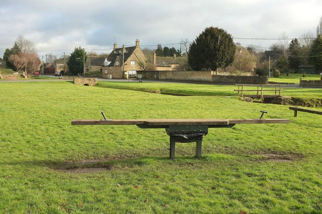
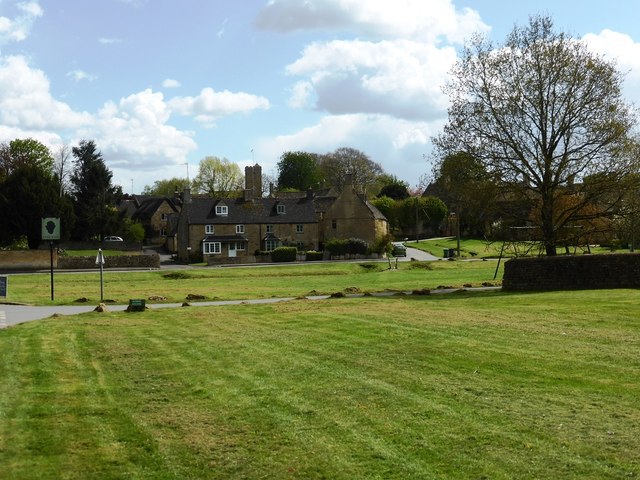
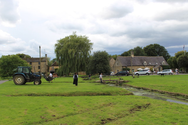
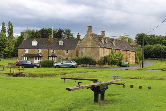
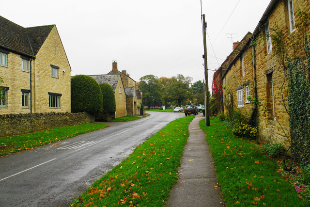
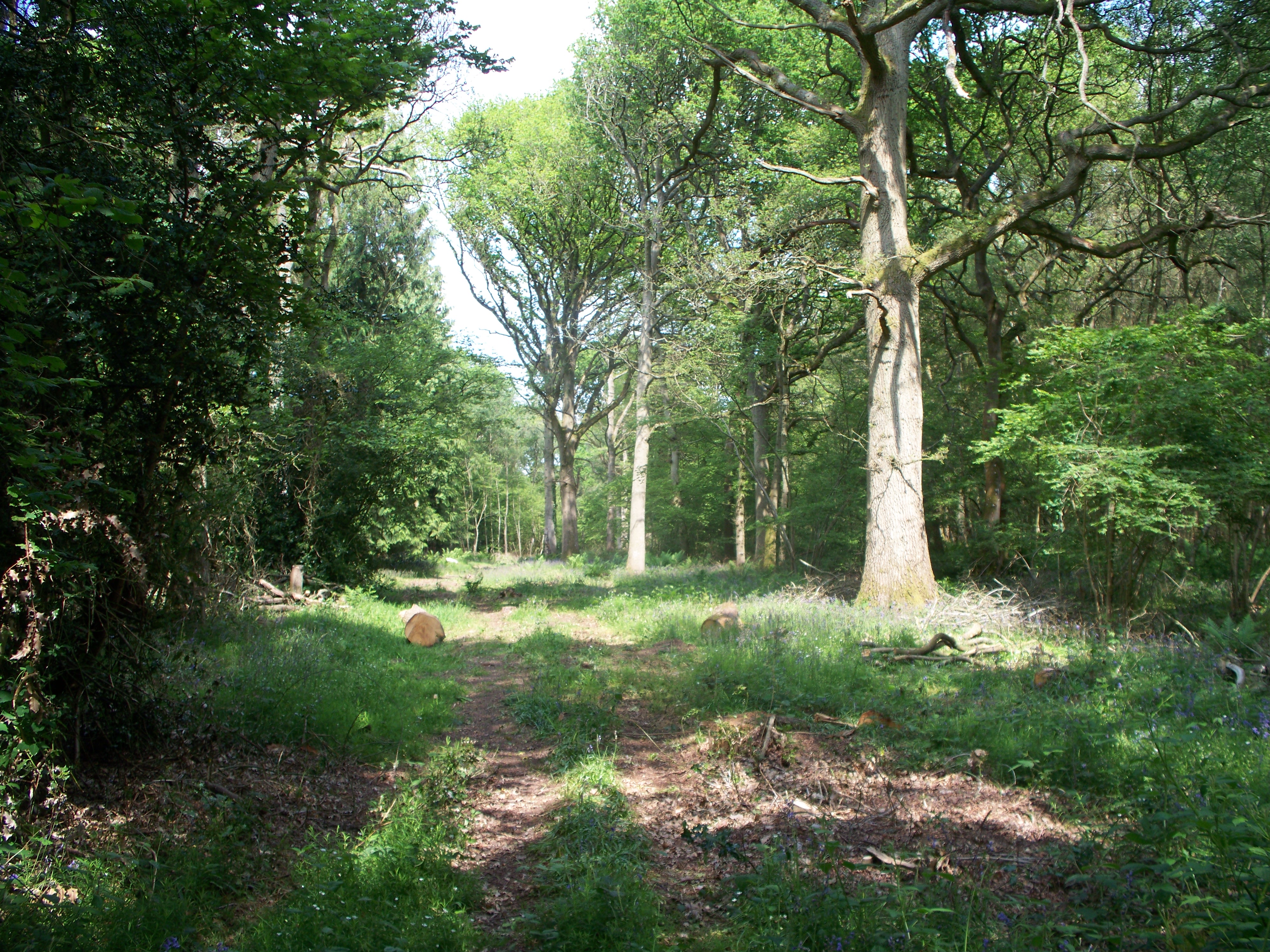
The village itself is small, with a population of around 300 people. It is characterized by its traditional Cotswold stone buildings, which add to its timeless appeal. Bledington is renowned for its idyllic setting, surrounded by rolling hills, lush meadows, and ancient woodlands. The River Evenlode flows through the village, adding to its scenic beauty.

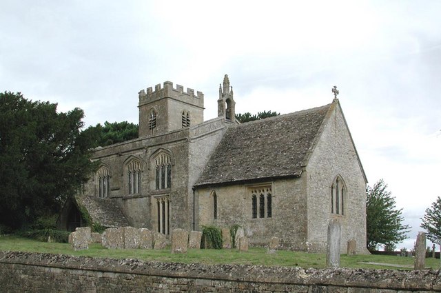
One of the most notable landmarks in Bledington is the Church of St. Leonard. Dating back to the 12th century, this historic church features stunning Norman architecture and is a must-visit for history enthusiasts. The village also boasts a traditional pub, The Kings Head, which offers a warm welcome to both locals and visitors.

Bledington is a close-knit community with a strong sense of community spirit. Throughout the year, various events and festivals take place, bringing residents together and attracting tourists from far and wide. These include the Bledington Music Festival, which showcases local talent, and the Bledington Country Fair, featuring traditional crafts, food, and entertainment.

For those seeking outdoor activities, Bledington provides ample opportunities for walking, cycling, and horse riding. The nearby countryside offers numerous trails and paths, allowing visitors to explore the stunning natural surroundings.

In conclusion, Bledington is a picturesque village nestled in the heart of the Cotswolds, offering a tranquil and scenic escape for visitors looking to experience the timeless beauty of rural England.

If you have any feedback on the listing, please let us know in the comments section below.

Bledington Images

Images are sourced within 2km of 51.901769/-1.64166 or Grid Reference SP2422. Thanks to Geograph Open Source API. All images are credited.

Green, Bledington With a see-saw in the foreground. See also <a title="https://www.geograph.org.uk/search.php?i=68988796" href="https://www.geograph.org.uk/search.php?i=68988796">Link</a> .
Green, Bledington
With a see-saw in the foreground. See also Link .
Green, Bledington Looking left from where <a href="https://www.geograph.org.uk/photo/5269082">SP2422 : Green, Bledington</a> was taken, showing the swings and seat. Partly obscured by a conifer in the background is the listed Gilberts Farmhouse <span class="nowrap"><a title="https://www.historicengland.org.uk/listing/the-list/list-entry/1089814" rel="nofollow ugc noopener" href="https://www.historicengland.org.uk/listing/the-list/list-entry/1089814">Link</a><img style="margin-left:2px;" alt="External link" title="External link - shift click to open in new window" src="https://s1.geograph.org.uk/img/external.png" width="10" height="10"/></span> .
Green, Bledington
Looking left from where SP2422 : Green, Bledington was taken, showing the swings and seat. Partly obscured by a conifer in the background is the listed Gilberts Farmhouse LinkExternal link .
Station Road, Kingham Followed by NCN442, and actually leading from an operating station unlike most "Station Roads" in villages. The red sign indicates the Mill House Hotel, off to the right.
Station Road, Kingham
Followed by NCN442, and actually leading from an operating station unlike most "Station Roads" in villages. The red sign indicates the Mill House Hotel, off to the right.
Bledington village green
The road through Foscot
Kingham station, 2000 View NW, towards Worcester etc. on the ex-GWR London - Oxford - Worcester main line. Fifty and more years ago, this was a junction of some importance: at the north end, to the right there was a branch to Chipping Norton (closed 3/12/62, goods 7/9/64), being the root of a line through to King's Sutton (for Banbury) closed 4/12/51); to the west (left) a branch went via Bourton-on-the-Water and Andoversford to Cheltenham, lasting until 15/10/62 (goods to Bourton, 7/9/64). Until 12/10/53 a bridge, subsequently demolished, across the main line allowed through running avoiding Kingham station.  (Cf.<a href="https://www.geograph.org.uk/photo/550655">SP2522 : Kingham railway station</a> and others).
Kingham station, 2000
View NW, towards Worcester etc. on the ex-GWR London - Oxford - Worcester main line. Fifty and more years ago, this was a junction of some importance: at the north end, to the right there was a branch to Chipping Norton (closed 3/12/62, goods 7/9/64), being the root of a line through to King's Sutton (for Banbury) closed 4/12/51); to the west (left) a branch went via Bourton-on-the-Water and Andoversford to Cheltenham, lasting until 15/10/62 (goods to Bourton, 7/9/64). Until 12/10/53 a bridge, subsequently demolished, across the main line allowed through running avoiding Kingham station. (Cf.SP2522 : Kingham railway station and others).
Clearing the stream at Bledington
The old see-saw on Bledington green
View from a Didcot-Worcester train - Fields and trees near Sars Brook The yellow milepost marks 83.75 miles from London Paddington.
View from a Didcot-Worcester train - Fields and trees near Sars Brook
The yellow milepost marks 83.75 miles from London Paddington.
View from a Didcot-Worcester train - Fields, scrub and trees near Kingham The yellow milepost marks 84.25 miles from London Paddington
View from a Didcot-Worcester train - Fields, scrub and trees near Kingham
The yellow milepost marks 84.25 miles from London Paddington
The Wild Rabbit, Kingham Formerly the Tollgate Inn, and reopened as the Wild Rabbit following extensive internal renovation.
The Wild Rabbit, Kingham
Formerly the Tollgate Inn, and reopened as the Wild Rabbit following extensive internal renovation.
Church Street, Kingham The main street through the village showing autumnal dampness. The tower of St Andrew's Church is behind.
Church Street, Kingham
The main street through the village showing autumnal dampness. The tower of St Andrew's Church is behind.
Church Street, Kingham The main street through the village, but still quiet.
Church Street, Kingham
The main street through the village, but still quiet.
Development site in Kingham The chances to develop anything in a village such as this are rare. I am not sure what this will be, but you could certainly get some houses down here.
Development site in Kingham
The chances to develop anything in a village such as this are rare. I am not sure what this will be, but you could certainly get some houses down here.
Field in Kingham Nearly in the centre of the village, and viewed here from Church Street.
Field in Kingham
Nearly in the centre of the village, and viewed here from Church Street.
Church Street, Kingham The main street through the village. The village green is up ahead.
Church Street, Kingham
The main street through the village. The village green is up ahead.
The Kingham Plough One of two active pubs in the village.
The Kingham Plough
One of two active pubs in the village.
West Street, Kingham A secondary route through the village which is much quieter than Church Street.
West Street, Kingham
A secondary route through the village which is much quieter than Church Street.
Show me another place!

Bledington is located at Grid Ref: SP2422 (Lat: 51.901769, Lng: -1.64166)

Administrative County: Gloucestershire

District: Cotswold

Police Authority: Gloucestershire

What 3 Words

///reseller.raced.handbag. Near Shipton under Wychwood, Oxfordshire

Nearby Locations

Bledington

Related Wikis

Church of St Leonard, Bledington

The Anglican Church of St Leonard at Bledington in the Cotswold District of Gloucestershire, England, was built in 12th century. It is a grade I listed...

Bledington

Bledington is a village and civil parish in the Cotswold district of Gloucestershire, England, about four miles southeast of Stow-on-the-Wold and six miles...

Foscot, Oxfordshire

Foscot is a hamlet in the Cotswolds in the Evenlode valley. It falls within Idbury civil parish, in the West Oxfordshire District, about 5 miles (8.0 km...

Kingham railway station

Kingham railway station in Oxfordshire, England, is between the Oxfordshire village of Kingham and the Gloucestershire village of Bledington, to which...

Bould

Bould is a hamlet in Idbury civil parish, Oxfordshire, about 4.5 miles (7.2 km) southeast of Stow-on-the-Wold in neighbouring Gloucestershire. == External... ==

Kingham

Kingham is a village and civil parish in the Cotswolds about 4 miles (6.4 km) southwest of Chipping Norton, Oxfordshire. The 2011 Census recorded the parish...

Bould Wood

Bould Wood is a 58.2-hectare (144-acre) biological Site of Special Scientific Interest north of Shipton-under-Wychwood in Oxfordshire. An area of 23...

Idbury

Idbury is a village and civil parish in the Cotswold Hills in Oxfordshire, about 4+1⁄2 miles (7 km) southeast of Stow-on-the-Wold in neighbouring Gloucestershire...

Nearby Amenities

Located within 500m of 51.901769,-1.64166
Bledington
Place: village
Lat/Long: 51.9032651/-1.6459508
Access: yes
Leisure: playground
Lat/Long: 51.9029022/-1.6473526
Post Box
Collection Times: Mo-Fr 09:00; Sa 07:00
Postal Code: OX7
Ref: OX7 243
Royal Cypher: EIIR
Lat/Long: 51.8988282/-1.6363538
Barrier: kissing_gate
Source: survey
Lat/Long: 51.8997838/-1.6470476
Bus Stop
Foscot Turn
Bus: yes
Naptan AtcoCode: 1600GL2047
Naptan Bearing: NE
Naptan CommonName: Foscot Turn
Naptan Indicator: Opp
Naptan NaptanCode: glogjpta
Naptan Street: Station Rd
Naptan Verified: no
Public Transport: platform
Shelter: no
Source: naptan_import
Lat/Long: 51.8981621/-1.6382884
Bus Stop
Foscot Turn
Bus: yes
Naptan AtcoCode: 1600GL2048
Naptan Bearing: SW
Naptan CommonName: Foscot Turn
Naptan NaptanCode: glogjptd
Naptan Street: Station Rd
Naptan Verified: no
Public Transport: platform
Shelter: no
Source: naptan_import
Lat/Long: 51.8980899/-1.6382163
Bus Stop
The Green
Bus: yes
Naptan AtcoCode: 1600GL497
Naptan Bearing: NW
Naptan CommonName: The Green
Naptan NaptanCode: glogjpmd
Naptan Street: Stow Rd
Naptan Verified: no
Public Transport: platform
Source: naptan_import
Lat/Long: 51.9030614/-1.6468975
Bus Stop
The Green
Bus: yes
Naptan AtcoCode: 1600GL498
Naptan Bearing: NE
Naptan CommonName: The Green
Naptan NaptanCode: glogjpmg
Naptan Street: Main Road
Naptan Verified: no
Public Transport: platform
Source: naptan_import
Lat/Long: 51.9031139/-1.6464174
Bus Stop
Bledington School
Bus: yes
Naptan AtcoCode: 1600GL501
Naptan Bearing: NW
Naptan CommonName: Bledington School
Naptan Indicator: Opp
Naptan NaptanCode: glogjpmt
Naptan Street: Old Burford Rd
Naptan Verified: no
Public Transport: platform
Source: naptan_import
Lat/Long: 51.9017619/-1.6416427
Bus Stop
Bledington School
Bench: yes
Bin: yes
Bus: yes
Lit: yes
Naptan AtcoCode: 1600GL502
Naptan Bearing: SE
Naptan CommonName: Bledington School
Naptan NaptanCode: glogjpmw
Naptan Street: Old Burford Rd
Naptan Verified: no
Public Transport: platform
Shelter: yes
Source: naptan_import
Tactile Paving: no
Lat/Long: 51.9015872/-1.6413757
Kingham West Junction
Historic Railway: junction
Railway: site
Lat/Long: 51.9058215/-1.6401615
Bledington Mill
Place: locality
Wikidata: Q26382211
Lat/Long: 51.8995375/-1.6353908
Defibrillator
Access: yes
Booth: KX300
Covered: booth
Defibrillator Location: inside old phone box, Main Street, Bledington
Disused Amenity: telephone
Emergency: defibrillator
Indoor: no
Man Made: telephone_box
Source: local knowledge
Lat/Long: 51.9016384/-1.6414325
Board Type: notice
Check Date: 2023-09-10
Information: board
Source: survey
Tourism: information
Lat/Long: 51.9019035/-1.642635
Post Box
Collection Times: Mo-Fr 16:00; Sa 09:15
Post Box Type: lamp
Ref: OX7 951
Royal Cypher: EIIR
Royal Cypher Wikidata: Q33102113
Source: survey
Survey Date: 2013-04-27
Lat/Long: 51.9019184/-1.6425935
Bench
Backrest: yes
Source: survey
Lat/Long: 51.9032468/-1.6460222
Board Type: notice
Check Date: 2023-09-10
Information: board
Source: survey
Tourism: information
Lat/Long: 51.9033883/-1.6456757
Post Box
Collection Times: Mo-Fr 16:00; Sa 09:15
Post Box Type: wall
Ref: OX7 260
Royal Cypher: EIIR
Royal Cypher Wikidata: Q33102113
Source: survey
Survey Date: 2013-04-27
Lat/Long: 51.9034899/-1.6454537
Power: pole
Source: Bing
Lat/Long: 51.9048935/-1.6386878
Power: pole
Source: Bing
Lat/Long: 51.9055241/-1.6411259
Power: pole
Source: Bing
Lat/Long: 51.9042564/-1.6362362
Power: pole
Source: Bing
Lat/Long: 51.9058633/-1.6423593
Power: pole
Source: Bing
Lat/Long: 51.905203/-1.6398787
Power: pole
Source: Bing
Lat/Long: 51.9045759/-1.637454
Power: pole
Source: Bing
Lat/Long: 51.8988251/-1.642767
Power: pole
Source: Bing
Lat/Long: 51.8982226/-1.6419113
Power: pole
Source: Bing
Lat/Long: 51.8976384/-1.6410718
Power: pole
Source: Bing
Lat/Long: 51.8994059/-1.6436682
Barrier: kissing_gate
Lat/Long: 51.9010132/-1.6365067
Barrier: kissing_gate
Lat/Long: 51.900065/-1.6360683
Barrier: kissing_gate
Lat/Long: 51.899277/-1.639522
Bench
Backrest: yes
Lat/Long: 51.902235/-1.642015
The data included in this document is from www.openstreetmap.org. The data is made available under ODbL.

Have you been to Bledington?

Leave your review of Bledington below (or comments, questions and feedback).