Smailholm

Settlement in Roxburghshire

Scotland

Smailholm

Smailholm Tower From the south west.
'Smailholm Tower is a peel tower at Smailholm, around five miles (8 km) west of Kelso in the Scottish Borders. Its dramatic situation, atop a crag of Lady Hill, commands wide views over the surrounding countryside. 
In June 2007, it was awarded the maximum "five-star" status as a tourist attraction from VisitScotland, a rating bestowed on only eight other sites in Scotland.' <span class="nowrap"><a title="https://en.wikipedia.org/wiki/Smailholm_Tower" rel="nofollow ugc noopener" href="https://en.wikipedia.org/wiki/Smailholm_Tower">Link</a><img style="margin-left:2px;" alt="External link" title="External link - shift click to open in new window" src="https://s1.geograph.org.uk/img/external.png" width="10" height="10"/></span>
Smailholm Tower Credit: Russel Wills

Smailholm is a small village located in the county of Roxburghshire, in the Scottish Borders region of Scotland. Situated approximately 5 miles west of Kelso, the village is nestled in a picturesque setting, surrounded by rolling hills and countryside.

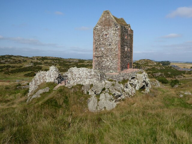
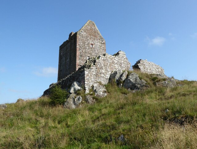
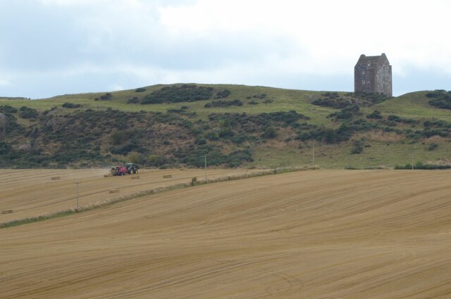
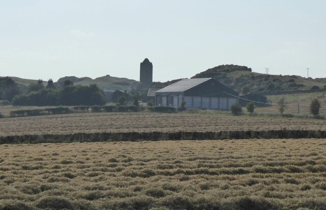
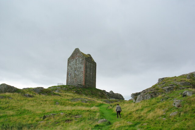
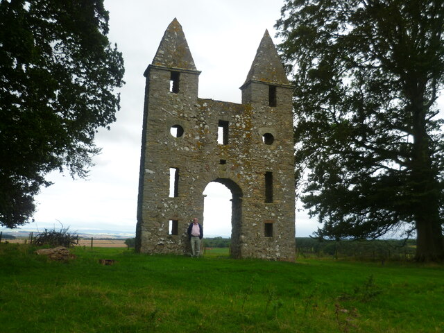
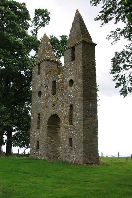
The village is best known for its historic Smailholm Tower, a 15th-century peel tower that stands proudly atop a rocky outcrop. The tower, which is now managed by Historic Environment Scotland, offers visitors a glimpse into the region's rich history. From the top of the tower, one can enjoy panoramic views of the surrounding landscape, with the Cheviot Hills and Eildon Hills visible in the distance.

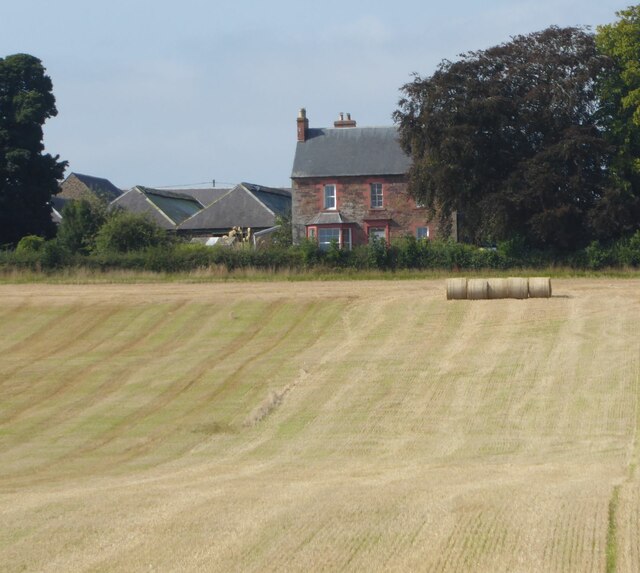
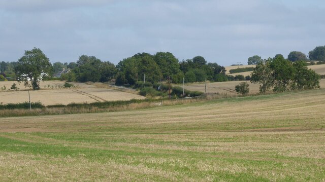
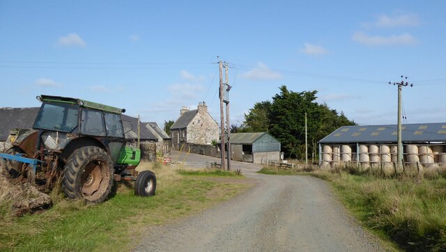
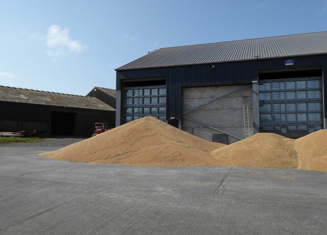
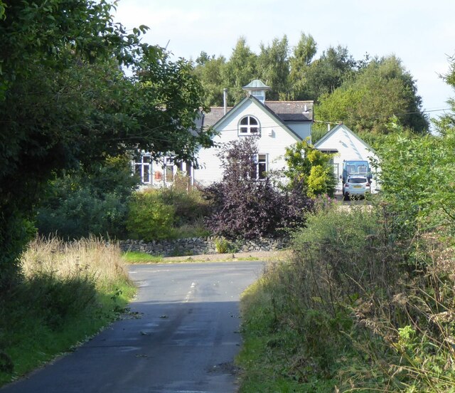
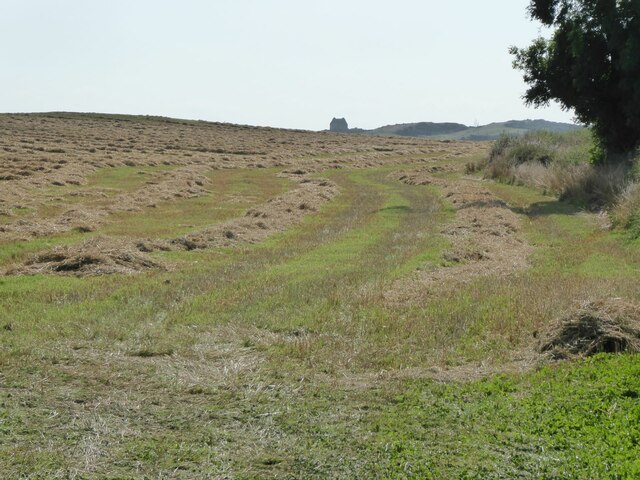
Aside from its famous tower, Smailholm also boasts a close-knit community and a peaceful, rural atmosphere. The village is home to a small number of houses, a local pub, and a village hall. The surrounding area is primarily agricultural, with farmland stretching as far as the eye can see.

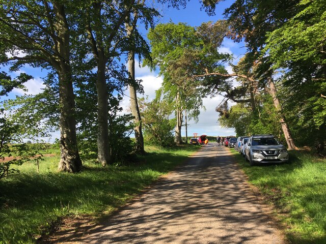
Smailholm is an ideal destination for those seeking a tranquil retreat or a base for exploring the beautiful Scottish Borders region. The village offers plenty of opportunities for outdoor pursuits, such as hiking, cycling, and birdwatching. Additionally, its proximity to the bustling town of Kelso means that residents and visitors can easily access amenities such as shops, restaurants, and leisure facilities.

Overall, Smailholm is a charming village with a rich historical heritage, breathtaking scenery, and a warm sense of community.

If you have any feedback on the listing, please let us know in the comments section below.

Smailholm Images

Images are sourced within 2km of 55.619113/-2.5623942 or Grid Reference NT6436. Thanks to Geograph Open Source API. All images are credited.

Smailholm Tower From the south west.
'Smailholm Tower is a peel tower at Smailholm, around five miles (8 km) west of Kelso in the Scottish Borders. Its dramatic situation, atop a crag of Lady Hill, commands wide views over the surrounding countryside. 
In June 2007, it was awarded the maximum "five-star" status as a tourist attraction from VisitScotland, a rating bestowed on only eight other sites in Scotland.' <span class="nowrap"><a title="https://en.wikipedia.org/wiki/Smailholm_Tower" rel="nofollow ugc noopener" href="https://en.wikipedia.org/wiki/Smailholm_Tower">Link</a><img style="margin-left:2px;" alt="External link" title="External link - shift click to open in new window" src="https://s1.geograph.org.uk/img/external.png" width="10" height="10"/></span>
Smailholm Tower
From the south west. 'Smailholm Tower is a peel tower at Smailholm, around five miles (8 km) west of Kelso in the Scottish Borders. Its dramatic situation, atop a crag of Lady Hill, commands wide views over the surrounding countryside. In June 2007, it was awarded the maximum "five-star" status as a tourist attraction from VisitScotland, a rating bestowed on only eight other sites in Scotland.' LinkExternal link
Smailholm Tower from the west Difficult of access!
Smailholm Tower from the west
Difficult of access!
Wall Brown butterfly (Lasiommata megera) On the grass below Smailholm Tower.
Wall Brown butterfly (Lasiommata megera)
On the grass below Smailholm Tower.
Stubble and cylindrical straw bales Near New Smailholm Farm.
Stubble and cylindrical straw bales
Near New Smailholm Farm.
Stubble and uncut cereal crops Approaching Glennewton and Smailholm.
Stubble and uncut cereal crops
Approaching Glennewton and Smailholm.
Sandyknowe Farm The farmhouse and steading of Sandyknowe lie to the east of Smailholm Tower. The site is associated with Sir Walter Scott, who after falling ill as a child, was moved here to the country from Edinburgh.
Sandyknowe was farmed by Scott's grandfather, and it was while he stayed at the farm that Scott was told stories of Border history and folklore by his aunt and grandmother. These had a profound impact on the future writer, inspiring him to write the works of historical romance for which he is renowned.
Sandyknowe Farm
The farmhouse and steading of Sandyknowe lie to the east of Smailholm Tower. The site is associated with Sir Walter Scott, who after falling ill as a child, was moved here to the country from Edinburgh. Sandyknowe was farmed by Scott's grandfather, and it was while he stayed at the farm that Scott was told stories of Border history and folklore by his aunt and grandmother. These had a profound impact on the future writer, inspiring him to write the works of historical romance for which he is renowned.
Cereal piled in the farmyard At Sandyknowe.
Would it be better in a silo?
Cereal piled in the farmyard
At Sandyknowe. Would it be better in a silo?
Baling the straw below Smailholm Tower The crop has been taken and piled at Sandyknowe farm.
See  <a title="https://www.geograph.org.uk/photo/6959114" href="https://www.geograph.org.uk/photo/6959114">Link</a>
Baling the straw below Smailholm Tower
The crop has been taken and piled at Sandyknowe farm. See Link
The last strip of cereal to be combine harvested With Miens Neuk in the background.
The field now awaits the baler!
The last strip of cereal to be combine harvested
With Miens Neuk in the background. The field now awaits the baler!
Fields waiting for the baler After combine harvesting.
Smailholm Tower in the background.
Fields waiting for the baler
After combine harvesting. Smailholm Tower in the background.
Approaching Smailholm village From Over Town and Sandyknowe.
Approaching Smailholm village
From Over Town and Sandyknowe.
Field margin after harvesting Straw still to be collected and baled.
Smailholm Tower is visible from miles around!
Field margin after harvesting
Straw still to be collected and baled. Smailholm Tower is visible from miles around!
Winter trees at Smailholm The trees by the B6397 on the southeast side of Smailholm village were viewed from a field boundary.
Winter trees at Smailholm
The trees by the B6397 on the southeast side of Smailholm village were viewed from a field boundary.
Smailholm Tower Viewed against a snow covered Cheviot from the slopes of Brotherstone Hill.
Smailholm Tower
Viewed against a snow covered Cheviot from the slopes of Brotherstone Hill.
Minor road near Mellerstain Mill
Smailholm Tower Quite a trek to reach!
Smailholm Tower
Quite a trek to reach!
Hundy Mundy The north facade of the eye-catcher for Mellerstain House
Hundy Mundy
The north facade of the eye-catcher for Mellerstain House
Hundy Mundy The eye-catcher for Mellerstain House
Hundy Mundy
The eye-catcher for Mellerstain House
Show me another place!

Smailholm is located at Grid Ref: NT6436 (Lat: 55.619113, Lng: -2.5623942)

Unitary Authority: The Scottish Borders

Police Authority: The Lothians and Scottish Borders

What 3 Words

///trick.signified.masterful. Near Earlston, Scottish Borders

Related Wikis

Smailholm

Smailholm (Scots: Smailhowm) is a small village in the historic county of Roxburghshire in south-east Scotland. It is at grid reference NT648364 and straddles...

Smailholm Tower

Smailholm Tower is a peel tower at Smailholm, around five miles (8 km) west of Kelso in the Scottish Borders. Its dramatic situation, atop a crag of Lady...
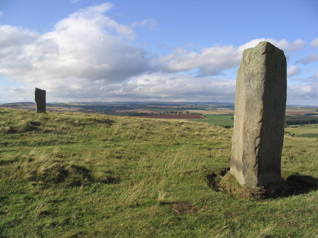
Brotherstone Hill

Brotherstone Hill is a hill near St. Boswells and the Eildon Hills in the Scottish Borders area of Scotland, with two standing stones from the megalithic...

Mellerstain House

Mellerstain House is a stately home around 8 miles (13 kilometres) north of Kelso in the Borders, Scotland. It is currently the home of George Baillie...

Nearby Amenities

Located within 500m of 55.619113,-2.5623942
Give Way
Direction: forward
Lat/Long: 55.6201757/-2.5599198
Smailholm
Name Sco: Smailham
Place: village
Wikidata: Q3486831
Wikipedia: en:Smailholm
Lat/Long: 55.620134/-2.5599402
Bus Stop
Smailholm Church
Bus: yes
Naptan AtcoCode: 6900771
Naptan Bearing: SW
Naptan CommonName: Church
Naptan Indicator: o/s
Naptan Landmark: Eden Road
Naptan NaptanCode: 72724345
Naptan Street: B6397
Operator: Scottish Borders Council
Public Transport: platform
Ref: 6900772
Source: NaPTAN
Lat/Long: 55.620152/-2.5597682
Bus Stop
Smailholm Church
Bus: yes
Naptan AtcoCode: 6900772
Naptan Bearing: SE
Naptan CommonName: Church
Naptan Indicator: opp
Naptan Landmark: Eden Road
Naptan NaptanCode: 72724348
Naptan Street: B6397
Operator: Scottish Borders Council
Public Transport: platform
Ref: 6900772
Source: NaPTAN
Lat/Long: 55.6205059/-2.5590111
Over Town
Place: locality
Lat/Long: 55.616339/-2.5609762
Natural: spring
Lat/Long: 55.6169188/-2.5602671
Noexit: yes
Lat/Long: 55.6193564/-2.560587
Post Box
Operator: Royal Mail
Post Box Mounting: stone_wall
Post Box Type: wall
Ref: TD5 101
Royal Cypher: GVIR
Lat/Long: 55.6203193/-2.559369
West Third
Place: hamlet
Lat/Long: 55.6175931/-2.5693708
Give Way
Direction: forward
Lat/Long: 55.6197672/-2.560376
Generator Method: photovoltaic
Generator Source: solar
Generator Type: solar_photovoltaic_panel
Power: generator
Lat/Long: 55.6177475/-2.5692558
Generator Method: photovoltaic
Generator Source: solar
Generator Type: solar_photovoltaic_panel
Power: generator
Lat/Long: 55.6177369/-2.5688361
Power: pole
Lat/Long: 55.6191254/-2.555412
Power: pole
Lat/Long: 55.6186884/-2.5564715
Power: pole
Lat/Long: 55.6186414/-2.5579531
Power: pole
Lat/Long: 55.6186065/-2.5590702
Power: pole
Lat/Long: 55.6187715/-2.5599719
Power: pole
Lat/Long: 55.618952/-2.560863
Power: pole
Lat/Long: 55.6185295/-2.5617307
Power: pole
Lat/Long: 55.6183104/-2.5627817
Power: pole
Lat/Long: 55.6180985/-2.5637836
Power: pole
Lat/Long: 55.617865/-2.5648687
Power: pole
Lat/Long: 55.6176687/-2.5658493
Power: pole
Lat/Long: 55.6174761/-2.5668193
Power: pole
Lat/Long: 55.6171703/-2.5682433
The data included in this document is from www.openstreetmap.org. The data is made available under ODbL.

Have you been to Smailholm?

Leave your review of Smailholm below (or comments, questions and feedback).