Blatchbridge

Settlement in Somerset Mendip

England

Blatchbridge

The Curlews Feltham Lane, Frome
The Curlews Feltham Lane, Frome Credit: Roy Hughes

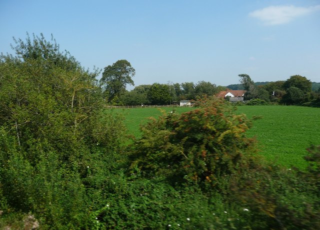
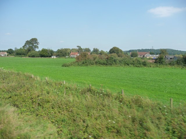
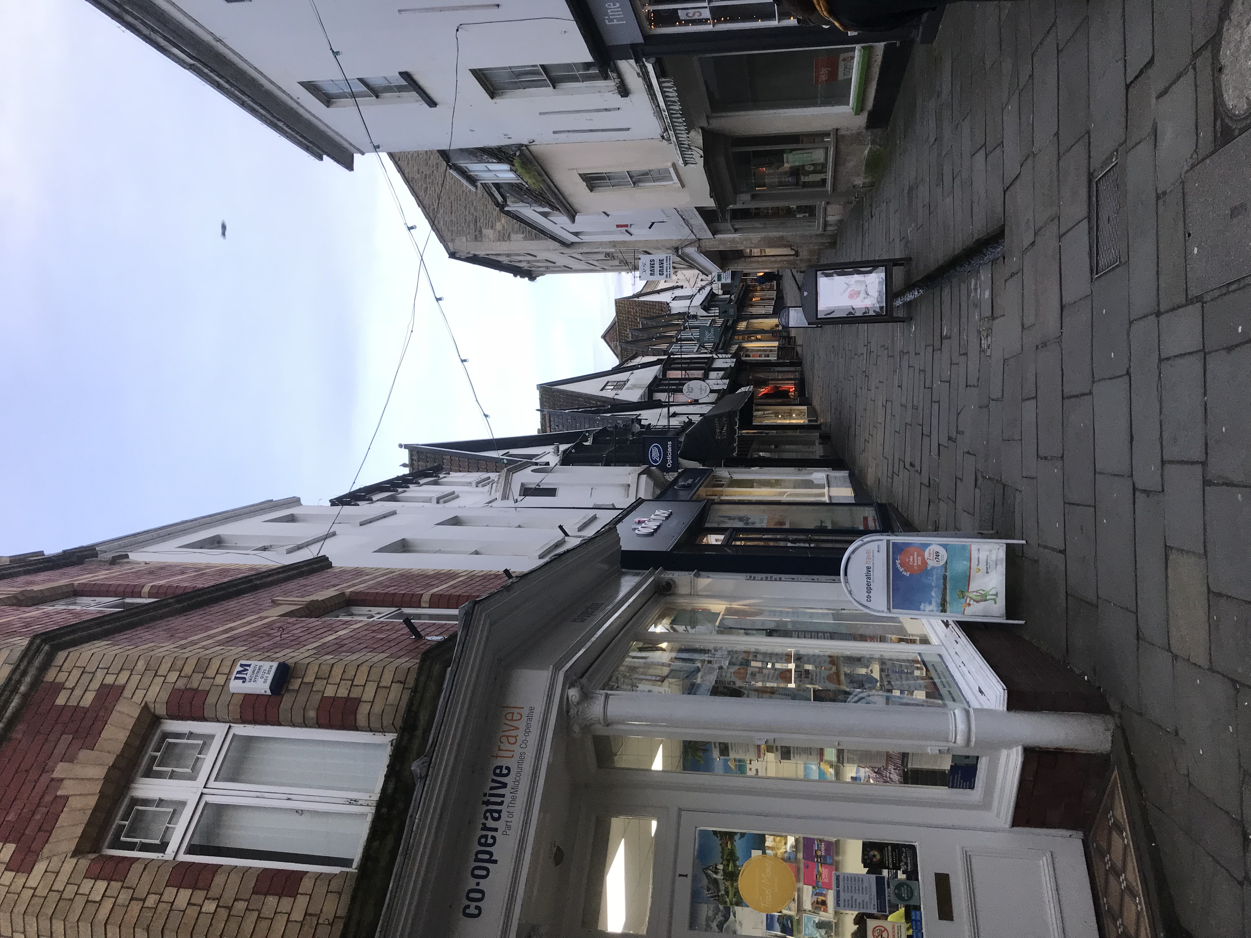
Blatchbridge is a picturesque village located in the county of Somerset, England. Situated on the fringes of the Mendip Hills, it is surrounded by lush green countryside and offers a tranquil and idyllic setting for its residents and visitors alike. Blatchbridge is conveniently positioned just a few miles south of the town of Shepton Mallet, making it easily accessible by road.

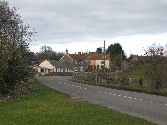
The village is characterized by its charming stone cottages, many of which date back several centuries, showcasing the area's rich historical heritage. Blatchbridge is home to a close-knit community, known for its warmth and hospitality. The village boasts a range of amenities, including a local pub, village hall, and a small convenience store, catering to the needs of its residents.

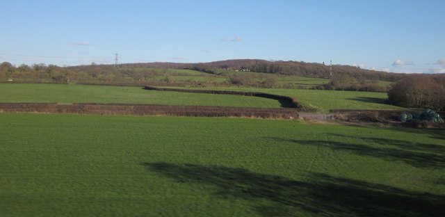
Nature enthusiasts will be delighted by the opportunities for outdoor activities in Blatchbridge. The nearby Mendip Hills offer an array of walking and cycling trails, allowing visitors to explore the stunning landscapes and take in panoramic views across the Somerset countryside. Additionally, the village is a short distance from the renowned Wookey Hole Caves, a popular tourist attraction that offers the chance to discover the underground wonders of the region.

Blatchbridge also benefits from its proximity to larger towns and cities. Bristol is just over 20 miles to the northwest, providing residents with access to a wide range of cultural, shopping, and entertainment options.

Overall, Blatchbridge is a charming and picturesque village, offering a peaceful and scenic retreat for those seeking a slower pace of life amidst the beauty of the Somerset countryside.

If you have any feedback on the listing, please let us know in the comments section below.

Blatchbridge Images

Images are sourced within 2km of 51.210554/-2.319215 or Grid Reference ST7745. Thanks to Geograph Open Source API. All images are credited.

The Curlews Feltham Lane, Frome
Frome Station Very few stations left with a overall wooden roof like this one. The station is on a loop line off the Western Region main line from Paddington to Penzance. A quiet station served by mainly the Weymouth to Bristol local trains and some others.
Frome Station
Very few stations left with a overall wooden roof like this one. The station is on a loop line off the Western Region main line from Paddington to Penzance. A quiet station served by mainly the Weymouth to Bristol local trains and some others.
Mendip : Bushes & Greenery Lots of greenery and bushes beside the railway here in Mendip.
Mendip : Bushes & Greenery
Lots of greenery and bushes beside the railway here in Mendip.
Mendip : Grassy Field A grassy field and bushes in the Mendips.
Mendip : Grassy Field
A grassy field and bushes in the Mendips.
Death of a nursery This site to the south of Frome town centre used to be a nursery and garden centre run as a work-experience project for disabled people.
Death of a nursery
This site to the south of Frome town centre used to be a nursery and garden centre run as a work-experience project for disabled people.
Fields by the B3092 The B road runs between hedges across the image, between Frome and Maiden Bradley. Silage bales are on the right. The pasture land rises towards New Church Farm at East Woodlands, in <a href="https://www.geograph.org.uk/gridref/ST7844">ST7844</a>, with Lower Woods clothing the hills west of Longleat. Taken from a train on the main railway line between Westbury and Bruton.
Fields by the B3092
The B road runs between hedges across the image, between Frome and Maiden Bradley. Silage bales are on the right. The pasture land rises towards New Church Farm at East Woodlands, in ST7844, with Lower Woods clothing the hills west of Longleat. Taken from a train on the main railway line between Westbury and Bruton.
Play Area off Newington Close, Keyford
New house, Marston Lane
Benchmark on Frome Auto Electrical and Diesel Ordnance Survey cut mark benchmark described on the Bench Mark Database at <span class="nowrap"><a title="http://www.bench-marks.org.uk/bm51663" rel="nofollow ugc noopener" href="http://www.bench-marks.org.uk/bm51663">Link</a><img style="margin-left:2px;" alt="External link" title="External link - shift click to open in new window" src="https://s1.geograph.org.uk/img/external.png" width="10" height="10"/></span>
Benchmark on Frome Auto Electrical and Diesel
Ordnance Survey cut mark benchmark described on the Bench Mark Database at LinkExternal link
Frome Auto Electrical & Diesel, Marston Trading Estate The premises on Manor Road has an OS benchmark <a href="https://www.geograph.org.uk/photo/3675585">ST7746 : Benchmark on Frome Auto Electrical and Diesel</a> on the side of the facing angle
Frome Auto Electrical & Diesel, Marston Trading Estate
The premises on Manor Road has an OS benchmark ST7746 : Benchmark on Frome Auto Electrical and Diesel on the side of the facing angle
Junction of The Mount and Mount Pleasant
Benchmark on #33 New Buildings Ordnance Survey cut mark benchmark described on the Bench Mark Database at <span class="nowrap"><a title="http://www.bench-marks.org.uk/bm51659" rel="nofollow ugc noopener" href="http://www.bench-marks.org.uk/bm51659">Link</a><img style="margin-left:2px;" alt="External link" title="External link - shift click to open in new window" src="https://s1.geograph.org.uk/img/external.png" width="10" height="10"/></span>
Benchmark on #33 New Buildings
Ordnance Survey cut mark benchmark described on the Bench Mark Database at LinkExternal link
Junction of New Buildings and New Buildings Lane There is an OS benchmark <a href="https://www.geograph.org.uk/photo/3675627">ST7747 : Benchmark on #33 New Buildings</a> on the side of the house.
Junction of New Buildings and New Buildings Lane
There is an OS benchmark ST7747 : Benchmark on #33 New Buildings on the side of the house.
Benchmark on #17 New Buildings Ordnance Survey cut mark benchmark described on the Bench Mark Database at <span class="nowrap"><a title="http://www.bench-marks.org.uk/bm51660" rel="nofollow ugc noopener" href="http://www.bench-marks.org.uk/bm51660">Link</a><img style="margin-left:2px;" alt="External link" title="External link - shift click to open in new window" src="https://s1.geograph.org.uk/img/external.png" width="10" height="10"/></span>
Benchmark on #17 New Buildings
Ordnance Survey cut mark benchmark described on the Bench Mark Database at LinkExternal link
West end of New Buildings at Long Ground junction There is an OS benchmark <a href="https://www.geograph.org.uk/photo/3675707">ST7747 : Benchmark on #17 New Buildings</a> on the side of the near house right of the guardstone
West end of New Buildings at Long Ground junction
There is an OS benchmark ST7747 : Benchmark on #17 New Buildings on the side of the near house right of the guardstone
Benchmark on #109 Lock's Hill Ordnance Survey cut mark benchmark described on the Bench Mark Database at <span class="nowrap"><a title="http://www.bench-marks.org.uk/bm51661" rel="nofollow ugc noopener" href="http://www.bench-marks.org.uk/bm51661">Link</a><img style="margin-left:2px;" alt="External link" title="External link - shift click to open in new window" src="https://s1.geograph.org.uk/img/external.png" width="10" height="10"/></span>
Benchmark on #109 Lock's Hill
Ordnance Survey cut mark benchmark described on the Bench Mark Database at LinkExternal link
Houses on Lock's Hill There is an OS benchmark <a href="https://www.geograph.org.uk/photo/3675757">ST7747 : Benchmark on #109 Lock's Hill</a> on the right hand side stone jamb of the dark green door near the left hand side of the image
Houses on Lock's Hill
There is an OS benchmark ST7747 : Benchmark on #109 Lock's Hill on the right hand side stone jamb of the dark green door near the left hand side of the image
Benchmark on gatepost beside Culverhill Ordnance Survey cut mark benchmark described on the Bench Mark Database at <span class="nowrap"><a title="http://www.bench-marks.org.uk/bm51662" rel="nofollow ugc noopener" href="http://www.bench-marks.org.uk/bm51662">Link</a><img style="margin-left:2px;" alt="External link" title="External link - shift click to open in new window" src="https://s1.geograph.org.uk/img/external.png" width="10" height="10"/></span>
Benchmark on gatepost beside Culverhill
Ordnance Survey cut mark benchmark described on the Bench Mark Database at LinkExternal link
Show me another place!

Blatchbridge is located at Grid Ref: ST7745 (Lat: 51.210554, Lng: -2.319215)

Administrative County: Somerset

District: Mendip

Police Authority: Avon and Somerset

What 3 Words

///living.towns.slower. Near Frome, Somerset

Nearby Locations

Tytherington Blatchbridge

Related Wikis

Blatchbridge

Blatchbridge is a hamlet within the civil parish of Selwood in Somerset, England, on the B3092 road from Frome to Maiden Bradley. It formerly had a blacksmith...

Frome Clay

The Frome Clay is a geological formation in England. It preserves fossils dating back to the Bathonian stage of the Middle Jurassic period. == See also... ==

Frome railway station

Frome railway station serves a largely rural area of the county of Somerset in England, and is situated in the town of Frome. The station is located on...

Frome

Frome ( FROOM) is a town and civil parish in eastern Somerset, England. The town is built on uneven high ground at the eastern end of the Mendip Hills...

Frome Rural District

Frome was a rural district in Somerset, England, from 1894 to 1974. The district was created in 1894 under the Local Government Act 1894. It was abolished...

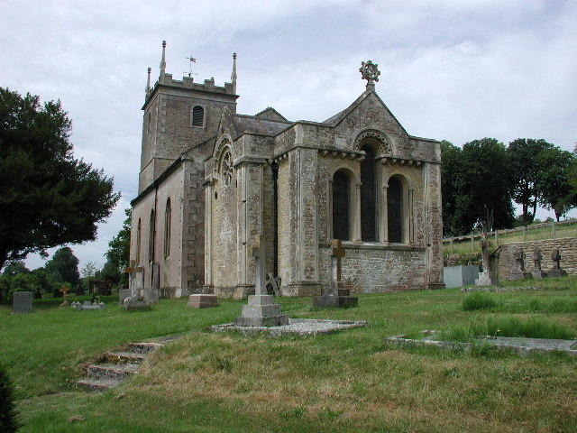
Church of St Katherine, East Woodlands

The Anglican Church of St Katherine in East Woodlands, Selwood, Somerset, England was built around 1712. It is a Grade II* listed building. == History... ==

Marston Bigot

Marston Bigot is a small village and former civil parish, now in the parish of Trudoxhill in the Somerset district, in the ceremonial county of Somerset...
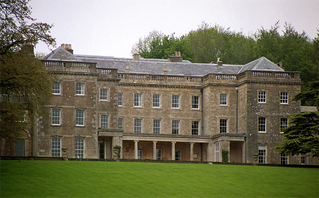
Marston Bigot Park

Marston Bigot Park encompasses approximately 222 hectares (2,220,000 m2) and includes Marston House, Marston Pond and the remains of the medieval shrunken...

Nearby Amenities

Located within 500m of 51.210554,-2.319215
Pub
The Cross Keys
Wikidata: Q26470204
Lat/Long: 51.2114941/-2.3173429
Railway: switch
Lat/Long: 51.2114264/-2.3138908
Railway: switch
Lat/Long: 51.2118279/-2.3132934
Blatchbridge Junction
Railway: switch
Lat/Long: 51.2122235/-2.3126284
Power: pole
Lat/Long: 51.2137811/-2.3232839
Power: pole
Lat/Long: 51.2140835/-2.3211139
Power: pole
Lat/Long: 51.2143053/-2.3196897
Power: pole
Lat/Long: 51.2126116/-2.3190862
Power: pole
Lat/Long: 51.2123025/-2.3190191
Power: pole
Lat/Long: 51.2120488/-2.3173803
Power: pole
Lat/Long: 51.2118051/-2.3179302
Power: pole
Lat/Long: 51.2121664/-2.3195636
Power: pole
Lat/Long: 51.2120219/-2.3201484
Power: pole
Lat/Long: 51.2118706/-2.3208296
Power: pole
Lat/Long: 51.213655/-2.3162404
Power: pole
Lat/Long: 51.2126906/-2.31745
Power: pole
Lat/Long: 51.2117312/-2.3187053
Power: pole
Lat/Long: 51.2107465/-2.3199472
Power: pole
Lat/Long: 51.2097417/-2.3211998
Power: pole
Lat/Long: 51.2085604/-2.3225758
Power: pole
Lat/Long: 51.2072968/-2.3240456
Power: pole
Lat/Long: 51.2076077/-2.3236862
Barrier: yes
Lat/Long: 51.2089537/-2.3138523
Blatchbridge Junction
Railway: junction
Lat/Long: 51.2122107/-2.3126087
Post Box
Mapillary: 823943199218653
Operator: Royal Mail
Operator Wikidata: Q638098
Post Box Mounting: pier
Post Box Type: lamp
Lat/Long: 51.2108963/-2.3173346
The data included in this document is from www.openstreetmap.org. The data is made available under ODbL.

Have you been to Blatchbridge?

Leave your review of Blatchbridge below (or comments, questions and feedback).