Blasford Hill

Settlement in Essex Chelmsford

England

Blasford Hill

Large house on Chelmsford Road, Minnow End Minnow End is the hamlet between Great Waltham and Little Waltham
Large house on Chelmsford Road, Minnow End Credit: David Howard

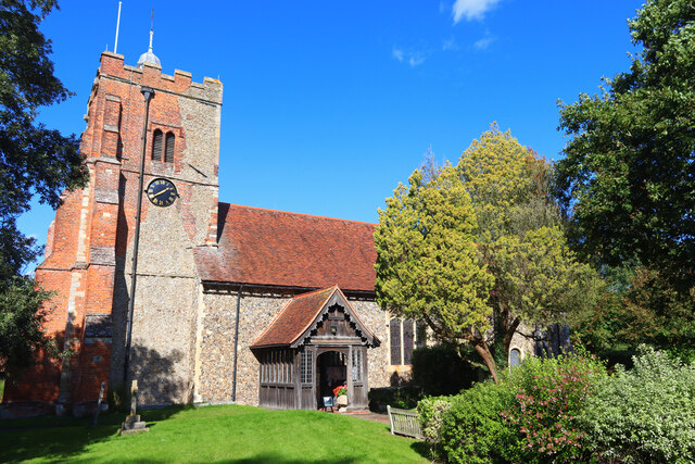
Blasford Hill is a small village located in the county of Essex, England. Situated in the rural countryside, it is known for its peaceful and picturesque surroundings. The village is positioned on a gentle slope, providing residents and visitors with breathtaking views of the surrounding landscape.

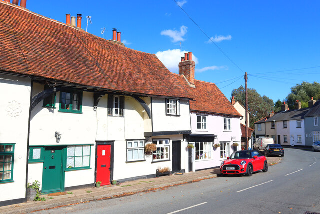
Blasford Hill has a population of approximately 500 people, making it a close-knit community where neighbors often know each other. The village consists of predominantly traditional English cottages, giving it a charming and quaint atmosphere. The architecture is a mix of historic buildings and newer constructions, blending the old with the new.

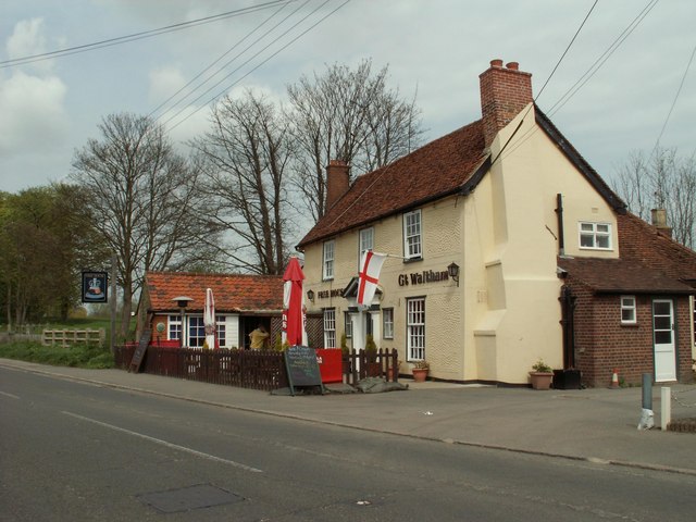
The village is well-served by amenities, including a local pub, a small convenience store, and a primary school. While the range of amenities is limited, larger towns and cities such as Chelmsford and Colchester are easily accessible by car or public transportation for additional services and entertainment.

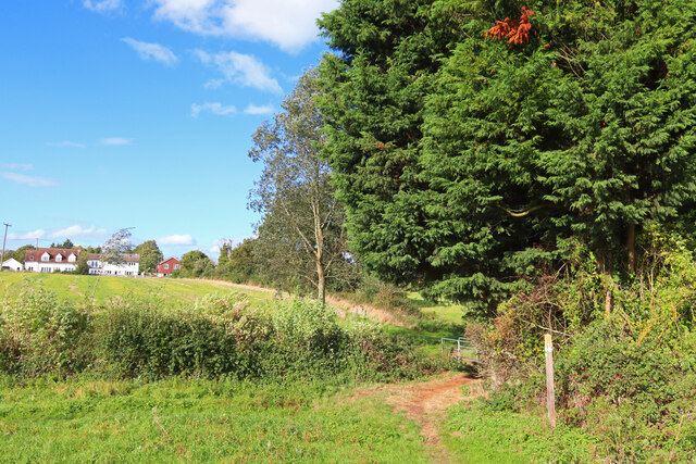
Nature enthusiasts will find plenty to explore in Blasford Hill and its surroundings. The village is surrounded by open fields, woodlands, and meandering footpaths, offering opportunities for leisurely walks and outdoor activities. Nearby attractions include Blasford Hill Nature Reserve, which is home to a diverse range of wildlife and offers stunning views from its hilltop location.

Blasford Hill is a peaceful and idyllic village that appeals to those seeking a quiet and close community in a picturesque rural setting. Its natural beauty, combined with its friendly atmosphere, makes it a desirable place to live or visit for those looking to escape the hustle and bustle of city life.

If you have any feedback on the listing, please let us know in the comments section below.

Blasford Hill Images

Images are sourced within 2km of 51.776218/0.475248 or Grid Reference TL7011. Thanks to Geograph Open Source API. All images are credited.

Large house on Chelmsford Road, Minnow End Minnow End is the hamlet between Great Waltham and Little Waltham
Large house on Chelmsford Road, Minnow End
Minnow End is the hamlet between Great Waltham and Little Waltham
Blasford Hill, Little Waltham
Chatham Hall Lane at the junction of Blasford Hill
Little Waltham Memorial Hall Village Hall in Little Waltham.
Little Waltham Memorial Hall
Village Hall in Little Waltham.
The Street Village of Little Waltham.
The Street
Village of Little Waltham.
River Chelmer River Chelmer and Mill Lane.
River Chelmer
River Chelmer and Mill Lane.
Butler's Farm Trees near the B1008 near Broomfield.
Butler's Farm
Trees near the B1008 near Broomfield.
Great Waltham View towards Great Waltham from near Salt House Farm.
Great Waltham
View towards Great Waltham from near Salt House Farm.
Pillbox near Broomfield Abandoned fortification near Broomfield.
Pillbox near Broomfield
Abandoned fortification near Broomfield.
St Martin's Church Church in Little Waltham.
St Martin's Church
Church in Little Waltham.
Rainbow near Broomfield View towards Croxtons Mill.
Rainbow near Broomfield
View towards Croxtons Mill.
School Lane Towards Parsonage Green.
School Lane
Towards Parsonage Green.
Flats on School Lane
Broomfield Library On Main Road.
Broomfield Library
On Main Road.
Main Road (B1008), Broomfield
The Kings Arms, Broomfield On Main Road.
See <a href="https://www.geograph.org.uk/photo/7267108">TL7010 : Sign for the Kings Arms, Broomfield</a> for sign.
The Kings Arms, Broomfield
On Main Road. See TL7010 : Sign for the Kings Arms, Broomfield for sign.
Sign for the Kings Arms, Broomfield See <a href="https://www.geograph.org.uk/photo/7267106">TL7010 : The Kings Arms, Broomfield</a> for context.
Sign for the Kings Arms, Broomfield
War Memorial on Church Green, Broomfield
Show me another place!

Blasford Hill is located at Grid Ref: TL7011 (Lat: 51.776218, Lng: 0.475248)

Administrative County: Essex

District: Chelmsford

Police Authority: Essex

What 3 Words

///copy.risky.prime. Near Chelmsford, Essex

Related Wikis

Nearby Amenities

Located within 500m of 51.776218,0.475248
Passing Place
Lat/Long: 51.7767086/0.4722068
Passing Place
Lat/Long: 51.7771787/0.4689493
Bus Stop
Butlers Farm
Bench: yes
Bin: yes
Bus: yes
Departures Board: timetable
Naptan AtcoCode: 15000100310
Naptan Bearing: N
Naptan CommonName: Butlers Farm
Naptan Crossing: Court Road
Naptan Indicator: Opp
Naptan Landmark: Butlers Farm
Naptan NaptanCode: esxdwawt
Naptan PlusbusZoneRef: CHLMSFD
Naptan Street: Main Road
Naptan Verified: no
Public Transport: platform
Shelter: yes
Source: naptan_import
Tactile Paving: yes
Lat/Long: 51.7721642/0.4731768
Bus Stop
Gernon Close
Bench: no
Bin: no
Bus: yes
Naptan AtcoCode: 15000101501
Naptan Bearing: W
Naptan CommonName: Hospital Approach
Naptan Crossing: Court Road
Naptan Indicator: W-bound
Naptan Landmark: Hospital Approach
Naptan NaptanCode: esxdwdad
Naptan PlusbusZoneRef: CHLMSFD
Naptan Street: Hospital Approach
Naptan Verified: no
Public Transport: platform
Shelter: no
Source: naptan_import
Tactile Paving: yes
Lat/Long: 51.7741414/0.4713225
Bus Stop
Ambulance HQ
Bench: no
Bin: no
Bus: yes
Naptan AtcoCode: 15000101502
Naptan Bearing: W
Naptan CommonName: The Millars
Naptan Crossing: The Millars
Naptan Indicator: Adj
Naptan Landmark: The Millars
Naptan NaptanCode: esxdwdag
Naptan PlusbusZoneRef: CHLMSFD
Naptan Street: Court Road
Naptan Verified: no
Public Transport: platform
Shelter: no
Source: naptan_import
Lat/Long: 51.7741079/0.4698886
Bus Stop
Croxton's Mill
Bench: no
Bin: no
Bus: yes
Naptan AtcoCode: 15000101505
Naptan Bearing: S
Naptan CommonName: Croxton's Mill
Naptan Crossing: Hospital Approach
Naptan Indicator: o/s
Naptan Landmark: Croxton's Mill
Naptan NaptanCode: esxdwdga
Naptan PlusbusZoneRef: CHLMSFD
Naptan Street: Blasford Hill
Naptan Verified: no
Public Transport: platform
Shelter: no
Source: naptan_import
Lat/Long: 51.7754203/0.474013
Bus Stop
Croxton's Mill
Bench: no
Bin: no
Bus: yes
Naptan AtcoCode: 15000101506
Naptan Bearing: N
Naptan CommonName: Croxton's Mill
Naptan Crossing: Hospital Approach
Naptan Indicator: Opp
Naptan Landmark: Croxton's Mill
Naptan NaptanCode: esxdwdgd
Naptan PlusbusZoneRef: CHLMSFD
Naptan Street: Blasford Hill
Naptan Verified: no
Public Transport: platform
Shelter: no
Source: naptan_import
Tactile Paving: no
Lat/Long: 51.7755716/0.4738438
Bus Stop
Woodhouse Lane
Bench: no
Bus: yes
Naptan AtcoCode: 15000101507
Naptan Bearing: S
Naptan CommonName: Blasford Hill
Naptan Indicator: S-bound
Naptan Landmark: Blasford Hill
Naptan NaptanCode: esxdwdgj
Naptan Street: Blansford Hill
Naptan Verified: no
Public Transport: platform
Shelter: no
Source: naptan_import
Lat/Long: 51.7785394/0.4734477
Bus Stop
Woodhouse Lane
Bench: no
Bin: no
Bus: yes
Naptan AtcoCode: 15000101508
Naptan Bearing: N
Naptan CommonName: Blasford Hill
Naptan Indicator: N-bound
Naptan Landmark: Blasford Hill
Naptan NaptanCode: esxdwdgm
Naptan Street: Blansford Hill
Naptan Verified: no
Public Transport: platform
Shelter: no
Source: naptan_import
Lat/Long: 51.7785771/0.4733628
Turning Circle
Lat/Long: 51.7721559/0.4725044
Turning Circle
Lat/Long: 51.7724608/0.4712953
Turning Circle
Lat/Long: 51.7729732/0.4728404
Barrier: lift_gate
Bicycle: no
Foot: no
Motorcar: yes
Motorcycle: yes
Lat/Long: 51.7740765/0.4693942
Crossing
Crossing: unmarked
Crossing Island: no
Crossing Markings: no
Tactile Paving: yes
Lat/Long: 51.7740258/0.4728648
Traffic Calming: island
Lat/Long: 51.7730347/0.4734219
Passing Place
Lat/Long: 51.7769822/0.4702328
Bus Stop
Ambulance HQ
Bench: yes
Bus: yes
Naptan AtcoCode: 150001015Y2
Naptan NaptanCode: esxjpgpt
Public Transport: platform
Shelter: yes
Source: naptan
Lat/Long: 51.7742882/0.4688243
Communication Mobile Phone: yes
Man Made: mast
Note: New mast, approximate location
Tower Construction: freestanding
Tower Type: communication
Lat/Long: 51.7756603/0.4693155
Barrier: lift_gate
Lat/Long: 51.7758297/0.4683058
Barrier: lift_gate
Lat/Long: 51.7757688/0.4682625
Barrier: lift_gate
Lat/Long: 51.7754347/0.468433
DAP Architecture Ltd
Addr City: Chelmsford
Addr Housename: The Millars
Addr Housenumber: 3-5
Addr Postcode: CM1 7FA
Addr Street: Hospital Approach
Email: studio@daparchitecture.co.uk
Office: architect
Phone: +44 1245 440302
Website: https://www.daparchitecture.co.uk/
Lat/Long: 51.7740417/0.4697163
Secure Haven Funeral Directors
Addr City: Chelmsford
Addr Housename: The Millars
Addr Housenumber: 1
Addr Postcode: CM1 7FA
Addr Street: Hospital Approach
Phone: +44 1245 377077
Shop: funeral_directors
Website: https://www.securehaven.co.uk/
Lat/Long: 51.7739864/0.4700105
Crossing
Crossing: unmarked
Crossing Island: yes
Crossing Markings: no
Tactile Paving: yes
Lat/Long: 51.7742033/0.4692169
Crossing
Crossing: unmarked
Crossing Island: yes
Crossing Markings: no
Tactile Paving: yes
Lat/Long: 51.7741682/0.4712336
Crossing
Crossing: unmarked
Crossing Island: yes
Crossing Markings: no
Tactile Paving: yes
Lat/Long: 51.7740663/0.4733461
Crossing
Crossing: unmarked
Crossing Island: yes
Crossing Markings: no
Tactile Paving: yes
Lat/Long: 51.7740018/0.4733076
Passing Place
Lat/Long: 51.7766221/0.471417
Crossing
Crossing: unmarked
Crossing Island: yes
Crossing Markings: no
Tactile Paving: yes
Lat/Long: 51.7738223/0.4737121
Crossing
Crossing: unmarked
Crossing Island: no
Crossing Markings: no
Lat/Long: 51.7742611/0.4694611
Crossing
Crossing: unmarked
Crossing Island: yes
Crossing Markings: no
Tactile Paving: yes
Lat/Long: 51.7738239/0.4735815
Generator Method: photovoltaic
Generator Output Electricity: yes
Generator Source: solar
Generator Type: solar_photovoltaic_panel
Location: roof
Power: generator
Lat/Long: 51.7722483/0.4729405
Generator Method: photovoltaic
Generator Output Electricity: yes
Generator Source: solar
Generator Type: solar_photovoltaic_panel
Location: roof
Power: generator
Lat/Long: 51.7736657/0.472455
Generator Method: photovoltaic
Generator Output Electricity: yes
Generator Source: solar
Generator Type: solar_photovoltaic_panel
Location: roof
Power: generator
Lat/Long: 51.7744474/0.4716852
Smoking Area
Bench: no
Bin: yes
Shelter: no
Lat/Long: 51.7750193/0.4684355
Passing Place
Lat/Long: 51.7751207/0.4683921
Barrier: lift_gate
Lat/Long: 51.7758666/0.4686353
Passing Place
Lat/Long: 51.7756471/0.4686438
Colour: yellow
Inscription: CP
Marker: post
Material: concrete
Utility: gas
Lat/Long: 51.7723261/0.4734826
Crossing
Crossing: marked
Crossing Island: no
Crossing Markings: zebra
Lat/Long: 51.7762753/0.4683892
Crossing
Crossing: marked
Crossing Markings: zebra
Lat/Long: 51.7763924/0.4683683
Crossing
Crossing: unmarked
Crossing Island: yes
Crossing Markings: no
Kerb: flush
Tactile Paving: yes
Lat/Long: 51.7735277/0.4735695
Post Box
Operator: Royal Mail
Operator Wikidata: Q638098
Lat/Long: 51.7764077/0.4739153
The data included in this document is from www.openstreetmap.org. The data is made available under ODbL.

Have you been to Blasford Hill?

Leave your review of Blasford Hill below (or comments, questions and feedback).