Adstock

Settlement in Buckinghamshire

England

Adstock

A413 north of Addington
A413 north of Addington Credit: Colin Pyle

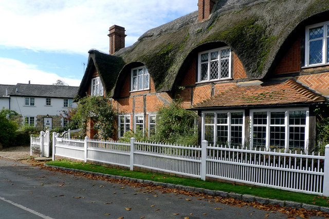
Adstock is a small village located in the Aylesbury Vale district of Buckinghamshire, England. Situated approximately 5 miles northwest of Buckingham, it is nestled in the picturesque countryside and surrounded by rolling hills and farmland. The village has a population of around 400 residents.

The history of Adstock can be traced back to the Roman times, as evidence of a Roman villa was discovered in the area. Throughout the centuries, the village has evolved into a charming and tranquil place, known for its rural beauty and peaceful atmosphere.

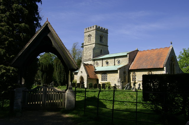
The village boasts a number of notable landmarks and historical buildings. One of the most prominent is St Cecilia's Church, a Grade II listed building that dates back to the 12th century. This medieval church features impressive stained glass windows and a stunning tower, making it a popular destination for history enthusiasts and visitors alike.

Adstock is also known for its strong sense of community, with various social and recreational activities taking place throughout the year. The village hall is a hub for local events, including art exhibitions, live performances, and community gatherings.

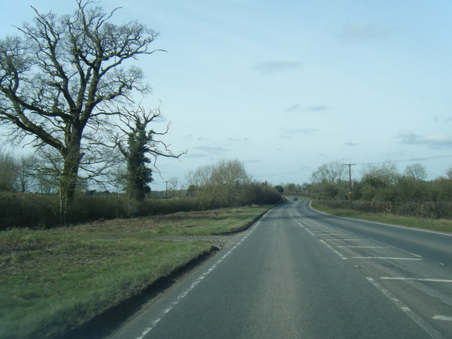
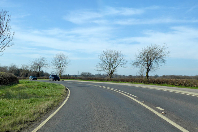
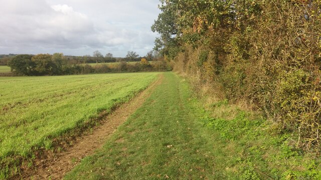
For those who enjoy nature and outdoor pursuits, Adstock offers plenty of opportunities. The surrounding countryside is ideal for walking, cycling, and horse riding, with numerous footpaths and bridleways winding through the scenic landscape.

Overall, Adstock is a charming village that combines a rich history, natural beauty, and a tight-knit community, making it an attractive place to live or visit for those seeking a peaceful retreat in the heart of Buckinghamshire.

If you have any feedback on the listing, please let us know in the comments section below.

Adstock Images

Images are sourced within 2km of 51.965548/-0.927713 or Grid Reference SP7330. Thanks to Geograph Open Source API. All images are credited.

A413 north of Addington
A413 nearing The Folly Inn, Adstock
Old Milestone by the A413 near Addington Carved stone post by the A413, in parish of Addington (Aylesbury Vale District), near Hanover Farm, North of Addington Manor Lodge, on wide grass verge, on South side of road. Aylesbury square, erected by the Wendover & Buckingham turnpike trust in the 18th century. 

Inscription reads:-
: BANBURY / 22 / BUCKINGHAM / 5 : : LONDON / 52 / AYLESBURY / 12 / WINSLOW / 1 :  
Carved benchmark on top.

Buckinghamshire HER.
HER Number: 1357000000 <span class="nowrap"><a title="https://www.heritagegateway.org.uk/Gateway/Results_Single.aspx?uid=MBC25710&resourceID=1024" rel="nofollow ugc noopener" href="https://www.heritagegateway.org.uk/Gateway/Results_Single.aspx?uid=MBC25710&resourceID=1024">Link</a><img style="margin-left:2px;" alt="External link" title="External link - shift click to open in new window" src="https://s1.geograph.org.uk/img/external.png" width="10" height="10"/></span>

Milestone Society National ID: BU_LC52
Old Milestone by the A413 near Addington
Carved stone post by the A413, in parish of Addington (Aylesbury Vale District), near Hanover Farm, North of Addington Manor Lodge, on wide grass verge, on South side of road. Aylesbury square, erected by the Wendover & Buckingham turnpike trust in the 18th century. Inscription reads:- : BANBURY / 22 / BUCKINGHAM / 5 : : LONDON / 52 / AYLESBURY / 12 / WINSLOW / 1 : Carved benchmark on top. Buckinghamshire HER. HER Number: 1357000000 LinkExternal link Milestone Society National ID: BU_LC52
Old Milestone by the A413, south of Adstock Carved stone post by the A413, in parish of Adstock (Aylesbury Vale District), South of Adstock near footpath to Addington, on grass verge where footpath sign points over a stile, on South side of road. Aylesbury square, erected by the Wendover & Buckingham turnpike trust in the 18th century. 

Inscription reads:-
: BANBURY / 21 / BUCKINGHAM / 4 : : LONDON / 53 / AYLESBURY / 13 / WINSLOW / 2 : 
Carved benchmark top right. 

Buckinghamshire HER.
HER Number: 1356900000 <span class="nowrap"><a title="https://www.heritagegateway.org.uk/Gateway/Results_Single.aspx?uid=MBC25703&resourceID=1024" rel="nofollow ugc noopener" href="https://www.heritagegateway.org.uk/Gateway/Results_Single.aspx?uid=MBC25703&resourceID=1024">Link</a><img style="margin-left:2px;" alt="External link" title="External link - shift click to open in new window" src="https://s1.geograph.org.uk/img/external.png" width="10" height="10"/></span>

Milestone Society National ID: BU_LC53
Old Milestone by the A413, south of Adstock
Carved stone post by the A413, in parish of Adstock (Aylesbury Vale District), South of Adstock near footpath to Addington, on grass verge where footpath sign points over a stile, on South side of road. Aylesbury square, erected by the Wendover & Buckingham turnpike trust in the 18th century. Inscription reads:- : BANBURY / 21 / BUCKINGHAM / 4 : : LONDON / 53 / AYLESBURY / 13 / WINSLOW / 2 : Carved benchmark top right. Buckinghamshire HER. HER Number: 1356900000 LinkExternal link Milestone Society National ID: BU_LC53
The A413, Adstock Since 2011 the bollards have appeared and a road narrows sign in front of the arrows has gone.
The A413, Adstock
Since 2011 the bollards have appeared and a road narrows sign in front of the arrows has gone.
The A413, Adstock
The A413, Adstock
Addington, St Mary
Addington, St Mary
A413 towards Buckingham By the turning for Adstock.
A413 towards Buckingham
By the turning for Adstock.
A413 towards Buckingham, bridge over a brook No apparent name for the brook, but it flows into the Claydon Brook, then the Padbury Brook (The Twins) and finally the River Great Ouse.
A413 towards Buckingham, bridge over a brook
No apparent name for the brook, but it flows into the Claydon Brook, then the Padbury Brook (The Twins) and finally the River Great Ouse.
Bend on A413 towards Buckingham
Path heading to Padbury From Padburyhill Farm the path heading to Padbury
Path heading to Padbury
From Padburyhill Farm the path heading to Padbury
Cottages in Adstock Village These cottages are on the main road through the village and close to the church.
Cottages in Adstock Village
These cottages are on the main road through the village and close to the church.
The Thatched Inn and Restaurant, Adstock The date on the signboard is c1645.
The Thatched Inn and Restaurant, Adstock
The date on the signboard is c1645.
The Thatched Inn and Restaurant in Adstock village
St. Cecilia, Adstock
The Church of St. Cecilia, Adstock
Cottage by the Churchyard, Adstock
St. Cecilia, Adstock
Show me another place!

Adstock is located at Grid Ref: SP7330 (Lat: 51.965548, Lng: -0.927713)

Unitary Authority: Buckinghamshire

Police Authority: Thames Valley

What 3 Words

///island.watches.composts. Near Great Horwood, Buckinghamshire

Nearby Locations

Adstock Haskell Wood

Related Wikis

Adstock

For the municipality in Quebec, see Adstock, Quebec Adstock is a village and civil parish about 2.5 miles (4.0 km) northwest of Winslow and 3 miles (4...

Addington, Buckinghamshire

Addington is a village and civil parish in Buckinghamshire, England, about 2 miles (3.2 km) west of Winslow and 3 miles (4.8 km) south east of Buckingham...

Padbury

Padbury is a village and civil parish in north Buckinghamshire, England. It is located on the A413 main road that links Buckingham with Winslow. ��2�...

Claydon Brook

Claydon Brook is a 24.06 km (14.95 mi) long river in Buckinghamshire, England that is a tributary of Padbury Brook, itself a tributary to the River Great...
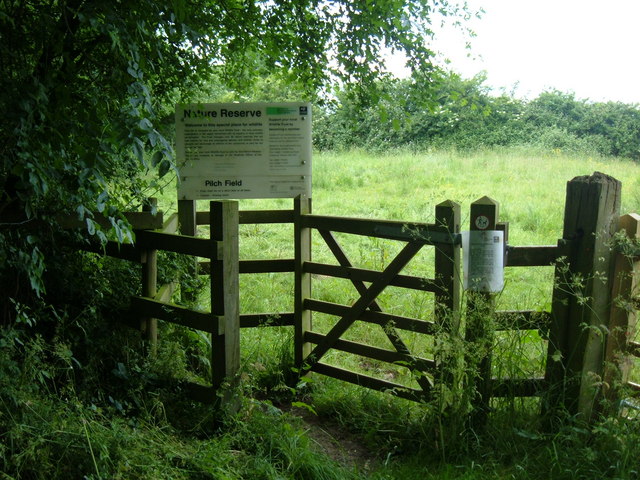
Pilch Fields

Pilch Fields is an 11.1-hectare (27-acre) biological Site of Special Scientific Interest (SSSI) west of Great Horwood in Buckinghamshire. It is managed...

Padbury railway station

Padbury railway station served the village of Padbury in the English county of Buckinghamshire. It opened in 1878 as part of the Buckinghamshire Railway...

Coombs Quarry

Coombs Quarry is a 0.5 hectare Local Nature Reserve east of Buckingham. It is owned and managed by Buckinghamshire County Council.This very small site...

Verney Junction railway station

Verney Junction railway station was an isolated railway station at a four-way railway junction in Buckinghamshire, open from 1868 to 1968; a junction existed...

Nearby Amenities

Located within 500m of 51.965548,-0.927713
Adstock
Is In: Buckinghamshire
Place: village
Lat/Long: 51.9656154/-0.9289244
Turning Circle
Lat/Long: 51.9671429/-0.9273935
Pub
The Old Thatched Inn
Addr City: Adstock
Addr Street: Main Street
Outdoor Seating: yes
Smoking: outside
Source: survey;local knowledge
Survey Date: 2015-05-04
Wikidata: Q26509534
Lat/Long: 51.9654116/-0.9301155
Post Box
Collection Times: Mo-Fr 16:30; Sa 08:30
Operator: Royal Mail
Post Box Type: lamp
Ref: MK18 96
Royal Cypher: EIIR
Royal Cypher Wikidata: Q33102113
Source: survey
Survey Date: 2015-05-04
Lat/Long: 51.9653119/-0.9300508
Power: pole
Lat/Long: 51.9676188/-0.9288622
Power: pole
Lat/Long: 51.9684552/-0.9285438
Direction: 235
Generator Method: photovoltaic
Generator Output Electricity: yes
Generator Solar Modules: 12
Generator Source: solar
Generator Type: solar_photovoltaic_panel
Location: roof
Power: generator
Lat/Long: 51.9630981/-0.9303541
Direction: 135
Generator Method: photovoltaic
Generator Output Electricity: yes
Generator Solar Modules: 7
Generator Source: solar
Generator Type: solar_photovoltaic_panel
Location: roof
Power: generator
Lat/Long: 51.9631449/-0.93056
Direction: 230
Generator Method: photovoltaic
Generator Output Electricity: yes
Generator Solar Modules: 9
Generator Source: solar
Generator Type: solar_photovoltaic_panel
Location: roof
Power: generator
Lat/Long: 51.9633162/-0.9300272
Direction: 220
Generator Method: photovoltaic
Generator Output Electricity: yes
Generator Solar Modules: 18
Generator Source: solar
Generator Type: solar_photovoltaic_panel
Location: roof
Power: generator
Lat/Long: 51.9648736/-0.9288529
Direction: 120
Generator Method: photovoltaic
Generator Output Electricity: yes
Generator Solar Modules: 3
Generator Source: solar
Generator Type: solar_photovoltaic_panel
Location: roof
Power: generator
Lat/Long: 51.9669047/-0.9263315
The data included in this document is from www.openstreetmap.org. The data is made available under ODbL.

Have you been to Adstock?

Leave your review of Adstock below (or comments, questions and feedback).