Sinton

Settlement in Worcestershire Wychavon

England

Sinton

Farmland north of Ombersley Flat meadows as far as the eye can see
Farmland north of Ombersley Credit: Eirian Evans

Sinton is a small village located in Worcestershire, England. Situated approximately 7 miles south of the city of Worcester, Sinton is nestled in the picturesque countryside of the county. It is part of the Malvern Hills District and falls under the jurisdiction of the Wychavon District Council.

The village of Sinton boasts a rich history, with evidence of settlement dating back to the prehistoric era. The area is known for its agricultural heritage, with farming and livestock rearing playing a significant role in the local economy.

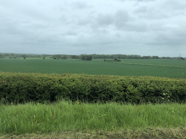
Sinton is characterized by its charming rural landscape, with rolling hills, meandering streams, and lush green fields. The village is surrounded by natural beauty, making it an attractive destination for nature enthusiasts and hikers. The nearby Malvern Hills, an Area of Outstanding Natural Beauty, provide ample opportunities for outdoor activities such as walking, cycling, and picnicking.

While Sinton itself is a small village with a limited number of amenities, the bustling city of Worcester is within easy reach, offering a wide range of services and facilities. Residents of Sinton enjoy a peaceful and close-knit community, with a number of local events and activities organized throughout the year.

Overall, Sinton is a quaint and idyllic village in Worcestershire, offering a tranquil rural lifestyle while being conveniently located near the amenities of a larger city.

If you have any feedback on the listing, please let us know in the comments section below.
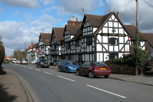
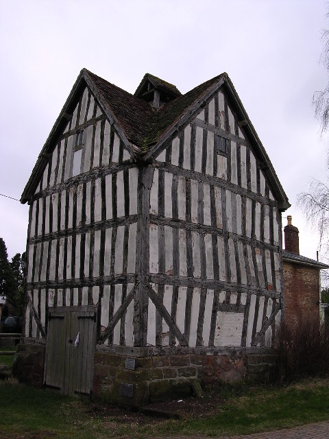
Sinton Images

Images are sourced within 2km of 52.264925/-2.2358646 or Grid Reference SO8463. Thanks to Geograph Open Source API. All images are credited.

Farmland north of Ombersley Flat meadows as far as the eye can see
Farmland north of Ombersley
Flat meadows as far as the eye can see
Fields next to a footpath, near to Uphampton
Field boundary near Uphampton, Worcestershire
Walkers heading for Boreley House With the Abberley Hills in the distance.
Walkers heading for Boreley House
With the Abberley Hills in the distance.
Farm buildings at Boreley House with Woodbury Hill behind
Black Barn, Boreley Lane from the field side
Lock Keeper's Cottage, Holt Fleet, Worcestershire
Fish pond by The Wharf Inn, Holt Fleet
Houses at Holt Fleet from the riverside path (1)
Houses at Holt Fleet from the riverside path (2)
Autumnal trees across the river from Holt
Holt Castle from across the River Severn
Path from the River Severn to Ombersley
Looking across Ombersley Park With Ombersley Court and St Andrew Church.
Looking across Ombersley Park
With Ombersley Court and St Andrew Church.
Ombersley Court from the footpath by the fishponds
St Andrews Church, Ombersley from the South West
Holt Castle Grade I Listed building in Worcestershire. A fortified house with a 14th century tower.
Holt Castle
Grade I Listed building in Worcestershire. A fortified house with a 14th century tower.
Old Milestone, A449, South of Ombersley The milestone is located 20m north of the junction with the A4133 old road through Ombersley on the grass verge on the west side of the road. Parish of Ombersley (Wychavon District). Concrete post with replacement metal plate, Bradley post design, originally erected by the County Council in the 1930's. 

The original plate was stolen by professional thieves in April 2019, see <a title="https://www.geograph.org.uk/photo/6583401" href="https://www.geograph.org.uk/photo/6583401">Link</a> . The replacement plate was provided by the Milestone Society in October 2021, funded by a bequest from society member Rob Bubb of Kidderminster, being painstakingly installed by Worcestershire Highways staff, with additional refurbishment by the Ombersley and Doverdale Parish Council.

Inscription reads:-
A449 / STOURPORT 7 / C.C.W.

Milestone Society National ID: WO_SPWO07
Old Milestone, A449, South of Ombersley
The milestone is located 20m north of the junction with the A4133 old road through Ombersley on the grass verge on the west side of the road. Parish of Ombersley (Wychavon District). Concrete post with replacement metal plate, Bradley post design, originally erected by the County Council in the 1930's. The original plate was stolen by professional thieves in April 2019, see Link . The replacement plate was provided by the Milestone Society in October 2021, funded by a bequest from society member Rob Bubb of Kidderminster, being painstakingly installed by Worcestershire Highways staff, with additional refurbishment by the Ombersley and Doverdale Parish Council. Inscription reads:- A449 / STOURPORT 7 / C.C.W. Milestone Society National ID: WO_SPWO07
Show me another place!

Sinton is located at Grid Ref: SO8463 (Lat: 52.264925, Lng: -2.2358646)

Administrative County: Worcestershire

District: Wychavon

Police Authority: West Mercia

What 3 Words

///animated.uncle.swung. Near Fernhill Heath, Worcestershire

Related Wikis

Ombersley

Ombersley is a village and civil parish in Wychavon district, in the county of Worcestershire, England. The parish includes the hamlet of Holt Fleet,...

Holt, Worcestershire

Holt is a village and civil parish in the Malvern Hills District of the county of Worcestershire, England. The church is dedicated to St. Martin, and dates...

Ombersley and Doverdale

Ombersley and Doverdale is an area in Wychavon district, Worcestershire, England served by a single parish council but comprising the two separate civil...

Holt Fleet Bridge

Holt Fleet Bridge, also known as Holt Bridge, is a cast-iron arch bridge over the River Severn, at Holt in Worcestershire, England. It has a span of 150...

Hawford

Hawford is a hamlet in Worcestershire, England. It falls within two parishes; North Claines and Ombersley and Doverdale in the outer suburbs of Worcester...

Holt Heath, Worcestershire

Holt Heath, in the parish of Holt, is a village near the west bank of the River Severn in Worcestershire. The nearest towns are all about 6 miles away...

Grimley, Worcestershire

Grimley is a village and civil parish (grid reference SO8360) in the Malvern Hills District in the county of Worcestershire, England about 3 miles (4...

A449 road

The A449 is a major road in the United Kingdom. It runs north from junction 24 of the A48 road at Newport in South Wales to Stafford in Staffordshire....

Nearby Amenities

Located within 500m of 52.264925,-2.2358646
Bus Stop
Ombersley- A449 North Bound
Bus: yes
Naptan AtcoCode: 2000G502411
Naptan Bearing: N
Naptan CommonName: Ombersley- A449 North Bound
Naptan Indicator: Adj
Naptan Landmark: Ombersley Road
Naptan NaptanCode: wocdpwad
Naptan Street: Sinton
Naptan Verified: no
Public Transport: platform
Source: naptan_import
Lat/Long: 52.2647641/-2.228955
Barrier: stile
Lat/Long: 52.2624008/-2.2412901
Barrier: stile
Lat/Long: 52.2648775/-2.2319677
Barrier: stile
Foot: yes
Lat/Long: 52.2631371/-2.239606
Barrier: stile
Foot: yes
Lat/Long: 52.2615031/-2.2382591
The data included in this document is from www.openstreetmap.org. The data is made available under ODbL.

Have you been to Sinton?

Leave your review of Sinton below (or comments, questions and feedback).