Blairlogie

Settlement in Stirlingshire

Scotland

Blairlogie

Pitch n' put at Airthrey Castle
Pitch n' put at Airthrey Castle Credit: Alan Reid

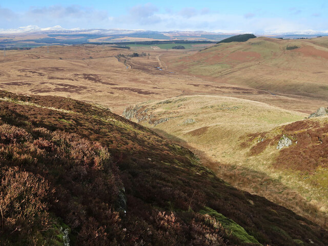
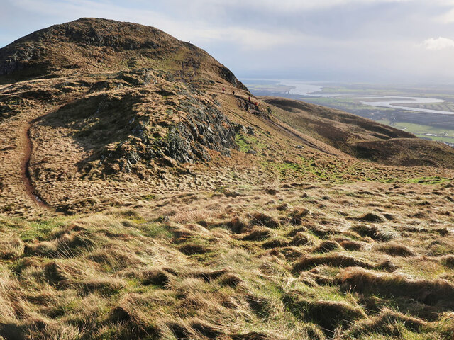
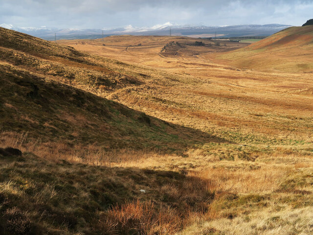
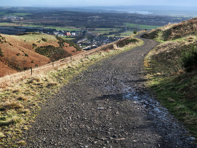
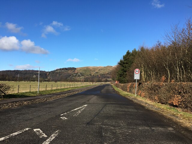
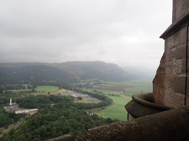
Blairlogie is a small village located in Stirlingshire, Scotland. Situated at the foot of the Ochil Hills, it is approximately 5 miles northwest of the city of Stirling. The village is known for its picturesque setting and stunning views of the surrounding countryside.

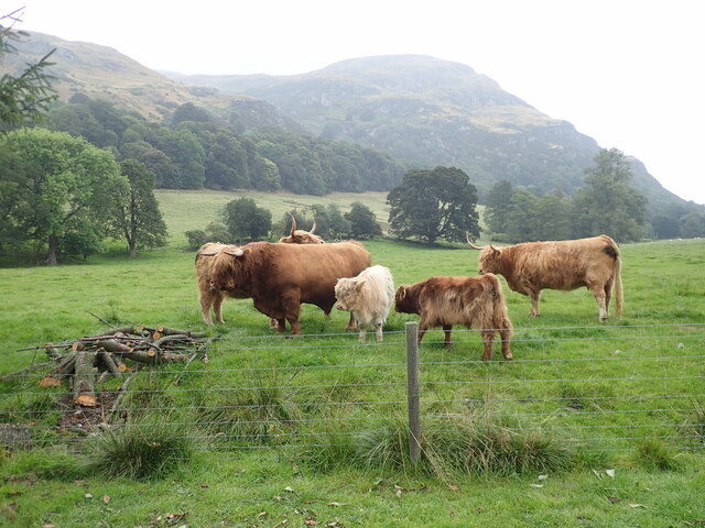
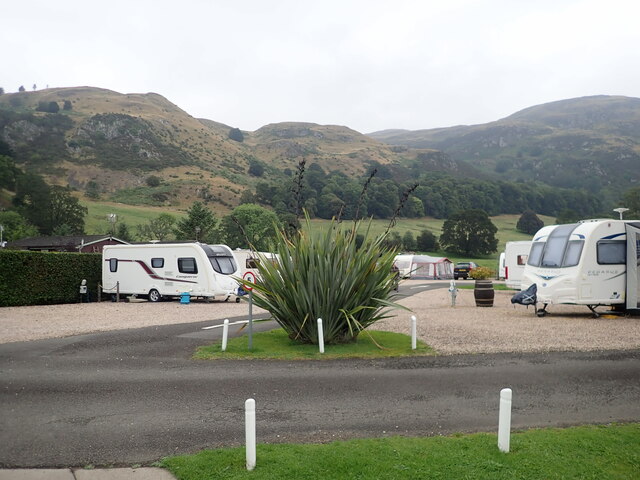
Blairlogie is a historic settlement with a rich heritage dating back centuries. It was originally established as a farming community and later became a popular destination for tourists seeking outdoor activities and natural beauty. The village is surrounded by lush green fields, rolling hills, and dense woodlands, making it an ideal location for hiking, cycling, and exploring nature.

One of the notable landmarks in Blairlogie is Blairlogie Castle, a 16th-century tower house that has been well-preserved over the years. The castle stands as a testament to the village's historical significance and offers visitors a glimpse into Scotland's past.

Despite its small size, Blairlogie offers a range of amenities to its residents and visitors. The village has a local pub where people can socialize and enjoy traditional Scottish cuisine. Additionally, there are several bed and breakfast establishments that provide accommodation for those wishing to stay and experience the tranquility of the area.

Blairlogie is well-connected to nearby towns and cities by road, making it easily accessible for travelers. Its proximity to Stirling allows residents to enjoy the convenience of urban amenities while still enjoying the peacefulness of village life. Overall, Blairlogie is a charming and idyllic location that offers a retreat from the hustle and bustle of modern life.

If you have any feedback on the listing, please let us know in the comments section below.

Blairlogie Images

Images are sourced within 2km of 56.150188/-3.887942 or Grid Reference NS8296. Thanks to Geograph Open Source API. All images are credited.

Pitch n' put at Airthrey Castle
Path on Dumyat A steep path from the car park at Blairlogie through woodland to the open moorland.
Path on Dumyat
A steep path from the car park at Blairlogie through woodland to the open moorland.
Moorland on the north side of Dumyat The gully in the foreground is a continuation of the one between Dumyat and Castle Law on the south scarp face of the hill. Ben Vorlich and Stuc a'Chroin are the distant snow covered hills on the left.
Moorland on the north side of Dumyat
The gully in the foreground is a continuation of the one between Dumyat and Castle Law on the south scarp face of the hill. Ben Vorlich and Stuc a'Chroin are the distant snow covered hills on the left.
Summit of Dumyat Viewed from the north west with the meandering River Forth in the distance.
Summit of Dumyat
Viewed from the north west with the meandering River Forth in the distance.
Moorland north of Dumyat View towards Sheriffmuir.
Moorland north of Dumyat
View towards Sheriffmuir.
Track on Dumyat An old farm track from Menstrie that goes to Lossburn Reservoir.
Track on Dumyat
An old farm track from Menstrie that goes to Lossburn Reservoir.
Entrance to Blairlogie Car Park One of the start points for a walk up Dumyat.
Entrance to Blairlogie Car Park
One of the start points for a walk up Dumyat.
Road to Manor Loan
Road to Manor Loan
Highland family Iconic highland cattle near the Witches Craig Caravan Site
Highland family
Iconic highland cattle near the Witches Craig Caravan Site
Witches Craig Caravan & Camping Park Just outside Stirling
Witches Craig Caravan & Camping Park
Just outside Stirling
View north-east from the Wallace Tower Looking towards the Ochil hills. The factory in the loop of the B998 produces commercial cooking equipment.
View north-east from the Wallace Tower
Looking towards the Ochil hills. The factory in the loop of the B998 produces commercial cooking equipment.
Old milestone Just west of the traffic island on the A91 at Logie Kirk is a milestone.   Searched for in autumn 2021 but not found.  But there it is, just visible before the Spring growth in April 2022.   Logie Kirk is behind the trees bordering the field.
Old milestone
Just west of the traffic island on the A91 at Logie Kirk is a milestone. Searched for in autumn 2021 but not found. But there it is, just visible before the Spring growth in April 2022. Logie Kirk is behind the trees bordering the field.
Old milestone A closer view of the 'hidden' milestone near Logie Kirk roundabout.   Compare with the much older photo <a href="https://www.geograph.org.uk/photo/6047616">NS8196 : Old Milestone by the A91, Logie Kirk, Logie Parish</a>.   It is adjacent to a Telephone cover in the path.  For benchmark enthusiasts a pin and benchmark can just be made out at the top of the bevel.   It may once have had Dollar 9½ painted on the left-hand side and Stirling 3 on the right.
Old milestone
A closer view of the 'hidden' milestone near Logie Kirk roundabout. Compare with the much older photo NS8196 : Old Milestone by the A91, Logie Kirk, Logie Parish. It is adjacent to a Telephone cover in the path. For benchmark enthusiasts a pin and benchmark can just be made out at the top of the bevel. It may once have had Dollar 9½ painted on the left-hand side and Stirling 3 on the right.
Faint path on the southern side of Dumyat As an alternative to the short walk up Dumyat from the Sheriffmuir road, the hill can be climbed from close to sea level at the foot of its southern slopes. A path can be followed from the Blairlogie car park steeply through woods and then through this area, passing through an old gate, and eventually on to the main path on the crest of the hill.
Faint path on the southern side of Dumyat
As an alternative to the short walk up Dumyat from the Sheriffmuir road, the hill can be climbed from close to sea level at the foot of its southern slopes. A path can be followed from the Blairlogie car park steeply through woods and then through this area, passing through an old gate, and eventually on to the main path on the crest of the hill.
Lumpy terrain on Dumyat Looking back down the well-trodden path towards the Sheriffmuir road.
Lumpy terrain on Dumyat
Looking back down the well-trodden path towards the Sheriffmuir road.
A91 near Menstrie
A91 near Menstrie
Location of OS Stirling FBM Aux 1 <span class="nowrap"><a title="https://trigpointing.uk/trig/578" rel="nofollow ugc noopener" href="https://trigpointing.uk/trig/578">Link</a><img style="margin-left:2px;" alt="External link" title="External link - shift click to open in new window" src="https://s1.geograph.org.uk/img/external.png" width="10" height="10"/></span>
Location of OS Stirling FBM Aux 1
Dumyat and Lossburn reservoir from the north Part of the hill track heading to Menstrie and Blairlogie can be made out at the right end of the reservoir in this view from the south slopes of Loss Hill.
Dumyat and Lossburn reservoir from the north
Part of the hill track heading to Menstrie and Blairlogie can be made out at the right end of the reservoir in this view from the south slopes of Loss Hill.
Show me another place!

Blairlogie is located at Grid Ref: NS8296 (Lat: 56.150188, Lng: -3.887942)

Unitary Authority: Stirling

Police Authority: Forth Valley

What 3 Words

///lunch.races.extensive. Near Menstrie, Clackmannanshire

Nearby Locations

Blairlogie

Related Wikis

Blairlogie

Blairlogie is a village in the Stirling council area of Scotland, situated at the base of the great southern rock-face of Dumyat between Stirling and Menstrie...
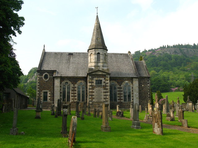
Logie Kirk

Logie Kirk, considered something of a ‘hidden gem, is nestled in a tranquil spot beneath Dumyat at the Western side of the Ochil Hills, east of Stirling...
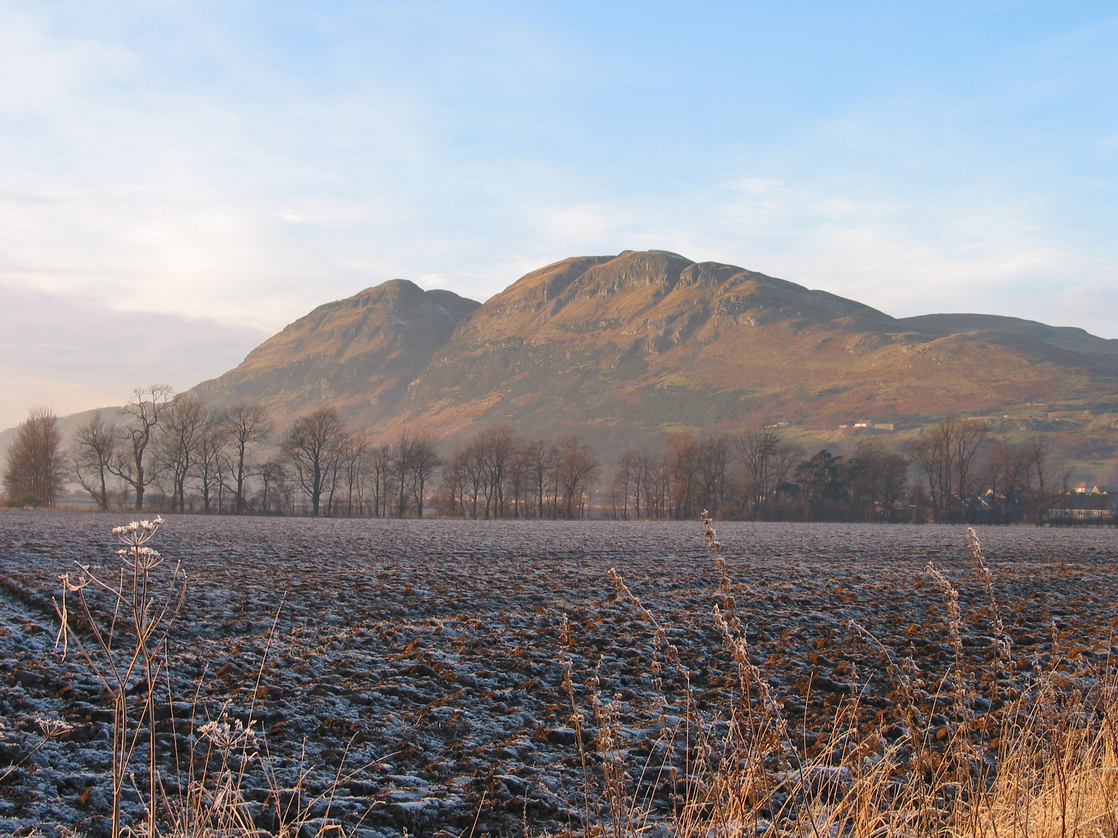
Dumyat

Dumyat or Dunmyat (Scottish Gaelic: Dùn Mhèad) is a hill at the western extremity of the Ochil Hills in central Scotland. The name is thought to originate...
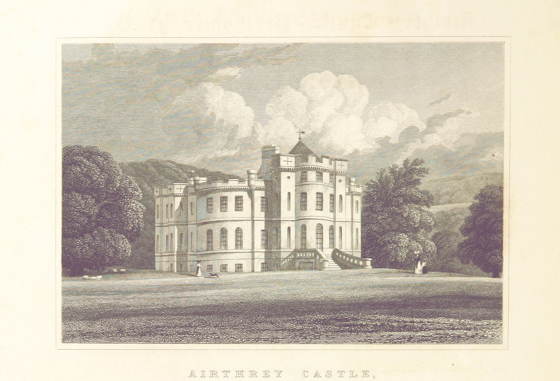
Airthrey Castle

Airthrey Castle is a historic building and estate which now forms part of the buildings and grounds of the University of Stirling in central Scotland....

Nearby Amenities

Located within 500m of 56.150188,-3.887942
Blairlogie
Name Gd: Blàr Lagaidh
Place: village
Population: 236
Source: npe
Wikidata: Q45832
Wikipedia: en:Blairlogie
Lat/Long: 56.1495727/-3.8874397
Parking
Parking: surface
Lat/Long: 56.1498005/-3.8830631
Post Box
Brand: Royal Mail
Brand Wikidata: Q638098
Brand Wikipedia: en:Royal Mail
Collection Times: Mo-Fr 16:15; Sa 09:30
Drive Through: no
Operator: Royal Mail
Operator Wikidata: Q638098
Post Box Type: lamp
Ref: FK9 62
Royal Cypher: scottish_crown
Lat/Long: 56.1491845/-3.8879579
Cafe
Coffee Bothy & Blairmains Farm Shop
Website: www.blairmains.com
Lat/Long: 56.1462859/-3.8864451
Barrier: kissing_gate
Lat/Long: 56.1502368/-3.8863066
Ford: yes
Lat/Long: 56.1512729/-3.8884502
Power: pole
Lat/Long: 56.1486492/-3.8873817
Power: pole
Lat/Long: 56.1479/-3.8868692
Power: pole
Lat/Long: 56.1471147/-3.8863254
Power: pole
Lat/Long: 56.1463689/-3.8858087
The data included in this document is from www.openstreetmap.org. The data is made available under ODbL.

Have you been to Blairlogie?

Leave your review of Blairlogie below (or comments, questions and feedback).