Blairhall

Settlement in Fife

Scotland

Blairhall

Harvest stored near Kinneddar Park Silage bales - not sure if the wrapping colour is of any significance?
Harvest stored near Kinneddar Park Credit: M J Richardson

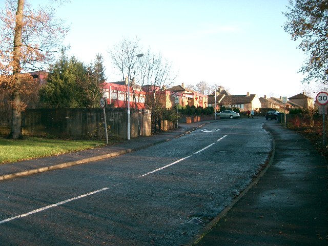
Blairhall is a small village located in the county of Fife, Scotland. Situated approximately 5 miles northwest of Dunfermline, Blairhall is nestled amidst a picturesque landscape of rolling hills and countryside.

The village is primarily residential, with a population of around 900 residents. Blairhall offers a peaceful and tranquil environment, making it an ideal place for families and individuals seeking a quieter lifestyle away from the hustle and bustle of city living.

Despite its small size, Blairhall has a strong sense of community and boasts a range of amenities and facilities to cater to its residents. These include a local primary school, a community center, a village hall, and a convenience store. Additionally, there are several parks and green spaces in and around the village, providing opportunities for outdoor activities and recreation.

Blairhall is well-connected to nearby towns and cities, with regular bus services and easy access to major road networks. The village also benefits from its proximity to Dunfermline, which offers a wider range of amenities, including shopping centers, restaurants, and leisure facilities.

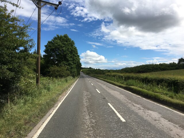
The surrounding area of Blairhall offers plenty of opportunities for exploring the beautiful Scottish countryside. Nearby attractions include the stunning Loch Fitty, which is popular for fishing and birdwatching, as well as various walking and cycling trails.

Overall, Blairhall offers a serene and close-knit community, making it an attractive place to live for those seeking a tranquil rural setting within easy reach of urban amenities.

If you have any feedback on the listing, please let us know in the comments section below.

Blairhall Images

Images are sourced within 2km of 56.088066/-3.603043 or Grid Reference NT0089. Thanks to Geograph Open Source API. All images are credited.

Harvest stored near Kinneddar Park Silage bales - not sure if the wrapping colour is of any significance?
Harvest stored near Kinneddar Park
Silage bales - not sure if the wrapping colour is of any significance?
Sheep pasture at Muirside of Kinneddar
A907 towards Dunfermline
A907 at Mains of Comrie
A907 near Comrie
A907 near Comrie
Path, Comrie The trackbed of the Oakley and Comrie Collieries mineral line. It links with the path along the Dunfermline to Alloa trackbed and paths through woodland.
Path, Comrie
The trackbed of the Oakley and Comrie Collieries mineral line. It links with the path along the Dunfermline to Alloa trackbed and paths through woodland.
Pigeon Lofts Kinneddar Park Lofts where some of the members of Oakley Pigeon Club keep their doos.
Pigeon Lofts
Kinneddar Park Lofts where some of the members of Oakley Pigeon Club keep their doos.
Ruined House Named on the map as Sunnyside.
Ruined House
Named on the map as Sunnyside.
Comrie Colliery This is some of what remains of Comrie Colliery which operated on this site from 1935 to 1986. The entrance has been blocked to prevent illegal dumping.
Comrie Colliery
This is some of what remains of Comrie Colliery which operated on this site from 1935 to 1986. The entrance has been blocked to prevent illegal dumping.
Derelict Building This is some of what remains of Comrie Colliery which operated on this site from 1935 to 1986.
Derelict Building
This is some of what remains of Comrie Colliery which operated on this site from 1935 to 1986.
Comrie Colliery This is some of what remains of Comrie Colliery which operated here from 1935 to 1986.
Comrie Colliery
This is some of what remains of Comrie Colliery which operated here from 1935 to 1986.
The auld hoose, Blairhall Doon the red ash road to Comrie pit
The auld hoose, Blairhall
Doon the red ash road to Comrie pit
Comrie Colliery Ruins of surface buildings at Comrie which was closed down in 1986. There was a lot of activity in the area suggesting some form of redevelopment.
Comrie Colliery
Ruins of surface buildings at Comrie which was closed down in 1986. There was a lot of activity in the area suggesting some form of redevelopment.
Field, Bickramside Plenty of activity nearby, open cast mining?
Field, Bickramside
Plenty of activity nearby, open cast mining?
Fields, Bickramside
Fields, Bickramside
Sunnyside A ruined farm.
Sunnyside
A ruined farm.
Road, Bickramside The road leads to the site of Comrie Colliery which is now showing a lot of signs of activity - flashing amber lights and deep engine noises. The snow will tell you that this is not the usual route of access, someone had attempted to slide down it and then later thought better of it.
Road, Bickramside
The road leads to the site of Comrie Colliery which is now showing a lot of signs of activity - flashing amber lights and deep engine noises. The snow will tell you that this is not the usual route of access, someone had attempted to slide down it and then later thought better of it.
Sunnyside A ruined farm.
Sunnyside
A ruined farm.
Show me another place!

Blairhall is located at Grid Ref: NT0089 (Lat: 56.088066, Lng: -3.603043)

Unitary Authority: Fife

Police Authority: Fife

What 3 Words

///lollipop.triathlon.staples. Near Oakley, Fife

Nearby Locations

Blairhall Dean Wood

Related Wikis

Blairhall

Blairhall is a village in West Fife, Scotland. It is situated 1.1 miles (1.77 km) west of Comrie, and 6.7 miles (10.783 km) west of Dunfermline. The village...

East Grange (Fife) railway station

East Grange railway station served the area of East Grange, Fife, Scotland, from 1850 to 1958 on the Stirling and Dunfermline Railway. == History == The...

Comrie, Fife

Comrie ( locally or ); is a village in Fife, Scotland, located immediately west of the neighbouring village of Oakley, 6.2 miles (9.98 km) west of Dunfermline...

Oakley United F.C.

Oakley United Football Club are a Scottish football club based in Oakley, Fife. Formed in 1964, they play their home games at Blairwood Park. The club...

Nearby Amenities

Located within 500m of 56.088066,-3.603043
Blairhall
Place: village
Wikidata: Q1011615
Wikipedia: en:Blairhall
Lat/Long: 56.0888348/-3.6029259
Mini Roundabout
Lat/Long: 56.0896919/-3.6008386
Mini Roundabout
Direction: clockwise
Lat/Long: 56.0892105/-3.6014609
Material: wood
Power: pole
Lat/Long: 56.0837088/-3.6012238
Material: wood
Power: pole
Lat/Long: 56.0838974/-3.6025971
Material: wood
Power: pole
Lat/Long: 56.084083/-3.6039436
Material: wood
Power: pole
Lat/Long: 56.0842955/-3.6053115
Man Made: tower
Tower Type: communication
Lat/Long: 56.0921415/-3.6053798
Bus Stop
Woodlands Terrace
Bus: yes
Naptan AtcoCode: 6500D1162
Naptan NaptanCode: 34346476
Public Transport: platform
Lat/Long: 56.0902465/-3.6002428
Bus Stop
Woodlands Terrace
Bench: yes
Bus: yes
Check Date Shelter: 2023-09-03
Public Transport: platform
Shelter: yes
Lat/Long: 56.09017/-3.6004679
Bus Stop
Blairhall Primary School
Bus: yes
Naptan AtcoCode: 6500D9631
Naptan NaptanCode: 34346765
Public Transport: platform
Lat/Long: 56.0904494/-3.6013503
Bus Stop
Wilson Street
Bench: yes
Bus: yes
Naptan AtcoCode: 6500D0667
Naptan NaptanCode: 34325626
Public Transport: platform
Shelter: yes
Lat/Long: 56.0882109/-3.6028522
Bus Stop
Wilson Street
Bench: no
Bus: yes
Naptan AtcoCode: 6500D9367
Naptan NaptanCode: 34346754
Public Transport: platform
Shelter: no
Lat/Long: 56.0883912/-3.6027137
Bus Stop
Houldsworth Street
Bench: yes
Bus: yes
Naptan AtcoCode: 6500D0670
Naptan NaptanCode: 34325496
Public Transport: platform
Shelter: yes
Lat/Long: 56.0868897/-3.6052446
Material: wood
Power: pole
Lat/Long: 56.0845026/-3.606745
Crossing
Crossing: zebra
Tactile Paving: yes
Lat/Long: 56.089769/-3.6011741
Power: pole
Lat/Long: 56.0891942/-3.608091
Power: pole
Lat/Long: 56.0897098/-3.6087144
Power: pole
Lat/Long: 56.0885148/-3.6072865
Material: wood
Power: pole
Lat/Long: 56.08807/-3.6068008
Crossing
Crossing: zebra
Tactile Paving: yes
Lat/Long: 56.0903815/-3.6007513
Defibrillator
Booth: KX100
Covered: booth
Defibrillator Location: inside phone box opposite Blairhall New Community Centre
Disused Amenity: telephone
Emergency: defibrillator
Indoor: no
Man Made: telephone_box
Lat/Long: 56.0880636/-3.60274
Post Box
Brand: Royal Mail
Brand Wikidata: Q638098
Brand Wikipedia: en:Royal Mail
Collection Times: Mo-Fr 16:45; Sa 10:30
Operator: Royal Mail
Operator Wikidata: Q638098
Post Box Type: pillar
Ref: KY12 91
Royal Cypher: EVIIR
Royal Cypher Wikidata: Q33102324
Lat/Long: 56.0879857/-3.6021097
Post Office
Blairhall Post Office
Addr City: Blairhall
Addr Housenumber: 20
Addr Postcode: KY12 9PS
Addr Street: Wilson Street
Branch: Blairhall
Brand: Post Office
Brand Wikidata: Q1783168
Brand Wikipedia: en:Post Office Ltd
Check Date: 2020-02-20
Contact Website: https://www.postoffice.co.uk/branch-finder/1818449/blairhall
Opening Hours: Mo-Sa 07:00-20:00; Su 08:00-18:00
Ref Pol Id: 5421
Lat/Long: 56.0879432/-3.6021897
Generator Method: photovoltaic
Generator Output Electricity: yes
Generator Source: solar
Generator Type: solar_photovoltaic_panel
Power: generator
Lat/Long: 56.0912383/-3.6056551
Traffic Calming: cushion
Lat/Long: 56.0909548/-3.5999445
Generator Method: photovoltaic
Generator Output Electricity: yes
Generator Source: solar
Generator Type: solar_photovoltaic_panel
Power: generator
Lat/Long: 56.0900913/-3.6046799
Generator Method: photovoltaic
Generator Output Electricity: yes
Generator Source: solar
Generator Type: solar_photovoltaic_panel
Power: generator
Lat/Long: 56.0903662/-3.6076154
Generator Method: photovoltaic
Generator Output Electricity: yes
Generator Source: solar
Generator Type: solar_photovoltaic_panel
Power: generator
Lat/Long: 56.0903533/-3.6073872
Generator Method: photovoltaic
Generator Output Electricity: yes
Generator Source: solar
Generator Type: solar_photovoltaic_panel
Power: generator
Lat/Long: 56.090776/-3.6058244
Material: wood
Power: pole
Lat/Long: 56.0911715/-3.5975365
Material: wood
Power: pole
Lat/Long: 56.0913775/-3.5987387
Material: wood
Power: pole
Lat/Long: 56.0914736/-3.5993315
Material: wood
Power: pole
Lat/Long: 56.0916659/-3.6008045
Material: wood
Power: pole
Lat/Long: 56.0918203/-3.6019963
Power: pole
Lat/Long: 56.0913923/-3.6027082
Power: pole
Lat/Long: 56.0901174/-3.5967631
Power: pole
Lat/Long: 56.0895291/-3.5970257
Power: pole
Lat/Long: 56.0889844/-3.5969601
Material: wood
Power: pole
Lat/Long: 56.084562/-3.607715
Material: wood
Power: pole
Lat/Long: 56.0876175/-3.6077777
Power: pole
Lat/Long: 56.0871296/-3.6087587
Power: pole
Lat/Long: 56.0866371/-3.609767
The data included in this document is from www.openstreetmap.org. The data is made available under ODbL.

Have you been to Blairhall?

Leave your review of Blairhall below (or comments, questions and feedback).