Sheffield Bottom

Settlement in Berkshire

England

Sheffield Bottom

Farmland by the railway
Farmland by the railway Credit: N Chadwick

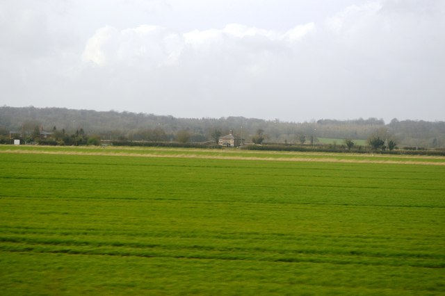
Sheffield Bottom is a small village located in the county of Berkshire, England. Situated approximately 6 miles east of Newbury, it is part of the civil parish of Bucklebury. The village is nestled in the picturesque Berkshire countryside, surrounded by rolling hills, farmlands, and woodlands.

The area is known for its tranquility and natural beauty, making it a popular destination for nature lovers and outdoor enthusiasts. Sheffield Bottom is home to a close-knit community, with a population of around 400 residents. The village has a mixture of traditional and modern architecture, with charming cottages and newer housing developments.

The village benefits from its proximity to Newbury, which provides residents with access to a wide range of amenities and services. Newbury offers a variety of shopping centers, supermarkets, restaurants, and leisure facilities, ensuring that the needs of Sheffield Bottom's inhabitants are well catered for.

Sheffield Bottom is also well-connected in terms of transportation. The village is conveniently located near the A4 road, providing easy access to nearby towns and cities. Additionally, Newbury railway station is a short distance away, offering frequent train services to London and other major cities.

The surrounding area of Sheffield Bottom is rich in natural attractions and recreational opportunities. The nearby Bucklebury Farm Park is a popular family-friendly attraction, offering a range of activities such as animal encounters, tractor rides, and nature trails.

In summary, Sheffield Bottom is a charming village in Berkshire, offering a peaceful and picturesque setting, a close-knit community, and easy access to amenities and outdoor activities.

If you have any feedback on the listing, please let us know in the comments section below.

Sheffield Bottom Images

Images are sourced within 2km of 51.424344/-1.067244 or Grid Reference SU6469. Thanks to Geograph Open Source API. All images are credited.

Farmland by the railway
Horses grazing, Kennet valley Looking from Bottom Lane, with one of the  strands of the Kennet drainage forming the far side of the field.
Horses grazing, Kennet valley
Looking from Bottom Lane, with one of the strands of the Kennet drainage forming the far side of the field.
Roundabout and houses, Sheffield Bottom The roundabout is a fairly recent replacement for a three-way junction with a fairly large grass triangle. The houses were aligned with one side of the triangle, and a fragment remains for access.
Roundabout and houses, Sheffield Bottom
The roundabout is a fairly recent replacement for a three-way junction with a fairly large grass triangle. The houses were aligned with one side of the triangle, and a fragment remains for access.
Evening light, Sulhamstead, Berkshire
Farmland, Burghfield, Berkshire
Flooded gravel pit
Flooded gravel pit
Flooded gravel pit
Flooded gravel pit
Towpath, Kennet & Avon Canal
Flooded gravel pit
Flooded gravel pit
Flooded gravel pit
Flooded gravel pit
Flooded gravel pit
Flooded gravel pit
Flooded gravel pit
Flooded gravel pit
Kennet & Avon Canal The Kennet and Avon is made up of two river navigations and a linking stretch of canal. It runs from Hanham Lock near Bristol to the River Thames at Reading, over 100 miles long with more than 100 locks, some magnificent engineering and crossing some of the most beautiful scenery in southern England. It was only reopened in 1990 after decades of dereliction.
Kennet & Avon Canal
The Kennet and Avon is made up of two river navigations and a linking stretch of canal. It runs from Hanham Lock near Bristol to the River Thames at Reading, over 100 miles long with more than 100 locks, some magnificent engineering and crossing some of the most beautiful scenery in southern England. It was only reopened in 1990 after decades of dereliction.
River Kennet The Kennet is a 45 mile long river in the south of England, and a tributary of the River Thames. The lower reaches of the river are navigable to river craft and are known as the Kennet Navigation, which, together with the Avon Navigation, the Kennet and Avon Canal and the Thames, links the cities of Bristol and London.
The river rises at Swallowhead Spring near Silbury Hill, Wiltshire and joins the River Thames at Reading.
The River Kennet has been assigned as a Site of Special Scientific Interest (SSSI) from near its sources west of Marlborough down to Woolhampton. This is primarily because it has an extensive range of rare plants and animals that are unique to chalk watercourses.
Wikipedia: <span class="nowrap"><a title="http://en.wikipedia.org/wiki/River_Kennet" rel="nofollow ugc noopener" href="http://en.wikipedia.org/wiki/River_Kennet">Link</a><img style="margin-left:2px;" alt="External link" title="External link - shift click to open in new window" src="https://s1.geograph.org.uk/img/external.png" width="10" height="10"/></span>
River Kennet
The Kennet is a 45 mile long river in the south of England, and a tributary of the River Thames. The lower reaches of the river are navigable to river craft and are known as the Kennet Navigation, which, together with the Avon Navigation, the Kennet and Avon Canal and the Thames, links the cities of Bristol and London. The river rises at Swallowhead Spring near Silbury Hill, Wiltshire and joins the River Thames at Reading. The River Kennet has been assigned as a Site of Special Scientific Interest (SSSI) from near its sources west of Marlborough down to Woolhampton. This is primarily because it has an extensive range of rare plants and animals that are unique to chalk watercourses. Wikipedia: LinkExternal link
Sulhamstead Lock (No.100), Kennet & Avon Canal The Kennet and Avon is made up of two river navigations and a linking stretch of canal. It runs from Hanham Lock near Bristol to the River Thames at Reading, over 100 miles long with more than 100 locks, some magnificent engineering and crossing some of the most beautiful scenery in southern England. It was only reopened in 1990 after decades of dereliction.
Sulhamstead Lock (No.100), Kennet & Avon Canal
The Kennet and Avon is made up of two river navigations and a linking stretch of canal. It runs from Hanham Lock near Bristol to the River Thames at Reading, over 100 miles long with more than 100 locks, some magnificent engineering and crossing some of the most beautiful scenery in southern England. It was only reopened in 1990 after decades of dereliction.
Sulhamstead Lock (N0.100), Kennet & Avon Canal The Kennet and Avon is made up of two river navigations and a linking stretch of canal. It runs from Hanham Lock near Bristol to the River Thames at Reading, over 100 miles long with more than 100 locks, some magnificent engineering and crossing some of the most beautiful scenery in southern England. It was only reopened in 1990 after decades of dereliction.
Sulhamstead Lock (N0.100), Kennet & Avon Canal
The Kennet and Avon is made up of two river navigations and a linking stretch of canal. It runs from Hanham Lock near Bristol to the River Thames at Reading, over 100 miles long with more than 100 locks, some magnificent engineering and crossing some of the most beautiful scenery in southern England. It was only reopened in 1990 after decades of dereliction.
Show me another place!

Sheffield Bottom is located at Grid Ref: SU6469 (Lat: 51.424344, Lng: -1.067244)

Unitary Authority: West Berkshire

Police Authority: Thames Valley

What 3 Words

///potato.parks.paid. Near Theale, Berkshire

Related Wikis

Hosehill Lake

Hosehill Lake is a 23.6-hectare (58-acre) Local Nature Reserve west of Reading in Berkshire. It is owned by West Berkshire Council and managed by the...

RAF Theale

Royal Air Force Theale or more simply RAF Theale is a former Royal Air Force satellite station located south of Theale, Berkshire, England. The following...

Sheffield Lock

Sheffield Lock, at grid reference SU648706, is a lock on the Kennet and Avon Canal, in the civil parish of Burghfield in the English county of Berkshire...

Draper's Osier Bed Stream

Draper's Osier Bed Stream is a small stream in southern England, in the county of Berkshire. It is formed at a weir on a section of the River Kennet running...

Nearby Amenities

Located within 500m of 51.424344,-1.067244
Traffic Signals
Lat/Long: 51.4216348/-1.0628552
Bench
Backrest: yes
Lat/Long: 51.422327/-1.0720519
Waste Basket
Lat/Long: 51.4235607/-1.0656524
Board Type: nature
Information: board
Tourism: information
Lat/Long: 51.4214106/-1.0708874
Bench
Backrest: no
Lat/Long: 51.4233567/-1.0641184
Bench
Backrest: no
Lat/Long: 51.4237418/-1.0709498
Bench
Backrest: yes
Lat/Long: 51.4233534/-1.0671078
Bench
Backrest: yes
Lat/Long: 51.42392/-1.0687167
Tourism: viewpoint
Lat/Long: 51.4234812/-1.0656937
Bench
Backrest: no
Lat/Long: 51.4239458/-1.0697347
Bench
Backrest: yes
Lat/Long: 51.42056/-1.0687861
Bench
Backrest: yes
Lat/Long: 51.4218675/-1.0642332
Hosehill Lake Local Nature Reserve
Hiking: yes
Information: map
Map Size: site
Tourism: information
Lat/Long: 51.4233318/-1.0680344
Bench
Backrest: yes
Lat/Long: 51.4235604/-1.0657319
Bench
Backrest: yes
Lat/Long: 51.4207582/-1.069358
Tourism: viewpoint
Lat/Long: 51.4231063/-1.0674306
Bench
Backrest: yes
Lat/Long: 51.4222794/-1.0641306
Bench
Backrest: yes
Lat/Long: 51.4219787/-1.0717414
Leisure: bird_hide
Tourism: viewpoint
Lat/Long: 51.42142/-1.0708301
Bench
Backrest: no
Lat/Long: 51.4235663/-1.0715014
Board Type: nature
Information: board
Tourism: information
Lat/Long: 51.4223226/-1.0718736
Bench
Backrest: no
Lat/Long: 51.4232715/-1.0681034
Barrier: cycle_barrier
Lat/Long: 51.4236073/-1.0656978
Bench
Backrest: no
Lat/Long: 51.4230524/-1.0722047
Post Box
Operator: Royal Mail
Ref: RG7 183
Lat/Long: 51.4242803/-1.0683955
Power: tower
Source: bing
Lat/Long: 51.4237913/-1.0624253
Power: tower
Source: bing
Lat/Long: 51.4269382/-1.0637065
Tourism: viewpoint
Lat/Long: 51.4232405/-1.068297
Crossing
Crossing Island: yes
Kerb: lowered
Sloped Curb: yes
Source: Bing
Lat/Long: 51.4244515/-1.0686725
Crossing
Crossing Island: yes
Kerb: lowered
Sloped Curb: yes
Source: Bing
Lat/Long: 51.4244752/-1.0687414
Give Way
Source: Bing
Lat/Long: 51.4212459/-1.0720593
Give Way
Source: Bing
Lat/Long: 51.4212688/-1.0719325
Give Way
Source: Bing
Lat/Long: 51.4211145/-1.071878
Sheffield Bottom
Place: hamlet
Source: OS-OpenData_StreetView
Wikidata: Q27949971
Lat/Long: 51.4244699/-1.0678193
MFG UK Ltd
Office: yes
Phone: +44 118 914 8800
Lat/Long: 51.4245211/-1.069524
The data included in this document is from www.openstreetmap.org. The data is made available under ODbL.

Have you been to Sheffield Bottom?

Leave your review of Sheffield Bottom below (or comments, questions and feedback).