Blaen-y-cwm

Settlement in Monmouthshire

Wales

Blaen-y-cwm

Pantygasseg - Please drive carefully The sign also shows Welcome and the Welsh Croeso.
Pantygasseg - Please drive carefully Credit: Jaggery

Blaen-y-cwm is a small village located in the county of Monmouthshire, Wales. Situated in the eastern part of the county, it is nestled within the picturesque landscape of the Sirhowy Valley. The village is surrounded by rolling hills and lush green fields, offering residents and visitors a tranquil and scenic environment.

With a population of around 500 people, Blaen-y-cwm maintains a close-knit community. The village primarily consists of residential properties, with a few local businesses serving the needs of the residents. The architecture in Blaen-y-cwm is predominantly traditional Welsh, with charming stone and brick cottages dotting the streets.

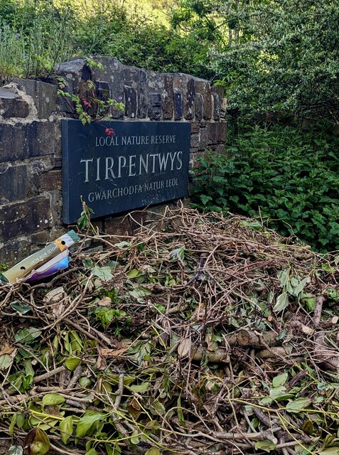
The village benefits from its proximity to natural attractions, including the nearby Sirhowy Valley Country Park. This expansive park offers opportunities for outdoor activities such as hiking, cycling, and birdwatching. The area is known for its rich biodiversity, with a variety of flora and fauna to be discovered.

Despite its rural setting, Blaen-y-cwm is conveniently located near major road networks, providing easy access to larger towns and cities in the region. The nearby town of Tredegar is just a short drive away, offering a wider range of amenities and services.

In summary, Blaen-y-cwm is a charming village in Monmouthshire, Wales, known for its stunning natural surroundings and close-knit community. It offers residents a peaceful and idyllic lifestyle, with the added convenience of nearby amenities and access to beautiful outdoor spaces.

If you have any feedback on the listing, please let us know in the comments section below.

Blaen-y-cwm Images

Images are sourced within 2km of 51.701726/-3.100749 or Grid Reference SO2400. Thanks to Geograph Open Source API. All images are credited.

Pantygasseg - Please drive carefully The sign also shows Welcome and the Welsh Croeso.
Pantygasseg - Please drive carefully
The sign also shows Welcome and the Welsh Croeso.
Bush Terrace, Pantygasseg, Torfaen Ahead for Hafodyrynys. Behind the camera for Pontypool.
Bush Terrace, Pantygasseg, Torfaen
Ahead for Hafodyrynys. Behind the camera for Pontypool.
Side road in Pantygasseg, Torfaen Viewed from Bush Terrace.
Side road in Pantygasseg, Torfaen
Viewed from Bush Terrace.
5-bar gate, Pantygasseg, Torfaen On the right here. <a title="https://www.geograph.org.uk/photo/7488539" href="https://www.geograph.org.uk/photo/7488539">Link</a>
5-bar gate, Pantygasseg, Torfaen
On the right here. Link
Hafodyrynys Coal Washery The washery at Hafodyrynys contained equipment for extracting coal dust from slurry and drying the remaining waste before tipping: processes which were rare before the 1950s. It was built entirely of reinforced concrete with continuous glazed panels. The colliery closed in 1966 and the site was cleared in 1985, but the slimes thickener at the washery was retained at the request of Sir Richard Hanbury-Tenison of Pontypool Park Estate, to which the site reverted. Plans were drawn up at the time to adapt the building as a restaurant. Its futuristic use of reinforced concrete and the splendid isolation in which it now stands have made it a well-known landmark.
Hafodyrynys Coal Washery
The washery at Hafodyrynys contained equipment for extracting coal dust from slurry and drying the remaining waste before tipping: processes which were rare before the 1950s. It was built entirely of reinforced concrete with continuous glazed panels. The colliery closed in 1966 and the site was cleared in 1985, but the slimes thickener at the washery was retained at the request of Sir Richard Hanbury-Tenison of Pontypool Park Estate, to which the site reverted. Plans were drawn up at the time to adapt the building as a restaurant. Its futuristic use of reinforced concrete and the splendid isolation in which it now stands have made it a well-known landmark.
Ordnance Survey Cut Mark This OS cut mark can be found on the wall NE side of High Street. It marks a point 167.469m above mean sea level.
Ordnance Survey Cut Mark
This OS cut mark can be found on the wall NE side of High Street. It marks a point 167.469m above mean sea level.
Ordnance Survey Cut Mark This OS cut mark can be found on the old Pithead Baths. It marks a point 164.741m above mean sea level.
Ordnance Survey Cut Mark
This OS cut mark can be found on the old Pithead Baths. It marks a point 164.741m above mean sea level.
The woodland of Graig Ddu
Near the head of Cwm Ddu Looking across the valley over colliery waste towards a disused brick building <a href="https://www.geograph.org.uk/photo/5707880">SO2402 : Derelict building, Blaenserchan Colliery site</a> that served the former Blaenserchan Colliery.
Near the head of Cwm Ddu
Looking across the valley over colliery waste towards a disused brick building SO2402 : Derelict building, Blaenserchan Colliery site that served the former Blaenserchan Colliery.
Towards the head of Cwm Ddu Looking across waste from former Blaenserchan Colliery to more natural woodland.
Towards the head of Cwm Ddu
Looking across waste from former Blaenserchan Colliery to more natural woodland.
Path up from Llanhilleth Colliery Memorial Path on the edge of Granny's Wood from memorial <a href="https://www.geograph.org.uk/photo/7241714">SO2200 : Llanhilleth Colliery Memorial, Granny's Wood</a> to derelict pithead baths.
Path up from Llanhilleth Colliery Memorial
Path on the edge of Granny's Wood from memorial SO2200 : Llanhilleth Colliery Memorial, Granny's Wood to derelict pithead baths.
Path under road to Llanhilleth Colliery Memorial The path goes down from the derelict pithead baths under the High Street, B4471, at Horseshoe Bend into Granny's Wood and to the memorial <a href="https://www.geograph.org.uk/photo/7241714">SO2200 : Llanhilleth Colliery Memorial, Granny's Wood</a>.
Path under road to Llanhilleth Colliery Memorial
The path goes down from the derelict pithead baths under the High Street, B4471, at Horseshoe Bend into Granny's Wood and to the memorial SO2200 : Llanhilleth Colliery Memorial, Granny's Wood.
Path up to derelict pithead baths The path, the continuation of <a href="https://www.geograph.org.uk/photo/724165">SE1322 : Bridge at Cromwell Lock, Southowram</a>, goes from Granny's Wood under the High Street bridge <a href="https://www.geograph.org.uk/photo/7241678">SO2200 : Path under road to Llanhilleth Colliery Memorial</a>.
Path up to derelict pithead baths
The path, the continuation of SE1322 : Bridge at Cromwell Lock, Southowram, goes from Granny's Wood under the High Street bridge SO2200 : Path under road to Llanhilleth Colliery Memorial.
Llanhilleth Colliery Memorial, Granny's Wood The colliery, opened in 1892, closed in 1969 and the area between the High Street and the railway has reverted largely to woodland.
Llanhilleth Colliery Memorial, Granny's Wood
The colliery, opened in 1892, closed in 1969 and the area between the High Street and the railway has reverted largely to woodland.
Local nature reserve direction sign, Tirpentwys, Torfaen The sign alongside Pantygasseg Road shows that
'Local nature reserve' is 'Gwarchodfa natur leol" in Welsh
Local nature reserve direction sign, Tirpentwys, Torfaen
The sign alongside Pantygasseg Road shows that 'Local nature reserve' is 'Gwarchodfa natur leol" in Welsh
Tirpentwys Local Nature Reserve, Torfaen Accessed from Pantygasseg Road, Tirpentwys Local Nature Reserve is on the site of a former colliery.
Tirpentwys Local Nature Reserve, Torfaen
Accessed from Pantygasseg Road, Tirpentwys Local Nature Reserve is on the site of a former colliery.
Tirpentwys Local Nature Reserve name sign, Torfaen The text is in English and Welsh.
Tirpentwys Local Nature Reserve name sign, Torfaen
The text is in English and Welsh.
Abergelli Cottages name sign, Torfaen On the corner of Pantygasseg Road and Ty-Bwmpyn Road (on the right).
Abergelli Cottages name sign, Torfaen
On the corner of Pantygasseg Road and Ty-Bwmpyn Road (on the right).
Show me another place!

Blaen-y-cwm is located at Grid Ref: SO2400 (Lat: 51.701726, Lng: -3.100749)

Unitary Authority: Torfaen

Police Authority: Gwent

What 3 Words

///boomed.huts.dreamers. Near Crumlin, Caerphilly

Nearby Locations

Blaen-y-cwm

Related Wikis

Cwmffrwdoer Halt railway station

Cwmffrwdoer Halt railway station served the suburb of Pontnewynydd, in the historical county of Monmouthshire, Wales, from 1912 to 1941 on the Pontypool...

Hafodyrynys

Hafodyrynys is a village on the A472 road between Pontypool and Crumlin in Caerphilly county borough, south-east Wales. It lies within the historic boundaries...

St Illtyd

St Illtyd is a hamlet near Aberbeeg, in southeast Wales, within the historic boundaries of Monmouthshire. It is situated on the mountain road between Pontypool...

St Illtyd's Church, Llanhilleth

St Illtyd's Church is a deconsecrated church in Llanhilleth, Blaenau Gwent, Wales. A Grade II* listed building, it is the oldest standing building in the...

Llanhilleth

Llanhilleth (from Welsh Llanheledd 'Church of Saint Heledd, the /i/ replacing the original /e/ due to the regional dialect of the area (Gwenhwyseg) changing...

Llanhilleth railway station

Llanhilleth railway station (Welsh: Llanhiledd) is a railway station on the Ebbw Valley Railway and serves the village of Llanhilleth, Wales. == History... ==

Torfaen (UK Parliament constituency)

Torfaen is a constituency in Wales represented in the House of Commons of the UK Parliament since 2015 by Nick Thomas-Symonds, a member of the Labour Party...

Torfaen (Senedd constituency)

Torfaen is a constituency of the Senedd. It elects one Member of the Senedd by the first past the post method of election. It is also one of eight constituencies...

Nearby Amenities

Located within 500m of 51.701726,-3.100749
The data included in this document is from www.openstreetmap.org. The data is made available under ODbL.

Have you been to Blaen-y-cwm?

Leave your review of Blaen-y-cwm below (or comments, questions and feedback).