Skigersta

Settlement in Ross-shire

Scotland

Skigersta

Peat road south of Skigersta
Peat road south of Skigersta Credit: Catherine Morgan

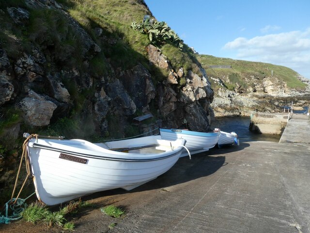
Skigersta is a small coastal village located in the county of Ross-shire, in the northern part of Scotland. Situated on the eastern coast of the Isle of Lewis, Skigersta offers breathtaking views of the North Atlantic Ocean and the surrounding rugged landscape.

The village is characterized by its remote and idyllic setting, making it a popular destination for those seeking tranquility and natural beauty. Skigersta is known for its pristine beaches, with golden sands stretching along the coastline, inviting visitors to take long walks or relax by the sea.

The local community in Skigersta is tight-knit and friendly, with a population of approximately 100 residents. The village has a strong connection to its Gaelic heritage, and many of the locals are fluent in the Gaelic language. Traditional Scottish culture and customs are also prominent in Skigersta, providing visitors with a unique opportunity to immerse themselves in the rich history of the region.

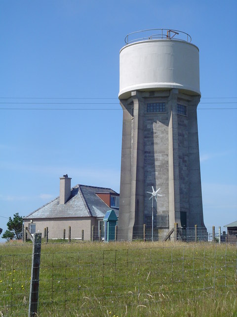
While primarily a residential area, Skigersta does offer some amenities to its residents and visitors. There is a small village shop where essential supplies can be purchased, as well as a charming local pub that serves traditional Scottish cuisine and beverages.

For outdoor enthusiasts, Skigersta is a paradise for activities such as hiking, fishing, and birdwatching. The village is surrounded by lush green hills, providing ample opportunities for exploration and adventure.

Overall, Skigersta is a hidden gem in Ross-shire, offering a peaceful retreat for those looking to experience the beauty of the Scottish coast and immerse themselves in the rich Gaelic culture.

If you have any feedback on the listing, please let us know in the comments section below.

Skigersta Images

Images are sourced within 2km of 58.47367/-6.2186745 or Grid Reference NB5461. Thanks to Geograph Open Source API. All images are credited.

Peat road south of Skigersta
Skigersta harbour
Skigersta harbour
Campar More trig
Campar More trig
Course of the Abhainn Chaidhsiadair You can hear the river, but barely see it as it flows in a narrow and deeply eroded channel through the peat. The line of the river is evidenced by the grass line through the moorland.
Course of the Abhainn Chaidhsiadair
You can hear the river, but barely see it as it flows in a narrow and deeply eroded channel through the peat. The line of the river is evidenced by the grass line through the moorland.
Abandoned car, Airigh na Gaoithe, Isle of Lewis The adjacent peat cutters' track provides easy access for vehicle dumping.

I think it's a Mark 1 Vauxhall Astra.  Only 44k on the clock, so if anyone wants a project.....
Abandoned car, Airigh na Gaoithe, Isle of Lewis
The adjacent peat cutters' track provides easy access for vehicle dumping. I think it's a Mark 1 Vauxhall Astra. Only 44k on the clock, so if anyone wants a project.....
View towards Port of Ness/Port Nis from Airigh na Gaoithe, Isle of Lewis Taken adjacent to a support for the transmitter mast shown at <a href="https://www.geograph.org.uk/photo/385222">NB5360 : Ness of Lewis transmitters / Croinn-chraolaidh Nis</a>.
View towards Port of Ness/Port Nis from Airigh na Gaoithe, Isle of Lewis
Taken adjacent to a support for the transmitter mast shown at NB5360 : Ness of Lewis transmitters / Croinn-chraolaidh Nis.
Abandoned building and phone box
Small wind turbines
Small wind turbines
Sgiogarstaigh View A chilly October view looking toward the buildings of Sgiogarstaigh.
Sgiogarstaigh View
A chilly October view looking toward the buildings of Sgiogarstaigh.
Glacial deposits exposed at Port Nis cliffs
Harbour, Port Sgiogarstaigh, Isle of Lewis Looking towards the headland called Cadha on which the <a href="https://www.geograph.org.uk/photo/4229050">NB5561 : Clifftop cairns, Cadha</a> can just be seen.
Harbour, Port Sgiogarstaigh, Isle of Lewis
Looking towards the headland called Cadha on which the NB5561 : Clifftop cairns, Cadha can just be seen.
Fishing boat, Port Sgiogarstaigh, Isle of Lewis SY751, which doesn't appear to be used anymore, is a Stornoway registered potter ie an inshore boat used to catch shellfish.
Fishing boat, Port Sgiogarstaigh, Isle of Lewis
SY751, which doesn't appear to be used anymore, is a Stornoway registered potter ie an inshore boat used to catch shellfish.
Peat cuttings at Seilastotar Peat has been the most important (inland) natural resource of the Western Isles since their deforestation around a thousand years ago.
Peat cuttings at Seilastotar
Peat has been the most important (inland) natural resource of the Western Isles since their deforestation around a thousand years ago.
Cealagbhal Port Nis or Port of Ness is the most northerly harbour on the east coast of Lewis.
Cealagbhal
Port Nis or Port of Ness is the most northerly harbour on the east coast of Lewis.
Ness Water Tower The village water storage facility at Adabrock. There is an identical tower at the other side of Ness.
Ness Water Tower
The village water storage facility at Adabrock. There is an identical tower at the other side of Ness.
Airigh Linngail A row of houses alongside the Cross-Skigersta Road.
Airigh Linngail
A row of houses alongside the Cross-Skigersta Road.
NOSWA Pumphouse This building houses the pumps which feed water from the reservoir to homes in the Ness area. It is owned by the North of Scotland Water Authority.
NOSWA Pumphouse
This building houses the pumps which feed water from the reservoir to homes in the Ness area. It is owned by the North of Scotland Water Authority.
Village Waste Site Located just outside Airigh Linngail, this site provides skip facilities as well as recycling for household waste and landfill for material such as building rubble.
Village Waste Site
Located just outside Airigh Linngail, this site provides skip facilities as well as recycling for household waste and landfill for material such as building rubble.
Show me another place!

Skigersta is located at Grid Ref: NB5461 (Lat: 58.47367, Lng: -6.2186745)

Unitary Authority: Na h-Eileanan an Iar

Police Authority: Highlands and Islands

Also known as: Sgiogarstaigh

What 3 Words

///coats.reactions.shorter. Near North Tolsta, Na h-Eileanan Siar

Nearby Locations

Sgiogarstaigh Skigersta

Related Wikis

Skigersta

Skigersta (Scottish Gaelic: Sgiogarstaigh) is a village to the south east of Ness on the Isle of Lewis, in the Outer Hebrides, Scotland. It is the easternmost...

Eorodale

Eorodale (Scottish Gaelic: EĆ²radal) is a settlement in the community of Ness, on Lewis, in the Outer Hebrides, Scotland. Eorodale is within the parish...

Adabroc

Adabrock (Scottish Gaelic: Adabroc), is a village in the area of Ness, Lewis, in the Outer Hebrides, Scotland. Adabrock is within the parish of Barvas...

Ness, Lewis

Ness (Scottish Gaelic: Nis) is the northernmost part of the Isle of Lewis, a community consisting of about 16 villages, including Lionel, Habost, Swainbost...

Nearby Amenities

Located within 500m of 58.47367,-6.2186745
Bus Stop
Skigersta
Bus: yes
Naptan AtcoCode: 6010731812
Naptan Bearing: S
Naptan CommonName: Skigersta
Naptan Indicator: Shelter
Naptan Landmark: Shelter
Naptan NaptanCode: 94724258
Naptan Street: Shelter
Naptan Verified: yes
Public Transport: platform
Source: naptan_import
Lat/Long: 58.4734746/-6.2184617
Bus Stop
Skigersta
Bench: no
Bin: no
Bus: yes
Lit: no
Naptan AtcoCode: 6010731813
Naptan Bearing: SE
Naptan CommonName: Skigersta
Naptan Indicator: Village
Naptan Landmark: Village
Naptan NaptanCode: 94724257
Naptan Street: Village
Naptan Verified: yes
Public Transport: platform
Shelter: no
Source: naptan_import
Tactile Paving: no
Lat/Long: 58.4736426/-6.2137769
Passing Place
Lat/Long: 58.4765528/-6.2231032
Barrier: cattle_grid
Lat/Long: 58.469963/-6.2149214
Post Box
Brand: Royal Mail
Brand Wikidata: Q638098
Collection Times: Mo-Sa 09:30; Su off
Operator: Royal Mail
Operator Wikidata: Q638098
Post Box Type: lamp
Ref: HS2 143
Lat/Long: 58.4738911/-6.2144085
Telephone
Booth: K6
Covered: booth
Operator: BT
Phone: +44 1851 810247
Lat/Long: 58.4737967/-6.2191175
Sgiogarstaigh
Name En: Skigersta
Name Gd: Sgiogarstaigh
Place: village
Wikidata: Q3776604
Wikipedia: en:Skigersta
Lat/Long: 58.4739947/-6.2141559
Fire Hydrant
Emergency: fire_hydrant
Lat/Long: 58.4728448/-6.2110835
Noexit: yes
Lat/Long: 58.4717362/-6.2174303
Turning Circle
Lat/Long: 58.4703861/-6.2153073
Passing Place
Lat/Long: 58.4747335/-6.212735
Passing Place
Lat/Long: 58.4740112/-6.2161843
Power: pole
Lat/Long: 58.4761633/-6.225214
Power: pole
Lat/Long: 58.4769038/-6.2229328
Power: pole
Lat/Long: 58.4772193/-6.2223293
Power: pole
Lat/Long: 58.477309/-6.2221965
Material: wood
Power: pole
Lat/Long: 58.4738205/-6.2125701
Material: wood
Power: pole
Lat/Long: 58.4740294/-6.2135625
Power: pole
Lat/Long: 58.4742847/-6.2148634
Power: pole
Lat/Long: 58.4744614/-6.2157512
Power: pole
Lat/Long: 58.4746381/-6.2166578
Power: pole
Lat/Long: 58.4748303/-6.2176046
Power: pole
Lat/Long: 58.4751907/-6.2182644
Power: pole
Lat/Long: 58.4755567/-6.218935
Power: pole
Lat/Long: 58.4759087/-6.2196162
Power: pole
Lat/Long: 58.4764655/-6.2206462
Power: pole
Lat/Long: 58.4764124/-6.224299
Power: pole
Lat/Long: 58.4766364/-6.2234705
Power: pole
Lat/Long: 58.4744085/-6.2212124
Power: pole
Lat/Long: 58.4745088/-6.220674
Power: pole
Lat/Long: 58.4745519/-6.2199263
Power: pole
Lat/Long: 58.47469/-6.2184445
Power: pole
Lat/Long: 58.4743612/-6.2177743
Power: pole
Lat/Long: 58.4738153/-6.2179683
Power: pole
Lat/Long: 58.473676/-6.2188427
Power: pole
Lat/Long: 58.4733143/-6.21834
Power: pole
Lat/Long: 58.4728725/-6.2176849
Power: pole
Lat/Long: 58.4726829/-6.2174452
Power: pole
Lat/Long: 58.4719419/-6.2170408
Power: pole
Lat/Long: 58.4715299/-6.2167544
Power: pole
Lat/Long: 58.4711796/-6.2165148
Power: pole
Lat/Long: 58.4706783/-6.2161608
Power: pole
Lat/Long: 58.4738271/-6.2172268
Power: pole
Lat/Long: 58.4731103/-6.2164878
Power: pole
Lat/Long: 58.4741826/-6.219357
Power: pole
Lat/Long: 58.4750072/-6.2205539
Power: pole
Lat/Long: 58.4754933/-6.2201099
Material: wood
Power: pole
Lat/Long: 58.4731425/-6.2120003
Material: wood
Power: pole
Lat/Long: 58.4733468/-6.2121773
Power: pole
Lat/Long: 58.4747768/-6.2141156
Power: pole
Lat/Long: 58.4753462/-6.2131618
Power: pole
Lat/Long: 58.475958/-6.2121171
Power: pole
Lat/Long: 58.4754631/-6.2109101
Street Lamp
Lamp Mount: straight_mast
Lamp Type: electric
Support: pole
Lat/Long: 58.4730077/-6.2116788
Barrier: cattle_grid
Lat/Long: 58.472891/-6.2174169
Passing Place
Lat/Long: 58.4742881/-6.2196443
Passing Place
Lat/Long: 58.4738173/-6.2189277
Passing Place
Lat/Long: 58.473854/-6.2144021
The data included in this document is from www.openstreetmap.org. The data is made available under ODbL.

Have you been to Skigersta?

Leave your review of Skigersta below (or comments, questions and feedback).