Selson

Settlement in Kent Dover

England

Selson

Flemings Water Supply Works, Fleming Road Planning permission has been granted by Dover District Council under application number DOV/21/01544 for the “change of use of land and erection of an ion exchange building, chemical dosing, changeover and wash-water kiosks, alterations to site access, bunds and associated plant and equipment”.
Flemings Water Supply Works, Fleming Road Credit: John Baker

Selson is a small village located in the county of Kent, England. Situated in the southeastern part of the country, it is nestled on the outskirts of the larger town of Ashford. Selson is known for its picturesque countryside, rolling hills, and quaint charm.

The village itself is home to a small population, with a close-knit community feel. It primarily consists of traditional brick and flint cottages, giving it a timeless and idyllic atmosphere. The surrounding landscape is characterized by lush green fields and meandering streams, providing ample opportunities for outdoor activities such as hiking and fishing.

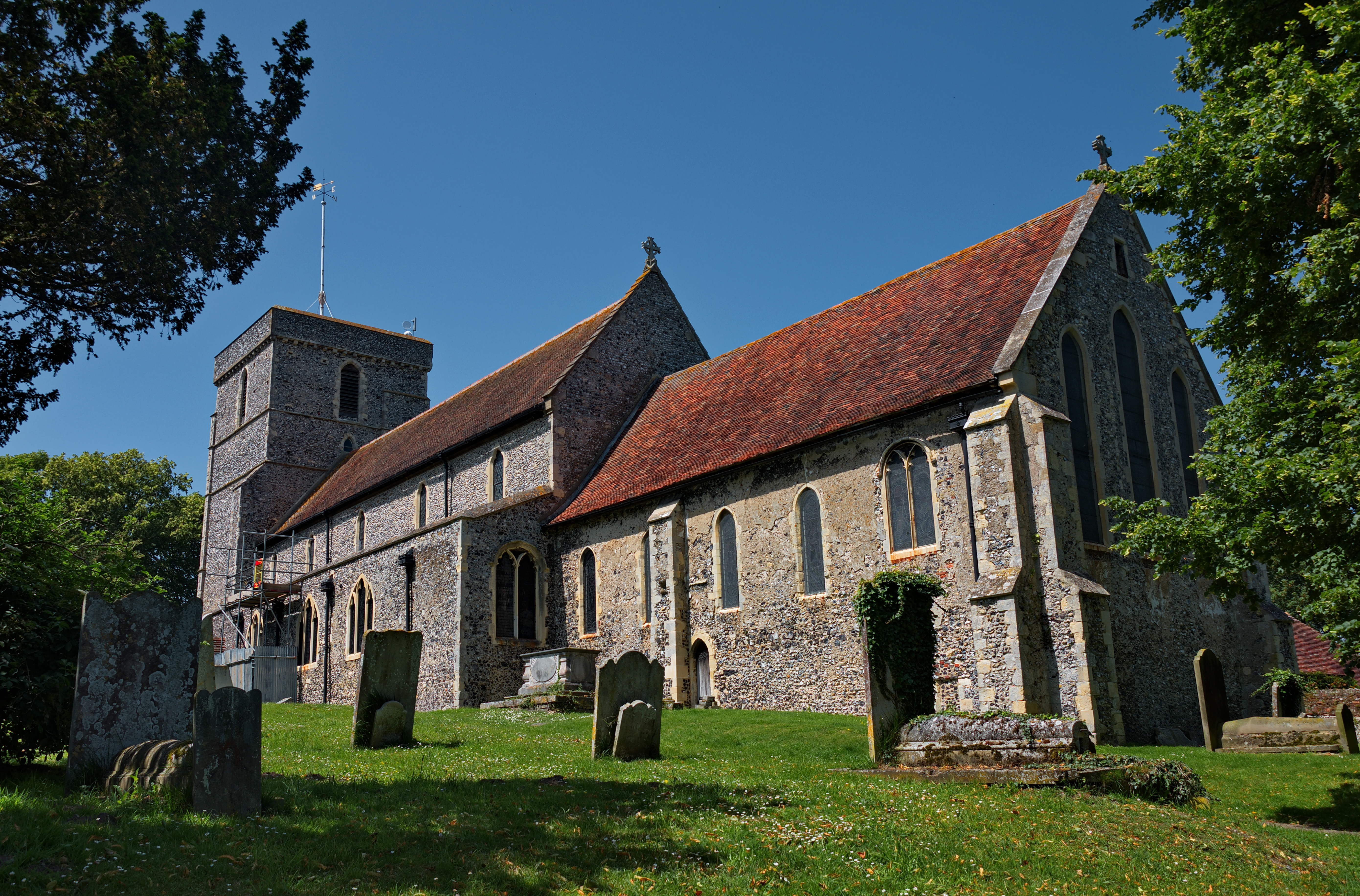
Despite its small size, Selson boasts a rich history. The village can trace its roots back to medieval times, and remnants of this past can still be found in the form of historic buildings and landmarks. The local church, St. Mary's, stands as a testament to the village's heritage and offers a glimpse into its architectural past.

Although Selson itself does not have extensive amenities, the larger town of Ashford is just a short distance away. This provides residents with access to a range of shops, restaurants, and services. Additionally, Ashford offers good transport links, with a train station connecting Selson to other major cities in the region.

Overall, Selson is a charming and tranquil village, offering residents and visitors a peaceful retreat from the bustle of nearby towns and cities. Its natural beauty and historical significance make it a hidden gem within the picturesque county of Kent.

If you have any feedback on the listing, please let us know in the comments section below.
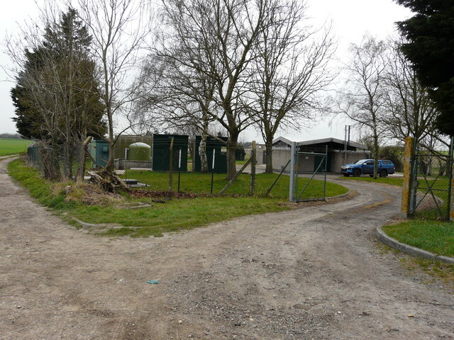
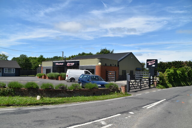
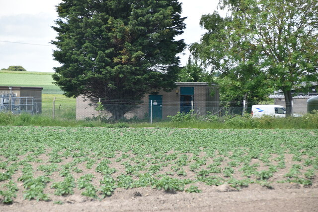
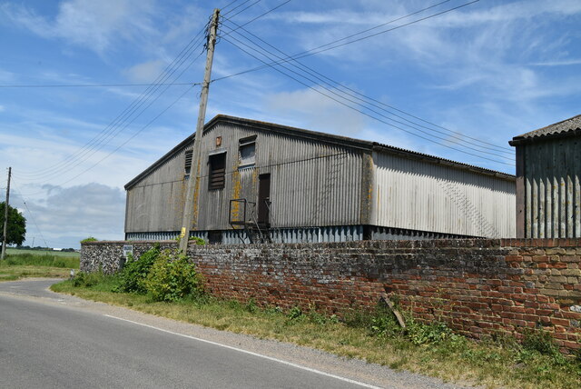
Selson Images

Images are sourced within 2km of 51.251604/1.299608 or Grid Reference TR3055. Thanks to Geograph Open Source API. All images are credited.

Flemings Water Supply Works, Fleming Road Planning permission has been granted by Dover District Council under application number DOV/21/01544 for the “change of use of land and erection of an ion exchange building, chemical dosing, changeover and wash-water kiosks, alterations to site access, bunds and associated plant and equipment”.
Flemings Water Supply Works, Fleming Road
Planning permission has been granted by Dover District Council under application number DOV/21/01544 for the “change of use of land and erection of an ion exchange building, chemical dosing, changeover and wash-water kiosks, alterations to site access, bunds and associated plant and equipment”.
Birnham, Hammill Road Planning permission has been approved by Dover District Council under application number DOV/22/00670 for the ”conversion of existing garage to habitable room, erection of play equipment, installation of a covered swimming pool, conversion of detached outbuilding to ancillary spa and alterations to existing elevations”.
Birnham, Hammill Road
Planning permission has been approved by Dover District Council under application number DOV/22/00670 for the ”conversion of existing garage to habitable room, erection of play equipment, installation of a covered swimming pool, conversion of detached outbuilding to ancillary spa and alterations to existing elevations”.
Elizabeth Drive Part of a housing estate, which has been named Hammill Park.
Elizabeth Drive
Part of a housing estate, which has been named Hammill Park.
Drainless Rd
Drainless Rd
Crossroads, Drainless Rd
Roadsign
Roadsign
Beacon Lane
Beacon Lane
Hammill Rd
Hammill Rd
Woodash Garage
Woodash Garage
Forge Cottage
Forge Cottage
Drainless Rd
Drainless Rd
Farmland
Farmland
Pumping Station
Pumping Station
Ringlemere Oast Twin square kiln oast house.
Ringlemere Oast
Twin square kiln oast house.
Ringlemere Oast Twin square kiln oast house.
Ringlemere Oast
Twin square kiln oast house.
Ringlemere Farm
Ringlemere Farm
Barn, Ringlemere Farm
Show me another place!

Selson is located at Grid Ref: TR3055 (Lat: 51.251604, Lng: 1.299608)

Administrative County: Kent

District: Dover

Police Authority: Kent

What 3 Words

///fishery.financial.working. Near Eastry, Kent

Nearby Locations

Gore Selson

Related Wikis

Eastry railway station

Eastry railway station was a railway station on the East Kent Light Railway. It opened on 16 October 1916 and closed to passenger traffic after the last...

Poison Cross railway station

Poison Cross railway station was a railway station on the East Kent Light Railway. It opened in May 1925 and closed to passenger traffic on 1 November...

Eastry

Eastry is a civil parish in Kent, England, around 2+1⁄2 miles (4 km) southwest of Sandwich. It was voted "Kent Village of the Year 2005". The name is derived...
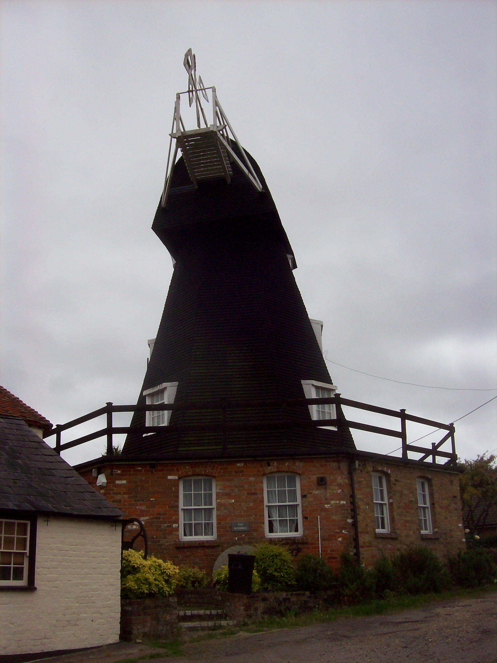
Upper Mill, Eastry

Upper Mill is a Grade II listed house converted smock mill in Eastry, Kent, England. It was built in the mid eighteenth century. == History == Upper Mill...

Nearby Amenities

Located within 500m of 51.251604,1.299608
Selson
Is In: Kent, England, UK
Is In County: Kent
Is In District: Dover
Place: hamlet
Source: NPE maps
Lat/Long: 51.2516102/1.2982673
Eastry
Historic Railway: station
Railway: site
Source: npe
Wikidata: Q5330906
Wikipedia: en:Eastry railway station
Lat/Long: 51.2495946/1.3009129
Eastry Junction
Historic Railway: junction
Railway: site
Lat/Long: 51.2502015/1.3018234
Bus Stop
Poison Cross
Flag: no
Local Ref: NE-bound
Naptan AtcoCode: 240097220
Naptan Bearing: NE
Naptan BusStopType: CUS
Naptan CommonName: Poison Cross
Naptan Indicator: NE-bound
Naptan Landmark: Woodnesborough Lane
Naptan NaptanCode: kntgpamd
Naptan PlusbusZoneRef: DEAL
Naptan RevisionNumber: 2
Naptan Status: act
Naptan Street: Lower Gore Lane
Naptan Verified: no
Public Transport: platform
Ref: kntgpamd
Source: naptan_import
Source Date: 2018-08-30
Lat/Long: 51.2518908/1.3066591
Bus Stop
Orchard Road
Bench: no
Bin: yes
Local Ref: opp
Naptan AtcoCode: 240097224
Naptan Bearing: NE
Naptan BusStopType: MKD
Naptan CommonName: Orchard Road
Naptan Indicator: opp
Naptan Landmark: Orchard Road
Naptan NaptanCode: kntgpajw
Naptan PlusbusZoneRef: DEAL
Naptan RevisionNumber: 2
Naptan Status: act
Naptan Street: Lower Gore Road
Naptan Verified: no
Public Transport: platform
Ref: kntgpajw
Shelter: no
Source: naptan_import
Source Date: 2018-08-30
Tactile Paving: no
Lat/Long: 51.2503975/1.3050756
Bus Stop
Orchard Road
Local Ref: adj
Naptan AtcoCode: 240097226
Naptan Bearing: SW
Naptan BusStopType: MKD
Naptan CommonName: Orchard Road
Naptan Indicator: adj
Naptan Landmark: Orchard Road
Naptan NaptanCode: kntgpajt
Naptan PlusbusZoneRef: DEAL
Naptan RevisionNumber: 2
Naptan Status: act
Naptan Street: Lower Gore Lane
Naptan Verified: no
Public Transport: platform
Ref: kntgpajt
Source: naptan_import
Source Date: 2018-08-30
Lat/Long: 51.2496017/1.3045885
Bus Stop
Gore Road
Local Ref: opp
Naptan AtcoCode: 2400A032720A
Naptan Bearing: NE
Naptan BusStopType: MKD
Naptan CommonName: Gore Road
Naptan Indicator: opp
Naptan Landmark: Gore Close
Naptan NaptanCode: kntdjtaj
Naptan PlusbusZoneRef: DEAL
Naptan RevisionNumber: 2
Naptan Status: act
Naptan Street: Gore Lane
Naptan Verified: no
Public Transport: platform
Ref: kntdjtaj
Source: naptan_import
Source Date: 2018-08-30
Lat/Long: 51.2478309/1.302756
Bus Stop
Gore Road
Local Ref: adj
Naptan AtcoCode: 2400A032730A
Naptan Bearing: SW
Naptan BusStopType: MKD
Naptan CommonName: Gore Road
Naptan Indicator: adj
Naptan Landmark: Gore Close
Naptan NaptanCode: kntdjtam
Naptan PlusbusZoneRef: DEAL
Naptan RevisionNumber: 2
Naptan Status: act
Naptan Street: Gore Lane
Naptan Verified: no
Public Transport: platform
Ref: kntdjtam
Source: naptan_import
Source Date: 2018-08-30
Lat/Long: 51.2478385/1.3030001
Post Box
Brand: Royal Mail
Brand Wikidata: Q638098
Collection Times: Mo-Fr 09:00; Sa 07:00
Operator: Royal Mail
Operator Wikidata: Q638098
Post Box Mounting: metal_post
Post Box Type: lamp
Postal Code: CT13
Ref: CT13 43
Royal Cypher: EIIR
Royal Cypher Wikidata: Q33102113
Source: survey
Lat/Long: 51.2503229/1.3053714
Power: tower
Lat/Long: 51.2523104/1.3054927
Power: tower
Lat/Long: 51.2484042/1.2988811
Power: tower
Lat/Long: 51.2498271/1.301354
Generator Method: photovoltaic
Generator Output Electricity: yes
Generator Source: solar
Generator Type: solar_photovoltaic_panel
Location: roof
Power: generator
Lat/Long: 51.2513614/1.3065134
Generator Method: photovoltaic
Generator Output Electricity: yes
Generator Source: solar
Generator Type: solar_photovoltaic_panel
Location: roof
Power: generator
Lat/Long: 51.2513505/1.306559
Generator Method: photovoltaic
Generator Output Electricity: yes
Generator Source: solar
Generator Type: solar_photovoltaic_panel
Location: roof
Power: generator
Lat/Long: 51.2512481/1.3064758
Generator Method: photovoltaic
Generator Output Electricity: yes
Generator Source: solar
Generator Type: solar_photovoltaic_panel
Location: roof
Power: generator
Lat/Long: 51.2500292/1.3057436
Generator Method: photovoltaic
Generator Output Electricity: yes
Generator Source: solar
Generator Type: solar_photovoltaic_panel
Location: roof
Power: generator
Lat/Long: 51.2500855/1.305297
Generator Method: photovoltaic
Generator Output Electricity: yes
Generator Source: solar
Generator Type: solar_photovoltaic_panel
Location: roof
Power: generator
Lat/Long: 51.250067/1.3053587
The data included in this document is from www.openstreetmap.org. The data is made available under ODbL.

Have you been to Selson?

Leave your review of Selson below (or comments, questions and feedback).