Sefton Park

Settlement in Lancashire

England

Sefton Park

Old Boundary Marker on Ashfield Road, Aigburth Vale Parish Boundary Marker against the brick wall of Boots on the north side of the crossroads of the A561 Aigburth Road and the A5058 Ashfield Road, Liverpool 17. Inscribed T / T P │ T G (Township of Toxteth Park and Township of Garston) and possibly dates from 1866 when Garston was made a parish.

Milestone Society National ID: LA_LCTPGA01pb
Old Boundary Marker on Ashfield Road, Aigburth Vale Credit: M Faherty

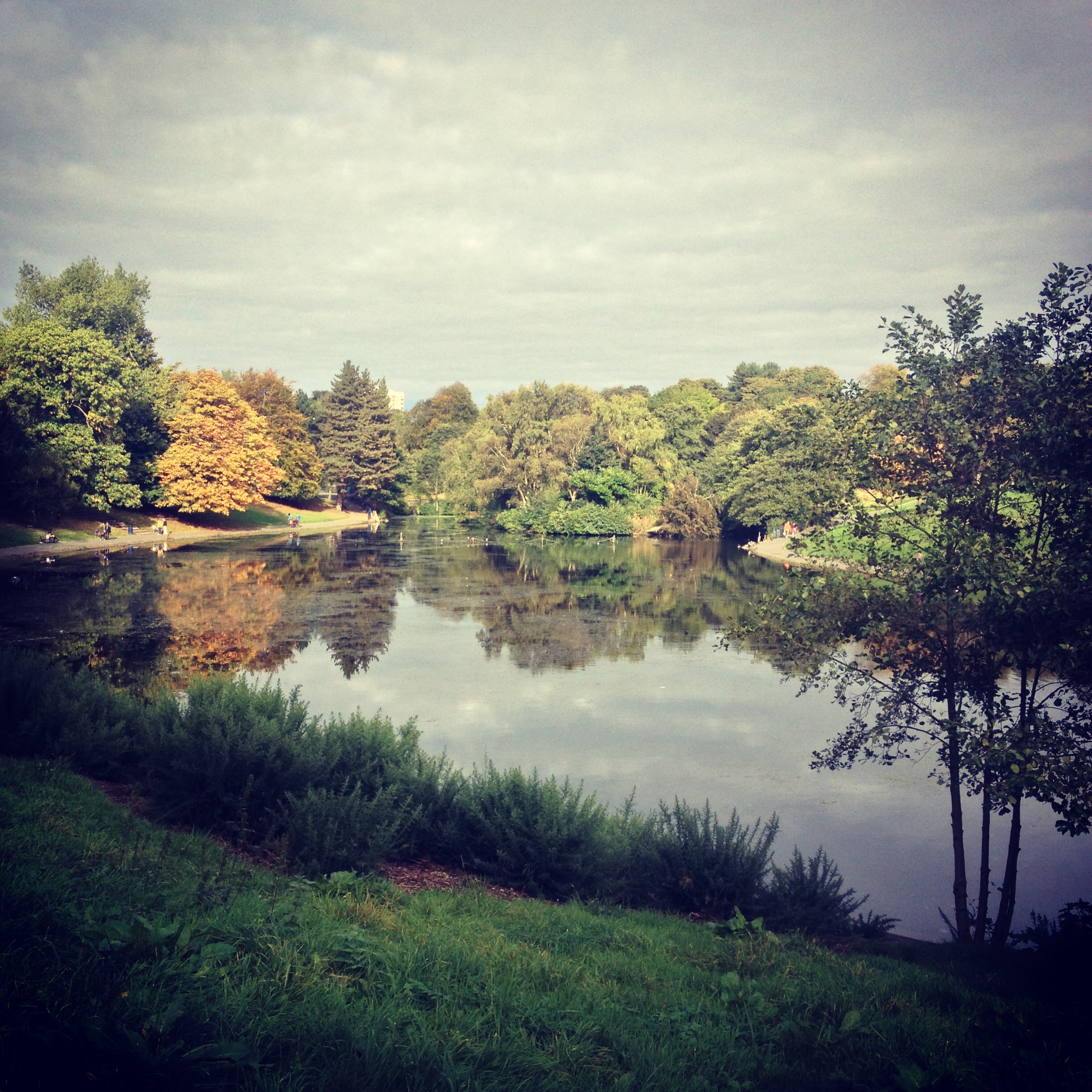
Sefton Park is a public park located in the city of Liverpool, in the county of Lancashire, England. It covers an area of 235 acres and is one of the largest parks in Liverpool. The park was opened to the public in 1872 and was designed by landscape architect Edouard André.

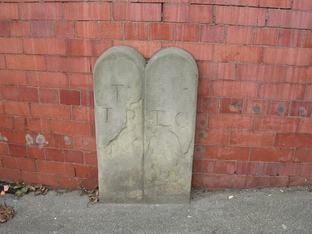
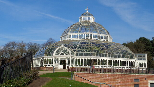
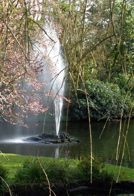
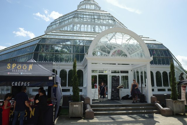
Sefton Park is known for its beautiful Victorian-style features, including a boating lake, ornamental bridges, and a palm house. The park also features a variety of trees and plants, as well as open grassy areas perfect for picnics and leisurely strolls.

The park is a popular destination for locals and tourists alike, offering a peaceful escape from the hustle and bustle of city life. It also hosts a number of events throughout the year, including music festivals, food fairs, and charity runs.

Overall, Sefton Park is a picturesque and tranquil green space that provides a welcome respite for visitors looking to relax and enjoy nature in the heart of Lancashire.

If you have any feedback on the listing, please let us know in the comments section below.

Sefton Park Images

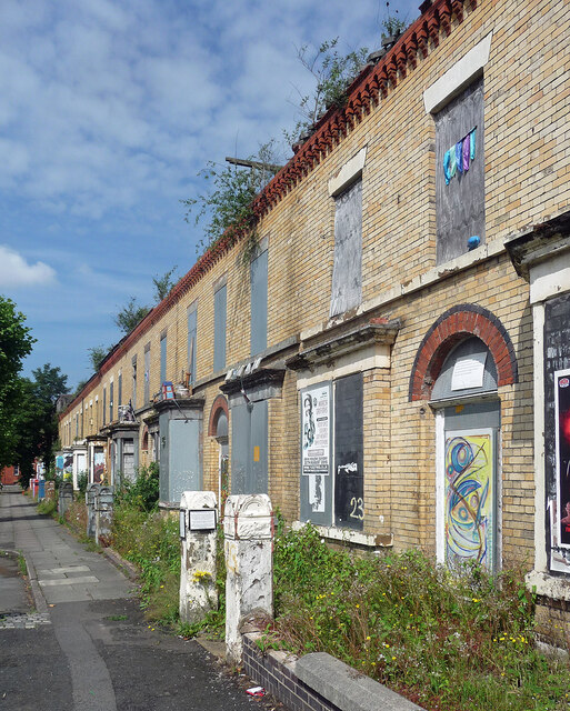
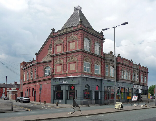
Images are sourced within 2km of 53.383364/-2.935858 or Grid Reference SJ3787. Thanks to Geograph Open Source API. All images are credited.

Old Boundary Marker on Ashfield Road, Aigburth Vale Parish Boundary Marker against the brick wall of Boots on the north side of the crossroads of the A561 Aigburth Road and the A5058 Ashfield Road, Liverpool 17. Inscribed T / T P │ T G (Township of Toxteth Park and Township of Garston) and possibly dates from 1866 when Garston was made a parish.

Milestone Society National ID: LA_LCTPGA01pb
Old Boundary Marker on Ashfield Road, Aigburth Vale
Parish Boundary Marker against the brick wall of Boots on the north side of the crossroads of the A561 Aigburth Road and the A5058 Ashfield Road, Liverpool 17. Inscribed T / T P │ T G (Township of Toxteth Park and Township of Garston) and possibly dates from 1866 when Garston was made a parish. Milestone Society National ID: LA_LCTPGA01pb
Railway crossing over B5178 Wavertree
The Palm House In Sefton Park
The Palm House
In Sefton Park
Fountain in Lake In Sefton Park near the 'Eros' drinking fountain
Fountain in Lake
In Sefton Park near the 'Eros' drinking fountain
The Palm House The Palm House, Sefton Park, Liverpool
The Palm House
The Palm House, Sefton Park, Liverpool
Church, Harthill Church, Harthill, Liverpool
Church, Harthill
Church, Harthill, Liverpool
Ducie Street, Liverpool One of numerous streets of Victorian terraced houses condemned to, or at least slated for, demolition under the misguided 'Pathfinder' initiative which ran from 2002 to 2011. Liverpool seems to have been more afflicted than anywhere else. In 2022, these houses were still standing, but were still empty and deteriorating.
Ducie Street, Liverpool
One of numerous streets of Victorian terraced houses condemned to, or at least slated for, demolition under the misguided 'Pathfinder' initiative which ran from 2002 to 2011. Liverpool seems to have been more afflicted than anywhere else. In 2022, these houses were still standing, but were still empty and deteriorating.
Voelas Street, Liverpool One of the so-called Welsh Streets. And one of numerous streets of Victorian terraced houses condemned to, or at least slated for, demolition under the misguided 'Pathfinder' initiative which ran from 2002 to 2011. Liverpool seems to have been more afflicted than anywhere else. These houses have subsequently been restored (the mature trees were sacrificed in the process), and new houses built on the south end of the street which had already been cleared (<a href="https://www.geograph.org.uk/photo/2230407">SJ3688 : Voelas Street, Toxteth</a>).
Voelas Street, Liverpool
One of the so-called Welsh Streets. And one of numerous streets of Victorian terraced houses condemned to, or at least slated for, demolition under the misguided 'Pathfinder' initiative which ran from 2002 to 2011. Liverpool seems to have been more afflicted than anywhere else. These houses have subsequently been restored (the mature trees were sacrificed in the process), and new houses built on the south end of the street which had already been cleared (SJ3688 : Voelas Street, Toxteth).
Rhiwlas Street, Liverpool One of the so-called Welsh Streets. And one of numerous streets of Victorian terraced houses condemned to, or at least slated for, demolition under the misguided 'Pathfinder' initiative which ran from 2002 to 2011. Liverpool seems to have been more afflicted than anywhere else. These houses have subsequently been restored (the mature tree was sacrificed in the process), and new houses built on the south-east section of the street which had already been cleared.
Rhiwlas Street, Liverpool
One of the so-called Welsh Streets. And one of numerous streets of Victorian terraced houses condemned to, or at least slated for, demolition under the misguided 'Pathfinder' initiative which ran from 2002 to 2011. Liverpool seems to have been more afflicted than anywhere else. These houses have subsequently been restored (the mature tree was sacrificed in the process), and new houses built on the south-east section of the street which had already been cleared.
Madryn Street, Liverpool One of the so-called Welsh Streets. And one of numerous streets of Victorian terraced houses condemned to, or at least slated for, demolition under the misguided 'Pathfinder' initiative which ran from 2002 to 2011. Liverpool seems to have been more afflicted than anywhere else. These houses have subsequently been restored (the tree was sacrificed in the process).
Madryn Street, Liverpool
One of the so-called Welsh Streets. And one of numerous streets of Victorian terraced houses condemned to, or at least slated for, demolition under the misguided 'Pathfinder' initiative which ran from 2002 to 2011. Liverpool seems to have been more afflicted than anywhere else. These houses have subsequently been restored (the tree was sacrificed in the process).
Kinmel Street, Liverpool One of the so-called Welsh Streets. And one of numerous streets of Victorian terraced houses condemned to, or at least slated for, demolition under the misguided 'Pathfinder' initiative which ran from 2002 to 2011. Liverpool seems to have been more afflicted than anywhere else. These houses have subsequently been restored.
Kinmel Street, Liverpool
One of the so-called Welsh Streets. And one of numerous streets of Victorian terraced houses condemned to, or at least slated for, demolition under the misguided 'Pathfinder' initiative which ran from 2002 to 2011. Liverpool seems to have been more afflicted than anywhere else. These houses have subsequently been restored.
Powis Street, Liverpool One of the so-called Welsh Streets. And one of numerous streets of Victorian terraced houses condemned to, or at least slated for, demolition under the misguided 'Pathfinder' initiative which ran from 2002 to 2011. Liverpool seems to have been more afflicted than anywhere else. These houses have subsequently been restored, and are no longer painted black.
This post-apocalyptic vision was due to the street having been used as a filming location for the TV series, 'Peaky Blinders'.
Powis Street, Liverpool
One of the so-called Welsh Streets. And one of numerous streets of Victorian terraced houses condemned to, or at least slated for, demolition under the misguided 'Pathfinder' initiative which ran from 2002 to 2011. Liverpool seems to have been more afflicted than anywhere else. These houses have subsequently been restored, and are no longer painted black. This post-apocalyptic vision was due to the street having been used as a filming location for the TV series, 'Peaky Blinders'.
The Empress, High Park Street, Liverpool Narrow pub. Being featured on the cover of a Ringo Starr album was not enough to save it - it has now joined the former off licence just across Wellington Terrace.
The Empress, High Park Street, Liverpool
Narrow pub. Being featured on the cover of a Ringo Starr album was not enough to save it - it has now joined the former off licence just across Wellington Terrace.
9-15 High Park Street, Liverpool Former Toxteth Public Offices by Thomas Layland, 1865-66, in red sandstone. Grade II listed.
Now used as a community resource centre and given the moniker Toxteth Town Hall.
9-15 High Park Street, Liverpool
Former Toxteth Public Offices by Thomas Layland, 1865-66, in red sandstone. Grade II listed. Now used as a community resource centre and given the moniker Toxteth Town Hall.
Former reservoir, High Park Street, Liverpool Powerful retaining wall of what was Park Hill Reservoir, by Thomas Duncan, 1853. The tower, minus its conical roof, also survives. Grade II listed.
It now seems to be used as an event space.
Former reservoir, High Park Street, Liverpool
Powerful retaining wall of what was Park Hill Reservoir, by Thomas Duncan, 1853. The tower, minus its conical roof, also survives. Grade II listed. It now seems to be used as an event space.
The Pineapple Hotel, Park Road, Liverpool Solid Italianate boozer on the corner of Moses Street.
The pub may already have closed when this photo was taken - a sign read "Public bar open as usual", but it didn't look open. It continued as a hotel, but has now probably been converted to flats.
The Pineapple Hotel, Park Road, Liverpool
Solid Italianate boozer on the corner of Moses Street. The pub may already have closed when this photo was taken - a sign read "Public bar open as usual", but it didn't look open. It continued as a hotel, but has now probably been converted to flats.
334-338 Smithdown Road, Liverpool Aka Holyoake Hall. Built for the Co-operative Society in 1914 and featuring lots of terracotta and fussy stone detail.
Mostly occupied by TriBeCa, a bar and pizzeria, which has failed to weather the various storms since this photo.
334-338 Smithdown Road, Liverpool
Aka Holyoake Hall. Built for the Co-operative Society in 1914 and featuring lots of terracotta and fussy stone detail. Mostly occupied by TriBeCa, a bar and pizzeria, which has failed to weather the various storms since this photo.
Lodges, Smithdown Lane, Liverpool At the entrance to Toxteth Park Cemetery which was laid out in 1855-56 for the Toxteth Park Burial Board. Thomas D. Barry designed the buildings. Grade II listed.
Lodges, Smithdown Lane, Liverpool
At the entrance to Toxteth Park Cemetery which was laid out in 1855-56 for the Toxteth Park Burial Board. Thomas D. Barry designed the buildings. Grade II listed.
Show me another place!

Sefton Park is located at Grid Ref: SJ3787 (Lat: 53.383364, Lng: -2.935858)

Unitary Authority: Liverpool

Police Authority: Merseyside

What 3 Words

///mild.unrealistic.onions. Near Liverpool, Merseyside

Nearby Locations

Sefton Park

Related Wikis

Sefton Park

Sefton Park is a public park in south Liverpool, England. The park is in a district of the same name, located roughly within the historic bounds of the...

2008 Women's European Union Amateur Boxing Championships

The 2008 Women's European Union Amateur Boxing Championships were held in the Greenbank Sports Academy in Liverpool, England from August 4 to 8. This was...

Sefton Park (district)

Sefton Park is a district within the city of Liverpool, Merseyside, United Kingdom. The area is part of the Liverpool City Council Ward of Mossley Hill...

St Hilda's Church of England High School

St Hilda's Church of England High School is a secondary school with a sixth form, located in Croxteth Drive, Sefton Park, Liverpool, England. As of 2022...

Nearby Amenities

Located within 500m of 53.383364,-2.935858
Barrier: bollard
Bicycle: yes
Foot: yes
Lat/Long: 53.3809646/-2.9315649
Barrier: entrance
Bicycle: yes
Foot: yes
Lat/Long: 53.3816518/-2.9352534
Height: 2
Waterway: waterfall
Lat/Long: 53.3853821/-2.9385301
Rathbone Statue
Historic: memorial
Lat/Long: 53.380032/-2.9369183
Post Box
Ref: L17 333
Lat/Long: 53.3844837/-2.9330286
Bus Stop
GREENBANK LN/WESTFIELD CHILDRENS HOME
Bus: yes
Naptan AtcoCode: 2800S41173B
Naptan Bearing: W
Naptan CommonName: GREENBANK LN/WESTFIELD CHILDRENS HOME
Naptan Indicator: GREENBANK LANE/MOSSLEY HILL DRIVE
Naptan Landmark: GREENBANK LN/WESTFIELD CHILDRENS HOME
Naptan NaptanCode: mergmgdw
Naptan Notes: No Notes
Naptan PlusbusZoneRef: LVRPLCH
Naptan ShortCommonName: Westfield Home
Naptan Street: GREENBANK LANE
Naptan Verified: no
Public Transport: platform
Source: naptan_import
Lat/Long: 53.3850474/-2.930026
Bus Stop
GREENBANK LN / MERE BANK FLATS
Bus: yes
Naptan AtcoCode: 2800S41221A
Naptan Bearing: E
Naptan CommonName: GREENBANK LN / MERE BANK FLATS
Naptan Indicator: GREENBANK LANE/GREENBANK DRIVE
Naptan Landmark: O/S MERE BANK FLATS
Naptan NaptanCode: mergmgjg
Naptan Notes: No Notes
Naptan PlusbusZoneRef: LVRPLCH
Naptan ShortCommonName: Mere Bank Flats
Naptan Street: GREENBANK LANE
Naptan Verified: no
Public Transport: platform
Source: naptan_import
Lat/Long: 53.3847494/-2.9319518
Bus Stop
Mossley Hill Drive
Bus: yes
Naptan AtcoCode: 2800S43200A
Naptan Bearing: N
Naptan CommonName: Mossley Hill Drive
Naptan Indicator: Mossley Hill Drive
Naptan Landmark: Carnatic Road
Naptan NaptanCode: mertwgpg
Naptan PlusbusZoneRef: LVRPLCH
Naptan ShortCommonName: Mossley Hill Drive
Naptan Street: Mossley Hill Drive
Naptan Verified: no
Public Transport: platform
Source: naptan_import
Lat/Long: 53.3800742/-2.9314511
Fountain
Eros Fountain
Lat/Long: 53.3830125/-2.9390615
Crossing: informal
Lat/Long: 53.3872714/-2.937046
Barrier: bollard
Bicycle: yes
Foot: yes
Lat/Long: 53.3813599/-2.931621
Mini Roundabout
Direction: clockwise
Lat/Long: 53.380452/-2.931389
Tourism: picnic_site
Lat/Long: 53.3833479/-2.9392087
Bicycle Rental
Citybike
Network: city bike Liverpool
Operator: city bike Liverpool
Lat/Long: 53.3845452/-2.9337951
Tourism: picnic_site
Lat/Long: 53.3818539/-2.9356764
Defibrillator
Defibrillator Location: Front of building next to toilet corridor entrance
Emergency: defibrillator
Lat/Long: 53.3834113/-2.9392774
Information: milepost
Ncn Milepost: mills
Sustrans Ref: MP467
Lat/Long: 53.3831967/-2.9395849
Sefton Park - Lark Lane
Bicycle Rental: docking_station
Disused Amenity: bicycle_rental
Network: citybike Liverpool
Lat/Long: 53.383216/-2.9429957
Tourism: picnic_site
Lat/Long: 53.381052/-2.9342929
Ford: yes
Lat/Long: 53.3808134/-2.9330215
Peter Pan Statue
Artwork Type: statue
Tourism: artwork
Lat/Long: 53.3814987/-2.9356649
Bench
Colour: brown
Material: wood
Seats: 3
Lat/Long: 53.3813254/-2.9357173
Bench
Colour: brown
Material: wood
Seats: 3
Lat/Long: 53.3813819/-2.9357005
Bench
Colour: brown
Material: wood
Seats: 3
Lat/Long: 53.3814439/-2.9356646
Bench
Colour: brown
Material: wood
Seats: 3
Lat/Long: 53.3814922/-2.9355806
Bench
Colour: brown
Material: wood
Seats: 3
Lat/Long: 53.3815551/-2.9351199
Bench
Colour: brown
Material: wood
Seats: 3
Lat/Long: 53.3815049/-2.9349862
Bench
Colour: brown
Material: wood
Seats: 3
Lat/Long: 53.3814475/-2.934919
Bench
Colour: brown
Material: wood
Seats: 3
Lat/Long: 53.3812853/-2.9348449
Bench
Colour: brown
Material: wood
Seats: 3
Lat/Long: 53.3811973/-2.9348701
Bench
Colour: brown
Material: wood
Seats: 3
Lat/Long: 53.3812092/-2.9349969
Bench
Colour: brown
Material: wood
Seats: 3
Lat/Long: 53.3811973/-2.9350168
Bench
Colour: brown
Material: wood
Seats: 3
Lat/Long: 53.3811686/-2.9349144
Bench
Colour: brown
Material: wood
Seats: 3
Lat/Long: 53.3811181/-2.9349641
Bench
Colour: brown
Material: wood
Seats: 3
Lat/Long: 53.3810948/-2.9350214
Bench
Colour: brown
Material: wood
Seats: 3
Lat/Long: 53.381067/-2.9350993
Bench
Colour: brown
Material: wood
Seats: 3
Lat/Long: 53.3810483/-2.9352032
Bench
Colour: brown
Material: wood
Seats: 3
Lat/Long: 53.3810625/-2.9354385
Bench
Colour: brown
Material: wood
Seats: 3
Lat/Long: 53.3811035/-2.9355263
Bench
Colour: brown
Material: wood
Seats: 3
Lat/Long: 53.3811377/-2.9356058
Bench
Colour: brown
Material: wood
Seats: 3
Lat/Long: 53.3811951/-2.9356715
Bench
Colour: brown
Material: wood
Seats: 3
Lat/Long: 53.3812183/-2.935699
Bench
Colour: brown
Material: wood
Seats: 3
Lat/Long: 53.3811089/-2.9353575
Bench
Colour: brown
Material: wood
Seats: 3
Lat/Long: 53.3811267/-2.9351008
Covered: no
Leisure: picnic_table
Material: wood
Lat/Long: 53.3832886/-2.9407349
Covered: no
Leisure: picnic_table
Material: wood
Lat/Long: 53.3832604/-2.9406828
Covered: no
Leisure: picnic_table
Material: wood
Lat/Long: 53.3833001/-2.9406568
Covered: no
Leisure: picnic_table
Material: wood
Lat/Long: 53.3832653/-2.9406157
Playground: swing
Wheelchair: yes
Lat/Long: 53.3829932/-2.9409892
Playground: swing
Lat/Long: 53.3830791/-2.9408387
Playground: swing
Lat/Long: 53.3833646/-2.9409524
Playground: basketswing
Lat/Long: 53.3830596/-2.9410179
Playground: climbingframe
Lat/Long: 53.3831324/-2.9410156
Playground: climbingframe
Lat/Long: 53.383326/-2.941025
Playground: slide
Lat/Long: 53.3832586/-2.9410325
Fountain
Lat/Long: 53.3828727/-2.9385406
Fountain
Lat/Long: 53.3817812/-2.9376269
Old Nick's Cave
Access: no
Fee: no
Natural: cave_entrance
Lat/Long: 53.3876618/-2.9375677
Bench
Backrest: yes
Material: wood
Lat/Long: 53.3854494/-2.9380088
Waste Basket
Waste: trash
Lat/Long: 53.3855003/-2.9380741
Waste Basket
Waste: trash
Lat/Long: 53.3829478/-2.9407694
Bicycle Parking
Access: yes
Bicycle Parking: stands
Capacity: 6
Covered: no
Lat/Long: 53.3830054/-2.9407875
Bench
Backrest: yes
Material: wood
Lat/Long: 53.3830329/-2.9422346
Bicycle Parking
Access: yes
Bicycle Parking: stands
Capacity: 10
Covered: no
Lit: yes
Surface: asphalt
Lat/Long: 53.3832633/-2.9391223
Restaurant
Ferraiolo's Italian Bistro
Cuisine: italian
Outdoor Seating: yes
Wheelchair: yes
Lat/Long: 53.38345/-2.9390444
Cafe
Ice Cream Parlour
Cuisine: coffee_shop;ice_cream
Outdoor Seating: yes
Takeaway: yes
Wheelchair: yes
Lat/Long: 53.3834634/-2.9391708
Toilets
Access: yes
Fee: no
Lat/Long: 53.383473/-2.9392773
Barrier: bollard
Bollard: fixed
Motor Vehicle: no
Lat/Long: 53.3830833/-2.9431733
Barrier: kerb
Kerb: lowered
Tactile Paving: no
Lat/Long: 53.3830997/-2.9432995
Barrier: kerb
Kerb: lowered
Tactile Paving: no
Lat/Long: 53.3829946/-2.9430592
Bicycle Parking
Bicycle Parking: stands
Capacity: 10
Covered: no
Surface: compacted
Lat/Long: 53.3813777/-2.9348073
The data included in this document is from www.openstreetmap.org. The data is made available under ODbL.

Have you been to Sefton Park?

Leave your review of Sefton Park below (or comments, questions and feedback).