Sedgehill

Settlement in Wiltshire

England

Sedgehill

St Catherine, Sedgehill: late August 2016
St Catherine, Sedgehill: late August 2016 Credit: Basher Eyre

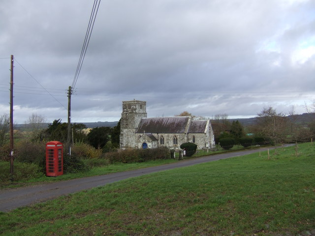
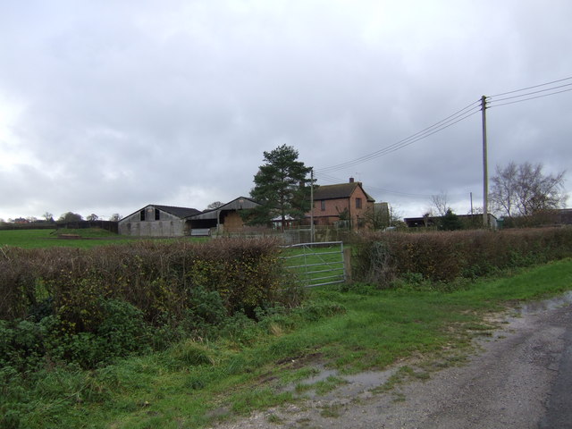
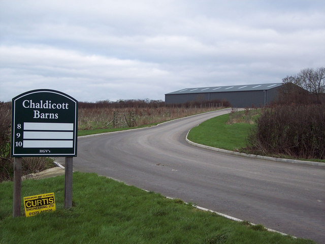
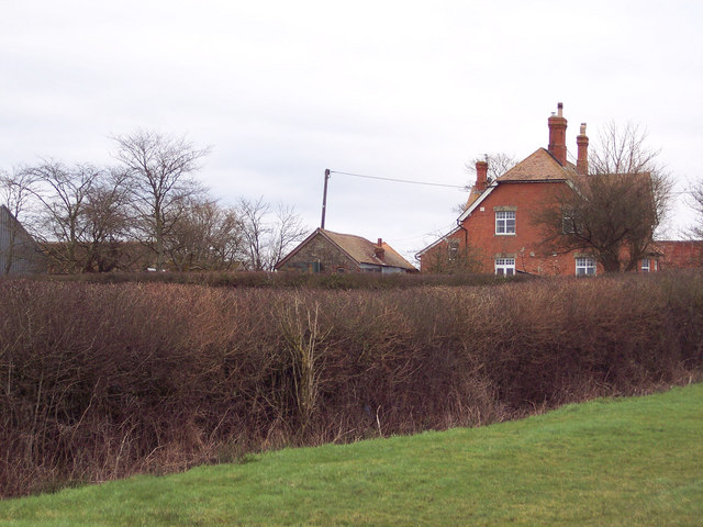
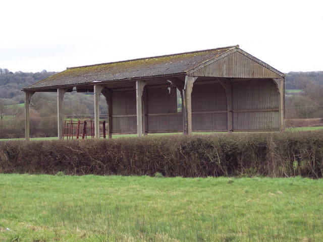
Sedgehill is a small village located in the county of Wiltshire, in southwest England. Situated on the edge of the Cranborne Chase and West Wiltshire Downs Area of Outstanding Natural Beauty, the village is surrounded by picturesque countryside and offers stunning views of the rolling hills and valleys.

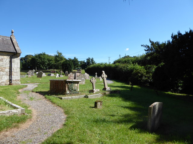
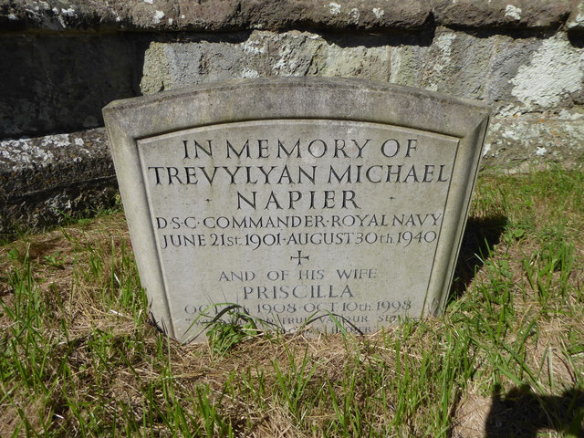
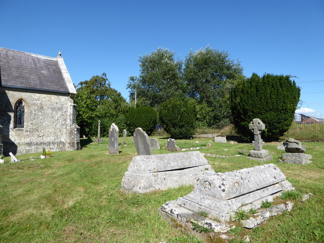
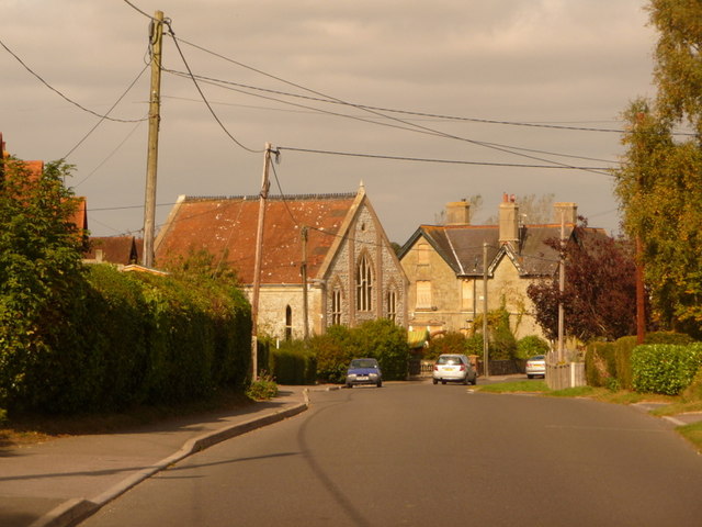
The origins of Sedgehill can be traced back to medieval times, and the village still retains much of its historic charm. The heart of the village is dominated by the All Saints Church, a Grade I listed building that dates back to the 12th century. The church is renowned for its beautiful stained glass windows and intricate carvings.

Despite its small size, Sedgehill is a vibrant community with a strong sense of community spirit. The village has a village hall, which hosts a range of events and activities throughout the year, including community gatherings, clubs, and classes. In addition, Sedgehill is home to a primary school, providing education for the local children.

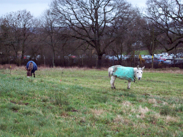
The surrounding countryside offers plenty of opportunities for outdoor activities, such as walking, hiking, and cycling. The village is also in close proximity to a number of notable attractions, including Longleat Safari Park and Stourhead House and Gardens, both of which are popular tourist destinations.

Overall, Sedgehill is a peaceful and picturesque village that offers a tranquil escape from the hustle and bustle of city life. With its rich history, stunning natural surroundings, and strong community spirit, it is a place that truly embodies the charm of rural England.

If you have any feedback on the listing, please let us know in the comments section below.
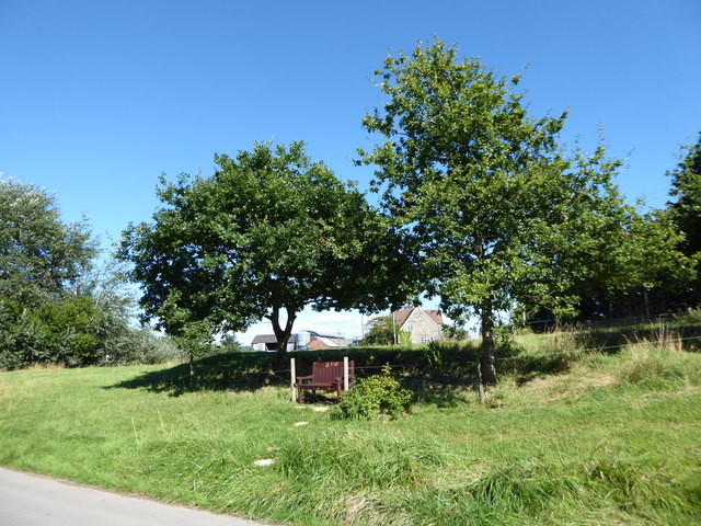
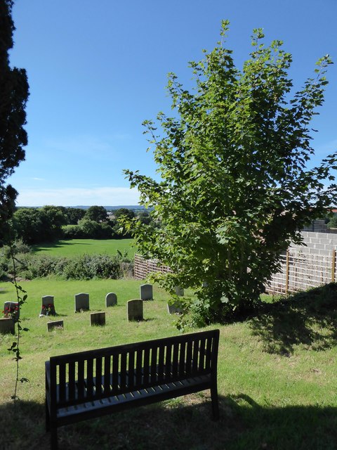
Sedgehill Images

Images are sourced within 2km of 51.049548/-2.19185 or Grid Reference ST8627. Thanks to Geograph Open Source API. All images are credited.

St Catherine, Sedgehill: late August 2016
Rush hour in Sedgehill
St Catherine, Sedgehill: churchyard (1)
St Catherine, Sedgehill: churchyard (2)
St Catherine, Sedgehill: churchyard (3) Also see <span class="nowrap"><a title="https://en.wikipedia.org/wiki/Priscilla_Napier" rel="nofollow ugc noopener" href="https://en.wikipedia.org/wiki/Priscilla_Napier">Link</a><img style="margin-left:2px;" alt="External link" title="External link - shift click to open in new window" src="https://s1.geograph.org.uk/img/external.png" width="10" height="10"/></span> <span class="nowrap"><a title="http://uboat.net/allies/commanders/1815.html" rel="nofollow ugc noopener" href="http://uboat.net/allies/commanders/1815.html">Link</a><img style="margin-left:2px;" alt="External link" title="External link - shift click to open in new window" src="https://s1.geograph.org.uk/img/external.png" width="10" height="10"/></span> and <span class="nowrap"><a title="http://www.cwgc.org/find-war-dead/casualty/2710207/NAPIER,%20TREVYLYAN%20MICHAEL" rel="nofollow ugc noopener" href="http://www.cwgc.org/find-war-dead/casualty/2710207/NAPIER,%20TREVYLYAN%20MICHAEL">Link</a><img style="margin-left:2px;" alt="External link" title="External link - shift click to open in new window" src="https://s1.geograph.org.uk/img/external.png" width="10" height="10"/></span>
St Catherine, Sedgehill: churchyard (3)
Also see LinkExternal link LinkExternal link and LinkExternal link
St Catherine, Sedgehill: churchyard (4)
St Catherine, Sedgehill: churchyard (5) Also see <span class="nowrap"><a title="http://www.cwgc.org/find-war-dead/casualty/405789/GRAY,%20E%20C" rel="nofollow ugc noopener" href="http://www.cwgc.org/find-war-dead/casualty/405789/GRAY,%20E%20C">Link</a><img style="margin-left:2px;" alt="External link" title="External link - shift click to open in new window" src="https://s1.geograph.org.uk/img/external.png" width="10" height="10"/></span>
St Catherine, Sedgehill: churchyard (5)
Also see LinkExternal link
Old Milestone by the A350, Sedgehill and Semley Parish Carved stone post by the A350, in parish of SEDGEHILL AND SEMLEY (SALISBURY District), 200m North of turning to Sedgehill on verge, by the road, on East side of road. Shaston stone, erected by the Shaftesbury & New Road to Blandford turnpike trust in the 18th century. 

Inscription reads:-
: (SEDGEHILL) : : III / Miles from / SHA(S)TON / 1766 : : (SEDGEHILL) : 

Grade II listed. List Entry Number: 1131126
<span class="nowrap"><a title="https://historicengland.org.uk/listing/the-list/list-entry/1131126" rel="nofollow ugc noopener" href="https://historicengland.org.uk/listing/the-list/list-entry/1131126">Link</a><img style="margin-left:2px;" alt="External link" title="External link - shift click to open in new window" src="https://s1.geograph.org.uk/img/external.png" width="10" height="10"/></span>

Milestone Society National ID: WI_WMSH12.
Old Milestone by the A350, Sedgehill and Semley Parish
Carved stone post by the A350, in parish of SEDGEHILL AND SEMLEY (SALISBURY District), 200m North of turning to Sedgehill on verge, by the road, on East side of road. Shaston stone, erected by the Shaftesbury & New Road to Blandford turnpike trust in the 18th century. Inscription reads:- : (SEDGEHILL) : : III / Miles from / SHA(S)TON / 1766 : : (SEDGEHILL) : Grade II listed. List Entry Number: 1131126 LinkExternal link Milestone Society National ID: WI_WMSH12.
Old Milestone by the A350, Semley Common Shaston stone by the A350, in parish of Sedgehill and Semley (Salisbury District), Semley Common, by the road.

Lost since 1970.

Inscription reads:-
II
Miles From
SHASTON
1766
(Shaston is the old name for Shaftesbury)

Milestone Society National ID: WI_WMSH13
Old Milestone by the A350, Semley Common
Shaston stone by the A350, in parish of Sedgehill and Semley (Salisbury District), Semley Common, by the road. Lost since 1970. Inscription reads:- II Miles From SHASTON 1766 (Shaston is the old name for Shaftesbury) Milestone Society National ID: WI_WMSH13
Old Milestone by the A350, Shaftesbury Road, East Knoyle parish Carved stone post by the A350, in parish of East Knoyle (Salisbury District), Shaftesbury Road, The Turnpike, by Southernmost unnamed cottage in hedgerow on bend, on East side of road. Shaston stone, erected by the Shaftesbury & New Road to Blandford turnpike trust in the 19th century. 

Inscription reads:-
: EAST KNOYLE (vertical) : : IV / Miles from / SHASTON : : (not possible to see) :
Carved benchmark lower front middle.

Grade II listed.  
List Entry Number: 1131144 <span class="nowrap"><a title="https://historicengland.org.uk/listing/the-list/list-entry/1131144" rel="nofollow ugc noopener" href="https://historicengland.org.uk/listing/the-list/list-entry/1131144">Link</a><img style="margin-left:2px;" alt="External link" title="External link - shift click to open in new window" src="https://s1.geograph.org.uk/img/external.png" width="10" height="10"/></span>

Milestone Society National ID: WI_WMSH11
Old Milestone by the A350, Shaftesbury Road, East Knoyle parish
Carved stone post by the A350, in parish of East Knoyle (Salisbury District), Shaftesbury Road, The Turnpike, by Southernmost unnamed cottage in hedgerow on bend, on East side of road. Shaston stone, erected by the Shaftesbury & New Road to Blandford turnpike trust in the 19th century. Inscription reads:- : EAST KNOYLE (vertical) : : IV / Miles from / SHASTON : : (not possible to see) : Carved benchmark lower front middle. Grade II listed. List Entry Number: 1131144 LinkExternal link Milestone Society National ID: WI_WMSH11
Snaggs Farm. View west down the no through lane towards Snaggs Farm.
Snaggs Farm.
View west down the no through lane towards Snaggs Farm.
Friar Hayes Lane Friar Hayes Lane with Friar Hayes Farm on the left
Friar Hayes Lane
Friar Hayes Lane with Friar Hayes Farm on the left
Sedgehill Church Ancient Church of Sedgehill view from the Green
Sedgehill Church
Ancient Church of Sedgehill view from the Green
Sweetwell Farm Lane and Farm at Sweetwell
Sweetwell Farm
Lane and Farm at Sweetwell
Grazing Donkeys at Semley Common These donkeys are about forty years old and have grazed on the common for most of their lives.  The srapyard is in the background.
Grazing Donkeys at Semley Common
These donkeys are about forty years old and have grazed on the common for most of their lives. The srapyard is in the background.
Barn Workshops at Chaldicott Farm
Chaldicott Farm
Chaldicott Farm
Field Barn near Semley
Show me another place!

Sedgehill is located at Grid Ref: ST8627 (Lat: 51.049548, Lng: -2.19185)

Unitary Authority: Wiltshire

Police Authority: Wiltshire

What 3 Words

///decently.excuse.uncouth. Near Motcombe, Dorset

Related Wikis

Sedgehill

Sedgehill is a small village and former civil parish, now in the parish of Sedgehill and Semley, in the southwest of the county of Wiltshire, England....

Sedgehill and Semley

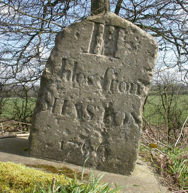
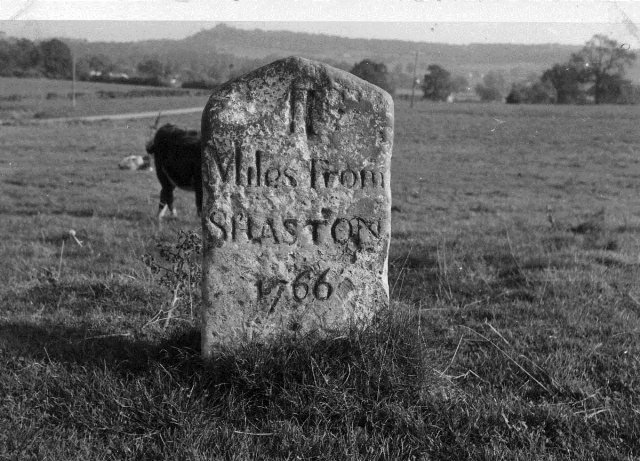
Sedgehill and Semley is a civil parish in the English county of Wiltshire, about 3 miles (4.8 km) north of the town of Shaftesbury on the main A350 road...

Semley railway station

Semley was a railway station in Wiltshire, England. It was served by trains on the West of England Main Line and was the railhead for the town of Shaftesbury...

Semley

Semley is a village and former civil parish, now in the parish of Sedgehill and Semley, in Wiltshire, England, about 3 miles (4.8 km) north-east of Shaftesbury...

Motcombe

Motcombe is a village and civil parish in north Dorset, England. It lies about two miles (three kilometres) north of Shaftesbury. It is sited on Kimmeridge...

St. Mary's Church, East Knoyle

St. Mary's Church is a Church of England parish church in East Knoyle, Wiltshire, England. == History == The Church of England Parish Church of St Mary...

East Knoyle

East Knoyle is a village and civil parish in Wiltshire, in the south-west of England, just west of the A350 and about 9 miles (14 km) south of Warminster...

East Knoyle War Memorial

The East Knoyle War Memorial is a monument that commemorates the lives of soldiers from East Knoyle, Wiltshire, England, who were killed in war. Unveiled...

Nearby Amenities

Located within 500m of 51.049548,-2.19185
Sedgehill
Is In: Wiltshire, England, UK
Place: village
Wikidata: Q7445241
Lat/Long: 51.051086/-2.1906768
The data included in this document is from www.openstreetmap.org. The data is made available under ODbL.

Have you been to Sedgehill?

Leave your review of Sedgehill below (or comments, questions and feedback).