Scots' Gap

Settlement in Northumberland

England

Scots' Gap

Jemmy's Well
Jemmy's Well Credit: Leanmeanmo

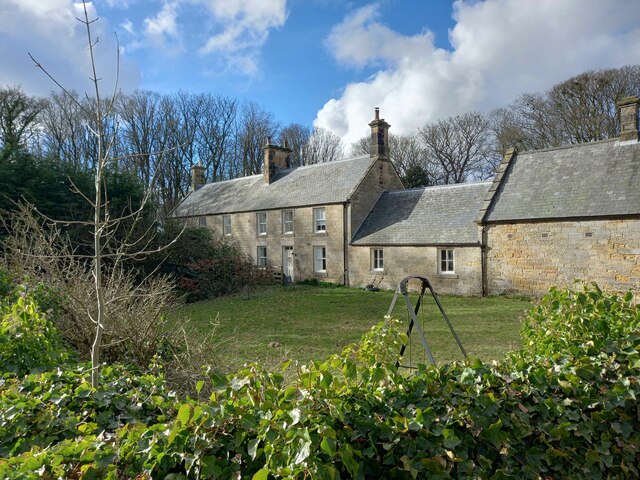
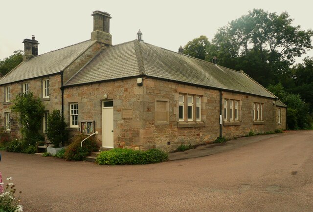
Scots' Gap is a small village located in the county of Northumberland, England. Situated approximately 15 miles northwest of the market town of Morpeth, it lies within the beautiful landscape of the North Pennines Area of Outstanding Natural Beauty.

The village is known for its picturesque setting, nestled amidst rolling hills and surrounded by vast expanses of open countryside. It offers residents and visitors alike a tranquil and peaceful environment, perfect for those seeking a retreat from the hustle and bustle of city life.

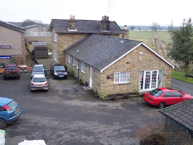
Despite its small size, Scots' Gap boasts a tight-knit community that takes pride in its local heritage. The village is home to a charming, traditional pub that serves as a social hub, offering a warm welcome to locals and visitors alike.

Scots' Gap is also renowned for its agricultural roots, with many residents engaged in farming and livestock rearing. The surrounding farmland is a patchwork of green fields, dotted with grazing sheep and cattle, showcasing the area's rural character.

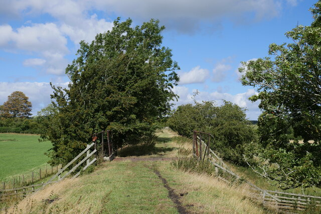
For outdoor enthusiasts, Scots' Gap provides ample opportunities for exploration and outdoor activities. The village is surrounded by a network of footpaths and bridleways, making it an ideal base for walkers, hikers, and cyclists to discover the breathtaking Northumberland countryside.

Overall, Scots' Gap offers a peaceful and idyllic setting, where residents and visitors can appreciate the natural beauty of the North Pennines while enjoying the warmth of a close-knit community.

If you have any feedback on the listing, please let us know in the comments section below.

Scots' Gap Images

Images are sourced within 2km of 55.173534/-1.937164 or Grid Reference NZ0486. Thanks to Geograph Open Source API. All images are credited.

Jemmy's Well
Jemmy's Well
Jemmy's Well In good condition.  It is well protected with stone slabs and the water looked clean.  I'm sure the sheep appreciate it.  Cambo First School in the background.
Jemmy's Well
In good condition. It is well protected with stone slabs and the water looked clean. I'm sure the sheep appreciate it. Cambo First School in the background.
Rothley Castle in Morpeth A beautiful little folly siting on crags in the spectacular Northumberland countryside.
Rothley Castle in Morpeth
A beautiful little folly siting on crags in the spectacular Northumberland countryside.
Dry stone wall at Rothley Crags This substantial and well built dry stone wallis a curious addition to the bottom of The Stell.
Dry stone wall at Rothley Crags
This substantial and well built dry stone wallis a curious addition to the bottom of The Stell.
Former bridge abutment on the Wannie Line walk A pleasant walk along the former Wannie Line near Scots' Gap along which reminders of a bygone era can be noted, such as this former bridge abutment.

This photograph was taken during the Coronavirus (COVID-19) pandemic of 2020/21/22.
Former bridge abutment on the Wannie Line walk
A pleasant walk along the former Wannie Line near Scots' Gap along which reminders of a bygone era can be noted, such as this former bridge abutment. This photograph was taken during the Coronavirus (COVID-19) pandemic of 2020/21/22.
On the former Rothbury Line near Rothley In this photograph, the footpath is just about to pass over one of numerous bridges in this section of the Rothbury Line.

This photograph was taken during the Coronavirus (COVID-19) pandemic of 2020/21/22.
On the former Rothbury Line near Rothley
In this photograph, the footpath is just about to pass over one of numerous bridges in this section of the Rothbury Line. This photograph was taken during the Coronavirus (COVID-19) pandemic of 2020/21/22.
Remains of an occupational bridge abutment on the Rothbury Line The remains of a bridge abutment on the Rothbury Line near Rothley.

This photograph was taken during the Coronavirus (COVID-19) pandemic of 2020/21/22.
Remains of an occupational bridge abutment on the Rothbury Line
The remains of a bridge abutment on the Rothbury Line near Rothley. This photograph was taken during the Coronavirus (COVID-19) pandemic of 2020/21/22.
Cambo First School
Cambo First School
Middle Row, Cambo
Middle Row, Cambo
Middle Row, Cambo
Middle Row, Cambo
North Row, Cambo
North Row, Cambo
West End, Cambo The building on the right once houses a smithy.
West End, Cambo
The building on the right once houses a smithy.
Middle Row, Cambo
Middle Row, Cambo
West Plantation Hedgerow and woodland at West Plantation
West Plantation
Hedgerow and woodland at West Plantation
Gateway to field Gateway to field next to Grangemoor Plantation
Gateway to field
Gateway to field next to Grangemoor Plantation
A row of houses in Cambo These houses are perhaps part of Sir Charles Trevelyan's remodelling of the village in c.1880.  Cambo is an estate village for Wallington Hall.
A row of houses in Cambo
These houses are perhaps part of Sir Charles Trevelyan's remodelling of the village in c.1880. Cambo is an estate village for Wallington Hall.
Village Hall, Cambo Former school built in the early 19C and extended in 1911, when it became a hall and reading room. Given to the village community in 1938. Listed, Grade II.
Village Hall, Cambo
Former school built in the early 19C and extended in 1911, when it became a hall and reading room. Given to the village community in 1938. Listed, Grade II.
Plaque dated 1911 on the village hall, Cambo This includes the information that Lancelot Brown attended school here.
Plaque dated 1911 on the village hall, Cambo
This includes the information that Lancelot Brown attended school here.
Show me another place!

Scots' Gap is located at Grid Ref: NZ0486 (Lat: 55.173534, Lng: -1.937164)

Unitary Authority: Northumberland

Police Authority: Northumbria

What 3 Words

///massive.seatbelt.enlarge. Near Rothley, Northumberland

Nearby Locations

Scots' Gap

Related Wikis

West Grange Hall

West Grange Hall is an English country house and estate in the village of Scots Gap, Northumberland, built between 1863 and 1896 and originally part of...

Scots Gap

Scots Gap is a small village in Northumberland, United Kingdom. == Population == Scots Gap has approximately 70 private residential dwellings, the oldest...

Scotsgap railway station

Scotsgap was a stone-built railway station in Northumberland on the Wansbeck Railway, which served the villages of Scots' Gap and Cambo. It was located...

Rothley, Northumberland

Rothley is a small settlement and civil parish in Northumberland, England about 2 miles (3 km) north east of Cambo and about 6 miles (10 km) west of Morpeth...

Nearby Amenities

Located within 500m of 55.173534,-1.937164
Turning Circle
Lat/Long: 55.1734556/-1.9401638
Scots Gap
Place: village
Wikidata: Q24993734
Lat/Long: 55.1729576/-1.9412517
Post Box
Collection Times: Mo-Fr 16:30; Sa 09:30
Post Box Type: lamp
Ref: NE61 24
Royal Cypher: EIIR
Royal Cypher Wikidata: Q33102113
Source: survey
Lat/Long: 55.1728462/-1.9384755
Bus Stop
Bench: yes
Bin: yes
Naptan AtcoCode: 3100Z040864
Naptan NaptanCode: nldagajm
Shelter: yes
Lat/Long: 55.1725122/-1.9392304
Bus Stop
Naptan AtcoCode: 3100Z039865
Naptan NaptanCode: nldgpadj
Tactile Paving: no
Lat/Long: 55.1723014/-1.9399056
Generator Method: photovoltaic
Generator Output Electricity: yes
Generator Source: solar
Generator Type: solar_photovoltaic_panel
Power: generator
Lat/Long: 55.1727761/-1.9387302
Generator Method: photovoltaic
Generator Output Electricity: yes
Generator Source: solar
Generator Type: solar_photovoltaic_panel
Power: generator
Lat/Long: 55.1726765/-1.9391057
Entrance: main
Lat/Long: 55.1720158/-1.9401833
Generator Method: photovoltaic
Generator Output Electricity: yes
Generator Source: solar
Generator Type: solar_photovoltaic_panel
Power: generator
Lat/Long: 55.1730196/-1.9402966
Addr City: Scots Gap
Addr Housenumber: 10
Addr Street: The Birches
Entrance: main
Lat/Long: 55.1723987/-1.9403457
Entrance: main
Lat/Long: 55.172509/-1.9399039
Defibrillator
Access: yes
Defibrillator Location: South wall of Robson & Cowan
Emergency: defibrillator
Opening Hours: 24/7
Phone: +44 999
Source: survey
Survey Date: 2022-09-19
Wheelchair: yes
Lat/Long: 55.172498/-1.9399662
Scotsgap
Historic Railway: station
Railway: site
Wikidata: Q7435801
Wikipedia: en:Scotsgap railway station
Lat/Long: 55.1718839/-1.9407726
The data included in this document is from www.openstreetmap.org. The data is made available under ODbL.

Have you been to Scots' Gap?

Leave your review of Scots' Gap below (or comments, questions and feedback).