Blaencelyn

Settlement in Cardiganshire

Wales

Blaencelyn

Direction Sign – Signpost on the B4321 in Pontgarreg Located in Pontgarreg, on the southeast of the junction on the B4321 near the bridge over Nant Hawen. Llangrannog community. 3 arms, 1 missing, and ogee finial. 

Milestone Society National ID: CRD_SN3354
Direction Sign – Signpost on the B4321 in Pontgarreg Credit: P Bradley

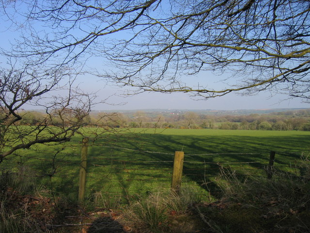
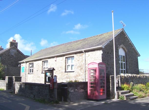
Blaencelyn is a small village located in the county of Cardiganshire, Wales. Situated in the heart of the beautiful countryside, it is surrounded by rolling hills and stunning landscapes. The village is nestled in the Teifi Valley, with the River Teifi flowing through its vicinity.

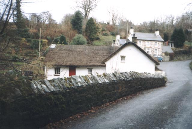
The community of Blaencelyn is known for its close-knit and friendly atmosphere. The village is home to a small population, primarily engaged in agriculture and farming. Traditional stone cottages and farmhouses dot the area, adding to its rural charm.

Despite its small size, Blaencelyn offers a range of amenities to its residents and visitors. The village has a local pub, providing a gathering place for socializing and enjoying a pint. There is also a village hall, where various community events and gatherings take place throughout the year.

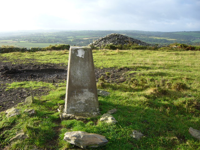
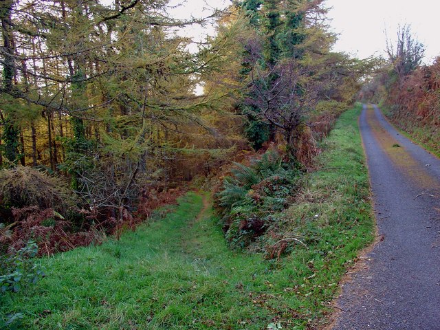
Nature enthusiasts and outdoor lovers are drawn to Blaencelyn due to its proximity to stunning natural wonders. The area offers numerous walking and biking trails, allowing visitors to explore the picturesque countryside and enjoy breathtaking views. The River Teifi provides opportunities for fishing and water sports, attracting anglers and adventurers alike.

Blaencelyn is strategically located near larger towns and cities, providing access to a wider range of services and amenities. The nearby town of Cardigan offers shopping centers, schools, and healthcare facilities.

Overall, Blaencelyn is a tranquil and idyllic village that attracts those seeking a peaceful rural lifestyle, surrounded by natural beauty.

If you have any feedback on the listing, please let us know in the comments section below.

Blaencelyn Images

Images are sourced within 2km of 52.164402/-4.407767 or Grid Reference SN3554. Thanks to Geograph Open Source API. All images are credited.

Direction Sign – Signpost on the B4321 in Pontgarreg Located in Pontgarreg, on the southeast of the junction on the B4321 near the bridge over Nant Hawen. Llangrannog community. 3 arms, 1 missing, and ogee finial. 

Milestone Society National ID: CRD_SN3354
Direction Sign – Signpost on the B4321 in Pontgarreg
Located in Pontgarreg, on the southeast of the junction on the B4321 near the bridge over Nant Hawen. Llangrannog community. 3 arms, 1 missing, and ogee finial. Milestone Society National ID: CRD_SN3354
Pontgarreg Primary School The 'Welsh Not' was used in this school during the eighteenth and nineteenth century in a bid to prevent pupils from speaking Welsh. The 'Welsh Not', which usually consisted of a small piece of wood or slate inscribed with the letters 'W.N', was hung around the neck of a child who was caught speaking Welsh. At the end of the school day, the child wearing the 'Welsh Not' would be punished by the schoolteacher.
Pontgarreg Primary School
The 'Welsh Not' was used in this school during the eighteenth and nineteenth century in a bid to prevent pupils from speaking Welsh. The 'Welsh Not', which usually consisted of a small piece of wood or slate inscribed with the letters 'W.N', was hung around the neck of a child who was caught speaking Welsh. At the end of the school day, the child wearing the 'Welsh Not' would be punished by the schoolteacher.
Thatched Cottage This Cottage lies alongside the river Nant Rhydyfothau at Penbont between Blaencelyn and Llwyndafydd.
Thatched Cottage
This Cottage lies alongside the river Nant Rhydyfothau at Penbont between Blaencelyn and Llwyndafydd.
Capel y Wig Capel y Wig Independent Chapel near the little Village of Pontgarreg.
Capel y Wig
Capel y Wig Independent Chapel near the little Village of Pontgarreg.
Llandyssiliogogo Head trig
The Crown Inn - Llwyndafydd
Derelict farm buildings
Lane junction
Lane junction
Lane leading down into Penbontrhydyfothau
Small stream
Small stream
Farm house
Farm house
B4321 ger Pentregat / The B4321 near Pentregat Ffordd B syn arwain i Langrannog / B road leading to Llangrannog
B4321 ger Pentregat / The B4321 near Pentregat
Ffordd B syn arwain i Langrannog / B road leading to Llangrannog
Lon Cae y Wig / Cae y Wig Lane Lon Cae y Wig ger Blaencelyn / Cae y Wig Lane near Blaencelyn
Lon Cae y Wig / Cae y Wig Lane
Lon Cae y Wig ger Blaencelyn / Cae y Wig Lane near Blaencelyn
Tir Amaethyddol  ger Plwmp / Farmland near Plwmp Ffens Cae ar dir amaethyddol ger Plwmp / Field edge on farmland near Plwmp
Tir Amaethyddol ger Plwmp / Farmland near Plwmp
Ffens Cae ar dir amaethyddol ger Plwmp / Field edge on farmland near Plwmp
Defaid mewn cae ger Blaencelyn / Sheep in a field near Blaencelyn Defaid mewn cae ger Blaencelyn / Sheep in a field near Blaencelyn
Defaid mewn cae ger Blaencelyn / Sheep in a field near Blaencelyn
Cyffordd ffordd / Road Junction Cyffordd ffordd ar lwybyr beicio Sustrans 3e / A Road junction on Sustrans Cycle Route 3e.
Cyffordd ffordd / Road Junction
Cyffordd ffordd ar lwybyr beicio Sustrans 3e / A Road junction on Sustrans Cycle Route 3e.
Sietyn a Cae ger Llwyndafydd / A Hedge and field near Llwyndafydd Sietyn a Cae ger Llwyndafydd / A Hedge and field near Llwyndafydd
Sietyn a Cae ger Llwyndafydd / A Hedge and field near Llwyndafydd
Track down into Cwm Fothau, Llandisiliogogo
Show me another place!

Blaencelyn is located at Grid Ref: SN3554 (Lat: 52.164402, Lng: -4.407767)

Unitary Authority: Ceredigion

Police Authority: Dyfed Powys

Also known as: Blaen Celyn

What 3 Words

///drizzly.empire.intelligible. Near Llanllwchaiarn, Ceredigion

Related Wikis

Blaen Celyn

Blaen Celyn is a hamlet in the community of Llangrannog, Ceredigion, Wales, 2 miles (3.2 km) east of Llangrannog village. The local St. David's Church...

Penbontrhydyfoethau

Penbontrhydyfothau is a hamlet in the community of Llandysiliogogo, Ceredigion, Wales, which is 70.5 miles (113.4 km) from Cardiff and 187.9 miles (302...

Pentre-gat

Pentre-gat is a small village in the community of Llangrannog, Ceredigion, Wales, which is 69.6 miles (112 km) from Swansea and 381 miles (302.3 km) from...

Caerwedros

Caerwedros (pronounced [kaɨrˈwɛdrɔs] ) is a small village in western Ceredigion, Wales, in the community of Llandysiliogogo. Caerwedros village has a Memorial...

Pigeon's Ford

Pigeon's Ford is a hamlet in the community of Llangrannog, Ceredigion, Wales, which is 71.8 miles (115.5 km) from Cardiff and 189.9 miles (305.5 km) from...

Hafodiwan

Hafodiwan is a hamlet in the community of Llandysiliogogo, Ceredigion, Wales, which is 69.6 miles (112 km) from Cardiff and 186.6 miles (300.2 km) from...

Blaenbedw Fawr

Blaenbedw Fawr is a small village in the community of Llandysiliogogo, Ceredigion, Wales, which is 68.9 miles (110.8 km) from Cardiff and 187 miles (300...
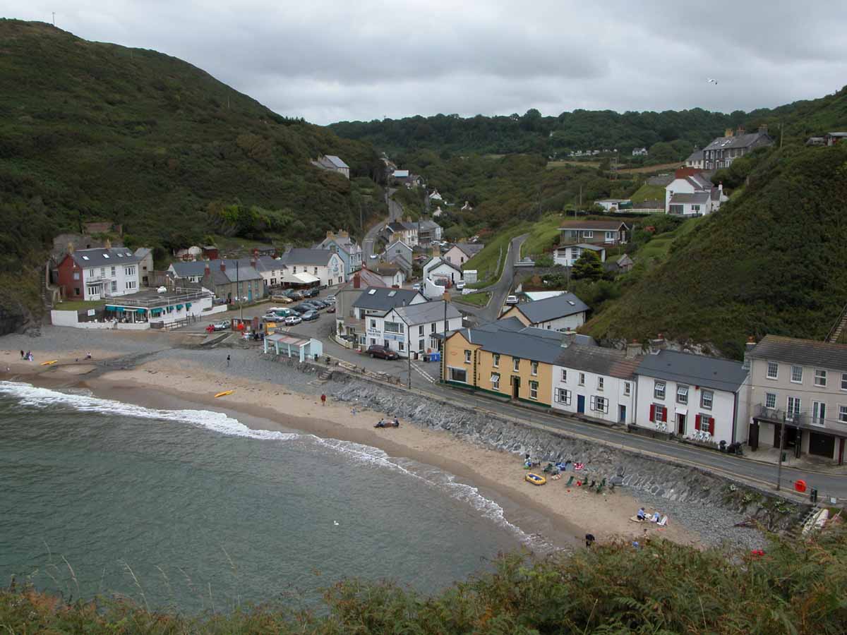
Llangrannog

Llangrannog (sometimes spelt as Llangranog) is both a village and a community in Ceredigion, Wales, 6 miles (10 km) southwest of New Quay. It lies in...

Nearby Amenities

Located within 500m of 52.164402,-4.407767
Place: farm
Lat/Long: 52.1679567/-4.4086013
Place: farm
Lat/Long: 52.1649822/-4.4047818
Post Office
Blaencelyn Post Office
Addr City: Llandysul
Addr Country: GB
Addr Hamlet: Blaencelyn
Addr Postcode: SA44 6DE
Opening Hours: Mo,Tu,Th,Fr 09:00-13:00,14:00-17:30; We,Sa 09:00-13:00
Ref Pol Id: 3433
Lat/Long: 52.1646738/-4.4104167
Blaencelyn
Place: hamlet
Wikidata: Q15987467
Wikipedia: en:Blaen Celyn
Lat/Long: 52.1643432/-4.4104745
Shop: convenience
Lat/Long: 52.1646959/-4.4107232
Direction: SSW
Generator Method: photovoltaic
Generator Output Electricity: yes
Generator Solar Modules: 14
Generator Source: solar
Generator Type: solar_photovoltaic_panel
Location: roof
Power: generator
Lat/Long: 52.1610189/-4.4049946
Direction: SW
Generator Method: photovoltaic
Generator Output Electricity: yes
Generator Solar Modules: 8
Generator Source: solar
Generator Type: solar_photovoltaic_panel
Location: roof
Power: generator
Lat/Long: 52.1618202/-4.4064564
Direction: SW
Generator Method: photovoltaic
Generator Output Electricity: yes
Generator Solar Modules: 6
Generator Source: solar
Generator Type: solar_photovoltaic_panel
Location: roof
Power: generator
Lat/Long: 52.1618638/-4.4065315
The data included in this document is from www.openstreetmap.org. The data is made available under ODbL.

Have you been to Blaencelyn?

Leave your review of Blaencelyn below (or comments, questions and feedback).