Saxon Street

Settlement in Cambridgeshire East Cambridgeshire

England

Saxon Street

Uphill to the crossroads The road from Dullingham and Stetchworth to Cheveley (ahead), photographed on a bright March morning. Early blossom shows in some trees and the hedgerow on the left.
Uphill to the crossroads Credit: John Sutton

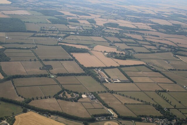
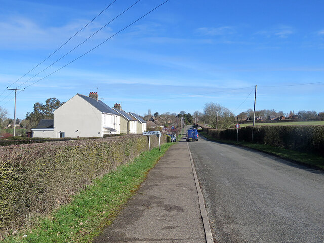
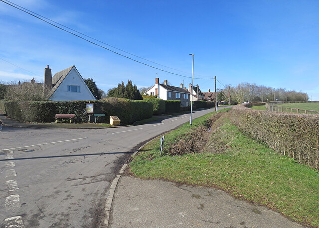
Saxon Street is a small village located in the county of Cambridgeshire, England. Situated approximately 12 miles south of Cambridge, it falls within the administrative district of South Cambridgeshire. The village is nestled amidst the picturesque countryside of the Cambridgeshire Fens, offering residents and visitors a tranquil and idyllic setting.

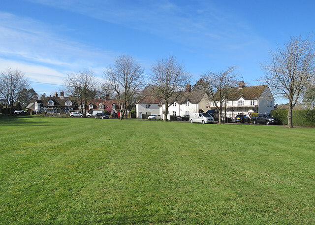
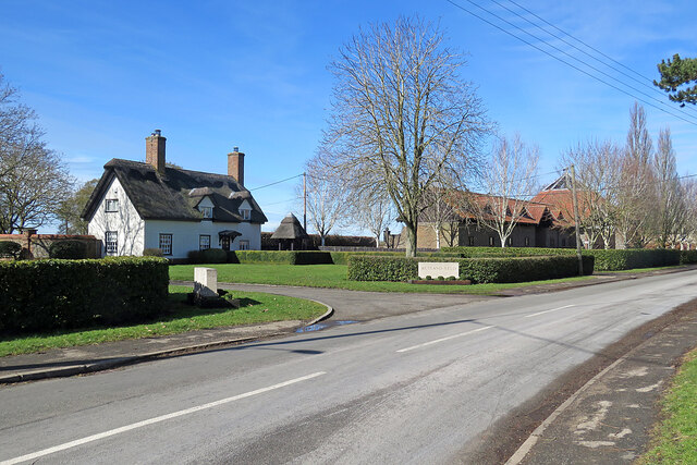
Saxon Street is characterized by its charming rural atmosphere and traditional English village architecture. The village is home to a close-knit community, with a population size of around 300 residents. The tight-knit nature of the community fosters a friendly and welcoming atmosphere, making Saxon Street an appealing place to live.

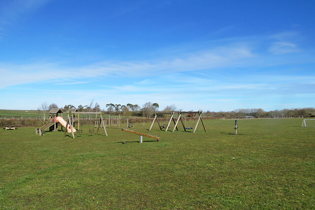
The village boasts a range of amenities to cater to the needs of its residents. These include a local pub, providing a social hub for villagers to gather and enjoy a drink or a meal. Additionally, there is a village hall that hosts various community events and activities throughout the year.

Surrounded by vast open fields and meadows, Saxon Street offers ample opportunities for outdoor pursuits. The village is intersected by several footpaths and bridleways, making it an ideal location for those who enjoy walking, cycling, or horse riding. The nearby countryside also provides a haven for wildlife enthusiasts, with various species of birds and animals inhabiting the area.

Overall, Saxon Street, Cambridgeshire, offers a peaceful and picturesque setting, complemented by a sense of community spirit and a range of amenities. It is a place where residents can enjoy the beauty of the English countryside while still having access to essential facilities.

If you have any feedback on the listing, please let us know in the comments section below.
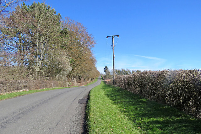
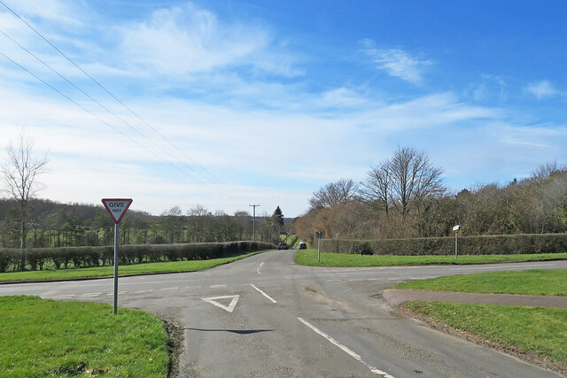
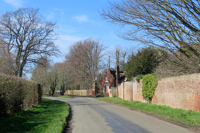
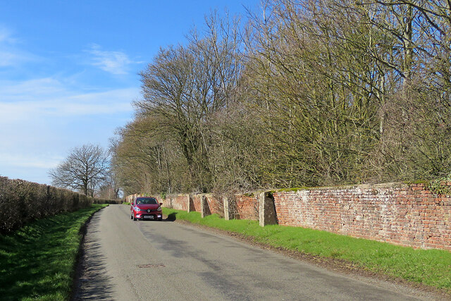
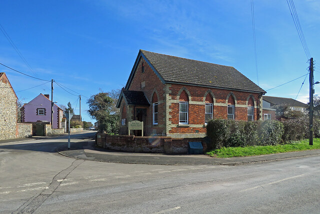
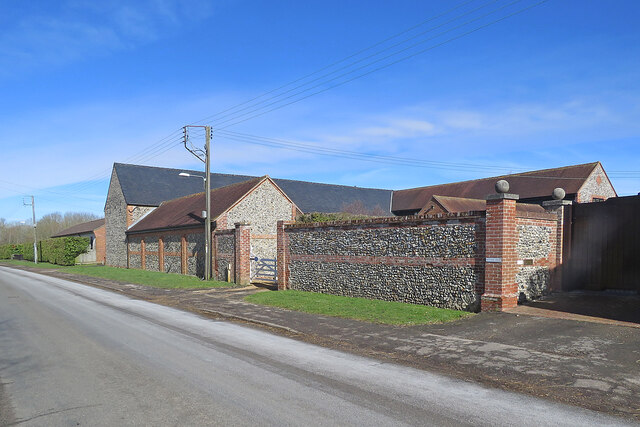
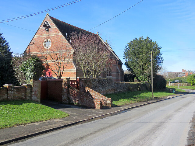
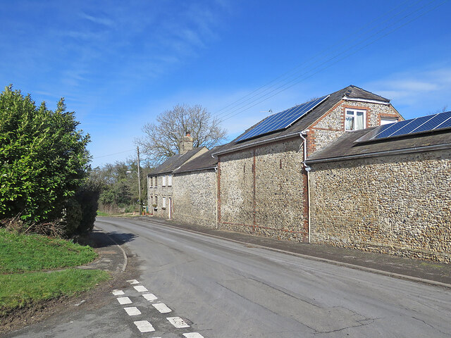
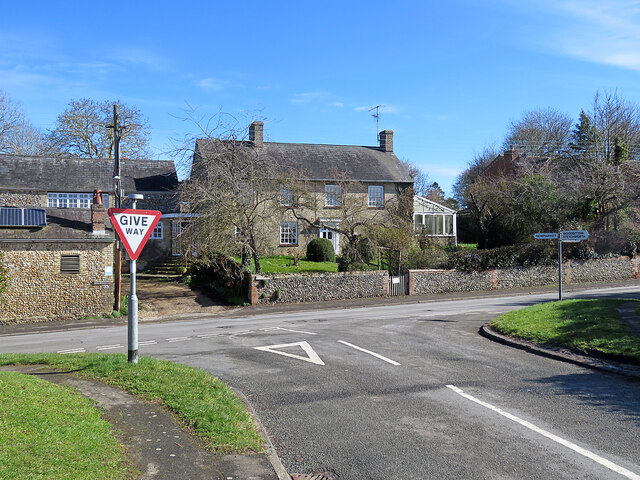
Saxon Street Images

Images are sourced within 2km of 52.206802/0.453596 or Grid Reference TL6759. Thanks to Geograph Open Source API. All images are credited.

Uphill to the crossroads The road from Dullingham and Stetchworth to Cheveley (ahead), photographed on a bright March morning. Early blossom shows in some trees and the hedgerow on the left.
Uphill to the crossroads
The road from Dullingham and Stetchworth to Cheveley (ahead), photographed on a bright March morning. Early blossom shows in some trees and the hedgerow on the left.
Give way at the crossroads This is where the road from Cheveley to Stetchworth and Dullingham (ahead) crosses the road from Kirtling and Saxon Street (left) to Newmarket.
Give way at the crossroads
This is where the road from Cheveley to Stetchworth and Dullingham (ahead) crosses the road from Kirtling and Saxon Street (left) to Newmarket.
Park Road and the entrance to Cheveley Park Stud-farm country south of Newmarket. The lodge on the right is at the gate to Cheveley Park Stud. The road forks here: straight on for Newmarket, left for Stetchworth and Dullingham.
Park Road and the entrance to Cheveley Park
Stud-farm country south of Newmarket. The lodge on the right is at the gate to Cheveley Park Stud. The road forks here: straight on for Newmarket, left for Stetchworth and Dullingham.
On Park Road in early spring The leaning and buttressed wall encloses Cheveley Park Stud.
On Park Road in early spring
The leaning and buttressed wall encloses Cheveley Park Stud.
Cheveley: on Park Road The flint cottage on the right has arch-headed windows and a chimney-stack with a Jacobean flavour - suggesting the Gothick taste of the early years of the nineteenth century.
Cheveley: on Park Road
The flint cottage on the right has arch-headed windows and a chimney-stack with a Jacobean flavour - suggesting the Gothick taste of the early years of the nineteenth century.
Broad Green: across the green A small settlement near Cheveley, on the eastern edge of Cambridgeshire.
Broad Green: across the green
A small settlement near Cheveley, on the eastern edge of Cambridgeshire.
Saxon Street and Rutland Stud, looking towards Little Ditton: aerial 2022
Cottages at Broad Green The road past the red-brick cottages leads to Cheveley.
Cottages at Broad Green
The road past the red-brick cottages leads to Cheveley.
Nearing Broad Green The road from Saxon Street on a bright March morning. The blackthorn hedge in the centre is coming into flower.
Nearing Broad Green
The road from Saxon Street on a bright March morning. The blackthorn hedge in the centre is coming into flower.
Saxon Street Methodist Church A Victorian Primitive Methodist chapel at the corner of Cheveley Road (left).
Saxon Street Methodist Church
A Victorian Primitive Methodist chapel at the corner of Cheveley Road (left).
Saxon Street: the entrance to Rutland Stud This is one of the many stud farms in this horsey part of Cambridgeshire, near Newmarket. The 17th-century thatched house, The Elms, is Grade II listed.
Saxon Street: the entrance to Rutland Stud
This is one of the many stud farms in this horsey part of Cambridgeshire, near Newmarket. The 17th-century thatched house, The Elms, is Grade II listed.
Saxon Street: flint barns at Rutland Farm Flint was a common walling material in this part of Cambridgeshire, near the Suffolk border.
Saxon Street: flint barns at Rutland Farm
Flint was a common walling material in this part of Cambridgeshire, near the Suffolk border.
Saxon Street: a former church Holy Trinity, the Lord Manners memorial church, was designed by J D Stedding and built in 1876 ("before he found his own style", thought Nikolaus Pevsner). It is Grade II listed.
Saxon Street: a former church
Holy Trinity, the Lord Manners memorial church, was designed by J D Stedding and built in 1876 ("before he found his own style", thought Nikolaus Pevsner). It is Grade II listed.
Saxon Street: flint farm buildings Flint was a common walling material in this part of Cambridgeshire.
Saxon Street: flint farm buildings
Flint was a common walling material in this part of Cambridgeshire.
Saxon Street: Syde House A Grade II listed nineteenth-century brick farmhouse.
Saxon Street: Syde House
A Grade II listed nineteenth-century brick farmhouse.
Nearing Saxon Street on School Road This is the road from Woodditton. The first three houses are an early Council-built type which is found in other Cambridgeshire villages.
Nearing Saxon Street on School Road
This is the road from Woodditton. The first three houses are an early Council-built type which is found in other Cambridgeshire villages.
Queen Elizabeth II Memorial Playing Field On the Little Ditton to Saxon Street road and administered by Woodditton Parish Council.
Queen Elizabeth II Memorial Playing Field
On the Little Ditton to Saxon Street road and administered by Woodditton Parish Council.
Little Ditton: Maypole Lane The lane leads to Woodditton Church, which is some way north of the village, and the road to Newmarket.
Little Ditton: Maypole Lane
The lane leads to Woodditton Church, which is some way north of the village, and the road to Newmarket.
Show me another place!

Saxon Street is located at Grid Ref: TL6759 (Lat: 52.206802, Lng: 0.453596)

Administrative County: Cambridgeshire

District: East Cambridgeshire

Police Authority: Cambridgeshire

What 3 Words

///etchings.unwind.employ. Near Newmarket, Suffolk

Nearby Locations

Saxon Street

Related Wikis

Woodditton

Woodditton is a village and civil parish in East Cambridgeshire, England. The other settlements in the parish are Ditton Green, Little Ditton and Saxon...

Cheveley

The village of Cheveley is situated in the county of Cambridgeshire and lies about four miles east-south-east of the market town of Newmarket. The population...

Ashley, Cambridgeshire

Ashley is a village and civil parish in the East Cambridgeshire district of Cambridgeshire, England, about 4 miles (6.4 km) east of Newmarket. The modern...

Cheveley Castle

Cheveley Castle was a medieval fortified manor house near Cheveley, Cambridgeshire, England. == Details == Cheveley Castle was built by Sir John Pulteney...
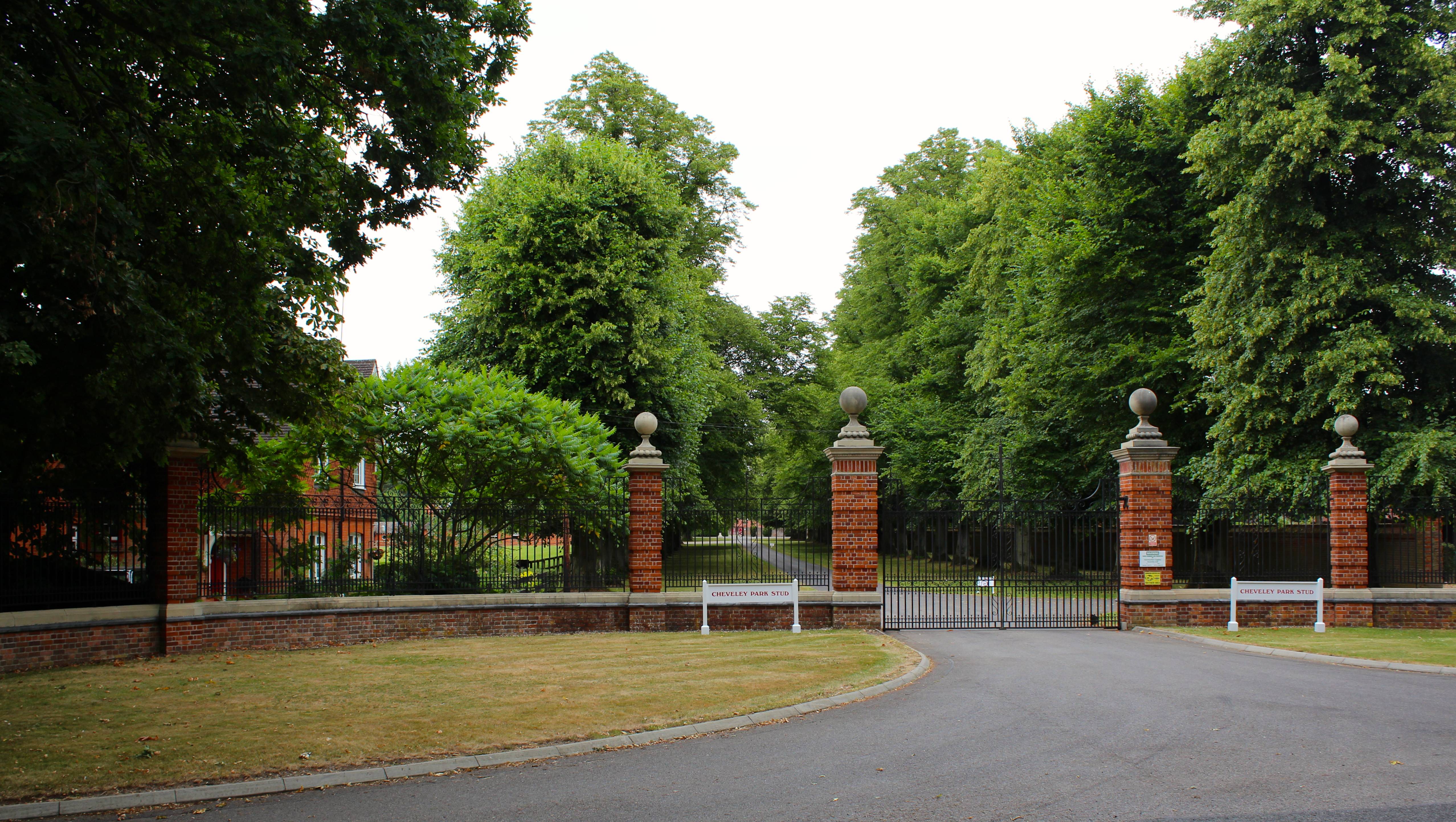
Cheveley Park Stud

Cheveley Park Stud is a thoroughbred racehorse ownership and breeding operation in Newmarket, Suffolk, UK, which has bred and owned many notable horses...

Kirtling Tower

Kirtling Tower was a medieval castle and Tudor country house in Kirtling, Cambridgeshire, England, of which the gatehouse still remains. == History... ==

Beech House Stud

Beech House Stud is an English Thoroughbred racehorse breeding farm located on Cheveley Road near Newmarket, Suffolk currently owned by Sheikh Hamdan bin...

Upend

Upend is a hamlet in the east of Cambridgeshire. It is five miles (8.0 km) south-east of Newmarket and lies in the same parish as Kirtling. Until the...

Nearby Amenities

Located within 500m of 52.206802,0.453596
Saxon Street
Is In: Cambridgeshire, England, UK
Place: village
Lat/Long: 52.206826/0.4575986
Post Box
Collection Times: Mo-Fr 16:15; Sa 10:45
Operator: Royal Mail
Post Box Type: lamp
Ref: CB8 76
Royal Cypher: EIIR
Royal Cypher Wikidata: Q33102113
Source: survey
Lat/Long: 52.2065255/0.45685
Pub
The Reindeer
Brewery: pitfield
Internet Access: wlan
Lat/Long: 52.2070068/0.4561686
Post Box
CB8 9RX – School Road | Saxon Street
Collection Times: Mo-Fr 09:00; Sa 07:00
Operator: Royal Mail
Post Box Type: lamp
Ref: CB8 77
Royal Cypher: EIIR
Royal Cypher Wikidata: Q33102113
Source: survey
Lat/Long: 52.2078314/0.4499968
Bus Stop
School Road
Naptan AtcoCode: 0500EWOOD001
Naptan Bearing: NE
Naptan BusStopType: CUS
Naptan CommonName: School Road
Naptan Indicator: o/s No 62
Naptan Landmark: School Road
Naptan NaptanCode: cmbdjmpt
Naptan ShortCommonName: School Road
Naptan Street: School Road
Naptan Verified: no
Source: naptan_import
Lat/Long: 52.2076939/0.4497236
Bus Stop
School Road
Naptan AtcoCode: 0500EWOOD002
Naptan Bearing: SW
Naptan CommonName: School Road
Naptan Indicator: opp No 62
Naptan Landmark: School Road
Naptan NaptanCode: cmbdjmpw
Naptan ShortCommonName: School Road
Naptan Street: School Road
Naptan Verified: no
Source: naptan_import
Lat/Long: 52.2076822/0.4498547
Bus Stop
Cheveley Road
Naptan AtcoCode: 0500EWOOD007
Naptan Bearing: NW
Naptan BusStopType: CUS
Naptan CommonName: Cheveley Road
Naptan Indicator: opp
Naptan Landmark: Cheveley Road
Naptan NaptanCode: cmbdjmtg
Naptan ShortCommonName: Cheveley Road
Naptan Street: Kirtling Road
Naptan Verified: no
Source: naptan_import
Lat/Long: 52.2059438/0.457341
Bus Stop
Holy Trinity Church
Naptan AtcoCode: 0500EWOOD009
Naptan Bearing: NW
Naptan BusStopType: CUS
Naptan CommonName: Holy Trinity Church
Naptan Indicator: near
Naptan Landmark: School Road
Naptan NaptanCode: cmbdjmtm
Naptan ShortCommonName: Holy Trinity Church
Naptan Street: The Street
Naptan Verified: no
Source: naptan_import
Lat/Long: 52.2088615/0.4541207
Bus Stop
Holy Trinity Church
Naptan AtcoCode: 0500EWOOD010
Naptan Bearing: SE
Naptan BusStopType: CUS
Naptan CommonName: Holy Trinity Church
Naptan Indicator: opp
Naptan Landmark: School Road
Naptan NaptanCode: cmbdjmtp
Naptan ShortCommonName: Holy Trinity Church
Naptan Street: The Street
Naptan Verified: no
Source: naptan_import
Lat/Long: 52.2089049/0.4541963
Bus Stop
Cheveley Road
Naptan AtcoCode: 0500EWOOD013
Naptan Bearing: SE
Naptan BusStopType: CUS
Naptan CommonName: Cheveley Road
Naptan Indicator: near
Naptan Landmark: Cheveley Road
Naptan NaptanCode: cmbdjmwd
Naptan ShortCommonName: Cheveley Road
Naptan Street: Kirtling Road
Naptan Verified: no
Source: naptan_import
Lat/Long: 52.2059769/0.4574746
Power: transformer
Lat/Long: 52.2053186/0.458104
Power: transformer
Lat/Long: 52.2034135/0.450025
Power: pole
Lat/Long: 52.2041417/0.4531149
Power: pole
Lat/Long: 52.2051288/0.4573367
Power: pole
Lat/Long: 52.2037701/0.4515582
Power: pole
Lat/Long: 52.2045049/0.4546668
Power: pole
Lat/Long: 52.2051997/0.4542143
Power: pole
Lat/Long: 52.2048823/0.4562236
Power: pole
Lat/Long: 52.206687/0.4538605
Power: transformer
Lat/Long: 52.2076654/0.4539816
Power: pole
Lat/Long: 52.2059461/0.4537308
Power: pole
Lat/Long: 52.2058397/0.4600256
Power: pole
Lat/Long: 52.2060517/0.4606304
Power: pole
Lat/Long: 52.2071526/0.4607126
Power: pole
Lat/Long: 52.2056083/0.4593447
Power: pole
Lat/Long: 52.2059252/0.4607056
Barrier: yes
Lat/Long: 52.2077391/0.4558985
Public Bookcase
Booth: K6
Colour: red
Disused Amenity: telephone
Man Made: telephone_box
Public Bookcase Type: phone_box
Lat/Long: 52.2078359/0.4502086
Noexit: yes
Lat/Long: 52.2058586/0.4595147
Noexit: yes
Lat/Long: 52.205677/0.4592304
The data included in this document is from www.openstreetmap.org. The data is made available under ODbL.

Have you been to Saxon Street?

Leave your review of Saxon Street below (or comments, questions and feedback).