Blades
Settlement in Yorkshire Richmondshire
England
Blades

Blades is a small village located in the county of Yorkshire, England. Situated approximately 10 miles east of the city of Sheffield, it is nestled in the picturesque countryside, surrounded by rolling hills and lush green fields. With a population of around 500 residents, Blades offers a peaceful and rural setting for its inhabitants.
The village is known for its strong agricultural roots, with farming being the main occupation of many locals. The landscape around Blades is dominated by farmland, where crops such as wheat, barley, and oats are cultivated. The village is also home to a number of livestock farms, including sheep and cattle.
Blades has a close-knit community, with a few amenities to cater to the needs of its residents. There is a small convenience store that provides essential groceries, and a local pub where villagers can gather for a pint and a friendly chat. Despite its small size, Blades has a primary school, ensuring that the educational needs of the children are met within the village itself.
The village is surrounded by beautiful countryside, making it an ideal location for nature lovers and outdoor enthusiasts. There are several walking and cycling routes in the area, allowing residents and visitors to explore the scenic surroundings. The nearby river provides opportunities for fishing and boating, adding to the recreational activities available.
Blades offers a tranquil and idyllic lifestyle, away from the hustle and bustle of city living. Its charming rural setting and strong sense of community make it an attractive place to call home for those seeking a peaceful retreat in the heart of Yorkshire.
If you have any feedback on the listing, please let us know in the comments section below.
Blades Images
Images are sourced within 2km of 54.382/-2.0323 or Grid Reference SD9898. Thanks to Geograph Open Source API. All images are credited.

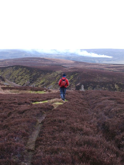
![View along Mill Gill Mill Gill [aka Old Gang Beck] is one of the many feeder streams for the Swale, although on this July day it is contributing very little water thanks to weeks of drought conditions.](https://s2.geograph.org.uk/geophotos/05/84/42/5844214_f4e3849e.jpg)
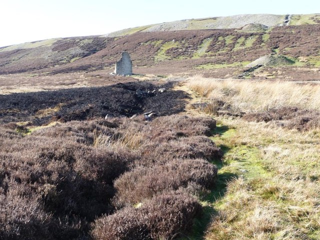
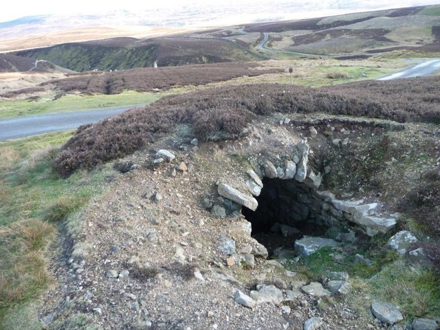
![Tipped twice! There's a huge long pile of waste material from the two levels just above Old Gang smelt mill, but look carefully and you will notice grassed over 'fingers' of much older tips emerging from beneath the rubble indicating that there was once a level on this side of the beck [true right bank] that was covered over by later workings.](https://s2.geograph.org.uk/geophotos/05/84/42/5844234_70f4bdf4.jpg)


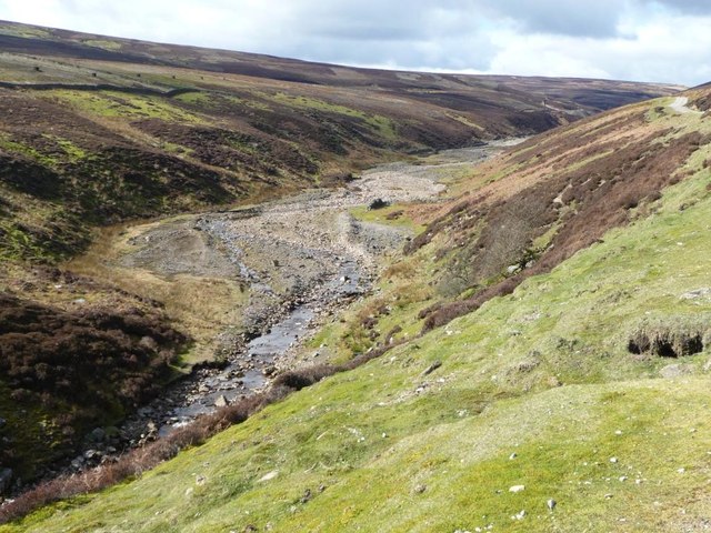


![Gill crossed by drystone wall On the western side of Mill Gill [aka Old Gang Beck].](https://s1.geograph.org.uk/geophotos/02/86/67/2866773_1357b302.jpg)

![Animal trap on lower part of lead smelting flue Presumably to catch mammals [rats?] that predate the grouse on this grouse moor. Must let the birds live long enough to be shot.](https://s0.geograph.org.uk/geophotos/02/86/73/2867336_98e7dc79.jpg)
Blades is located at Grid Ref: SD9898 (Lat: 54.382, Lng: -2.0323)
Division: North Riding
Administrative County: North Yorkshire
District: Richmondshire
Police Authority: North Yorkshire
What 3 Words
///sweeping.terminology.forge. Near Bowes, Co. Durham
Nearby Locations
Related Wikis

Feetham
Feetham is a hamlet opposite Low Row in the Yorkshire Dales, North Yorkshire, England. The origin of the place-name is from Old Norse and means place at...

Low Row
Low Row is a village in Swaledale, in the Yorkshire Dales, North Yorkshire, England. It lies about 3 miles west of Reeth and is between Healaugh and Gunnerside...

Kearton
Kearton is a hamlet in the Yorkshire Dales, North Yorkshire, England. Kearton is situated near Low Row and Reeth. == References == == External links... ==

Crackpot, North Yorkshire
Crackpot is a village in Swaledale, North Yorkshire, England. Its name derives from the Old English kraka (crow) and the Viking word pot (usually a pit...
Nearby Amenities
Located within 500m of 54.382,-2.0323Have you been to Blades?
Leave your review of Blades below (or comments, questions and feedback).