Sandridge

Settlement in Hertfordshire St. Albans

England

Sandridge

The Green Man, Sandridge
The Green Man, Sandridge Credit: David Howard

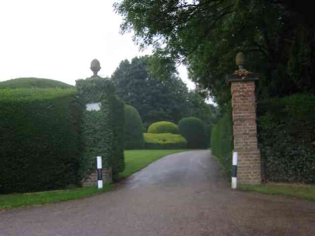
Sandridge is a charming village located in the county of Hertfordshire, England. Situated approximately four miles east of the city of St Albans, Sandridge is nestled in the picturesque Lea Valley, surrounded by stunning countryside and rolling hills. The village has a population of around 3,500 residents.

Sandridge boasts a rich history, dating back to Roman times. Evidence of Roman settlements can still be seen, including the remains of a Roman road that once connected Verulamium (now St Albans) to London. The village also played a role in the English Civil War, with several skirmishes taking place in the area.

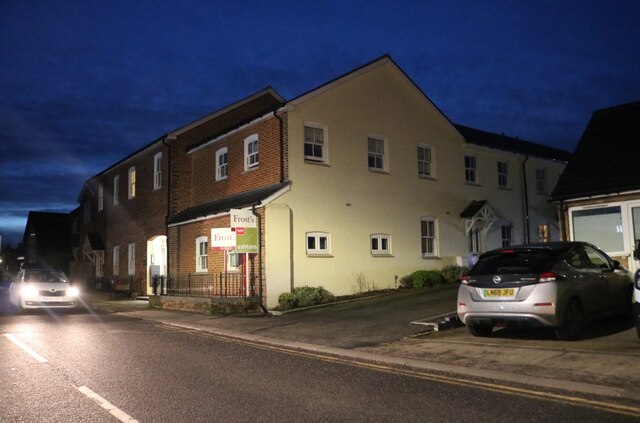
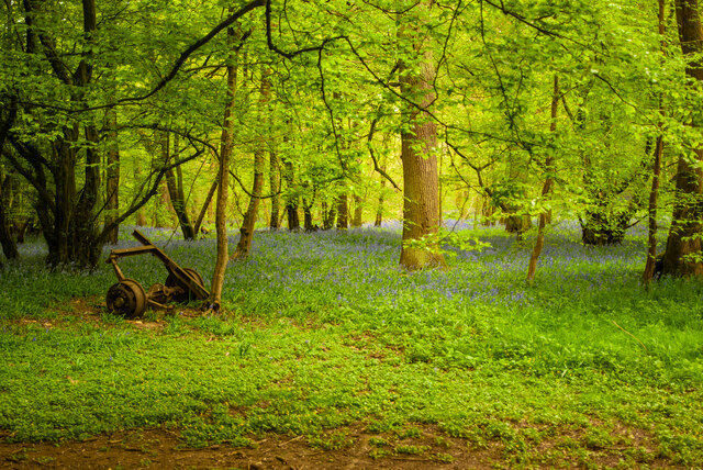
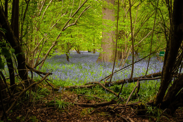
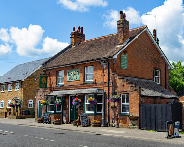
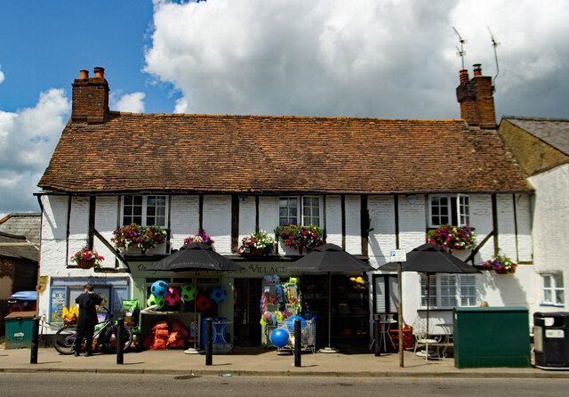
Despite its small size, Sandridge offers a range of amenities for its residents. The village has a primary school, a church, a village hall, and a local pub, providing a sense of community and a focal point for social gatherings. Additionally, there are numerous walking and cycling routes in the surrounding area, allowing residents to explore the beautiful countryside.

Sandridge benefits from its close proximity to St Albans, a historic city known for its Roman heritage and stunning cathedral. The city offers a wide range of shops, restaurants, and entertainment options, ensuring that residents of Sandridge have access to all necessary amenities.

Overall, Sandridge is a picturesque village with a rich history and a strong sense of community. Its proximity to St Albans and its beautiful surroundings make it an attractive place to live for those seeking a peaceful village lifestyle with easy access to city amenities.

If you have any feedback on the listing, please let us know in the comments section below.

Sandridge Images

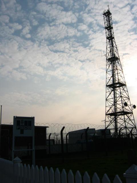
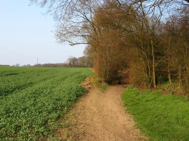
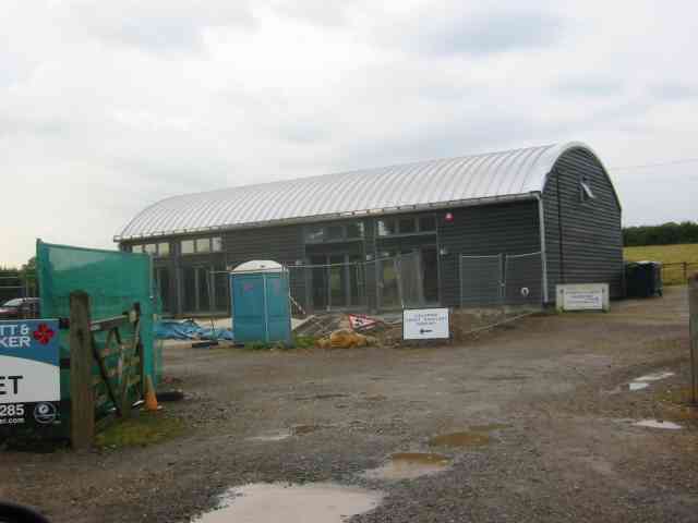
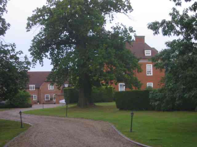
Images are sourced within 2km of 51.781323/-0.30495659 or Grid Reference TL1710. Thanks to Geograph Open Source API. All images are credited.

The Green Man, Sandridge
High Street, Sandridge
Sandridge : Heartwood Forest
Sandridge : Heartwood Forest bluebells
Sandridge : "Green Man" public house
Sandridge : village shop Grade II listed - <span class="nowrap"><a title="https://historicengland.org.uk/listing/the-list/list-entry/1308275?section=official-list-entry" rel="nofollow ugc noopener" href="https://historicengland.org.uk/listing/the-list/list-entry/1308275?section=official-list-entry">Link</a><img style="margin-left:2px;" alt="External link" title="External link - shift click to open in new window" src="https://s1.geograph.org.uk/img/external.png" width="10" height="10"/></span>.
Sandridge : village shop
Grade II listed - LinkExternal link.
Sandridge : "Queens Head" public house Grade II listed - <span class="nowrap"><a title="https://historicengland.org.uk/listing/the-list/list-entry/1102874?section=official-list-entry" rel="nofollow ugc noopener" href="https://historicengland.org.uk/listing/the-list/list-entry/1102874?section=official-list-entry">Link</a><img style="margin-left:2px;" alt="External link" title="External link - shift click to open in new window" src="https://s1.geograph.org.uk/img/external.png" width="10" height="10"/></span>.
Sandridge : "Queens Head" public house
Grade II listed - LinkExternal link.
Sandridge : Queens Head and flag
Sandridge : Church of St Leonard Grade II* listed church : description at this <span class="nowrap"><a title="https://historicengland.org.uk/listing/the-list/list-entry/1308298?section=official-list-entry" rel="nofollow ugc noopener" href="https://historicengland.org.uk/listing/the-list/list-entry/1308298?section=official-list-entry">Link</a><img style="margin-left:2px;" alt="External link" title="External link - shift click to open in new window" src="https://s1.geograph.org.uk/img/external.png" width="10" height="10"/></span>.
Sandridge : Church of St Leonard
Grade II* listed church : description at this LinkExternal link.
Sandridge : lych-gate to Church of St Leonard "Built 1920, dedicated as a war memorial 1921" - <span class="nowrap"><a title="https://historicengland.org.uk/listing/the-list/list-entry/1102872?section=official-list-entry" rel="nofollow ugc noopener" href="https://historicengland.org.uk/listing/the-list/list-entry/1102872?section=official-list-entry">Link</a><img style="margin-left:2px;" alt="External link" title="External link - shift click to open in new window" src="https://s1.geograph.org.uk/img/external.png" width="10" height="10"/></span>.
Sandridge : lych-gate to Church of St Leonard
"Built 1920, dedicated as a war memorial 1921" - LinkExternal link.
St Leonard's church, Sandridge Looking East from TL171106 to St Leonard's church (with a steeple).
St Leonard's church, Sandridge
Looking East from TL171106 to St Leonard's church (with a steeple).
Signal mast Looking E to the signal mast at TL184103.
Signal mast
Looking E to the signal mast at TL184103.
Signal mast and razor wire Looking almost straight into the sun from TL185104 at the signal mast on the road coming east out of Sandridge.
No normal phone mast this; the thing's ringed with two layers of razor wire fence and has a sign at the entrance with a royal coat of arms on it. Photo notes: for better results take photo in morning, not afternoon like I did - the mast's partially obscured by trees from the west, so better to be east of it with the sun behind you.
Signal mast and razor wire
Looking almost straight into the sun from TL185104 at the signal mast on the road coming east out of Sandridge. No normal phone mast this; the thing's ringed with two layers of razor wire fence and has a sign at the entrance with a royal coat of arms on it. Photo notes: for better results take photo in morning, not afternoon like I did - the mast's partially obscured by trees from the west, so better to be east of it with the sun behind you.
Fork in the path Looking North from TL188105, the path forking right into Symondshyde Great Wood
Fork in the path
Looking North from TL188105, the path forking right into Symondshyde Great Wood
New Dutch Barn workshops Fairfolds Farm This is obviously a farm refurbished as business premises
New Dutch Barn workshops Fairfolds Farm
This is obviously a farm refurbished as business premises
Fairshot Court in Woodcockhill Sandridge The gates were shut and barred but with no fence alongside the gate posts.
Fairshot Court in Woodcockhill Sandridge
The gates were shut and barred but with no fence alongside the gate posts.
Entrance gates, Sandridgebury Entrance gate on the lane leading to Sandridgebury Farm, though not the entrance to the farm.
Entrance gates, Sandridgebury
Entrance gate on the lane leading to Sandridgebury Farm, though not the entrance to the farm.
Farmhouse at Hammonds Farm Nr Coleman Green This is a fine Victorian building with much dignity
Farmhouse at Hammonds Farm Nr Coleman Green
This is a fine Victorian building with much dignity
Show me another place!

Sandridge is located at Grid Ref: TL1710 (Lat: 51.781323, Lng: -0.30495659)

Administrative County: Hertfordshire

District: St. Albans

Police Authority: Hertfordshire

What 3 Words

///pools.cube.curve. Near Wheathampstead, Hertfordshire

Nearby Locations

Sandridge

Related Wikis

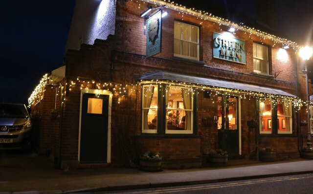
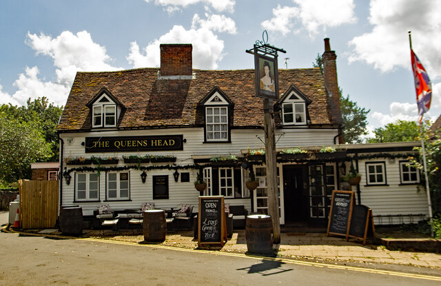
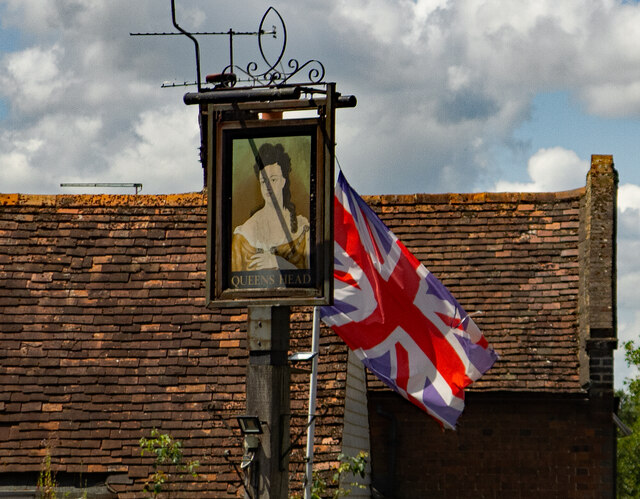
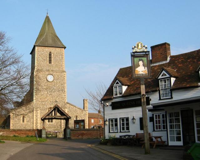
The Queen's Head, Sandridge

The Queens Head is a public house in the village of Sandridge to the north of St Albans, Hertfordshire, England. The timber framed building is weather...
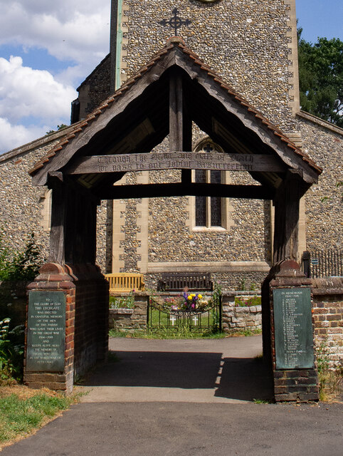
Sandridge Lychgate

Sandridge Lychgate is a war memorial in the village of Sandridge, Hertfordshire, England. The timber lychgate with its flanking walls is listed Grade II...

Sandridge

Sandridge is a village and civil parish between the city centre of St Albans (2.5 miles (4.0 km) to the south-west) and Wheathampstead in Hertfordshire...

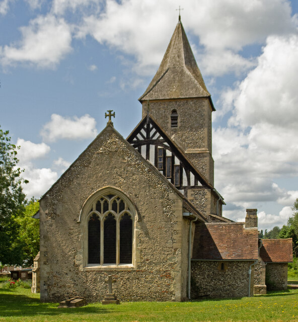
St Leonard's Church, Sandridge

St Leonard's Church is in Sandridge, a village in Hertfordshire, England. It is an active Anglican parish church. The building is Grade II* listed: notable...

Nearby Amenities

Located within 500m of 51.781323,-0.30495659
Crossing
Crossing: zebra
Crossing Island: no
Tactile Paving: yes
Lat/Long: 51.7799473/-0.3063089
Sandridge
Is In: Hertfordshire,England,UK
Place: village
Population: 4113
Population Date: 2011
Wikidata: Q2596049
Wikipedia: en:Sandridge
Lat/Long: 51.7807377/-0.3053949
Mini Roundabout
FIXME: ?confrim wrt to STRM?
Direction: clockwise
Ele NPE: 274 ft
Source: npe
Lat/Long: 51.7834601/-0.303422
Crossing
Crossing Island: no
Crossing Markings: no
Crossing Signals: no
Tactile Paving: no
Lat/Long: 51.7822306/-0.2996317
Pub
Green Man
Addr City: Sandridge
Addr Housenumber: 31
Addr Postcode: AL4 9DD
Addr Street: High Street
Fhrs Authority: St Albans City
Fhrs Id: 305648
Wikidata: Q83558889
Lat/Long: 51.7807036/-0.3057334
Pub
The Rose & Crown
Addr City: Sandridge
Addr Housenumber: 24
Addr Postcode: AL4 9DA
Addr Street: High Street
Fhrs Authority: St Albans City
Fhrs Id: 305645
Wikidata: Q26470097
Lat/Long: 51.7805291/-0.3055567
Turning Circle
Lat/Long: 51.7785635/-0.3058618
Barrier: kissing_gate
Foot: yes
Lat/Long: 51.7812583/-0.3118554
Bus Stop
Langley Grove
Bench: yes
Bin: no
Bus: yes
Lit: yes
Naptan AtcoCode: 210021501680
Naptan Bearing: S
Naptan CommonName: Langley Grove
Naptan Crossing: Langley Grove
Naptan Indicator: adj
Naptan Landmark: Langley Grove
Naptan NaptanCode: hrtdagpa
Naptan PlusbusZoneRef: STALBCY
Naptan ShortCommonName: NA
Naptan Street: High Street
Naptan Verified: no
Public Transport: platform
Shelter: yes
Source: naptan_import
Tactile Paving: no
Lat/Long: 51.7838618/-0.303088
Bus Stop
St Leonard's Church
Bench: no
Bin: no
Bus: yes
Lit: yes
Naptan AtcoCode: 210021501700
Naptan Bearing: SW
Naptan CommonName: St Leonard's Church
Naptan Crossing: Church End
Naptan Indicator: nr
Naptan Landmark: Church End
Naptan NaptanCode: hrtdagpd
Naptan PlusbusZoneRef: STALBCY
Naptan ShortCommonName: NA
Naptan Street: High Street
Naptan Verified: no
Public Transport: platform
Shelter: no
Source: naptan_import
Tactile Paving: no
Lat/Long: 51.7814469/-0.3046947
Bus Stop
Village Hall
Bus: yes
Naptan AtcoCode: 210021501720
Naptan Bearing: SW
Naptan CommonName: Village Hall
Naptan Crossing: opp Hopkins Crescent
Naptan Indicator: opp
Naptan Landmark: opp Hopkins Crescent
Naptan NaptanCode: hrtdagdm
Naptan PlusbusZoneRef: STALBCY
Naptan ShortCommonName: NA
Naptan Street: St Albans Road
Naptan Verified: no
Public Transport: platform
Source: naptan_import
Lat/Long: 51.7788686/-0.3072907
Bus Stop
Village Hall
Bus: yes
Naptan AtcoCode: 210021510040
Naptan Bearing: NE
Naptan CommonName: Village Hall
Naptan Crossing: Hopkins Crescent
Naptan Indicator: nr
Naptan Landmark: Hopkins Crescent
Naptan NaptanCode: hrtatmpa
Naptan PlusbusZoneRef: STALBCY
Naptan ShortCommonName: NA
Naptan Street: St Albans Road
Naptan Verified: no
Public Transport: platform
Source: naptan_import
Lat/Long: 51.7794576/-0.3068892
Bus Stop
St Leonard's Church
Bus: yes
Naptan AtcoCode: 210021510060
Naptan Bearing: NE
Naptan CommonName: St Leonard's Church
Naptan Crossing: Pound Close
Naptan Indicator: opp
Naptan Landmark: Pound Close
Naptan NaptanCode: hrtatmpm
Naptan PlusbusZoneRef: STALBCY
Naptan ShortCommonName: NA
Naptan Street: High Street
Naptan Verified: no
Public Transport: platform
Source: naptan_import
Lat/Long: 51.7818692/-0.3045789
Bus Stop
Langley Grove
Bench: yes
Bin: no
Bus: yes
Lit: yes
Naptan AtcoCode: 210021510080
Naptan Bearing: N
Naptan CommonName: Langley Grove
Naptan Crossing: opp Langley Grove
Naptan Indicator: opp
Naptan Landmark: opp Langley Grove
Naptan NaptanCode: hrtatmpt
Naptan PlusbusZoneRef: STALBCY
Naptan ShortCommonName: NA
Naptan Street: High Street
Naptan Verified: no
Public Transport: platform
Shelter: no
Source: naptan_import
Tactile Paving: no
Lat/Long: 51.7838119/-0.3033231
Noexit: yes
Lat/Long: 51.7820249/-0.30196
Barrier: lych_gate
Lat/Long: 51.7814083/-0.3039694
Noexit: yes
Lat/Long: 51.7805225/-0.3033822
Pub
The Queens Head
Addr City: Sandridge
Addr Housenumber: 7
Addr Postcode: AL4 9DL
Addr Street: Church End
Fhrs Authority: St Albans City
Fhrs Id: 305462
Wikidata: Q26396952
Lat/Long: 51.7813636/-0.3041546
Post Box
Collection Times: Mo-Fr 09:00; Sa 07:00
Post Box Type: lamp
Ref: AL4 200
Royal Cypher: EIIR
Royal Cypher Wikidata: Q33102113
Lat/Long: 51.7787594/-0.2992008
Post Box
Post Box Type: pillar
Ref: AL4 87
Royal Cypher: EIIR
Royal Cypher Wikidata: Q33102113
Lat/Long: 51.7810053/-0.3053891
Post Box
Post Box Type: lamp
Ref: AL4 252D
Royal Cypher: EIIR
Royal Cypher Wikidata: Q33102113
Lat/Long: 51.783376/-0.3028296
Bench
Backrest: no
Source: gps
Lat/Long: 51.7807264/-0.3014811
Traffic Calming: island
Lat/Long: 51.7835542/-0.3034106
Sandridge Sports & Youth Centre
Leisure: sports_centre
Lat/Long: 51.779649/-0.3079923
Recycling
Recycling Type: container
Lat/Long: 51.7800638/-0.3072303
Barrier: kissing_gate
Foot: yes
Lat/Long: 51.7809315/-0.3096402
Barrier: kissing_gate
Foot: yes
Lat/Long: 51.7816023/-0.3114309
Shop: car
Lat/Long: 51.7803313/-0.3056995
Direction: 220
Generator Method: photovoltaic
Generator Output Electricity: yes
Generator Solar Modules: 12
Generator Source: solar
Generator Type: solar_photovoltaic_panel
Location: roof
Power: generator
Lat/Long: 51.7779403/-0.3076046
Direction: 220
Generator Method: photovoltaic
Generator Output Electricity: yes
Generator Solar Modules: 7
Generator Source: solar
Generator Type: solar_photovoltaic_panel
Location: roof
Power: generator
Lat/Long: 51.7781219/-0.3060566
Direction: 40
Generator Method: photovoltaic
Generator Output Electricity: yes
Generator Solar Modules: 9
Generator Source: solar
Generator Type: solar_photovoltaic_panel
Location: roof
Power: generator
Lat/Long: 51.7781389/-0.3060312
Direction: 175
Generator Method: photovoltaic
Generator Output Electricity: yes
Generator Solar Modules: 6
Generator Source: solar
Generator Type: solar_photovoltaic_panel
Location: roof
Power: generator
Lat/Long: 51.7785544/-0.3054922
Traffic Calming: island
Lat/Long: 51.7833656/-0.3035264
Direction: 130
Generator Method: photovoltaic
Generator Output Electricity: yes
Generator Solar Modules: 10
Generator Source: solar
Generator Type: solar_photovoltaic_panel
Location: roof
Power: generator
Lat/Long: 51.7790208/-0.3054431
Direction: 210
Generator Method: photovoltaic
Generator Output Electricity: yes
Generator Solar Modules: 18
Generator Source: solar
Generator Type: solar_photovoltaic_panel
Location: roof
Power: generator
Lat/Long: 51.7797296/-0.3040734
Direction: 265
Generator Method: photovoltaic
Generator Output Electricity: yes
Generator Solar Modules: 6
Generator Source: solar
Generator Type: solar_photovoltaic_panel
Location: roof
Power: generator
Lat/Long: 51.7811522/-0.3009341
Direction: 145
Generator Method: photovoltaic
Generator Output Electricity: yes
Generator Solar Modules: 10
Generator Source: solar
Generator Type: solar_photovoltaic_panel
Location: roof
Power: generator
Lat/Long: 51.7817222/-0.2991182
Noexit: yes
Lat/Long: 51.7805216/-0.3036468
Noexit: yes
Lat/Long: 51.7810291/-0.3043049
Defibrillator
Access: yes
Defibrillator Location: sandrige community centre defibrillator
Emergency: defibrillator
Indoor: no
Lat/Long: 51.780002/-0.3064019
Barrier: kissing_gate
Lat/Long: 51.7831935/-0.3095212
Barrier: kissing_gate
Lat/Long: 51.7829364/-0.3085447
Access: yes
Leisure: pitch
Sport: table_tennis
Lat/Long: 51.7804067/-0.3016566
Entrance: yes
Lat/Long: 51.7802193/-0.2985643
Barrier: kissing_gate
Lat/Long: 51.7796591/-0.3023396
Barrier: kissing_gate
Lat/Long: 51.7802333/-0.3017276
The data included in this document is from www.openstreetmap.org. The data is made available under ODbL.

Have you been to Sandridge?

Leave your review of Sandridge below (or comments, questions and feedback).