Sale

Settlement in Cheshire

England

Sale

Bridgewater Canal, Dane Road Often considered to be the first "true" canal, the Bridgewater Canal was commissioned by Francis Egerton, 3rd Duke of Bridgewater, to transport coal from his mines in Worsley. The section from Worsley to Manchester opened on 17th July 1761; it was later extended from Manchester to Runcorn, and then from Worsley to Leigh. Coal was needed in large quantities to fuel the industrial revolution and the canal enabled coal and other goods to be transported efficiently and cheaply to the rapidly expanding towns and cities. Its success helped inspire a period of intense canal building although it later faced intense competition from the Liverpool and Manchester Railway and the Macclesfield Canal.

The canal is connected to the Rochdale Canal (<a title="https://www.geograph.org.uk/snippet/1707" href="https://www.geograph.org.uk/snippet/1707">Link</a> ) in Manchester, the Trent and Mersey Canal at Preston Brook, south-east of Runcorn, and to the Leeds and Liverpool Canal at Leigh. It once connected with the River Mersey at Runcorn but has since been cut off by a slip road to the Silver Jubilee Bridge.

Navigable throughout its history, it is one of the few canals in Britain not to have been nationalised, and remains privately owned. Commercial traffic continued on the canal until 1974. By this time, canals were becoming more important as a leisure facility and pleasure craft now use the canal which forms part of the Cheshire Ring circular canal route.

For many years, the canal around Worsley was noted for the distinctive bright orange colouring of the water. This was a result of iron oxide from the mines tainting the water as the canal passes through Worsley. A £2.5 million remedial scheme was undertaken in 2013 to remove this colouration.

The Bridgewater Canal is owned and operated by the Manchester Ship Canal Company in conjunction with the Bridgewater Canal Trust.

<span class="nowrap"><a title="http://www.bridgewatercanal.co.uk/" rel="nofollow ugc noopener" href="http://www.bridgewatercanal.co.uk/">Link</a><img style="margin-left:2px;" alt="External link" title="External link - shift click to open in new window" src="https://s1.geograph.org.uk/img/external.png" width="10" height="10"/></span> Bridgewater Canal Company
<span class="nowrap"><a title="http://www.penninewaterways.co.uk/bridgewater/bri2.htm" rel="nofollow ugc noopener" href="http://www.penninewaterways.co.uk/bridgewater/bri2.htm">Link</a><img style="margin-left:2px;" alt="External link" title="External link - shift click to open in new window" src="https://s1.geograph.org.uk/img/external.png" width="10" height="10"/></span> Pennine Waterways
<span class="nowrap"><a title="http://en.wikipedia.org/wiki/Bridgewater_Canal" rel="nofollow ugc noopener" href="http://en.wikipedia.org/wiki/Bridgewater_Canal">Link</a><img style="margin-left:2px;" alt="External link" title="External link - shift click to open in new window" src="https://s1.geograph.org.uk/img/external.png" width="10" height="10"/></span> Wikipedia
Bridgewater Canal, Dane Road Credit: David Dixon

Sale is a suburban town located in the borough of Trafford, Greater Manchester, England. Situated approximately five miles southwest of Manchester city center, Sale is a well-connected and desirable residential area. With a population of around 55,000, it is one of the largest towns in the borough.

Sale boasts a rich history that dates back to the medieval period. The town's name originates from the Old English word "sawyl," meaning "sallow tree," which reflects its past as a rural settlement. Today, Sale seamlessly combines its historical charm with modern amenities and facilities.

The town center of Sale features a range of shops, cafes, restaurants, and pubs, providing residents with ample opportunities for dining and entertainment. The nearby Trafford Centre, one of Europe's largest indoor shopping complexes, offers an extensive selection of retail outlets, leisure activities, and restaurants, adding to the town's appeal.

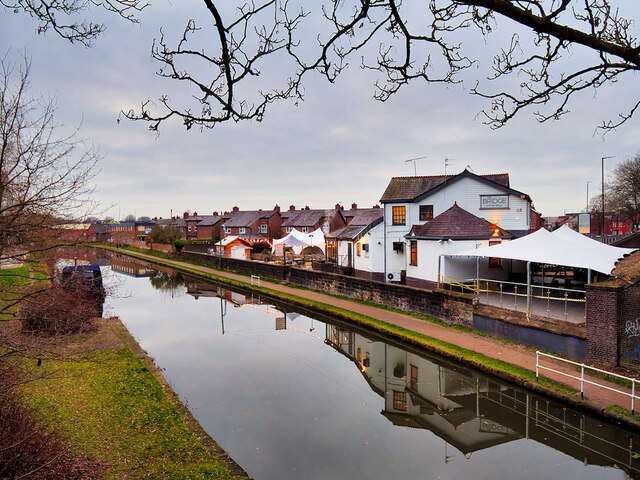
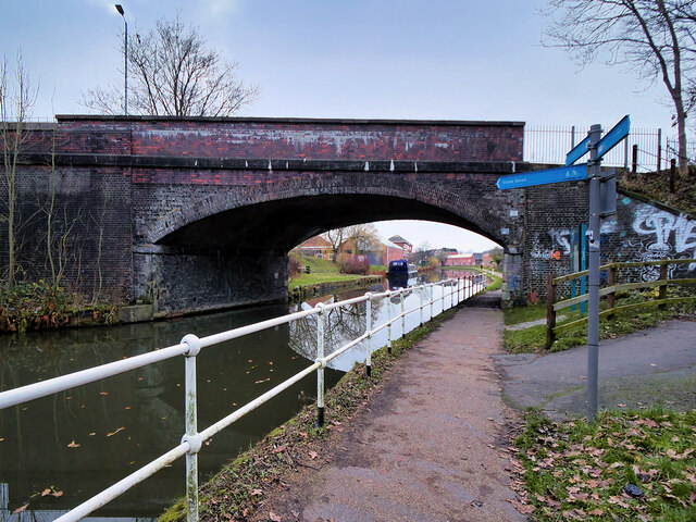
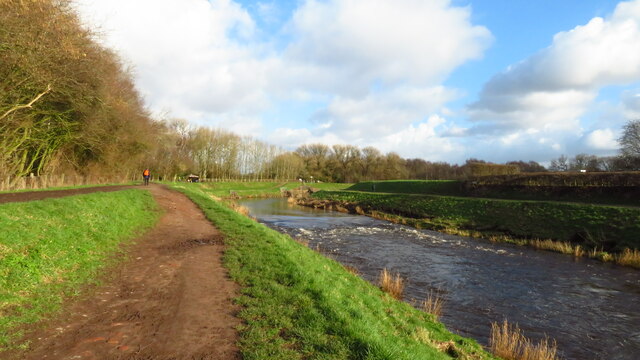
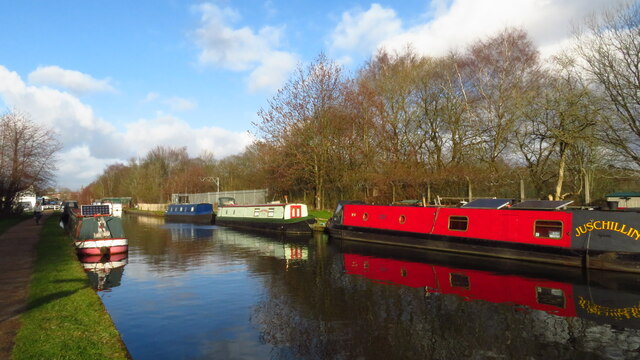
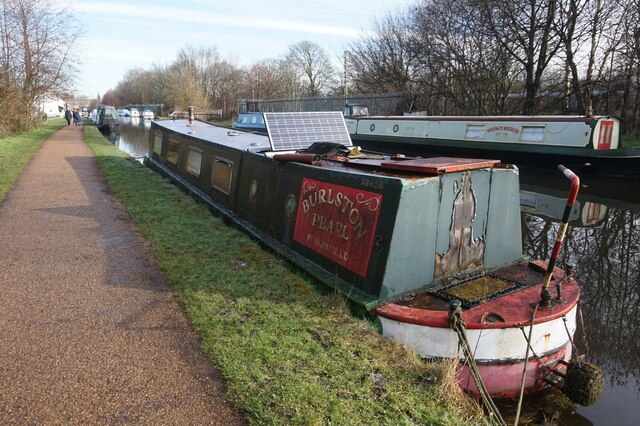
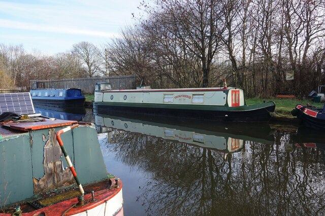
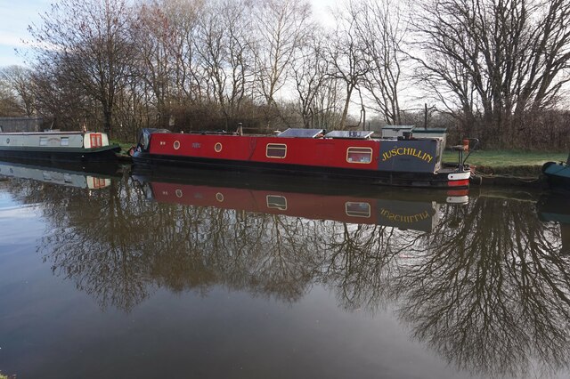
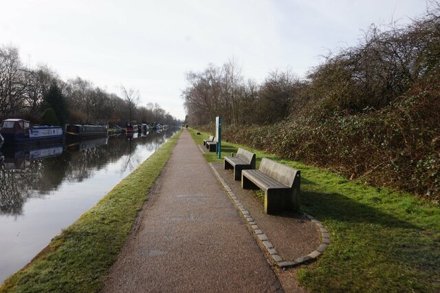
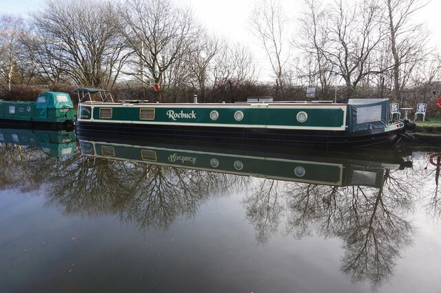
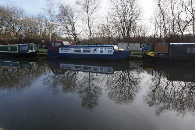
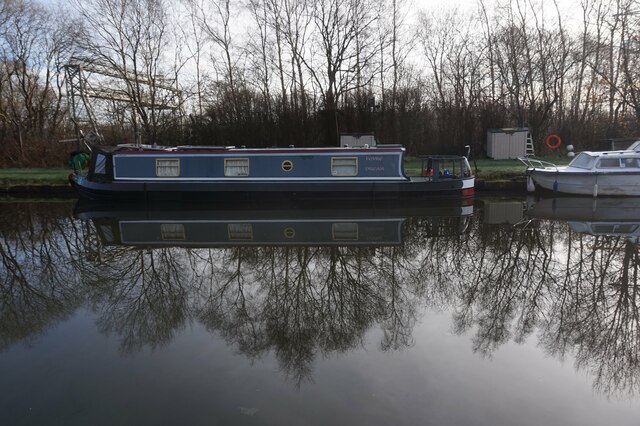
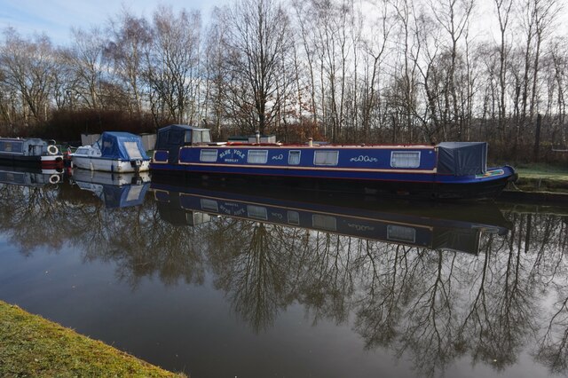
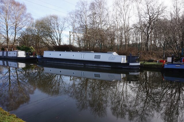
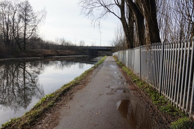
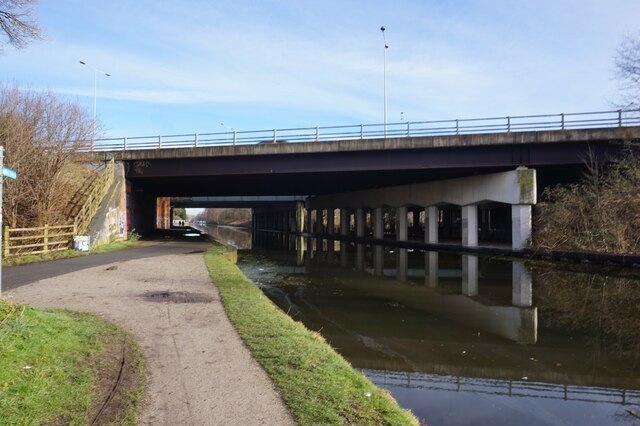
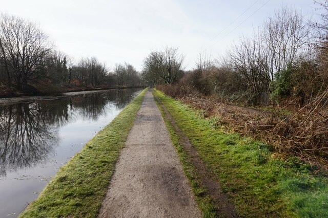
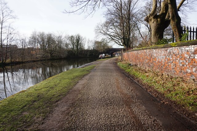
Sale is renowned for its green spaces and parks, including Worthington Park and Sale Water Park. These picturesque areas are ideal for leisurely walks, picnics, and various outdoor activities. Moreover, the Bridgewater Canal runs through the town, providing opportunities for boating, fishing, and cycling along its scenic towpaths.

Transport links in Sale are excellent, with easy access to the M60 motorway and Manchester Airport. The town is served by several Metrolink tram stops and has regular bus services, ensuring convenient transportation within the area and to nearby towns and cities.

With its attractive mix of historical character, green spaces, and convenient amenities, Sale offers a desirable place to live, attracting families, professionals, and retirees alike.

If you have any feedback on the listing, please let us know in the comments section below.
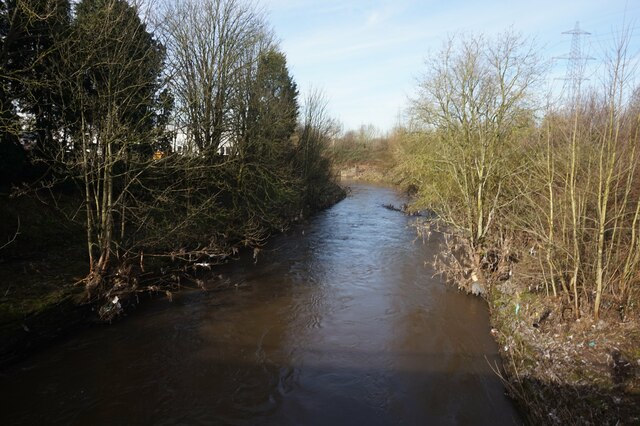
Sale Images

Images are sourced within 2km of 53.424/-2.3198 or Grid Reference SJ7891. Thanks to Geograph Open Source API. All images are credited.

Bridgewater Canal, Dane Road Often considered to be the first "true" canal, the Bridgewater Canal was commissioned by Francis Egerton, 3rd Duke of Bridgewater, to transport coal from his mines in Worsley. The section from Worsley to Manchester opened on 17th July 1761; it was later extended from Manchester to Runcorn, and then from Worsley to Leigh. Coal was needed in large quantities to fuel the industrial revolution and the canal enabled coal and other goods to be transported efficiently and cheaply to the rapidly expanding towns and cities. Its success helped inspire a period of intense canal building although it later faced intense competition from the Liverpool and Manchester Railway and the Macclesfield Canal.

The canal is connected to the Rochdale Canal (<a title="https://www.geograph.org.uk/snippet/1707" href="https://www.geograph.org.uk/snippet/1707">Link</a> ) in Manchester, the Trent and Mersey Canal at Preston Brook, south-east of Runcorn, and to the Leeds and Liverpool Canal at Leigh. It once connected with the River Mersey at Runcorn but has since been cut off by a slip road to the Silver Jubilee Bridge.

Navigable throughout its history, it is one of the few canals in Britain not to have been nationalised, and remains privately owned. Commercial traffic continued on the canal until 1974. By this time, canals were becoming more important as a leisure facility and pleasure craft now use the canal which forms part of the Cheshire Ring circular canal route.

For many years, the canal around Worsley was noted for the distinctive bright orange colouring of the water. This was a result of iron oxide from the mines tainting the water as the canal passes through Worsley. A £2.5 million remedial scheme was undertaken in 2013 to remove this colouration.

The Bridgewater Canal is owned and operated by the Manchester Ship Canal Company in conjunction with the Bridgewater Canal Trust.

<span class="nowrap"><a title="http://www.bridgewatercanal.co.uk/" rel="nofollow ugc noopener" href="http://www.bridgewatercanal.co.uk/">Link</a><img style="margin-left:2px;" alt="External link" title="External link - shift click to open in new window" src="https://s1.geograph.org.uk/img/external.png" width="10" height="10"/></span> Bridgewater Canal Company
<span class="nowrap"><a title="http://www.penninewaterways.co.uk/bridgewater/bri2.htm" rel="nofollow ugc noopener" href="http://www.penninewaterways.co.uk/bridgewater/bri2.htm">Link</a><img style="margin-left:2px;" alt="External link" title="External link - shift click to open in new window" src="https://s1.geograph.org.uk/img/external.png" width="10" height="10"/></span> Pennine Waterways
<span class="nowrap"><a title="http://en.wikipedia.org/wiki/Bridgewater_Canal" rel="nofollow ugc noopener" href="http://en.wikipedia.org/wiki/Bridgewater_Canal">Link</a><img style="margin-left:2px;" alt="External link" title="External link - shift click to open in new window" src="https://s1.geograph.org.uk/img/external.png" width="10" height="10"/></span> Wikipedia
Bridgewater Canal, Dane Road
Often considered to be the first "true" canal, the Bridgewater Canal was commissioned by Francis Egerton, 3rd Duke of Bridgewater, to transport coal from his mines in Worsley. The section from Worsley to Manchester opened on 17th July 1761; it was later extended from Manchester to Runcorn, and then from Worsley to Leigh. Coal was needed in large quantities to fuel the industrial revolution and the canal enabled coal and other goods to be transported efficiently and cheaply to the rapidly expanding towns and cities. Its success helped inspire a period of intense canal building although it later faced intense competition from the Liverpool and Manchester Railway and the Macclesfield Canal. The canal is connected to the Rochdale Canal (Link ) in Manchester, the Trent and Mersey Canal at Preston Brook, south-east of Runcorn, and to the Leeds and Liverpool Canal at Leigh. It once connected with the River Mersey at Runcorn but has since been cut off by a slip road to the Silver Jubilee Bridge. Navigable throughout its history, it is one of the few canals in Britain not to have been nationalised, and remains privately owned. Commercial traffic continued on the canal until 1974. By this time, canals were becoming more important as a leisure facility and pleasure craft now use the canal which forms part of the Cheshire Ring circular canal route. For many years, the canal around Worsley was noted for the distinctive bright orange colouring of the water. This was a result of iron oxide from the mines tainting the water as the canal passes through Worsley. A £2.5 million remedial scheme was undertaken in 2013 to remove this colouration. The Bridgewater Canal is owned and operated by the Manchester Ship Canal Company in conjunction with the Bridgewater Canal Trust. LinkExternal link Bridgewater Canal Company LinkExternal link Pennine Waterways LinkExternal link Wikipedia
Bridgewater Canal, White's Bridge (Dane Road) Often considered to be the first "true" canal, the Bridgewater Canal was commissioned by Francis Egerton, 3rd Duke of Bridgewater, to transport coal from his mines in Worsley. The section from Worsley to Manchester opened on 17th July 1761; it was later extended from Manchester to Runcorn, and then from Worsley to Leigh. Coal was needed in large quantities to fuel the industrial revolution and the canal enabled coal and other goods to be transported efficiently and cheaply to the rapidly expanding towns and cities. Its success helped inspire a period of intense canal building although it later faced intense competition from the Liverpool and Manchester Railway and the Macclesfield Canal.

The canal is connected to the Rochdale Canal (<a title="https://www.geograph.org.uk/snippet/1707" href="https://www.geograph.org.uk/snippet/1707">Link</a> ) in Manchester, the Trent and Mersey Canal at Preston Brook, south-east of Runcorn, and to the Leeds and Liverpool Canal at Leigh. It once connected with the River Mersey at Runcorn but has since been cut off by a slip road to the Silver Jubilee Bridge.

Navigable throughout its history, it is one of the few canals in Britain not to have been nationalised, and remains privately owned. Commercial traffic continued on the canal until 1974. By this time, canals were becoming more important as a leisure facility and pleasure craft now use the canal which forms part of the Cheshire Ring circular canal route.

For many years, the canal around Worsley was noted for the distinctive bright orange colouring of the water. This was a result of iron oxide from the mines tainting the water as the canal passes through Worsley. A £2.5 million remedial scheme was undertaken in 2013 to remove this colouration.

The Bridgewater Canal is owned and operated by the Manchester Ship Canal Company in conjunction with the Bridgewater Canal Trust.

<span class="nowrap"><a title="http://www.bridgewatercanal.co.uk/" rel="nofollow ugc noopener" href="http://www.bridgewatercanal.co.uk/">Link</a><img style="margin-left:2px;" alt="External link" title="External link - shift click to open in new window" src="https://s1.geograph.org.uk/img/external.png" width="10" height="10"/></span> Bridgewater Canal Company
<span class="nowrap"><a title="http://www.penninewaterways.co.uk/bridgewater/bri2.htm" rel="nofollow ugc noopener" href="http://www.penninewaterways.co.uk/bridgewater/bri2.htm">Link</a><img style="margin-left:2px;" alt="External link" title="External link - shift click to open in new window" src="https://s1.geograph.org.uk/img/external.png" width="10" height="10"/></span> Pennine Waterways
<span class="nowrap"><a title="http://en.wikipedia.org/wiki/Bridgewater_Canal" rel="nofollow ugc noopener" href="http://en.wikipedia.org/wiki/Bridgewater_Canal">Link</a><img style="margin-left:2px;" alt="External link" title="External link - shift click to open in new window" src="https://s1.geograph.org.uk/img/external.png" width="10" height="10"/></span> Wikipedia
Bridgewater Canal, White's Bridge (Dane Road)
Often considered to be the first "true" canal, the Bridgewater Canal was commissioned by Francis Egerton, 3rd Duke of Bridgewater, to transport coal from his mines in Worsley. The section from Worsley to Manchester opened on 17th July 1761; it was later extended from Manchester to Runcorn, and then from Worsley to Leigh. Coal was needed in large quantities to fuel the industrial revolution and the canal enabled coal and other goods to be transported efficiently and cheaply to the rapidly expanding towns and cities. Its success helped inspire a period of intense canal building although it later faced intense competition from the Liverpool and Manchester Railway and the Macclesfield Canal. The canal is connected to the Rochdale Canal (Link ) in Manchester, the Trent and Mersey Canal at Preston Brook, south-east of Runcorn, and to the Leeds and Liverpool Canal at Leigh. It once connected with the River Mersey at Runcorn but has since been cut off by a slip road to the Silver Jubilee Bridge. Navigable throughout its history, it is one of the few canals in Britain not to have been nationalised, and remains privately owned. Commercial traffic continued on the canal until 1974. By this time, canals were becoming more important as a leisure facility and pleasure craft now use the canal which forms part of the Cheshire Ring circular canal route. For many years, the canal around Worsley was noted for the distinctive bright orange colouring of the water. This was a result of iron oxide from the mines tainting the water as the canal passes through Worsley. A £2.5 million remedial scheme was undertaken in 2013 to remove this colouration. The Bridgewater Canal is owned and operated by the Manchester Ship Canal Company in conjunction with the Bridgewater Canal Trust. LinkExternal link Bridgewater Canal Company LinkExternal link Pennine Waterways LinkExternal link Wikipedia
Trans Pennine Trail & R Mersey near New Croft Farm, Stretford
Bridgewater Canal by Hawthorn Rd, Stretford
Canal boat Burlston, Bridgewater Canal
Canal boat Thingymebob, Bridgewater Canal
Canal boat Juschillin, Bridgewater Canal
Bridgewater Canal towards the M60 Bridge
Canal boat Roebuck, Bridgewater Canal
Canal boat Abigail, Bridgewater Canal
Canal boat Fevre Dream, Bridgewater Canal
Canal boat Blue Vole, Bridgewater Canal
Canal boat Star, Bridgewater Canal
River Mersey from the Bridgewater Canal
Bridgewater Canal towards the M60 Bridge
Bridgewater Canal at M60 Bridge
Bridgewater Canal towards White's Bridge
Show me another place!

Sale is located at Grid Ref: SJ7891 (Lat: 53.424, Lng: -2.3198)

Unitary Authority: Trafford

Police Authority: Greater Manchester

What 3 Words

///armed.rigid.pines. Near Sale, Manchester

Nearby Locations

Sale

Related Wikis

Sale tram stop

Sale is a tram stop on the Altrincham Line of the Metrolink light-rail system in Sale, Greater Manchester, England. It opened on 15 June 1992 as part of...
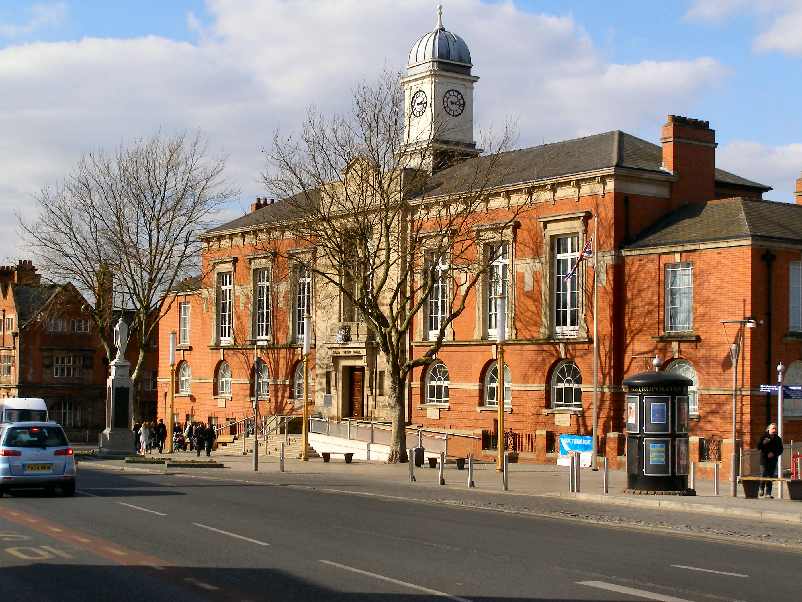
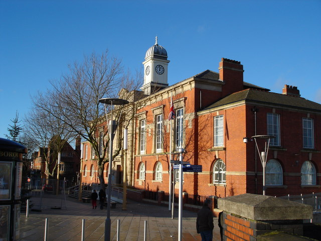
Sale Town Hall

Sale Town Hall is a municipal building on School Road in Sale, Greater Manchester, England. The town hall was the headquarters of Sale Borough Council...

Municipal Borough of Sale

Sale was, from 1867 to 1974, a district in Cheshire, England. The district had in turn the status of local government district, urban district and municipal...

Sale, Greater Manchester

Sale is a town in Trafford, Greater Manchester, England, in the historic county of Cheshire on the south bank of the River Mersey, 2 miles (3.2 km) south...

Chartered Institution of Civil Engineering Surveyors

The Chartered Institution of Civil Engineering Surveyors or CICES is a professional association in the field of civil engineering surveying, headquartered...

Sale Grammar School

Sale Grammar School is a grammar school located in Sale to the south of Manchester, England. The school became an Academy Trust Grammar School in 2011...

Walkden Gardens

Walkden Gardens is a public green space in Sale, Greater Manchester, England. The gardens are named after Harry Walkden on whose death in 1949 his plant...
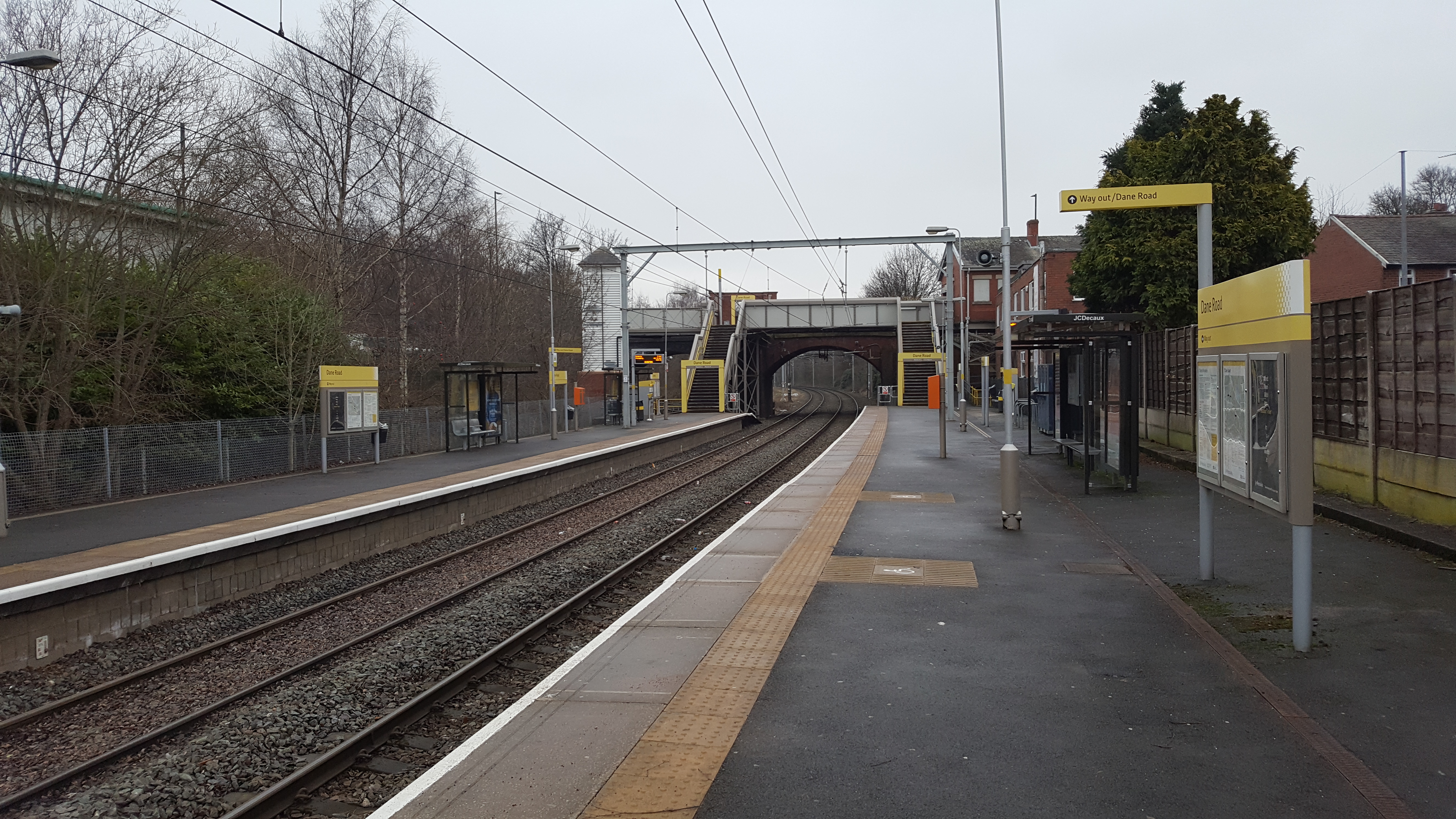
Dane Road tram stop

Dane Road is a tram stop on the Altrincham Line of Greater Manchester's Metrolink light rail system. It is located on Dane Road in northern Sale, Greater...

Nearby Amenities

Located within 500m of 53.424,-2.3198
Sale
Network: Manchester Metrolink
Network Wikidata: Q18548
Operator: Transport for Greater Manchester
Operator Wikidata: Q7834921
Public Transport: stop_position
Railway: tram_stop
Tram: yes
Wheelchair: yes
Zone: 3
Lat/Long: 53.4241481/-2.3191378
Sale
Is In: Trafford, Greater Manchester, England, UK
Is In District: Trafford
Name Ru: Сейл
Name Ur: سیلم
Place: town
Wikidata: Q1022733
Wikipedia: en:Sale, Greater Manchester
Lat/Long: 53.4244939/-2.318415
Mini Roundabout
Direction: clockwise
Lat/Long: 53.4263092/-2.3224507
Traffic Signals
Lat/Long: 53.4234241/-2.3150231
Traffic Calming: island
Lat/Long: 53.4229821/-2.3227318
Turning Circle
Noexit: yes
Lat/Long: 53.4227177/-2.3254275
Bus Stop
Sale, Cross Street / near Ashfield Road
Bus: yes
Naptan AtcoCode: 1800SJ03301
Naptan Bearing: SW
Naptan CommonName: Cross Street/Ashfield Road
Naptan Indicator: Os Beauty Shop
Naptan Landmark: Shops
Naptan NaptanCode: manjpgad
Naptan PlusbusZoneRef: MNCRPIC
Naptan ShortCommonName: Ashfield Road
Naptan Street: CROSS STREET
Naptan Verified: no
Network: TfGM
Public Transport: platform
Source: naptan_import
Lat/Long: 53.4277034/-2.3227618
Bus Stop
Sale, Washway Road / Marks and Spencer (Stop C)
Bus: yes
Local Ref: C
Naptan AtcoCode: 1800SJ03311
Naptan Bearing: SW
Naptan CommonName: Washway Road/Marks and Spencer (Stop C)
Naptan Indicator: Stop C
Naptan Landmark: COUNCIL OFFICES
Naptan NaptanCode: manjpgag
Naptan Notes: LOCATION AMENDED
Naptan PlusbusZoneRef: MNCRPIC
Naptan ShortCommonName: Marks and Spencer
Naptan Street: WASHWAY ROAD
Naptan Verified: no
Network: TfGM
Operator: TfGM
Public Transport: platform
Ref: C
Shelter: yes
Source: naptan_import
Lat/Long: 53.4248795/-2.3258858
Bus Stop
Sale, Cross Street / opposite Ashfield Road
Bus: yes
Naptan AtcoCode: 1800SJ03451
Naptan Bearing: NE
Naptan CommonName: Cross Street/Ashfield Road
Naptan Indicator: Shops
Naptan Landmark: SHOPS
Naptan NaptanCode: manjpgjd
Naptan PlusbusZoneRef: MNCRPIC
Naptan ShortCommonName: Ashfield Road
Naptan Street: CROSS STREET
Naptan Verified: no
Network: TfGM
Operator: TfGM
Public Transport: platform
Source: naptan_import
Lat/Long: 53.4276935/-2.3231229
Bus Stop
Sale, Northenden Road / near Wardle Road
Bus: yes
Naptan AtcoCode: 1800SJ47281
Naptan Bearing: NW
Naptan CommonName: Northenden Road/Wardle Road
Naptan Indicator: O/s House 32
Naptan Landmark: HOUSE 32
Naptan NaptanCode: manjtmgm
Naptan PlusbusZoneRef: MNCRPIC
Naptan ShortCommonName: Wardle Road
Naptan Street: NORTHENDEN ROAD
Naptan Verified: no
Network: TfGM
Operator: TfGM
Public Transport: platform
Route Ref: 18;19;41;99;266;267;268;272;X5;41_NB
Source: naptan_import
Lat/Long: 53.4236252/-2.3157949
Bus Stop
Sale, Sibson Road / outside Moorside Court
Bus: yes
Naptan AtcoCode: 1800SJ47331
Naptan Bearing: NW
Naptan CommonName: Sibson Road/Moorside Court
Naptan Indicator: Op Dom House
Naptan Landmark: MOORSIDE COURT
Naptan NaptanCode: manjtmgt
Naptan PlusbusZoneRef: MNCRPIC
Naptan ShortCommonName: Moorside Court
Naptan Street: SIBSON ROAD
Naptan Verified: no
Network: TfGM
Operator: TfGM
Public Transport: platform
Route Ref: 19;268
Source: naptan_import
Lat/Long: 53.4235637/-2.3245513
Bus Stop
Sale, Springfield Road / outside Market
Bus: yes
Naptan AtcoCode: 1800SJ47341
Naptan Bearing: NE
Naptan CommonName: Springfield Road/Market
Naptan Indicator: Sale Precinct
Naptan Landmark: SALE PRECINCT
Naptan NaptanCode: manjtmgw
Naptan PlusbusZoneRef: MNCRPIC
Naptan ShortCommonName: Market
Naptan Street: Springfield Road
Naptan Verified: no
Network: TfGM
Operator: TfGM
Public Transport: platform
Source: naptan_import
Lat/Long: 53.423533/-2.3217234
Bus Stop
Sale, Ashfield Road / outside Sainsbury's
Bus: yes
Naptan AtcoCode: 1800SJ47351
Naptan Bearing: NW
Naptan CommonName: Ashfield Road/Sainsbury's
Naptan Indicator: Car Park
Naptan Landmark: SUPERMARKET
Naptan NaptanCode: manjtmja
Naptan PlusbusZoneRef: MNCRPIC
Naptan ShortCommonName: Sainsbury's
Naptan Street: ASHFIELD ROAD
Naptan Verified: no
Network: TfGM
Operator: TfGM
Public Transport: platform
Source: naptan_import
Lat/Long: 53.426394/-2.3216834
Bus Stop
Ashfield Road/Cross Street
Bus: yes
Naptan AtcoCode: 1800SJ47361
Naptan Bearing: NW
Naptan CommonName: Ashfield Road/Cross Street
Naptan Indicator: Vet's Surgery
Naptan Landmark: VET'S SURGERY
Naptan NaptanCode: manjtmjd
Naptan PlusbusZoneRef: MNCRPIC
Naptan ShortCommonName: Cross Street
Naptan Street: ASHFIELD ROAD
Naptan Verified: no
Network: TfGM
Public Transport: platform
Shelter: no
Source: naptan_import
Lat/Long: 53.4268316/-2.3227402
Bus Stop
Sale, Ashfield Road / adjacent Cross Street
Bus: yes
Naptan AtcoCode: 1800SJ47371
Naptan Bearing: SE
Naptan CommonName: Ashfield Road/Cross Street
Naptan Indicator: Sign Shop
Naptan Landmark: SHOP
Naptan NaptanCode: manjtmjg
Naptan PlusbusZoneRef: MNCRPIC
Naptan ShortCommonName: Cross Street
Naptan Street: ASHFIELD ROAD
Naptan Verified: no
Network: TfGM
Operator: TfGM
Public Transport: platform
Shelter: no
Source: naptan_import
Lat/Long: 53.4270648/-2.3229075
Bus Stop
Sale, Ashfield Road / near Claremont Road
Bus: yes
Naptan AtcoCode: 1800SJ47381
Naptan Bearing: SE
Naptan CommonName: Ashfield Road/Claremont Road
Naptan Indicator: Op Shoe Shop
Naptan Landmark: ORIEL COURT
Naptan NaptanCode: manjtmjm
Naptan PlusbusZoneRef: MNCRPIC
Naptan ShortCommonName: Claremont Road
Naptan Street: ASHFIELD ROAD
Naptan Verified: no
Network: TfGM
Operator: TfGM
Public Transport: platform
Source: naptan_import
Lat/Long: 53.4259842/-2.3203108
Bus Stop
Sale, Broad Road / Sale Metrolink Stop (Stop H)
Bus: yes
Local Ref: H
Naptan AtcoCode: 1800SJ47391
Naptan Bearing: E
Naptan CommonName: Broad Road/Sale Tram Stop (H)
Naptan Indicator: Stop H
Naptan Landmark: SALE STATION
Naptan NaptanCode: manjtmjp
Naptan Notes: Stop Moved
Naptan PlusbusZoneRef: MNCRPIC
Naptan ShortCommonName: Sale Tram Stop
Naptan Street: BROAD ROAD
Naptan Verified: no
Network: TfGM
Operator: TfGM
Public Transport: platform
Ref: H
Shelter: yes
Source: naptan_import
Lat/Long: 53.424696/-2.3177849
Bus Stop
Sale, Northenden Road / near Woodlands Road
Bus: yes
Naptan AtcoCode: 1800SJ47411
Naptan Bearing: SE
Naptan CommonName: Northenden Road/Woodlands Road
Naptan Indicator: Ferroll Lodge
Naptan Landmark: FERROLL LODGE
Naptan NaptanCode: manjtmjw
Naptan PlusbusZoneRef: MNCRPIC
Naptan ShortCommonName: Woodlands Road
Naptan Street: NORTHENDEN ROAD
Naptan Verified: no
Network: TfGM
Operator: TfGM
Public Transport: platform
Route Ref: 18;19;41;99;268;272;X5;41_NB
Source: naptan_import
Lat/Long: 53.4232881/-2.314342
Bus Stop
Sale, Broad Road / opposite Lynwood Grove
Bus: yes
Naptan AtcoCode: 1800SJ47831
Naptan Bearing: W
Naptan CommonName: Broad Road/Lynwood Lodge
Naptan Indicator: O/s House 24
Naptan Landmark: HOUSE 24
Naptan NaptanCode: manjtpga
Naptan PlusbusZoneRef: MNCRPIC
Naptan ShortCommonName: Lynwood Lodge
Naptan Street: BROAD ROAD
Naptan Verified: no
Network: TfGM
Operator: TfGM
Public Transport: platform
Source: naptan_import
Wheelchair: limited
Lat/Long: 53.4251181/-2.3147211
Bus Stop
Sale, Broad Road / near Oldfield Road
Bus: yes
Naptan AtcoCode: 1800SJ47841
Naptan Bearing: E
Naptan CommonName: Broad Road/Oldfield Road
Naptan Indicator: O/s House 25
Naptan Landmark: HOUSE 25
Naptan NaptanCode: manjtpgd
Naptan PlusbusZoneRef: MNCRPIC
Naptan ShortCommonName: Oldfield Road
Naptan Street: BROAD ROAD
Naptan Verified: no
Network: TfGM
Operator: TfGM
Public Transport: platform
Source: naptan_import
Wheelchair: limited
Lat/Long: 53.4253786/-2.3135625
Bus Stop
Sale, Ashton Lane / Magistrates Court (Stop A)
Bus: yes
Local Ref: A
Naptan AtcoCode: 1800SJ04491
Naptan Bearing: E
Naptan CommonName: Ashton Lane/Magistrates Court (Stop A)
Naptan Indicator: Stop A
Naptan Landmark: COURTS
Naptan NaptanCode: manjpmgd
Naptan PlusbusZoneRef: MNCRPIC
Naptan ShortCommonName: Magistrates Court
Naptan Street: ASHTON LANE
Naptan Verified: no
Network: TfGM
Operator: TfGM
Public Transport: platform
Ref: A
Route Ref: 16;19;252;260;261;268
Source: naptan_import
Lat/Long: 53.4258473/-2.3260553
Bus Stop
Sale, Springfield Road / opposite Market
Bus: yes
Naptan AtcoCode: 1800SJ05921
Naptan Bearing: SW
Naptan CommonName: Springfield Road/Market
Naptan Indicator: School Field
Naptan Landmark: SCHOOL FIELD
Naptan NaptanCode: manjpmjw
Naptan PlusbusZoneRef: MNCRPIC
Naptan ShortCommonName: Market
Naptan Street: Springfield Road
Naptan Verified: no
Network: TfGM
Operator: TfGM
Public Transport: platform
Route Ref: 19;268
Source: naptan_import
Lat/Long: 53.4233105/-2.3217805
Bus Stop
Springfield Road/School Road
Bus: yes
Naptan AtcoCode: 1800SJ09421
Naptan Bearing: NE
Naptan CommonName: Springfield Road/School Road
Naptan Indicator: Car Park
Naptan Landmark: CAR PARK
Naptan NaptanCode: manjptap
Naptan PlusbusZoneRef: MNCRPIC
Naptan ShortCommonName: School Road
Naptan Street: Springfield Road
Naptan Verified: no
Network: TfGM
Public Transport: platform
Source: naptan_import
Lat/Long: 53.4244458/-2.3207808
Bus Stop
Sale, Hayfield Street (Stop F)
Bus: yes
Local Ref: F
Naptan AtcoCode: 1800SJ12451
Naptan Bearing: SW
Naptan CommonName: Hayfield Street/Kwiksave (Stop F)
Naptan Indicator: Stop F
Naptan Landmark: Car Park
Naptan NaptanCode: manjtapm
Naptan PlusbusZoneRef: MNCRPIC
Naptan ShortCommonName: Kwiksave
Naptan Street: HAYFIELD STREET
Naptan Verified: no
Network: TfGM
Operator: TfGM
Public Transport: platform
Ref: F
Source: naptan_import
Wheelchair: yes
Lat/Long: 53.4250647/-2.3246079
Taxi
Sale - School Road
Naptan AtcoCode: 1800SJT0891
Naptan CommonName: Sale - School Road
Naptan Indicator: School Lane - Hayfield St
Naptan Landmark: HAYFIELD ST
Naptan PlusbusZoneRef: MNCRPIC
Naptan Street: School Lane
Naptan Verified: no
Source: naptan_import
Lat/Long: 53.4254431/-2.3242948
Taxi
Sale - Washway Road
Naptan AtcoCode: 1800SJT0901
Naptan CommonName: Sale - Washway Road
Naptan Indicator: Washway Rd - School Lane
Naptan Landmark: SCHOOL LANE
Naptan PlusbusZoneRef: MNCRPIC
Naptan Street: Washway Rd
Naptan Verified: no
Source: naptan_import
Lat/Long: 53.4251329/-2.3259779
Taxi
Sale - Wynnstay Road
Naptan AtcoCode: 1800SJT0911
Naptan CommonName: Sale - Wynnstay Road
Naptan Indicator: Wynnstay Rd - Curzon Rd
Naptan Landmark: CURZON RD
Naptan PlusbusZoneRef: MNCRPIC
Naptan Street: Wynnstay Rd
Naptan Verified: no
Source: naptan_import
Lat/Long: 53.4257085/-2.322536
Taxi
Sale - Hereford Street
Naptan AtcoCode: 1800SJT0921
Naptan CommonName: Sale - Hereford Street
Naptan Indicator: Hereford St - Sibson Rd
Naptan Landmark: SIBSON RD
Naptan PlusbusZoneRef: MNCRPIC
Naptan Street: Hereford St
Naptan Verified: no
Source: naptan_import
Lat/Long: 53.4238427/-2.324418
Bus Stop
Sale, Hayfield Street (Stop E)
Bus: yes
Local Ref: E
Naptan AtcoCode: 1800SJ18971
Naptan Bearing: SW
Naptan CommonName: Hayfield Street/Kwiksave (Stop E)
Naptan Indicator: Stop E
Naptan Landmark: Car Park
Naptan NaptanCode: manjtdmp
Naptan PlusbusZoneRef: MNCRPIC
Naptan ShortCommonName: Kwiksave
Naptan Street: HAYFIELD STREET
Naptan Verified: no
Network: TfGM
Operator: TfGM
Public Transport: platform
Ref: E
Source: naptan_import
Wheelchair: yes
Lat/Long: 53.425209/-2.3244284
Pharmacy
Boots
Brand: Boots
Brand Wikidata: Q6123139
Brand Wikipedia: en:Boots (company)
Healthcare: pharmacy
Shop: chemist
Website: https://www.boots.com/stores/1123-sale-the-mall-m33-7xz
Wheelchair: yes
Lat/Long: 53.4248223/-2.3221728
Bank
NatWest
Atm: yes
Brand: NatWest
Brand Wikidata: Q2740021
Brand Wikipedia: en:NatWest
Opening Hours: Mo,Tu,Th,Fr 09:30-16:30; We 10:00-16:30; Sa 09:30-13:00
Operator: NatWest
Website: https://www.natwest.com/search-results/locator/branch.html?sortcode=010771&name=Sale
Wheelchair: yes
Lat/Long: 53.4247663/-2.3207191
Restaurant
Red Chilli Qingdao
Cuisine: chinese
Lat/Long: 53.4254814/-2.3202607
Bar
Block and Gasket
Operator: Stonegate
Operator Wikidata: Q7619176
Real Ale: yes
Website: https://www.crafted-social.co.uk/block-and-gasket-sale
Wheelchair: yes
Lat/Long: 53.4247299/-2.3201823
Barrier: cycle_barrier
Cycle Barrier: double
Lat/Long: 53.4230583/-2.3209153
Crossing
Crossing: unmarked
Crossing Island: no
Crossing Markings: no
Tactile Paving: yes
Lat/Long: 53.4258261/-2.3185459
Noexit: yes
Lat/Long: 53.4267691/-2.3256019
Noexit: yes
Lat/Long: 53.424034/-2.3272465
Turning Circle
Lat/Long: 53.4203012/-2.3219371
Noexit: yes
Lat/Long: 53.4277994/-2.3164861
Crossing
Crossing: unmarked
Crossing Island: yes
Crossing Markings: no
Tactile Paving: yes
Lat/Long: 53.4264862/-2.3184854
Noexit: yes
Lat/Long: 53.426829/-2.3174081
Crossing
Crossing: zebra
Crossing Island: no
Crossing Markings: zebra
Crossing Ref: zebra
Tactile Paving: yes
Lat/Long: 53.4258103/-2.3198733
Traffic Calming: island
Lat/Long: 53.423017/-2.3223786
Noexit: yes
Lat/Long: 53.4232477/-2.3246393
Noexit: yes
Lat/Long: 53.4227579/-2.323273
Noexit: yes
Lat/Long: 53.4216854/-2.3225569
Power: substation
Lat/Long: 53.4228918/-2.322242
Jacks DIY
Phone: +44 161 962 2043
Shop: doityourself
Lat/Long: 53.423661/-2.3183388
Cleaning Solutions
Addr Housenumber: 13
Addr Postcode: M33 3AB
Addr Street: Hope Road
Phone: +44 161 718 0800
Shop: cleaning
Lat/Long: 53.4235294/-2.3184645
Trim & Tonic
Phone: +44 161 282 7988
Shop: hairdresser
Lat/Long: 53.4234388/-2.318559
Post Box
Ref: M33 137
Lat/Long: 53.421785/-2.3161889
Power: substation
Ref: 171836
Lat/Long: 53.4221533/-2.3165491
Phone: +44 161 973 9737
Lat/Long: 53.4236121/-2.3146094
Martin Leah Flooring
Addr Housenumber: 12
Addr Postcode: M33 3AA
Addr Street: Thorn Grove
Phone: +44 161 962 5065
Shop: flooring
Lat/Long: 53.4233709/-2.3182831
Dynamic Europractic
Healthcare: physiotherapist
Phone: +44 161 905 3440
Lat/Long: 53.4229299/-2.3126241
Restaurant
Golden Bowl
Addr Housenumber: 11
Addr Postcode: M33 3AB
Addr Street: Hope Road
Cuisine: chinese
Opening Hours: We-Mo 16:30-23:00
Website: https://www.mygoldenbowl.co.uk/
Lat/Long: 53.4235752/-2.3184283
Changes
Phone: +44 161 976 5665
Shop: furniture
Lat/Long: 53.4234837/-2.3185075
Power: substation
Ref: 171072
Lat/Long: 53.4216575/-2.3208649
Kindergarten
Melrose Day Nursery School
Phone: +44 161 969 7754
Lat/Long: 53.4199193/-2.3215109
Traffic Calming: choker
Lat/Long: 53.4211955/-2.3164581
Crossing
Crossing: uncontrolled
Crossing Ref: zebra
Lat/Long: 53.424557/-2.3252348
Atm
Fee: no
Wheelchair: limited
Lat/Long: 53.4257922/-2.3229602
Barrier: bollard
Source: Local Knowledge
Lat/Long: 53.4250744/-2.3262583
Barrier: bollard
Lat/Long: 53.4251735/-2.3260946
Fixme: check if still exists
Shop: hairdresser
Lat/Long: 53.425804/-2.3266153
Bicycle Parking
Lat/Long: 53.4245106/-2.3257384
Bicycle Parking
Bicycle Parking: stands
Covered: no
Fee: no
Lat/Long: 53.4244755/-2.3236356
Barrier: bollard
Lat/Long: 53.4253447/-2.3258321
Barrier: bollard
Lat/Long: 53.4253654/-2.3258857
Barrier: bollard
Lat/Long: 53.4253638/-2.3258911
Parking Entrance
Lat/Long: 53.4246957/-2.3249176
ashbrooks
Addr Housenumber: 14-20
Addr Postcode: M33 7QY
Addr Street: Washway Road
Phone: +44 161 973 3406
Shop: furniture
Website: https://ashbrooks.co.uk/
Lat/Long: 53.4252804/-2.3261013
Barrier: bollard
Lat/Long: 53.4251961/-2.3261352
Solicitors
Bannister Preston
Addr Housenumber: 30
Office: solicitor
Phone: +44 161 973 2434
Website: https://www.bannisterpreston.co.uk/
Lat/Long: 53.4249472/-2.3264701
Fairytal Brides
Shop: clothes
Lat/Long: 53.4250679/-2.326332
laserina clinic
Shop: beauty
Lat/Long: 53.4250879/-2.3263107
Operator: united utilities
Power: transformer
Lat/Long: 53.4255013/-2.3267066
Operator: united utilities
Power: substation
Lat/Long: 53.4254822/-2.3266474
beauty bar
Shop: beauty
Lat/Long: 53.4254748/-2.3257093
Traffic Calming: cushion
Lat/Long: 53.4242811/-2.3255296
Entrance: yes
Lat/Long: 53.4250828/-2.3193151
Parking Entrance
Lat/Long: 53.4250371/-2.3236403
Parking Entrance
Level: 2
Lat/Long: 53.4235983/-2.3228274
Entrance: yes
Lat/Long: 53.4236104/-2.321698
Bench
Lat/Long: 53.4241394/-2.3224541
Entrance: main
Lat/Long: 53.4261878/-2.322591
Parking Entrance
Level: 0
Lat/Long: 53.4235958/-2.3228304
Barrier: bollard
Lat/Long: 53.4255908/-2.3229859
Barrier: bollard
Lat/Long: 53.4255014/-2.3236911
Pub
The J. P. Joule
Addr City: Sale
Addr County: Manchester
Addr Housenumber: 2a
Addr Postcode: M33 3BR
Addr Street: Northenden Road
Address1: 2a Northenden Road
Brand: Wetherspoon
Brand Wikidata: Q6109362
Brand Wikipedia: en:Wetherspoons
Changing Table: yes
Contact Phone: 0161 962 9889
Contact Website: https://www.jdwetherspoon.com/pubs/all-pubs/england/manchester/the-j-p-joule-sale
Diet Vegan: Yes
Diet Vegetarian: Yes
Food: yes
Note: Has TV screens
Outdoor Seating: yes
Payment Debit Cards: Yes
Payment Mastercard: Yes
Payment Visa: Yes
Real Ale: yes
Toilets: yes
Toilets Access: customers
Wheelchair: yes
Lat/Long: 53.4241248/-2.3175945
Pub
The Steamhouse
Real Ale: yes
Wheelchair: limited
Lat/Long: 53.4245022/-2.3180239
Bicycle Parking
Bicycle Parking: stands
Capacity: 8
Covered: no
Lat/Long: 53.4252855/-2.3234038
Barrier: bollard
Lat/Long: 53.4248692/-2.317021
Barrier: bollard
Lat/Long: 53.424866/-2.3170451
Barrier: bollard
Lat/Long: 53.4248732/-2.3169915
Parking Entrance
Lat/Long: 53.4256747/-2.3162096
Entrance: yes
Wheelchair: yes
Lat/Long: 53.4257173/-2.3164387
Taxi
Sale station taxi rank
Lat/Long: 53.4246173/-2.3192122
Bank
Lloyds Bank
Brand: Lloyds Bank
Brand Wikidata: Q1152847
Brand Wikipedia: en:Lloyds Bank
Contact Website: https://branches.lloydsbank.com/sale/40-42-school-road
Wheelchair: yes
Lat/Long: 53.4251191/-2.3215753
B&M
Brand Wikidata: Q4836931
Shop: supermarket
Lat/Long: 53.4250928/-2.316555
Addr City: Sale
Addr Housenumber: 1a
Addr Postcode: M33 2AA
Addr Street: Britannia Road
Building: apartments
Building Levels: 3
Lat/Long: 53.4260218/-2.3173472
The Ravenstone Group
Addr Housenumber: Ravenstone House
Addr Street: Britannia Road
Office: company
Lat/Long: 53.4260322/-2.3176376
Give Way
Direction: backward
Lat/Long: 53.4249329/-2.3247318
Traffic Signals
Lat/Long: 53.4272478/-2.3234753
Noexit: yes
Lat/Long: 53.4269658/-2.3243699
Noexit: yes
Lat/Long: 53.4270812/-2.3251059
Noexit: yes
Lat/Long: 53.4270266/-2.3248712
Noexit: yes
Lat/Long: 53.4269849/-2.3246264
Defibrillator
Emergency: defibrillator
Lat/Long: 53.4256782/-2.3233348
Defibrillator
Emergency: defibrillator
Lat/Long: 53.4250964/-2.3174661
Defibrillator
Emergency: defibrillator
Lat/Long: 53.4236772/-2.315256
Defibrillator
Emergency: defibrillator
Lat/Long: 53.424796/-2.315653
Addr City: Manchester
Addr Housenumber: Bank House
Addr Postcode: M33 2AF
Addr Street: Wharf Road
Lat/Long: 53.4260337/-2.3162241
Entrance: yes
Lat/Long: 53.4253512/-2.3192237
Entrance: yes
Lat/Long: 53.4253277/-2.3192268
Entrance: yes
Lat/Long: 53.4237552/-2.3192761
Barrier: bollard
Lat/Long: 53.4248823/-2.3192436
Crossing
Crossing: traffic_signals
Crossing Ref: pelican
Lat/Long: 53.4239679/-2.3211311
Entrance: yes
Lat/Long: 53.4225056/-2.3220922
Noexit: yes
Lat/Long: 53.4227519/-2.3216951
Fast Food
Star Pizzas
Cuisine: pizza
Delivery: yes
Drive Through: no
Lat/Long: 53.425863/-2.320637
Restaurant
Oca
Lat/Long: 53.4252081/-2.3193445
The Hair Boutique
Shop: hairdresser
Lat/Long: 53.4257048/-2.3202764
Sale Barber Shop
Shop: hairdresser
Lat/Long: 53.4256785/-2.3202171
Major's Pet Foods
Shop: pet
Lat/Long: 53.4257286/-2.3203385
Lish
Shop: art
Lat/Long: 53.4257565/-2.3204033
Home Design Centre
Shop: yes
Lat/Long: 53.4258839/-2.320697
Carpet Inn
Shop: carpet
Lat/Long: 53.4258182/-2.320537
Cadmans Dance Centre
Building: yes
Lat/Long: 53.4257804/-2.3204957
Artisan
Shop: art
Lat/Long: 53.4256407/-2.320213
Fast Food
Ellie's Pizza
Lat/Long: 53.4255955/-2.3202282
The Emporium
Shop: art
Lat/Long: 53.4252554/-2.3203343
Petites Modes
Addr City: Sale
Addr Housenumber: 9
Addr Postcode: M33 7EB
Addr Street: Tatton Road
Clothes: wedding
Shop: clothes
Lat/Long: 53.4253523/-2.3203095
Bench
Backrest: yes
Lat/Long: 53.4256829/-2.3183917
Bench
Backrest: yes
Lat/Long: 53.425572/-2.3186488
Bench
Backrest: yes
Lat/Long: 53.4256071/-2.3186086
Bench
Backrest: yes
Lat/Long: 53.4256454/-2.3185811
Description: End/Start of Cycleway
Information: sign
Tourism: information
Lat/Long: 53.4256788/-2.3185181
Crossing
Crossing: unmarked
Lat/Long: 53.4229097/-2.322572
Crossing
Crossing: unmarked
Lat/Long: 53.4231244/-2.3234703
Crossing
Crossing: traffic_signals
Lat/Long: 53.4244855/-2.326508
Crossing
Crossing: unmarked
Lat/Long: 53.4238911/-2.3253752
Elevator
Fixme: check elevator connections/layout
Lat/Long: 53.4244513/-2.3187417
Elevator
Fixme: check elevator connections/layout
Lat/Long: 53.4245056/-2.3188873
Sale
Network: Manchester Metrolink
Network Wikidata: Q18548
Operator: Transport for Greater Manchester
Operator Wikidata: Q7834921
Public Transport: stop_position
Railway: tram_stop
Tram: yes
Wheelchair: yes
Zone: 3
Lat/Long: 53.424166/-2.319184
Folk Like You
Addr City: Sale
Addr Housenumber: 23 The Mall
Addr Postcode: M33 7XZ
Addr Street: The Square Shopping Centre
Check Date Opening Hours: 2020-11-08
Opening Hours: Mo-Sa 10:00-17:00 closed; Tu, Su 11:00-15:00
Phone: +44 7786 132921
Shop: bicycle
Website: https://www.folklikeyou.com/pages/our-shop
Lat/Long: 53.4243658/-2.3221415
Entrance: yes
Lat/Long: 53.4249508/-2.3197272
Noexit: yes
Lat/Long: 53.4266699/-2.3255191
Noexit: yes
Lat/Long: 53.4269275/-2.3253513
Noexit: yes
Lat/Long: 53.4270258/-2.3250846
Noexit: yes
Lat/Long: 53.4270196/-2.3251914
Traffic Signals
Traffic Signals: traffic_lights
Traffic Signals Direction: forward
Lat/Long: 53.4256947/-2.3255182
Traffic Signals
Traffic Signals: signal
Traffic Signals Direction: forward
Lat/Long: 53.4258116/-2.3250532
Traffic Signals
Traffic Signals: signal
Traffic Signals Direction: backward
Lat/Long: 53.4255031/-2.3253874
Crossing
Crossing: traffic_signals
Lat/Long: 53.4256249/-2.3250136
Crossing
Crossing: traffic_signals
Lat/Long: 53.4256855/-2.3254683
Crossing
Crossing: traffic_signals
Lat/Long: 53.4257871/-2.3250789
Crossing
Crossing: traffic_signals
Lat/Long: 53.4255294/-2.3253579
Crossing
Crossing: unmarked
Lat/Long: 53.4241734/-2.3255195
Crossing
Crossing: unmarked
Lat/Long: 53.4242034/-2.3256363
Give Way
Direction: forward
Lat/Long: 53.4240692/-2.3255219
Traffic Signals
Traffic Signals: signal
Traffic Signals Direction: backward
Lat/Long: 53.4242962/-2.3262914
Traffic Signals
Traffic Signals: signal
Traffic Signals Direction: backward
Lat/Long: 53.4243205/-2.3266886
Traffic Signals
Traffic Signals: signal
Traffic Signals Direction: forward
Lat/Long: 53.4245703/-2.3264122
Crossing
Crossing: traffic_signals
Lat/Long: 53.4245434/-2.3264425
Crossing
Crossing: traffic_signals
Lat/Long: 53.424469/-2.3267012
Crossing
Crossing: traffic_signals
Lat/Long: 53.4243124/-2.3263298
Traffic Calming: table
Lat/Long: 53.4245984/-2.3236599
Traffic Calming: table
Lat/Long: 53.4248564/-2.3232055
Give Way
Direction: backward
Lat/Long: 53.4238739/-2.3253851
Parking Entrance
Level: 0
Lat/Long: 53.4236363/-2.3257544
Parking Entrance
Level: 0
Lat/Long: 53.4237508/-2.3256285
Parking Entrance
Level: -1
Lat/Long: 53.4237993/-2.3255028
Crossing
Crossing: unmarked
Lat/Long: 53.4236779/-2.3248439
Noexit: yes
Lat/Long: 53.4216503/-2.3227051
Noexit: yes
Lat/Long: 53.422016/-2.3227353
Noexit: yes
Lat/Long: 53.4226275/-2.3247632
Noexit: yes
Lat/Long: 53.4225862/-2.3246254
Noexit: yes
Lat/Long: 53.4225171/-2.3244569
Noexit: yes
Lat/Long: 53.4221463/-2.324967
Noexit: yes
Lat/Long: 53.4221006/-2.324851
Entrance: yes
Lat/Long: 53.4227722/-2.3222121
Entrance: yes
Lat/Long: 53.4227751/-2.3219525
Barrier: cycle_barrier
Cycle Barrier: double
Lat/Long: 53.4232574/-2.3207172
Barrier: kerb
Kerb: lowered
Lat/Long: 53.4248133/-2.3202857
Traffic Signals
Traffic Signals: signal
Traffic Signals Direction: forward
Lat/Long: 53.4247923/-2.3203726
Noexit: yes
Lat/Long: 53.423197/-2.3215741
Noexit: yes
Lat/Long: 53.4234388/-2.321197
Crossing
Crossing: traffic_signals
Lat/Long: 53.4248264/-2.3203521
Crossing
Crossing: traffic_signals
Lat/Long: 53.4247865/-2.3202138
Traffic Signals
Traffic Signals: signal
Traffic Signals Direction: forward
Lat/Long: 53.4247915/-2.3201733
Give Way
Direction: forward
Lat/Long: 53.4257828/-2.3199829
Give Way
Direction: forward
Lat/Long: 53.425878/-2.3196817
Traffic Signals
Traffic Signals: signal
Traffic Signals Direction: forward
Lat/Long: 53.4251042/-2.3202306
Crossing
Crossing: traffic_signals
Lat/Long: 53.4248356/-2.3202071
Crossing
Crossing: traffic_signals
Lat/Long: 53.4250339/-2.3202506
Traffic Signals
Traffic Signals: signal
Traffic Signals Direction: forward
Lat/Long: 53.4248223/-2.3201519
Crossing
Crossing: traffic_signals
Lat/Long: 53.4248836/-2.3200915
Crossing
Crossing: unmarked
Lat/Long: 53.42417/-2.3210464
Crossing
Crossing: unmarked
Lat/Long: 53.4233477/-2.3219657
Parking Entrance
Level: 2
Lat/Long: 53.4232592/-2.322208
Parking Entrance
Level: 2
Lat/Long: 53.4235053/-2.3227667
Crossing
Crossing: unmarked
Lat/Long: 53.4232574/-2.3233268
Crossing
Crossing: unmarked
Lat/Long: 53.4235854/-2.324266
Give Way
Direction: backward
Lat/Long: 53.424883/-2.3248716
O2
Brand: O2
Brand Wikidata: Q1759255
Brand Wikipedia: en:O2 (brand)
Shop: mobile_phone
Website: https://stores.o2.co.uk/o2-store-sale
Lat/Long: 53.4248782/-2.3219001
Entrance: yes
Lat/Long: 53.4244538/-2.323828
Crossing
Crossing: zebra
Crossing Island: yes
Crossing Markings: zebra
Tactile Paving: yes
Lat/Long: 53.4261462/-2.3209275
Restaurant
Battered Cod
Lat/Long: 53.4253847/-2.3232744
Crossing
Crossing: marked
Lat/Long: 53.4273749/-2.3233248
Crossing
Lat/Long: 53.4244858/-2.3207494
Farmfoods
Addr Housenumber: 1
Addr Postcode: M33 7ZZ
Addr Street: Market Walk
Brand: Farmfoods
Brand Wikidata: Q5435841
Brand Wikipedia: en:Farmfoods
Fhrs Id: 428662
Shop: frozen_food
Lat/Long: 53.4242962/-2.3237103
Bus Stop
Sale, School Road / Sale Metrolink Stop (Stop G)
Bus: yes
Local Ref: G
Naptan AtcoCode: 1800SJ47301
Naptan Bearing: W
Naptan Landmark: TOWN HALL
Naptan NaptanCode: MANJTMGP
Naptan Street: School Road
Network: TfGM
Operator: TfGM
Public Transport: platform
Ref: G
Lat/Long: 53.4246285/-2.3195162
Bus Stop
Sale, Sibson Road / outside Friars Court
Bus: yes
Naptan AtcoCode: 1800SJ17781
Naptan NaptanCode: MANTWAJW
Network: TfGM
Operator: TfGM
Public Transport: platform
Lat/Long: 53.4233336/-2.3235364
Bus Stop
Washway Road/Marks and Spencer
Bus: yes
Local Ref: B
Naptan AtcoCode: 1800SJ03441
Naptan Bearing: NE
Naptan Landmark: FITNESS CLUB
Naptan NaptanCode: MANJPGJA
Naptan Street: Washway Road
Naptan Verified: no
Network: TfGM
Operator: TfGM
Public Transport: platform
Shelter: yes
Source: naptan_import
Lat/Long: 53.4251113/-2.3260143
Cafe
Bean and Brush
Addr Housenumber: 51-52
Addr Postcode: M33 7XZ
Addr Street: Stanley Square
Opening Hours: Mo-Su 09:00-17:00
Outdoor Seating: yes
Phone: +44 161 973 2140
Website: http://www.beanandbrush.co.uk/
Lat/Long: 53.4244092/-2.3224216
Sale Masonic Hall
Addr Housename: Masonic Hall
Addr Postcode: M33 7EE
Addr Street: Tatton Road
Club: freemasonry
Phone: +44 161 973 1119
Website: https://salemasonichall.co.uk/
Lat/Long: 53.4262908/-2.319233
Social Club
Sale Excelsior Working Mens Club
Addr Postcode: M33 7FJ
Addr Street: Symons Road
Club: social
Opening Hours: Su-Th 12:00-23:00; Fr 12:00-24:00; Sa 12:00-23:30
Phone: +44 161 973 4920
Website: http://saleexcel.awardspace.co.uk/
Lat/Long: 53.426919/-2.3190584
Simply Art
Addr Housenumber: 11
Addr Street: Ashton Lane
Shop: craft
Lat/Long: 53.4258219/-2.3266904
Inspire
Addr Housename: Charter Buildings
Addr Housenumber: 9
Addr Street: Ashton Lane
Office: accountant
Website: https://bwp-inspire.co.uk/
Lat/Long: 53.4257816/-2.3264954
Post Box
Lat/Long: 53.4258462/-2.3264947
Tomorrow Studios
Phone: +44 161 973 3999
Shop: hifi
Lat/Long: 53.4257338/-2.326301
Armaan's
Phone: +44 161 969 2868
Shop: kitchen
Lat/Long: 53.4257084/-2.3261886
Sarieh
Addr Housenumber: 1B
Addr Postcode: M33 6WT
Addr Street: Ashton Lane
Craft: dressmaker
Opening Hours: Mo-Fr 09:00-18:00; Sa 09:00-13:00
Phone: +44 161 425 1585
Website: https://sarieh-dressmaker.business.site/
Lat/Long: 53.4256588/-2.3258519
Cafe
Egginton's
Lat/Long: 53.425642/-2.3257943
Maison Build
Addr Housename: 2-4
Addr Postcode: M33 7QY
Craft: builder
Phone: +44 161 962 5542
Website: https://www.maisonbuild.co.uk/
Lat/Long: 53.4256101/-2.3255971
The B Company
Addr Housenumber: 12
Addr Postcode: M33 7QY
Addr Street: Washway Road
Opening Hours: We 10:00-19:00; Th 10:00-20:00; Fr 10:00-19:00; Sa 09:00-17:00
Phone: +44 161 962 5454
Shop: clothes
Lat/Long: 53.4254223/-2.3257701
Social Facility
Addr Housenumber: 47
Capacity: 6
Phone: +44 161 962 0978
Social Facility: assisted_living
Social Facility For: disabled
Website: https://www.nhs.uk/Services/Careproviders/Overview/DefaultView.aspx?id=1-113737519
Wheelchair: yes
Lat/Long: 53.4256888/-2.3260643
Jordan Fishwick
Addr Housenumber: 95-97
Addr Postcode: M33 7XA
Addr Street: School Road
Office: estate_agent
Opening Hours: Mo-Fr 09:00-18:00; Sa 09:00-16:00; Su 12:00-16:00
Phone: +44 161 962 2828
Website: https://jordanfishwick.co.uk/estate-agents-in-sale/
Lat/Long: 53.4255493/-2.3251114
Cheetham Jackson
Office: financial_advisor
Website: https://www.cheethamjackson.com/
Lat/Long: 53.4254822/-2.325184
The Salvation Army
Brand: The Salvation Army
Brand Wikidata: Q188307
Shop: charity
Lat/Long: 53.4254368/-2.3252318
SiS
Office: insurance
Lat/Long: 53.4252214/-2.3254478
Tan n Tonic
Beauty: tanning
Shop: beauty
Lat/Long: 53.4251966/-2.3254961
Bath Store
Shop: bathroom_furnishing
Lat/Long: 53.4250784/-2.3256114
Indigo Sun
Addr Housenumber: 21-23
Addr Postcode: M33 7AD
Beauty: tanning
Brand: Indigo Sun
Brand Wikidata: Q63436906
Opening Hours: Mo-Fr 09:00-22:00; Sa-Su 09:00-21:00
Phone: +44 161 972 0980
Shop: beauty
Website: https://www.indigosun.co.uk/
Lat/Long: 53.4249554/-2.3257153
Urban Cuts
Male: yes
Shop: hairdresser
Lat/Long: 53.4260833/-2.32457
Ashworth Holme
Office: estate_agent
Website: https://www.ashworthholme.co.uk/
Lat/Long: 53.4261504/-2.32449
Red hot nails
Beauty: nails
Shop: beauty
Lat/Long: 53.4262266/-2.3244096
Hairport
Shop: hairdresser
Lat/Long: 53.4262538/-2.3243794
Restaurant
Lucky Wok
Addr Housenumber: 24
Addr Street: Cross Street
Cuisine: chinese
Phone: +44 161 962 3183
Website: https://www.luckywoktakeaway.co.uk/
Lat/Long: 53.4262809/-2.3243559
Tanzo-GoTravel
Phone: +44 161 437 4033
Shop: travel_agency
Lat/Long: 53.4265181/-2.3244469
Ideal
Shop: yes
Website: http://www.idealwindowsystems.com/
Lat/Long: 53.4265496/-2.3244123
Helen Rose Beauty
Shop: beauty
Lat/Long: 53.4265914/-2.3243676
Shop: e-cigarette
Lat/Long: 53.4266525/-2.3242995
PPM
Addr Housenumber: 37
Addr Postcode: M33 7FT
Addr Street: Cross Street
Office: employment_agency
Phone: +44 333 241 6800
Website: https://www.ppmrecruit.com/
Lat/Long: 53.4266768/-2.3242741
Fast Food
Old Name: Yasin's
Lat/Long: 53.4267137/-2.3242263
Old Name: Ace Trophies
Lat/Long: 53.4267494/-2.3241938
Northwood
Office: estate_agent
Website: https://www.northwooduk.com/branches/south-manchester-estate-agents
Lat/Long: 53.4267949/-2.3241491
Women and Children’s Centre
Addr Housenumber: 33
Addr Postcode: M33 7FT
Addr Street: Cross Street
Office: yes
Lat/Long: 53.4266156/-2.3243371
Prep School
kumon
Addr Postcode: M33 7FT
Brand: Kumon
Brand Wikidata: Q142054
Lat/Long: 53.426983/-2.3240887
Prep School
Explore Learning
Frame Shop
Shop: art
Lat/Long: 53.4270995/-2.3228193
Veterinary
Ashleigh Veterinary Centre
Opening Hours: Mo-Fr 08:00-19:00; Sa 09:00-11:00
Website: https://www.ashleigh-veterinary-centre.com/branches/sale
Lat/Long: 53.426837/-2.3230211
Slater Heelis
Addr Floor: 2nd Floor
Addr Housename: Oaklands House
Addr Housenumber: 34
Addr Postcode: M33 6FS
Addr Street: Washway Road
Addr Unit: Suite 2
Building Floor: 2
Office: solicitor
Service: commercial
Website: https://www.slaterheelis.co.uk/contact/solicitors-in-sale/
Lat/Long: 53.4243116/-2.3271804
Homecare Support
Office: nursing_service
Lat/Long: 53.4275233/-2.3234976
Cafe
Minikin Paint a Pot Art Cafe
Addr Housenumber: 57
Addr Postcode: M33 7HF
Addr Street: Cross Street
Phone: +44 161 973 6822
Website: https://www.minikinartcafe.com/
Lat/Long: 53.4274725/-2.3235567
George Frank
Addr Housenumber: 61
Addr Street: Cross Street
Shop: hairdresser
Website: https://www.georgefranksalon.co.uk
Lat/Long: 53.4275795/-2.3234247
Plan Printing Ltd
Addr Housenumber: 63
Addr Postcode: M33 7HF
Addr Street: Cross Street
Old Name: Peter Rowan Plan Printing
Phone: +44 161 962 7986
Shop: copyshop
Website: http://www.planprintingltd.co.uk/
Lat/Long: 53.4276473/-2.3233517
Malcolm Hughes
Addr Housenumber: 65
Addr Postcode: M33 7HF
Addr Street: Cross Street
Office: surveyor
Phone: +44 161 905 1265
Website: https://www.malcolmhughes.co.uk/
Lat/Long: 53.4277074/-2.323283
Cafe
Anet's Deli
Lat/Long: 53.4278327/-2.3231457
Fast Food
Addr Housenumber: 73
Addr Postcode: M33 7HF
Addr Street: Cross Street
Cuisine: pizza;burger;kebab;wrap
Phone: +44 161 962 3898
Website: https://www.pinocchios-sale.co.uk/
Lat/Long: 53.4277879/-2.3231951
Post Box
Lat/Long: 53.4278864/-2.322473
Bench
Backrest: yes
Material: wood
Lat/Long: 53.4279714/-2.3222885
Bench
Backrest: yes
Material: wood
Lat/Long: 53.427958/-2.3223132
Addr Housenumber: 80
Addr Postcode: M33 7AN
Addr Street: Cross Street
Massage: thai
Phone: +44 161 286 6702
Shop: massage
Website: https://www.pothongthaitherapy.co.uk/
Lat/Long: 53.4278461/-2.3224483
Sol
Beauty: tanning
Shop: beauty
Lat/Long: 53.4276332/-2.3227198
Zahra Cakes
Addr Housenumber: 60
Addr Street: Cross Street
Opening Hours: Mo-Fr 11:00-18:00l Sa 10:00-16:00
Phone: +44 161 667 1322
Shop: pastry
Website: http://zahracakes.com/
Lat/Long: 53.4275616/-2.322797
Girl Code
Shop: beauty
Lat/Long: 53.427452/-2.3229236
Addr Housenumber: 62
Addr Postcode: M33 7AN
Addr Street: Cross Street
Clothes: dance;ballroom;women
Phone: +44 161 962 2184
Shop: clothes
Website: https://www.sarajoy.co.uk/
Lat/Long: 53.4274076/-2.3229794
Restaurant
Addr Housenumber: 43
Addr Postcode: M33 7AB
Addr Street: Washway Road
Cuisine: indian
Opening Hours: Mo-Sa 17:00-23:00; Su 16:00-20:00
Phone: +44 161 973 0027
Website: https://www.mughalbaltihouse.co.uk/
Lat/Long: 53.4236233/-2.3270776
Fast Food
Domino's
Addr Housenumber: 45
Addr Postcode: M33 7AB
Addr Street: Washway Road
Brand: Domino's
Brand Wikidata: Q839466
Cuisine: pizza
Opening Hours: Mo-Su 11:00-23:00
Phone: +44 161 969 6444
Takeaway: yes
Website: https://www.dominos.co.uk/pizza-near-me/manchester/45-washway-road
Lat/Long: 53.4235847/-2.3271177
Nelson Hart
Addr Housenumber: 47
Addr Street: Washway Road
Phone: +44 161 969 9539
Shop: hairdresser
Lat/Long: 53.4235444/-2.3271654
Fast Food
Turkish Grill
Addr Housenumber: 49
Addr Postcode: M33 7AB
Addr Street: Washway Road
Cuisine: pizza;kebab;burger
Diet Halal: yes
Opening Hours: Mo-Su 16:00-23:00
Phone: +44 161 969 6888
Website: https://www.turkishgrillsale.com/
Lat/Long: 53.4235007/-2.3272131
Hi-Fi Stero
Addr Housenumber: 51
Addr Postcode: M33 7AB
Addr Street: Washway Road
Opening Hours: Mo-Sa 10:00-17:00
Phone: +44 161 973 5577
Shop: hifi
Website: https://www.hifistereo.co.uk/
Lat/Long: 53.4234597/-2.3272536
Parking Entrance
Level: 1
Lat/Long: 53.4247348/-2.3236337
Vending Machine
Note: Parking Validator 30min free free parking for hrs when paying £5 in Tesco
Vending: parking_tickets
Lat/Long: 53.4243612/-2.3240123
Parking Space
Capacity: 2
Parking Space: disabled
Lat/Long: 53.4248237/-2.3229562
Parking Space
Capacity: 3
Parking Space: disabled
Lat/Long: 53.4247509/-2.3229927
Give Way
Lat/Long: 53.4248472/-2.3237628
Entrance: yes
Wheelchair: yes
Lat/Long: 53.4243061/-2.3188393
Entrance: yes
Wheelchair: yes
Lat/Long: 53.4242195/-2.3189353
Parking Space
Parking Space: disabled
Lat/Long: 53.4243221/-2.3188081
Parking Space
Parking Space: disabled
Lat/Long: 53.4241935/-2.31894
Parking Space
Parking Space: disabled
Lat/Long: 53.424228/-2.3189034
A Little Sweet
Shop: confectionery
Lat/Long: 53.4254948/-2.3238877
Poundbakery
Brand: Poundbakery
Brand Wikidata: Q21061591
Shop: bakery
Website: https://www.poundbakery.co.uk/store/sale/
Lat/Long: 53.4251237/-2.3217622
Grapefruit
Shop: pastry
Lat/Long: 53.4245603/-2.3191349
Post Office
Sale Post Office
Addr City: Sale
Addr Housename: The Mall
Addr Postcode: M33 7XZ
Addr Unit: 18
Brand: Post Office
Brand Wikidata: Q1783168
Check Date: 2023-04-23
Check Date Opening Hours: 2022‑05‑27
Opening Hours: Mo-Sa 09:00-17:30
Ref Pol Id: 127937
Lat/Long: 53.4244677/-2.3223607
Colour: green
Man Made: crane
Lat/Long: 53.4245973/-2.3194381
Boat Rental
Kings Ransom
Canoe Rental: yes
Fee: yes
Kayak Rental: yes
Phone: +447919993669
Website: https://www.gripadventure.co.uk/canoe-kayak-hire/
Lat/Long: 53.4248265/-2.3189167
Marketplace
Little Orange
Contact Instagram: https://www.instagram.com/littleorangeco/
Contact Twitter: https://twitter.com/LittleOrangeCo
Currency XBT: yes
Description: Arancini makers. With Sicilian heritage & artisan craft. Wholesaling delis & cafes + monthly pop ups in West Didsbury, Sale, Chorlton & Knutsford!
Opening Hours: Su[3] 11:00-16:00
Payment Lightning: yes
Payment Onchain: no
Survey Date: 2023-06-16
Website: https://www.littleorangeco.co.uk/
Lat/Long: 53.4245992/-2.3238074
Fast Food
Krispy Kreme
Brand: Krispy Kreme
Brand Wikidata: Q1192805
Cuisine: donut
Takeaway: yes
Lat/Long: 53.4244747/-2.3241385
Defibrillator
Emergency: defibrillator
Indoor: no
Lat/Long: 53.4245233/-2.3235763
Parking Space
Capacity: 2
Parking Space: disabled
Lat/Long: 53.4242608/-2.3240961
Parking Space
Capacity: 3
Parking Space: disabled
Lat/Long: 53.4244264/-2.3239046
Parking Space
Capacity: 12
Parking Space: parent
Lat/Long: 53.4246253/-2.3241475
Street Lamp
Support: pole
Lat/Long: 53.4243576/-2.325056
Street Lamp
Support: pole
Lat/Long: 53.4241196/-2.3244503
Street Lamp
Support: pole
Lat/Long: 53.4245793/-2.324741
Street Lamp
Support: pole
Lat/Long: 53.4242212/-2.3242017
Give Way
Direction: backward
Lat/Long: 53.4262394/-2.3220784
Crossing
Crossing: unmarked
Crossing Island: yes
Crossing Markings: no
Tactile Paving: no
Lat/Long: 53.4265854/-2.3219828
Crossing
Crossing: unmarked
Crossing Island: yes
Crossing Markings: no
Lat/Long: 53.4264705/-2.3223639
Parking Space
Capacity: 10
Parking Space: disabled
Lat/Long: 53.4261318/-2.3221983
Parking Space
Capacity: 4
Parking Space: disabled
Lat/Long: 53.4260869/-2.322404
Parking Space
Capacity: 7
Parking Space: parent
Lat/Long: 53.4263868/-2.3229356
The data included in this document is from www.openstreetmap.org. The data is made available under ODbL.

Have you been to Sale?

Leave your review of Sale below (or comments, questions and feedback).