S.t Lawrence

Settlement in Essex Maldon

England

S.t Lawrence

Tillingham: St. Lawrence Road
Tillingham: St. Lawrence Road Credit: Michael Garlick

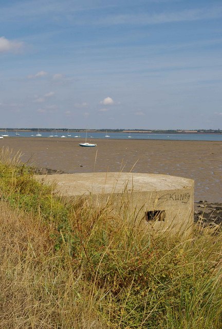
St. Lawrence is a small village located in the Tendring district of Essex, England. With a population of around 600 residents, it is a quiet and close-knit community. The village is situated about three miles northeast of the town of Clacton-on-Sea, and it lies in close proximity to the North Sea coast.

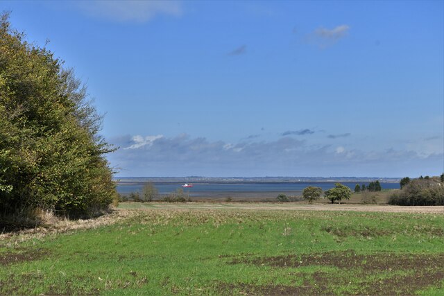
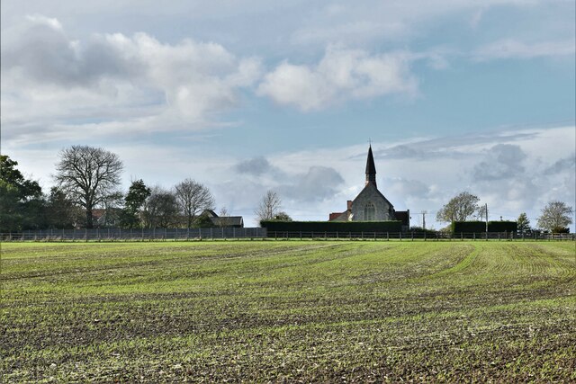
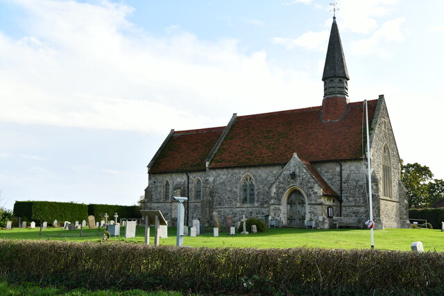
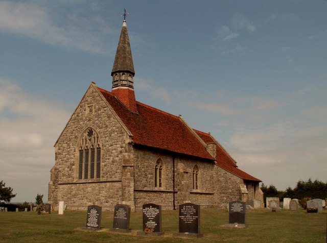
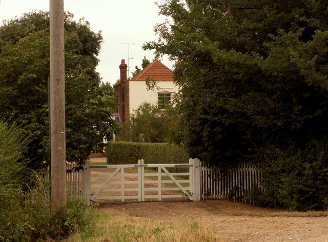
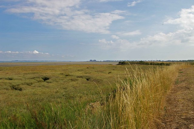
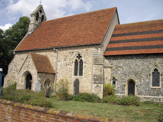
St. Lawrence is known for its picturesque countryside, with beautiful fields and farmland surrounding the village. The area is also rich in history, and there are several notable landmarks to explore. One such landmark is St. Lawrence Church, a charming medieval church dating back to the 13th century. The church features stunning architecture and is a focal point of the village.

The village itself offers a range of amenities for its residents, including a primary school, a local pub, and a village hall. The primary school provides education for children aged 4 to 11, ensuring a convenient and accessible learning environment for families.

St. Lawrence is well-connected to neighboring towns and cities through a network of roads, making it easily accessible for commuters. The nearby town of Clacton-on-Sea provides a wider range of amenities, including shops, restaurants, and leisure facilities.

The village of St. Lawrence offers a peaceful and scenic setting, making it an ideal place for those seeking a tranquil countryside lifestyle. With its rich history, friendly community, and natural beauty, it truly captures the essence of rural Essex.

If you have any feedback on the listing, please let us know in the comments section below.

S.t Lawrence Images

Images are sourced within 2km of 51.700507/0.83493623 or Grid Reference TL9604. Thanks to Geograph Open Source API. All images are credited.

Tillingham: St. Lawrence Road
St. Lawrence: Patchy spring cereal crop
St. Lawrence: Water tower
St. Lawrence, St. Lawrence's Church: Eastern aspect
St. Lawrence, St. Lawrence's Church: Northern aspect
St. Lawrence's church at St. Lawrence, Essex This church was designed by Robert Wheeler and built in 1877-8.
St. Lawrence's church at St. Lawrence, Essex
This church was designed by Robert Wheeler and built in 1877-8.
Mott's Farm, St. Lawrence, Essex
Type 22 and St Lawrence Bay This is St Lawrence bay looking back along the Blackwater towards Stone. For an explanation of type 22 see <span class="nowrap"><a title="http://www.pillboxesuk.co.uk/" rel="nofollow ugc noopener" href="http://www.pillboxesuk.co.uk/">Link</a><img style="margin-left:2px;" alt="External link" title="External link - shift click to open in new window" src="https://s1.geograph.org.uk/img/external.png" width="10" height="10"/></span>
Type 22 and St Lawrence Bay
This is St Lawrence bay looking back along the Blackwater towards Stone. For an explanation of type 22 see LinkExternal link
St Lawrence Bay Saltmarsh This is an example of coastal squeeze where saltmarsh is squeezed against an artificial land boundary. The unsightly blocks on the horizon are <a href="https://www.geograph.org.uk/photo/35708">TM0008 : Moody Magnox (Bradwell Nuclear Power Station)</a>
St Lawrence Bay Saltmarsh
This is an example of coastal squeeze where saltmarsh is squeezed against an artificial land boundary. The unsightly blocks on the horizon are TM0008 : Moody Magnox (Bradwell Nuclear Power Station)
St Peter's Way footpath, St Lawrence The footpath is just about apparent beside the trees. Virtually everything in the picture is within the gridsquare most of which looks like this. Taken from Southminster Road looking west.
St Peter's Way footpath, St Lawrence
The footpath is just about apparent beside the trees. Virtually everything in the picture is within the gridsquare most of which looks like this. Taken from Southminster Road looking west.
View across fields near Tillingham Taken from St Peter's Way footpath looking south-east. Virtually everything in the picture is within the gridsquare.
View across fields near Tillingham
Taken from St Peter's Way footpath looking south-east. Virtually everything in the picture is within the gridsquare.
Lane from West Hyde, Tillingham This lane links the isolated farmstead of West Hyde with the road from St Lawrence to Tillingham.
Lane from West Hyde, Tillingham
This lane links the isolated farmstead of West Hyde with the road from St Lawrence to Tillingham.
View from St Peter's Way footpath, Tillingham The line of trees marks the road from St Lawrence to Tillingham. This view is typical of most of the gridsquare.
View from St Peter's Way footpath, Tillingham
The line of trees marks the road from St Lawrence to Tillingham. This view is typical of most of the gridsquare.
High House Farm High House Farm is on Southminster Rd Asheldham.
High House Farm
High House Farm is on Southminster Rd Asheldham.
Power to Bradwell This is the transmission Line that connects <a href="https://www.geograph.org.uk/photo/242333">TM0008 : Bradwell Power Station</a> with <a href="https://www.geograph.org.uk/photo/120372">TQ7791 : Rayleigh Substation</a>
The picture was taken from Southminster Rd. The line now takes power from the grid to aid the decommissioning of the power station
Power to Bradwell
This is the transmission Line that connects TM0008 : Bradwell Power Station with TQ7791 : Rayleigh Substation The picture was taken from Southminster Rd. The line now takes power from the grid to aid the decommissioning of the power station
Steeple Rd & St Peter's Way This lay-by on Steeple Rd forms part of the St Peter’s Way long distance footpath. The path continues along the road until the far side of the village.
Steeple Rd & St Peter's Way
This lay-by on Steeple Rd forms part of the St Peter’s Way long distance footpath. The path continues along the road until the far side of the village.
St Peters Way This is the St Peter’s Way long distance path south of Black House Court Farm looking towards Tillingham.
St Peters Way
This is the St Peter’s Way long distance path south of Black House Court Farm looking towards Tillingham.
Bend in Southminster Rd At this point Southminster Road takes an almost ninety degree turn from a westerly heading to near due north. The house in the background is called Gallants.
Bend in Southminster Rd
At this point Southminster Road takes an almost ninety degree turn from a westerly heading to near due north. The house in the background is called Gallants.
Show me another place!

S.t Lawrence is located at Grid Ref: TL9604 (Lat: 51.700507, Lng: 0.83493623)

Administrative County: Essex

District: Maldon

Police Authority: Essex

What 3 Words

///contacts.sonic.waxes. Near Southminster, Essex

Nearby Locations

St Lawrence S.t Lawrence

Related Wikis

St Lawrence, Essex

St Lawrence is a parish in the Maldon district of Essex in the East of England on the Dengie peninsula. The village of St Lawrence Bay, which takes its...

St Lawrence Bay

St Lawrence Bay is a village in Essex, UK. It is in an area known as the Dengie Hundred, next to the River Blackwater. The village is now known as St Lawrence...

Steeple, Essex

Steeple is a village on the Dengie Peninsula in Essex, England. It is situated just east of Maylandsea and Mayland, on the southern side of the River Blackwater...

Asheldham

Asheldham is a village and civil parish in Essex, England. It is located about 14 km (8.7 mi) southeast of Maldon and is 26 km (16 mi) east-southeast from...

Dengie Hundred

Dengie is a hundred in the county of Essex, England. It corresponded to the Dengie peninsula, with the inland, western boundary running from North Fambridge...

Tillingham

Tillingham is a small village and civil parish with 1,015 inhabitants in 2001, increasing to 1,058 at the 2011 Census, located 8 miles (13 km) from Burnham...

Dengie

Dengie is a village and civil parish in the Maldon district of Essex, England, with a population of 119 at the 2011 census.It gives its name to the Dengie...

MV Ross Revenge

MV Ross Revenge is a radio ship, the home of Radio Caroline, as well as having supported Radio Monique and various religious broadcasters. Funded by the...

Related Videos

Church Steeple in Winter. #sanjeevanitravelsshimla #viral #viralvideo #short #shorts #shortvideo

Church Steeple in Winter. Sanjeevani Travels shimla ,has been providing first-class travel planning services and advice since ...

#4 Essex: Star Inn Caravan Park

A lovely caravan park in rural Essex. Site page: ...

Nearby Amenities

Located within 500m of 51.700507,0.83493623
Bus Stop
Main Road
Bus: yes
Naptan AtcoCode: 1500IM1828
Naptan BusStopType: CUS
Naptan NaptanCode: esxadmja
Naptan Verified: no
Public Transport: platform
Source: naptan_import
Lat/Long: 51.7047959/0.8350425
Bus Stop
Main Road
Bus: yes
Naptan AtcoCode: 1500IM1828AA
Naptan BusStopType: CUS
Naptan NaptanCode: esxgtpmp
Naptan Verified: no
Public Transport: platform
Source: naptan_import
Lat/Long: 51.7046306/0.8350665
Recycling
Recycling Type: container
Lat/Long: 51.7047723/0.8346251
The data included in this document is from www.openstreetmap.org. The data is made available under ODbL.

Have you been to S.t Lawrence?

Leave your review of S.t Lawrence below (or comments, questions and feedback).