Rushock

Settlement in Worcestershire Wyre Forest

England

Rushock

Upton Farm, Elmley Lovett
Upton Farm, Elmley Lovett Credit: Philip Halling

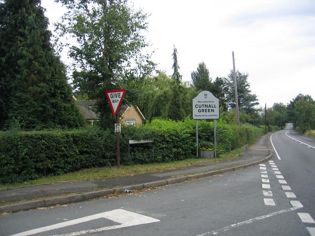
Rushock is a small village located in the county of Worcestershire, England. Situated approximately 10 miles south of Kidderminster, it is nestled in a rural setting characterized by rolling hills, charming countryside, and picturesque views. The village falls within the boundaries of Wychavon District Council.

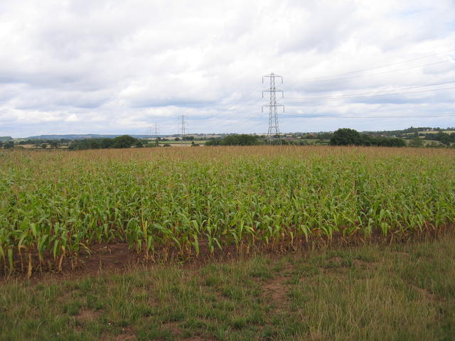
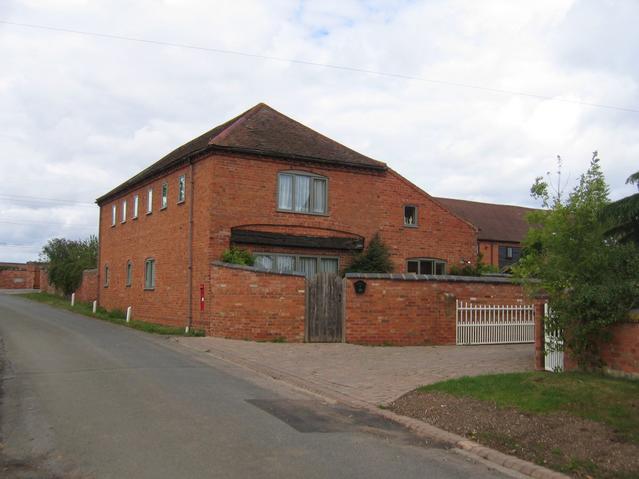
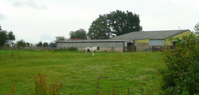
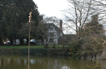
With a population of around 200 residents, Rushock is a close-knit community that offers a peaceful and tranquil environment for its residents. The village primarily consists of traditional stone cottages and farmhouses, adding to its rustic charm. The surrounding farmlands contribute to the village's agricultural character, as farming remains an important part of the local economy.

While Rushock is a predominantly residential area, it is well-served by essential amenities. The village is home to a local pub, providing a welcoming place for locals and visitors to gather and socialize. Additionally, there is a village hall that hosts various community events and gatherings throughout the year.

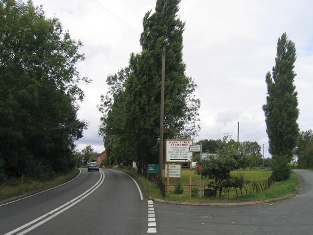
The village benefits from its proximity to nearby towns and cities. Residents have easy access to a range of amenities and services in Kidderminster, including supermarkets, shopping centers, and healthcare facilities. The city of Worcester is also within a reasonable distance, offering further opportunities for employment, education, and leisure activities.

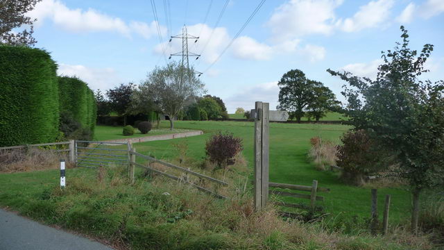
Rushock's rural location makes it an attractive destination for nature enthusiasts and outdoor lovers. The surrounding countryside provides ample opportunities for walking, hiking, and exploring the beautiful Worcestershire landscape. The village's idyllic setting, combined with its friendly community spirit, makes Rushock a desirable place to live for those seeking a peaceful and countryside lifestyle.

If you have any feedback on the listing, please let us know in the comments section below.

Rushock Images

Images are sourced within 2km of 52.335891/-2.1756149 or Grid Reference SO8870. Thanks to Geograph Open Source API. All images are credited.

Upton Farm, Elmley Lovett
Maize near Cashes Farm A power line strides across the field of maize in the north of the square.  The hills on the skyline are the northern edge of the Lickey's and beyond lies SW Birmingham.
Maize near Cashes Farm
A power line strides across the field of maize in the north of the square. The hills on the skyline are the northern edge of the Lickey's and beyond lies SW Birmingham.
Clattercut Lane junction The interestingly named Clattercut Lane joins the Kidderminster - Droitwich road on the northern edge of Cutnall Green.  Judging by internet searches the name of this lane is unique, however nothing appears to explain the origin of the name.
Clattercut Lane junction
The interestingly named Clattercut Lane joins the Kidderminster - Droitwich road on the northern edge of Cutnall Green. Judging by internet searches the name of this lane is unique, however nothing appears to explain the origin of the name.
The Old Bakehouse Part of the old farm building conversions at Cashes Farm.
The Old Bakehouse
Part of the old farm building conversions at Cashes Farm.
Bannut Tree Bannut Tree Farm is situated in the "v" of the road junction between Clattercut Lane and the Droitwich - Kidderminster Road just to the north of Cutnall Green.
Bannut Tree
Bannut Tree Farm is situated in the "v" of the road junction between Clattercut Lane and the Droitwich - Kidderminster Road just to the north of Cutnall Green.
Paddock and barn At Cornshire House Farm.
Paddock and barn
At Cornshire House Farm.
Pylon and post. In the foreground, a marker post indicating a 2 footpaths leading across fields and, in the background, a large pylon.
Pylon and post.
In the foreground, a marker post indicating a 2 footpaths leading across fields and, in the background, a large pylon.
Southern end of Ryeland Lane
Lane to Elmley Lovett
Field off Elmley Lane
Access road to Upton Farm Very easy to head straight up the drive as the lane swings sharp right, but the road signs have been obscured.
Access road to Upton Farm
Very easy to head straight up the drive as the lane swings sharp right, but the road signs have been obscured.
Upton Farm crossroads Note that two of the signs visible have been obscured, making it less than obvious that the through route is the narrow passage to the left of the signpost.
Upton Farm crossroads
Note that two of the signs visible have been obscured, making it less than obvious that the through route is the narrow passage to the left of the signpost.
Lane south of Upton Farm crossroads
Garden centre near Cutnall Green
Access track to Little Gains
Clattercut Lane at Little Gains
Power line near Cashes Farm
Elmbridge Lane Cashes Farm is visible in the distance.
Elmbridge Lane
Cashes Farm is visible in the distance.
Show me another place!

Rushock is located at Grid Ref: SO8870 (Lat: 52.335891, Lng: -2.1756149)

Administrative County: Worcestershire

District: Wyre Forest

Police Authority: West Mercia

What 3 Words

///scenes.expectant.grape. Near Hartlebury, Worcestershire

Nearby Locations

Rushock Rushock

Related Wikis

Rushock

Rushock is a village and civil parish in the Wyre Forest District of Worcestershire, England. At the 2001 census it had a population of 138. The grave...

Elmley Lovett

Elmley Lovett in Worcestershire, England is a civil parish whose residents' homes are quite loosely clustered east of its Hartlebury Trading Estate, as...

Badge Court

Badge Court is an estate in Worcestershire, England. Originally known as Batchcott, the home's most famous occupant was Helena Wintour, daughter of Gunpowder...

Chaddesley Corbett

Chaddesley Corbett is a village and civil parish in the Wyre Forest District of Worcestershire, England. The Anglican and secular versions of the parish...

Nearby Amenities

Located within 500m of 52.335891,-2.1756149
Rushock
Is In: Worcestershire, UK
Place: hamlet
Wikidata: Q3933107
Lat/Long: 52.3373163/-2.1737771
Power: pole
Lat/Long: 52.3338051/-2.169607
Barrier: stile
Foot: yes
Lat/Long: 52.3339062/-2.1702729
Power: pole
Lat/Long: 52.3339712/-2.1702367
Power: pole
Lat/Long: 52.3341221/-2.1708339
Power: pole
Lat/Long: 52.3347927/-2.1714434
Power: pole
Lat/Long: 52.3354888/-2.1720983
Barrier: stile
Foot: yes
Lat/Long: 52.3360868/-2.1701878
Barrier: stile
Foot: yes
Lat/Long: 52.3361468/-2.1701975
Power: pole
Lat/Long: 52.3362139/-2.1726707
Power: pole
Lat/Long: 52.3364646/-2.1730638
Barrier: stile
Foot: yes
Lat/Long: 52.3373413/-2.171404
Barrier: stile
Foot: yes
Lat/Long: 52.3380213/-2.1707694
Power: pole
Lat/Long: 52.3368608/-2.1744679
Power: pole
Lat/Long: 52.3370654/-2.1752835
Power: pole
Lat/Long: 52.3373729/-2.1760807
Power: pole
Lat/Long: 52.3375737/-2.1771471
Power: pole
Lat/Long: 52.3381909/-2.179297
Power: pole
Lat/Long: 52.3385606/-2.1804098
Power: pole
Lat/Long: 52.3366219/-2.1735783
Power: pole
Lat/Long: 52.3378187/-2.1782124
Post Box
Collection Times: Mo-Fr 15:45; Sa 10:30
Post Box Type: lamp
Ref: WR9 350
Royal Cypher: EIIR
Royal Cypher Wikidata: Q33102113
Lat/Long: 52.3354886/-2.1753544
John Bonham's grave
Buried Wikidata: Q485490
Historic: tomb
Tomb: tombstone
Lat/Long: 52.3388742/-2.1708689
Bench
Lat/Long: 52.3387357/-2.1713355
The data included in this document is from www.openstreetmap.org. The data is made available under ODbL.

Have you been to Rushock?

Leave your review of Rushock below (or comments, questions and feedback).