Rushden

Settlement in Northamptonshire

England

Rushden

Bedford Road, Rushden
Bedford Road, Rushden Credit: Alex McGregor

Rushden is a small market town located in the county of Northamptonshire, England. Situated in the East Midlands region, it lies approximately 14 miles east of Northampton and 18 miles south of Peterborough. With a population of around 30,000, it is one of the larger towns in the area.

The town has a rich history, with evidence of settlements dating back to the Iron Age. In the 19th century, Rushden became a major center for the shoe industry, which brought prosperity and growth to the town. Although the shoe industry declined in the late 20th century, remnants of its legacy can still be seen in the town's architecture and local museums.

Rushden offers a range of amenities and services to its residents and visitors. The town center features a variety of shops, restaurants, and cafes, providing a vibrant atmosphere for shopping and socializing. Additionally, there are several supermarkets and leisure facilities, including a leisure center with a swimming pool and gym.

For those interested in outdoor activities, Rushden has a number of parks and green spaces, such as Rushden Hall Park and Hall Park, which offer opportunities for walking, picnicking, and leisure activities. The town also hosts various events throughout the year, including a popular annual carnival and the Rushden Lakes Shopping Centre, which is a retail and leisure complex with a lake, nature reserves, and a cinema.

Rushden benefits from good transportation links, with easy access to major roads such as the A45 and A6, connecting it to nearby towns and cities. The town also has a railway station, providing regular train services to destinations including London and Birmingham.

Overall, Rushden is a charming town with a mix of historical character and modern amenities, making it an attractive place to live or visit in Northamptonshire.

If you have any feedback on the listing, please let us know in the comments section below.
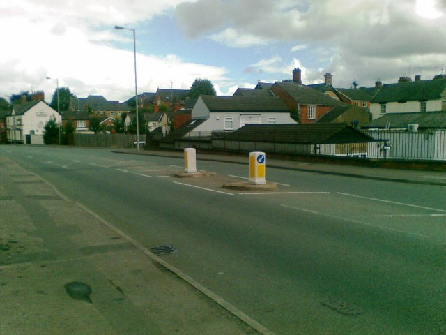
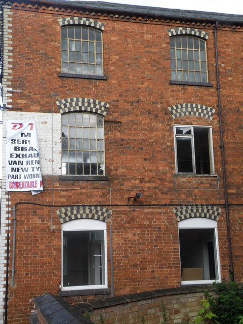
Rushden Images

Images are sourced within 2km of 52.285157/-0.600662 or Grid Reference SP9566. Thanks to Geograph Open Source API. All images are credited.

Bedford Road, Rushden
Demolished buildings, High Street South, Rushden
Signal Box at Rushden station Railway rolling stock at the Rushden transport museum based at the old station.
Signal Box at Rushden station
Railway rolling stock at the Rushden transport museum based at the old station.
Diesel locomotive 31 206 at rest in Rushden station Rushden Transport Museum based at the former town station has a short running track of about half a mile on which rolling stock is operated on selected weekends. 
As important is the fabulous real ale bar that forms part of the museum.
It is a recent CAMRA award winning location with many guest beers. My pint awaits on the picnic table.
Diesel locomotive 31 206 at rest in Rushden station
Rushden Transport Museum based at the former town station has a short running track of about half a mile on which rolling stock is operated on selected weekends. As important is the fabulous real ale bar that forms part of the museum. It is a recent CAMRA award winning location with many guest beers. My pint awaits on the picnic table.
Rolling stock on the line at Rushden A line of mixed rolling stock on the short railway line at Rushden Transport Museum.
Rolling stock on the line at Rushden
A line of mixed rolling stock on the short railway line at Rushden Transport Museum.
Euclid dump truck Various bits of old plant and machinery in the stock yard of the Rushden Transport museum. Beyond the dump truck is most likely a Ransomes Rapier yard crane. The dump truck is usually displayed at the annual transport gathering organised by the museum at a suitably large field location nearby.
Euclid dump truck
Various bits of old plant and machinery in the stock yard of the Rushden Transport museum. Beyond the dump truck is most likely a Ransomes Rapier yard crane. The dump truck is usually displayed at the annual transport gathering organised by the museum at a suitably large field location nearby.
Former bus depot Former town centre bus station now being used as a recycling centre.
Former bus depot
Former town centre bus station now being used as a recycling centre.
Former shoe factory in Rectory road This was the Co-op boot and shoe factory. The link is about the in house fire brigade. <span class="nowrap"><a title="http://www.rushdenheritage.co.uk/shoetrade/Co-op-firebrigade-PeterDanby.html" rel="nofollow ugc noopener" href="http://www.rushdenheritage.co.uk/shoetrade/Co-op-firebrigade-PeterDanby.html">Link</a><img style="margin-left:2px;" alt="External link" title="External link - shift click to open in new window" src="https://s1.geograph.org.uk/img/external.png" width="10" height="10"/></span>
Former shoe factory in Rectory road
This was the Co-op boot and shoe factory. The link is about the in house fire brigade. LinkExternal link
Former factory on Park road A typical 3 storey factory/ works of Rushden. Most likely associated with the shoe manufacturing industry. The side wall features access doors and jibs, hoists and pulleys.
Former factory on Park road
A typical 3 storey factory/ works of Rushden. Most likely associated with the shoe manufacturing industry. The side wall features access doors and jibs, hoists and pulleys.
Window detail of factory in Park Road Chequer style headers over the window frames on a former factory/ works in Park Road. See <a href="https://www.geograph.org.uk/photo/2498324">SP9566 : Former factory on Park road</a>
Window detail of factory in Park Road
Chequer style headers over the window frames on a former factory/ works in Park Road. See SP9566 : Former factory on Park road
Park Road Motors Traditional forecourt garage with a booth between pumps. Unfortunately not traditional fuel prices!
Park Road Motors
Traditional forecourt garage with a booth between pumps. Unfortunately not traditional fuel prices!
Former shoe factory on Park Road The last owners of this shoe and boot works were John White.
<span class="nowrap"><a title="http://www.johnwhiteshoes.com/about.asp" rel="nofollow ugc noopener" href="http://www.johnwhiteshoes.com/about.asp">Link</a><img style="margin-left:2px;" alt="External link" title="External link - shift click to open in new window" src="https://s1.geograph.org.uk/img/external.png" width="10" height="10"/></span>
Former shoe factory on Park Road
The last owners of this shoe and boot works were John White. LinkExternal link
Hoist and Jib detail of former shoe works Lifting mechanisms for products delivered to the former John White works on Park Road.
Hoist and Jib detail of former shoe works
Lifting mechanisms for products delivered to the former John White works on Park Road.
Works on Harborough Road Joinery works, apologies for the bendy chimney, need a more expensive camera to accommodate wide angles with straight edges.
Works on Harborough Road
Joinery works, apologies for the bendy chimney, need a more expensive camera to accommodate wide angles with straight edges.
Leather works on Harborough Road The sign says Clifford Collins Leather Manufacturers but is not believed to be in use. The accompanying link is a historical walk up or down Harborough Road in 1993
<span class="nowrap"><a title="http://www.rushdenheritage.co.uk/history/HarboroughRoadSurvey1993.html" rel="nofollow ugc noopener" href="http://www.rushdenheritage.co.uk/history/HarboroughRoadSurvey1993.html">Link</a><img style="margin-left:2px;" alt="External link" title="External link - shift click to open in new window" src="https://s1.geograph.org.uk/img/external.png" width="10" height="10"/></span>
Leather works on Harborough Road
The sign says Clifford Collins Leather Manufacturers but is not believed to be in use. The accompanying link is a historical walk up or down Harborough Road in 1993 LinkExternal link
Yew Topiary in the Cemetery, Rushden
Former Shoe factory, York Road Now converted to flats, an interesting link of how a fire at the premises in 1907 was dealt with <span class="nowrap"><a title="http://www.rushdenheritage.co.uk/crime/EllardandHowes-fire.html" rel="nofollow ugc noopener" href="http://www.rushdenheritage.co.uk/crime/EllardandHowes-fire.html">Link</a><img style="margin-left:2px;" alt="External link" title="External link - shift click to open in new window" src="https://s1.geograph.org.uk/img/external.png" width="10" height="10"/></span>
Former Shoe factory, York Road
Now converted to flats, an interesting link of how a fire at the premises in 1907 was dealt with LinkExternal link
Factory on Roberts Street Shoe or leather works or other. Looks to be in use with modernised windows. A fantastic reference to the shoe trade can be found here <span class="nowrap"><a title="http://www.rushdenheritage.co.uk/shoetrade/index-shoetrade.html" rel="nofollow ugc noopener" href="http://www.rushdenheritage.co.uk/shoetrade/index-shoetrade.html">Link</a><img style="margin-left:2px;" alt="External link" title="External link - shift click to open in new window" src="https://s1.geograph.org.uk/img/external.png" width="10" height="10"/></span>
Factory on Roberts Street
Shoe or leather works or other. Looks to be in use with modernised windows. A fantastic reference to the shoe trade can be found here LinkExternal link
Show me another place!

Rushden is located at Grid Ref: SP9566 (Lat: 52.285157, Lng: -0.600662)

Unitary Authority: North Northamptonshire

Police Authority: Northamptonshire

What 3 Words

///ballparks.officer.comet. Near Rushden, Northamptonshire

Nearby Locations

Rushden

Related Wikis

Rushden Hall

Rushden Hall is a historic Grade II* listed country house located in the town of Rushden in Northamptonshire which was built for the Pemberton family in...

Rushden

Rushden is a town and civil parish in North Northamptonshire, England, around 18 miles (29 km) east of Northampton. The parish is on the border with Bedfordshire...

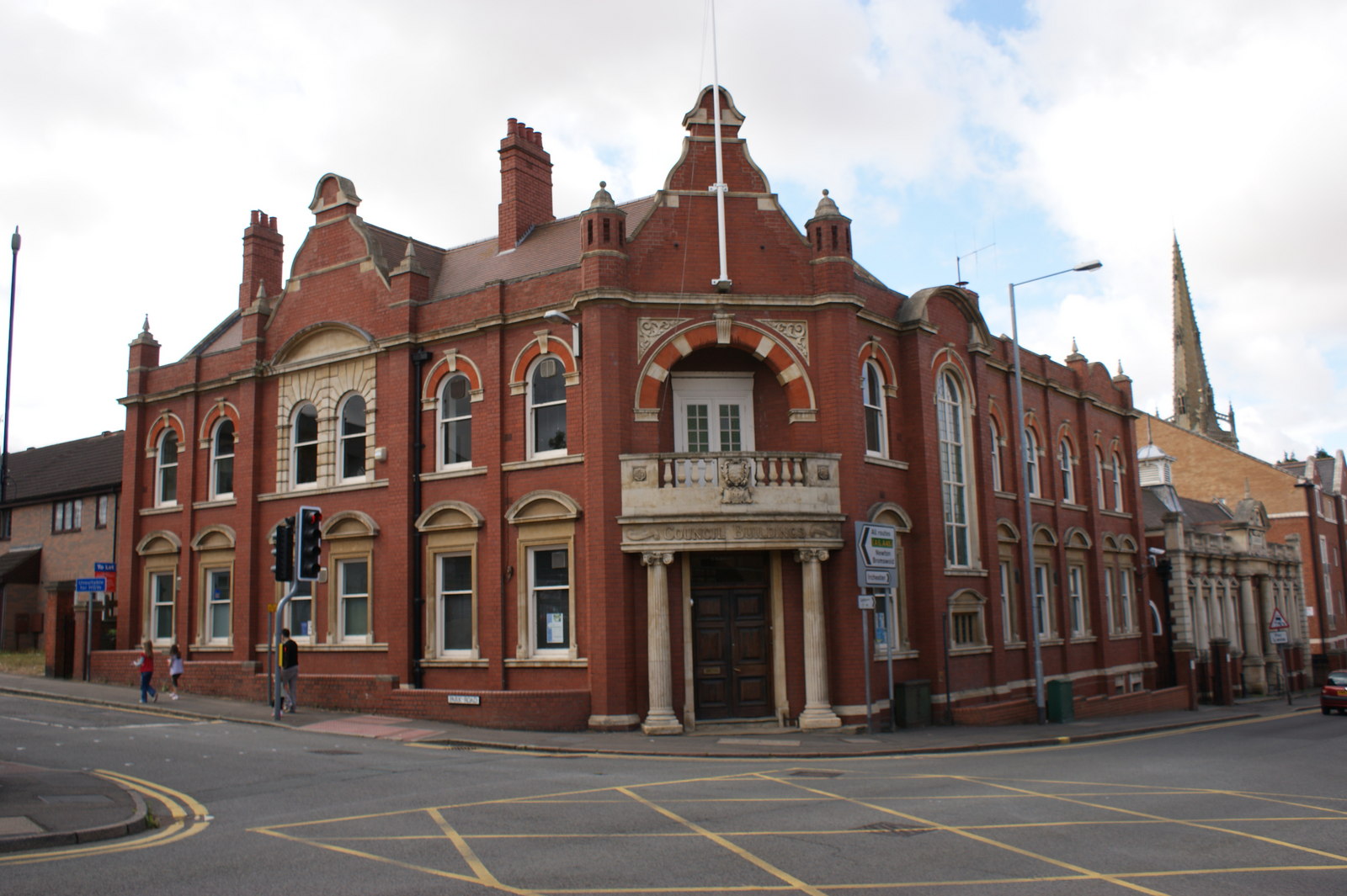
Council Buildings, Rushden

The Council Buildings are based in Newton Road, Rushden, Northamptonshire, England. The structure, which was the headquarters of Rushden Urban District...

Rushden railway station

Rushden railway station is a railway station that once served the town of Rushden in Northamptonshire, England. It is now a heritage station at the end...

Nearby Amenities

Located within 500m of 52.285157,-0.600662
Traffic Signals
Lat/Long: 52.2883629/-0.5984018
Crossing
Crossing: unmarked
Crossing Island: yes
Traffic Calming: table
Lat/Long: 52.2892024/-0.6005202
Fast Food
Ocean Blue Fish & chip
Addr City: Rushden
Addr Country: GB
Addr Housenumber: 2
Addr Postcode: NN10 9YE
Addr Street: Wellingborough Road
Fhrs Authority: North Northamptonshire
Fhrs Id: 44169
Fhrs Local Authority Id: 10730/0002/0/000
Lat/Long: 52.2889006/-0.6000486
Fast Food
Pizza 2 Go
Addr City: Rushden
Addr Country: GB
Addr Housenumber: 1
Addr Postcode: NN10 9YE
Addr Street: Wellingborough Road
Fhrs Authority: North Northamptonshire
Fhrs Id: 44168
Fhrs Local Authority Id: 10730/0001/0/000
Lat/Long: 52.2888974/-0.5999682
Restaurant
The Curry Garden
Addr City: Rushden
Addr Country: GB
Addr Housenumber: 24
Addr Postcode: NN10 9YT
Addr Street: Church Street
Lat/Long: 52.2892468/-0.5994211
Bus Stop
Skinners Hill Layby (Bay 2)
Bench: yes
Bin: yes
Naptan AtcoCode: 300000304SK
Naptan CommonName: Skinners Hill Layby
Naptan Indicator: Bay 2
Naptan Landmark: Skinners Hill Layby
Naptan NaptanCode: nthatdtg
Naptan Street: Skinners Hill
Public Transport: platform
Shelter: yes
Lat/Long: 52.2890096/-0.5997939
Fast Food
Domino's
Addr City: Rushden
Addr Country: GB
Addr Housenumber: 3
Addr Postcode: NN10 0QU
Addr Street: High Street South
Brand: Domino's
Brand Wikidata: Q839466
Brand Wikipedia: en:Domino's Pizza
Contact Website: https://www.dominos.co.uk/pizza-near-me/rushden/3-the-precinct
Cuisine: pizza
Fhrs Id: 32200
Takeaway: yes
Lat/Long: 52.2880982/-0.5979832
Pub
The Weatsheaf
Addr City: Rushden
Addr Country: GB
Addr Housenumber: 1
Addr Postcode: NN10 0QU
Addr Street: High Street South
Lat/Long: 52.2882984/-0.5979591
Taxi
Brians Taxi
Addr City: Rushden
Addr Country: GB
Addr Housenumber: 15
Addr Postcode: NN10 0QU
Addr Street: High Street South
Lat/Long: 52.2878931/-0.5978143
Tesco Express
Addr City: Rushden
Addr Country: GB
Addr Housenumber: 7
Addr Postcode: NN10 9JR
Addr Street: High Street
Brand: Tesco Express
Brand Wikidata: Q98456772
Brand Wikipedia: en:Tesco
Contact Website: https://www.tesco.com/store-locator/rushden/1-7-high-st
Fhrs Id: 45763
Shop: convenience
Lat/Long: 52.2888662/-0.5980079
Bus Stop
Bus: yes
Public Transport: platform
Source: survey
Lat/Long: 52.284317/-0.6034592
Bus Stop
Hall Avenue (o/s 1)
Bench: yes
Naptan AtcoCode: 300000304HS
Naptan CommonName: Hall Avenue
Naptan Indicator: o/s 1
Naptan Landmark: Number 1
Naptan NaptanCode: nthdtapw
Naptan Street: Hall Avenue
Public Transport: platform
Lat/Long: 52.286774/-0.602346
Bus Stop
Barnwell Drive (opp)
Naptan AtcoCode: 300000304HB
Naptan CommonName: Barnwell Drive
Naptan Indicator: opp
Naptan Landmark: Barnwell Drive
Naptan NaptanCode: nthdtapt
Naptan Street: Hall Avenue
Public Transport: platform
Lat/Long: 52.2831717/-0.6014689
Bus Stop
Abbey Way (adj)
Naptan AtcoCode: 300000304AB
Naptan CommonName: Abbey Way
Naptan Indicator: adj
Naptan Landmark: Abbey Way
Naptan NaptanCode: nthapwpt
Naptan Street: Manor Road
Public Transport: platform
Lat/Long: 52.2819574/-0.6003371
Bus Stop
Abbey Way (opp)
Naptan AtcoCode: 300000304MN
Naptan CommonName: Abbey Way
Naptan Indicator: opp
Naptan Landmark: Abbey Way
Naptan NaptanCode: nthatdga
Naptan Street: Manor Road
Public Transport: platform
Lat/Long: 52.2809729/-0.6005503
Bus Stop
Hall Avenue (o/s 18)
Naptan AtcoCode: 300000304HL
Naptan CommonName: Hall Avenue
Naptan Indicator: o/s 18
Naptan Landmark: Number 18
Naptan NaptanCode: nthdwjwj
Naptan Street: Hall Avenue
Public Transport: platform
Lat/Long: 52.2863565/-0.6030703
Post Box
Ref: NN10 105
Source: survey
Lat/Long: 52.2866912/-0.6024131
Doctors
Parklands GP Surgery
No
Addr City: Rushden
Addr Country: GB
Addr Postcode: NN10 9EB
Addr Street: Wymington Road
Emergency: no
Healthcare: doctor
Phone: +44 1933 396000
Website: https://www.parklandssurgery.co.uk
Lat/Long: 52.2834954/-0.5961836
Rushden Hall and Museum
Addr City: Rushden
Addr Country: GB
Addr Housename: The Old Stable Block
Addr Postcode: NN10 9EP
Addr Street: Hall Avenue
Tourism: museum
Website: https://rushdenmuseum.co.uk/
Lat/Long: 52.2867176/-0.6000706
Cafe
Rushden Cafe
Addr City: Rushden
Addr Country: GB
Addr Housenumber: 2
Addr Postcode: NN10 9YT
Addr Street: Church Street
Fhrs Authority: North Northamptonshire
Fhrs Id: 28084
Fhrs Local Authority Id: 08560/0002/0/000
Opening Hours: Mo-Sa 07:30-17:00; Su 08:00-16:00
Phone: +44 1933 411424
Lat/Long: 52.2891321/-0.5974144
Iron Man Dry Cleaners
Addr City: Rushden
Addr Country: GB
Addr Housenumber: 13
Addr Postcode: NN10 0QE
Addr Street: High Street
Shop: vacant
Lat/Long: 52.2891617/-0.5973634
Fast Food
Dragon City
Addr City: Rushden
Addr Country: GB
Addr Housenumber: 107
Addr Postcode: NN10 0RB
Addr Street: High Street South
Fhrs Authority: North Northamptonshire
Fhrs Id: 32209
Fhrs Local Authority Id: 09340/0107/0/000
Lat/Long: 52.285537/-0.5936099
Fast Food
Peri Peri Hut
Addr City: Rushden
Addr Country: GB
Addr Housenumber: 105a
Addr Postcode: NN10 0RB
Addr Street: High Street South
Fhrs Authority: North Northamptonshire
Fhrs Id: 32207
Fhrs Local Authority Id: 09340/0105/A/000
Lat/Long: 52.2855748/-0.5936984
Vickers Menswear
Addr City: Rushden
Addr Country: GB
Addr Housenumber: 61a
Addr Postcode: NN10 0RA
Addr Street: High Street South
Shop: clothes
Lat/Long: 52.2864411/-0.5962304
Restaurant
Little Teza
Addr City: Rushden
Addr Country: GB
Addr Housenumber: 26
Addr Postcode: NN10 0QX
Addr Street: High Street South
Fhrs Authority: North Northamptonshire
Fhrs Id: 1341638
Fhrs Local Authority Id: 21/00010/COM
Lat/Long: 52.2868907/-0.5977566
Fast Food
Imperial Garden
Addr City: Rushden
Addr Country: GB
Addr Housenumber: 38
Addr Postcode: NN10 0QX
Addr Street: High Street South
Fhrs Authority: North Northamptonshire
Fhrs Id: 21386
Fhrs Local Authority Id: 07/00016/COM
Lat/Long: 52.2868316/-0.5976681
Fast Food
Pizza Plus
Addr City: Rushden
Addr Country: GB
Addr Housenumber: 91
Addr Postcode: NN10 0RA
Addr Street: High Street South
Cuisine: pizza
Fhrs Authority: North Northamptonshire
Fhrs Id: 202757
Fhrs Local Authority Id: CFD09/00009/COM
Lat/Long: 52.286026/-0.5949323
Pub
Rushden Conservative Club
Addr City: Rushden
Addr Country: GB
Addr Housenumber: 44
Addr Postcode: NN10 0QX
Addr Street: High Street South
Fhrs Authority: North Northamptonshire
Fhrs Id: 32205
Fhrs Local Authority Id: 09340/0044/0/000
Lat/Long: 52.2866462/-0.597475
Sainsbury's Local
Addr City: Rushden
Addr Country: GB
Addr Housenumber: 100
Addr Postcode: NN10 0RD
Addr Street: High Street South
Brand: Sainsbury's Local
Brand Wikidata: Q13218434
Brand Wikipedia: en:Sainsbury's Local
Fhrs Authority: North Northamptonshire
Fhrs Id: 840370
Fhrs Local Authority Id: 14/00012/COM
Shop: convenience
Website: https://stores.sainsburys.co.uk/4398/rushden-high-street-south-local
Lat/Long: 52.2857241/-0.5949269
Restaurant
Rokka
Addr City: Rushden
Addr Country: GB
Addr Housenumber: 24
Addr Postcode: NN10 0QX
Addr Street: High Street South
Fhrs Authority: North Northamptonshire
Fhrs Id: 17844
Fhrs Local Authority Id: 06/00039/COM
Lat/Long: 52.2869776/-0.5978451
Fast Food
Masala Hut
Addr City: Rushden
Addr Country: GB
Addr Housenumber: 3
Addr Postcode: NN10 9YE
Addr Street: Wellingborough Road
Fhrs Authority: North Northamptonshire
Fhrs Id: 25328
Fhrs Local Authority Id: 08/00070/COM
Lat/Long: 52.2889181/-0.6001282
Restaurant
Pizzeria Venezia
Addr City: Rushden
Addr Country: GB
Addr Housenumber: 30
Addr Postcode: NN10 9YT
Addr Street: Church Street
Fhrs Authority: North Northamptonshire
Fhrs Id: 28088
Fhrs Local Authority Id: 08560/0030/0/000
Lat/Long: 52.2892315/-0.5995971
Historic: monument
Lat/Long: 52.288584/-0.5982363
Taylor Griffin
Addr City: Rushden
Addr Country: GB
Addr Housenumber: 17
Addr Postcode: NN10 0QU
Addr Street: High Street South
Office: estate_agent
Lat/Long: 52.2878747/-0.5979583
Gucio
Addr City: Rushden
Addr Country: GB
Addr Housename: The Precinct
Addr Housenumber: 11
Addr Postcode: NN10 0QU
Addr Street: High Street South
Fhrs Authority: North Northamptonshire
Fhrs Id: 859860
Fhrs Local Authority Id: 16/00018/COM
Shop: deli
Lat/Long: 52.2879337/-0.5976874
Post Box
Operator: Royal Mail
Operator Wikidata: Q638098
Post Box Type: pillar
Ref: NN10 126
Lat/Long: 52.2816068/-0.6007907
Post Box
Operator: Royal Mail
Operator Wikidata: Q638098
Post Box Type: lamp
Ref: NN10 114
Lat/Long: 52.284708/-0.5957133
Dentist
Dental Surgery
Addr City: Rushden
Addr Country: GB
Addr Housenumber: 2
Addr Postcode: NN10 0QS
Addr Street: High Street South
Healthcare: dentist
Phone: +44 1933312256
Lat/Long: 52.2882701/-0.5984196
Cafe
SERVE (Memory Lane Tea Rooms)
Addr City: Rushden
Addr Country: GB
Addr Housenumber: 19
Addr Postcode: NN10 9YU
Addr Street: Church Street
Lat/Long: 52.2891971/-0.5983176
Barry Miller's
Addr City: Rushden
Addr Country: GB
Addr Housenumber: 42
Addr Postcode: NN10 0QX
Addr Street: High Street South
Shop: hairdresser
Lat/Long: 52.2867557/-0.5975962
Clinic
Rushden Osteopathic Clinic
Healthcare: clinic
Lat/Long: 52.2855186/-0.5935407
Bonaparte Hair Studio
Addr City: Rushden
Addr Country: GB
Addr Housenumber: 89
Addr Postcode: NN10 0RA
Addr Street: High Street South
Shop: hairdresser
Lat/Long: 52.2862143/-0.5955684
Scruffies Dog Grooming
Addr City: Rushden
Addr Country: GB
Addr Housenumber: 59
Addr Postcode: NN10 0RA
Addr Street: High Street South
Shop: pet
Lat/Long: 52.2864555/-0.596298
Dentist
Visage Denture Clinic & Dental Laboratory
Addr City: Rushden
Addr Country: GB
Addr Housenumber: 57a
Addr Postcode: NN10 0RA
Addr Street: High Street South
Healthcare: dentist
Lat/Long: 52.2864948/-0.5964401
Commerce Windows
Addr City: Rushden
Addr Country: GB
Addr Housenumber: 44
Addr Postcode: NN10 0RL
Addr Street: Griffith Street
Craft: window_construction
Lat/Long: 52.2874694/-0.5976123
Taxi
Alco Taxis
Lat/Long: 52.2893424/-0.5993796
Hockridge Mortgages & Insurance
Addr City: Rushden
Addr Country: GB
Addr Housenumber: 26
Addr Postcode: NN10 9YT
Addr Street: Church Street
Office: insurance
Lat/Long: 52.2892345/-0.5995185
Veterinary
Northlands Veterinary Clinic
Addr City: Rushden
Addr Country: GB
Addr Housenumber: 22
Addr Postcode: NN10 9YT
Addr Street: Church Street
Lat/Long: 52.289244/-0.5993542
Waste Basket
Lat/Long: 52.2892005/-0.5997701
Leisure: bandstand
Lat/Long: 52.285826/-0.59988
Ladies Stylist
Shop: hairdresser
Lat/Long: 52.2893048/-0.598133
Holley Protect Limited
Office: insurance
Lat/Long: 52.2891457/-0.5988837
Rjb
Office: accountant
Lat/Long: 52.2891807/-0.5986224
Happy Feet
Healthcare: podiatrist
Lat/Long: 52.2891625/-0.5981594
Anytime Fitness
Brand: Anytime Fitness
Brand Wikidata: Q4778364
Brand Wikipedia: en:Anytime Fitness
Leisure: fitness_centre
Website: https://www.anytimefitness.co.uk/gyms/uk-0087/rushden-east-midlands-nn10-9yu/
Lat/Long: 52.2891133/-0.5979842
Halo Recruit
Office: employment_agency
Lat/Long: 52.2891652/-0.5988132
Fratelli Bosco
Addr City: Rushden
Addr Housenumber: 23
Addr Postcode: NN10 9YU
Addr Street: Church Street
Craft: caterer
Fhrs Authority: North Northamptonshire
Fhrs Id: 1001102
Fhrs Local Authority Id: 17/00055/COM
Lat/Long: 52.2891989/-0.5985309
Hannah Solicitors
Office: lawyer
Lat/Long: 52.2891558/-0.5980933
Charles Orlebar
Office: estate_agent
Lat/Long: 52.289/-0.5976193
Defibrillator
Defibrillator Location: Next to door to reception
Emergency: defibrillator
Indoor: no
Ref: cpad 2513
Ref GB The Circuit: 8006A083-2F1E-4BA8-B8A9-783B943CBA98
Lat/Long: 52.2892951/-0.5986518
Aura Beauty And Therapy Centre
Shop: beauty
Lat/Long: 52.2891659/-0.5987481
Tj’s Alternative Gifts
Shop: gift
Lat/Long: 52.2893399/-0.5982311
Social Facility
Townsend Court
Addr City: Rushden
Addr Country: GB
Addr Housenumber: 58
Addr Postcode: NN10 0QY
Addr Street: High Street South
Fhrs Authority: North Northamptonshire
Fhrs Id: 840350
Fhrs Local Authority Id: 09/00007/COM
Social Facility: group_home
Social Facility For: senior
Lat/Long: 52.2862126/-0.5965823
Direction: SE
Generator Method: photovoltaic
Generator Output Electricity: yes
Generator Solar Modules: 16
Generator Source: solar
Generator Type: solar_photovoltaic_panel
Location: roof
Power: generator
Lat/Long: 52.2814977/-0.6040549
Direction: SW
Generator Method: photovoltaic
Generator Output Electricity: yes
Generator Solar Modules: 10
Generator Source: solar
Generator Type: solar_photovoltaic_panel
Location: roof
Power: generator
Lat/Long: 52.2819979/-0.6034165
Direction: SE
Generator Method: photovoltaic
Generator Output Electricity: yes
Generator Solar Modules: 16
Generator Source: solar
Generator Type: solar_photovoltaic_panel
Location: roof
Power: generator
Lat/Long: 52.2829491/-0.6055773
Direction: SE
Generator Method: photovoltaic
Generator Output Electricity: yes
Generator Solar Modules: 13
Generator Source: solar
Generator Type: solar_photovoltaic_panel
Location: roof
Power: generator
Lat/Long: 52.2835169/-0.606765
Direction: ESE
Generator Method: photovoltaic
Generator Output Electricity: yes
Generator Solar Modules: 5
Generator Source: solar
Generator Type: solar_photovoltaic_panel
Location: roof
Power: generator
Lat/Long: 52.2815338/-0.6025291
Direction: SE
Generator Method: photovoltaic
Generator Output Electricity: yes
Generator Solar Modules: 16
Generator Source: solar
Generator Type: solar_photovoltaic_panel
Location: roof
Power: generator
Lat/Long: 52.282472/-0.6057943
Direction: SW
Generator Method: photovoltaic
Generator Output Electricity: yes
Generator Solar Modules: 12
Generator Source: solar
Generator Type: solar_photovoltaic_panel
Location: roof
Power: generator
Lat/Long: 52.2825939/-0.605679
Direction: SSW
Generator Method: photovoltaic
Generator Output Electricity: yes
Generator Solar Modules: 10
Generator Source: solar
Generator Type: solar_photovoltaic_panel
Location: roof
Power: generator
Lat/Long: 52.2845714/-0.6057434
Direction: ESE
Generator Method: photovoltaic
Generator Output Electricity: yes
Generator Solar Modules: 4
Generator Source: solar
Generator Type: solar_photovoltaic_panel
Location: roof
Power: generator
Lat/Long: 52.2845942/-0.6056595
Direction: ESE
Generator Method: photovoltaic
Generator Output Electricity: yes
Generator Solar Modules: 11
Generator Source: solar
Generator Type: solar_photovoltaic_panel
Location: roof
Power: generator
Lat/Long: 52.2850739/-0.6055972
Direction: SSW
Generator Method: photovoltaic
Generator Output Electricity: yes
Generator Solar Modules: 4
Generator Source: solar
Generator Type: solar_photovoltaic_panel
Location: roof
Power: generator
Lat/Long: 52.2850456/-0.6056435
Direction: SW
Generator Method: photovoltaic
Generator Output Electricity: yes
Generator Solar Modules: 11
Generator Source: solar
Generator Type: solar_photovoltaic_panel
Location: roof
Power: generator
Lat/Long: 52.2865644/-0.605968
Direction: SW
Generator Method: photovoltaic
Generator Output Electricity: yes
Generator Solar Modules: 1
Generator Source: solar
Generator Type: solar_photovoltaic_panel
Location: roof
Power: generator
Lat/Long: 52.2865365/-0.605909
Direction: 260
Generator Method: photovoltaic
Generator Output Electricity: yes
Generator Solar Modules: 7
Generator Source: solar
Generator Type: solar_photovoltaic_panel
Location: roof
Power: generator
Lat/Long: 52.2818116/-0.6005627
Direction: 80
Generator Method: photovoltaic
Generator Output Electricity: yes
Generator Solar Modules: 7
Generator Source: solar
Generator Type: solar_photovoltaic_panel
Location: roof
Power: generator
Lat/Long: 52.2818161/-0.6005265
Direction: SW
Generator Method: photovoltaic
Generator Output Electricity: yes
Generator Solar Modules: 16
Generator Source: solar
Generator Type: solar_photovoltaic_panel
Location: roof
Power: generator
Lat/Long: 52.2838081/-0.6040076
Direction: SE
Generator Method: photovoltaic
Generator Output Electricity: yes
Generator Solar Modules: 17
Generator Source: solar
Generator Type: solar_photovoltaic_panel
Location: roof
Power: generator
Lat/Long: 52.2845394/-0.6048404
Direction: 215
Generator Method: photovoltaic
Generator Output Electricity: yes
Generator Solar Modules: 16
Generator Source: solar
Generator Type: solar_photovoltaic_panel
Location: roof
Power: generator
Lat/Long: 52.2836285/-0.5976342
Direction: 215
Generator Method: photovoltaic
Generator Output Electricity: yes
Generator Solar Modules: 11
Generator Source: solar
Generator Type: solar_photovoltaic_panel
Location: roof
Power: generator
Lat/Long: 52.283491/-0.6040841
Direction: SE
Generator Method: photovoltaic
Generator Output Electricity: yes
Generator Solar Modules: 17
Generator Source: solar
Generator Type: solar_photovoltaic_panel
Location: roof
Power: generator
Lat/Long: 52.2841155/-0.6047963
Direction: SSW
Generator Method: photovoltaic
Generator Output Electricity: yes
Generator Solar Modules: 7
Generator Source: solar
Generator Type: solar_photovoltaic_panel
Location: roof
Power: generator
Lat/Long: 52.2818107/-0.5991494
Direction: 215
Generator Method: photovoltaic
Generator Output Electricity: yes
Generator Solar Modules: 16
Generator Source: solar
Generator Type: solar_photovoltaic_panel
Location: roof
Power: generator
Lat/Long: 52.2834516/-0.6034796
Direction: 215
Generator Method: photovoltaic
Generator Output Electricity: yes
Generator Solar Modules: 9
Generator Source: solar
Generator Type: solar_photovoltaic_panel
Location: roof
Power: generator
Lat/Long: 52.2832307/-0.6037917
Direction: 215
Generator Method: photovoltaic
Generator Output Electricity: yes
Generator Solar Modules: 20
Generator Source: solar
Generator Type: solar_photovoltaic_panel
Location: roof
Power: generator
Lat/Long: 52.2847686/-0.5976069
Direction: 235
Generator Method: photovoltaic
Generator Output Electricity: yes
Generator Solar Modules: 5
Generator Source: solar
Generator Type: solar_photovoltaic_panel
Location: roof
Power: generator
Lat/Long: 52.2885986/-0.6031928
Direction: SE
Generator Method: photovoltaic
Generator Output Electricity: yes
Generator Solar Modules: 15
Generator Source: solar
Generator Type: solar_photovoltaic_panel
Location: roof
Power: generator
Lat/Long: 52.2823603/-0.6053902
Direction: 145
Generator Method: photovoltaic
Generator Output Electricity: yes
Generator Solar Modules: 5
Generator Source: solar
Generator Type: solar_photovoltaic_panel
Location: roof
Power: generator
Lat/Long: 52.2885936/-0.6031203
Direction: 145
Generator Method: photovoltaic
Generator Output Electricity: yes
Generator Solar Modules: 20
Generator Source: solar
Generator Type: solar_photovoltaic_panel
Location: roof
Power: generator
Lat/Long: 52.287745/-0.6035708
Bus Stop
Salvation Army Citadel (o/s)
Naptan AtcoCode: 300000304C
Naptan CommonName: Salvation Army Citadel
Naptan Indicator: o/s
Naptan Landmark: Salvation Army Citadel
Naptan NaptanCode: nthatadp
Naptan Street: Church Street
Public Transport: platform
Lat/Long: 52.2892504/-0.5989252
Bus Stop
BP Garage (opp)
Naptan AtcoCode: 300000304WH
Naptan CommonName: BP Garage
Naptan Indicator: opp
Naptan Landmark: BP Garage
Naptan NaptanCode: nthatgat
Naptan Street: High Street South
Public Transport: platform
Lat/Long: 52.2877844/-0.5980334
Bus Stop
Wymington Road (adj)
Naptan AtcoCode: 300000304WN
Naptan CommonName: Wymington Road
Naptan Indicator: adj
Naptan Landmark: Council Offices
Naptan NaptanCode: nthatgda
Naptan Street: High Street South
Public Transport: platform
Lat/Long: 52.286106/-0.5958527
Bus Stop
Wymington Road (near)
Naptan AtcoCode: 300000304WR
Naptan CommonName: Wymington Road
Naptan Indicator: near
Naptan Landmark: Little Street
Naptan NaptanCode: nthatgdj
Naptan Street: High Street South
Public Transport: platform
Lat/Long: 52.2856745/-0.5939242
Bus Stop
Skinners Hill Layby (Bay 1)
Bench: yes
Bin: yes
Naptan AtcoCode: 300000304S
Naptan CommonName: Skinners Hill Layby
Naptan Indicator: Bay 1
Naptan Landmark: Skinners Hill Layby
Naptan NaptanCode: nthatdpj
Naptan Street: Skinners Hill
Public Transport: platform
Shelter: yes
Lat/Long: 52.2889231/-0.5995354
Bus Stop
South End Infant School (o/s)
Naptan AtcoCode: 300000304SE
Naptan CommonName: South End Infant School
Naptan Indicator: o/s
Naptan Landmark: South End Infant School
Naptan NaptanCode: nthatdpm
Naptan Street: Wymington Road
Public Transport: platform
Lat/Long: 52.2809947/-0.5989587
Bus Stop
South End Infant School (opp)
Naptan AtcoCode: 300000304JS
Naptan CommonName: South End Infant School
Naptan Indicator: opp
Naptan Landmark: South End Infant School
Naptan NaptanCode: nthatawa
Naptan Street: Wymington Road
Public Transport: platform
Lat/Long: 52.2823222/-0.5986074
Social Facility
The Food Bank
Addr City: Rushden
Addr Country: GB
Addr Housenumber: 19-21
Addr Postcode: NN10 9YU
Addr Street: Church Street
Fhrs Authority: North Northamptonshire
Fhrs Id: 1495119
Fhrs Local Authority Id: 22/00022/COM
Social Facility: food_bank
Lat/Long: 52.2891996/-0.5983957
Bench
Lat/Long: 52.2891003/-0.5972256
Waste Basket
Lat/Long: 52.2890896/-0.5971959
Defibrillator
Access: yes
Booth: KX300
Covered: booth
Defibrillator Location: in old phone box Haddon Close, Rushden
Disused Amenity: telephone
Emergency: defibrillator
Indoor: no
Man Made: telephone_box
Ref GB The Circuit: 36228B48-C656-4CCC-B29E-AD7401266C0D
Lat/Long: 52.2833609/-0.6051753
Man Made: street_cabinet
Lat/Long: 52.2833281/-0.6052258
Man Made: street_cabinet
Lat/Long: 52.2833823/-0.6051499
Man Made: street_cabinet
Lat/Long: 52.2834025/-0.605144
Pharmacy
Rowlands Pharmacy
Addr City: Rushden
Addr Country: GB
Addr Housename: Parklands
Addr Postcode: NN10 9EB
Addr Street: The Drive
Fhrs Authority: North Northamptonshire
Fhrs Id: 1225203
Fhrs Local Authority Id: 05/00024/COM
Lat/Long: 52.2834638/-0.5958797
The data included in this document is from www.openstreetmap.org. The data is made available under ODbL.

Have you been to Rushden?

Leave your review of Rushden below (or comments, questions and feedback).