Ruchazie

Settlement in Lanarkshire

Scotland

Ruchazie

Limestone outcrop Outcrop of carboniferous limestone between Riddrie Knowes and Gogar Street.
Limestone outcrop Credit: Rosalind Mitchell

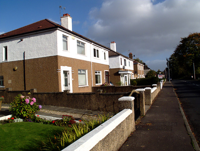
Ruchazie is a residential area located in the eastern part of Glasgow, Scotland. It falls within the jurisdiction of the city council of Glasgow and is situated in the historic county of Lanarkshire. The neighborhood is bordered by the communities of Carntyne, Cranhill, and Garthamlock.

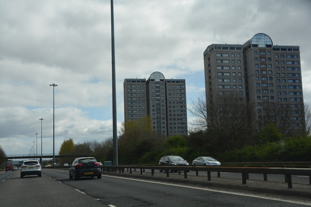
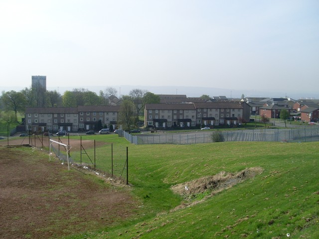
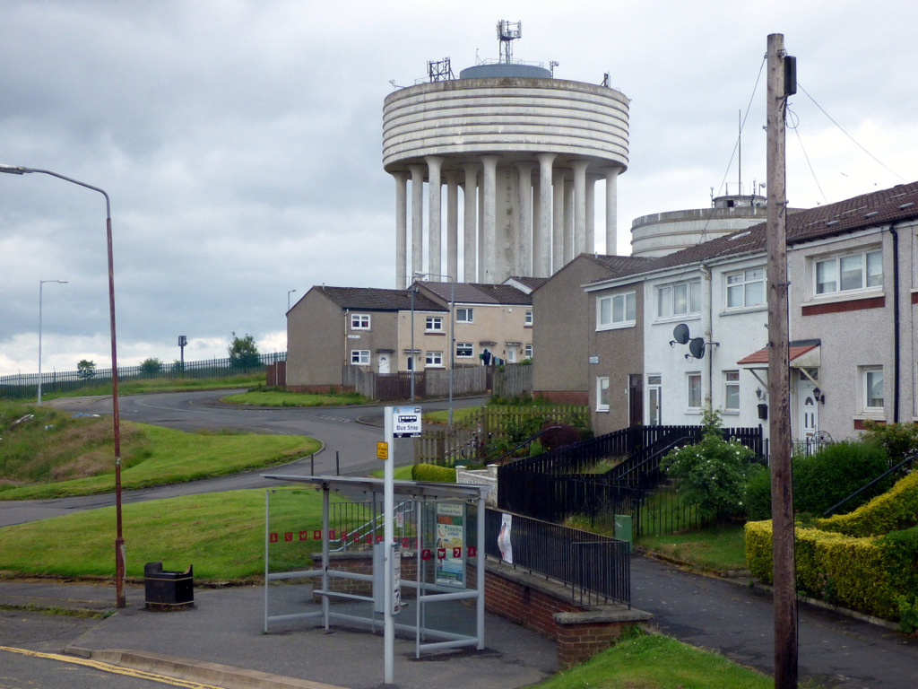
Originally developed in the mid-20th century, Ruchazie is predominantly made up of public housing schemes, with a mix of high-rise and low-rise buildings. The area has seen significant redevelopment efforts in recent years, with many of the older properties being replaced with modern, energy-efficient housing units.

Ruchazie is home to a diverse population, with a mix of families, young professionals, and older residents. The area offers a range of amenities to cater to the needs of its residents, including several primary schools, a community center, a library, and various local shops and supermarkets. There are also several parks and green spaces, providing recreational opportunities for residents.

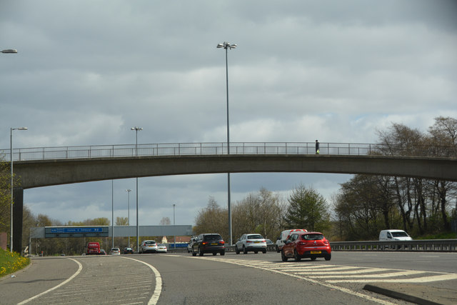
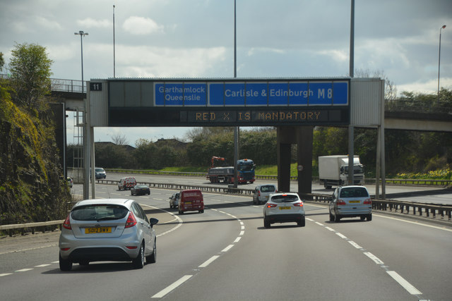
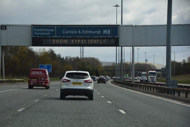
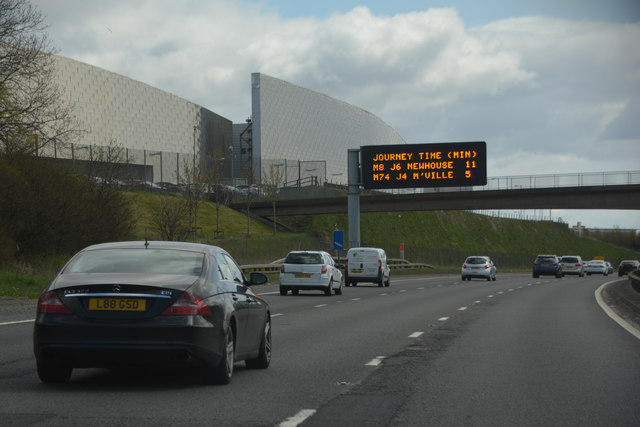
Transportation in Ruchazie is well-served by buses, with regular services connecting the area to Glasgow city center and other nearby neighborhoods. The area is also easily accessible by car, with good road connections to the M8 motorway and the wider Glasgow area.

Overall, Ruchazie offers a quiet and affordable residential environment, making it an attractive place to live for those seeking a suburban lifestyle within easy reach of the amenities and employment opportunities of Glasgow city center.

If you have any feedback on the listing, please let us know in the comments section below.
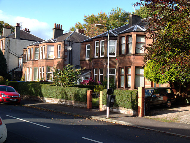
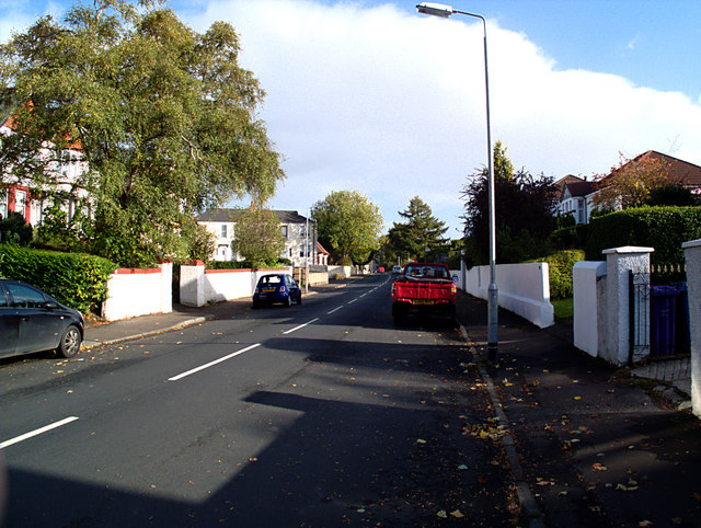
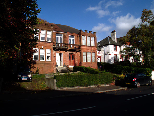
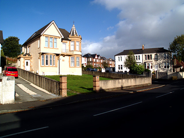
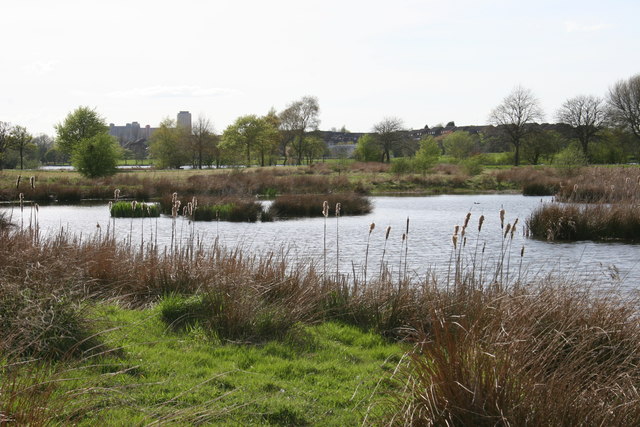
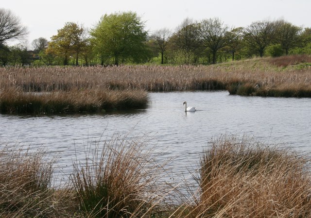
Ruchazie Images

Images are sourced within 2km of 55.872721/-4.1652971 or Grid Reference NS6466. Thanks to Geograph Open Source API. All images are credited.

Limestone outcrop Outcrop of carboniferous limestone between Riddrie Knowes and Gogar Street.
Limestone outcrop
Outcrop of carboniferous limestone between Riddrie Knowes and Gogar Street.
Riddrie Knowes Sandstone villas.
Riddrie Knowes
Sandstone villas.
Riddrie Knowes Looking eastwards
Riddrie Knowes
Looking eastwards
Riddrie Knowes Although the square is dominated by twentieth-century social housing, Riddrie Knowes is an enclave of older and more afflent private development, exhibiting a variety of styles.
Riddrie Knowes
Although the square is dominated by twentieth-century social housing, Riddrie Knowes is an enclave of older and more afflent private development, exhibiting a variety of styles.
Riddrie Knowes And round the corner into Riddrie Crescent.
Riddrie Knowes
And round the corner into Riddrie Crescent.
Riddrie Knowes Bungalows.
Riddrie Knowes
Bungalows.
Riddrie Knowes More typical housing further east on Riddrie Knowes.
Riddrie Knowes
More typical housing further east on Riddrie Knowes.
Frankfield Loch The source of the Molendinar Burn.
Frankfield Loch
The source of the Molendinar Burn.
Hogganfield Park Local Nature Reserve Hogganfield Park was declared a Local Nature Reserve in 1998. Small ponds and marsh have been created on the eastern side of the Reserve. They are particularly attractive in summer with the flag iris, reedmace (seen here) and rushes. A wide variety of birds and other wildlife can be seen within the LNR.

Hogganfield Loch can be seen in the distance, as can the Red Road Flats beyond.
Hogganfield Park Local Nature Reserve
Hogganfield Park was declared a Local Nature Reserve in 1998. Small ponds and marsh have been created on the eastern side of the Reserve. They are particularly attractive in summer with the flag iris, reedmace (seen here) and rushes. A wide variety of birds and other wildlife can be seen within the LNR. Hogganfield Loch can be seen in the distance, as can the Red Road Flats beyond.
Mute Swan, Hogganfield Park Local Nature Reserve
Glasgow City : The M80 Motorway Heading into the city of Glasgow along the M80.
Glasgow City : The M80 Motorway
Heading into the city of Glasgow along the M80.
Glasgow City : The M80 Motorway Looking along the M80 as it heads underneath a bridge carrying the B765.
Glasgow City : The M80 Motorway
Looking along the M80 as it heads underneath a bridge carrying the B765.
Glasgow City : The M8 Motorway The M8 seen after joining at junction 13.
Glasgow City : The M8 Motorway
The M8 seen after joining at junction 13.
Glasgow City : The M8 Motorway The M8 heading through Glasgow.
Glasgow City : The M8 Motorway
The M8 heading through Glasgow.
Glasgow City : The M8 Motorway The M8 is the busiest motorway in Scotland and one of the busiest in the United Kingdom.
Glasgow City : The M8 Motorway
The M8 is the busiest motorway in Scotland and one of the busiest in the United Kingdom.
Glasgow City : The M8 Motorway Heading along the M8 with some tower blocks on the right.
Glasgow City : The M8 Motorway
Heading along the M8 with some tower blocks on the right.
Glasgow City : The M8 Motorway Heading out from Glasgow on the M8 motorway.
Glasgow City : The M8 Motorway
Heading out from Glasgow on the M8 motorway.
Glasgow City : The M8 Motorway Heading along the M8 motorway out from Glasgow.
Glasgow City : The M8 Motorway
Heading along the M8 motorway out from Glasgow.
Show me another place!

Ruchazie is located at Grid Ref: NS6466 (Lat: 55.872721, Lng: -4.1652971)

Unitary Authority: City of Glasgow

Police Authority: Greater Glasgow

What 3 Words

///mobile.digit.divisions. Near Stepps, North Lanarkshire

Nearby Locations

Ruchazie

Related Wikis

Ruchazie

Ruchazie ( rukh-HAY-zee) is a neighbourhood in the Scottish city of Glasgow. It is situated to the north-east of the city, bordered by Craigend and Garthamlock...

Craigend, Glasgow

Craigend is a neighbourhood in the Scottish city of Glasgow. It is situated north of the River Clyde, immediately west of Garthamlock, east of Hogganfield...

Cranhill

Cranhill is an inner city district and housing scheme in the north east of Glasgow, Scotland. Cranhill was developed from public funding in the early...

HM Prison Barlinnie

HM Prison Barlinnie is the largest prison in Scotland. It is operated by the Scottish Prison Service and is located in the residential suburb of Riddrie...

Nearby Amenities

Located within 500m of 55.872721,-4.1652971
Traffic Signals
Traffic Signals: signal
Lat/Long: 55.8713215/-4.158926
Motorway Junction
Stepps Road
Ref: 11
Lat/Long: 55.8683649/-4.1641745
Traffic Signals
Traffic Signals: signal
Lat/Long: 55.8712855/-4.1590624
Traffic Signals
Lat/Long: 55.8730294/-4.1604735
Traffic Calming: cushion
Lat/Long: 55.8699737/-4.1710782
Mini Roundabout
Direction: clockwise
Lat/Long: 55.8710226/-4.1622351
Traffic Calming: cushion
Lat/Long: 55.8719253/-4.1578777
Traffic Calming: table
Lat/Long: 55.8764933/-4.164505
Traffic Calming: bump
Lat/Long: 55.8758448/-4.1654932
Traffic Calming: bump
Lat/Long: 55.8760878/-4.1624003
Crossing
Crossing: traffic_signals
Crossing Island: no
Lat/Long: 55.8727991/-4.164149
Ruchazie
Place: suburb
Wikidata: Q7376577
Wikipedia: en:Ruchazie
Lat/Long: 55.8736808/-4.16656
Post Office
Source: OS OpenData StreetView
Lat/Long: 55.8729828/-4.1650576
Barber Shop
Shop: hairdresser
Lat/Long: 55.8730083/-4.1644359
Fast Food
Chopsticks
Cuisine: chinese
Phone: +44 141 774 5599
Lat/Long: 55.8729949/-4.1646994
Community Centre
Garthamlock Family Learning Centre
Operator: Glasgow City Council
Lat/Long: 55.8727732/-4.1580794
One O One
Shop: convenience
Lat/Long: 55.8729855/-4.1648722
Fast Food
Red Chilli
Cuisine: indian
Lat/Long: 55.8729976/-4.164579
Pharmacy
Rowlands Pharmacy
Brand: Rowlands Pharmacy
Brand Wikidata: Q62663235
Dispensing: yes
Healthcare: pharmacy
Website: https://rowlandspharmacy.co.uk/find-local-pharmacy#!/l/glasgow/69-gilbertfield-street/1318
Lat/Long: 55.8752983/-4.1619264
Ruchazie News
Shop: newsagent
Lat/Long: 55.8730176/-4.1643239
Bus Stop
Ruchazie, Gartloch Road
Bench: yes
Naptan AtcoCode: 60901994
Naptan Bearing: SW
Naptan CommonName: Post Office
Naptan Indicator: opp
Naptan Landmark: St Phillips Primary School
Naptan NaptanCode: 45236927
Naptan Street: Gartloch Road
Nat Ref: 60901994
Ref: 60901994
Shelter: yes
Lat/Long: 55.8724431/-4.1663723
Bus Stop
Ruchazie, Gartloch Road
Bench: yes
Naptan AtcoCode: 60901995
Naptan Bearing: E
Naptan CommonName: Post Office
Naptan Indicator: before
Naptan Landmark: St Phillips Primary School
Naptan NaptanCode: 45242489
Naptan Street: Gartloch Road
Nat Ref: 60901995
Ref: 60901995
Shelter: yes
Lat/Long: 55.8726171/-4.1661504
Bus Stop
Ruchazie, Gartloch Road/ Blairlogie Street
Bench: yes
Naptan AtcoCode: 60901996
Naptan Bearing: W
Naptan CommonName: Hallforest Street
Naptan Indicator: Opp
Naptan Landmark: Blairlogie Street
Naptan NaptanCode: 45232728
Naptan Street: Gartloch Road
Nat Ref: 60901996
Ref: 60901996
Shelter: yes
Lat/Long: 55.8727957/-4.1630594
Post Box
Collection Times: Mo-Fr 17:15; Sa 12:00
Operator: Royal Mail
Ref: G33 1239
Lat/Long: 55.8728633/-4.1650346
Bus Stop
Ruchazie, Gartloch Road/ Avenue End Road
Bench: yes
Naptan AtcoCode: 60901997
Naptan Bearing: E
Naptan CommonName: Hallforest Street
Naptan Indicator: after
Naptan Landmark: Avenue End Road
Naptan NaptanCode: 45238597
Naptan Street: Gartloch Road
Nat Ref: 60901997
Ref: 60901997
Shelter: yes
Lat/Long: 55.8729415/-4.1626207
Atm
Operator: Clydesdale
Lat/Long: 55.8729601/-4.1647936
Barrier: bollard
Lat/Long: 55.8747218/-4.1581332
Crossing
Crossing: traffic_signals
Lat/Long: 55.875417/-4.1617265
Traffic Calming: table
Lat/Long: 55.8759863/-4.1635454
Bus Stop
Glasgow, Elibank Street, Gartloch Road
Bench: yes
Naptan AtcoCode: 60902001
Naptan Bearing: S
Naptan CommonName: Drumlochy Road
Naptan Indicator: before
Naptan NaptanCode: 45237462
Naptan Street: Elibank Street
Nat Ref: 60902001
Ref: 60902001
Shelter: yes
Lat/Long: 55.8712839/-4.170635
Bus Stop
Glasgow, Elibank Street, Gartloch Road
Bench: yes
Naptan AtcoCode: 60902000
Naptan Bearing: N
Naptan CommonName: Drumlochy Road
Naptan Indicator: opp & after
Naptan Landmark: Drumlochy Road
Naptan NaptanCode: 45236959
Naptan Street: Elibank Street
Nat Ref: 60902000
Ref: 60902000
Shelter: yes
Lat/Long: 55.8713374/-4.1708137
Bus Stop
Ruchazie, Gartloch Road/ Elibank Street
Bench: yes
Naptan AtcoCode: 60901993
Naptan Bearing: W
Naptan CommonName: Elibank Street
Naptan Indicator: before
Naptan Landmark: Ruchazie Primary School
Naptan NaptanCode: 45236367
Naptan Street: Gartloch Road
Nat Ref: 60901993
Ref: 60901993
Shelter: yes
Lat/Long: 55.8716514/-4.1700039
Bus Stop
Ruchazie, Gartloch Road/ Elibank Street
Bench: no
Naptan AtcoCode: 60901992
Naptan Bearing: E
Naptan CommonName: Elibank Street
Naptan Indicator: Opp
Naptan Landmark: Elibank Street
Naptan NaptanCode: 45237548
Naptan Street: Gartloch Road
Nat Ref: 60901992
Ref: 60901992
Shelter: no
Lat/Long: 55.8717767/-4.1709228
Traffic Calming: cushion
Lat/Long: 55.8700255/-4.1715948
Bus Stop
Ruchazie, Elibank Street/ Balcomie Street
Bench: no
Naptan AtcoCode: 60901999
Naptan Bearing: S
Naptan CommonName: Balcomie Street
Naptan Indicator: Opp
Naptan Landmark: Balcomie Street
Naptan NaptanCode: 45236273
Naptan Street: Elibank Street
Nat Ref: 60901999
Ref: 60901999
Shelter: no
Lat/Long: 55.8701918/-4.1707517
Bus Stop
Ruchazie, Elibank Street/ Balcomie Street
Bench: no
Naptan AtcoCode: 60903834
Naptan Bearing: N
Naptan CommonName: Balcomie Street
Naptan Indicator: after
Naptan Landmark: Balcomie Street
Naptan NaptanCode: 45279248
Naptan Street: Elibank Street
Nat Ref: 60903834
Ref: 60903834
Shelter: no
Lat/Long: 55.8702697/-4.1709167
Man Made: surveillance
Lat/Long: 55.8717716/-4.1707214
Man Made: surveillance
Lat/Long: 55.8749044/-4.1655804
Traffic Calming: bump
Lat/Long: 55.8758903/-4.1646764
Traffic Calming: bump
Lat/Long: 55.8761625/-4.1642877
Traffic Calming: bump
Lat/Long: 55.8762824/-4.1655428
Bus Stop
Craigend, Glenraith Road/ Mossvale Road
Naptan AtcoCode: 60902020
Naptan Bearing: N
Naptan CommonName: Mossvale Road
Naptan Indicator: opp
Naptan Landmark: Mossvale Road
Naptan NaptanCode: 45232856
Naptan Street: Glenraith Road
Ref: 60902020
Lat/Long: 55.87474/-4.15995
Bus Stop
Craigend, Mossvale Road/ Kishorn Place
Naptan AtcoCode: 60903565
Naptan Bearing: SE
Naptan CommonName: Kishorn Place
Naptan Indicator: before
Naptan Landmark: Kishorn Place
Naptan NaptanCode: 45242384
Naptan Street: Mossvale Road
Ref: 60903565
Lat/Long: 55.87266/-4.15846
Bus Stop
Craigend, Mossvale Road/ Kishorn Place
Naptan AtcoCode: 60902032
Naptan Bearing: N
Naptan CommonName: Kishorn Place
Naptan Indicator: Opp
Naptan Landmark: Kishorn Place
Naptan NaptanCode: 45232735
Naptan Street: Mossvale Road
Ref: 60902032
Lat/Long: 55.87281/-4.15871
Bus Stop
Stepps Road / Borthwick Street
Bus: yes
Naptan AtcoCode: 60902013
Naptan Bearing: NW
Naptan CommonName: Borthwick Street
Naptan Indicator: before
Naptan Landmark: Borthwick Street
Naptan NaptanCode: 45235438
Naptan Street: Stepps Road
Public Transport: platform
Ref: 60902013
Lat/Long: 55.87086/-4.15863
Bus Stop
Stepps Road / Borthwick Street
Bus: yes
Naptan AtcoCode: 60902014
Naptan Bearing: SE
Naptan CommonName: Borthwick Street
Naptan Indicator: opp
Naptan Landmark: Borthwick Street
Naptan NaptanCode: 45234957
Naptan Street: Stepps Road
Public Transport: platform
Ref: 60902014
Lat/Long: 55.87092/-4.15836
Generator Method: photovoltaic
Generator Output Electricity: yes
Generator Source: solar
Generator Type: solar_photovoltaic_panel
Location: roof
Power: generator
Lat/Long: 55.871907/-4.1589314
Generator Method: photovoltaic
Generator Output Electricity: yes
Generator Source: solar
Generator Type: solar_photovoltaic_panel
Power: generator
Lat/Long: 55.8704549/-4.1684206
Generator Method: photovoltaic
Generator Output Electricity: yes
Generator Source: solar
Generator Type: solar_photovoltaic_panel
Power: generator
Lat/Long: 55.8704504/-4.1683413
Generator Method: photovoltaic
Generator Output Electricity: yes
Generator Source: solar
Generator Type: solar_photovoltaic_panel
Power: generator
Lat/Long: 55.870415/-4.1677213
Generator Method: photovoltaic
Generator Output Electricity: yes
Generator Source: solar
Generator Type: solar_photovoltaic_panel
Power: generator
Lat/Long: 55.8704162/-4.1674713
Generator Method: photovoltaic
Generator Output Electricity: yes
Generator Source: solar
Generator Type: solar_photovoltaic_panel
Power: generator
Lat/Long: 55.8704025/-4.1673676
Generator Method: photovoltaic
Generator Output Electricity: yes
Generator Source: solar
Generator Type: solar_photovoltaic_panel
Power: generator
Lat/Long: 55.8753694/-4.1663341
Generator Method: photovoltaic
Generator Output Electricity: yes
Generator Source: solar
Generator Type: solar_photovoltaic_panel
Power: generator
Lat/Long: 55.8750535/-4.1647892
Generator Method: photovoltaic
Generator Output Electricity: yes
Generator Source: solar
Generator Type: solar_photovoltaic_panel
Power: generator
Lat/Long: 55.875064/-4.1646953
Generator Method: photovoltaic
Generator Output Electricity: yes
Generator Source: solar
Generator Type: solar_photovoltaic_panel
Power: generator
Lat/Long: 55.8750896/-4.1644592
Generator Method: photovoltaic
Generator Output Electricity: yes
Generator Source: solar
Generator Type: solar_photovoltaic_panel
Power: generator
Lat/Long: 55.8751844/-4.1626917
Barrier: entrance
Lat/Long: 55.8715131/-4.1660943
Bench
Backrest: no
Material: stone
Lat/Long: 55.8723615/-4.1661398
Bench
Backrest: no
Material: stone
Lat/Long: 55.8721681/-4.1665328
Bench
Backrest: no
Material: stone
Lat/Long: 55.8721745/-4.1660412
Bench
Backrest: no
Material: stone
Lat/Long: 55.8720259/-4.1664369
Bench
Backrest: no
Material: stone
Lat/Long: 55.8720128/-4.1659594
Bench
Backrest: no
Material: stone
Lat/Long: 55.8718514/-4.1663336
Bench
Backrest: no
Material: stone
Lat/Long: 55.871845/-4.1658803
Barrier: entrance
Lat/Long: 55.872284/-4.1666061
Bench
Backrest: no
Material: stone
Lat/Long: 55.8716839/-4.1662303
Bench
Backrest: no
Material: stone
Lat/Long: 55.8716734/-4.1657978
Addr Housenumber: 71
Addr Street: Glenraith Road
Lat/Long: 55.8755379/-4.1596386
Addr Housenumber: 69
Addr Street: Glenraith Road
Lat/Long: 55.8757065/-4.1596659
Addr Housenumber: 67
Addr Street: Glenraith Road
Lat/Long: 55.8759124/-4.1596516
Addr Housenumber: 33
Addr Street: Gilbertfield Street
Lat/Long: 55.8745713/-4.1657756
Addr Housenumber: 16
Addr Street: Cobington Place
Lat/Long: 55.8721378/-4.1612594
Addr Housenumber: 10
Addr Street: Cobington Place
Lat/Long: 55.8718208/-4.1611574
Addr Housenumber: 32
Addr Street: Avenue End Drive
Lat/Long: 55.8763224/-4.1649465
Addr Housenumber: 3
Addr Street: Bigton Street
Lat/Long: 55.8753987/-4.1662608
Addr Housenumber: 75
Addr Street: Dunnottar Street
Lat/Long: 55.8731743/-4.1656317
Addr Housenumber: 71
Addr Street: Dunnottar Street
Lat/Long: 55.8731758/-4.1654592
Addr Housenumber: 2
Addr Street: Borthwick Street
Lat/Long: 55.8714511/-4.1621379
Addr Housenumber: 24
Addr Street: Borthwick Street
Lat/Long: 55.872315/-4.1625947
Addr Housenumber: 19
Addr Street: Cobington Place
Lat/Long: 55.8722564/-4.1620045
Addr Housenumber: 18
Addr Street: Cobington Place
Lat/Long: 55.8721927/-4.161297
Addr Housenumber: 1
Addr Street: Avenue End Drive
Lat/Long: 55.8759496/-4.1622289
Addr Housenumber: 39
Addr Street: Avenue End Drive
Lat/Long: 55.8757582/-4.1646342
Addr Housenumber: 91
Addr Street: Dunnottar Street
Lat/Long: 55.8736314/-4.1659272
Addr Housenumber: 83
Addr Street: Dunnottar Street
Lat/Long: 55.8733653/-4.1659678
Addr Housenumber: 79
Addr Street: Dunnottar Street
Lat/Long: 55.8732494/-4.1659424
Addr Housenumber: 33
Addr Street: Borthwick Street
Lat/Long: 55.8722999/-4.1631642
Addr Housenumber: 7
Addr Street: Cobington Place
Entrance: yes
Lat/Long: 55.8717189/-4.1617041
Addr Housenumber: 43
Addr Street: Avenue End Drive
Lat/Long: 55.875724/-4.1649531
Addr Housenumber: 7
Addr Street: Gilbertfield Place
Lat/Long: 55.8755873/-4.1635942
Addr Housenumber: 57
Addr Street: Gilbertfield Street
Lat/Long: 55.8751571/-4.1635371
Addr Housenumber: 95
Addr Street: Croftcroighn Road
Lat/Long: 55.8714761/-4.1609645
Addr Housenumber: 79
Addr Street: Croftcroighn Road
Lat/Long: 55.8712702/-4.1619533
Addr Housenumber: 27
Addr Street: Borthwick Street
Lat/Long: 55.8720932/-4.1632315
Addr Housenumber: 35
Addr Street: Avenue End Drive
Lat/Long: 55.8757935/-4.1643509
Addr Housenumber: 53
Addr Street: Avenue End Drive
Lat/Long: 55.8756872/-4.1657262
Addr Housenumber: 31
Addr Street: Gilbertfield Place
Lat/Long: 55.875675/-4.1622262
Addr Housenumber: 47
Addr Street: Gilbertfield Street
Lat/Long: 55.8750957/-4.1645653
Addr Housenumber: 2
Addr Street: Banff Street
Lat/Long: 55.8750444/-4.1650732
Addr Housenumber: 77
Addr Street: Dunnottar Street
Lat/Long: 55.8731713/-4.1657363
Addr Housenumber: 67
Addr Street: Dunnottar Street
Lat/Long: 55.8732007/-4.1652621
Addr Housenumber: 29
Addr Street: Borthwick Street
Lat/Long: 55.8721358/-4.1632138
Addr Housenumber: 19
Addr Street: Borthwick Street
Lat/Long: 55.8717904/-4.1629768
Addr Housenumber: 2
Addr Street: Cobington Place
Lat/Long: 55.8716558/-4.1610817
Addr Housenumber: 15
Addr Street: Avenue End Drive
Lat/Long: 55.8758997/-4.1629987
Addr Housenumber: 16
Addr Street: Avenue End Drive
Lat/Long: 55.876048/-4.164584
Addr Housenumber: 6
Addr Street: Gilbertfield Place
Lat/Long: 55.8754309/-4.1629021
Addr Housenumber: 17
Addr Street: Bigton Street
Lat/Long: 55.8754429/-4.1655157
Addr Housenumber: 39
Addr Street: Gilbertfield Street
Lat/Long: 55.874781/-4.1658351
Addr Housenumber: 25
Addr Street: Gilbertfield Street
Lat/Long: 55.8743662/-4.1657377
Addr Housenumber: 99
Addr Street: Croftcroighn Road
Lat/Long: 55.8715143/-4.1608584
Addr Housenumber: 6
Addr Street: Cobington Place
Lat/Long: 55.871757/-4.1611027
Addr Housenumber: 65
Addr Street: Croftcroighn Road
Lat/Long: 55.8710461/-4.1629866
Addr Housenumber: 7
Addr Street: Avenue End Drive
Lat/Long: 55.875927/-4.1626183
Addr Housenumber: 55
Addr Street: Avenue End Drive
Lat/Long: 55.8756737/-4.1659045
Addr Housenumber: 30
Addr Street: Avenue End Drive
Lat/Long: 55.8762811/-4.1651993
Addr Housenumber: 47
Addr Street: Avenue End Drive
Lat/Long: 55.8757133/-4.1652421
Addr Housenumber: 2
Addr Street: Gilbertfield Place
Lat/Long: 55.8753071/-4.1628625
Addr Housenumber: 4
Addr Street: Gilbertfield Place
Lat/Long: 55.8753462/-4.1628862
Addr Housenumber: 31
Addr Street: Bigton Street
Lat/Long: 55.875505/-4.1646472
Addr Housenumber: 89
Addr Street: Croftcroighn Road
Lat/Long: 55.8713542/-4.1615548
Addr Housenumber: 85
Addr Street: Croftcroighn Road
Lat/Long: 55.8713282/-4.1616874
Addr Housenumber: 6
Addr Street: Borthwick Street
Lat/Long: 55.8715734/-4.1621905
Addr Housenumber: 22
Addr Street: Borthwick Street
Lat/Long: 55.8722874/-4.1625354
Addr Housenumber: 1
Addr Street: Cobington Place
Lat/Long: 55.8715381/-4.16165
Addr Housenumber: 19
Addr Street: Avenue End Drive
Lat/Long: 55.8758877/-4.1631893
Addr Housenumber: 26
Addr Street: Avenue End Drive
Lat/Long: 55.876073/-4.1653865
Addr Housenumber: 34
Addr Street: Avenue End Drive
Lat/Long: 55.8763558/-4.1646574
Addr Housenumber: 27
Addr Street: Gilbertfield Street
Lat/Long: 55.8744214/-4.1657481
Addr Housenumber: 81
Addr Street: Dunnottar Street
Lat/Long: 55.873307/-4.1659586
Addr Housenumber: 83
Addr Street: Croftcroighn Road
Lat/Long: 55.871306/-4.1618352
Addr Housenumber: 77
Addr Street: Croftcroighn Road
Lat/Long: 55.8711986/-4.1620122
Addr Housenumber: 14
Addr Street: Borthwick Street
Lat/Long: 55.8718721/-4.1624009
Addr Housenumber: 20
Addr Street: Borthwick Street
Lat/Long: 55.8722103/-4.1623797
Addr Housenumber: 5
Addr Street: Avenue End Drive
Lat/Long: 55.8759346/-4.1625299
Addr Housenumber: 65
Addr Street: Gilbertfield Street
Lat/Long: 55.8752059/-4.1626238
Addr Housenumber: 61
Addr Street: Gilbertfield Street
Lat/Long: 55.8751789/-4.1632916
Addr Housenumber: 1
Addr Street: Bigton Street
Lat/Long: 55.8753888/-4.1663323
Addr Housenumber: 31
Addr Street: Gilbertfield Street
Lat/Long: 55.8745094/-4.1657579
Addr Housenumber: 19
Addr Street: Gilbertfield Street
Lat/Long: 55.8742064/-4.1656911
Addr Housenumber: 93
Addr Street: Dunnottar Street
Lat/Long: 55.8736746/-4.1658876
Addr Housenumber: 25
Addr Street: Borthwick Street
Lat/Long: 55.8719788/-4.1632091
Addr Housenumber: 12
Addr Street: Cobington Place
Lat/Long: 55.8719602/-4.1612156
Addr Housenumber: 25
Addr Street: Gilbertfield Place
Lat/Long: 55.8756667/-4.1626057
Addr Housenumber: 17
Addr Street: Gilbertfield Place
Lat/Long: 55.8756272/-4.1631093
Addr Housenumber: 9
Addr Street: Bigton Street
Lat/Long: 55.8754189/-4.1658516
Addr Housenumber: 101
Addr Street: Dunnottar Street
Lat/Long: 55.8738778/-4.1657996
Addr Housenumber: 73
Addr Street: Dunnottar Street
Lat/Long: 55.8731691/-4.1655477
Addr Housenumber: 91
Addr Street: Croftcroighn Road
Lat/Long: 55.8713674/-4.1614448
Addr Housenumber: 4
Addr Street: Borthwick Street
Lat/Long: 55.8714994/-4.1621593
Addr Housenumber: 57
Addr Street: Croftcroighn Road
Lat/Long: 55.8709882/-4.1632403
Addr Housenumber: 21
Addr Street: Avenue End Drive
Lat/Long: 55.87588/-4.1632656
Addr Housenumber: 31
Addr Street: Avenue End Drive
Lat/Long: 55.8758265/-4.1640631
Addr Housenumber: 51
Addr Street: Avenue End Drive
Lat/Long: 55.875688/-4.1655433
Addr Housenumber: 55
Addr Street: Gilbertfield Street
Lat/Long: 55.8751445/-4.1636171
Addr Housenumber: 7
Addr Street: Bigton Street
Lat/Long: 55.8754158/-4.1660095
Addr Housenumber: 21
Addr Street: Bigton Street
Lat/Long: 55.875464/-4.1652669
Addr Housenumber: 15
Addr Street: Gilbertfield Street
Lat/Long: 55.874111/-4.165665
Addr Housenumber: 95
Addr Street: Dunnottar Street
Lat/Long: 55.8737145/-4.1658618
Addr Housenumber: 81
Addr Street: Croftcroighn Road
Lat/Long: 55.8712937/-4.1618977
Addr Housenumber: 9
Addr Street: Borthwick Street
Lat/Long: 55.8715225/-4.1628196
Addr Housenumber: 21
Addr Street: Cobington Place
Lat/Long: 55.8722883/-4.1619612
Addr Housenumber: 9
Addr Street: Cobington Place
Lat/Long: 55.8717961/-4.1617255
Addr Housenumber: 11
Addr Street: Avenue End Drive
Lat/Long: 55.8759096/-4.1627752
Addr Housenumber: 33
Addr Street: Gilbertfield Place
Lat/Long: 55.8756863/-4.1621398
Addr Housenumber: 15
Addr Street: Gilbertfield Place
Lat/Long: 55.8756228/-4.1632034
Addr Housenumber: 19
Addr Street: Bigton Street
Lat/Long: 55.8754554/-4.1653604
Addr Housenumber: 99
Addr Street: Dunnottar Street
Lat/Long: 55.8738297/-4.165824
Addr Housenumber: 24
Addr Street: Cobington Place
Lat/Long: 55.8723929/-4.1616737
Addr Housenumber: 59
Addr Street: Croftcroighn Road
Lat/Long: 55.8709935/-4.1631516
Addr Housenumber: 55
Addr Street: Croftcroighn Road
Lat/Long: 55.8709686/-4.163282
Addr Housenumber: 57
Addr Street: Avenue End Drive
Lat/Long: 55.8756666/-4.1660715
Addr Housenumber: 3
Addr Street: Gilbertfield Place
Lat/Long: 55.8755747/-4.1638347
Addr Housenumber: 43
Addr Street: Gilbertfield Street
Lat/Long: 55.8750759/-4.1647987
Addr Housenumber: 93
Addr Street: Croftcroighn Road
Lat/Long: 55.8714703/-4.1610678
Addr Housenumber: 8
Addr Street: Borthwick Street
Lat/Long: 55.8716226/-4.1622021
Addr Housenumber: 26
Addr Street: Cobington Place
Lat/Long: 55.8723837/-4.1617395
Addr Housenumber: 8
Addr Street: Cobington Place
Lat/Long: 55.8717877/-4.1611216
Addr Housenumber: 9
Addr Street: Avenue End Drive
Lat/Long: 55.8759155/-4.1626991
Addr Housenumber: 22
Addr Street: Avenue End Drive
Lat/Long: 55.876003/-4.1650703
Addr Housenumber: 29
Addr Street: Bigton Street
Lat/Long: 55.8755027/-4.1647885
Addr Housenumber: 3
Addr Street: Cobington Place
Lat/Long: 55.8715719/-4.1616606
Addr Housenumber: 17
Addr Street: Cobington Place
Lat/Long: 55.8720044/-4.1618173
Addr Housenumber: 61
Addr Street: Croftcroighn Road
Lat/Long: 55.8710103/-4.1630987
Addr Housenumber: 87
Addr Street: Dunnottar Street
Lat/Long: 55.8735299/-4.1659692
Addr Housenumber: 69
Addr Street: Dunnottar Street
Lat/Long: 55.8731858/-4.1653689
Addr Housenumber: 97
Addr Street: Croftcroighn Road
Lat/Long: 55.8714989/-4.1609013
Addr Housenumber: 41
Addr Street: Avenue End Drive
Lat/Long: 55.8757407/-4.1647609
Addr Housenumber: 14
Addr Street: Avenue End Drive
Lat/Long: 55.8760507/-4.1644769
Addr Housenumber: 27
Addr Street: Gilbertfield Place
Lat/Long: 55.8756609/-4.1624541
Addr Housenumber: 1
Addr Street: Gilbertfield Place
Lat/Long: 55.875566/-4.1639292
Addr Housenumber: 23
Addr Street: Bigton Street
Lat/Long: 55.8754736/-4.1651272
Addr Housenumber: 17
Addr Street: Gilbertfield Street
Lat/Long: 55.8741619/-4.1656765
Addr Housenumber: 85
Addr Street: Dunnottar Street
Lat/Long: 55.8734188/-4.1659843
Addr Housenumber: 14
Addr Street: Cobington Place
Lat/Long: 55.872014/-4.1611993
Addr Housenumber: 67
Addr Street: Croftcroighn Road
Lat/Long: 55.8710438/-4.162877
Addr Housenumber: 59
Addr Street: Gilbertfield Street
Lat/Long: 55.8751725/-4.1633692
Addr Housenumber: 97
Addr Street: Dunnottar Street
Lat/Long: 55.8737725/-4.1658497
Addr Housenumber: 29
Addr Street: Avenue End Drive
Lat/Long: 55.8758406/-4.1638618
Addr Housenumber: 49
Addr Street: Avenue End Drive
Lat/Long: 55.8757048/-4.1653192
Addr Housenumber: 24
Addr Street: Avenue End Drive
Lat/Long: 55.8759662/-4.165527
Addr Housenumber: 40
Addr Street: Avenue End Drive
Lat/Long: 55.8762116/-4.1646118
Addr Housenumber: 21
Addr Street: Gilbertfield Place
Lat/Long: 55.8756534/-4.1628442
Addr Housenumber: 4
Addr Street: Banff Street
Lat/Long: 55.8750939/-4.1650968
Addr Housenumber: 41
Addr Street: Gilbertfield Street
Lat/Long: 55.8748444/-4.1658434
Addr Housenumber: 23
Addr Street: Avenue End Drive
Lat/Long: 55.8758721/-4.1634563
Addr Housenumber: 27
Addr Street: Avenue End Drive
Lat/Long: 55.8758493/-4.1637587
Addr Housenumber: 17
Addr Street: Borthwick Street
Lat/Long: 55.8716969/-4.1628874
Addr Housenumber: 11
Addr Street: Borthwick Street
Entrance: yes
Lat/Long: 55.871578/-4.1628416
Addr Housenumber: 1
Addr Street: Borthwick Street
Lat/Long: 55.8713112/-4.162681
Addr Housenumber: 22
Addr Street: Cobington Place
Lat/Long: 55.8723723/-4.1613803
Addr Housenumber: 15
Addr Street: Cobington Place
Lat/Long: 55.8719836/-4.1617386
Addr Housenumber: 45
Addr Street: Avenue End Drive
Lat/Long: 55.8757187/-4.1650365
Addr Housenumber: 23
Addr Street: Gilbertfield Street
Lat/Long: 55.8743129/-4.1657257
Addr Housenumber: 7
Addr Street: Borthwick Street
Lat/Long: 55.8715043/-4.1628037
Addr Housenumber: 37
Addr Street: Avenue End Drive
Lat/Long: 55.8757832/-4.1644582
Addr Housenumber: 20
Addr Street: Avenue End Drive
Lat/Long: 55.8760117/-4.1649895
Addr Housenumber: 23
Addr Street: Gilbertfield Place
Lat/Long: 55.8756576/-4.1627182
Addr Housenumber: 8
Addr Street: Gilbertfield Place
Lat/Long: 55.8754779/-4.1629106
Addr Housenumber: 21
Addr Street: Gilbertfield Street
Lat/Long: 55.8742505/-4.1657104
Addr Housenumber: 16
Addr Street: Borthwick Street
Lat/Long: 55.871917/-4.1623719
Addr Housenumber: 5
Addr Street: Bigton Street
Lat/Long: 55.8754066/-4.166078
Addr Housenumber: 33
Addr Street: Bigton Street
Lat/Long: 55.8755107/-4.1645471
Addr Housenumber: 35
Addr Street: Gilbertfield Street
Lat/Long: 55.8746754/-4.1658036
Addr Housenumber: 5
Addr Street: Borthwick Street
Lat/Long: 55.8713996/-4.1627432
Addr Housenumber: 3
Addr Street: Avenue End Drive
Lat/Long: 55.8759435/-4.1623423
Addr Housenumber: 33
Addr Street: Avenue End Drive
Lat/Long: 55.8758209/-4.1641364
Addr Housenumber: 28
Addr Street: Avenue End Drive
Lat/Long: 55.8761676/-4.1652921
Addr Housenumber: 36
Addr Street: Avenue End Drive
Lat/Long: 55.876311/-4.1646544
Addr Housenumber: 51
Addr Street: Gilbertfield Street
Lat/Long: 55.8751457/-4.1638602
Addr Housenumber: 11
Addr Street: Bigton Street
Lat/Long: 55.8754216/-4.1657463
Addr Housenumber: 29
Addr Street: Gilbertfield Street
Lat/Long: 55.8744733/-4.1657541
Addr Housenumber: 89
Addr Street: Dunnottar Street
Lat/Long: 55.8735811/-4.1659512
Addr Housenumber: 31
Addr Street: Borthwick Street
Lat/Long: 55.8722541/-4.1631795
Addr Housenumber: 3
Addr Street: Borthwick Street
Lat/Long: 55.8713621/-4.1627183
Addr Housenumber: 5
Addr Street: Cobington Place
Lat/Long: 55.8716669/-4.1616759
Addr Housenumber: 11
Addr Street: Cobington Place
Lat/Long: 55.8718335/-4.1617542
Addr Housenumber: 63
Addr Street: Croftcroighn Road
Lat/Long: 55.8710368/-4.1630372
Addr Housenumber: 9
Addr Street: Gilbertfield Place
Lat/Long: 55.8756077/-4.1634343
Addr Housenumber: 105
Addr Street: Dunnottar Street
Lat/Long: 55.8739807/-4.1657355
Addr Housenumber: 10
Addr Street: Borthwick Street
Lat/Long: 55.8717254/-4.1622553
Addr Housenumber: 23
Addr Street: Borthwick Street
Lat/Long: 55.8719284/-4.1631487
Addr Housenumber: 38
Addr Street: Avenue End Drive
Lat/Long: 55.8762631/-4.1646388
Addr Housenumber: 19
Addr Street: Gilbertfield Place
Lat/Long: 55.8756378/-4.1629273
Addr Housenumber: 6
Addr Street: Banff Street
Lat/Long: 55.8751895/-4.1651162
Addr Housenumber: 25
Addr Street: Bigton Street
Lat/Long: 55.8754831/-4.1650274
Addr Housenumber: 37
Addr Street: Gilbertfield Street
Lat/Long: 55.8747318/-4.1658387
Addr Housenumber: 20
Addr Street: Cobington Place
Lat/Long: 55.8723484/-4.1612876
Addr Housenumber: 29
Addr Street: Gilbertfield Place
Lat/Long: 55.8756806/-4.1623806
Addr Housenumber: 63
Addr Street: Gilbertfield Street
Lat/Long: 55.8751949/-4.1627092
Addr Housenumber: 53
Addr Street: Gilbertfield Street
Lat/Long: 55.8751523/-4.1637775
Addr Housenumber: 87
Addr Street: Croftcroighn Road
Lat/Long: 55.8713385/-4.1616176
Addr Housenumber: 12
Addr Street: Borthwick Street
Lat/Long: 55.8717504/-4.1622696
Addr Housenumber: 15
Addr Street: Borthwick Street
Lat/Long: 55.8716559/-4.1628723
Addr Housenumber: 4
Addr Street: Cobington Place
Lat/Long: 55.8716916/-4.1610964
Addr Housenumber: 17
Addr Street: Avenue End Drive
Lat/Long: 55.8758963/-4.1630952
Addr Housenumber: 5
Addr Street: Gilbertfield Place
Lat/Long: 55.875593/-4.1636722
Addr Housenumber: 45
Addr Street: Gilbertfield Street
Lat/Long: 55.8750767/-4.1647172
Addr Housenumber: 103
Addr Street: Dunnottar Street
Lat/Long: 55.8739243/-4.1657536
Addr Housenumber: 18
Addr Street: Borthwick Street
Lat/Long: 55.8721841/-4.1623222
Addr Housenumber: 25
Addr Street: Avenue End Drive
Lat/Long: 55.8758686/-4.1635656
Addr Housenumber: 18
Addr Street: Avenue End Drive
Lat/Long: 55.8760491/-4.1647753
Addr Housenumber: 11
Addr Street: Gilbertfield Place
Lat/Long: 55.875609/-4.1633341
Addr Housenumber: 15
Addr Street: Bigton Street
Lat/Long: 55.875434/-4.1656106
Addr Housenumber: 49
Addr Street: Gilbertfield Street
Lat/Long: 55.8750971/-4.1644427
Addr Housenumber: 8
Addr Street: Banff Street
Lat/Long: 55.8752236/-4.1651281
Addr Housenumber: 27
Addr Street: Bigton Street
Lat/Long: 55.8754964/-4.1648903
Addr Housenumber: 21
Addr Street: Borthwick Street
Lat/Long: 55.8718331/-4.1630213
The data included in this document is from www.openstreetmap.org. The data is made available under ODbL.

Have you been to Ruchazie?

Leave your review of Ruchazie below (or comments, questions and feedback).